|
Monday, June 17 “Go early”, they said! “There won’t be crowds”, they said. “There will be snow on the ground, but the campsites will be open” . . . they said. When we came through the Crater Lake National Park West Entrance kiosk (at noon, after a 5-hour drive) the Ranger said the campground was “just open.” It was also full. We were crestfallen, and needed time to think over our options. We drove the rig 7 miles up to the Rim Village Lodge – all rooms full at the famous historic Crater Lake Lodge! We took some time and enjoyed a walk along the rim of the lake . . . walking in snow-melt water. Yes, there is still quite a bit of snow in the shaded areas. The views of the lake were a real pick-me-up from the disappointment of not getting a camping spot. Here are our first views of the lake 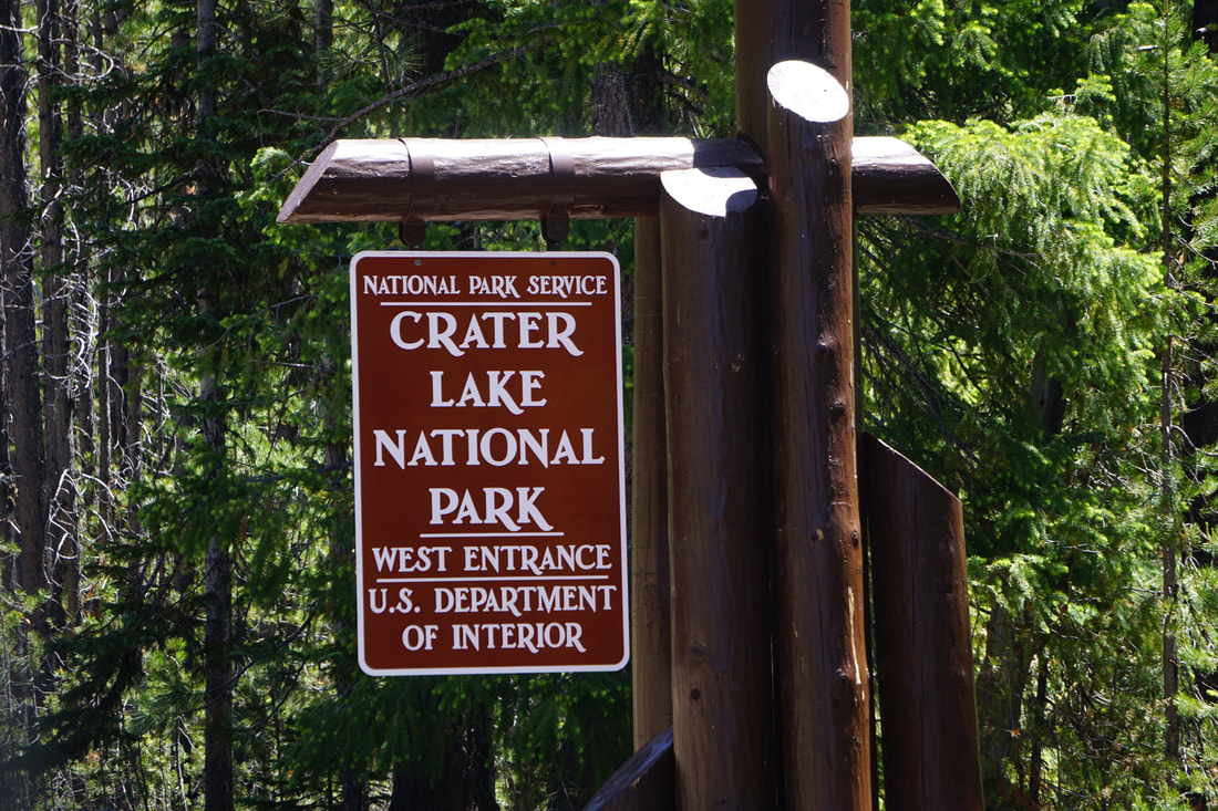 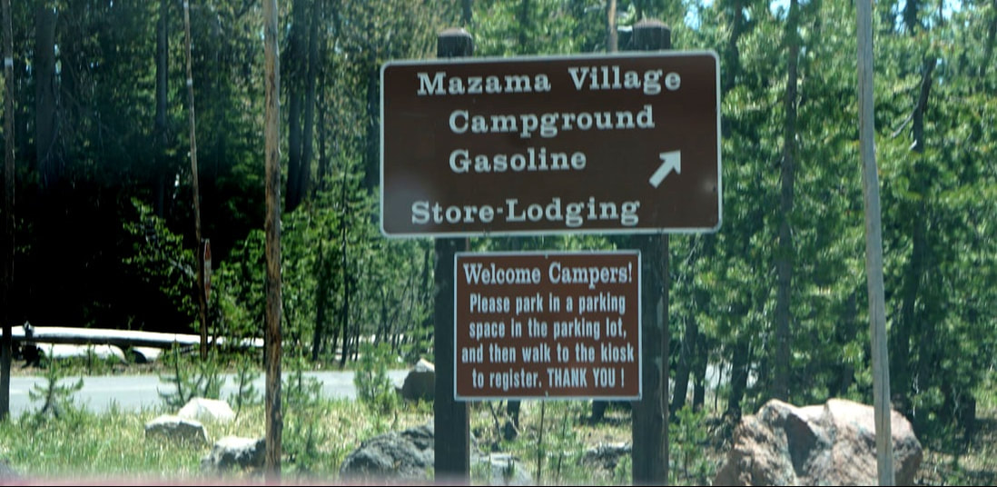 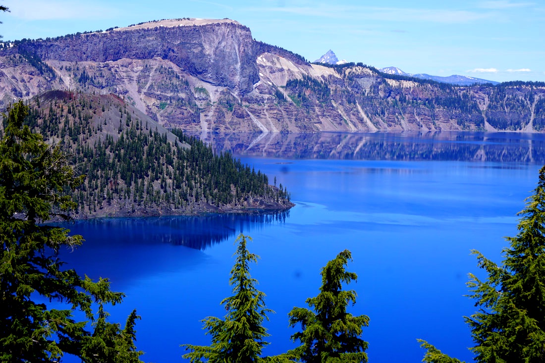 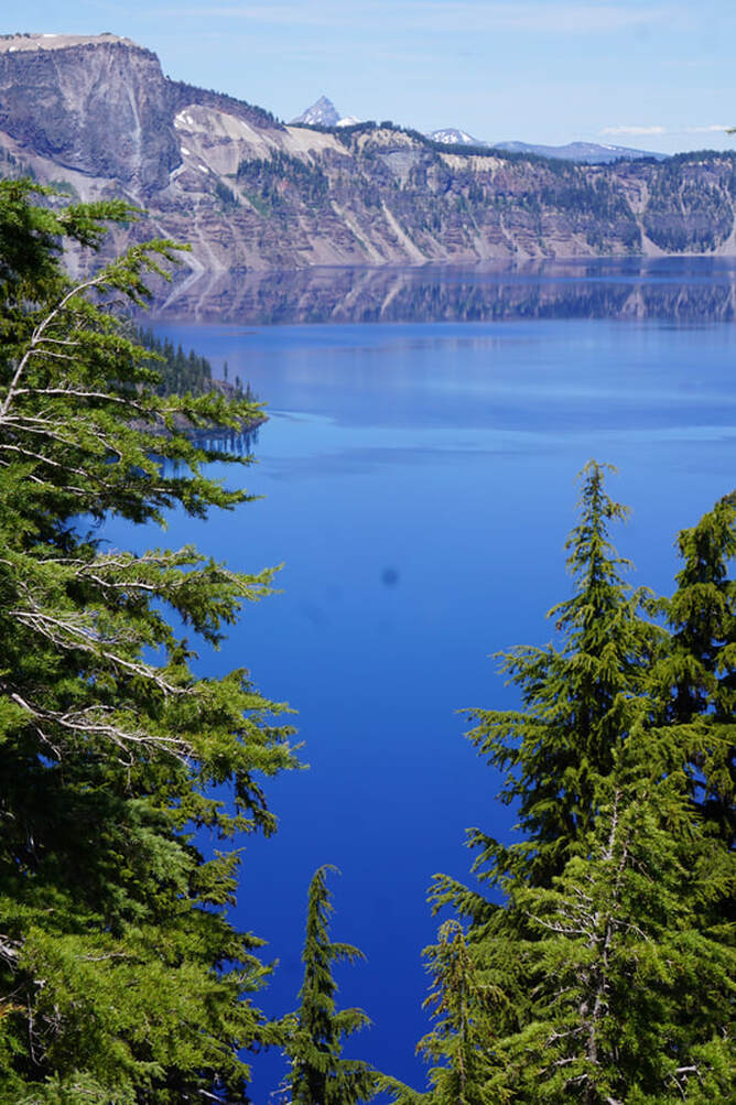 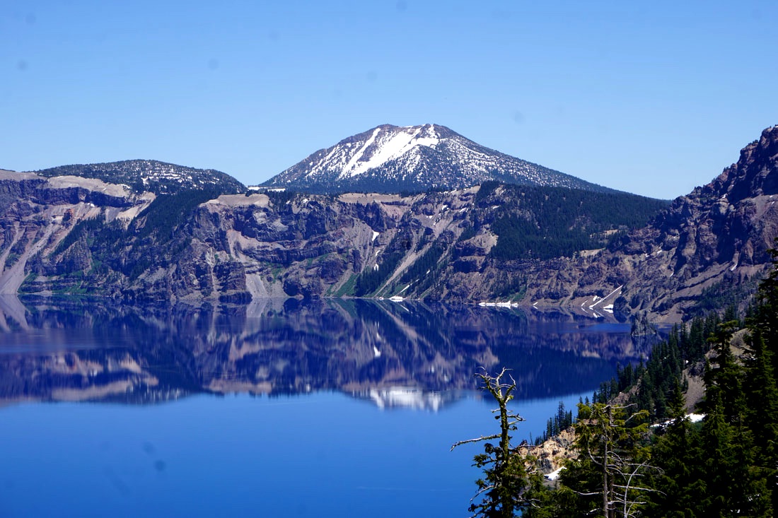 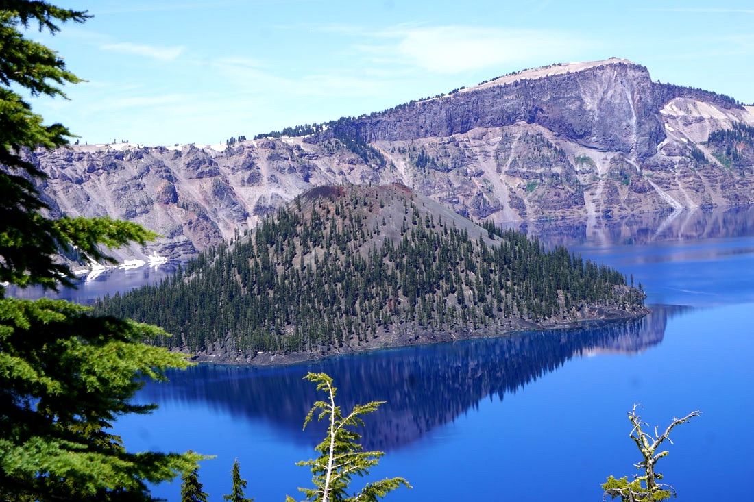 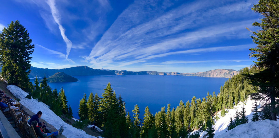  History lesson: For millions of years Mt. Mazama built up with layer after layer of volcanic eruptions. Then, 7,700 years ago a massive week-long eruption (with vents opening in a 360 degree circle) emptied out all of the molten magma that had built up in the volcano. In one day, the whole top of the mountain gave way, broke down, caved in, and formed a sealed bowl. For the next period of formation, the bowl filled with rain and snow melt. Today it is the most pristine water in the world – no contaminates (rivers or streams) flow into the lake! We heard that Annie Creek Sno Park (10 miles away) had free camping. . . and off we went. There was a large parking lot -- nice and breezy, no mosquitoes and even bits of shade to set up in! And, did I mention it was FREE! 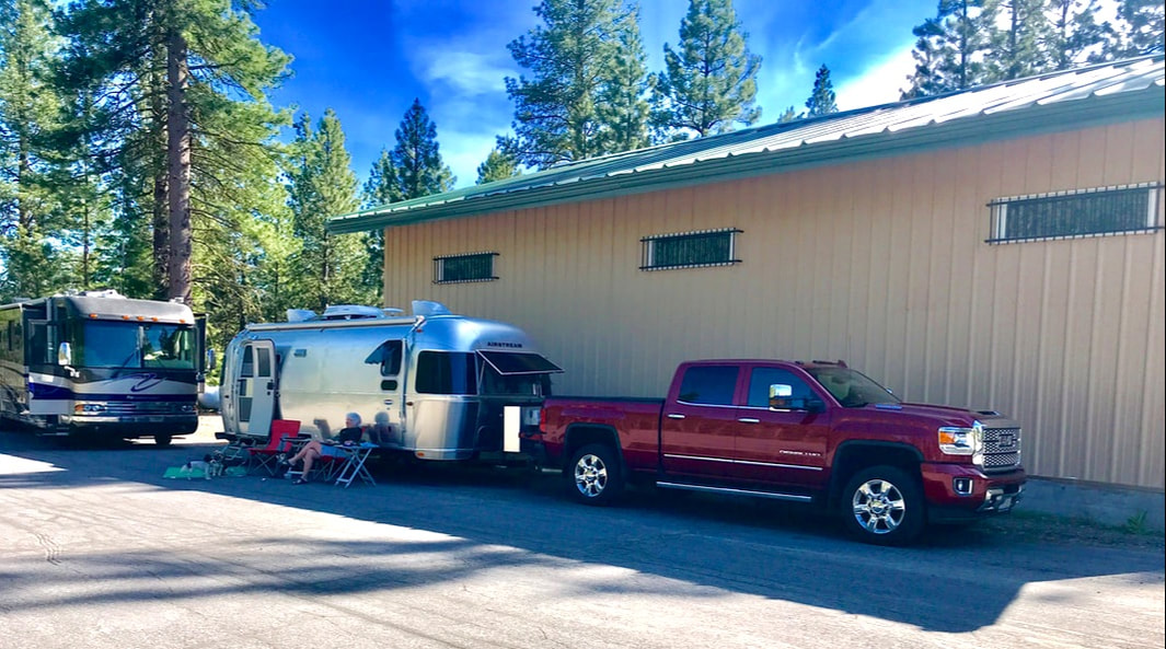 We sat outside with interesting neighbors for over an hour; they had a massive motor home that towed a big GMC truck. They were full-timers! He was an amazing carver and showed us two walking sticks that were intricately carved as well as a wooden carving of a cougar perched on a log. For the evening we unhooked from the camper and drove back to the Rim Village and the Crater Lake Lodge. We were able to order drinks and appetizers from the gourmet restaurant and have them delivered to the outdoor deck that overlooked the lake – salmon salad for Tom and mushroom flatbread for me. Just to make the experience last longer . . . I ordered another drink! A note about the lodge: Inside and out it was in a bit of disrepair. It was built in 1915, and it doesn’t look like it has been updated over the years . . . or recently. It is rustic – but it also slips a little beyond that into dingy, dirty, outdated, and shabby. When we think of National Parks, we think of the unique and beautiful lodges that are often a part of the experience. This one could be very grand, if they would just get the funds to renovate it! 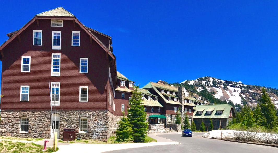 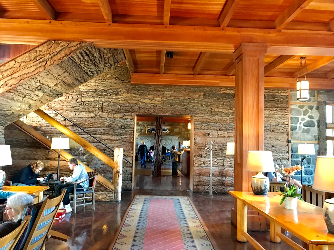 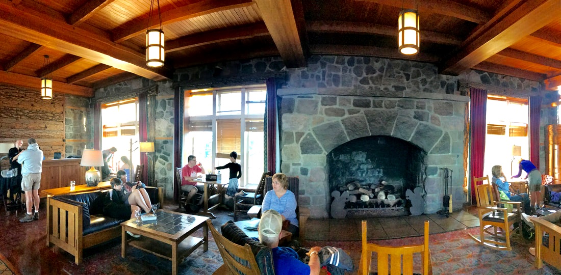 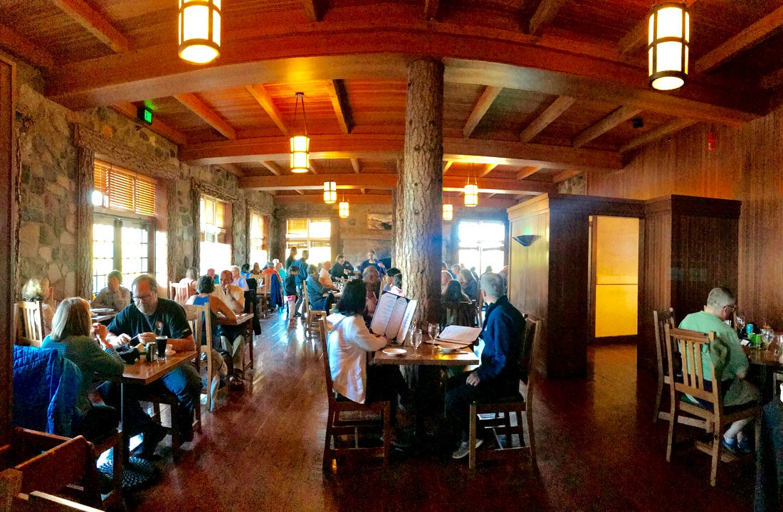 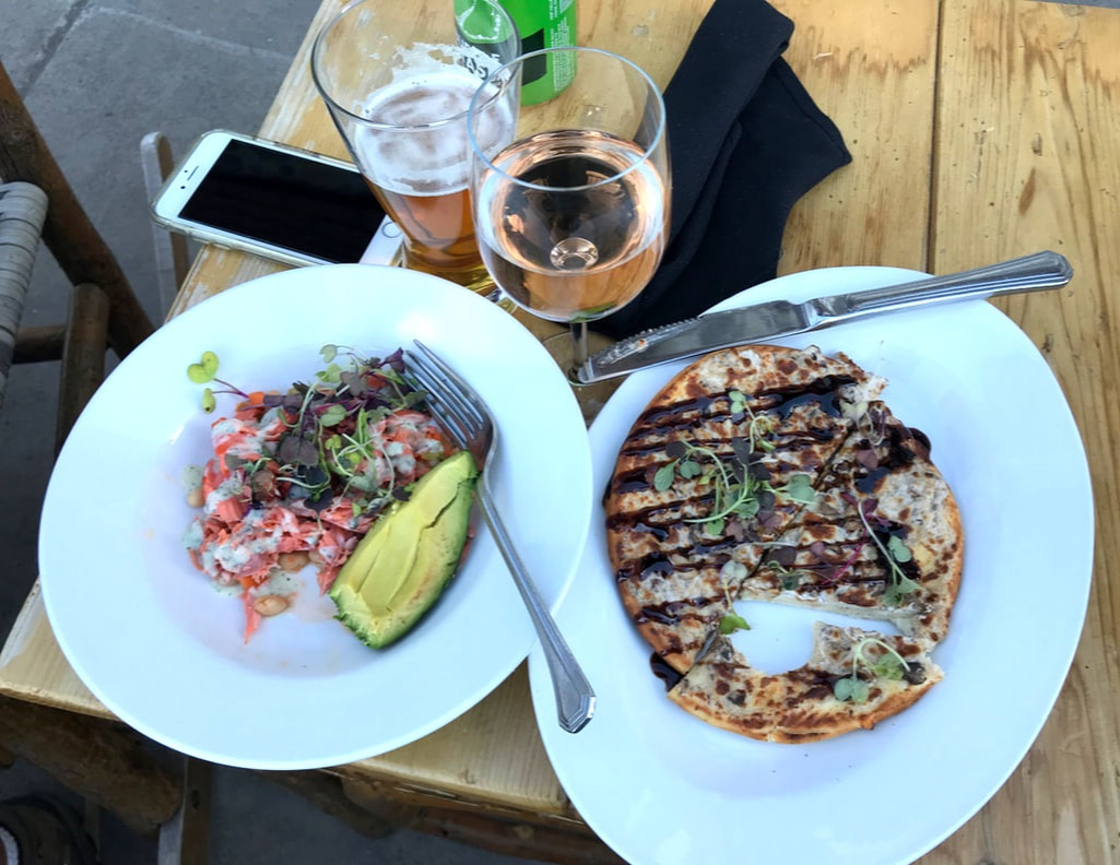 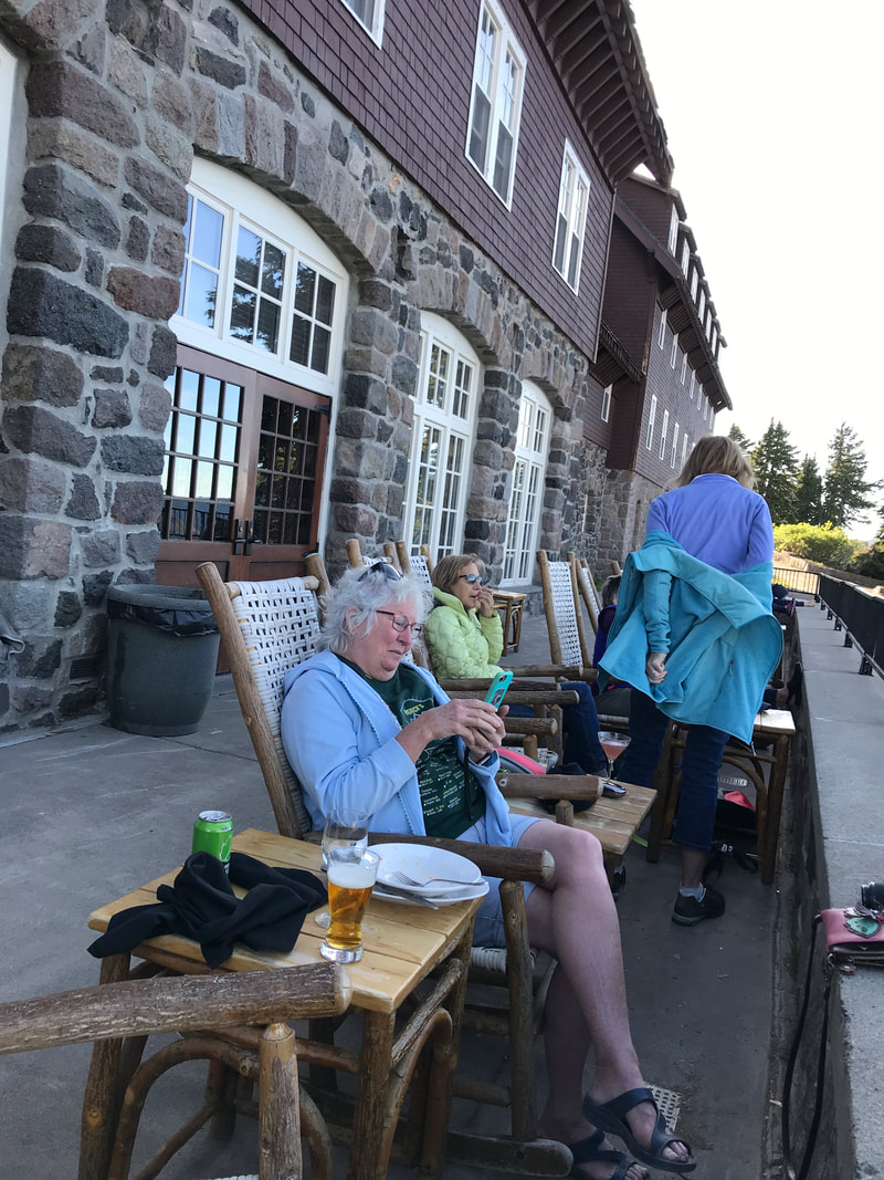 Tuesday, June 18 This morning we got a campsite. Only two loops were open, the workers in the office did not have a set policy, and campers were lined up a dozen deep. But . . . we got a campsite!  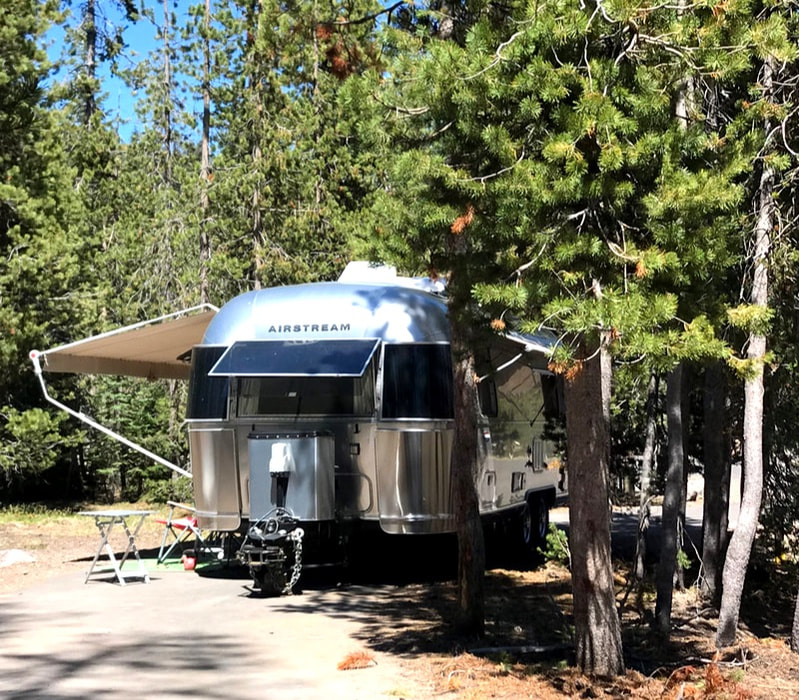 We spent some time getting settled, then off in the truck to drive some of the West Rim Drive. This is the high side of the Rim (highest is 1815 feet) and there was deep snow on either side of the road. We stopped frequently at the different lookouts for pictures. We made it to Discovery Point, Watchman Overlook and North Junction, less than a quarter of the entire loop road before it was still closed for the winter. 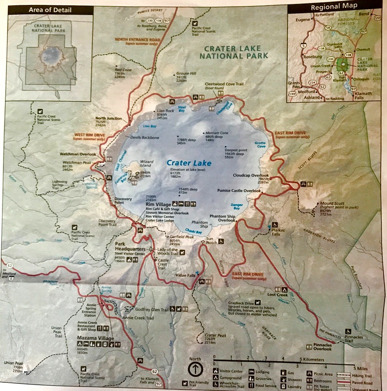 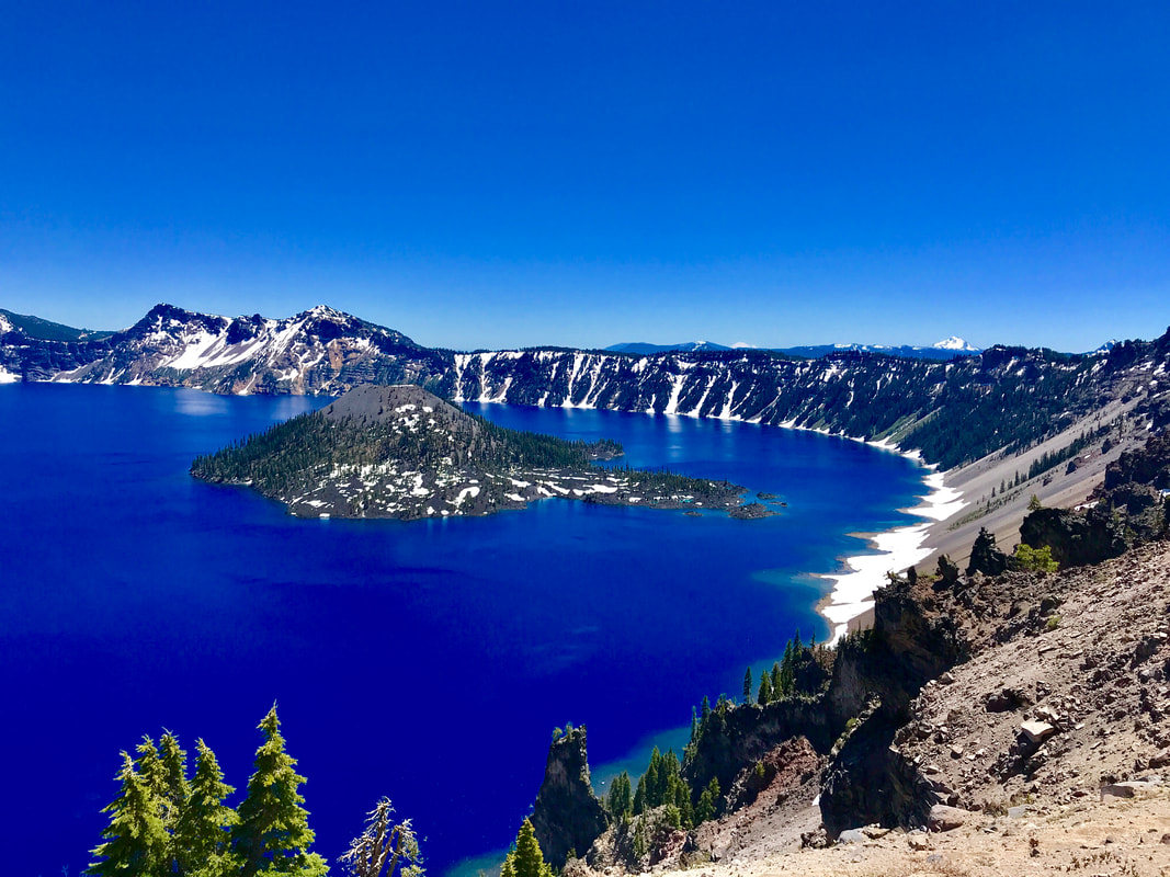  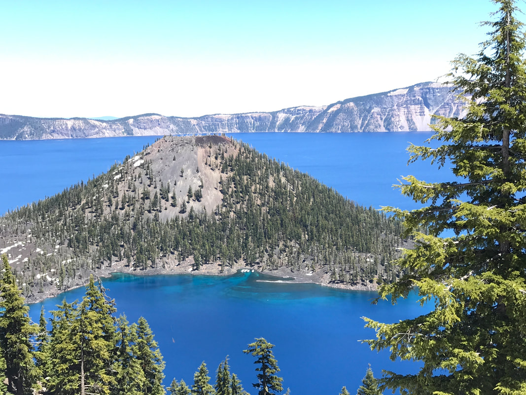 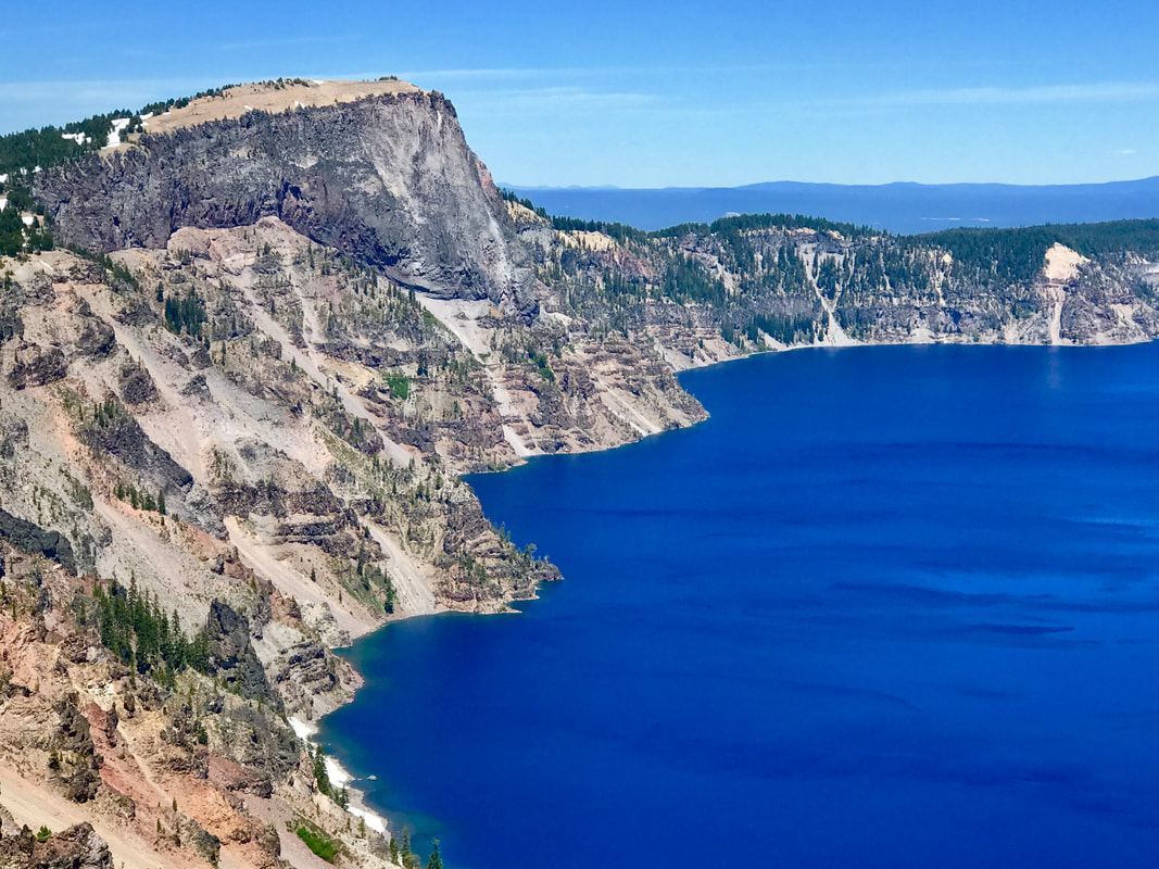 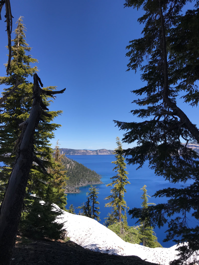  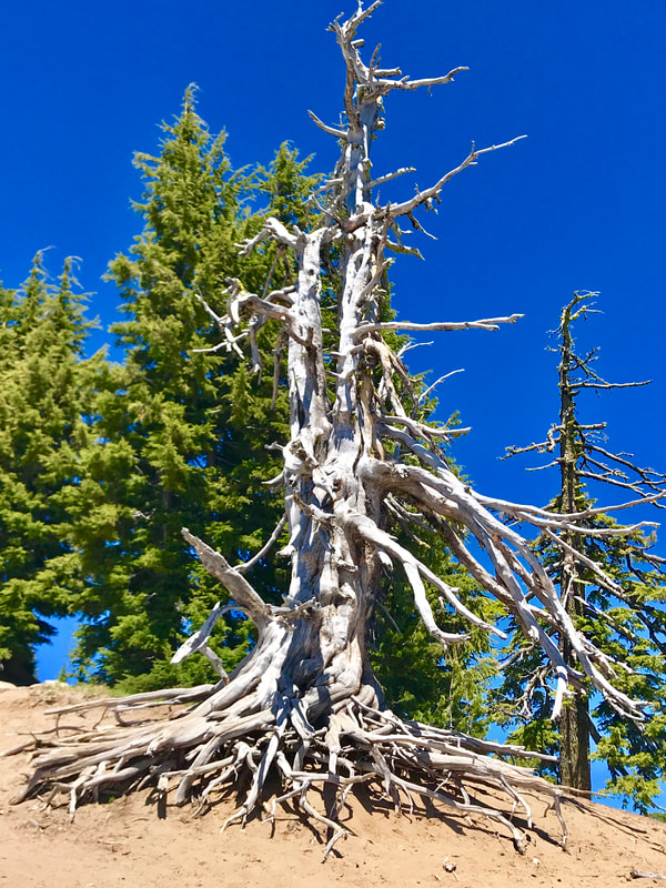  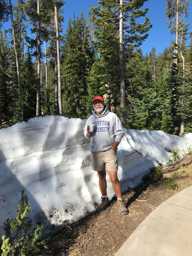 For dinner we fixed colossal size shrimp on the grill, and had shrimp Raman noodles, and coleslaw. With the park still more closed than open, we returned for the evening back to the Lodge and again enjoyed the outdoor patio. This time – no food or drink – but we did enjoy the wifi! 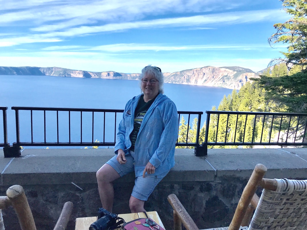 Wednesday, June 19 We slept till 8:00 and then walked over to the little café/gift shop in the campground for breakfast before heading out to tour. Much the same as yesterday, we found the road we wanted to follow to Pinnacle Valley closed. We drove to the Lodge again and walked the rim trail up to the jumping on place for the Pacific Crest National Scenic Trail. The only picture we took was one of Charlie Button and Jasper posing on the stone fence with the lake in the background! 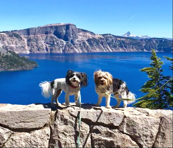 In the afternoon we hung around the camper for a while, and then walked up to the little gift shop to use the wifi. After dinner things were really winding down at Crater Lake for us as we drove up to the lodge one more time for a special treat . . . dessert. Tom had a berry cobbler and I had a cheesecake with berry topping. It was too cold to sit outside in our usual seats on the patio overlooking the lake, and we chose instead to sit inside by a fireplace. But, before leaving Tom did take one more picture of the Lodge, our patio, and the lake. Back at the Silvermine we walked the dogs, took showers, and otherwise prepared to take off in the morning. 
0 Comments
Sunday, June 16 The John Day Fossil Beds is made up of three main areas – “units.” Yesterday we did the Sheep Rock Unit, and today we tackled the Painted Hills and Clarno Units. It was a 40-mile drive to the start of the Painted Hills where we did two hikes: The Leaf Hill Trail and The Painted Cove Trail. It was still cool in the early morning, and both walks were short and easy. Aptly named, the colors of the Painted Hills was straight off my favorite paint palette: brick reds, dusky yellows, muted lavenders, sage greens, and warm tans. On top of the color array of the rocks and hills, there was also a mass bloom of wildflowers adding bright yellows, purples, and oranges. 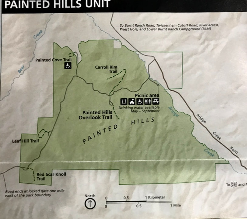 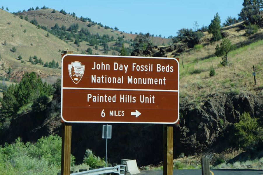 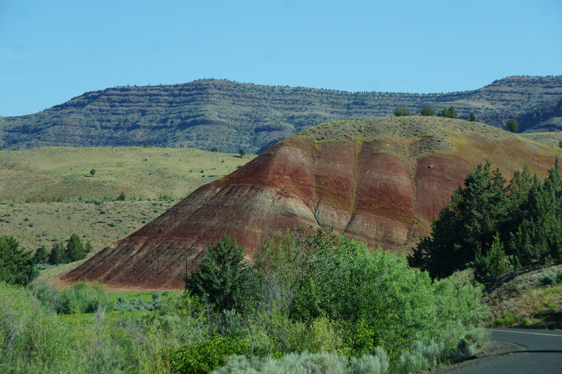 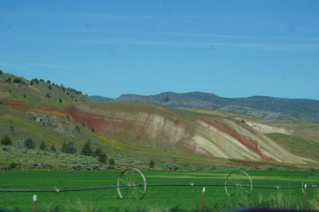 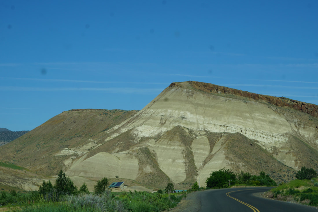 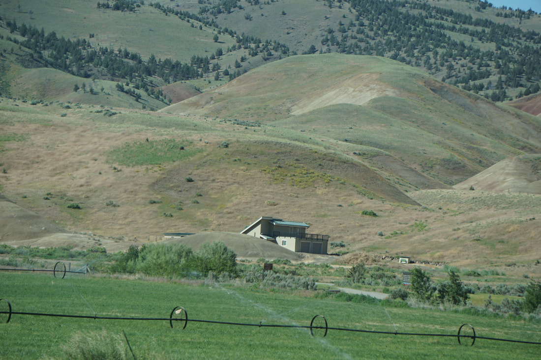 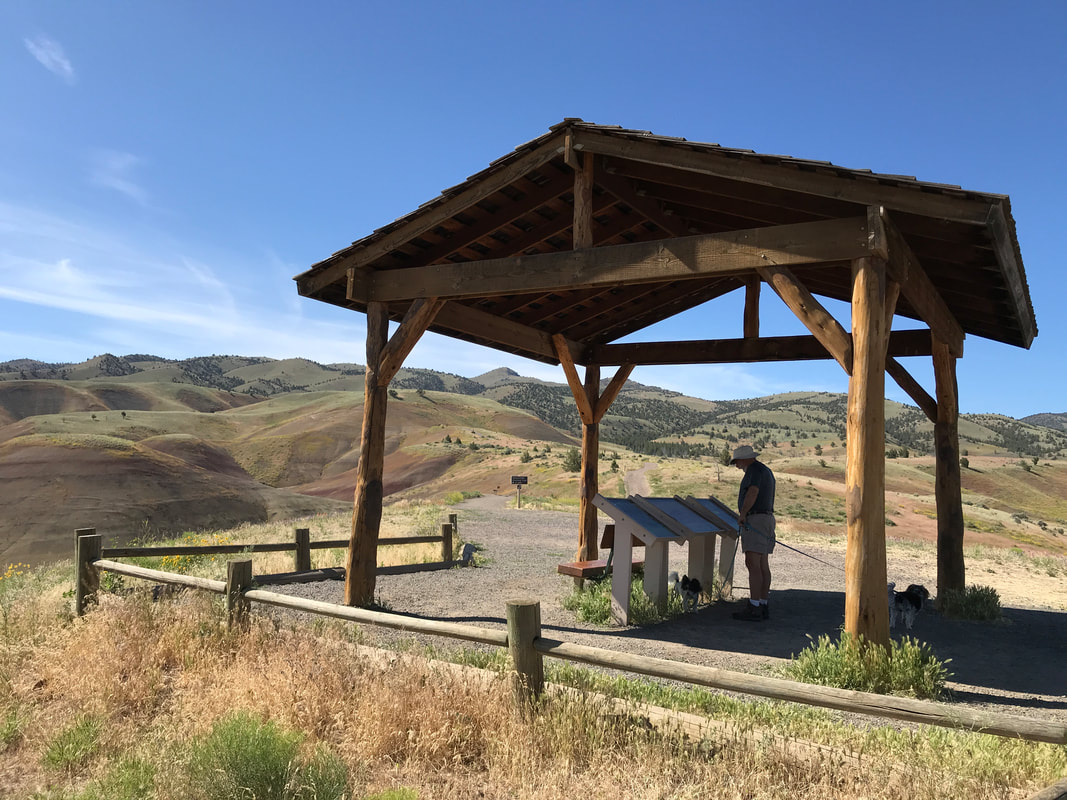 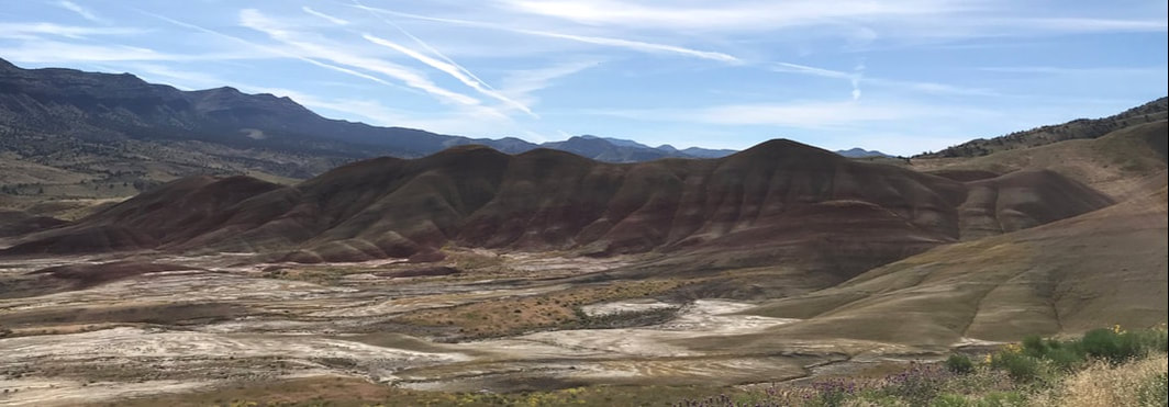  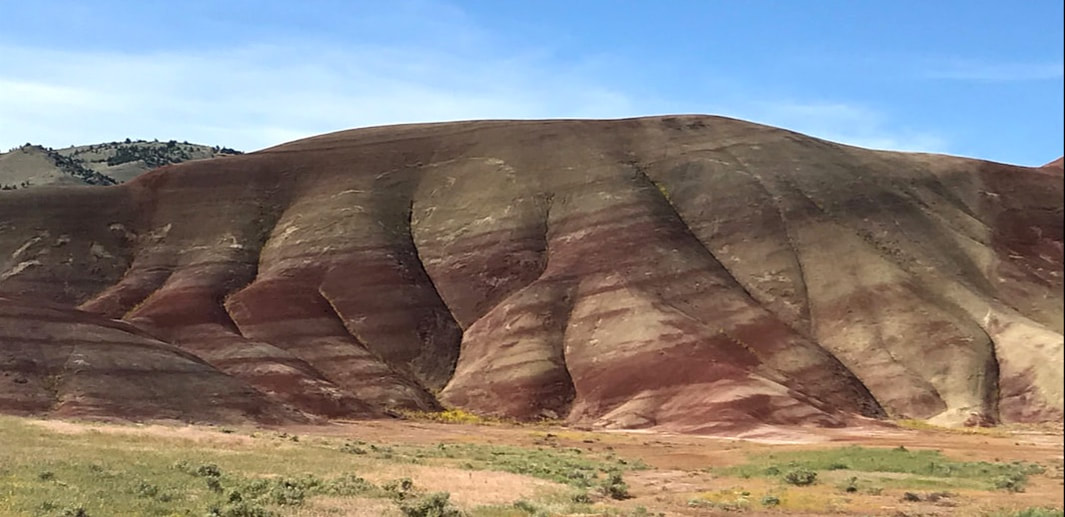 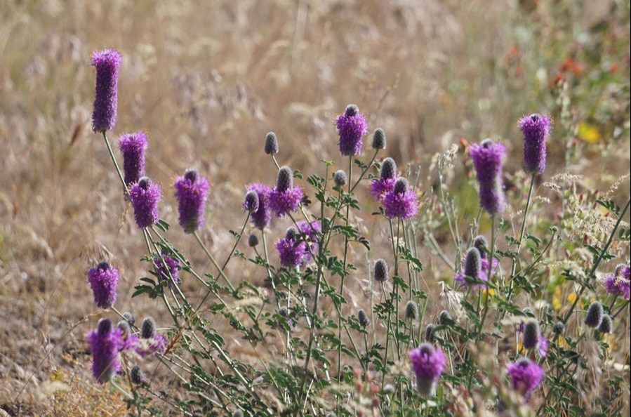 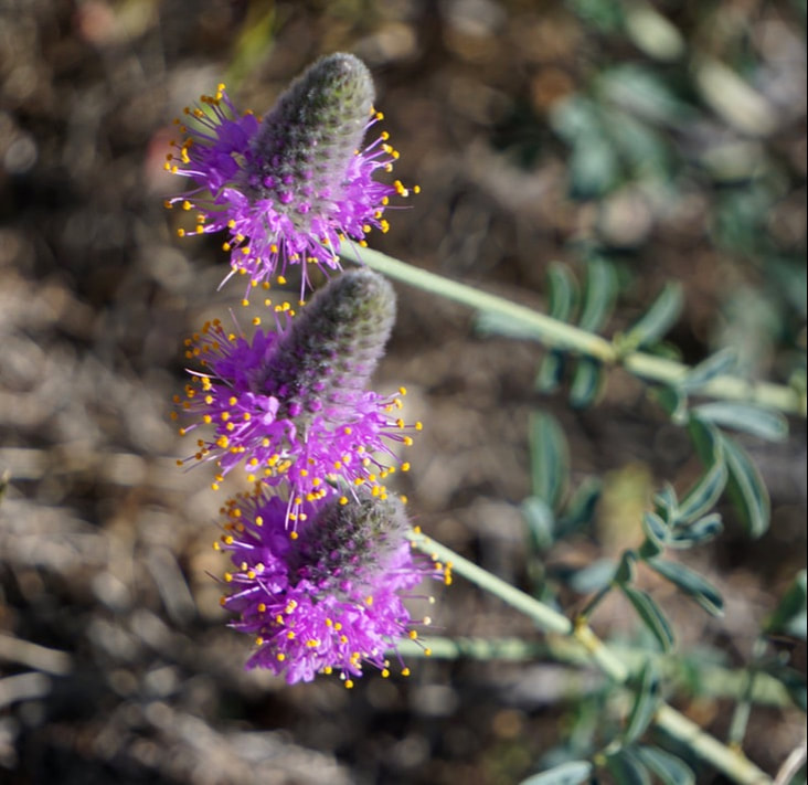 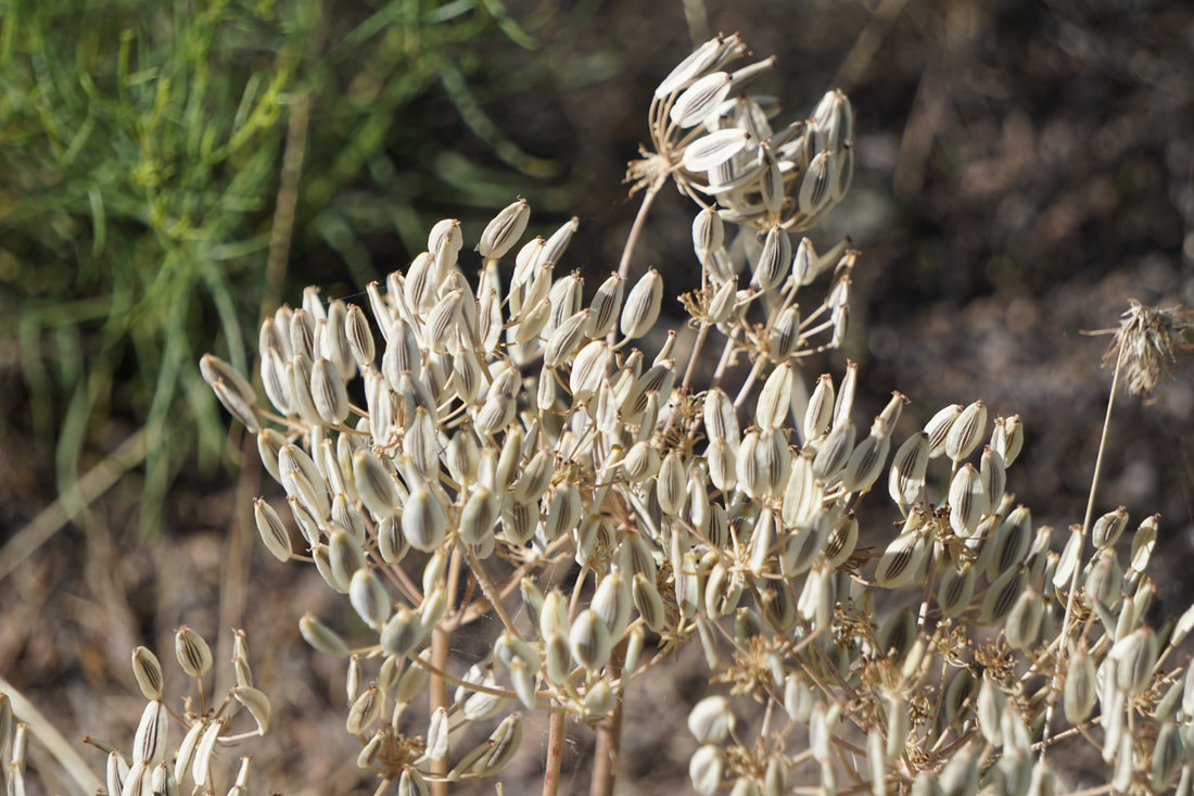 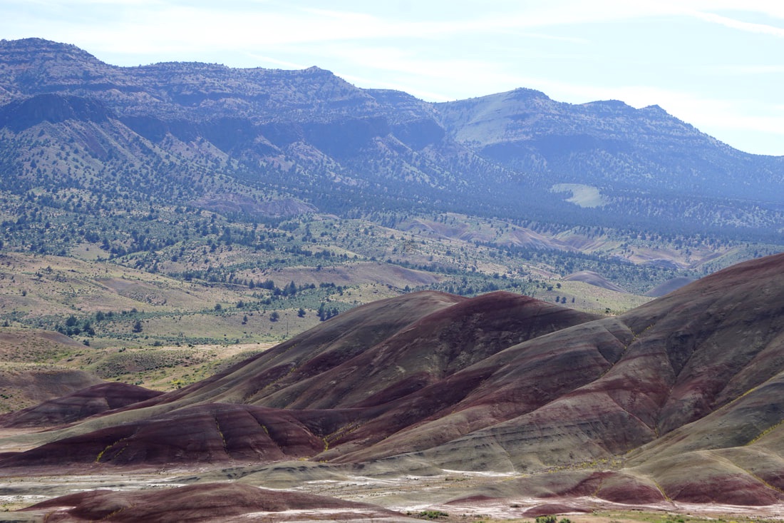 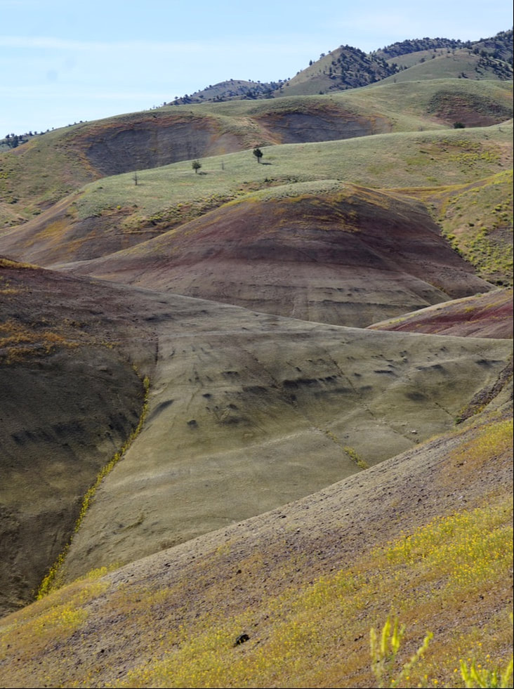 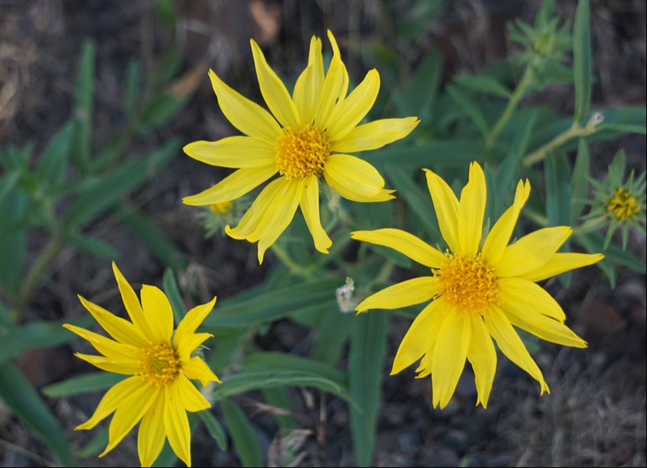 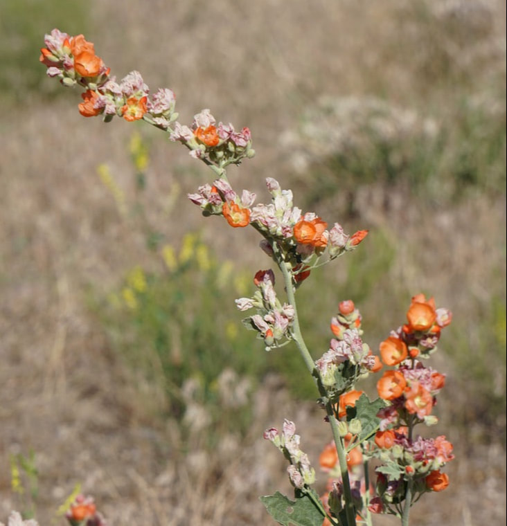 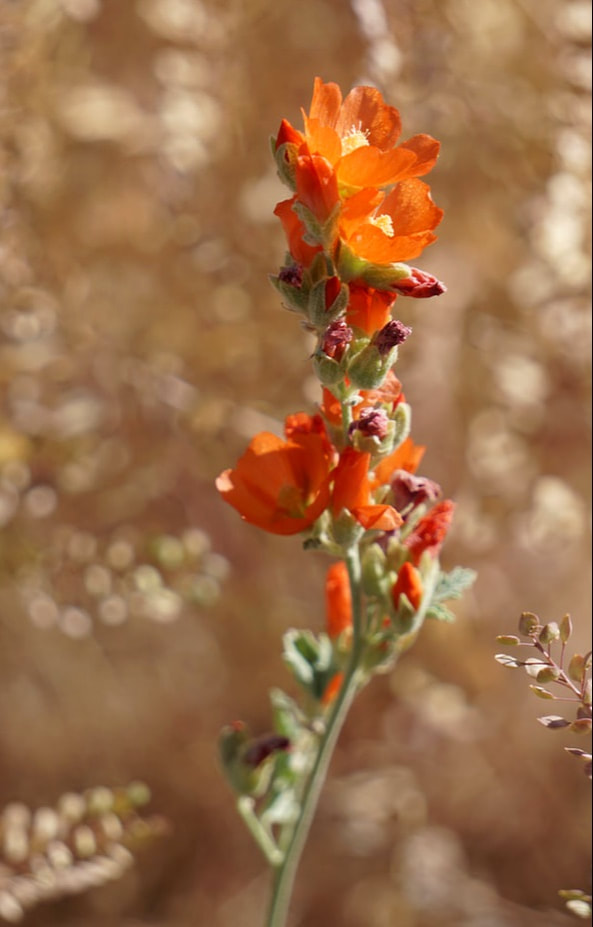  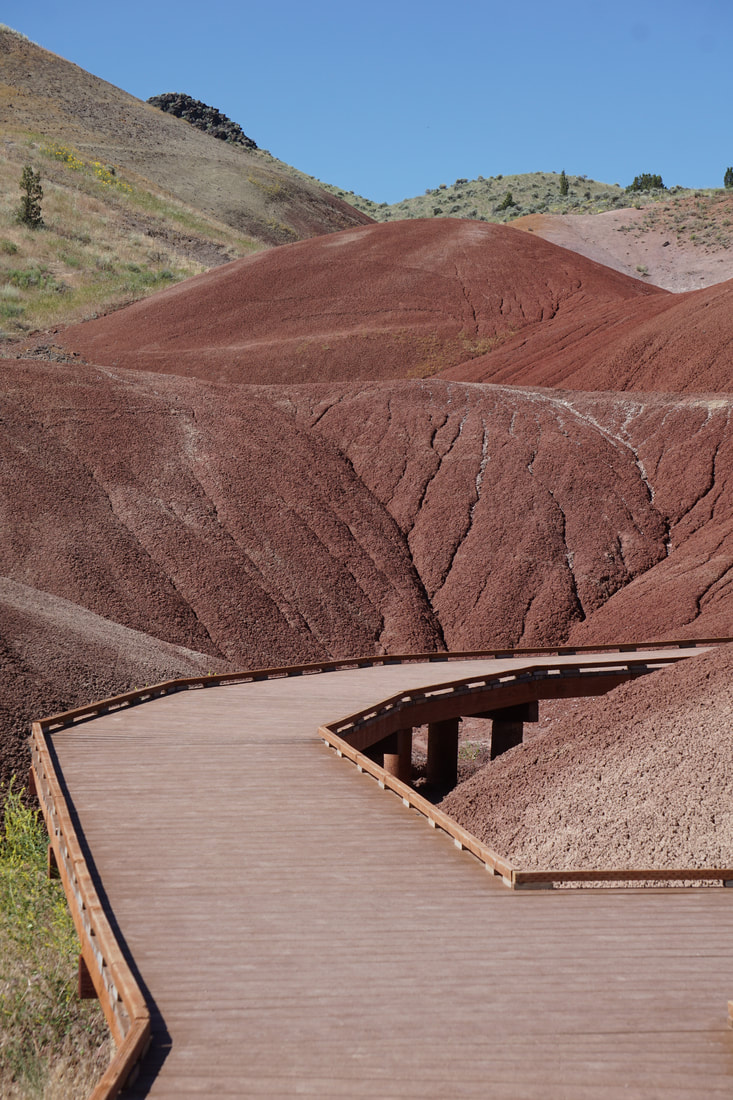 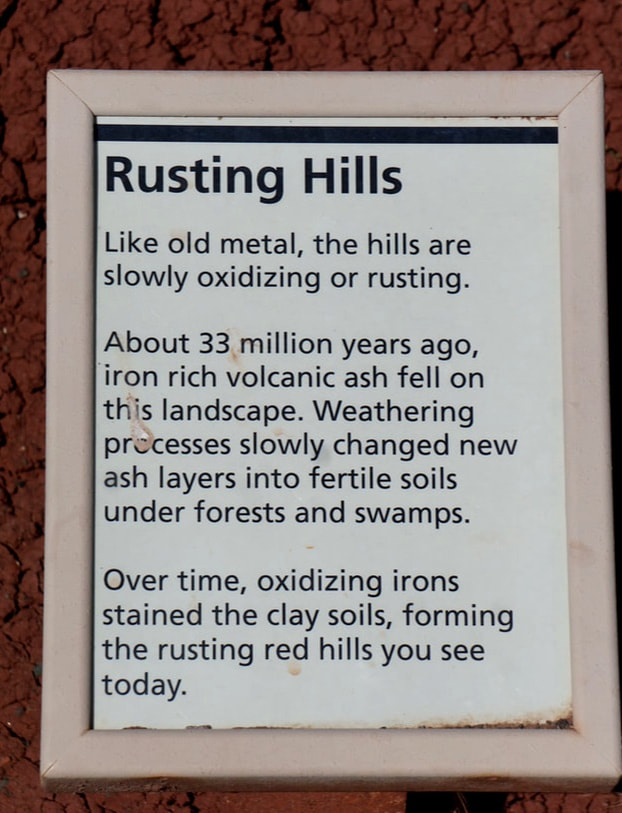 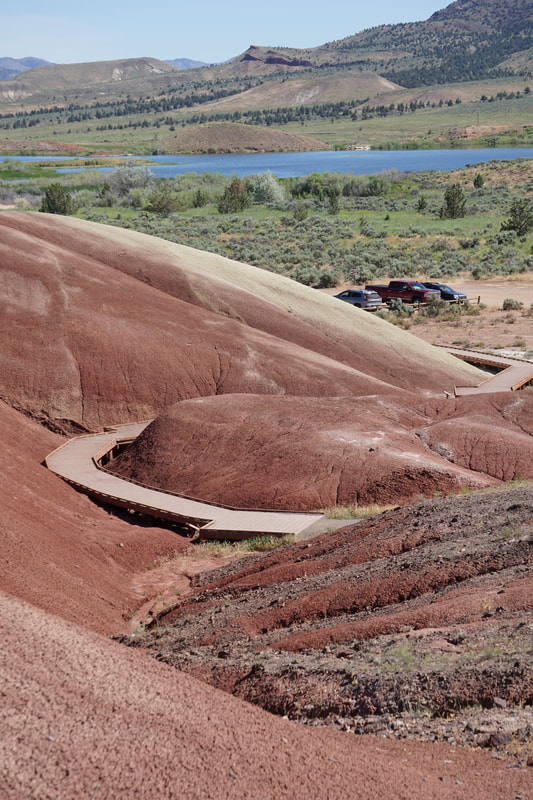 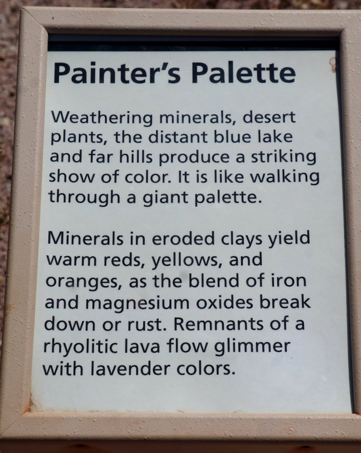 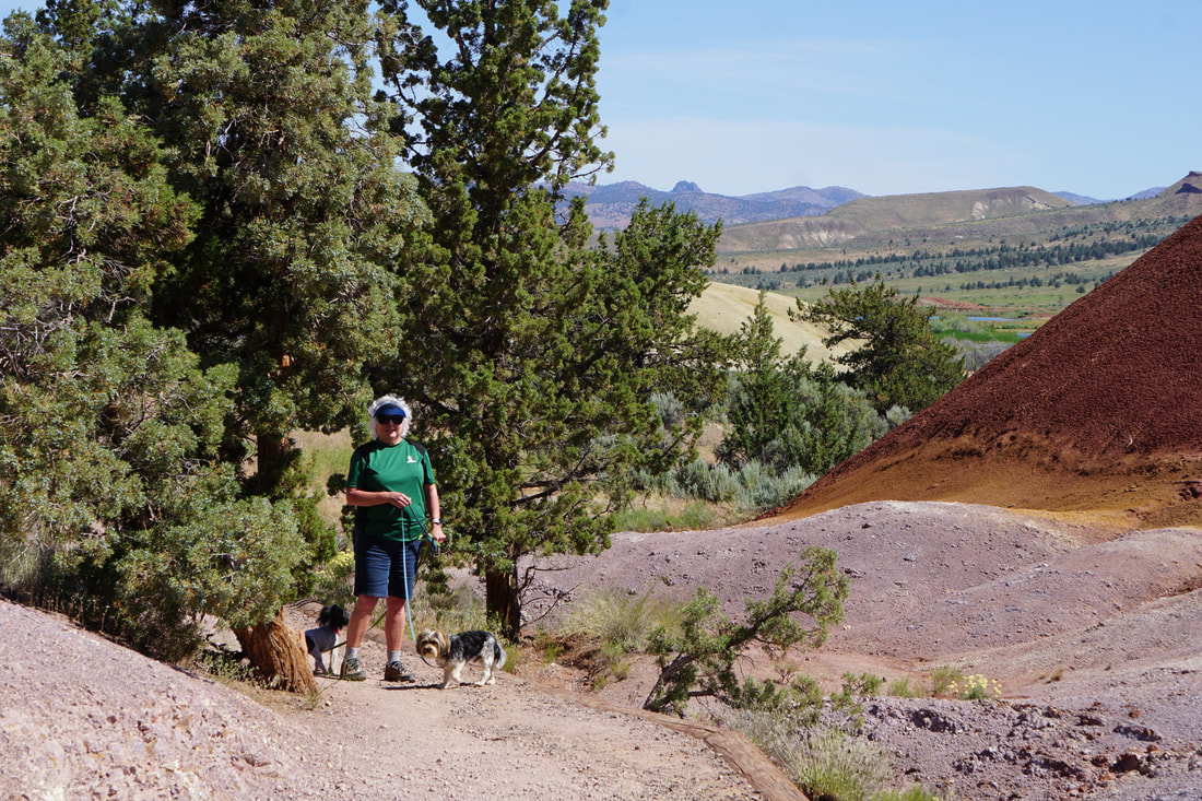 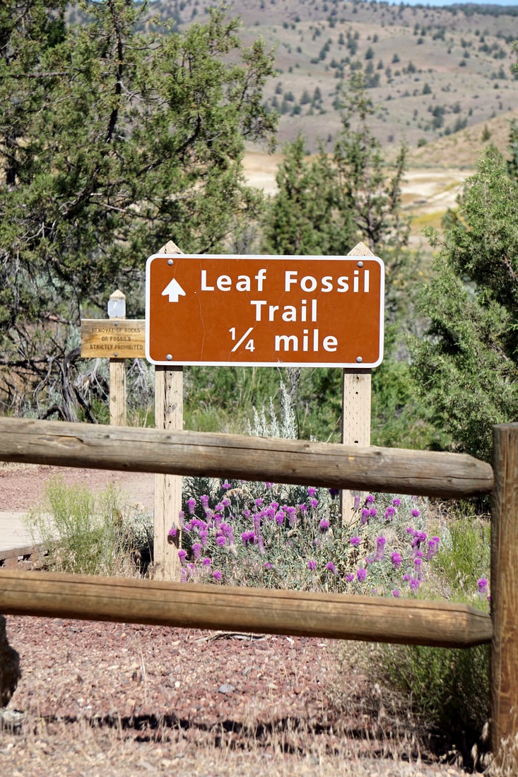  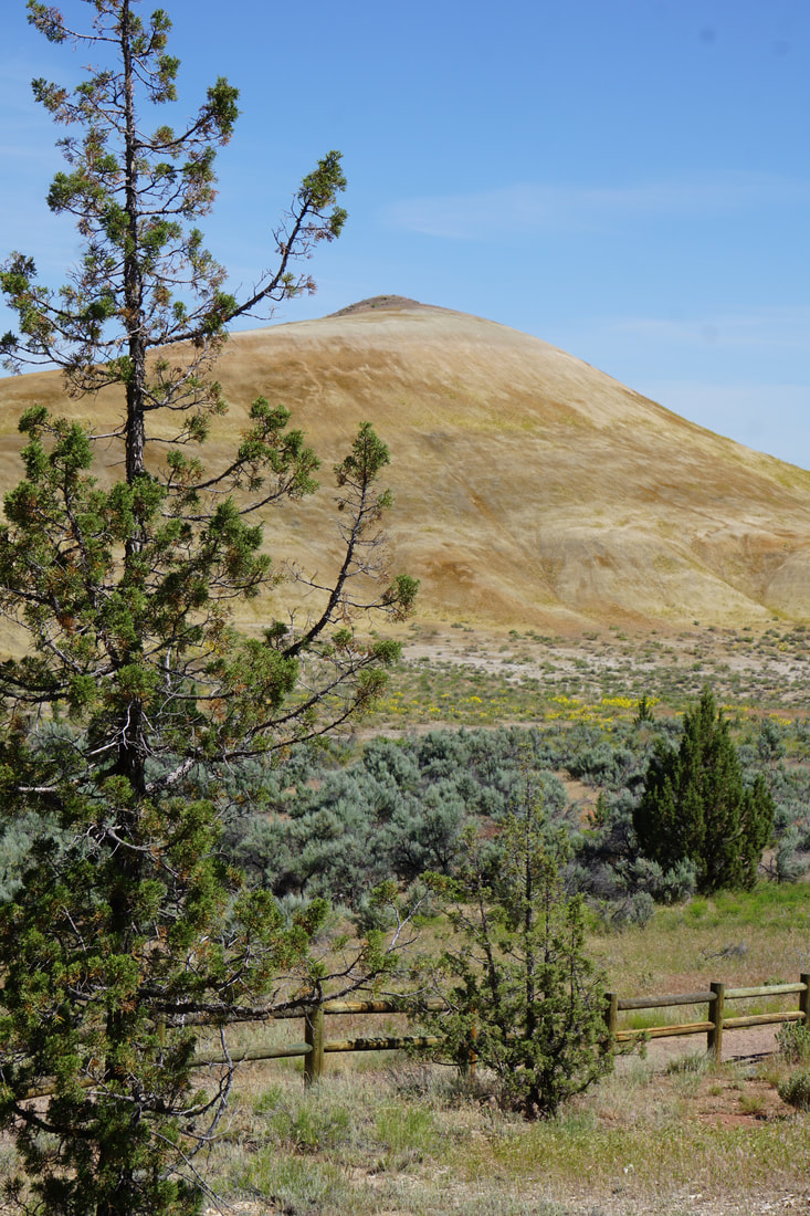 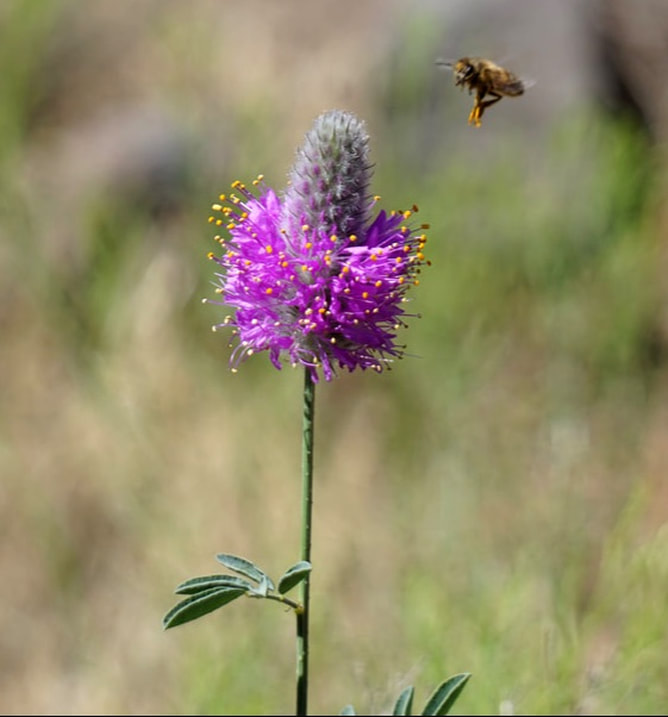 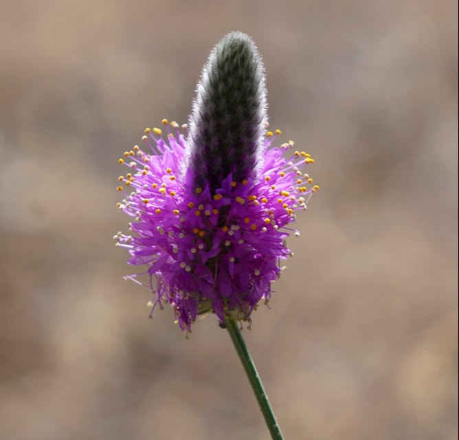 Out in the middle of this high-desert-wilderness, we passed this tree. It was heavy with shoes! We have no idea what the significance of this was, but I had to get pictures! 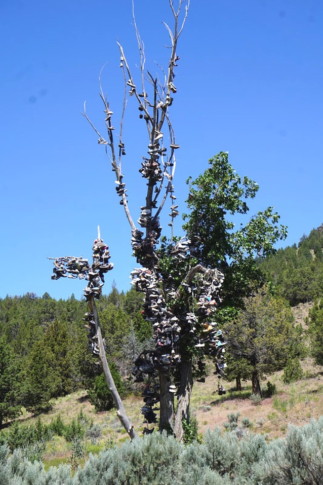 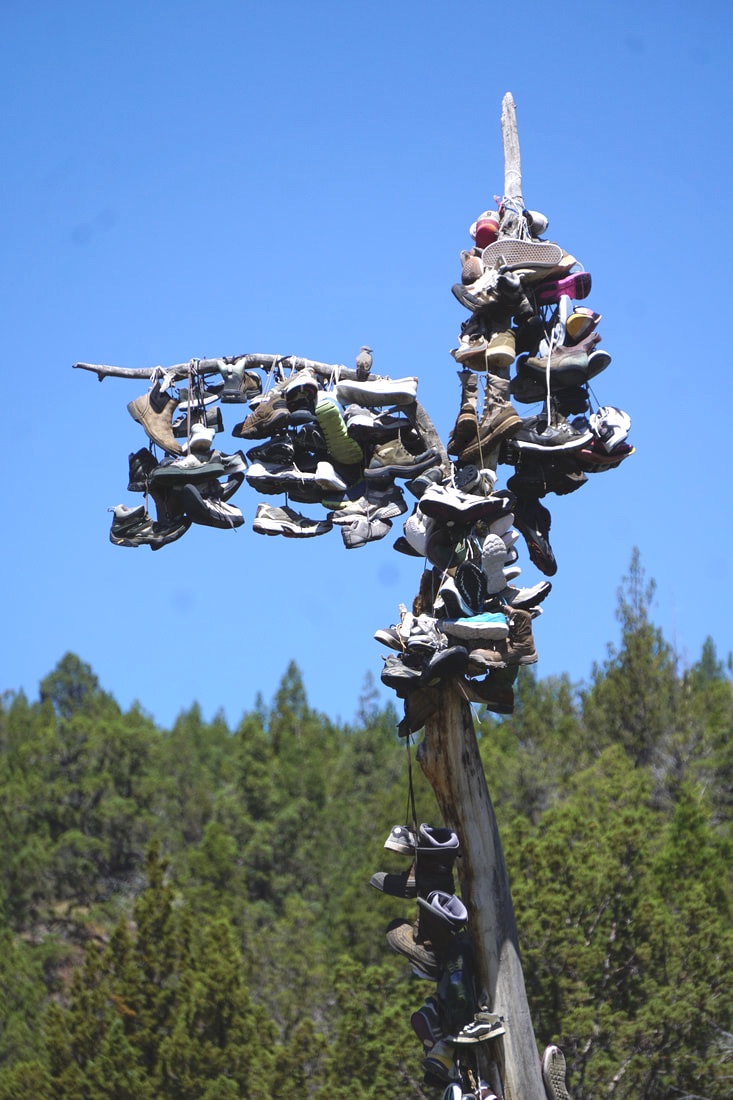 Our campground had accommodated us for two nights, but only if we could change sites midway! We were back at the campground by 11:30 where we quickly swapped sites, packed a snack/lunch for the car and set out again for the Clarno Unit. Supposed to be the most beautiful of the areas, it was an 80-mile drive covering new territory for us. It was very different with towering Palisades – craggy cliffs looming up to 150 feet over the valley. There were also some new wildflowers to see..  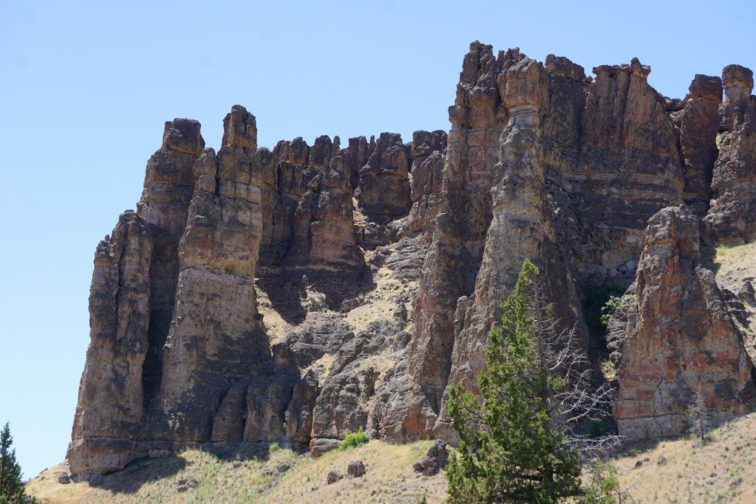 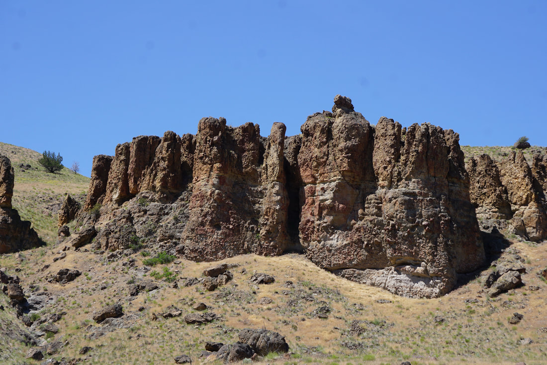 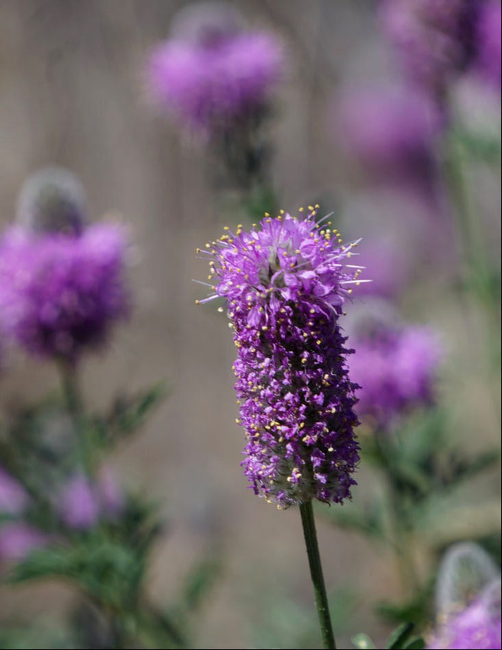 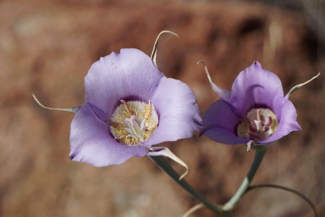 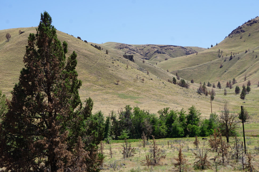 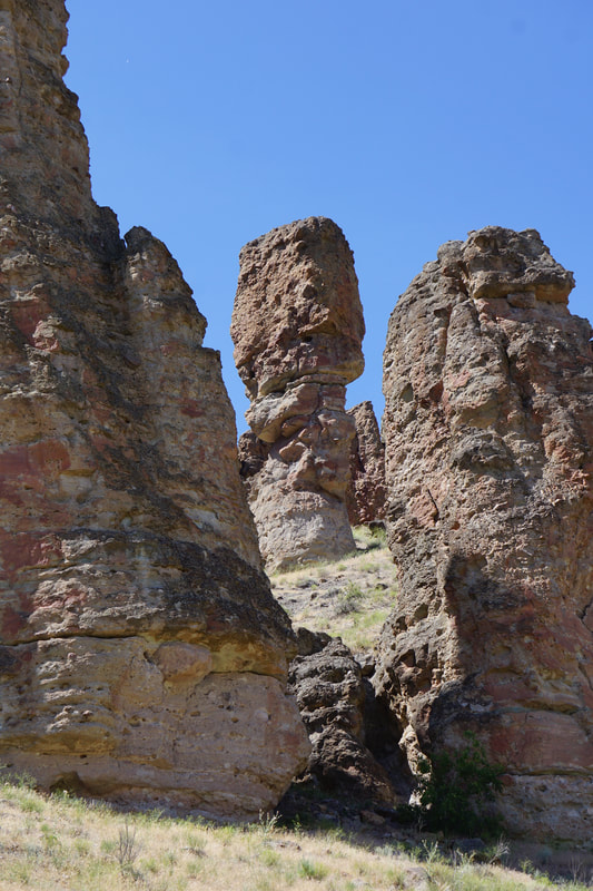  But, it was 90 degrees and just one .25 mile trail that was open. There are two significant fossil sites that are open “by appointment, only.” Jasper and Charlie did not appreciate the trail at all – probably the heat. They stopped every 50 feet for water, and when they found a bit of shade, they collapsed! We didn’t even finish that ¼ mile trail – just grabbed some pictures . . . and left.  We were back at the Silvermine by 4:30, and I had an agenda: I wanted the dogs and the bedding washed, and the inside of the trailer cleaned. With laundry facilities at the campsite, the bedding was easy. Even though they acted grump about baths, I like to think that the whole process added to cooling-down from the hike and their general well-being. Cleaning the trailer was really a practical means of using all our on-board water . . . so that we could empty black/grey water tanks and fill the fresh tank before heading for 4 nights of boon-docking at Crater Lake National Park.
Saturday, June 15 Our drive today was a 170-miles west into Oregon on State Route 26: newly-paved road, irrigated fields, free-range cattle, old ghost-ranch settlements . . . and very empty of services! Another time changed made up for the later than usual start this morning.    As the elevation climbed we entered an area of National Forests and State Parks with tall Yellow Pine trees. The temperature went up and down with the elevation as we climbed several mountain passes ranging between 5,000-6,000 feet.  We stopped at the beautiful Sumpter Valley Railway Hiking trail and followed along the well-marked historical walkway. . . 62 degrees and crisp, pine-scented air. From the early 1800’s stage coaches and freight wagons climbed Sumpter pass. From 1890-1947 the railroad laid tracks and logged the pine trees and later brought in tourists. Part of the trail led through a recent controlled burn area and there were very mature trees that were not visibly touched, younger trees that were charred but still standing, and lush new growth at the forest level. 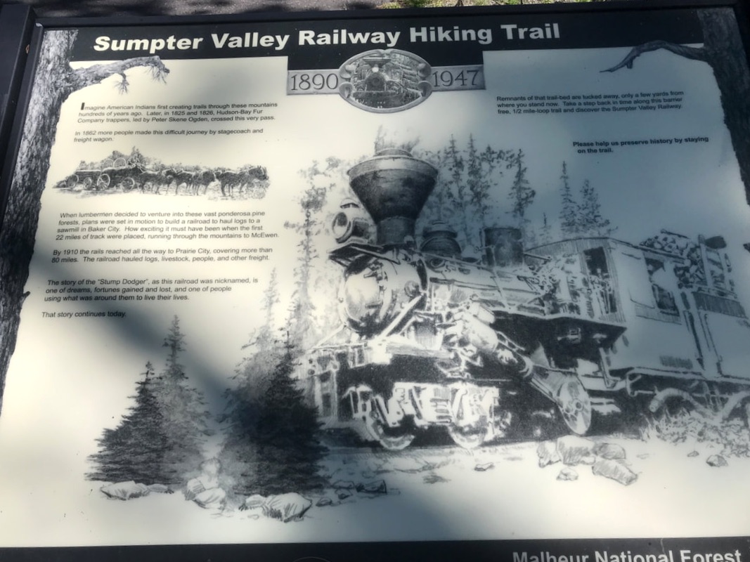 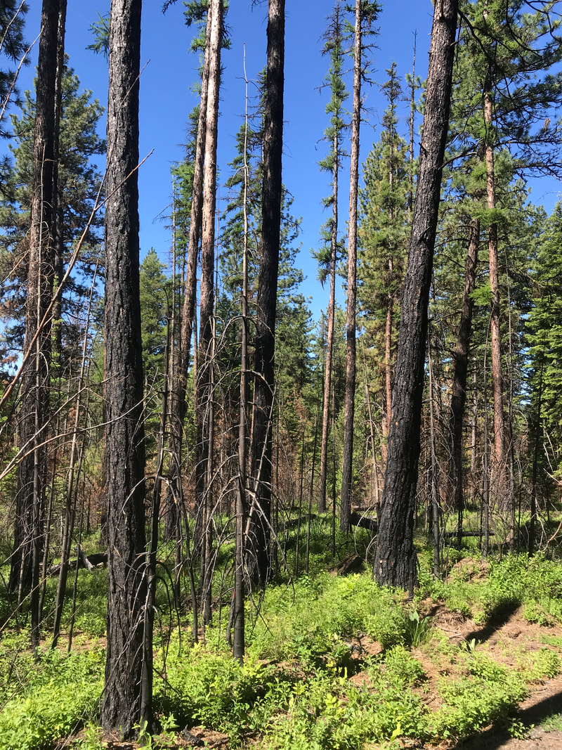 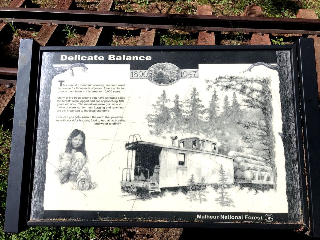 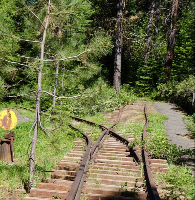 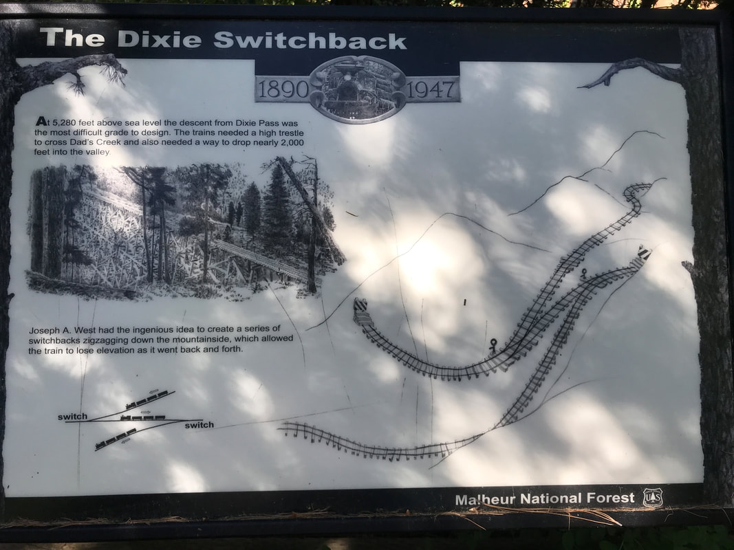 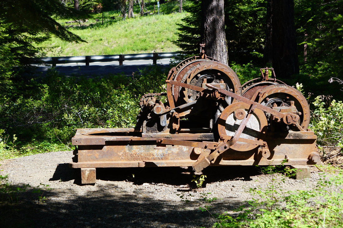 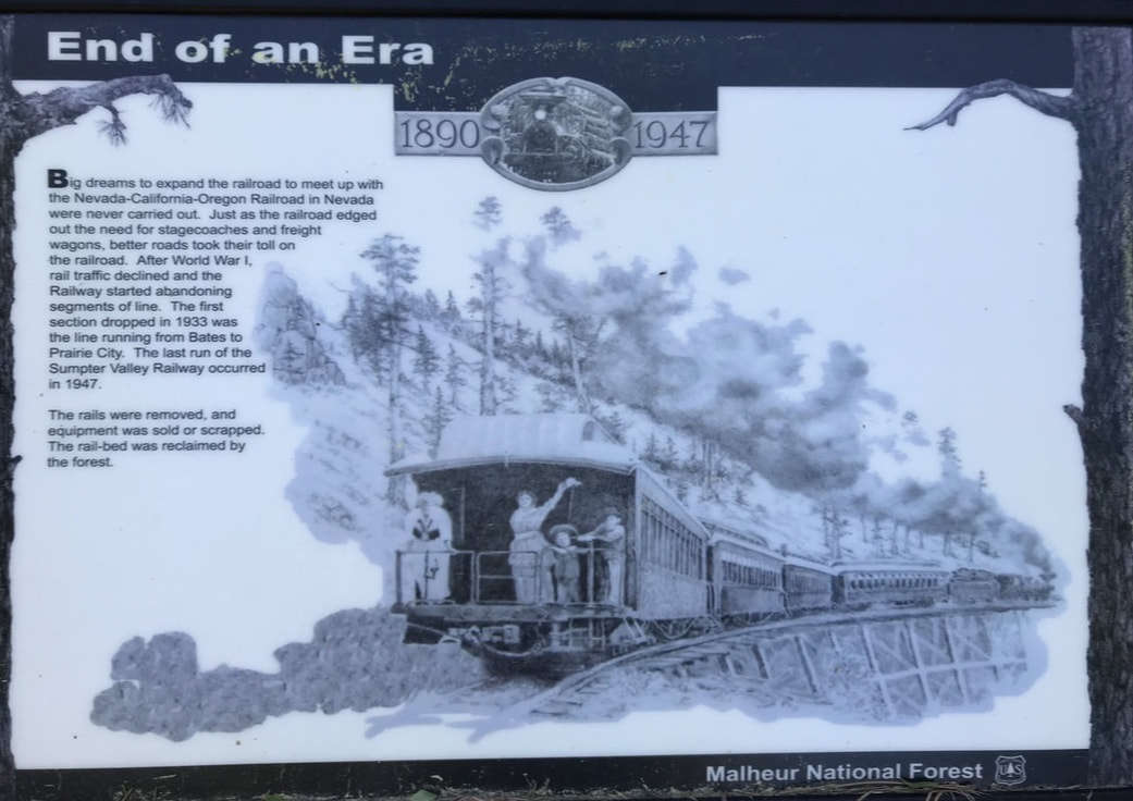 By 1:00 we reached the little town of Dayville and our Fish Inn and RV park. Both very small . . . but big on charm. The Fish Inn has no more than 6 RV sites and several little cottages nestled into his grassy out-back that is filled with shade trees. The bathroom/showers are private suites, and he provides the towels. From our site we can sit and view the downtown main drag, the mercantile, the local restaurant, and a few other little local stores. 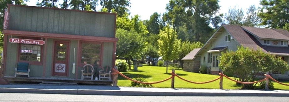 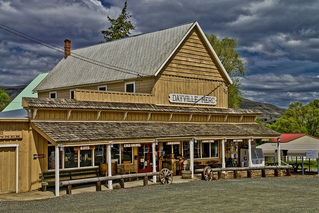   We enjoyed sitting in our campsite for a while, and then headed out to John Day Fossil Beds National Monument. There are several locations and today we visited the Sheep Rock Unit. The visitor center showcases 40 million years of Oregon’s ancient history: fossilized plants and animals, ecological changes, and violent volcanic activity. It is reported to be one of the biggest fossil locations anywhere. 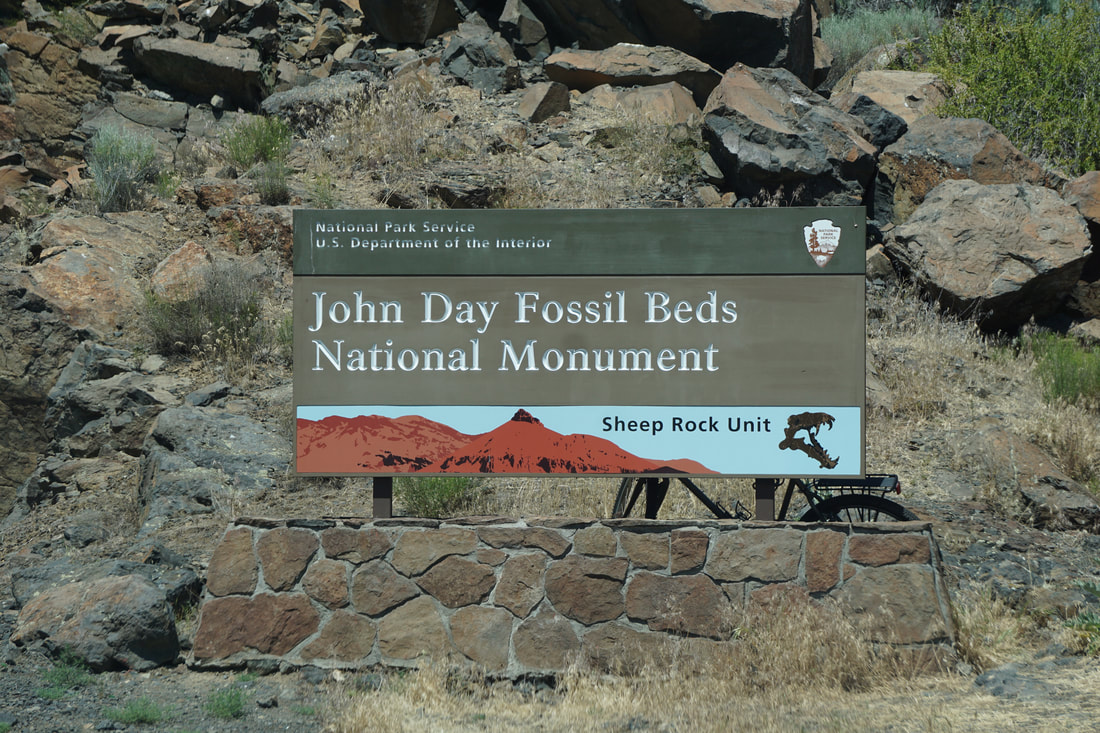 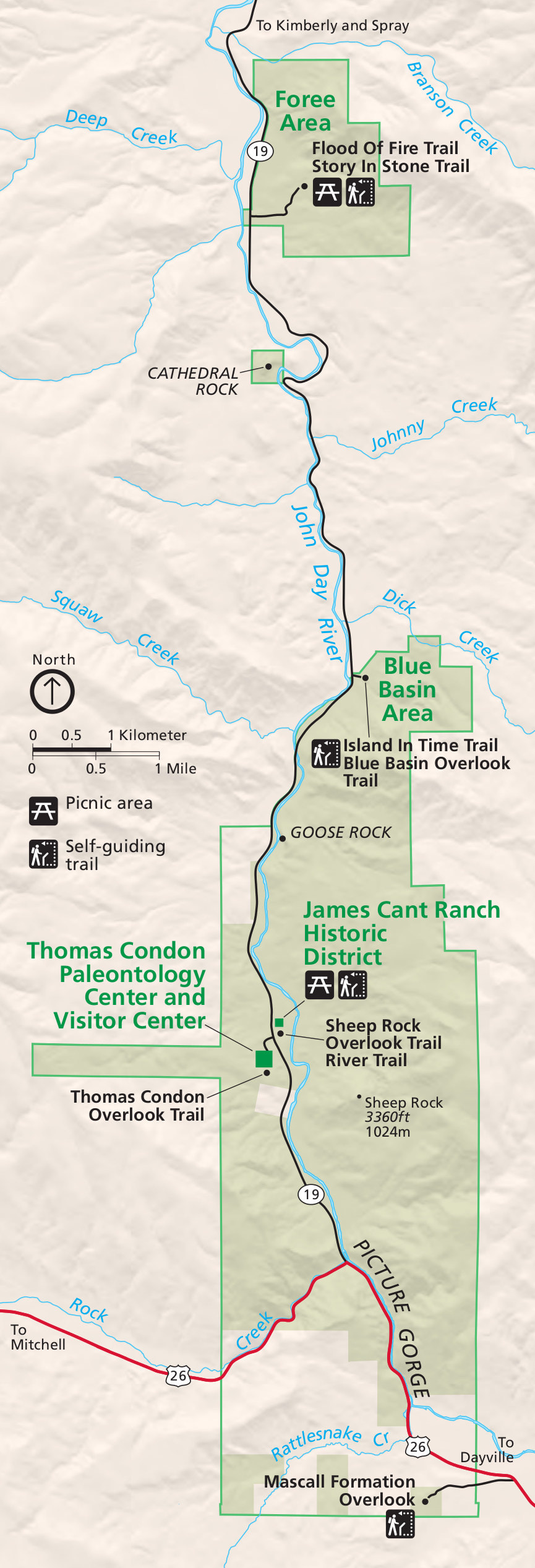 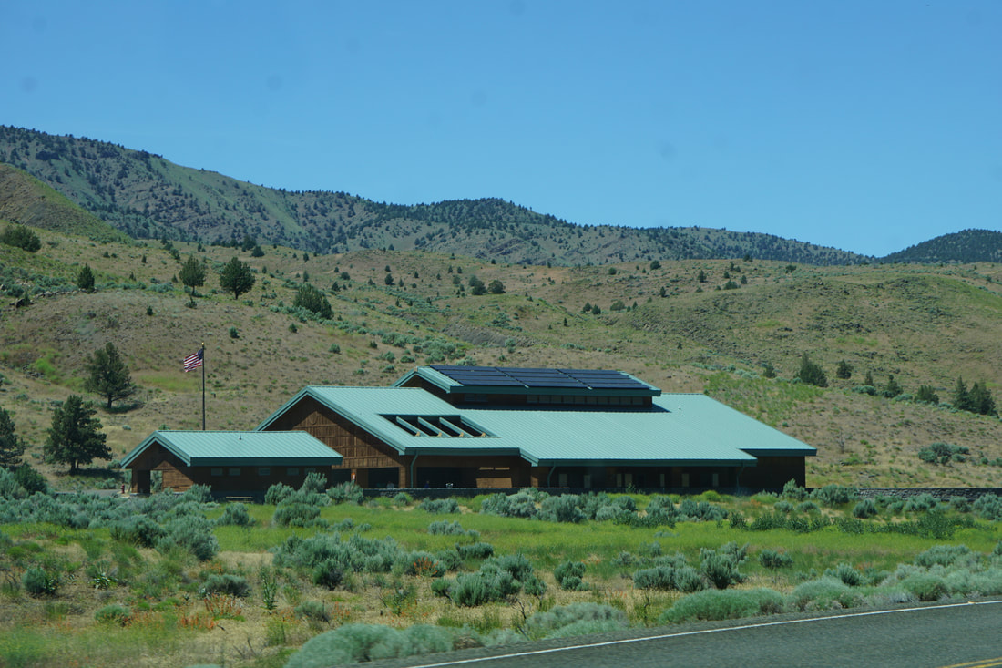 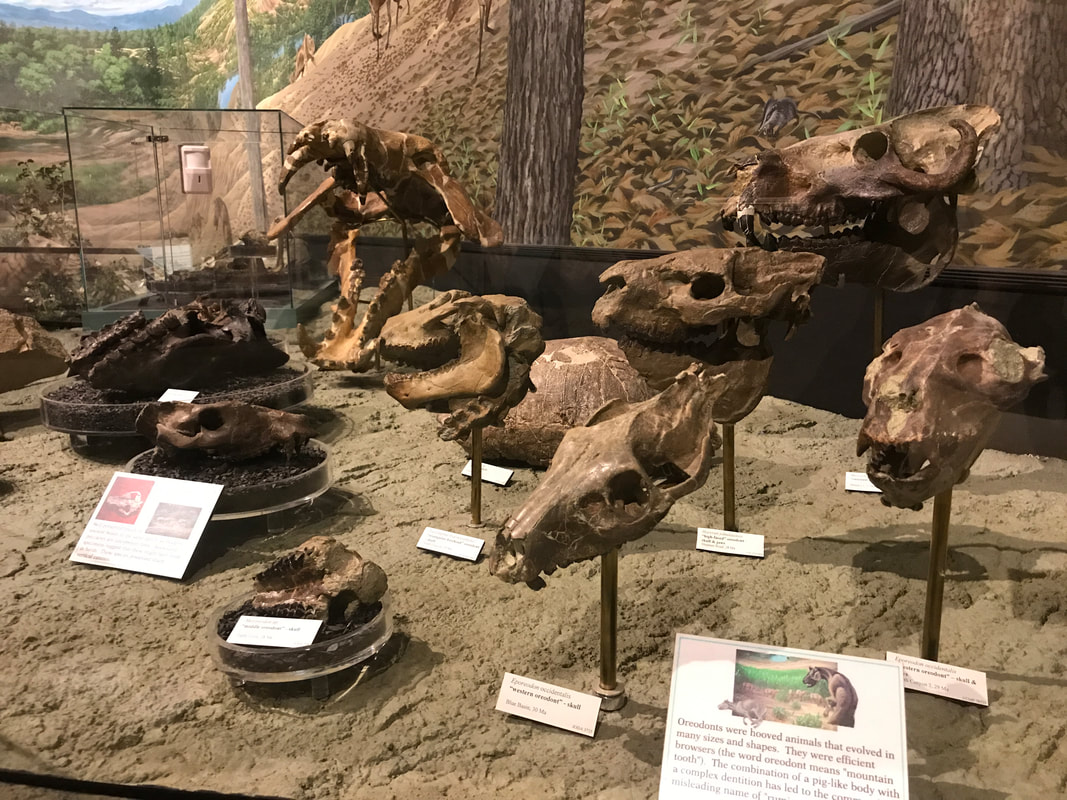  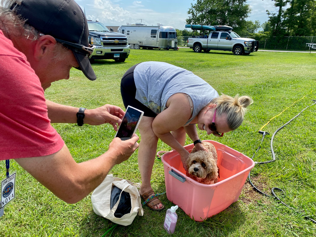 Dogs were allowed on the trails, but with the temperature reaching in the high 80s we thought they were better off in the Silvermine with the AC. Smart move, because there was no shade on the trail! We chose the Island in Time Trail that followed a canyon floor through incredible blue-green badlands called the Blue Basin. There was a trickle of water in the little canyon stream, and it was also a beautiful shade of sage-green. The trail had more than a dozen metal bridges with rough tread plates -- another reason it was good we didn't bring the dogs. It was hot, but there was a breeze and very little humidity. . . a beautiful hike. 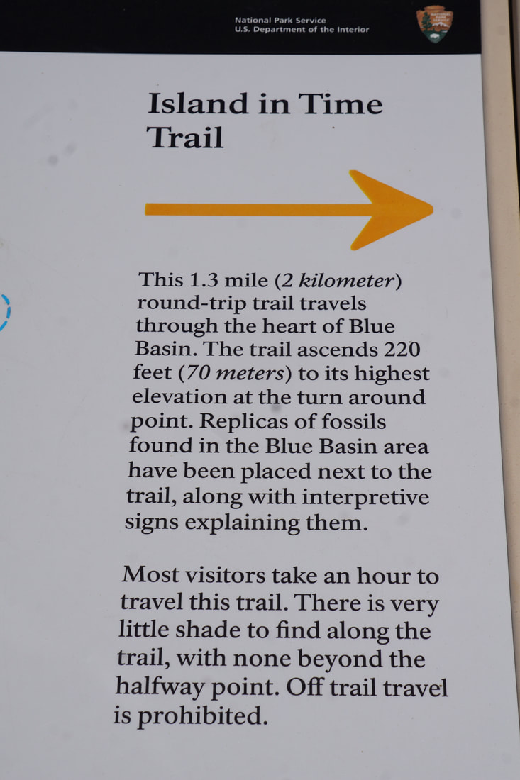   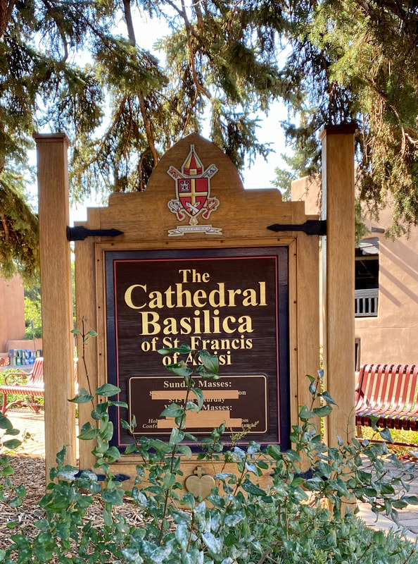 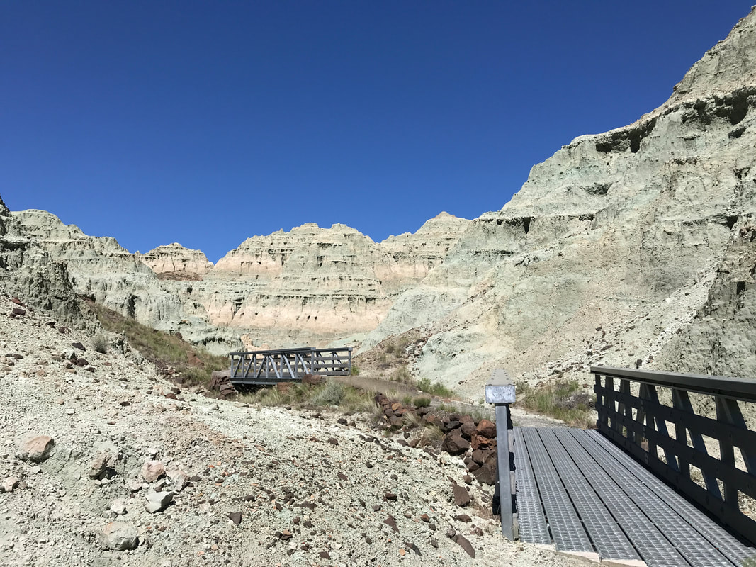 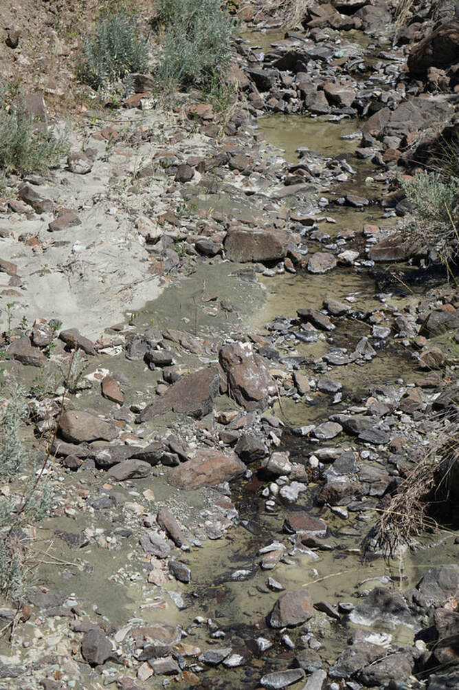 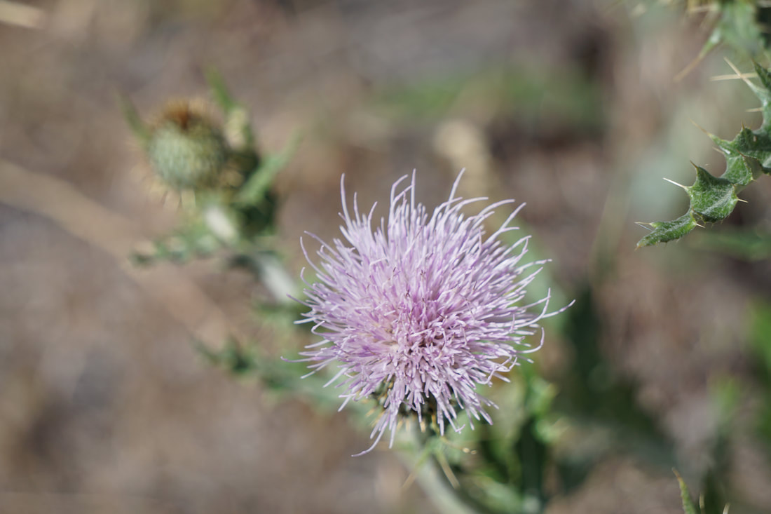 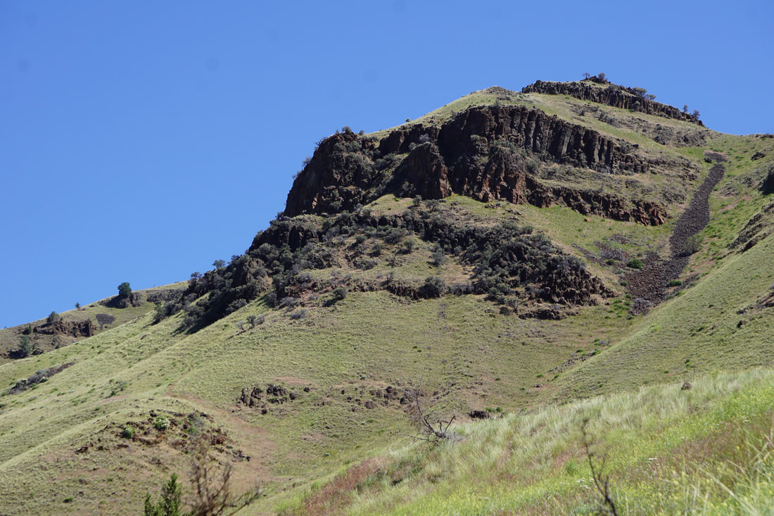 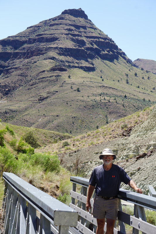  After the hike there was just a short drive up to the Foree location to finish off the park. This part was all driving tour and with the temperature registering 90 degrees, the AC in the truck was appreciated. Our truck also has ventilated seats with fans that suck the hot air away from your . . . underside! 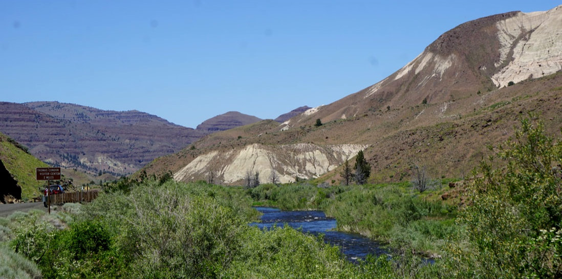 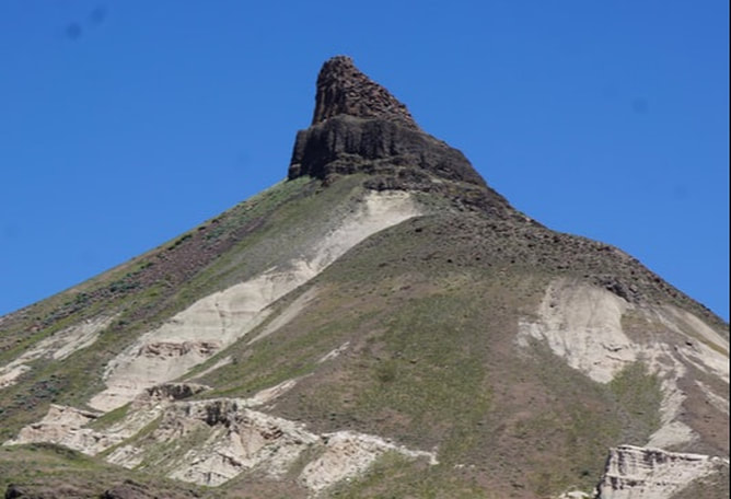 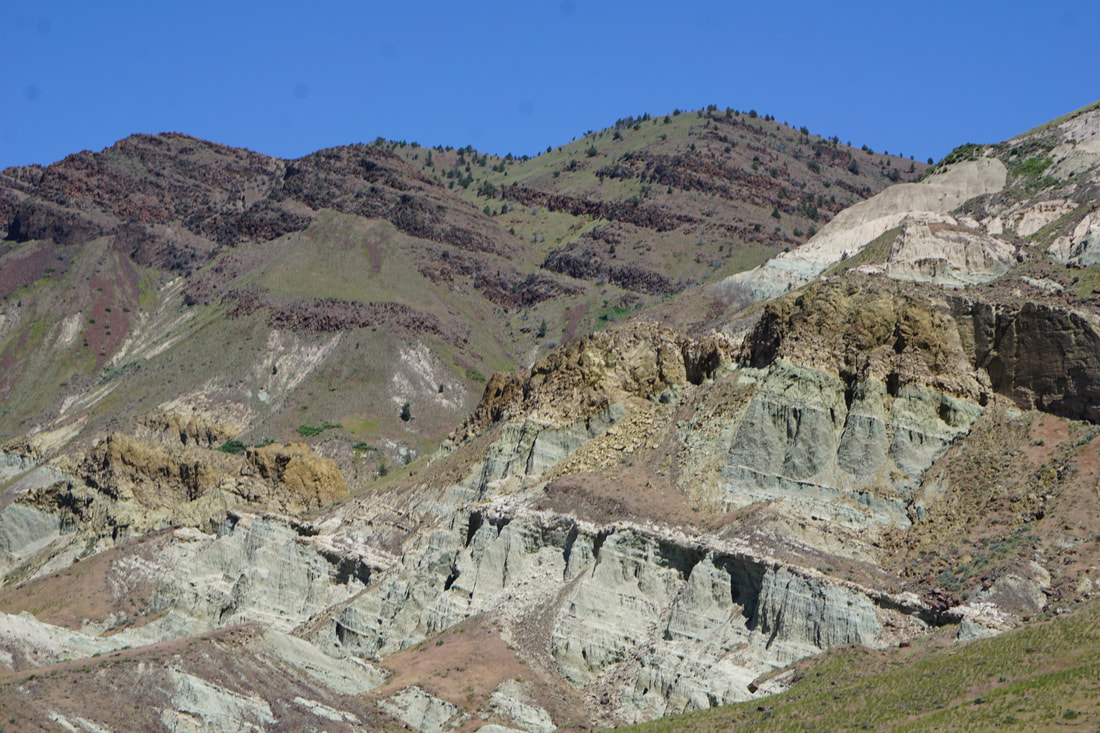 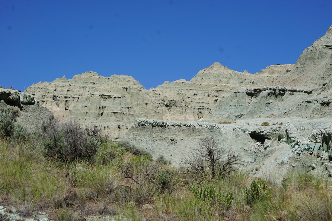 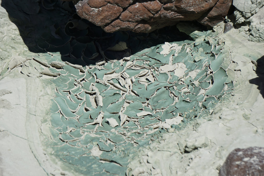 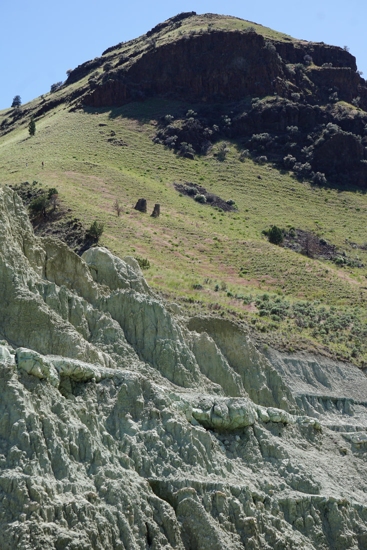 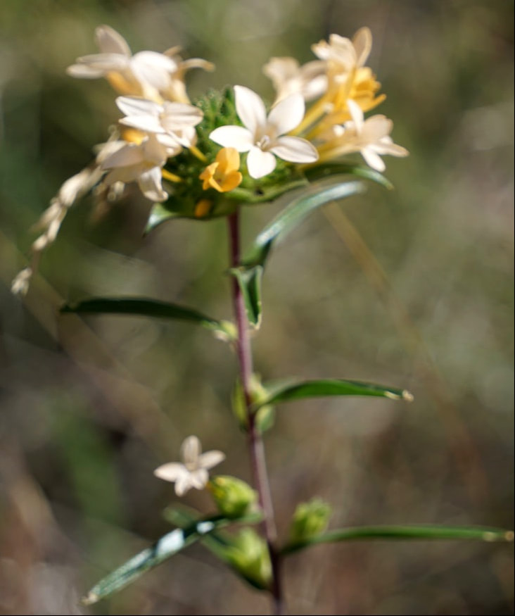 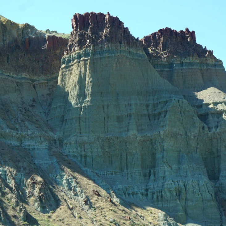 The dogs were fine when we returned to the Silvermine at 4:30, and we promised them that we had scoped out a hike for them in the cool of the morning! All we had left to do was hang around the campsite, walk across the green lawn to the Mercantile, cook supper (Lamb chops!) and relax for the evening.
There is a Twin Falls in Twin Falls, Idaho – but they built a power plant and have mostly shut the water off! Not to worry, because 212-foot Shoshone Falls plunges into the Snake River just 3 miles outside of town. There are three of falls: Bridal Falls, the Bridal Veil, and the Bride’s maid. (Take that Niagara Falls!)  Our first stop at Twin Falls was at the Visitor Center. It is perched on the rim of the Snake River Canyon and has beautiful green lawns, outdoor look-out platforms, and the inside facility has floor-to-ceiling widows offering stunning views of the Canyon. The Perrine Bridge carries four lanes of traffic across the Snake River Canyon – the eighth highest bridge in the USA. The Perrine Bridge is a popular BASE jumping site known all over the world; it may be the only man-made structure in the United States where BASE jumping is allowed year-round without a permit. While we were there two people jumped! 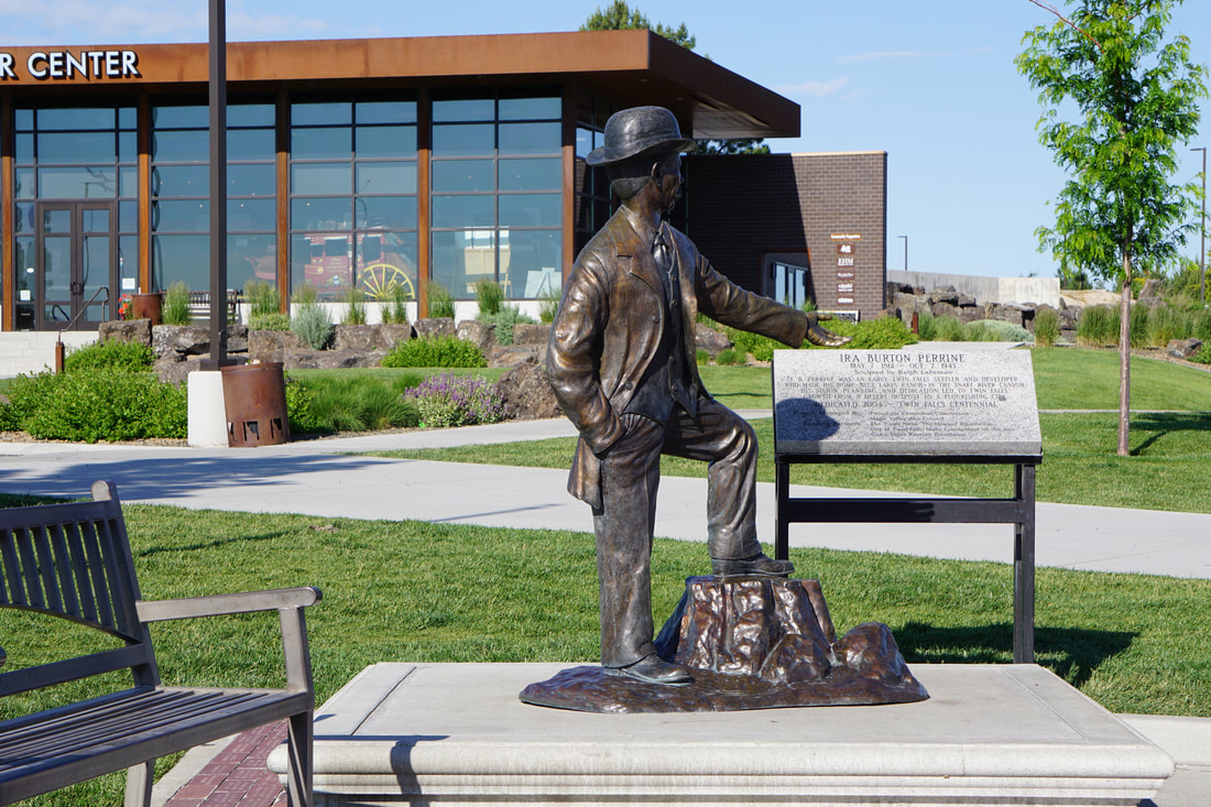 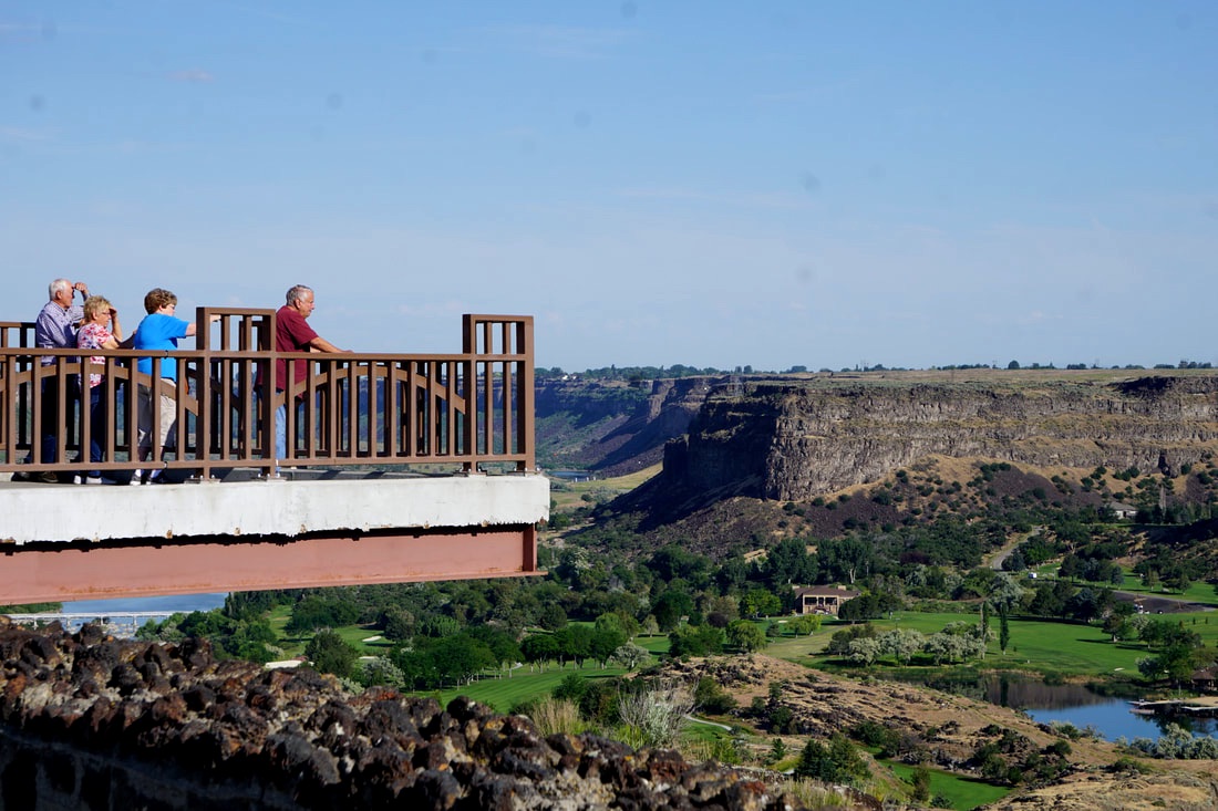 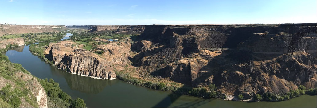 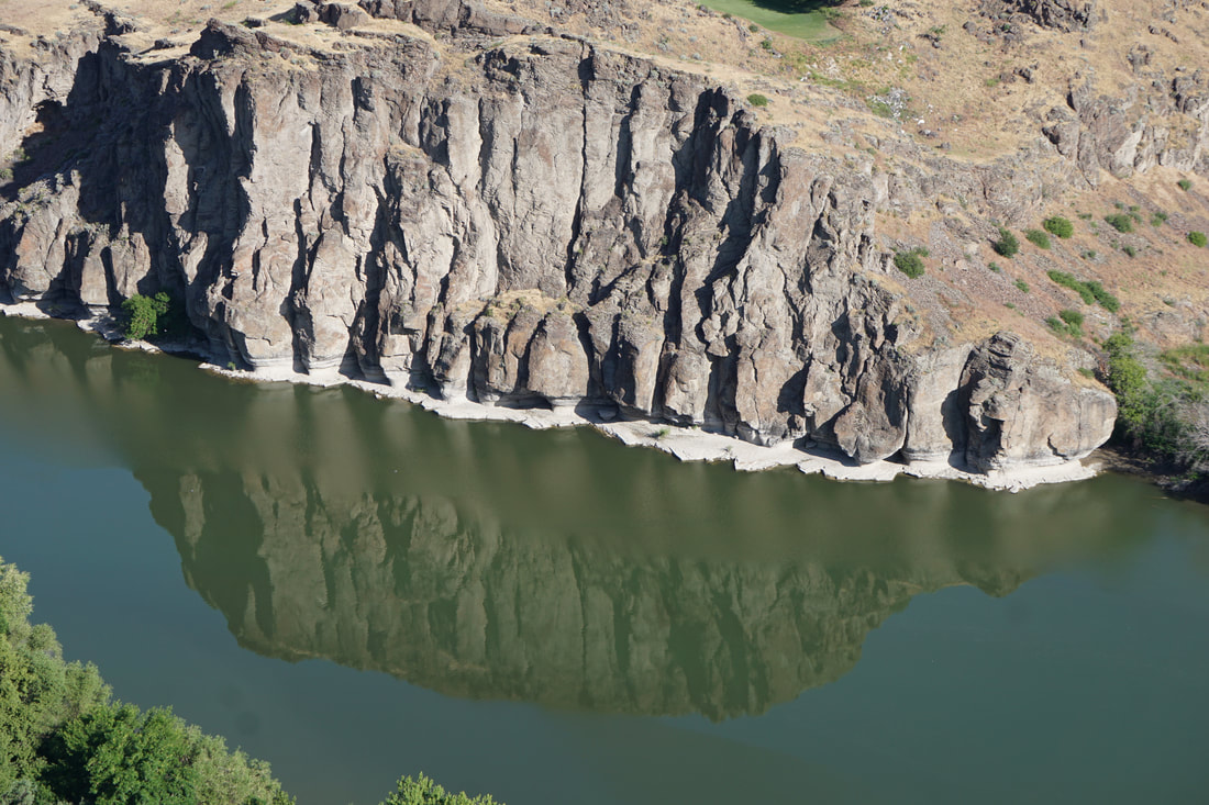 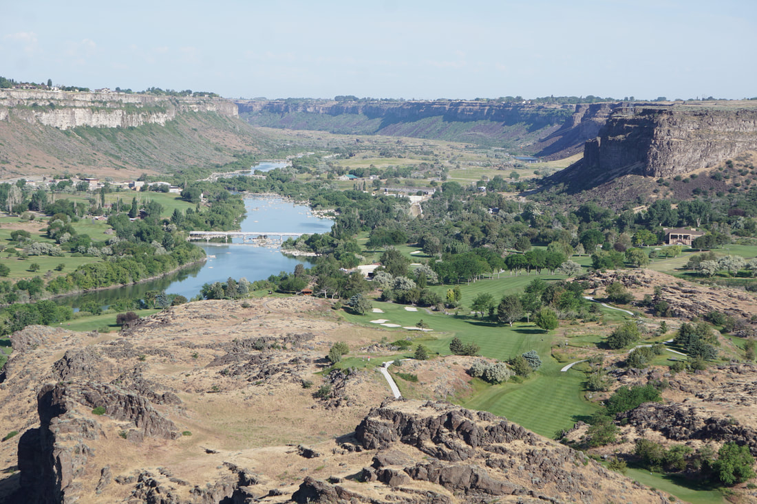 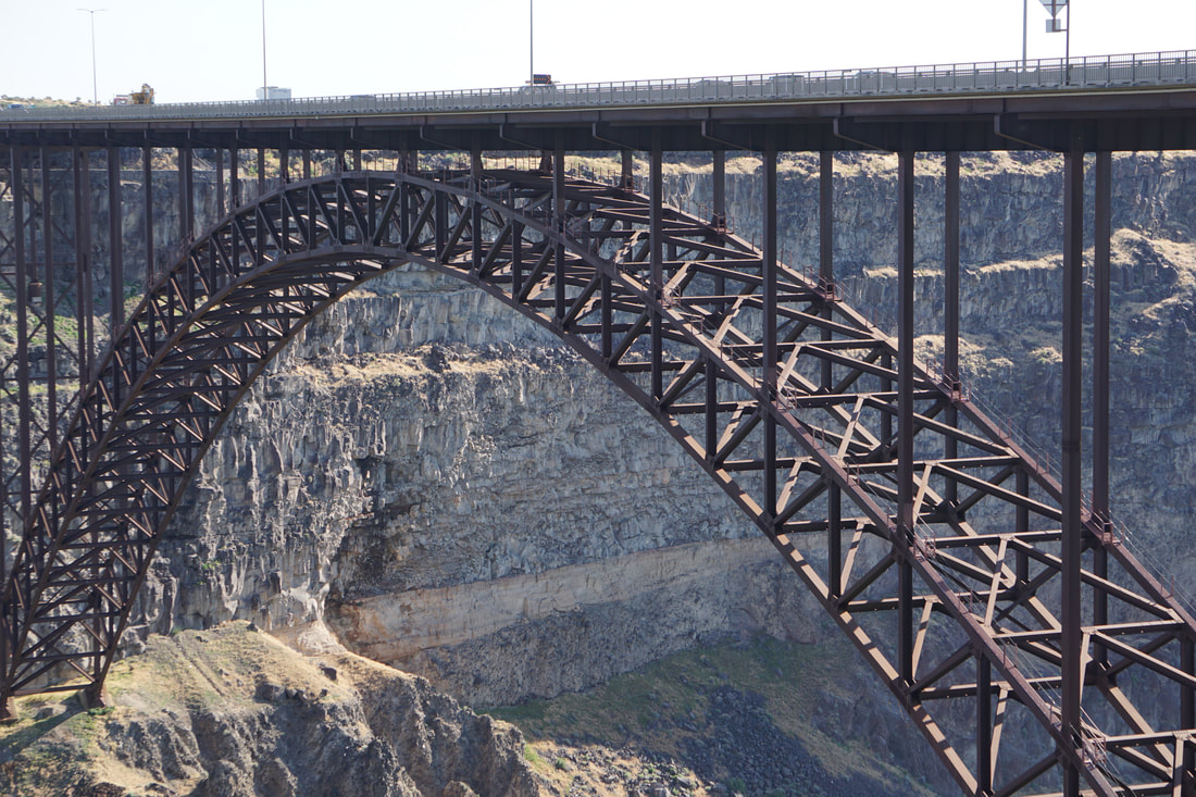 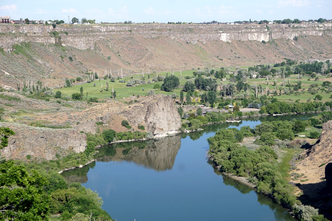 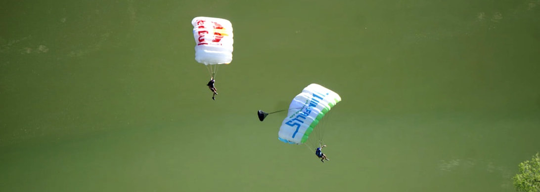 We did laundry in Twin Falls (the city, not the falls) and then hit the Shoshone Falls for a lunch break. There was a beautiful green, grassy, picnic area and a majestic Canyon Rim Trail that offered photo and viewing ops of the falls, the Snake River, and the steep gorge below. It was hard to stop taking pictures! 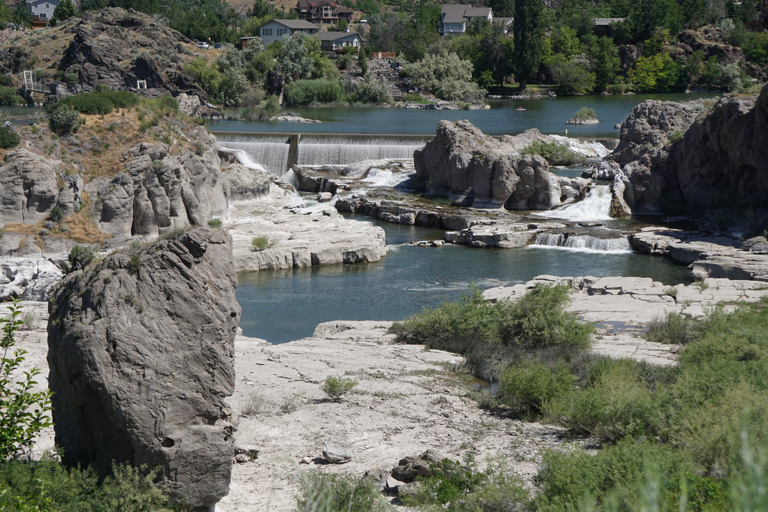 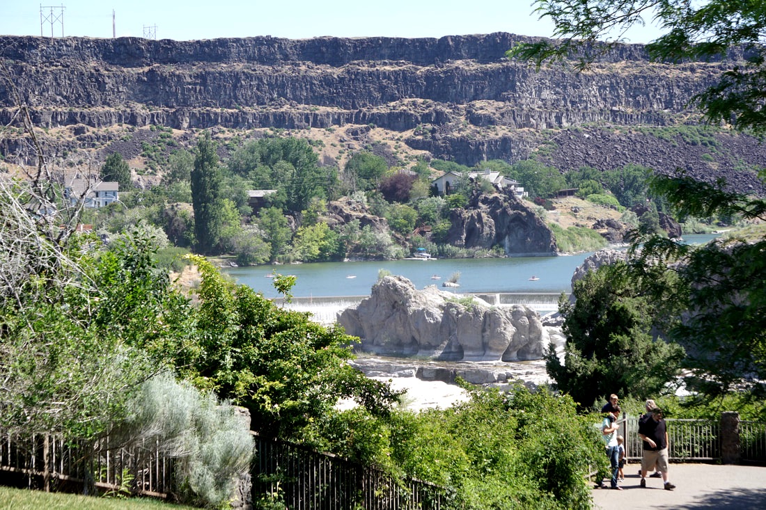 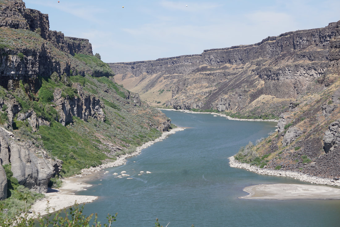 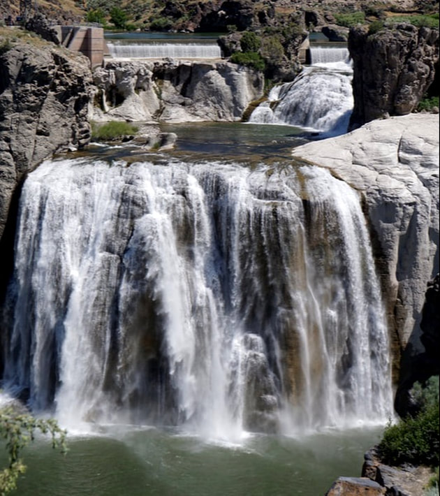 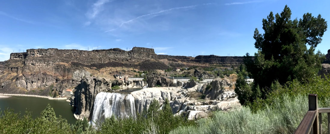 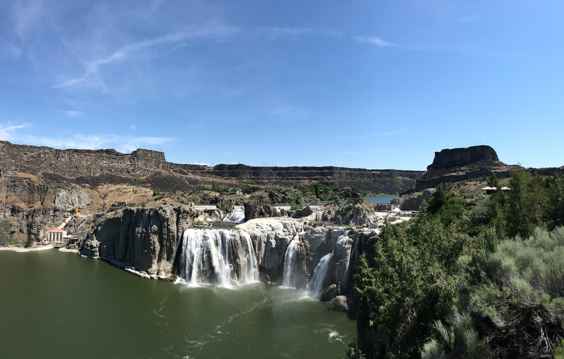 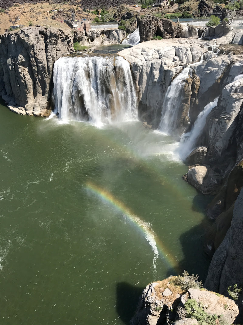 Bear with us – we are new to this selfi-thingy and need practice. Why does it make our heads look so BIG???? (Tom says it really is a wesie) 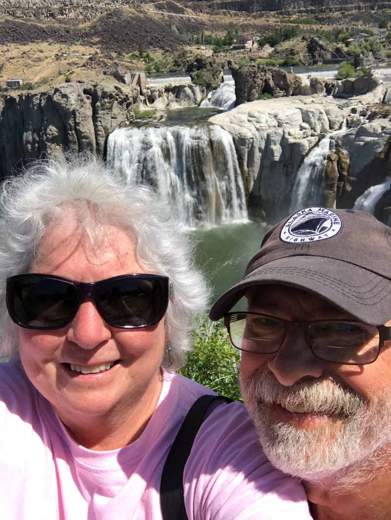 That was a wrap for sight-seeing today. We had another 3 hours to drive through and past Boise, arriving at the Neat Restreat at Fruitville, Idaho. It was full, but he had a wonderful “overflow” site he gave us for $10: full shade, all gravel, access to fast wifi, showers, and electric, and a wonderful little area to sit in without having to unhook or put out the awning. Tonight, an Idaho Potato is on our menu -- we brought it all the way from Van Wert!
Thursday, June 13 Today marks the start of our 2ndweek traveling! We left Lava Hot Springs before 8:00 with only a bit over 100 miles to travel to Craters of the Moon. We left the beautiful low peaks and grassy slopes behind for a flatter plain with some crops (potatoes?) – all irrigated.   Traveling on a state route the facilities were 60 miles apart, and the homesteads (ranches) were few and far between. We passed large solitary mountains (called Buttes) in the distance, and in the last 20 miles we saw a continuous string of mountain ranges covering 180 degrees of our horizon. Closer to our destination, out in the middle of nowhere, we crossed the Big Lost River. That says it all! 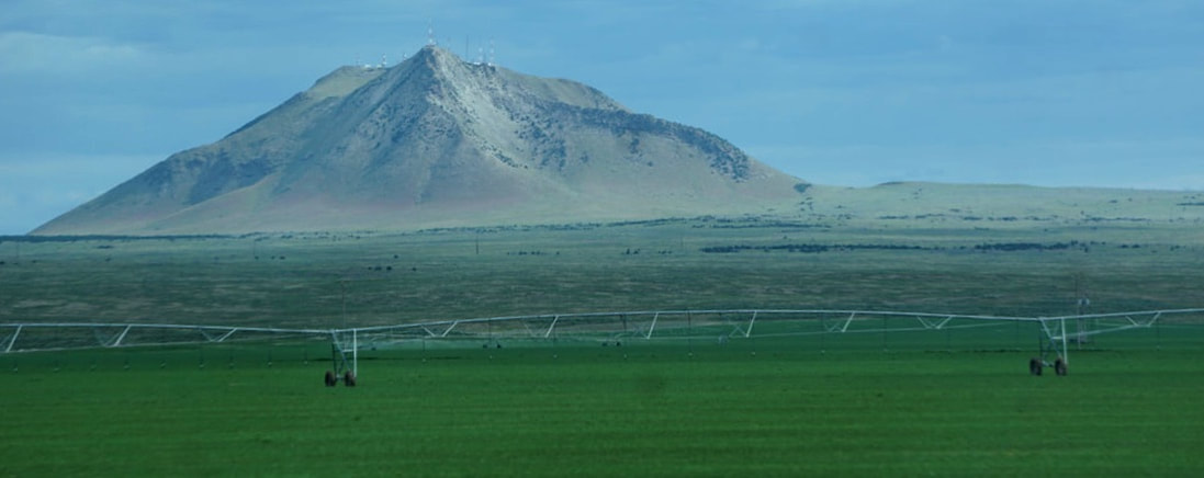 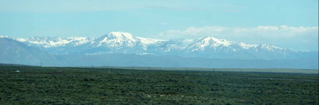  As we approached our destination, turning off towards the Visitor Center and campground, the scenery changed dramatically as we met up with the lava fields. It was like entering another world; there were a few illustrated turn-outs to introduce us to this new landscape concept. 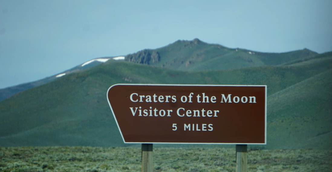 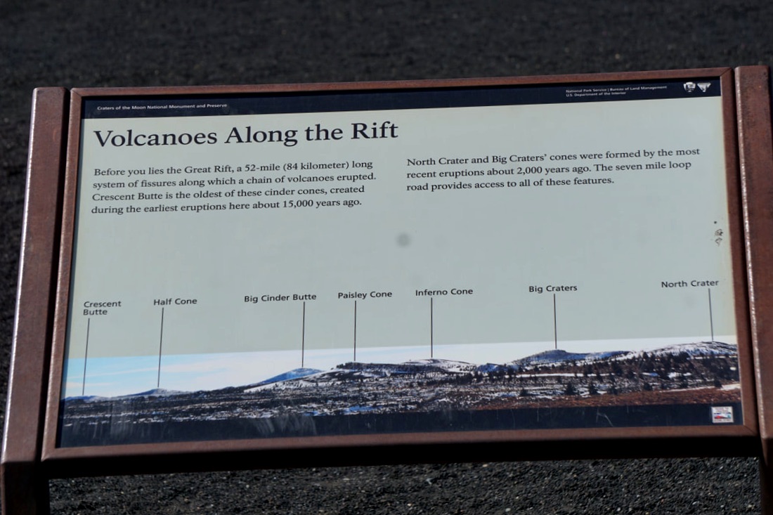 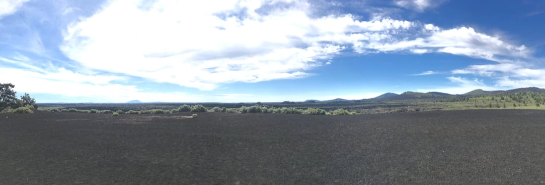 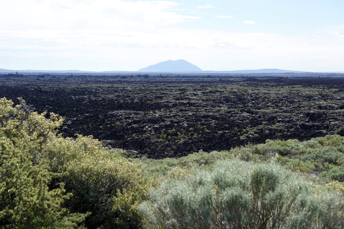 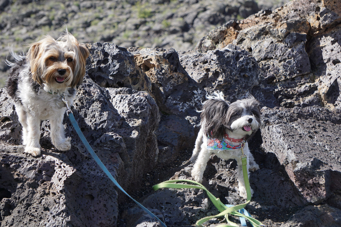 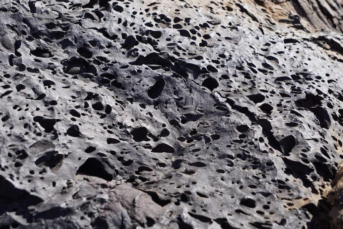 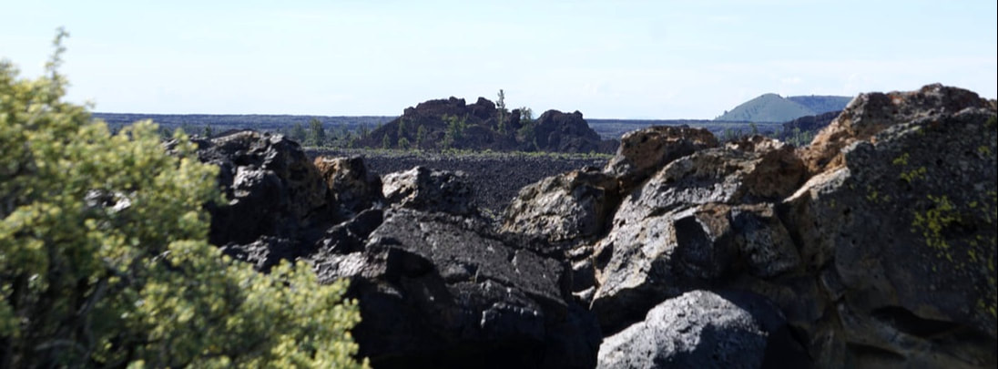 The campground at Craters of the Moon is first-come-first-serve, and we were happy to see that there were plenty of places to choose from; there are no hook-ups.Most of the campsites are pull through sites that tuck the camper away in-between black, rocky, cinder/ boulders. There are nice asphalt roads and camping pads but everything else is rugged rocks and black cinder/soil/dirt. 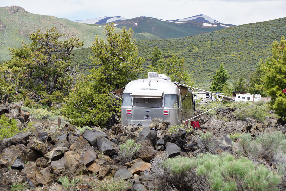 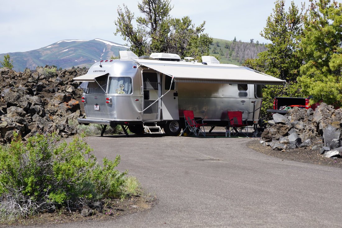 There is a scenic 7-mile loop road that winds over, under, and around the various volcanic features, and has stop-off points for several trails. We drove the loop first to scout out the trails that we wanted to tackle, then; Tom dropped me off at the camper while he went out to explore the cave area. CAVE is still a dirty word to me following my accident last year. 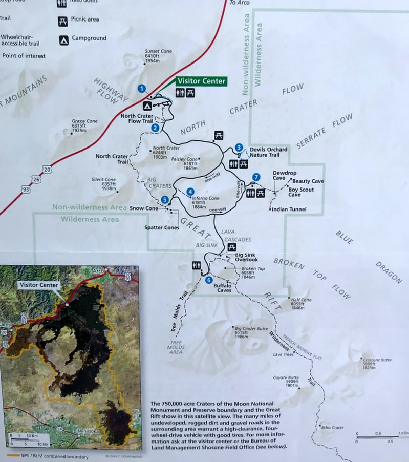 There is a scenic 7-mile loop road that winds over, under, and around the various volcanic features, and has stop-off points for several trails. We drove the loop first to scout out the trails that we wanted to tackle, then; Tom dropped me off at the camper while he went out to explore the cave area. CAVE is still a dirty word to me following my accident last year. Here are pictures of Tom's cave visits. 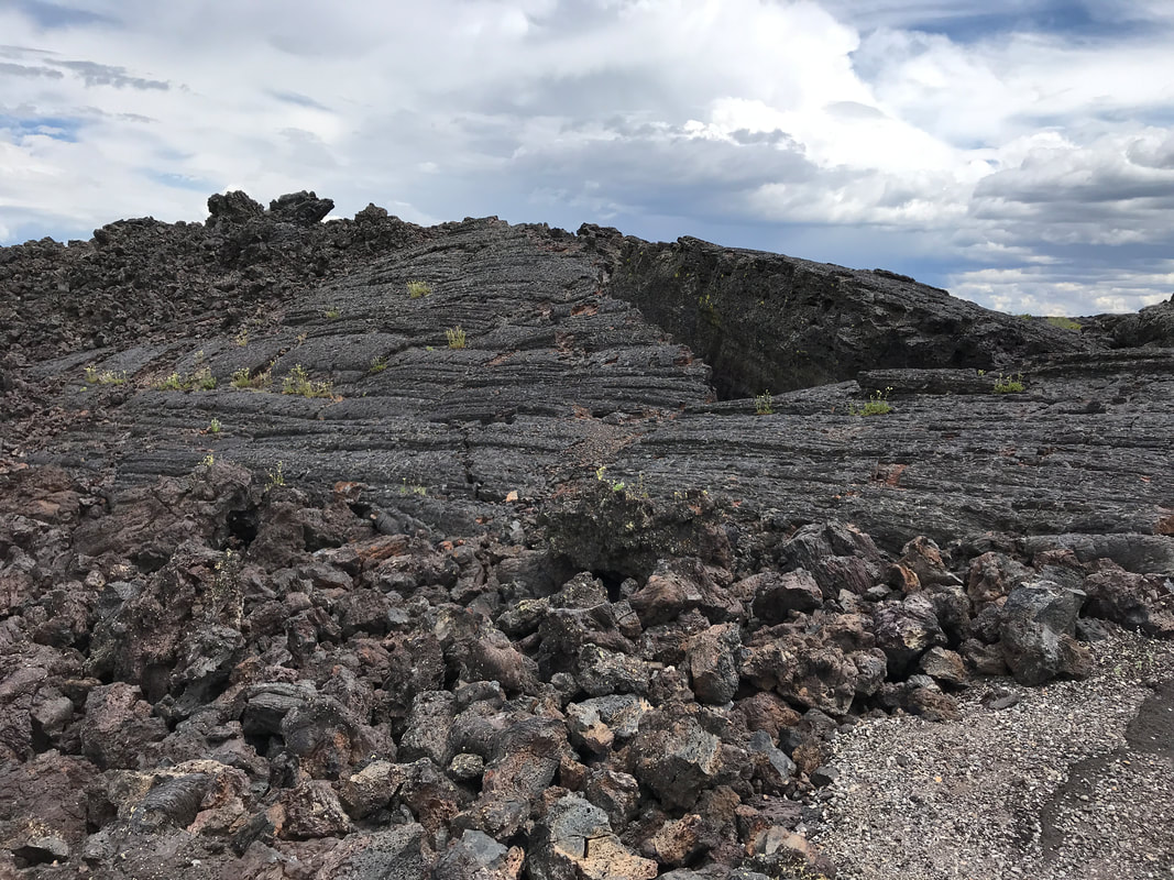    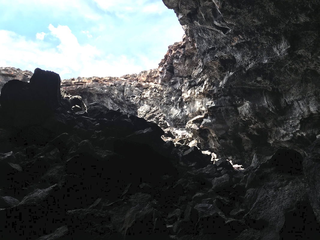 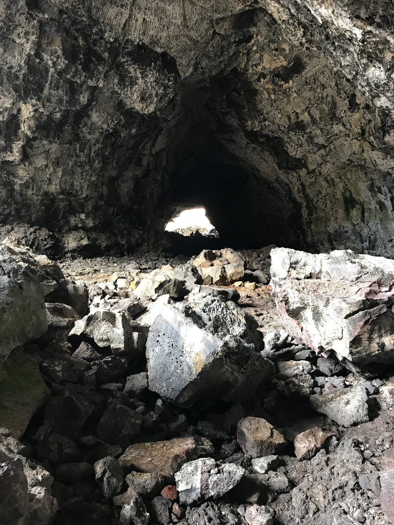 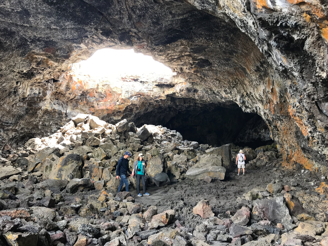 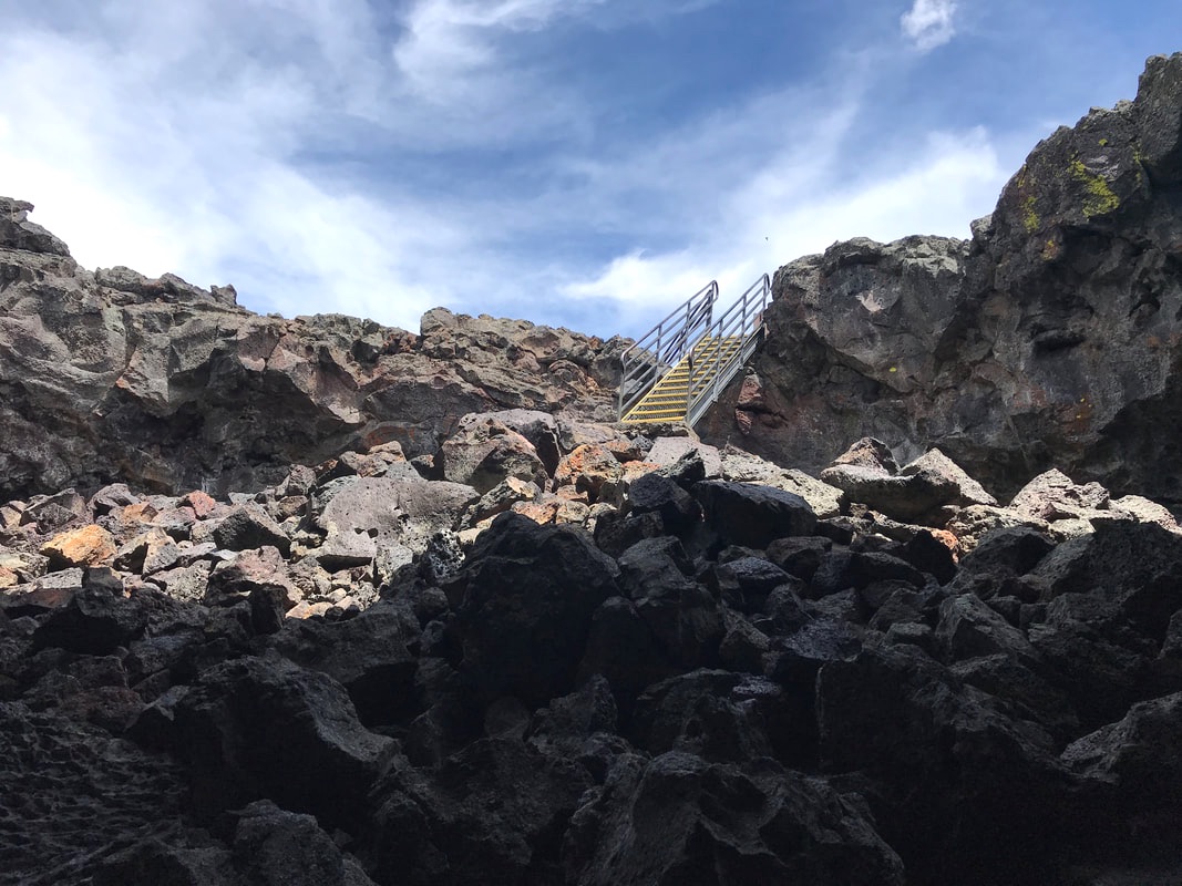 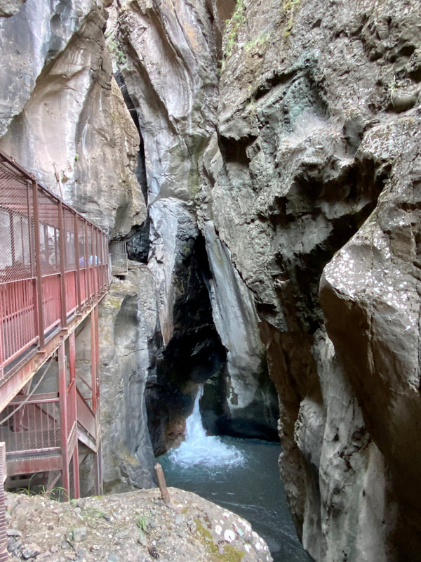 When Tom returned we headed out for some of the walks . . . dogs not allowed. We did the Devils Orchard Nature Trail, the Snow Cone, the Spatter Cones, and the Lava Cascades. Also on display were wildflowers that bloom right on the cinder/dirt -- called Cinder Gardens. Tom wanted me to see the start of the hike back to the caves, but a storm moved in and hurried us back to our campsite. There we sat out 20 minutes of hard rain, 5 minutes of pea-sized hail, and a 10 degree drop in temperature. The sun finally came out, the asphalt steamed for a while, and the temperature climbed! 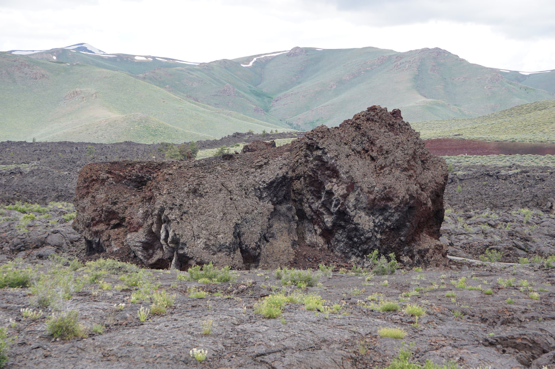 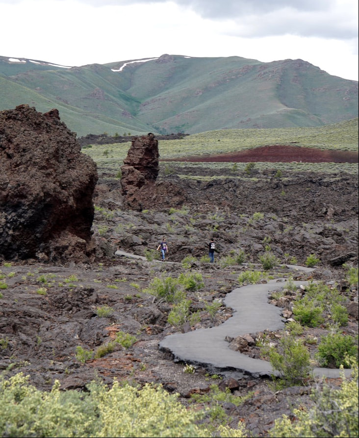 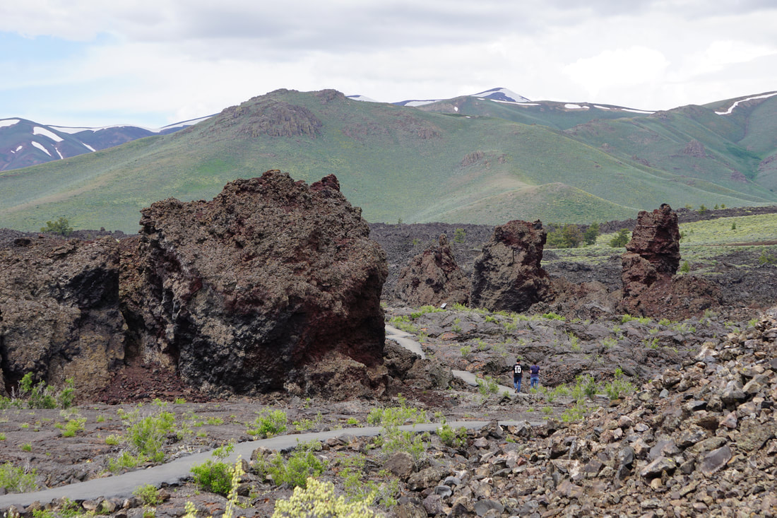 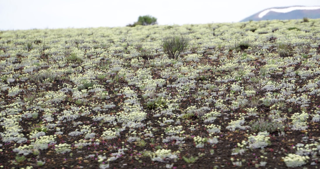 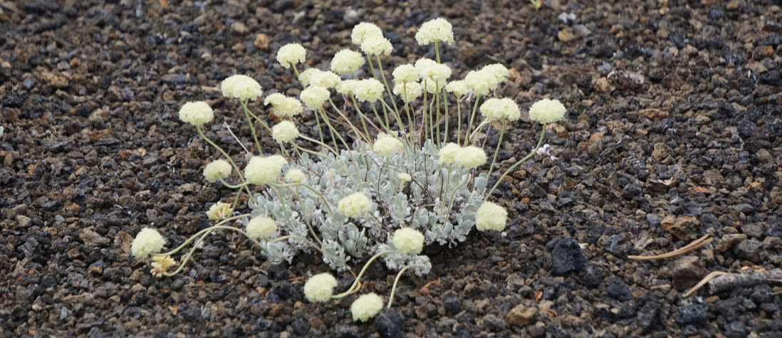 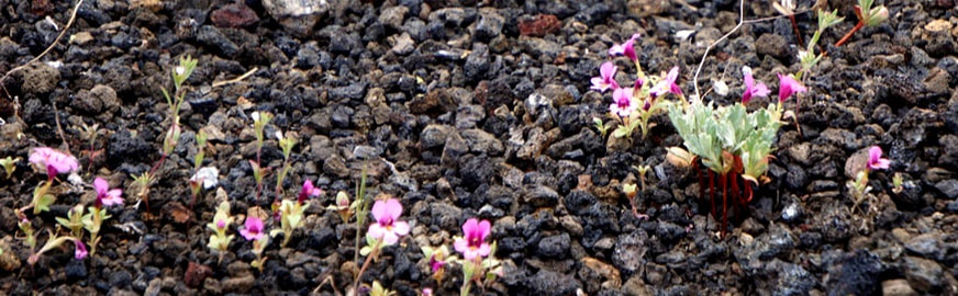 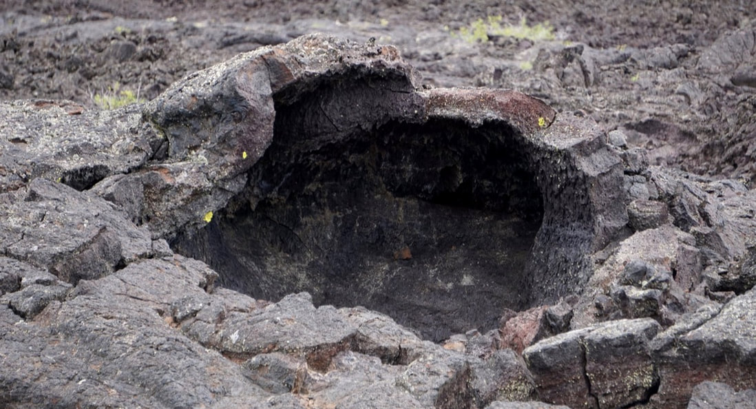 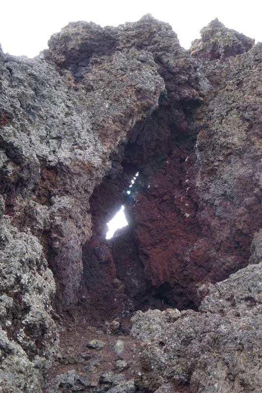 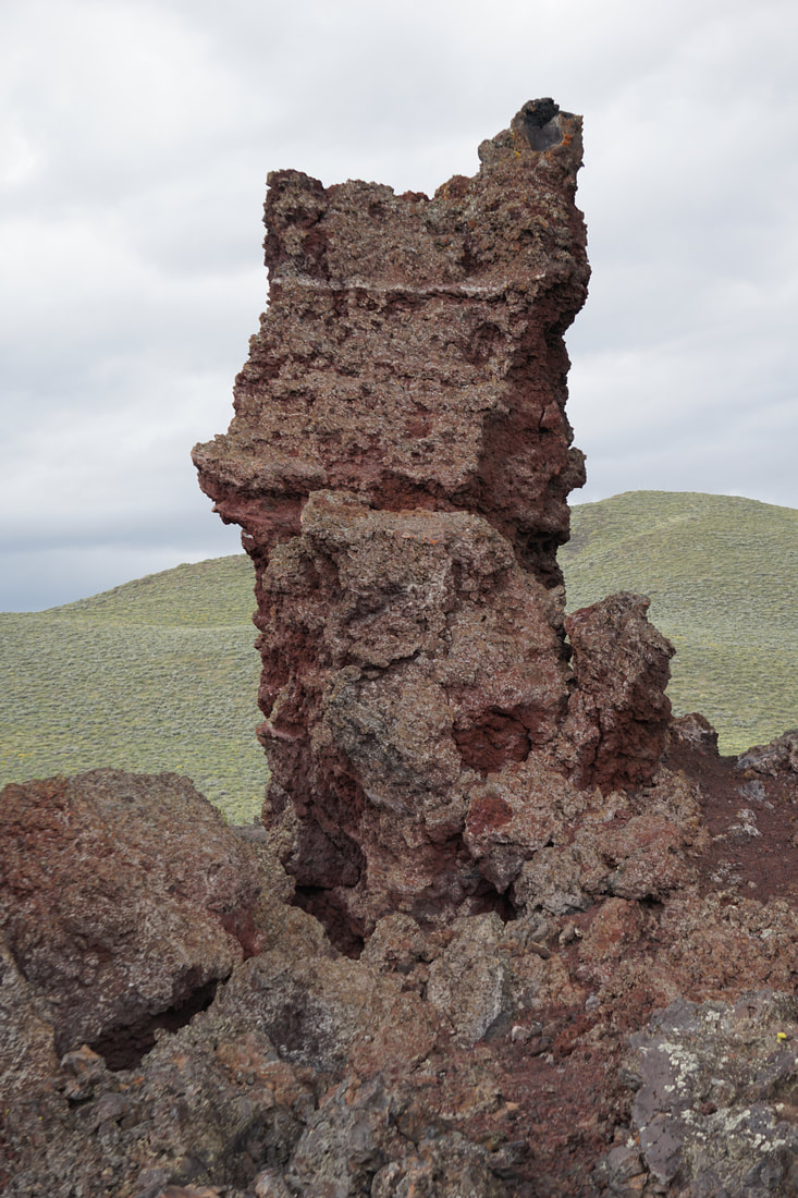  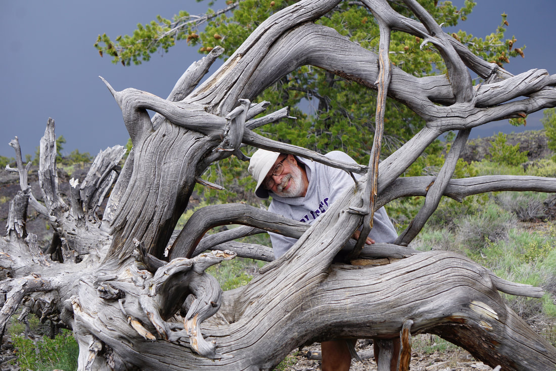  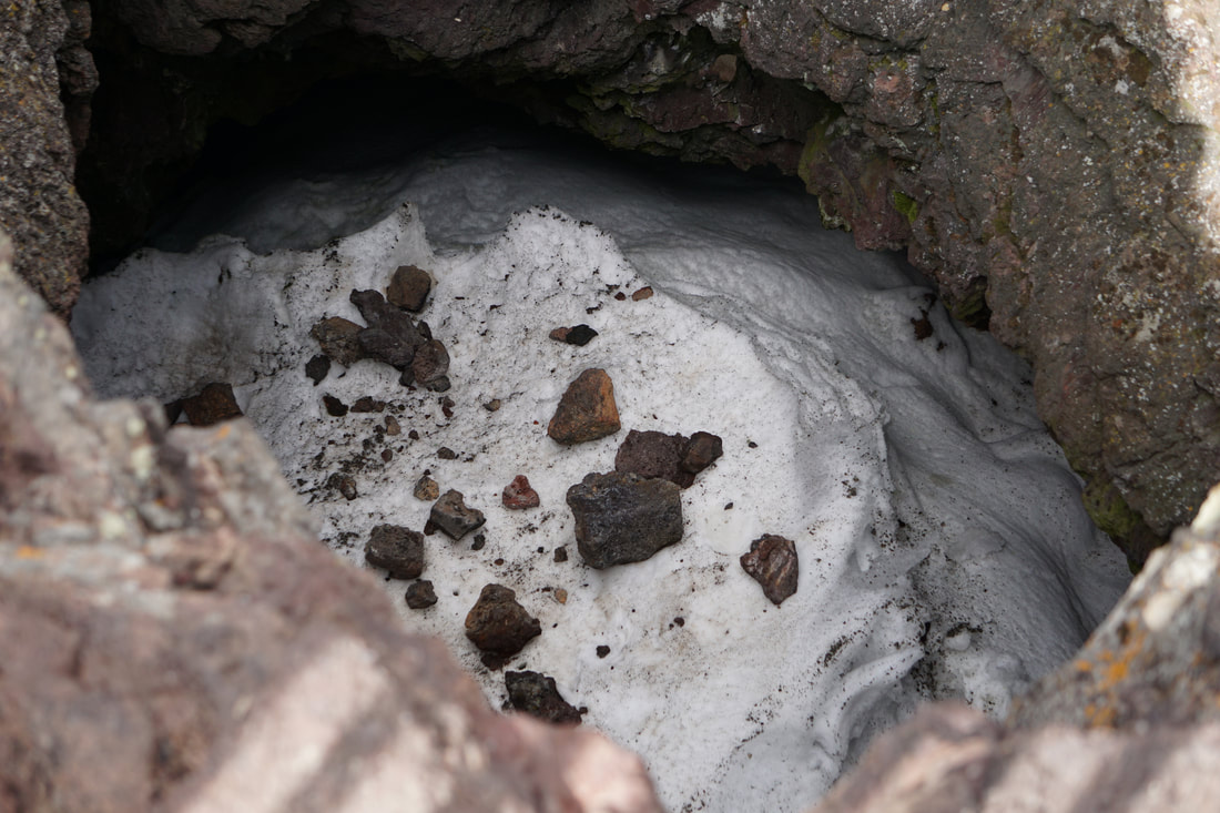  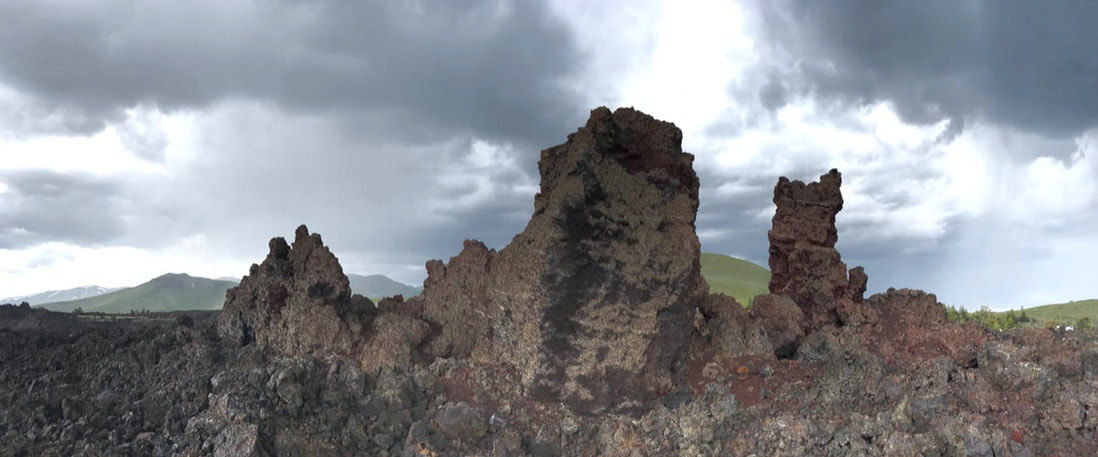 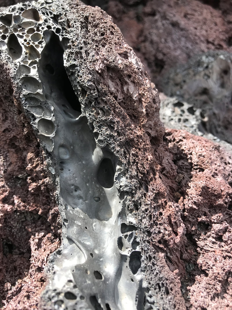 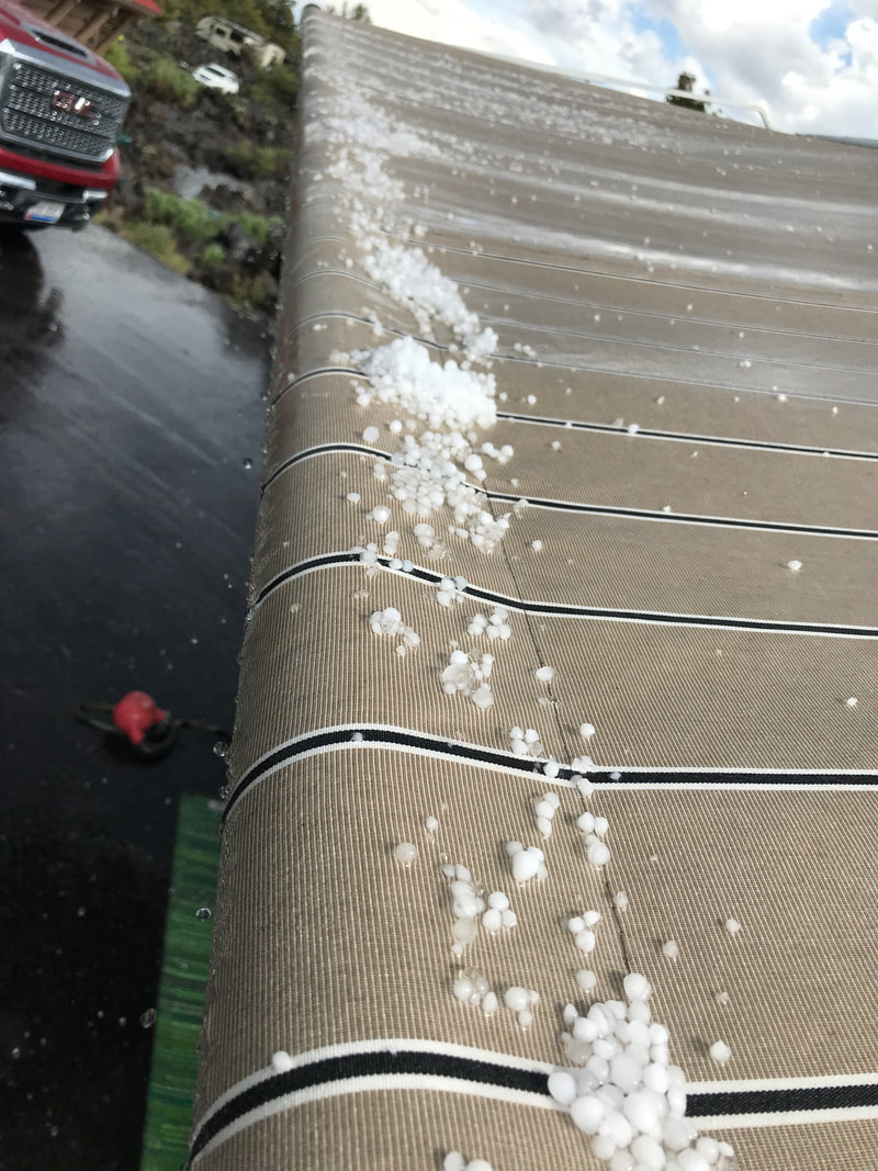 After dinner we took a ranger-led hike from the campground up a steep series of inclines to a marvelous overlook of the area. From high up we could see the campground . . . and the Silvermine. Neither of us was up for the ranger program at 9:30! 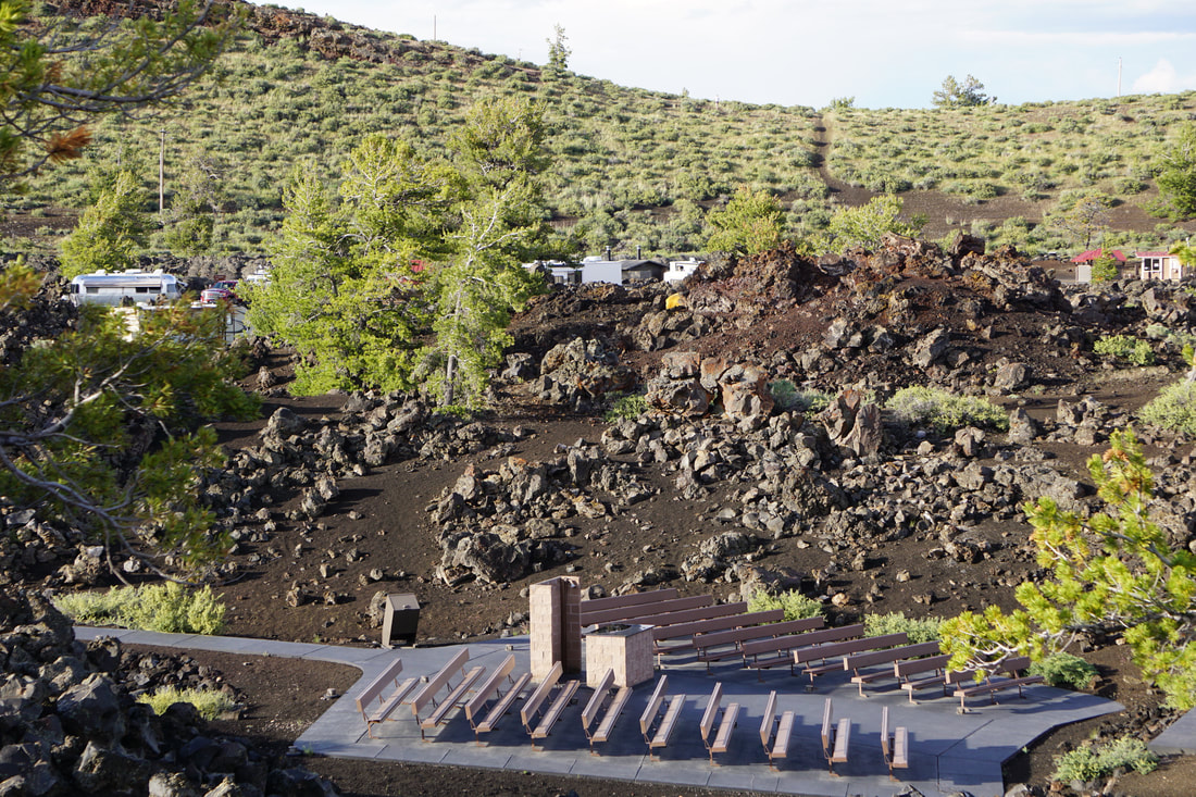 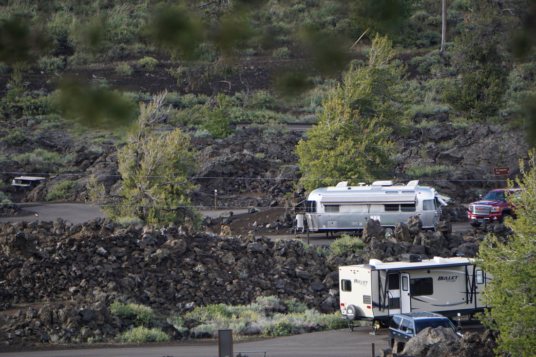 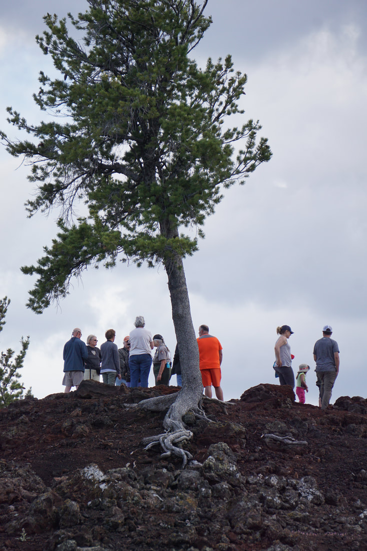 Craters of the Moon is like no other land features we have ever seen. The park is clean, beautifully paved and well-marked. But, more than any other park we have been to, everything preaches about conservation. Admonishments are included in every overlook and trail-path sign. Even the ranger on our evening hike preached and admonished our presence in the area. It was all a bit much, and left us with guilty and negative feelings about even visiting.
Wednesday, June 12 So many of you asked for it – here is a picture of Tom and I in our swimsuits! That’s all I’m going to say about that!  Staying put in Lava Hot Springs was a good idea; we drove downtown for a breakfast at the Chuckwagon. We would easily have been able to order 1 “mini-meat-skillet-breakfast” and share it! 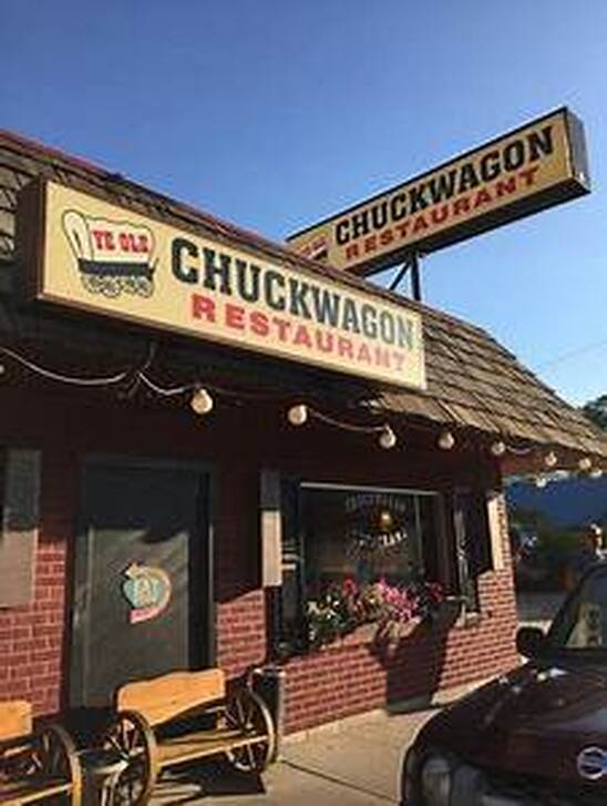 With beautiful scenery in every direction, Tom inquired at the campground desk where we were should head for a scenic drive . . . and off we went! We were misled a couple of times, and ended up just making a circle out in the country and back into town. With a late (and big) breakfast we had a couple snacks for lunch, and then enjoyed an afternoon siesta at the campground. I keep listening to Morman Tabernacle Choir albums – their greatest hymns, today! 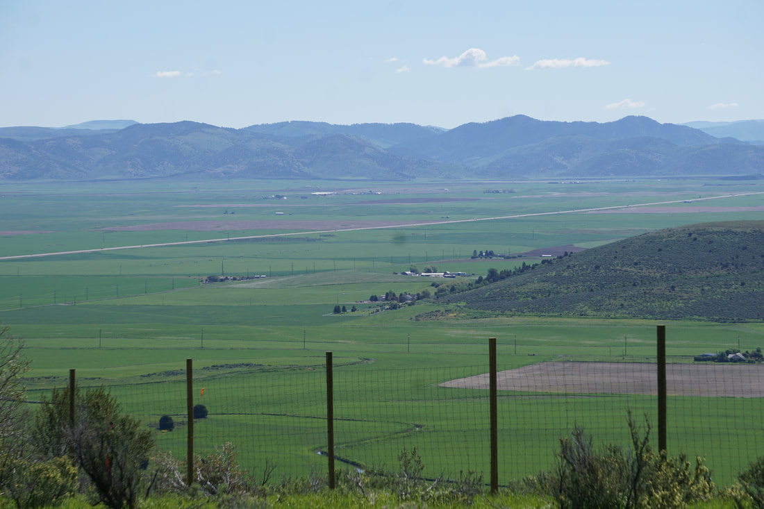 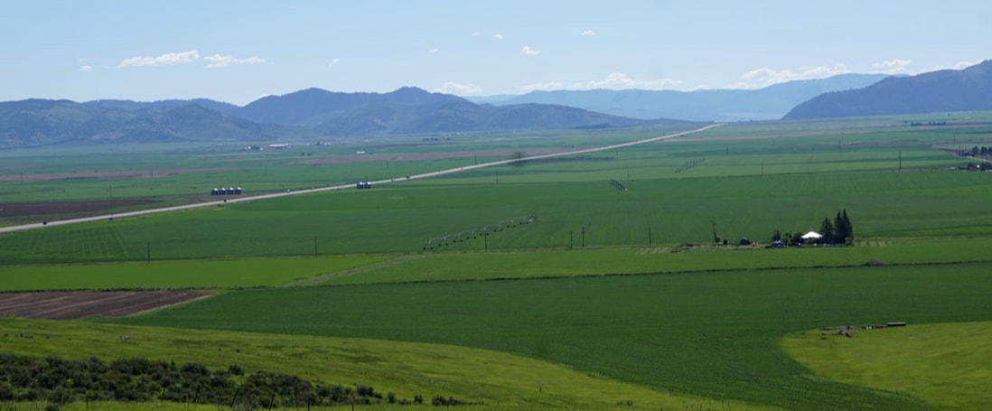  Mid-afternoon we went into town for a few grocery items, and then reported to the hot springs for a mineral dip. I took the camera inside the pool area this time to get pictures of the various mineral baths – but no pictures of us! Our tolerance for being down in the water is limited to the 105 degree pool and after 15 minutes submerged to the chin, we start moving to the ledges around the side and moving up by degree. We’re good for another hour in the water, and then sit in the shade on the edge with just feet and legs dangling while we dry off. Today we met a very like-minded couple that is camping the USA in a 1972 GMC motor-home, and enjoyed swapping favorite camping places with them. 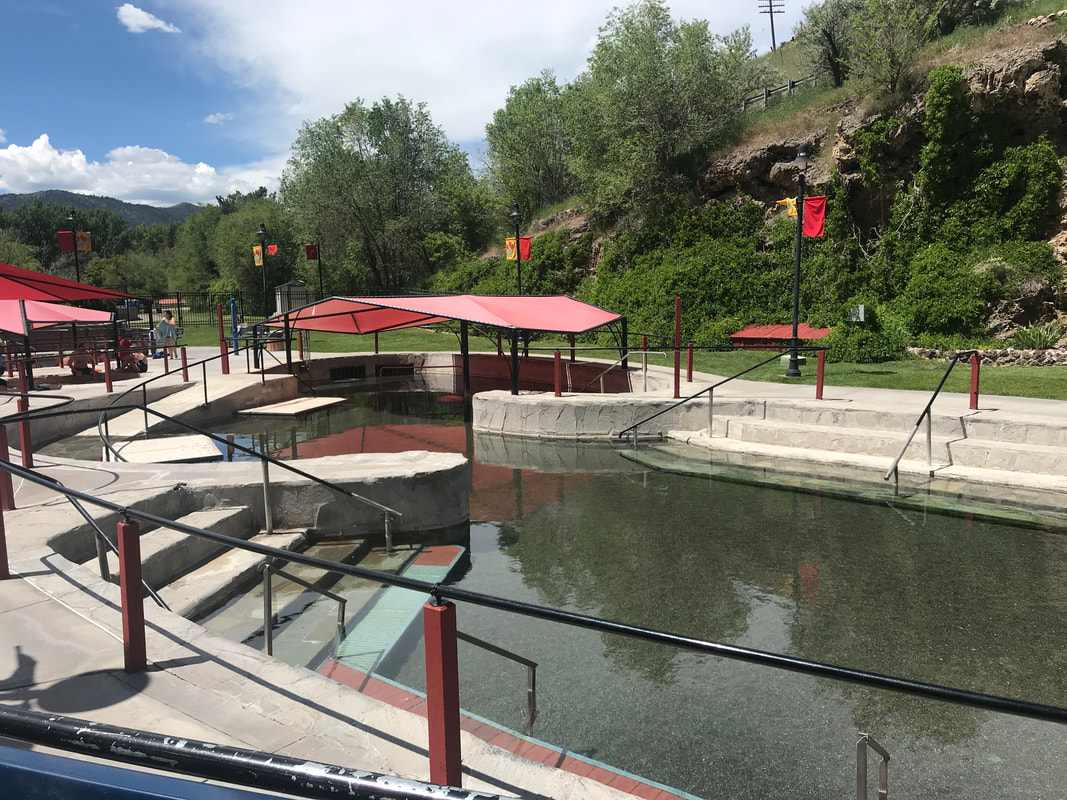 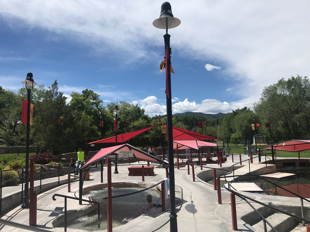  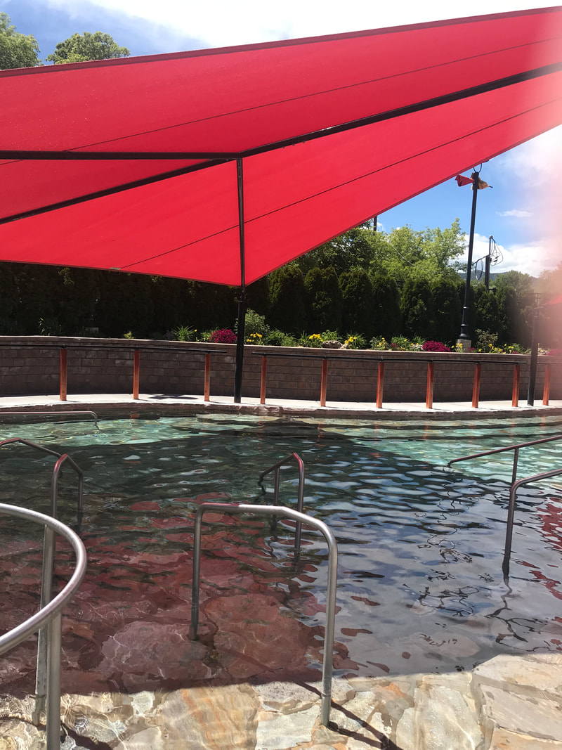 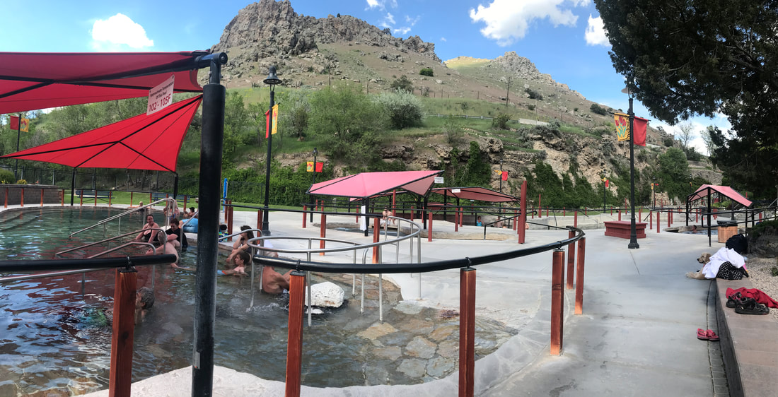 That pretty much wraps up our Lava Hot Springs escapade. Tomorrow we're on our way to another one of Tom's fond childhood memories . . . Craters of the Moon!
Tuesday, June 11 Leaving Salt Lake City at 8:00, we headed north on I-15 and jogged over to the Golden Spike National Historic Site at Promontory, Utah. We had thoroughly enjoyed listening to the “Iron Rails, Iron Men” audio book about the great race of the transcontinental railroad and following the Union Pacific tracks across the plains. Now we would be able to see where the Union Pacific met up with the Central Pacific and the famous golden spike was buried in tribute. We were here 150 years, 1 month, and 1 day after the great event! 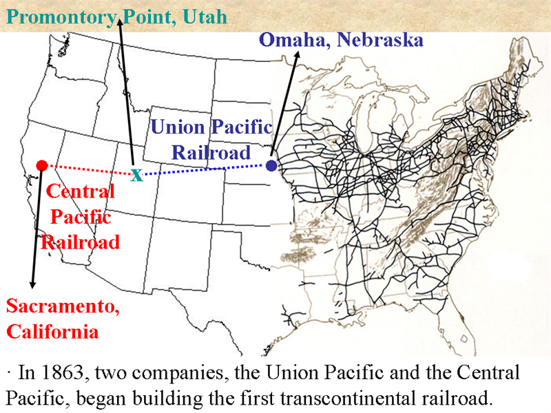 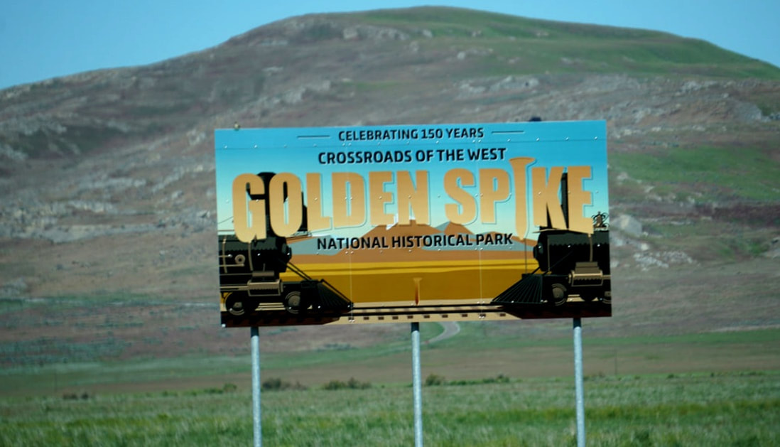 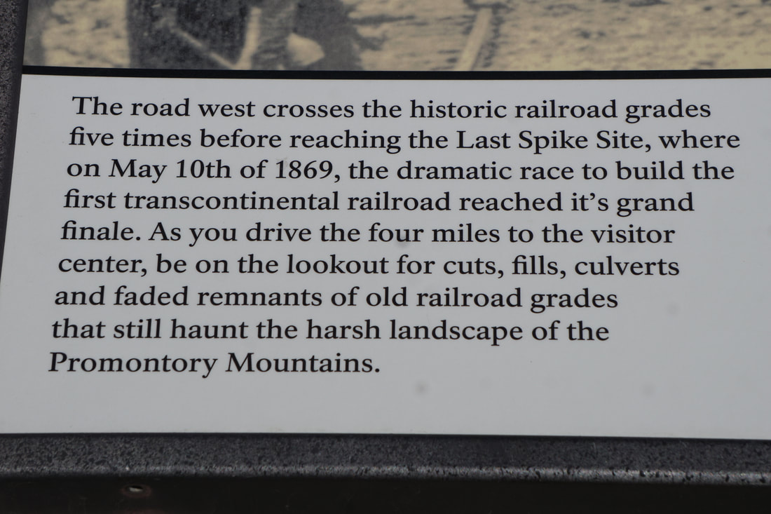 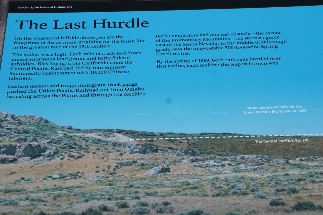  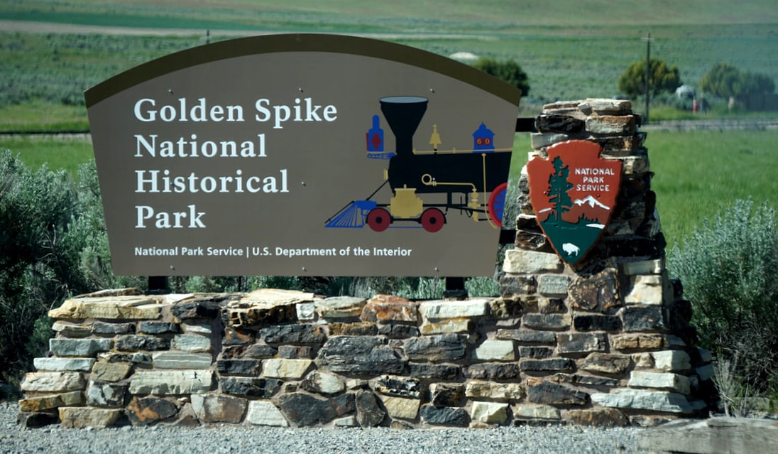 Talk about 20 miles from nowhere . . . that is where Promontory Summit was! And yet, it is one of the best historical sites we have ever seen. The Transcontinental Railroad used to run right through that desolate 20 miles, but in 1904 the tracks were abandoned when a new spur was constructed. Later 2 miles of tracks were laid at the location of the Visitor Center to allow reenactment of the golden spike moment. Two engines, the Union Pacific 119 and the Central Pacific Jupiter, were built in identical detail to the original engines at the meet-up. The gold colored portions of both trains are coated in gold leaf – NOT just gold paint! The Jupiter was a passenger train and looked like a circus train . . . the 119 was a freight train painted in beautiful Victorian style. This is a painting of the event showing the engines in 1869. 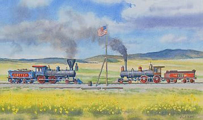 The reenactment began with the Jupiter chugging backwards down the tracks and getting into position right beside the golden stake plaque. Then engine 119 rolled down the track and pulled up nose-to-nose to the Jupiter. As soon as both trains were stopped and secured we were allowed to walk up close and around for a good look. The whole event was narrated over loudspeaker by a Park Ranger.  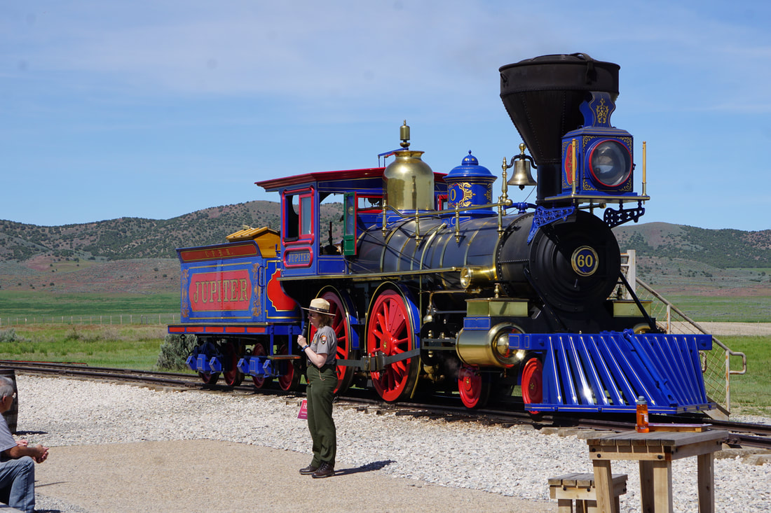 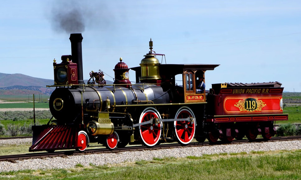 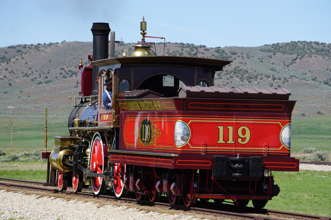  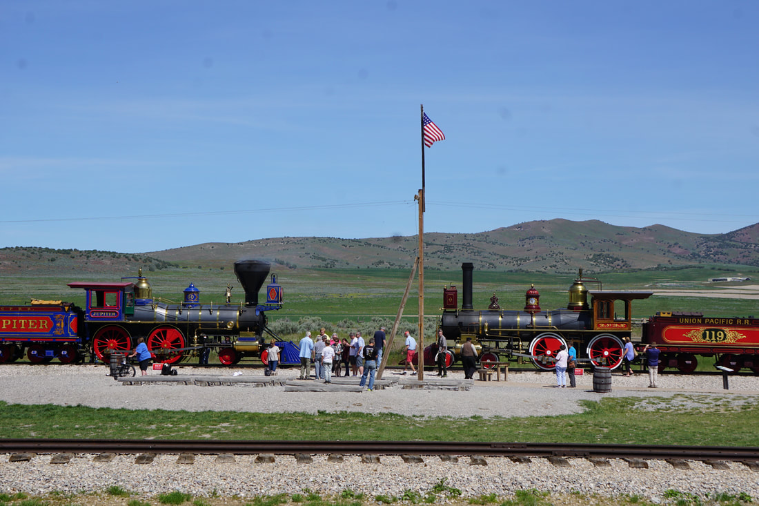 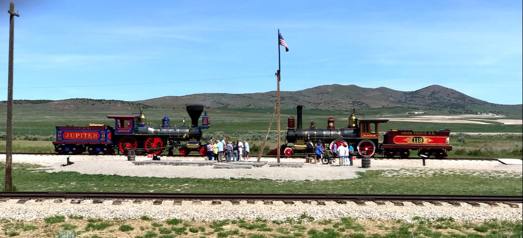 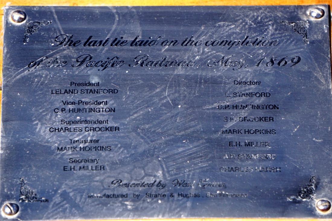 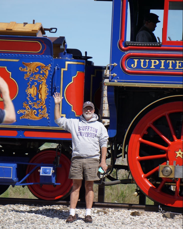 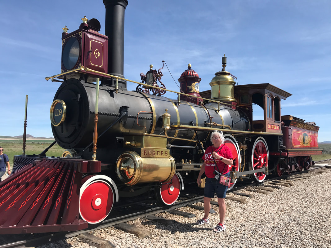 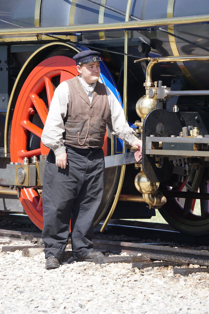 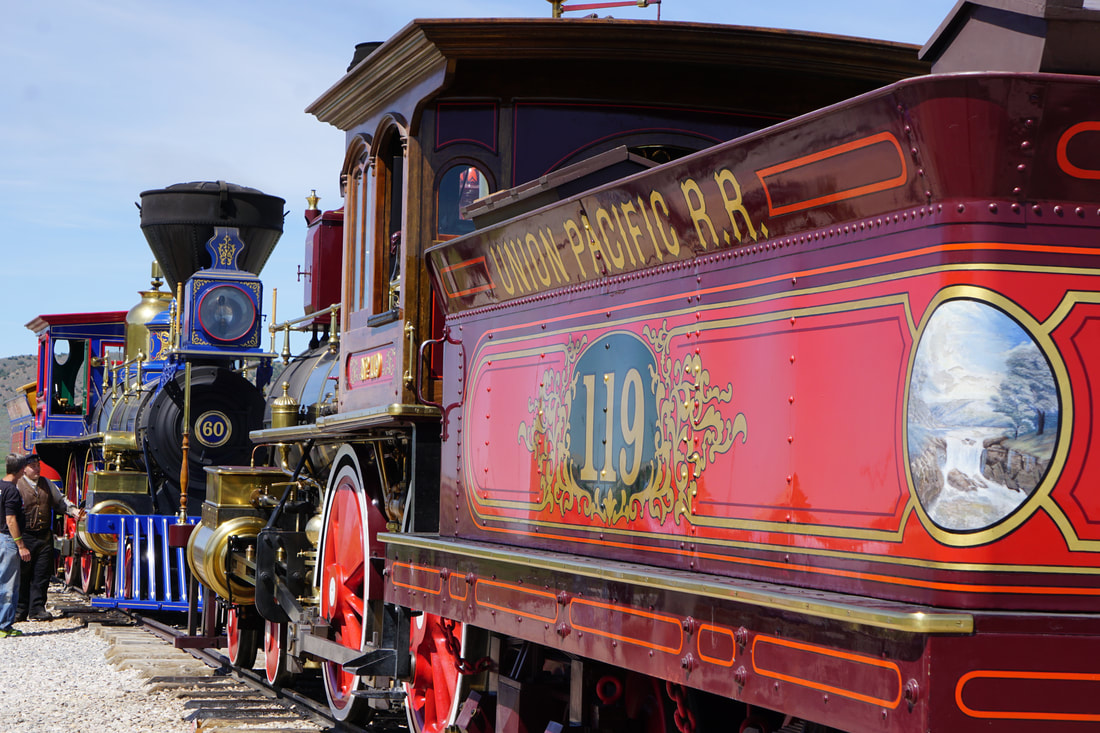 On the road again, we had a just 80 miles to cover to reach our Lava Hot Springs destination. Visions of soaking in a hot springs spurred us down the road. Tom remembers this location from when he was a kid, and he has always vowed to return. We’ll see if it lives up to his expectations. First we checked in at Mary’s Campground, less than a mile from the Hot Springs offerings. It is a small campground right along a river, less than 1 mile from the Hot Springs venue. It advertises “all grass and shade” – and it lives up to that motto. Aside from that it is very safe, as it is run by the local Sherriff’s Association as a money-maker for their retirement offerings. 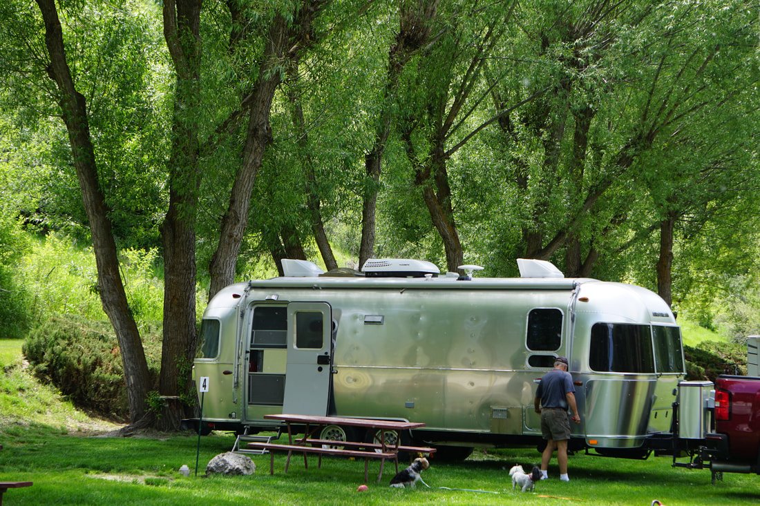  Lava Hot Springs is in Idaho – 100 miles from Jackson Hole and 144 from Yellowstone. It is open year-round and is made up of an indoor/outdoor swimming-pool-like facility and another outdoor complex of 5 different pools at 5 different temperatures – 102-112 degrees! Bubbling up from an ancient volcano, 2 ½ million gallons of natural hot spring water swirls through the pools every day. No chlorine, no sulphur and no odor! (Also -- no pictures of us in our swim-suits!) 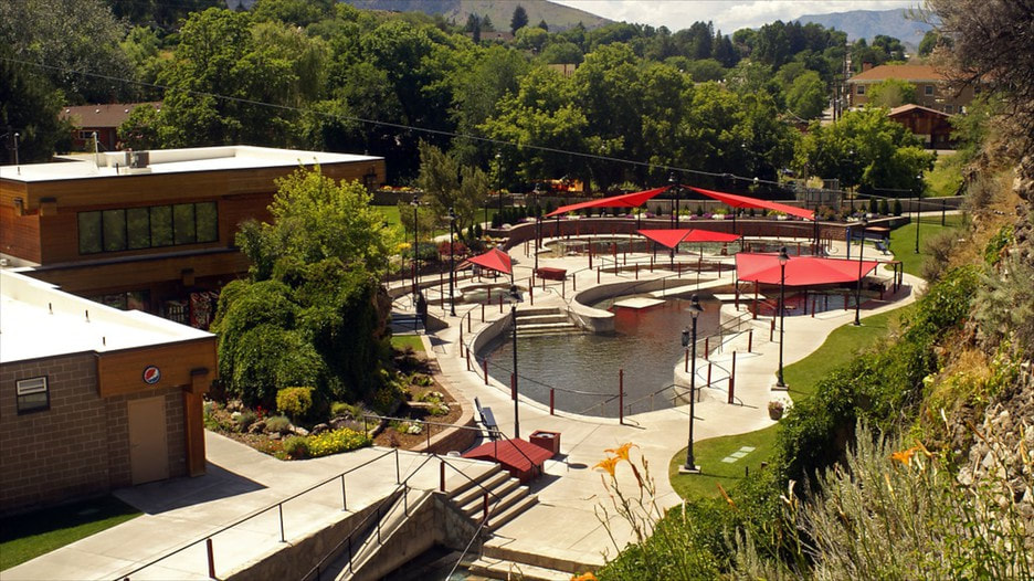 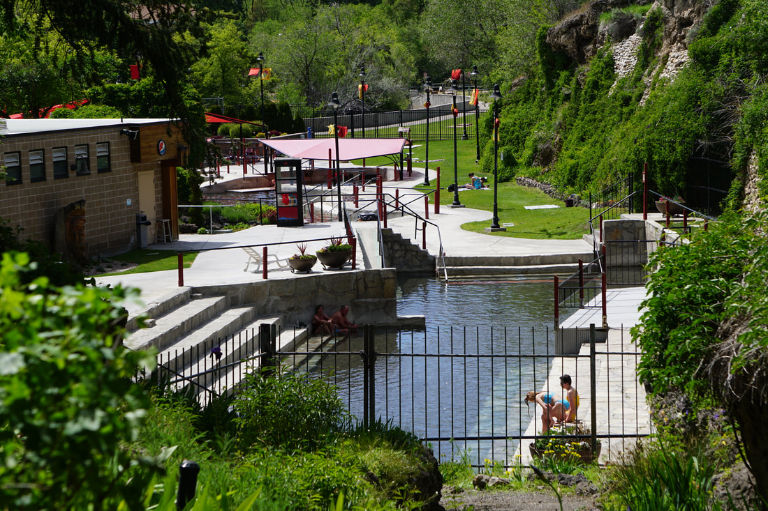 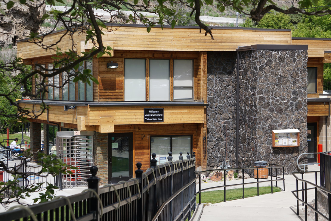 We liked this place so much . . . we're staying an extra night! I anticipate several mineral baths tomorrow!
Monday, June 10 As this would be our only full day in SLC, we planned carefully. By chance, we left the KOA (at a respectable 7:30!) and passed right by the Utah Department of Natural Resources headquarters! And, they were open! Tom was able to get good directions and maps of Antelope Island, our destination for today. I browsed the extensive bookstore, wishing that I had not sworn off large, beautiful coffee-table books and illustrated reads. There would not be enough room in the Silvermine for every book I would want to buy . . . thank goodness for Kindle and internet websites!  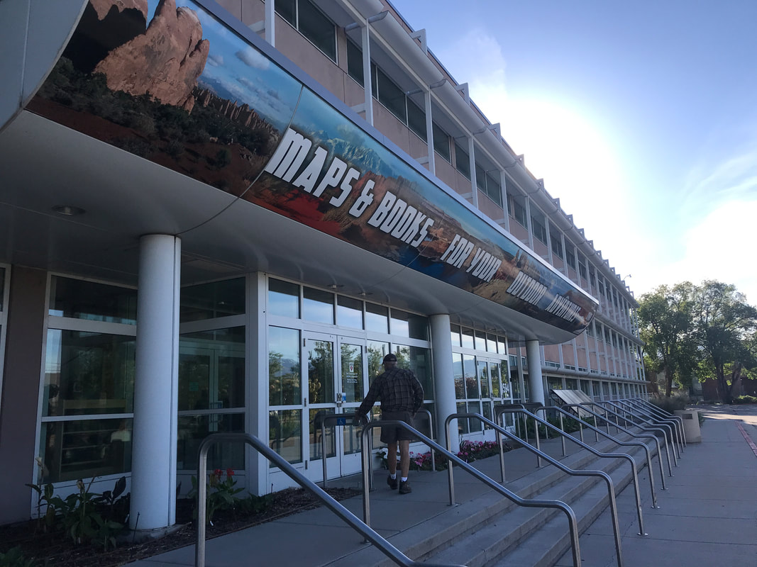 As we drove out of SLC I searched on Amazon Music and found several Mormon Tabernacle Choir albums. Glorious music to listen to while heading up and out of the basin and past the surrounding mountains. . . I’ve never heard “Climb Every Mountain” quite like that! Sitting in the Great Salt Lake is Antelope Island -- home to free-roaming herds of bison, bighorn sheep, mule deer and pronghorn antelope. . . . and 250 species of nesting birds! The island roads provide spectacular view of Great Salt Lake and the Wasatch Mountains. 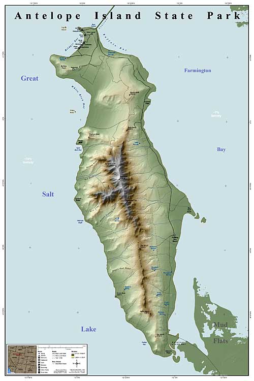 As we drove over the causeway onto the island there was a flashing billboard sign advertising that the local gnats had just hatched! We attempted several of the walks, but within a few minutes gave up from the gnat siege. They are vicious! They swarm your face and ears, get trapped in your hair, and just about drive you crazy in 5 minutes! Most of our tour of Antelope Island was destined to be a beautiful drive around the island and a visit to the Visitor Center! There is a campground on the island – praise be that we weren’t able to get reservations! It is out in the open with lots of scrub shrubs and no shade, and gazillions of those little no-seeums hanging in the air. 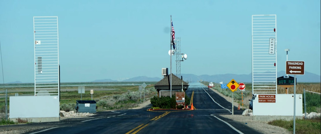 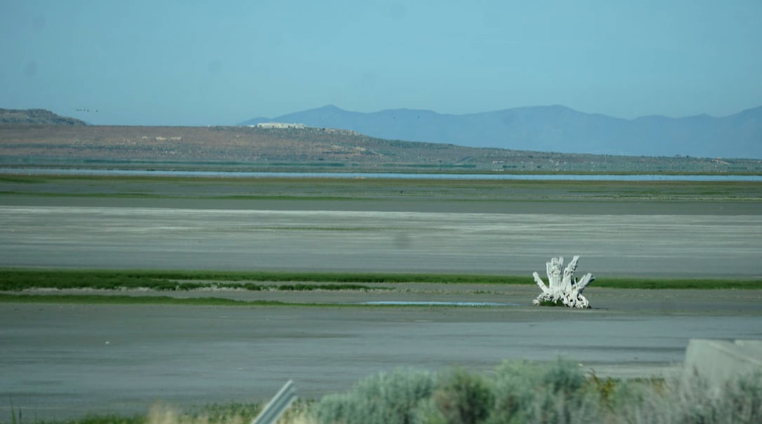 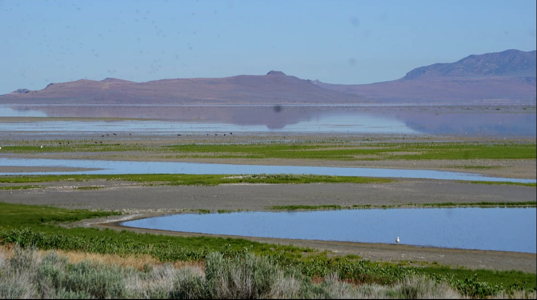 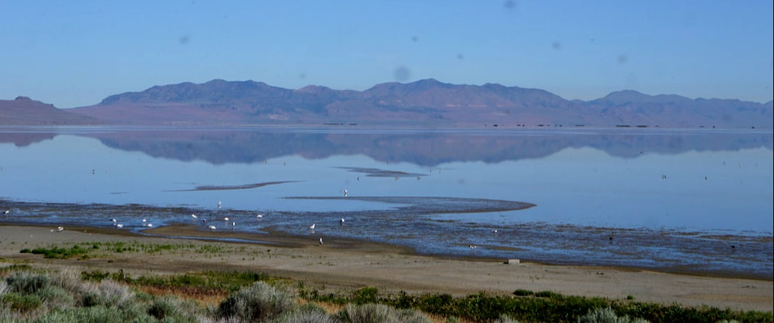 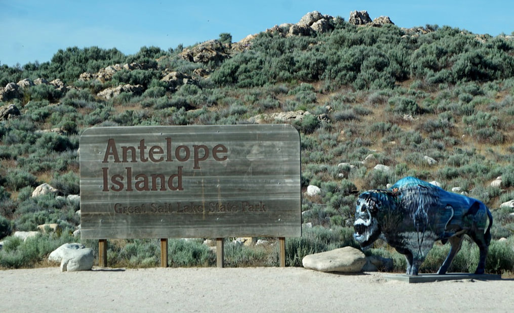    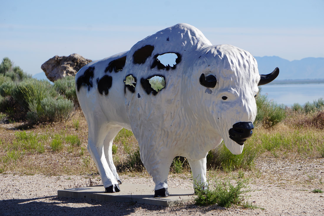 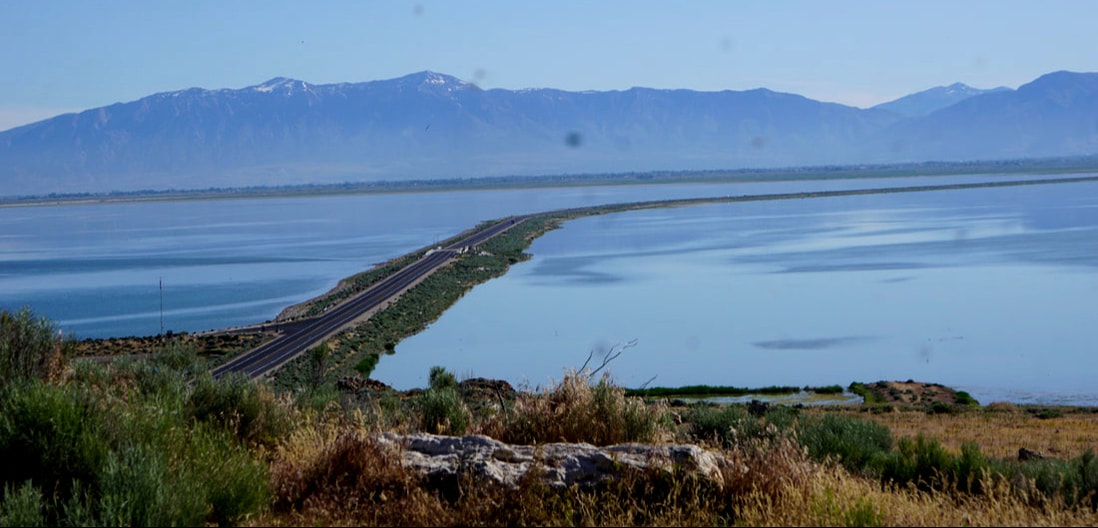  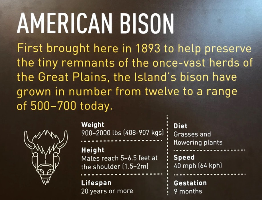 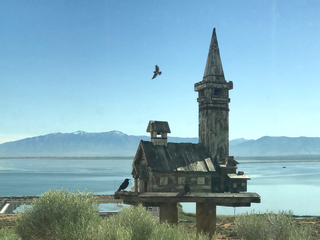 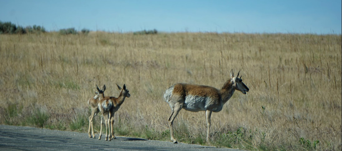 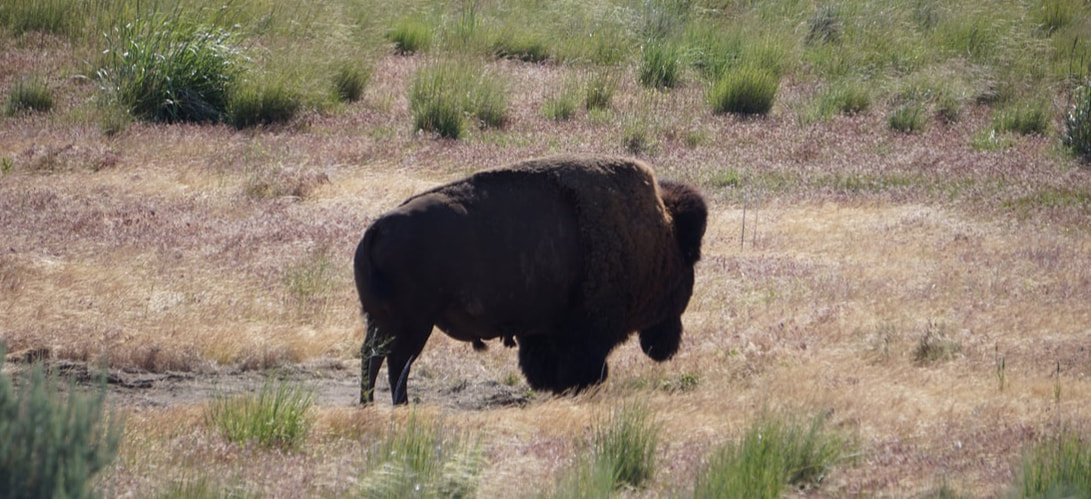   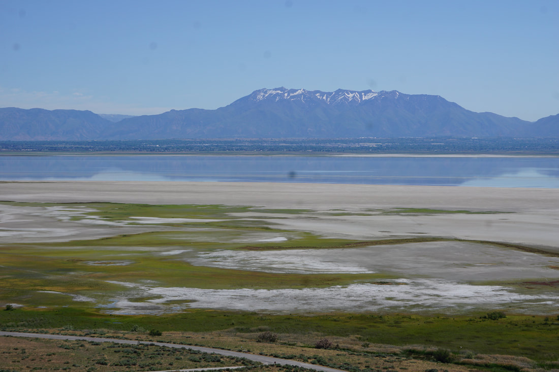 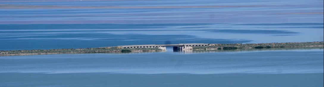 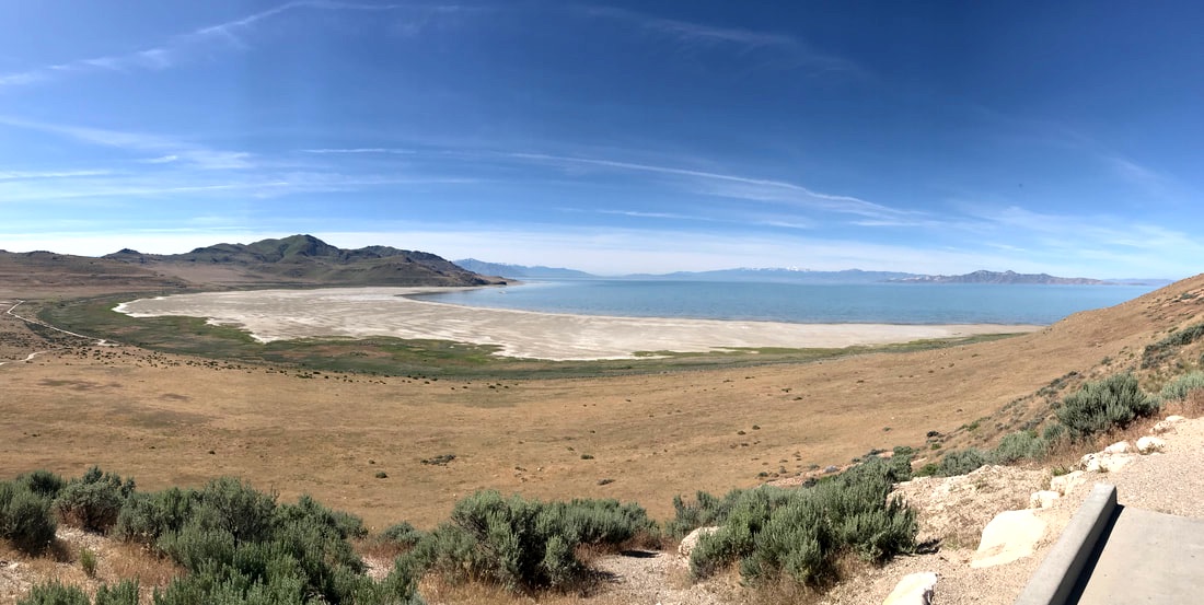 Back at the Silvermine we took an afternoon siesta outside under the awning . . . the first for this trip! Leaving at 3:00 pm our afternoon excursion was to visit Emigration Canyon. It was here high on a mountain, overlooking the Salt Lake Valley , that Brigham Young proclaimed, “This is the place!” Heritage Park commemorates the spot where Brigham Young declared that the search was over for the Mormon Zion. The location also commemorates the Pony Express route which went right through the area.  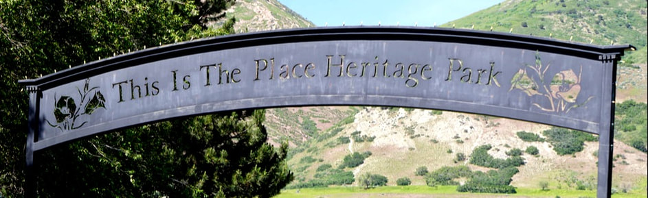 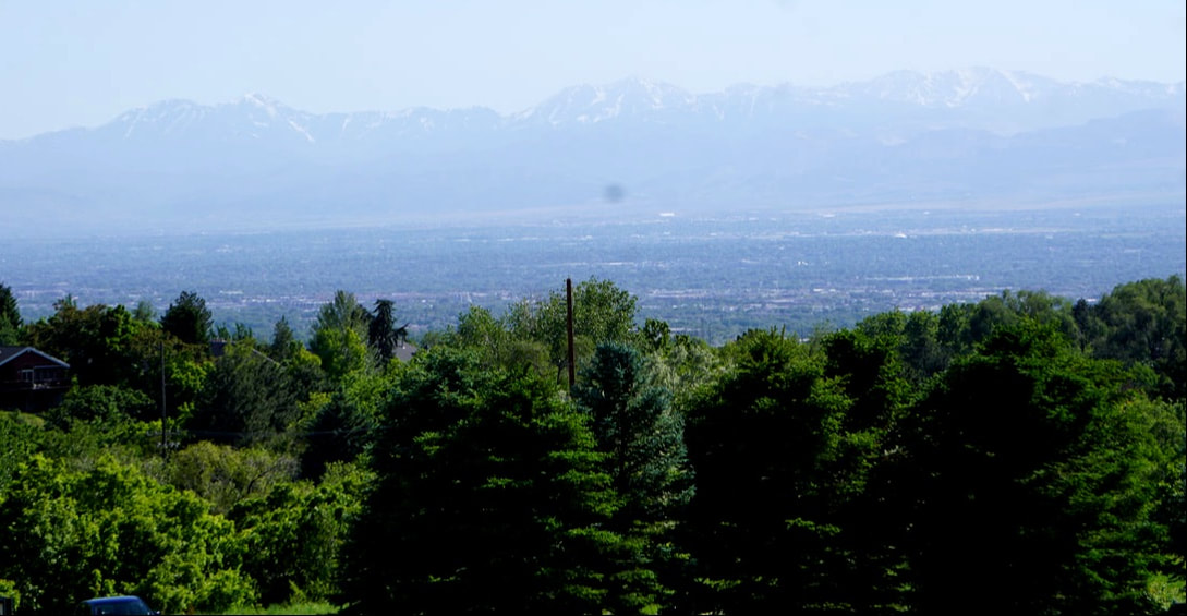  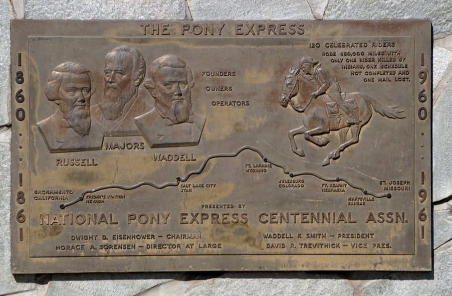 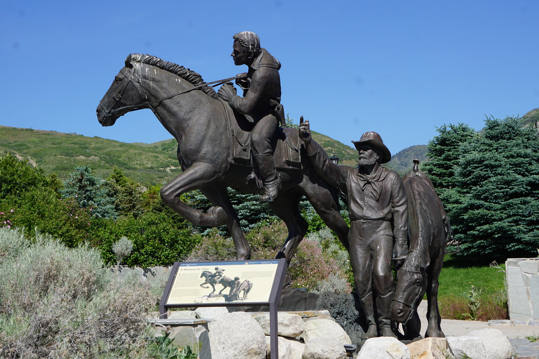 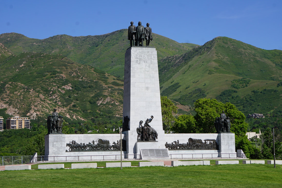 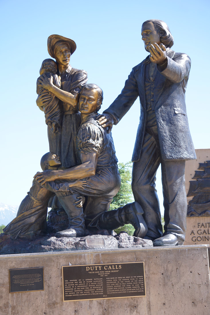 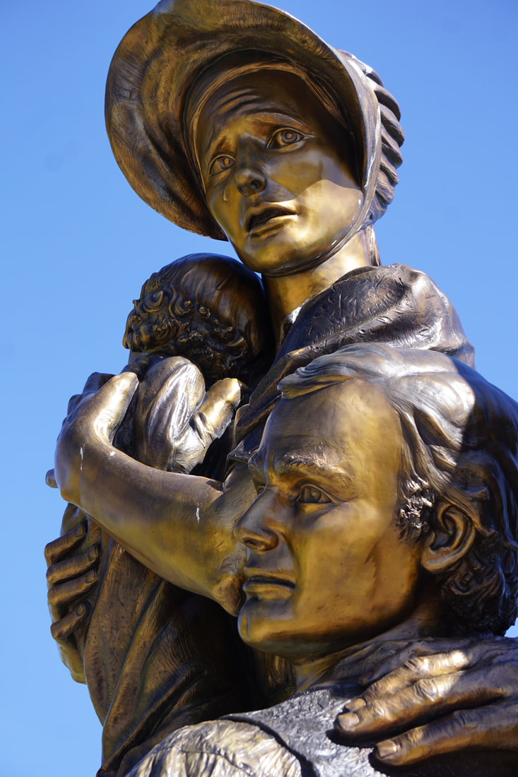 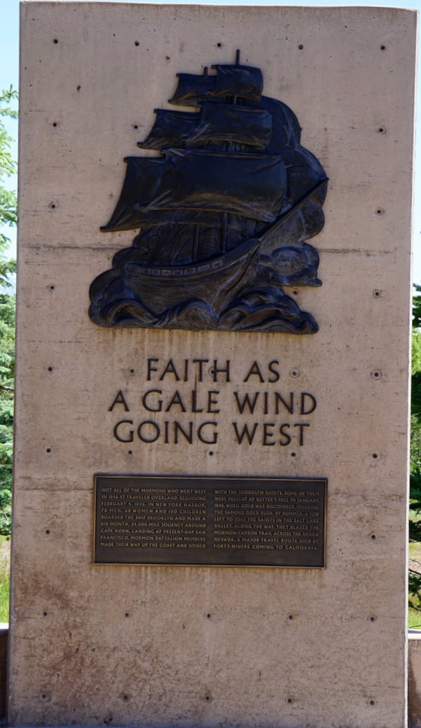 We drove the rest of the 12-mile Emigration Canyon road to the summit – the route that the Mormons (and other settlers) followed down the steep, steep, trail into the valley below. Today it is a beautiful drive with intermittent home settlements and a heavily used bicycle path. 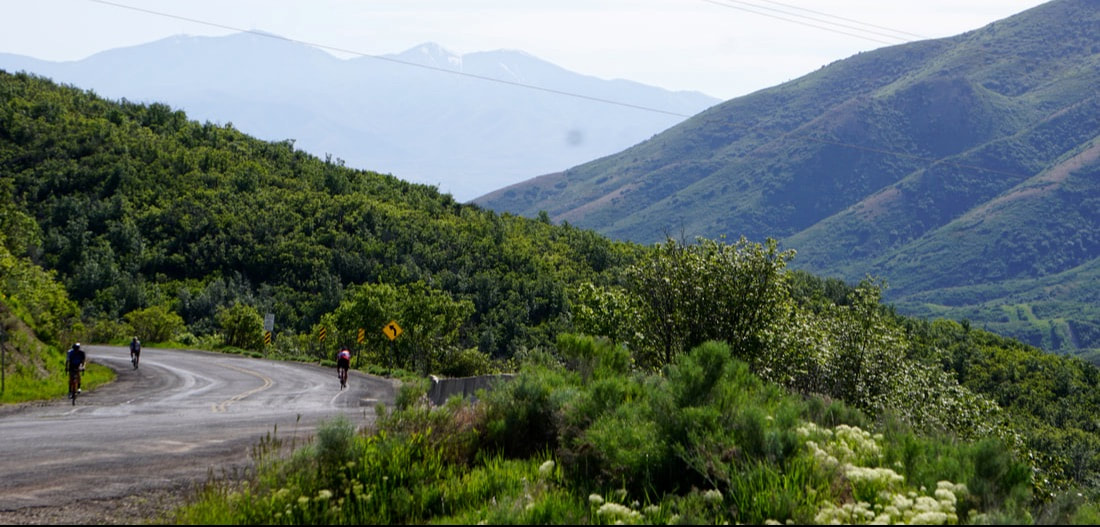 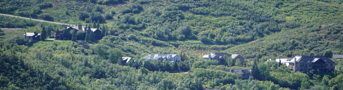 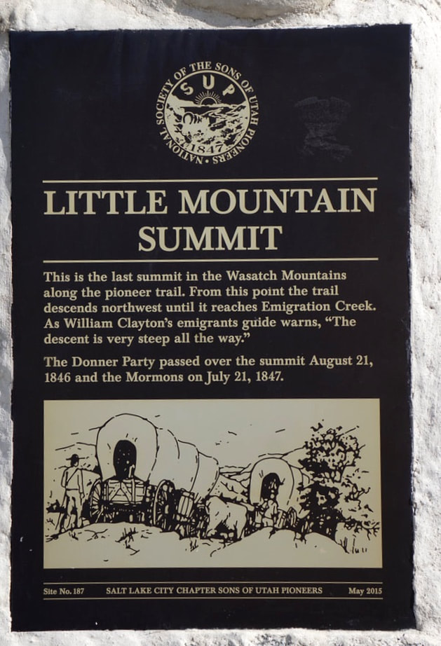  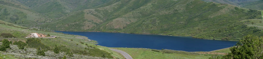 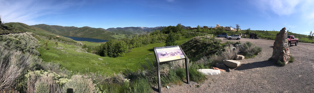 Finishing the day we chose a Mexican restaurant for dinner – well, it was kind of Mexican! It served tacos – but they were combinations we had never heard of! For an appetizer we ordered the guacamole with sweet corn dip and chips. Tom had the Carne Asada tacos, and I had simple cheese quesadillas with a very wonderful dip. We were back at the Silvermine by 7:00 with time to write and post the blog of a great day!  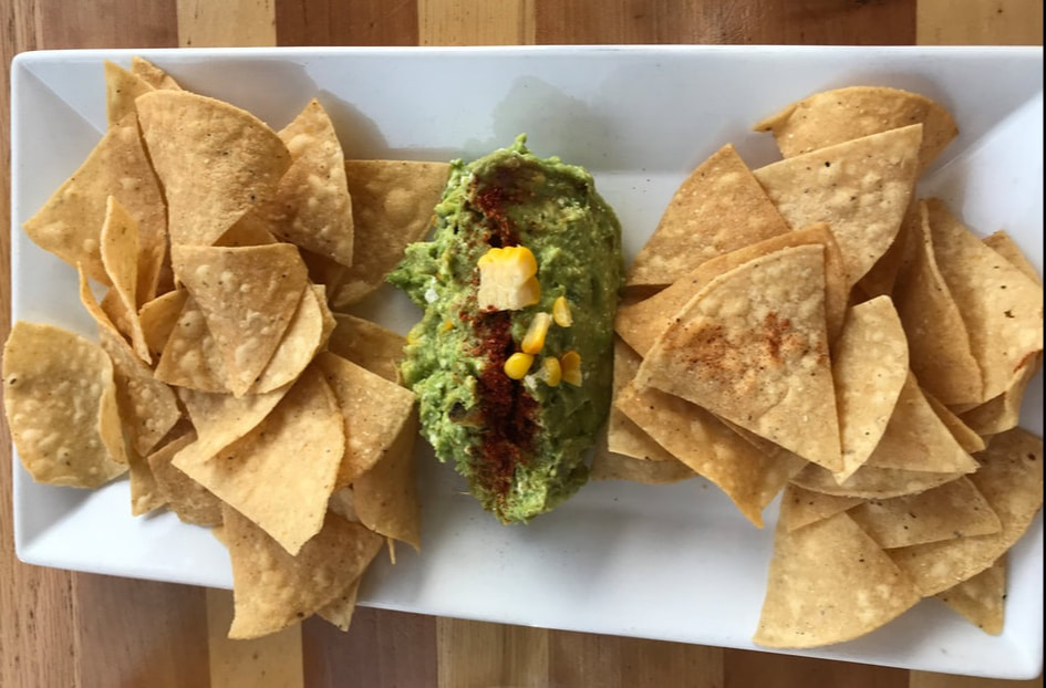 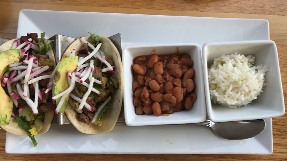 Sunday, June 9 We didn’t waste any time this morning and pulled out at 6:45, at 35 degrees! We were headed for Salt Lake City (Brigham Young’s Zion) where we would stay for 2 days. I-80 followed a high prairie with grazing cattle, lots of flowing streams and water holes, aspen and cedar tree groves, and windmills lining the high ridges. Long lines of snow fences hint of what the weather must be in the winter. We drove at an altitude of about 7,000 feet, skirted past Elk Mountain, elevation 11,156, and crossed the Continental Divide twice by 9:00. All of this – and not a sign of a McDonalds or a Walmart or a billboard of any kind! 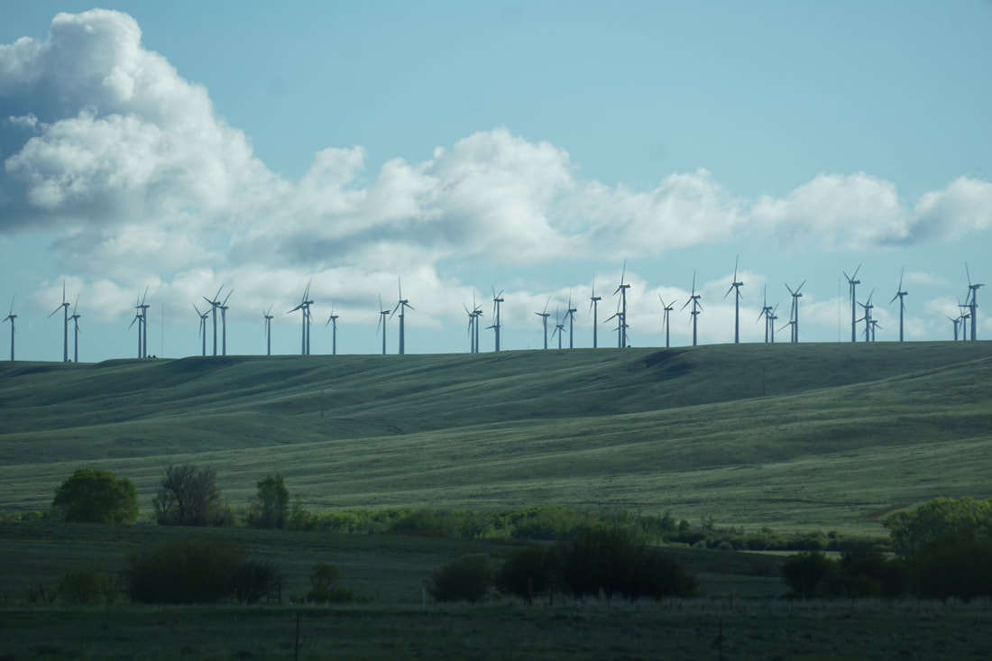 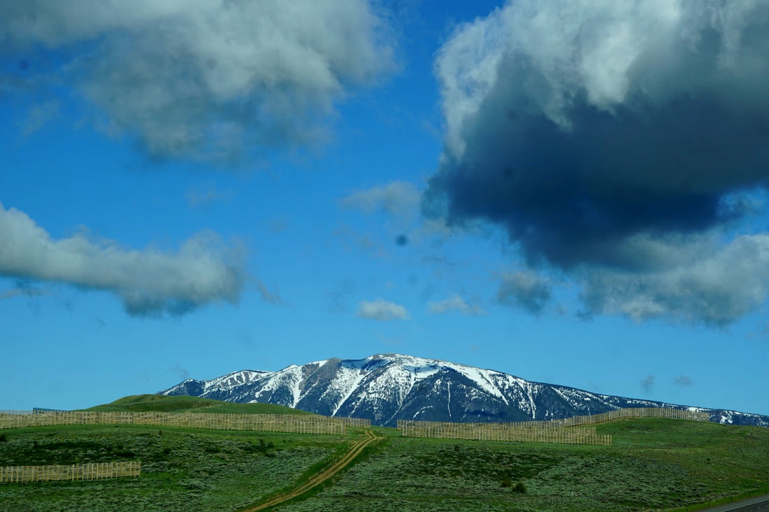 We made one stop at the Fort Bridger State Historic Site to walk the dogs and fix our lunch. It was not a very welcoming spot to stop with many signs in the parking lot demanding, “you have entered a fee-paying area.” (It was the only place we had seen to get off the interstate and stop in the last 100 miles!) With tall fences preventing any free-pre-viewing, we walked the parking lot, fixed our lunch and moved on. It was interesting that we were still running parallel to Route 30  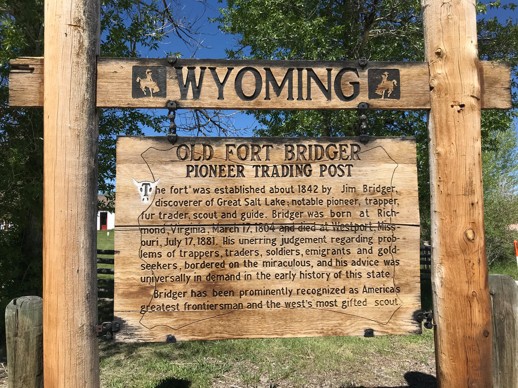 Our landscape changed several times during our 8-hour drive: from green grassy meadows and rolling hills to red rocky buttes and desert-like red sandy plains. In the distance were snow-covered mountains. As we approached SLC the elevation went down considerably, landing us in a big bowl surrounded by mountains.    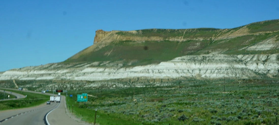 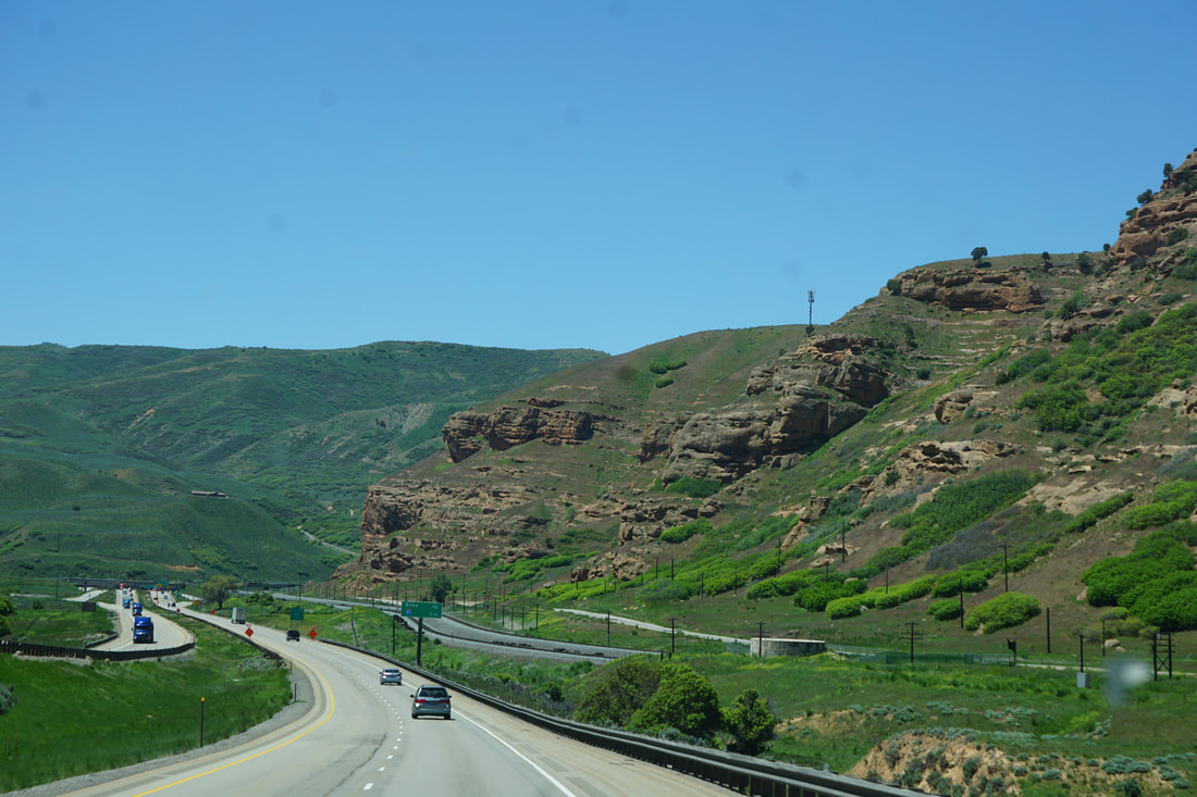 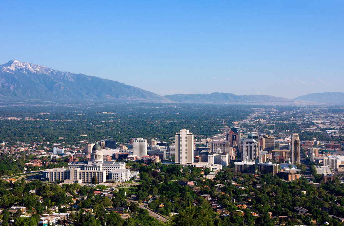 Our KOA was again just a mile off the Interstate, but beautifully shaded with all amenities. To top it off -- we had a corner lot! 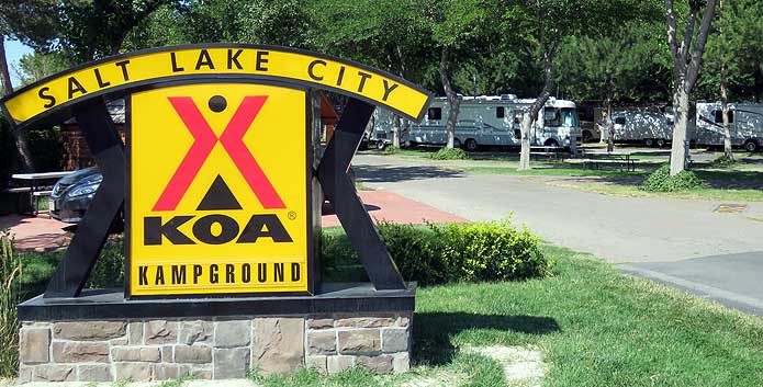 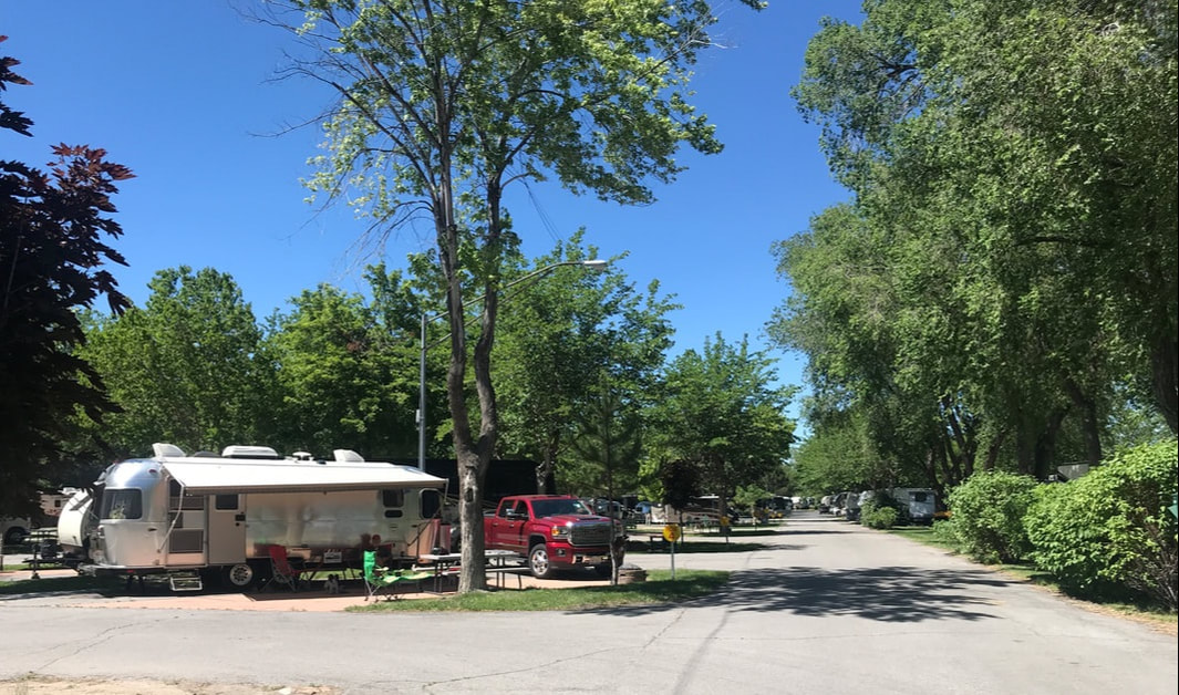 By 2:30 we were headed into SLC to scope out the offerings. Our KOA did not have the usual maps and sightseeing pamphlets, and we were hoping to find a visitor center open on a Sunday afternoon. Mission successful, and we loaded up with paperwork to plan our day tomorrow. We were parked at the top of a hill where the Utah State Capital Building overlooked the city. From there we walked down to the Mormon Temple Square that sat in the heart of downtown – surrounded by all things Mormon. You have to be a card-carrying Mormon to enter the temple, but it was surrounded by beautiful gardens, paths, statutes, and fountains that were open to the public. It was a beautiful 67-degree afternoon for walking . . . we were back at our KOA by 5:00 for dinner. 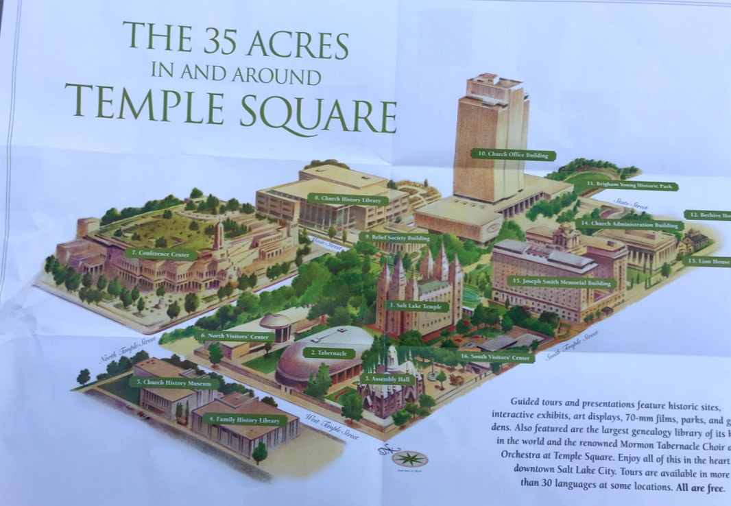 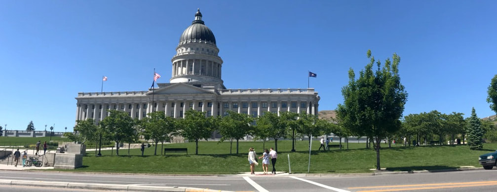 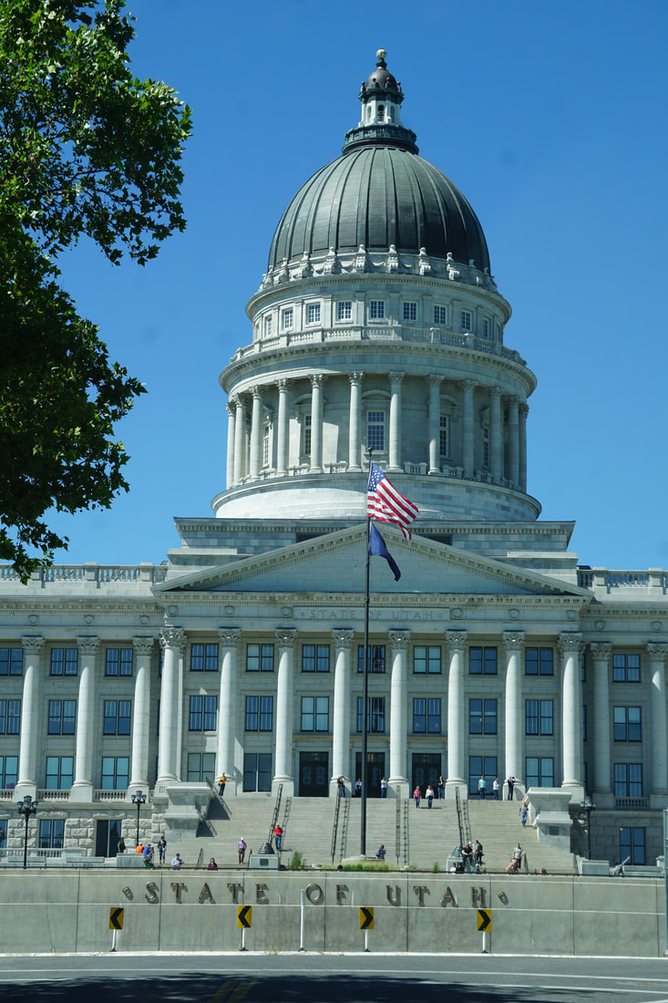 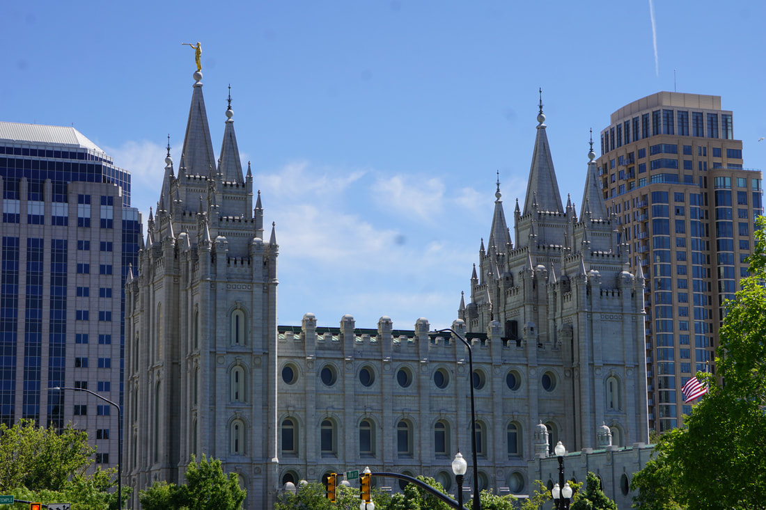 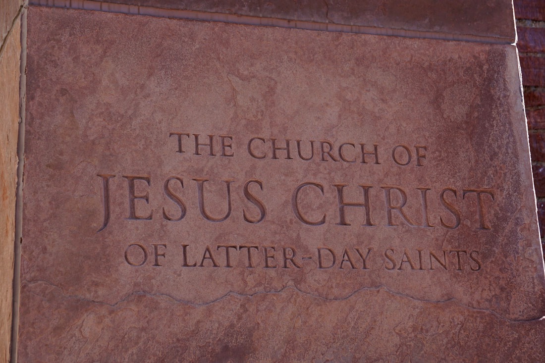 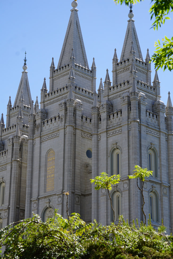 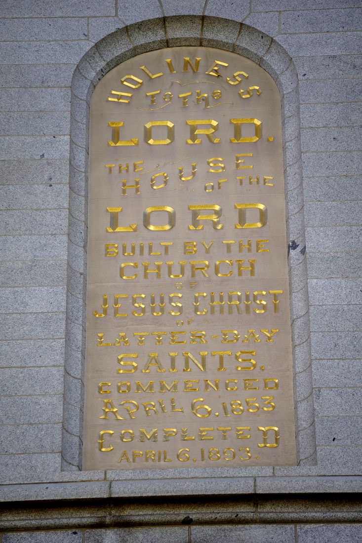 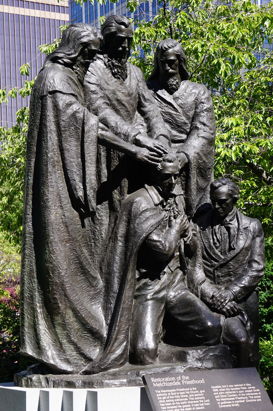  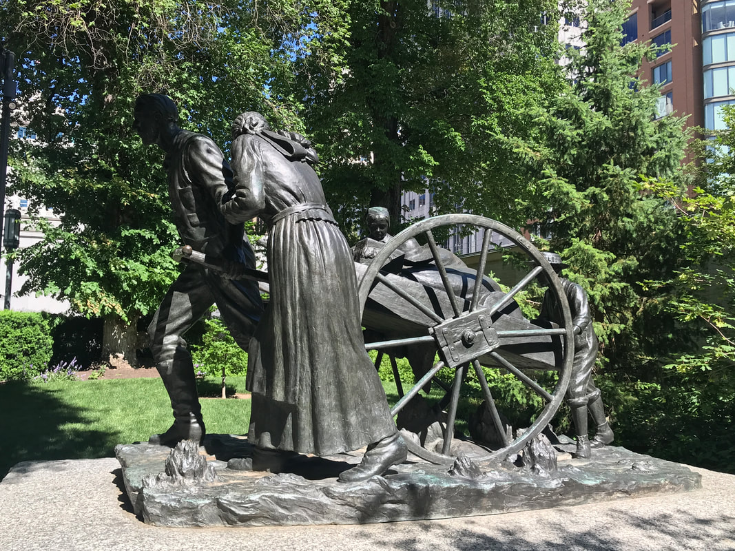 Saturday, June 8 Gothenburg – the Pony Express Capital of Nebraska! The little way-station was used as a Pony Express Station from 1860-61 and has served as a museum since 1954. It was moved to this lovely little park in 1931, is carefully cared for and tells the story of the Pony Express . . . which was only in existence for 18 months! We enjoyed this informative historical stop, and the dogs enjoyed the green grass of the park. 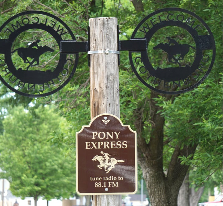 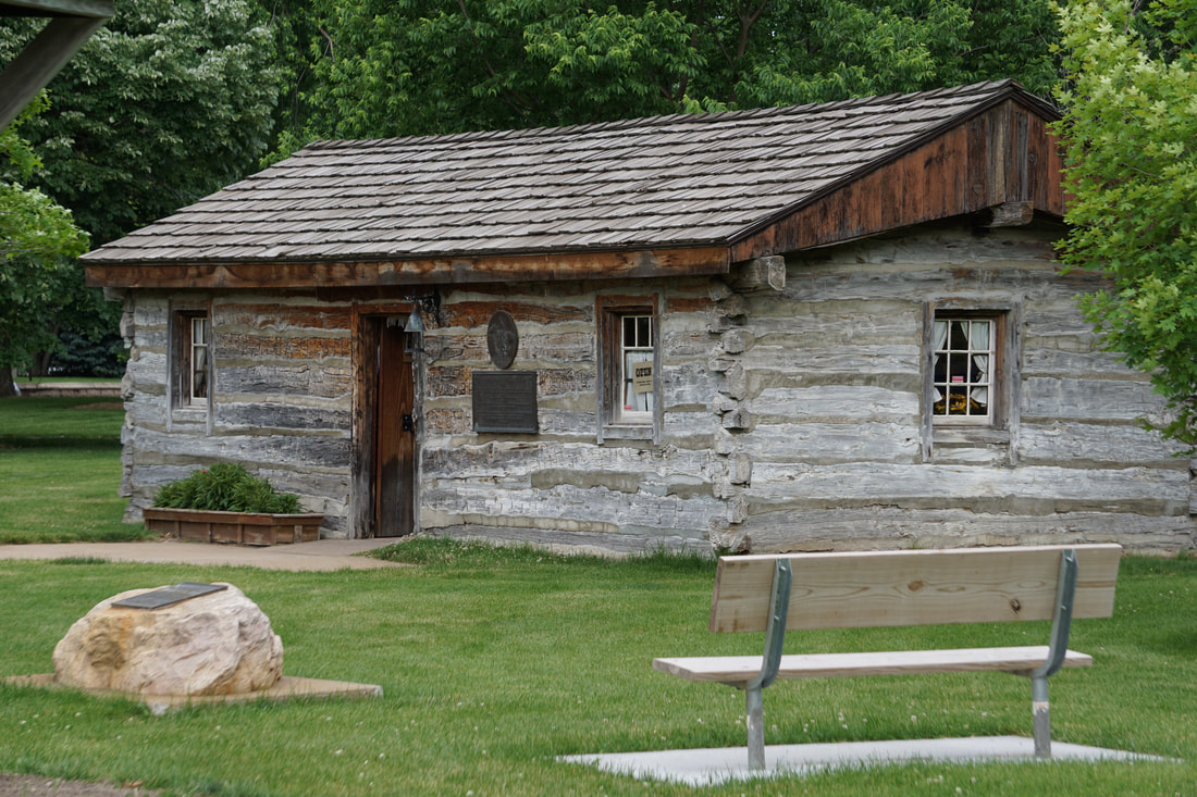 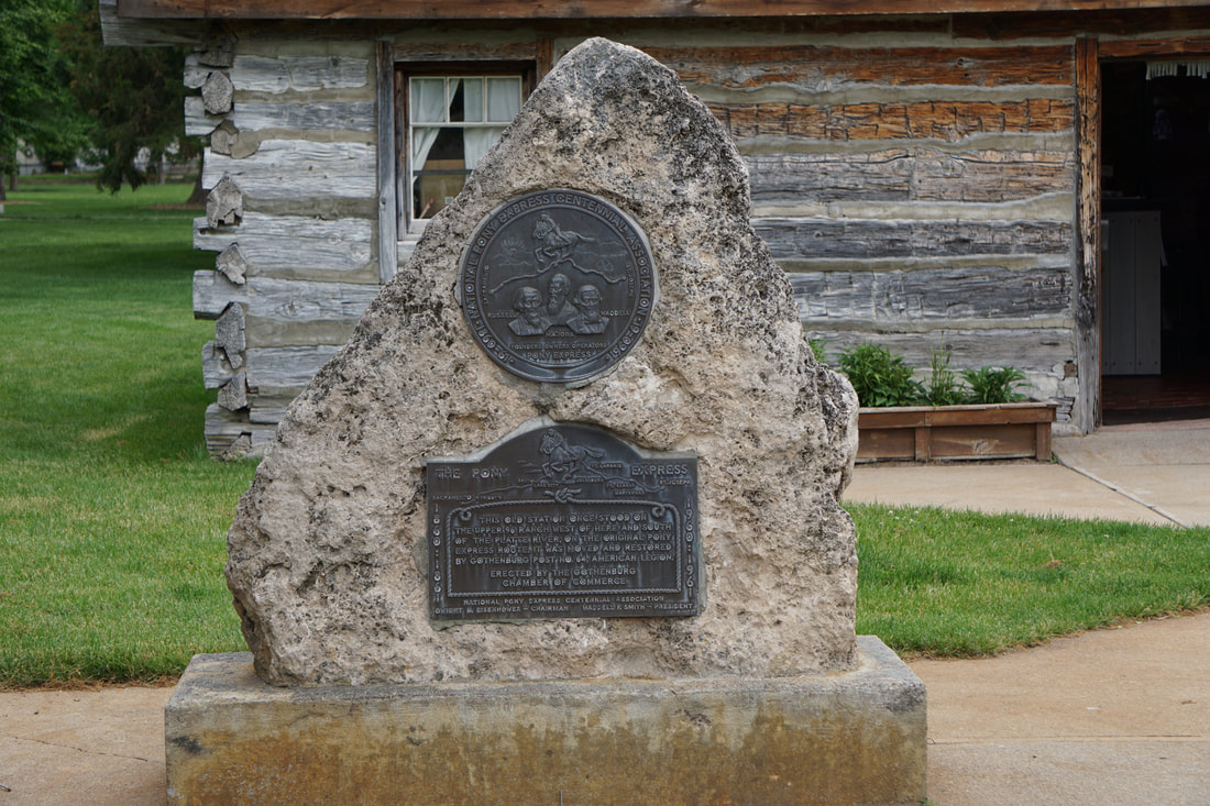 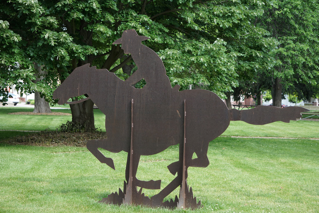 The great Pony Express Reride (a yearly event) is set to mount up June 10-20 (westbound) starting at St. Joseph, MO. You can follow along at www.nationalponyexress.org. We weren’t paying attention when I-80 split with I-76, and we took a wrong turn . . . ending up in Colorado! Not to worry, as within a few miles we discovered the mistake and rerouted back to I-80 . . . where we were in Nebraska again. But the exit was closed where we wanted to get back on . . . we followed along beside I-80 on US Route 30 with the Union Pacific Railroad tracks between! In another 8 miles we were back on I-80. It was listening to our audio book on the Transcontinental/Union Pacific Railroad that led us off track to begin with, and it was fun to see an east-bound train on those very tracks! 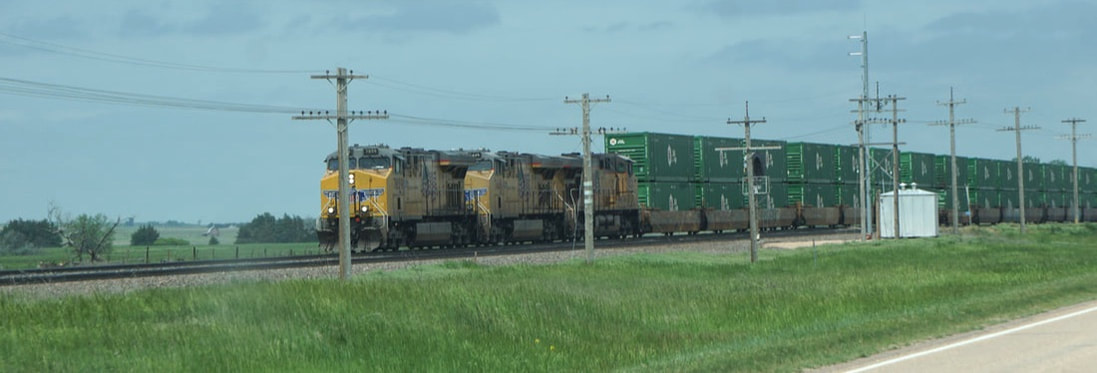 At mile-marker 367 just outside Cheyenne, Wyoming at 1:16 pm we suddenly saw mountains in the distance – tall, very snow-covered mountains! Proof that we were making our way WEST! We detoured off of I-80 and headed for downtown Cheyenne for a little exploratory visit. We were within an hour of our final destination, and had plenty of time to fritter. 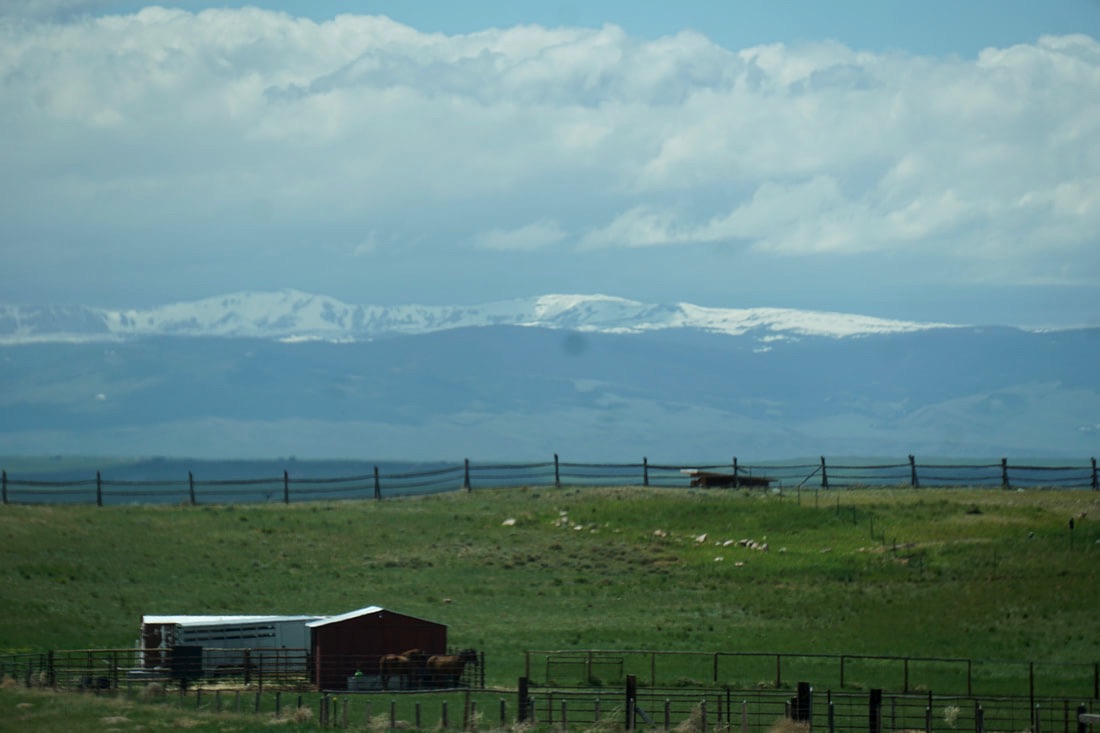 We went up over an overpass past the Union Pacific railroad and train yards. It would have been nice to go in the State House, but it was under major renovation and completely shut down. With all the construction we even had trouble walking around the outside. A sudden spurt of fat raindrops chased us back to our truck, and we drove around downtown Cheyenne noting the display of cowboy boots. Then back onto I-80 for a quick drive to Laramie for the evening. 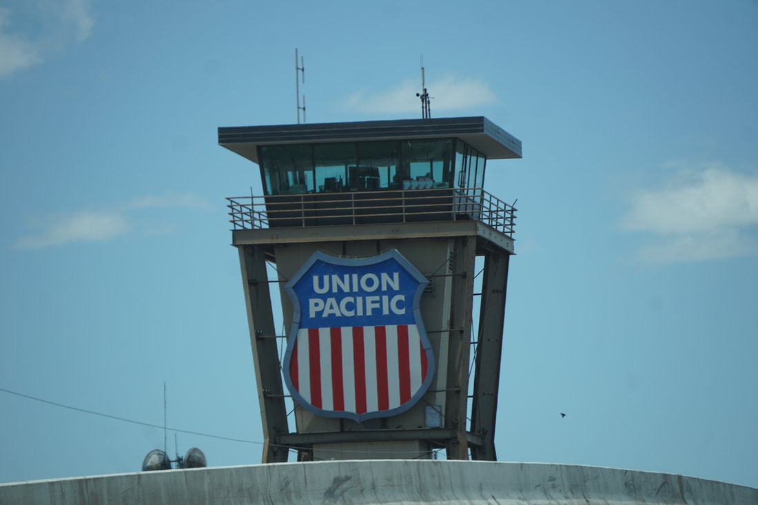 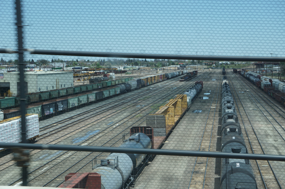 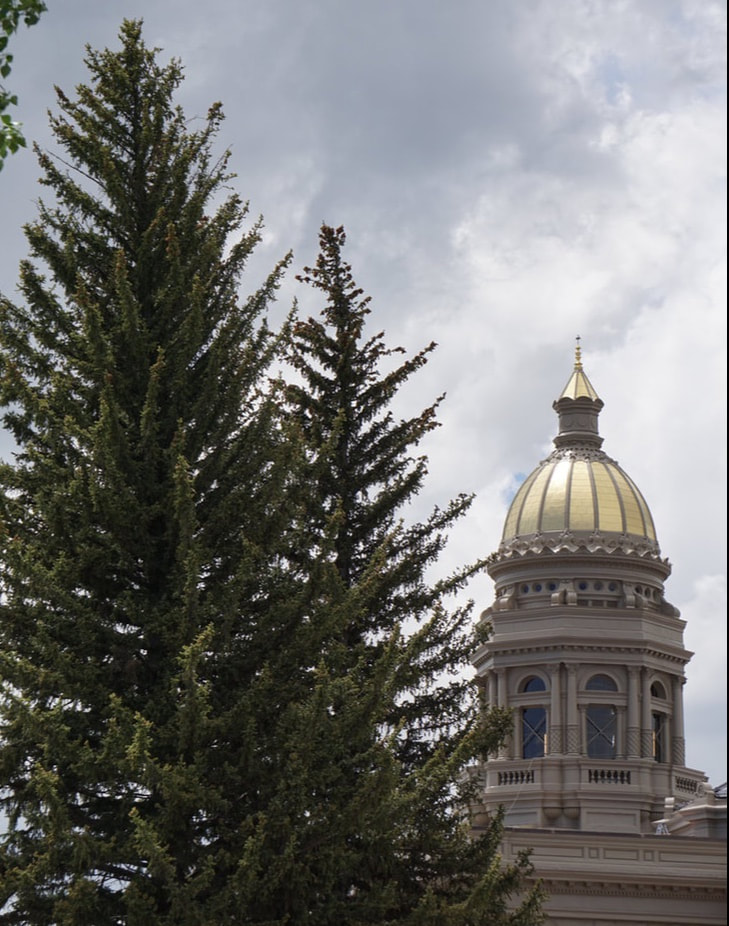 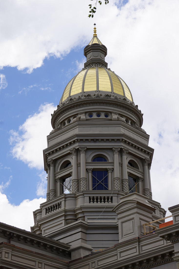 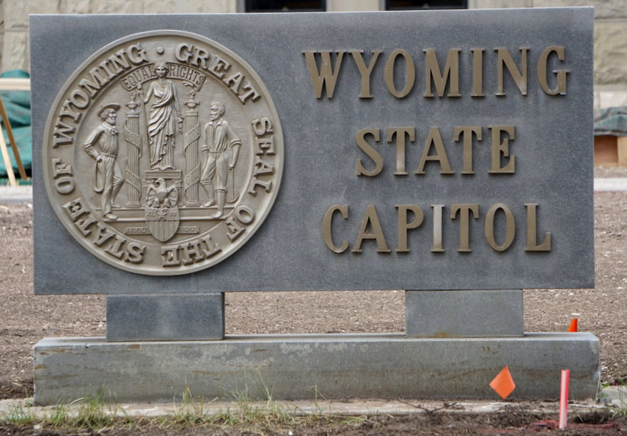   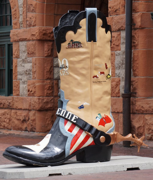  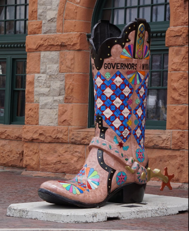 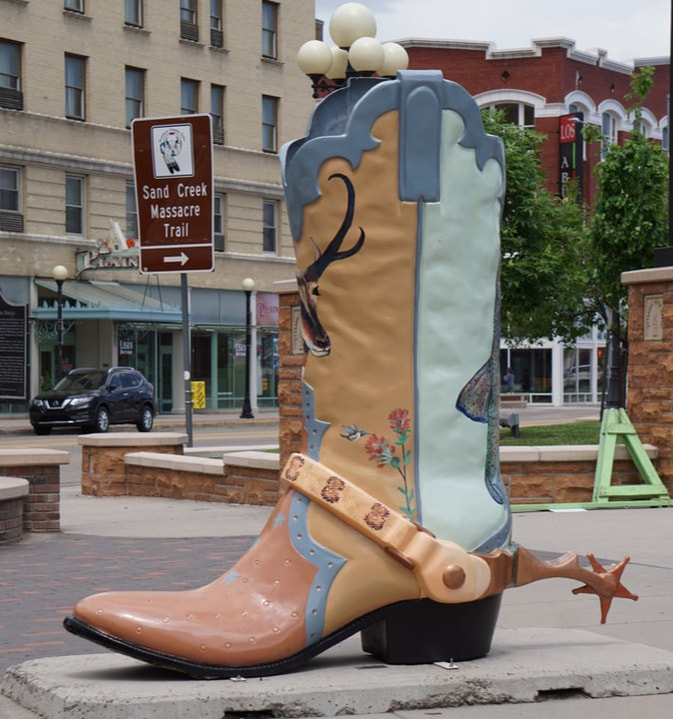 We found our KOA right along the interstate – nothing fancy except for the price! A flat field of dirt roads with rows of pull-thru sites with minimal strips of grass and gravel. We walked the dogs and left them as we plotted some things we wanted to see in Laramie. Number one on our list was the Historic Railroad Depot Museum – we had just finished the audio book about the Union Pacific and Transcontinental Railroad. The whole museum was shut down for a wedding. We ducked inside for a quick look while the bride/groom were out posing on the station platform. It was all set up for a banquet. 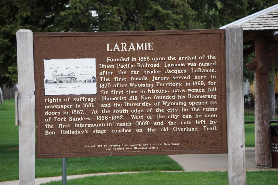  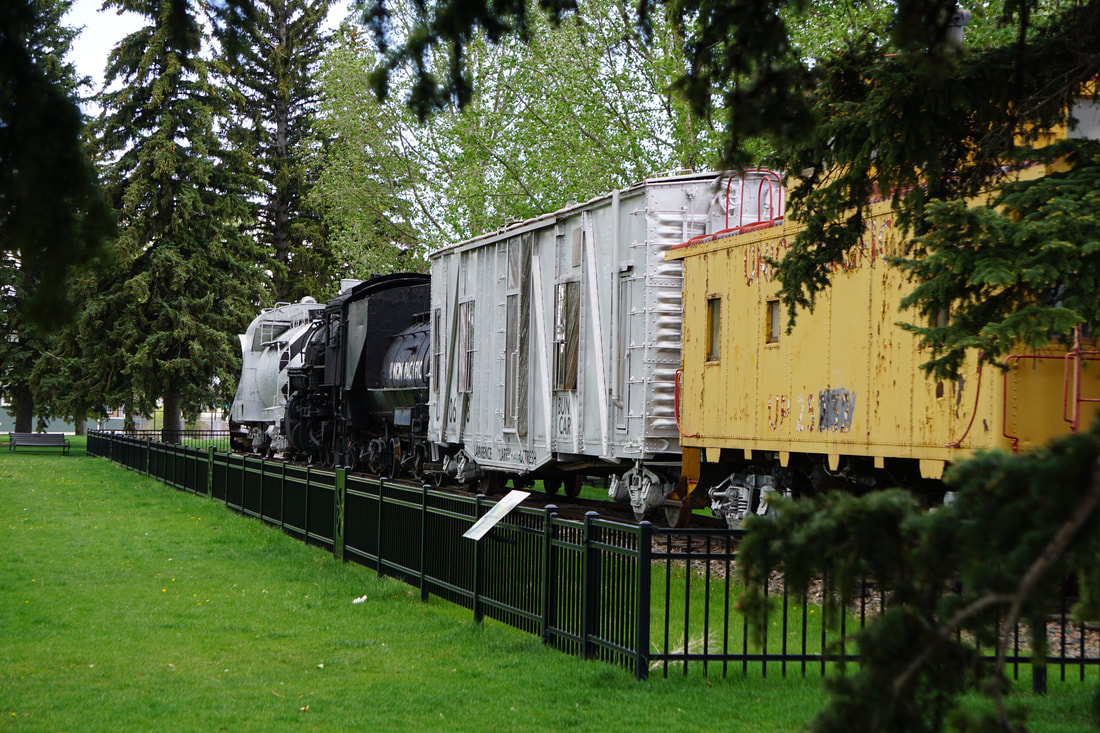 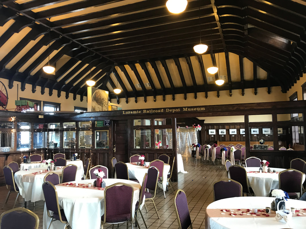 Next on our list was the Historic Ivinson Mansion. Once again we walked the outside perimeter! We managed to locate the old downtown area and walked a short couple of blocks and scouted a few stores. The temperature was dropping and the wind was picking up – prompting me to check the weather. It was to be down to freezing by 6:00 am! 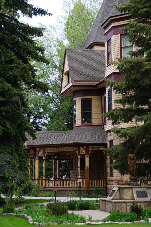   We returned to the KOA and decided on Cornish Hen for supper. The bathroom facilities are nice and the TV reception is good, the INDY cars are racing tonight, and that probably hints on what is in store for us the rest of the evening!
|
