|
Sunday, June 30 The morning started good with French Press coffee . . . a special treat when we do not have electricity! We set out at 8:30 to resume our trip from yesterday . . . one way or the other, we’re going to Paradise! This time we knew we had all day to spend.  We had several views of the mountain and were amazed at how close we were to it. Later when we watched the Visitor Center movie, we learned that every aspect of this drive was made with viewing the mountain in mind – not the ease of road construction. 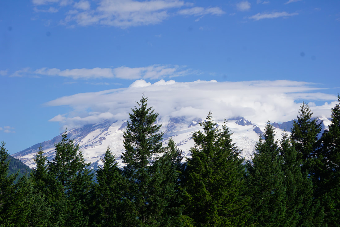 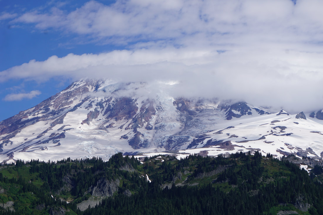 We passed by the famous reflection lakes –but the surface was choppy and there was no reflection of the mountain today. Tom got a water sample for his collection. 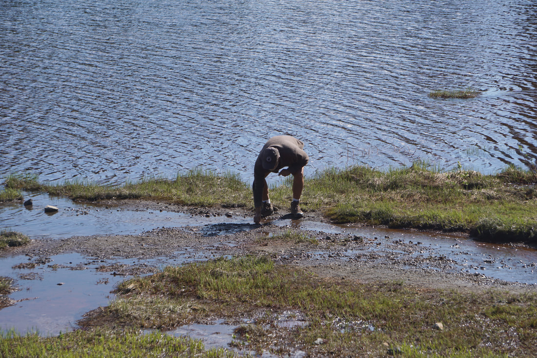 The Paradise Visitor Center was just opening as we arrived and walked around the outside; the mountaintop was covered in clouds, but we had hopes that it would clear if we waited long enough. Inside there were several stories with connected glass windows, offering lovely views of the mountain. 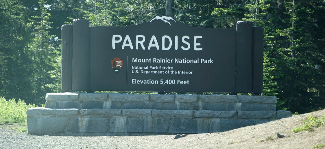 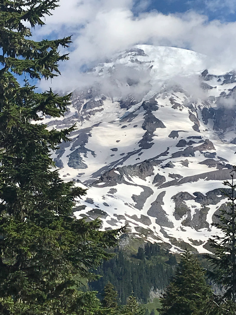 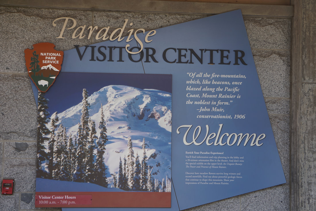 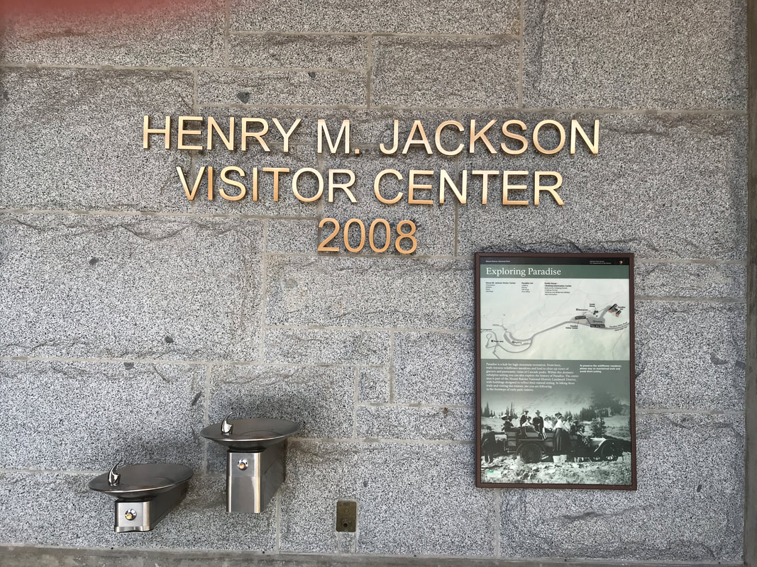 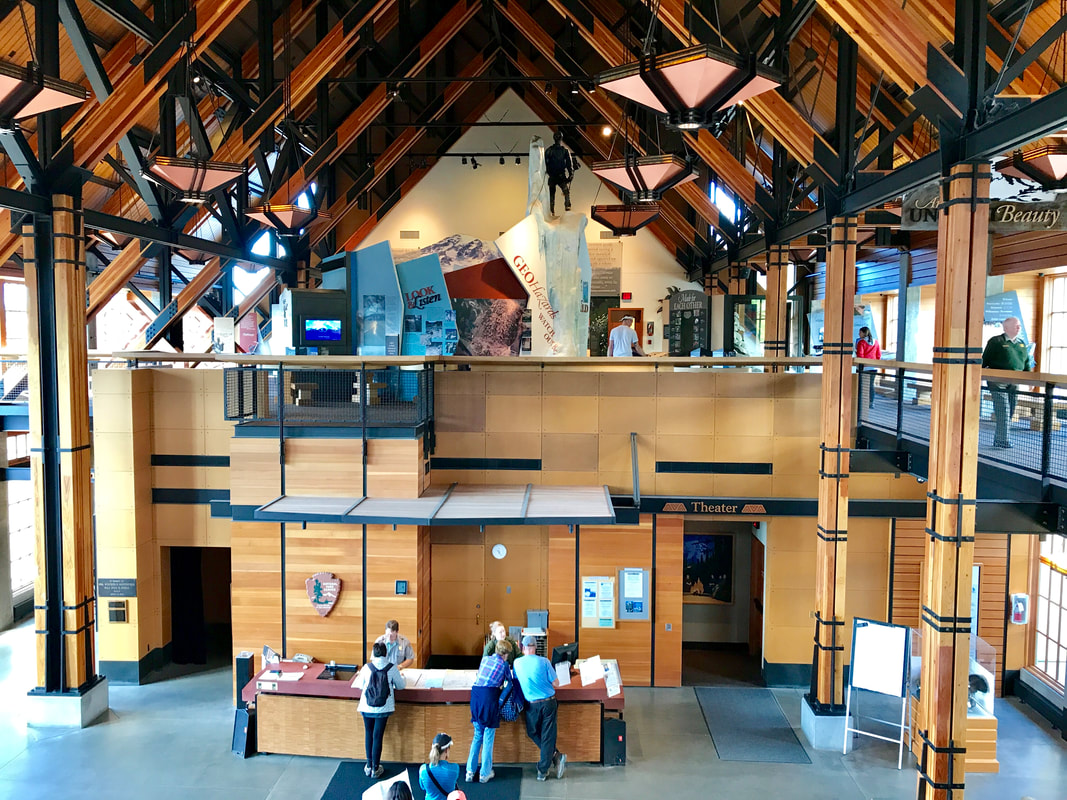 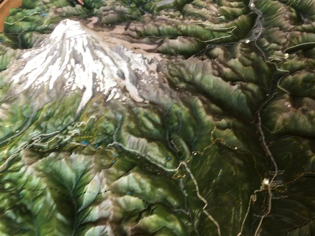 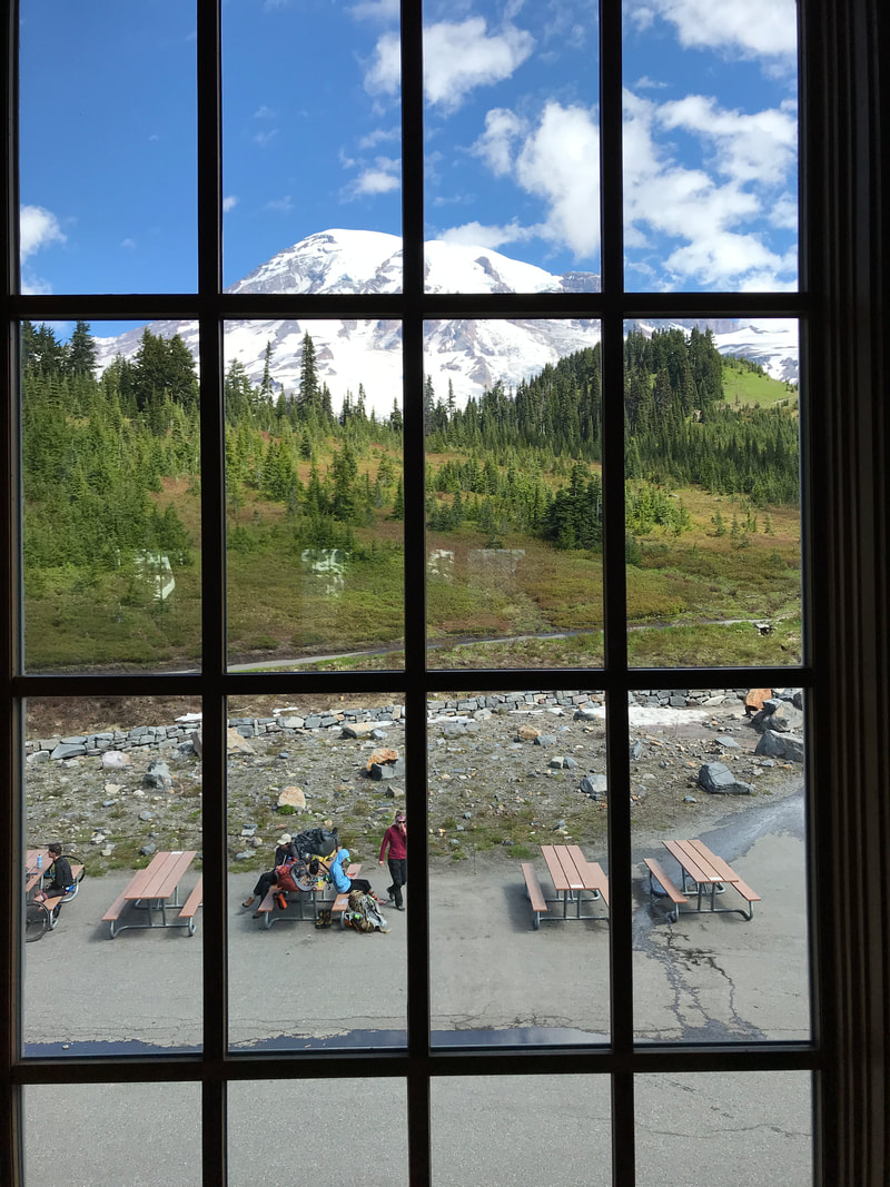 At one point the top of the mountain appeared as the clouds cleared and we were lucky to get these pictures. 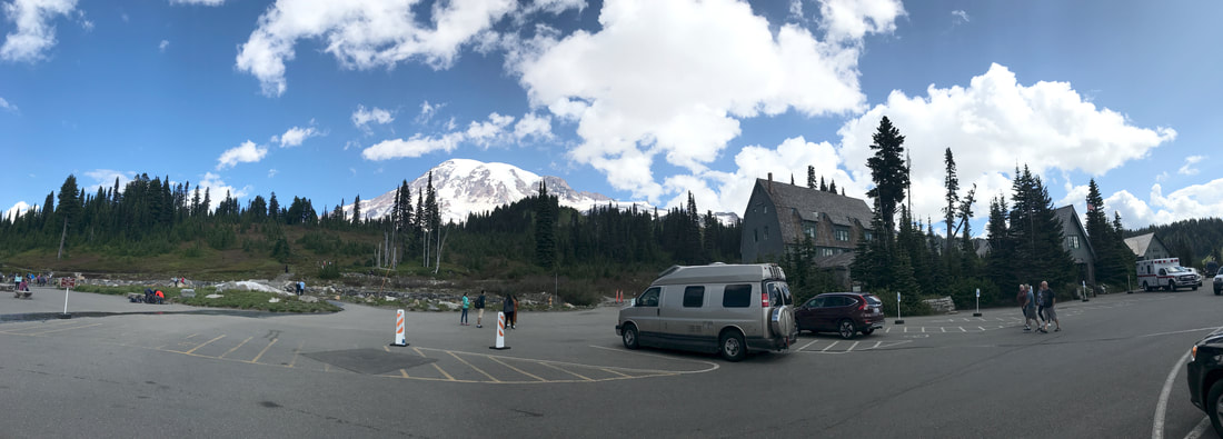 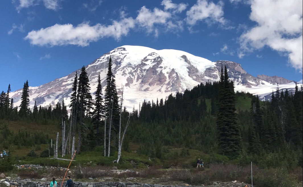 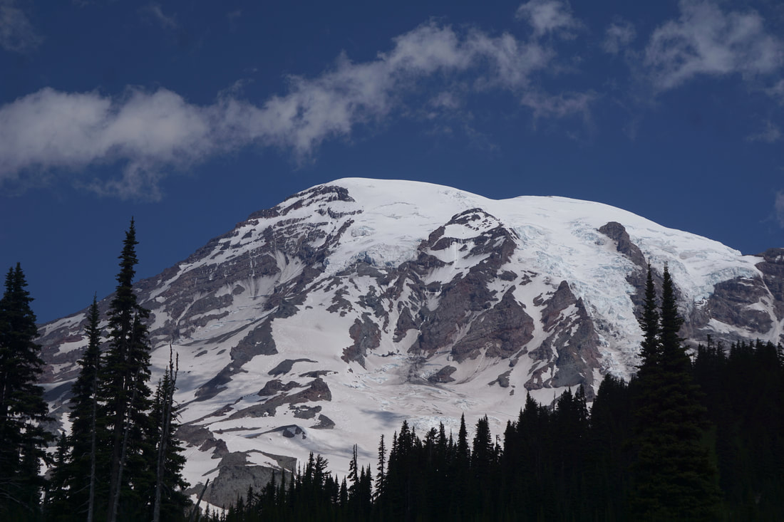 We walked the dogs and, because it was 55 degrees, bedded them down in the truck while we went into the Paradise Inn. It was a true testament to the National Park Lodges, built in what is known as “the wilderness style” in about 1909 and copied by many lodges afterwards. It has just undergone a restoration. 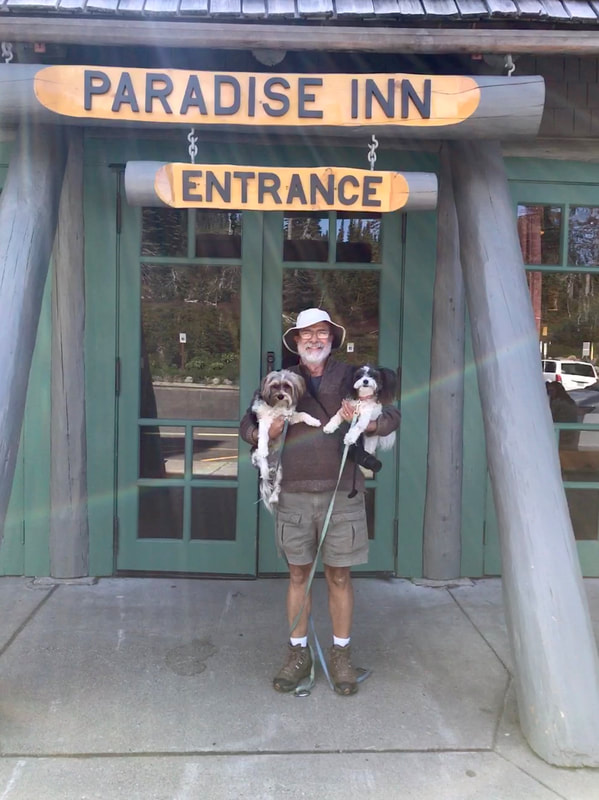 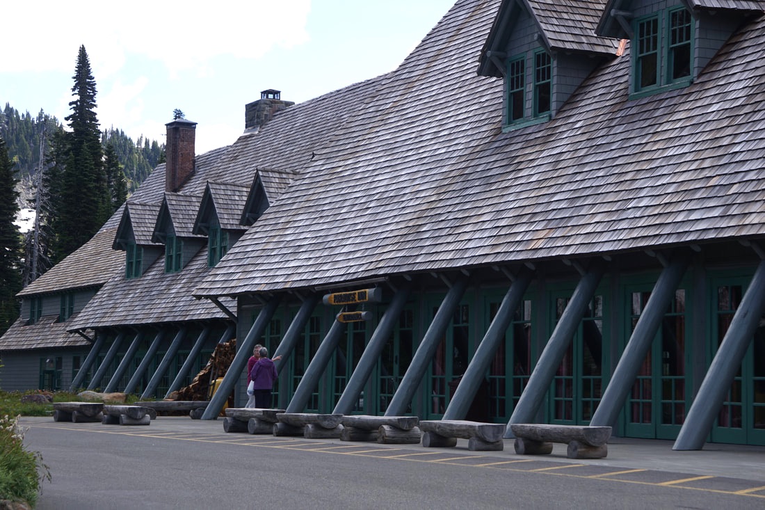 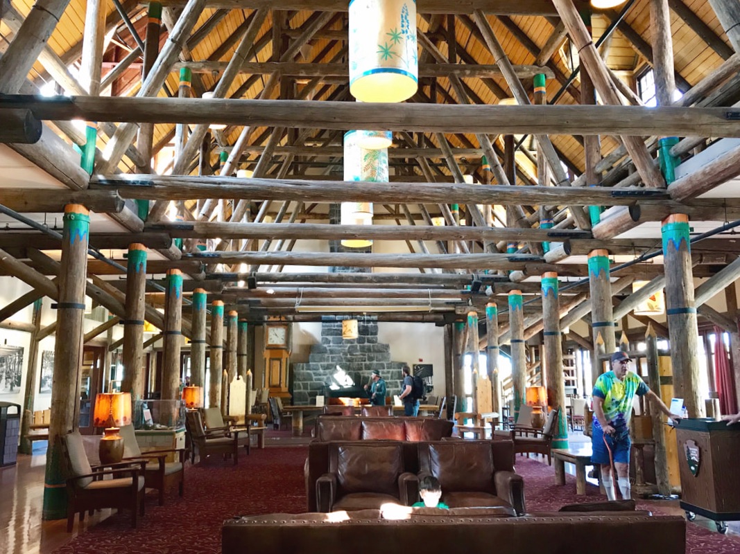 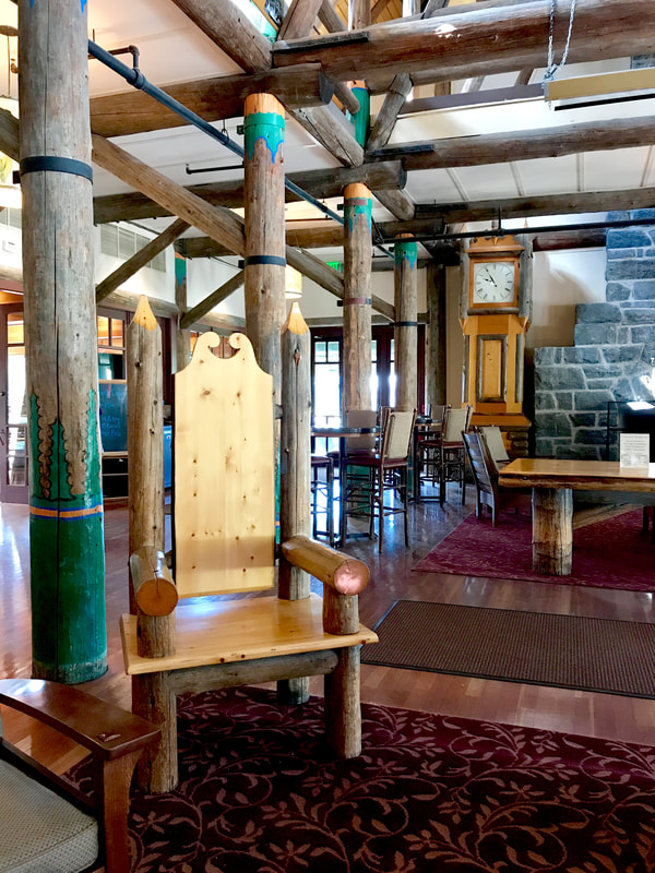   The beautiful dining room was open for Sunday morning brunch . . . everything from standard breakfast (bacon, sausage, eggs, waffles, omelets, pastries, grits) to a variety of fish, rice, fruits, breads, rolls, pasta salads. As we ate, I couldn’t believe we got all of this, in this beautiful setting, for only $7.00. Turns out that I heard the price wrong – it was $27 for seniors! Worth. Every. Dollar! 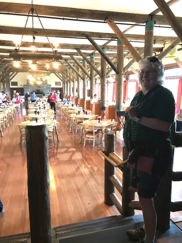
0 Comments
Saturday, June 29, 19 We were off early in the morning with laundry on our minds. This time every piece of clothing, bedding, towels and even the rugs, got washed. The laundry in the little remote town had deluxe, large-load appliances, and boy did they swallow up the quarters! We were done by 11:00, and only 25 miles away from our destination of Mt. Rainer. At the little town of Packwood we stopped for a burger before driving the last 7 miles into Ohanapecosh River Campground.  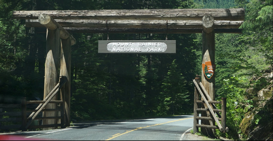 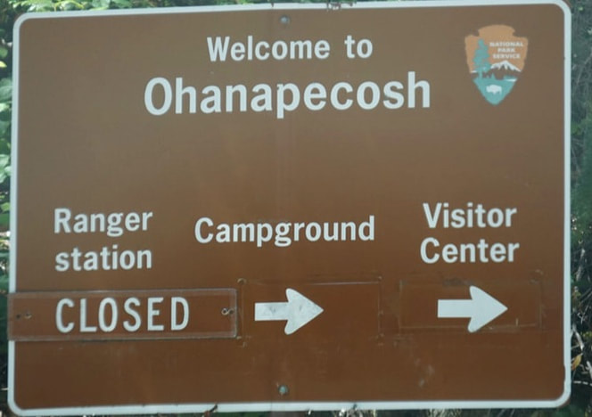 Here, we set up camp among thousand-year-old trees! Tall, tall Spruce trees with long thickly barked trunks that were bare until where the branches congregated near the top. The forest floor was pine cones, pine needles, ferns, and other sparse growth – and very little sunlight. It was to be our little piece of heaven for the next 4 days. 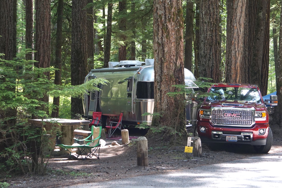 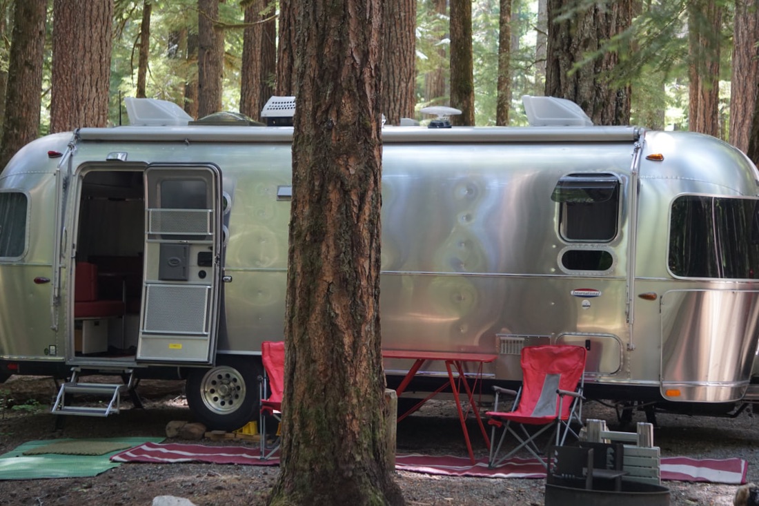   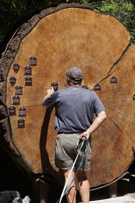 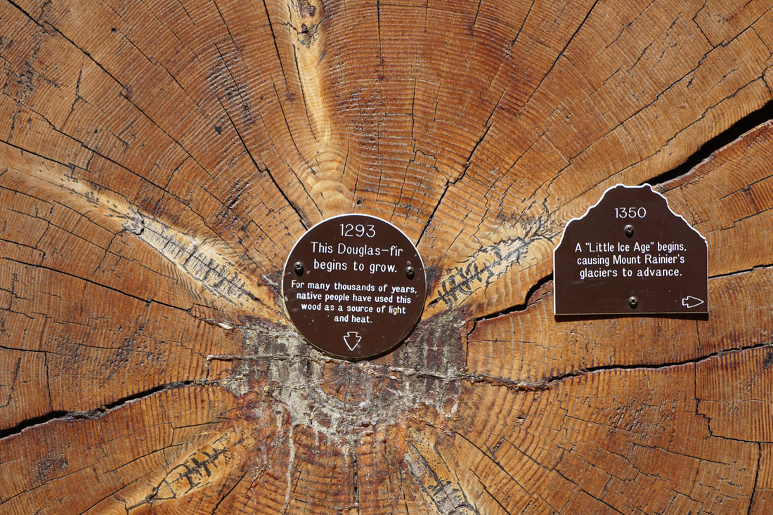 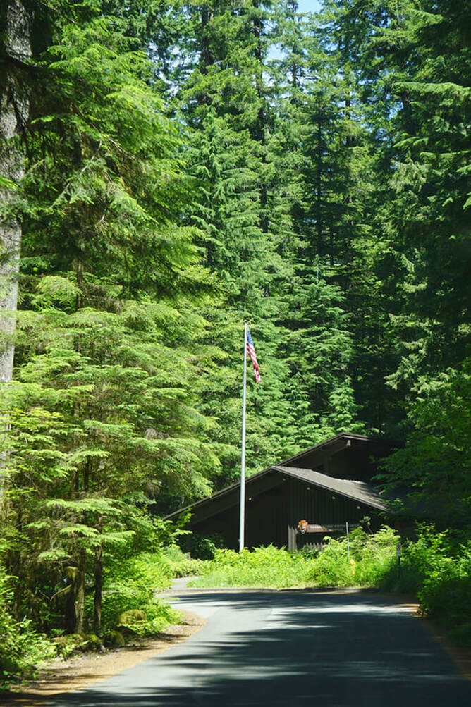 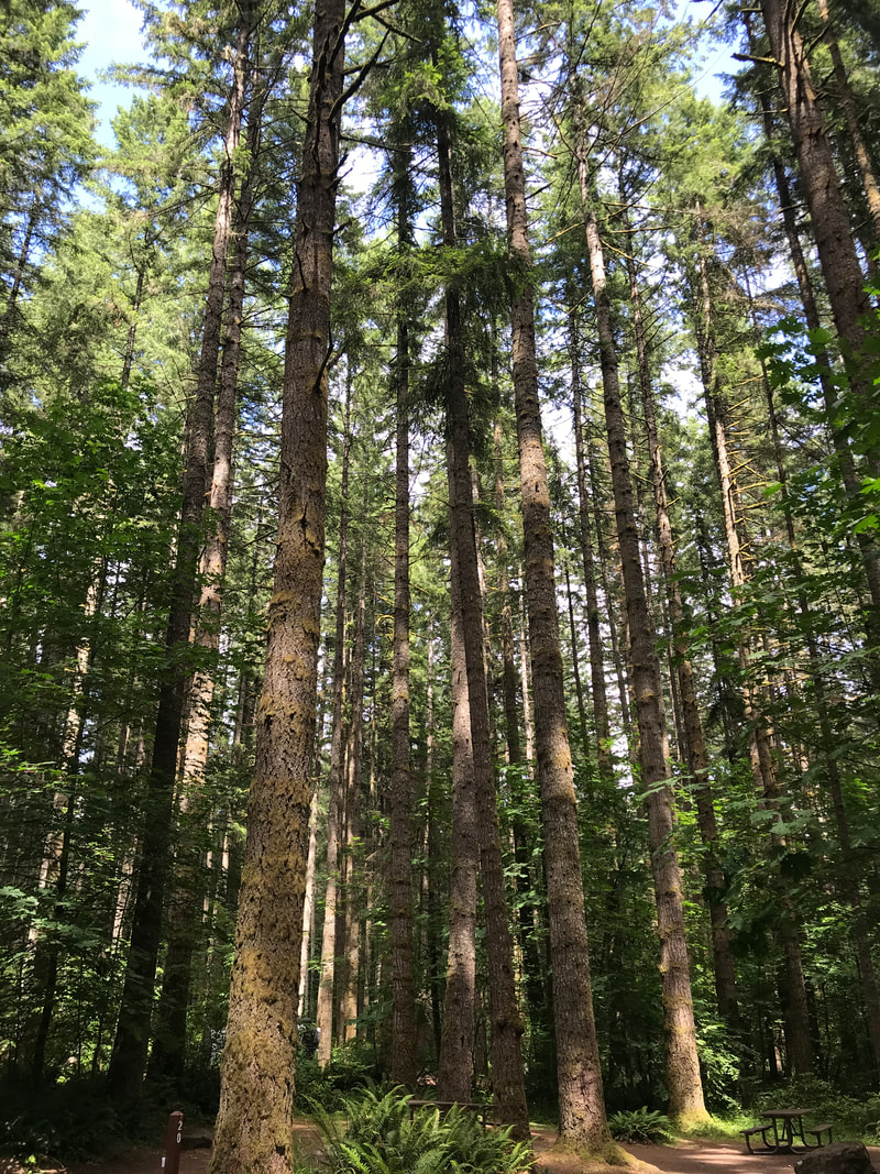 I immediately set my lounge chair out to enjoy the 74-degree weather and finished a basket . . . my first completion of the trip! Tom walked the dogs, explored the campground loops, and talked to Rangers that were out and about, and declared the campground “almost as good as Elkmont”! Here is a view from my lounge chair -- after I finished the basket and cranked back to rest. 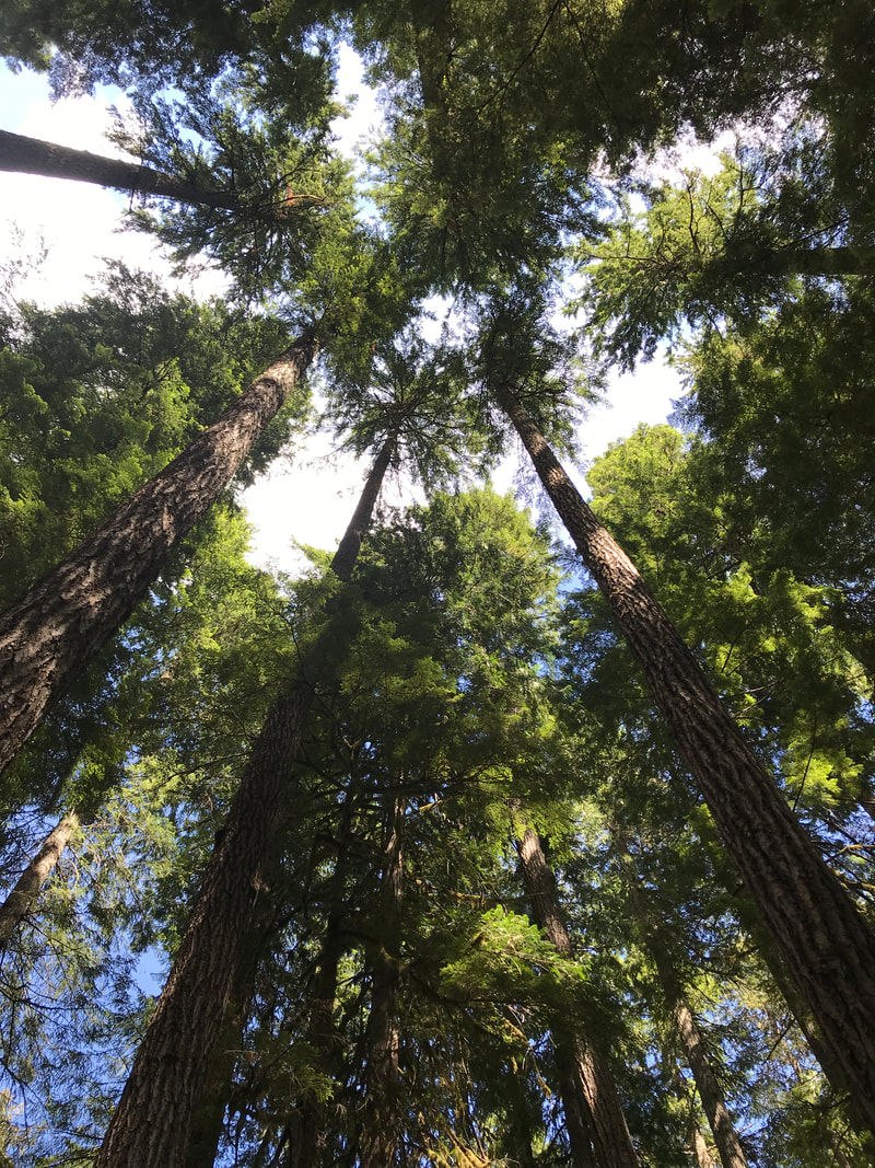 An after-dinner drive took us deeper in the park toward Paradise Inn, a climb of 3,400 feet. As we made the U-turn corner around Backbone Ridge . . . we saw our first (and completely unexpected) view of Mt. Rainer. 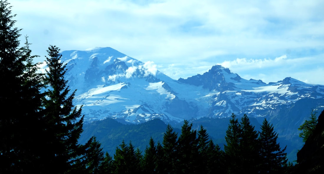 Another 10 miles into the drive – we turned back! The steep, narrow, snaking road had long sections with no guardrails on the cliff side. It was fine for the moment, but our minds pictured the return trip in the dark – driving on the cliff side of the road! It could wait until tomorrow when we had a whole day to spend!
Friday, June 28 We followed Route 504 (the Spirit Lake Highway) from our Silver Lake campground 60 miles along the Toutle Mountain Range and back to the ground zero Mount St. Helens National Volcanic Monument. 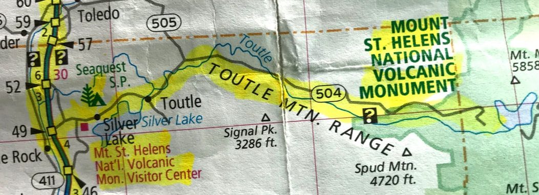 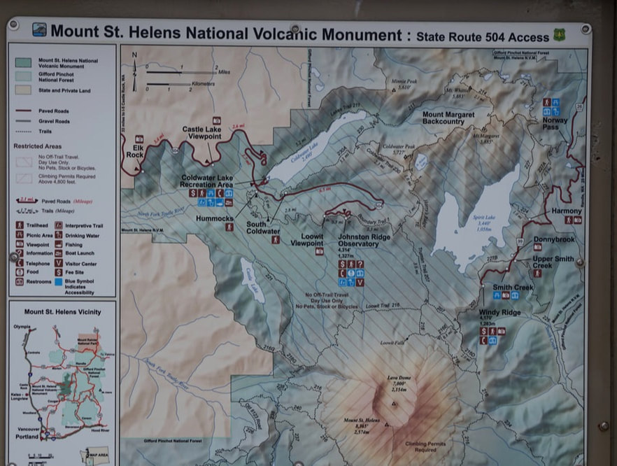 Highway 504 was built to access the area after the blast, and 14 bridges had to be constructed. The largest, Hoffstadt Creek Bridge, is 370 feet high and 2,340 feet long. 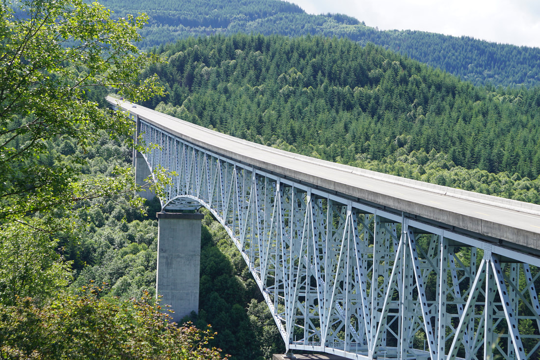 The Forest Learning Center offered the incredible story of the Weyerhaeuser Logging Company. They were logging the mountain at the time of the eruption and within four weeks afterwards they established research that showed that the ash was very low in nutrients for new tree growth. But, if seedlings were planted firmly in the earth, below the ash, they should grow. Weyerhaeuser spent two years harvesting the knocked over, branch-stripped logs . . . at the rate of 700 truck-loads a day! Then, they replanted, one by one by shovel, tens of millions of trees firmly down in the soil, to start new forest growth. Their efforts hastened the recovery of the wildlife and mountain streams. 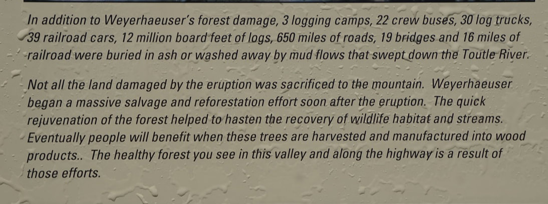 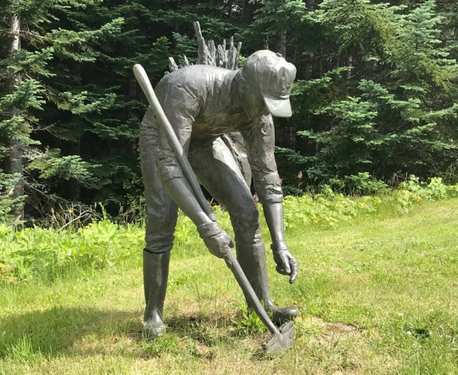 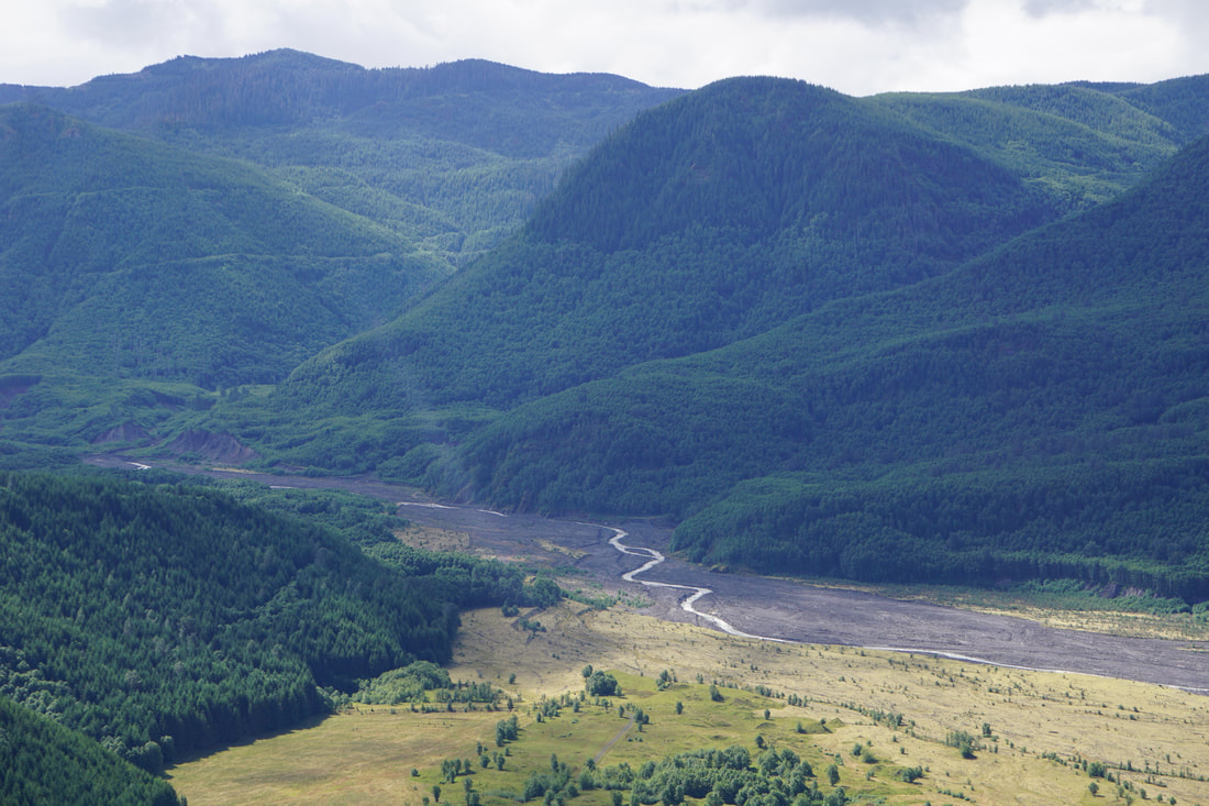 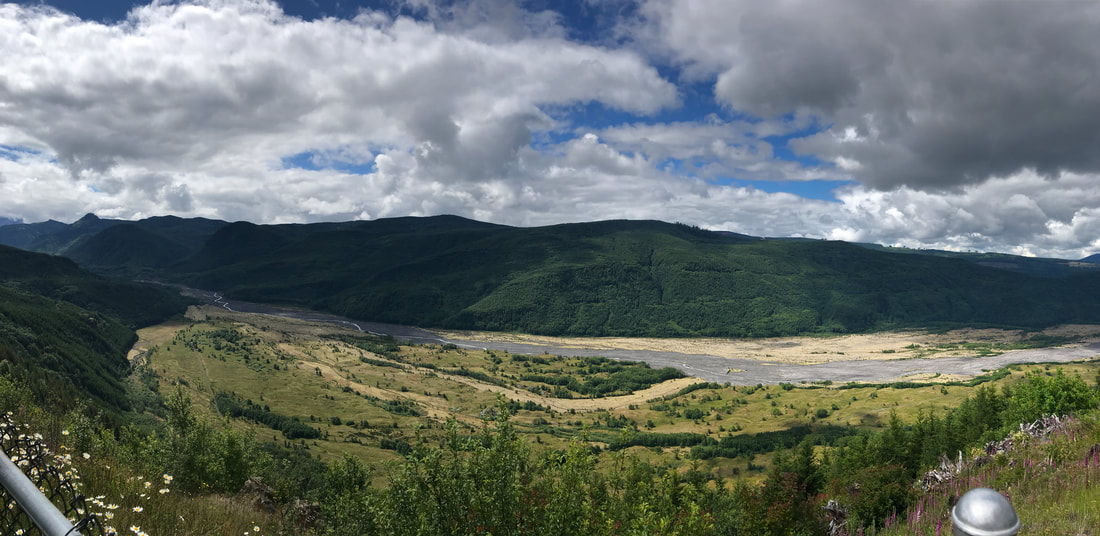 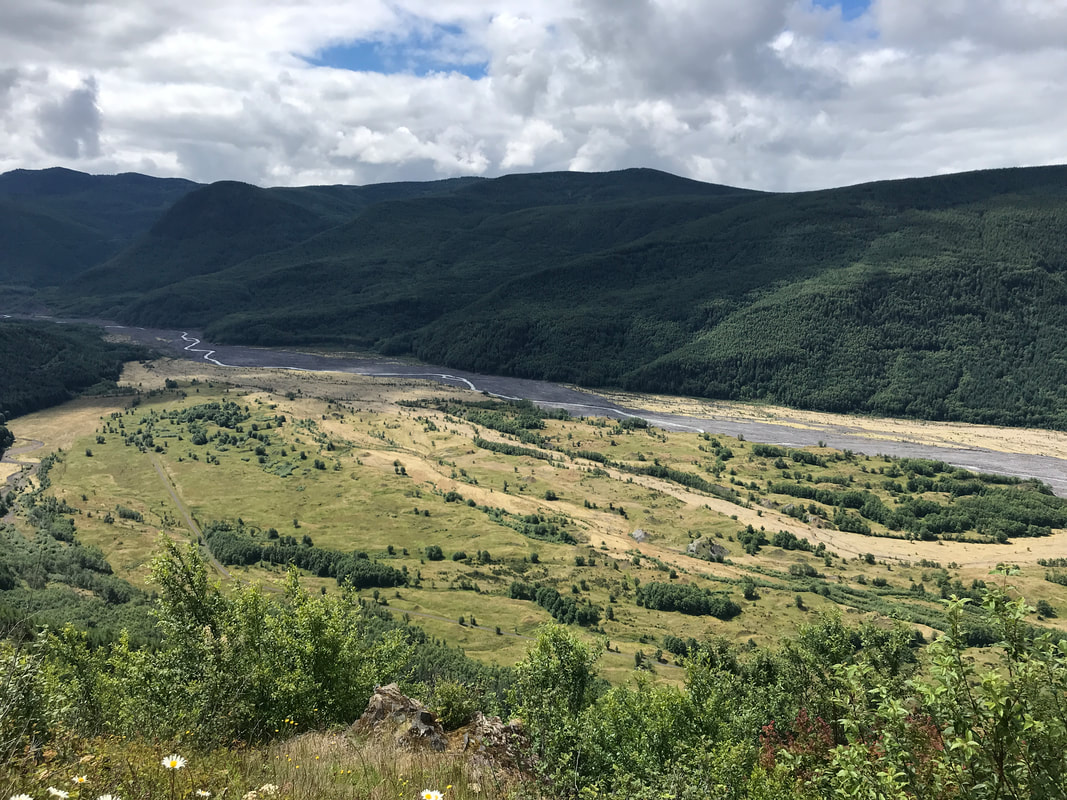 The next stop was the Coldwater Recreation Area, where a new lake was formed after the eruption. We had a lunch that we had packed and then did the 1-mile loop hike that meandered by trail into the forest, and by boardwalk out onto the lake. 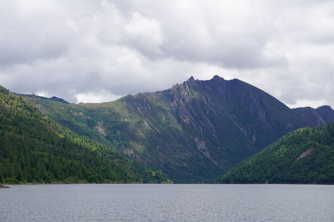 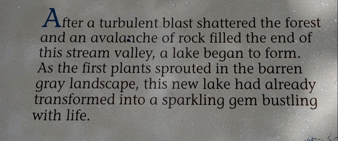 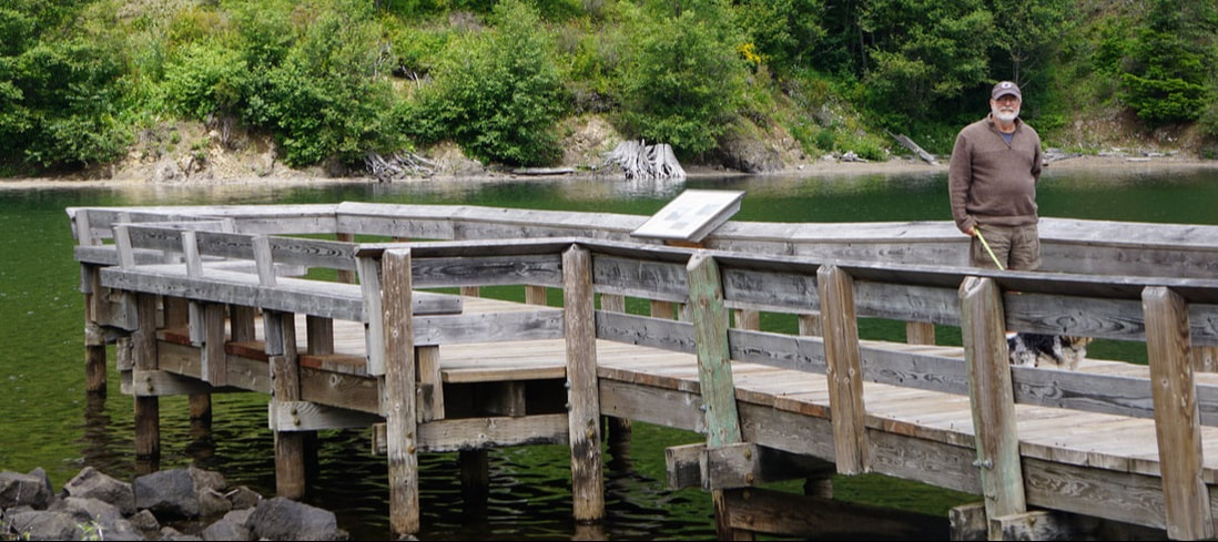 We reached our final stop – Johnston Ridge Observatory. The Visitor Center is situated facing the South side of the mountain where the lateral explosion took place. The surrounding mountain slopes still showed fallen trees, stripped of branches. Despite heavy cloud cover we could make out the crater that resulted from the blast. . . there is no top of the mountain to be covered by clouds any more! The exhibits inside were nicely done and the movie was excellent. I need to say that each observation/learning center has been a separate entrance fee, adding up throughout our two-day visit! 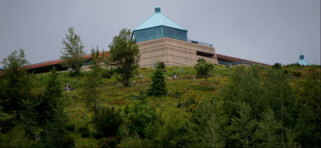 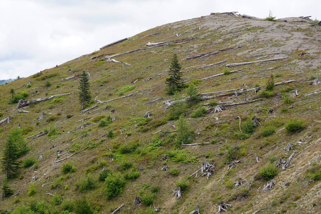 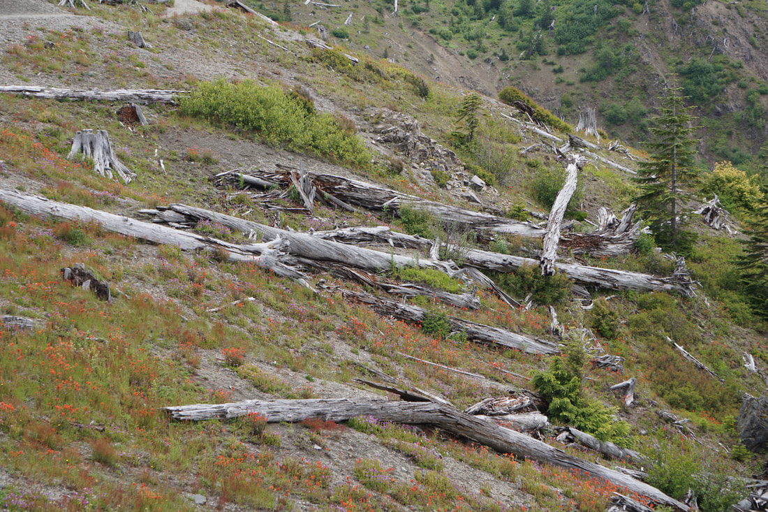 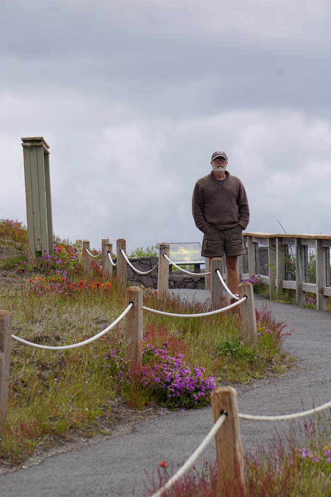 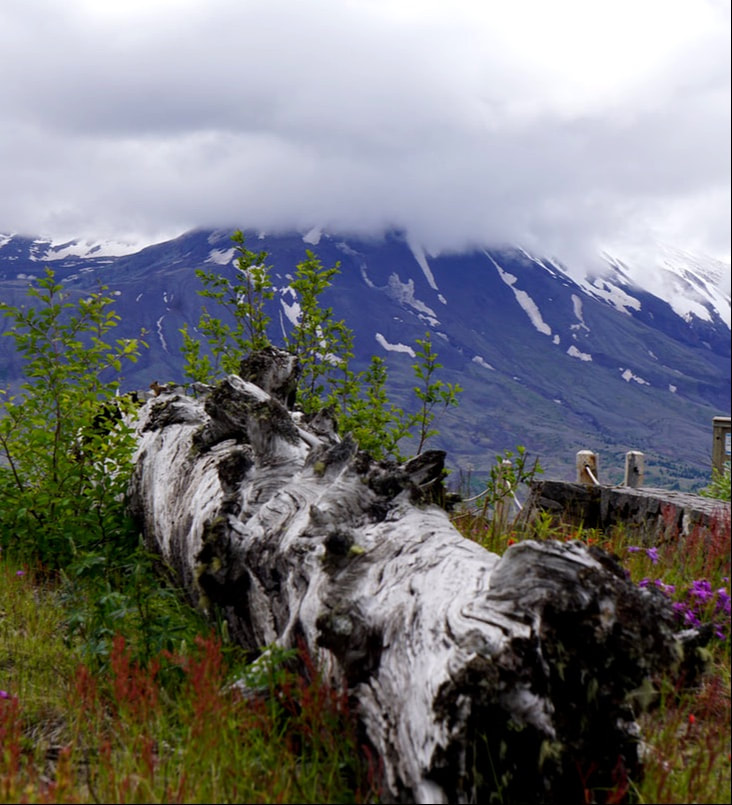 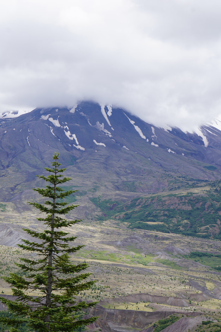 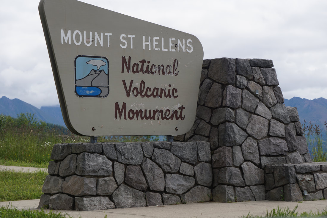  Driving back down the hour trip to our campsite, we now had a pretty good idea of what happened on May 18, 1980. We could identify the impact area still with trees on the ground, the location of the former Spirit Lake at the base of St. Helens, the new Coldwater Lake and streams forged from the disruption, and the recent growths of forest planted so tediously by Weyerhaeuser . . all for a total understanding and picture. The one thing we both found strange was that there was no mention of molten lava flowing from the mountain – just a big blast of rock and ash.
Thursday, June 27 We left the coast this morning for Mount St. Helens. Before getting too far, however, we concluded our Lewis and Clark saga with the last of the historical sites we had not yet visited – Dismal Nitch. 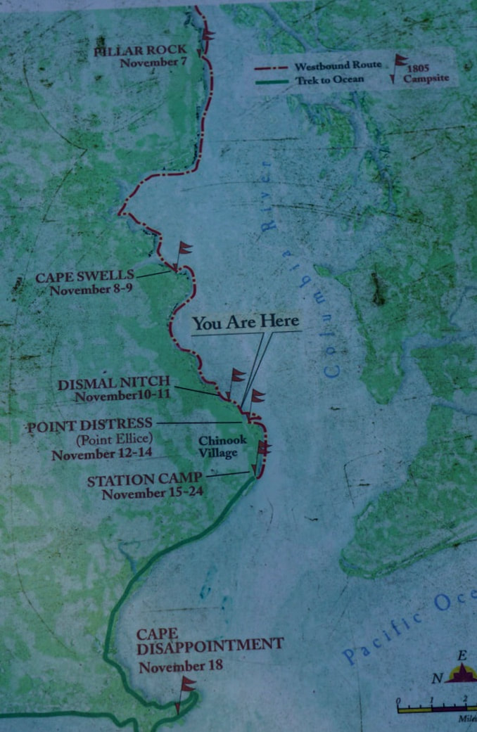  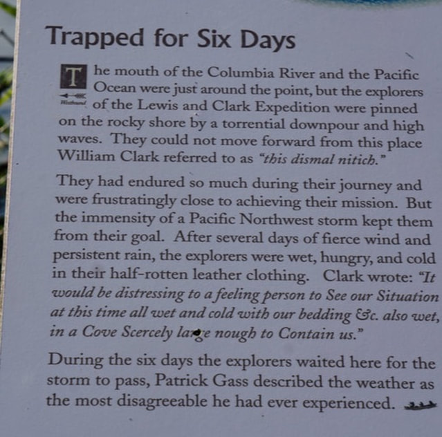 When we continued towards Mount St. Helens we only had 60 miles, but added a lunch stop and grocery shop to take up some time, and arrived at Seaquest State Park at 1:30. Tom has been a bit put out with the park attendants scolding us for arriving before check-in time. . . Tom always wants to get his money’s worth! All sites were huge, densely forested with dampish rain-forest growth that was a brilliant emerald green, and had electric and water hook-up. We’ll be here for two nights. 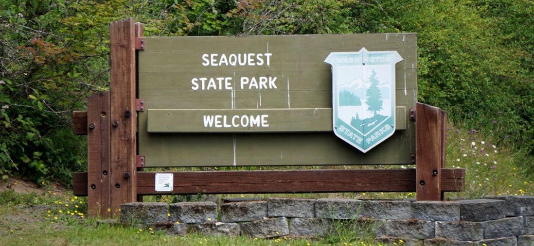 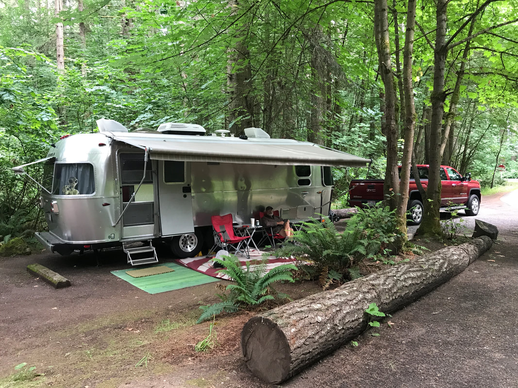 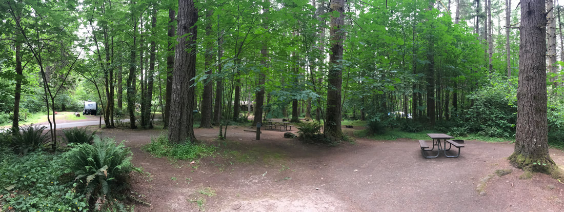 Seaquest State Park is directly across the road from a Mount St. Helen’s Visitor Center at Silver Lake– which is still almost 40 miles away from Mount St. Helens itself. There were nice exhibits on the 1980 eruption, an animated Ranger talk by a young girl not afraid to act it out, an excellent movie detailing the eruption and aftermath with real video footage, and a beautiful 1-mile nature trail on a wetland boardwalk. We have not see the mountain yet, and hope to have a more comprehensive view of what took place in the surrounding areas as we explore tomorrow. The mountain and all of the areas bordering it were affected and changed in catastrophic ways. 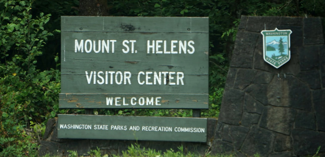 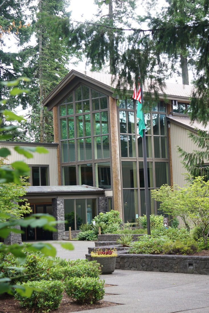 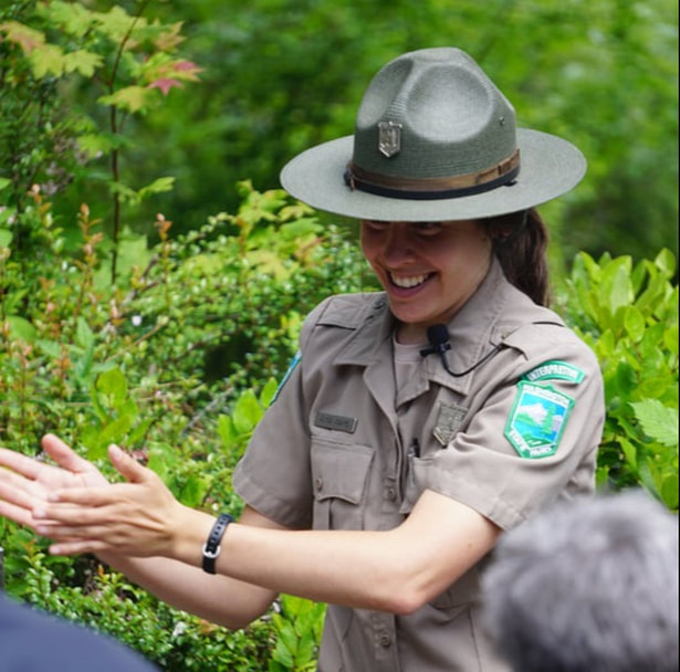 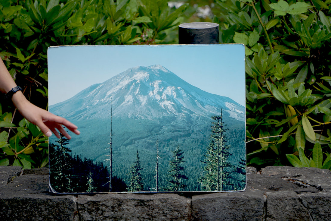 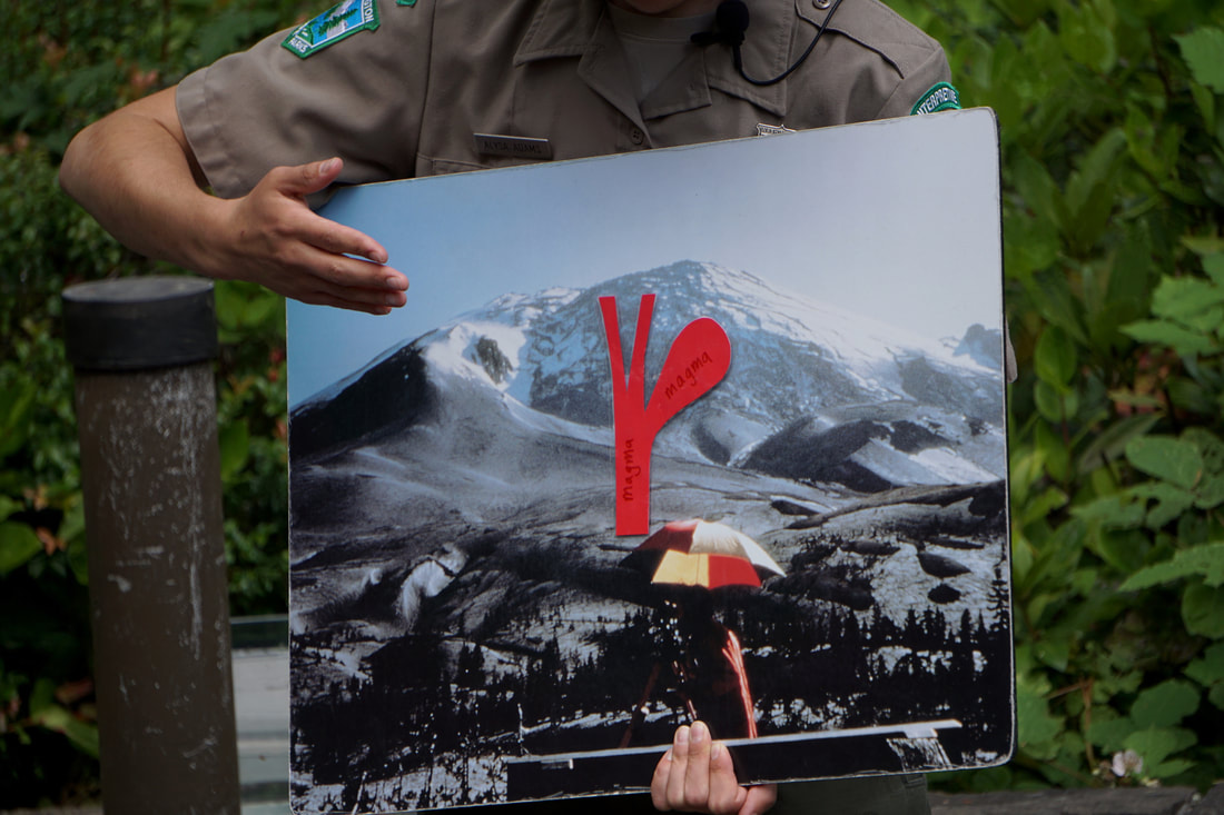 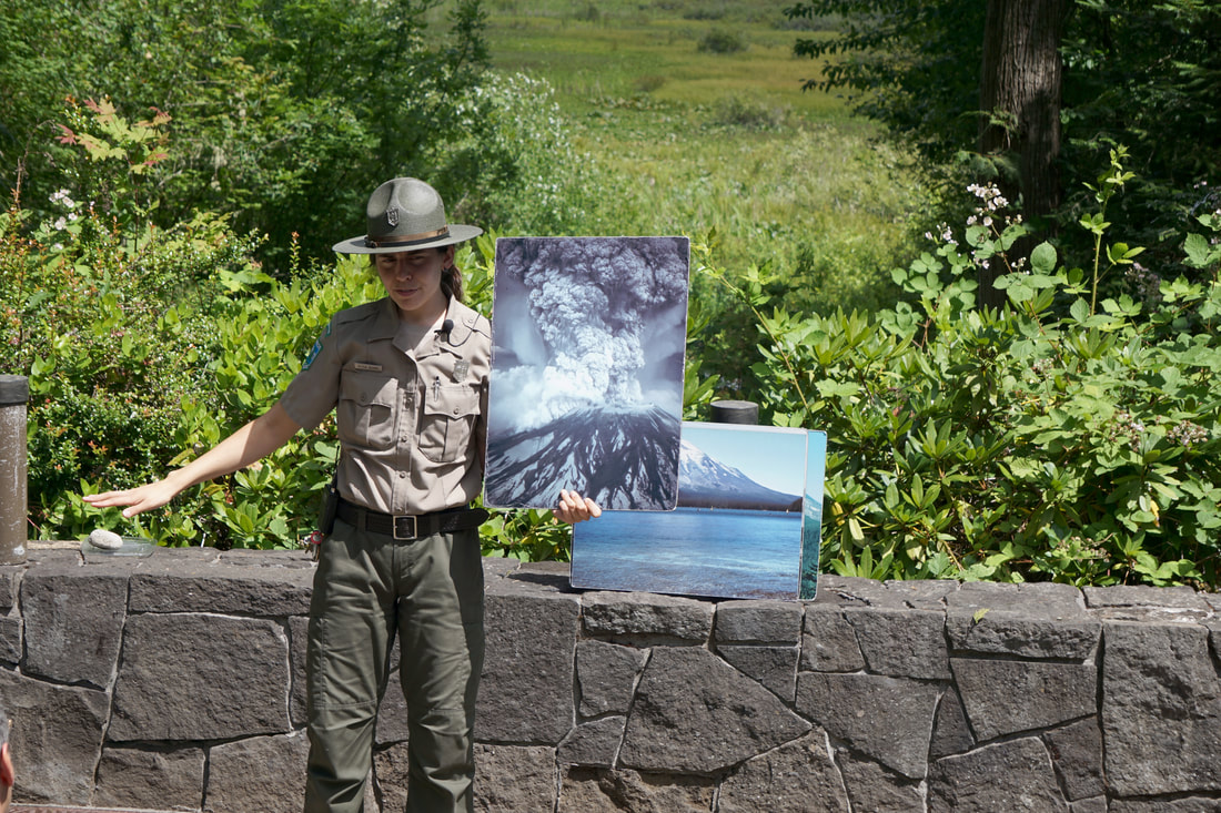 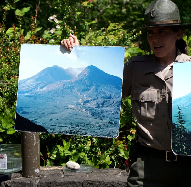 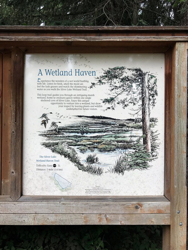 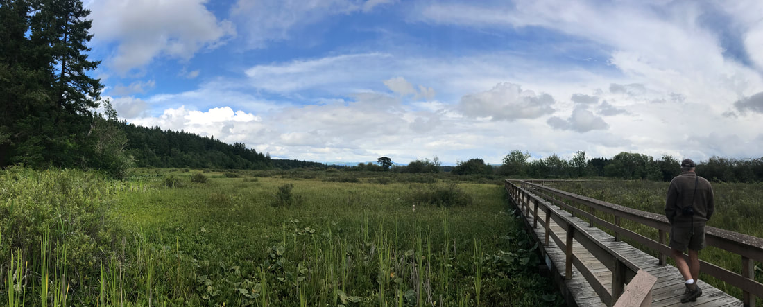 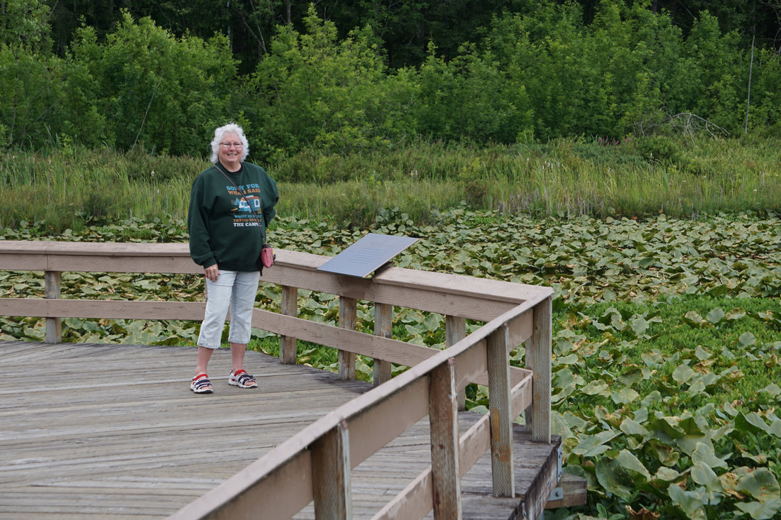 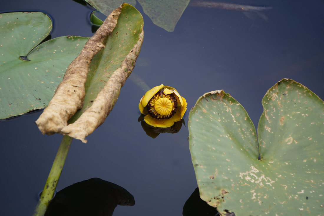 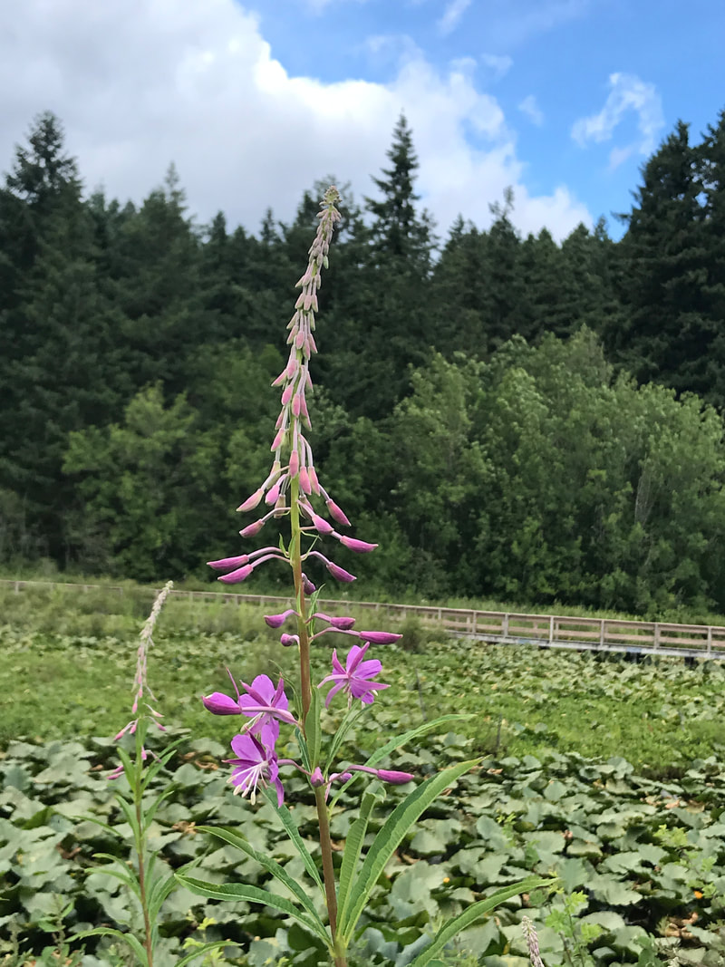 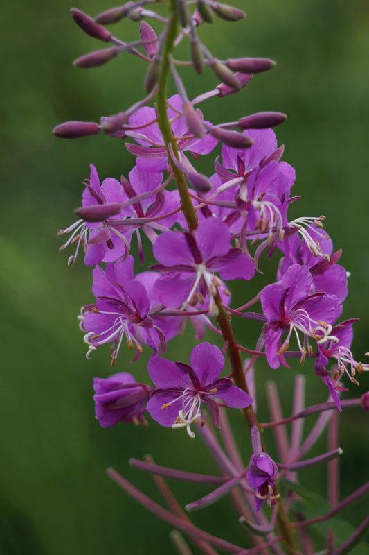 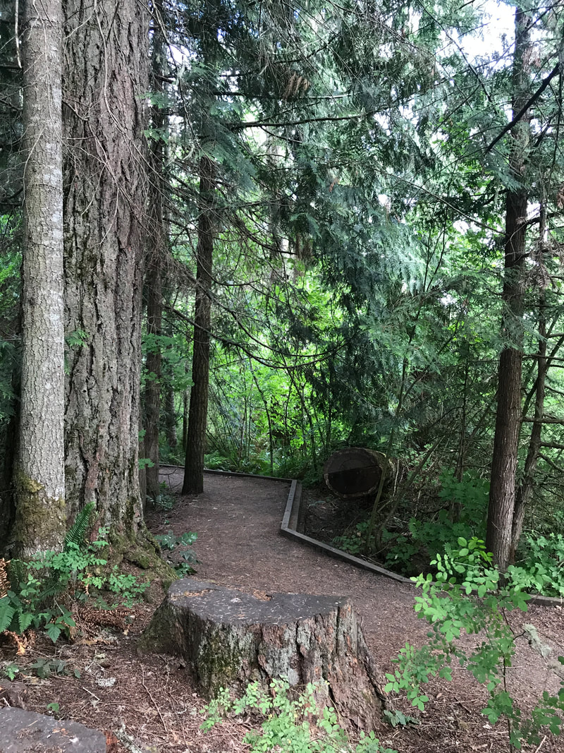  That evening we had a surprise for two good little doggies: We bought a rack of very meaty beef ribs and Tom separated them and cut most of the meat off of the bone. We used the beef to make fajitas, and the dogs each got a bone. The rest of the bones were put in the freezer for future chews! 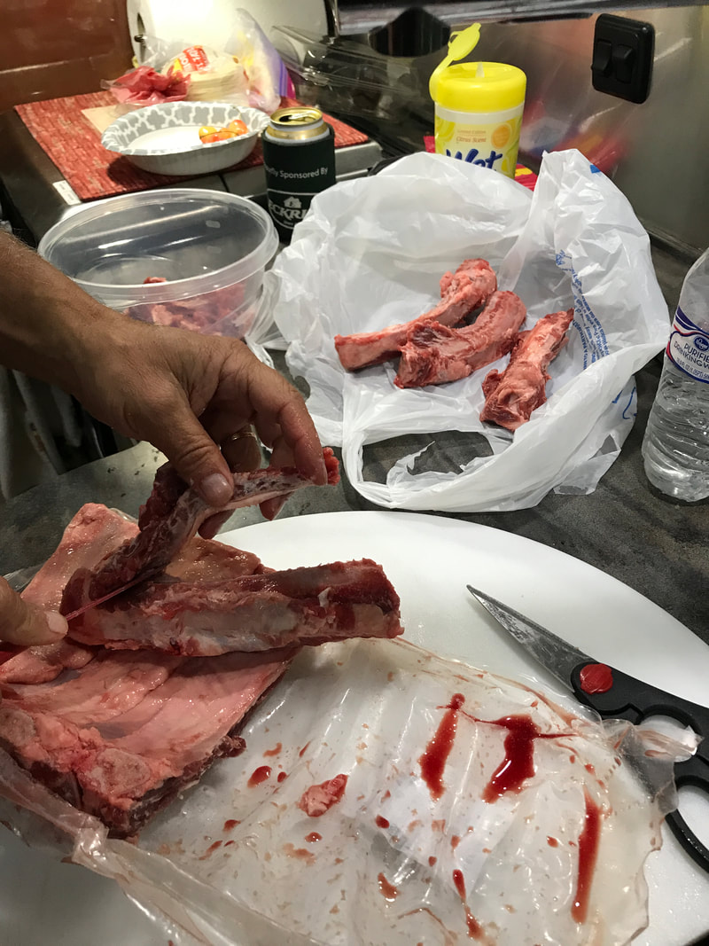 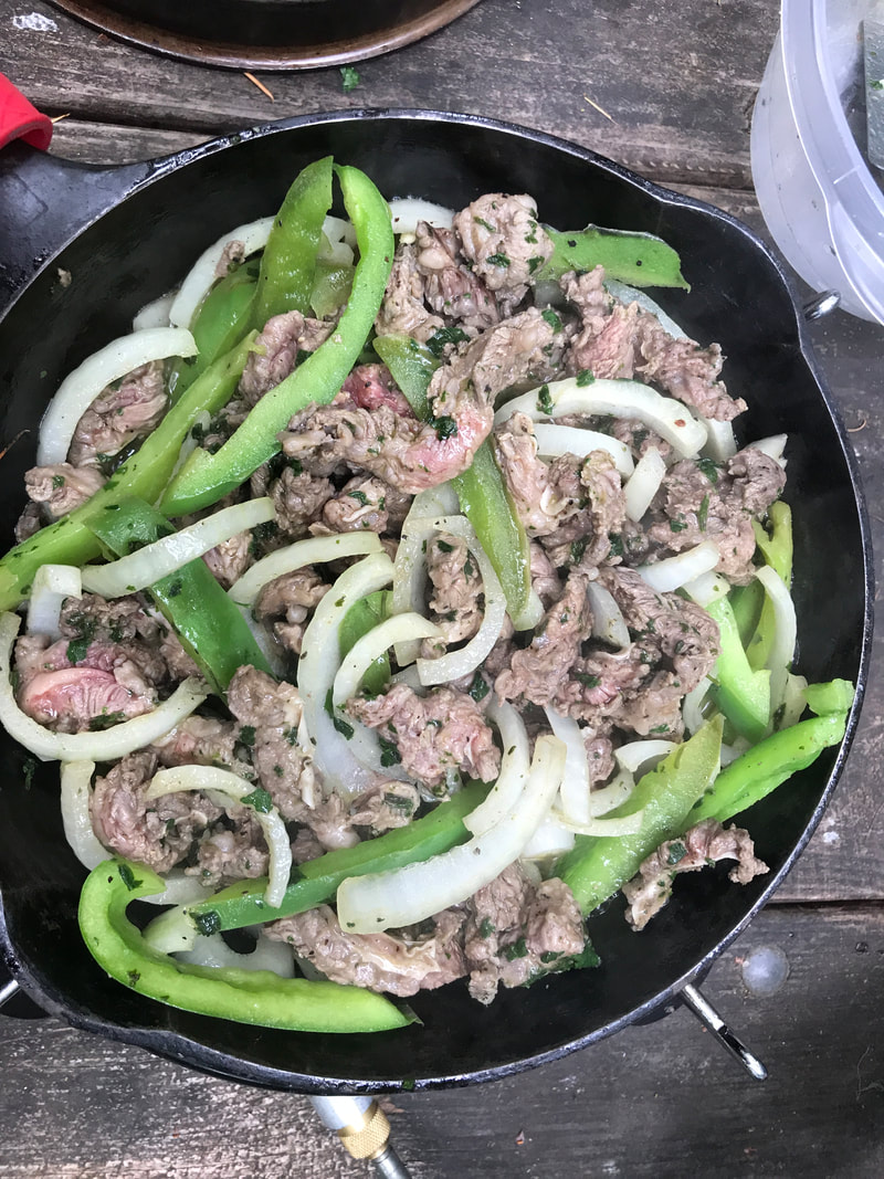 June 26, Wednesday We’re still in the same coastal area – just a different state! Our drive today was only 29 miles: back into Astoria, across the mouth of the Columbia River and down US 101 to Cape Disappointment State Park. We set up camp, ate lunch, walked the dogs on the beach, and by 12:00 we were of to explore. 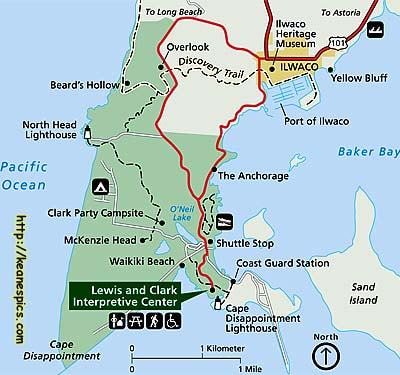 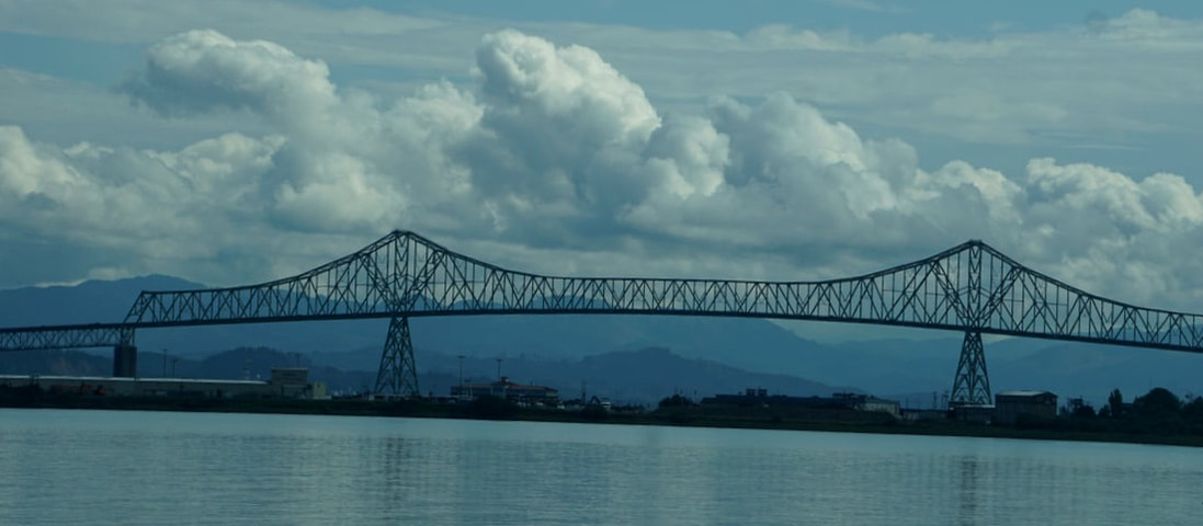 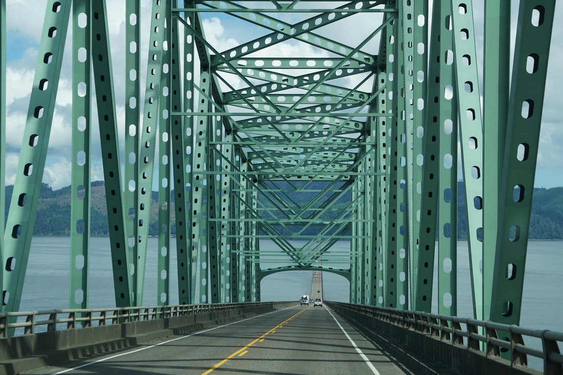  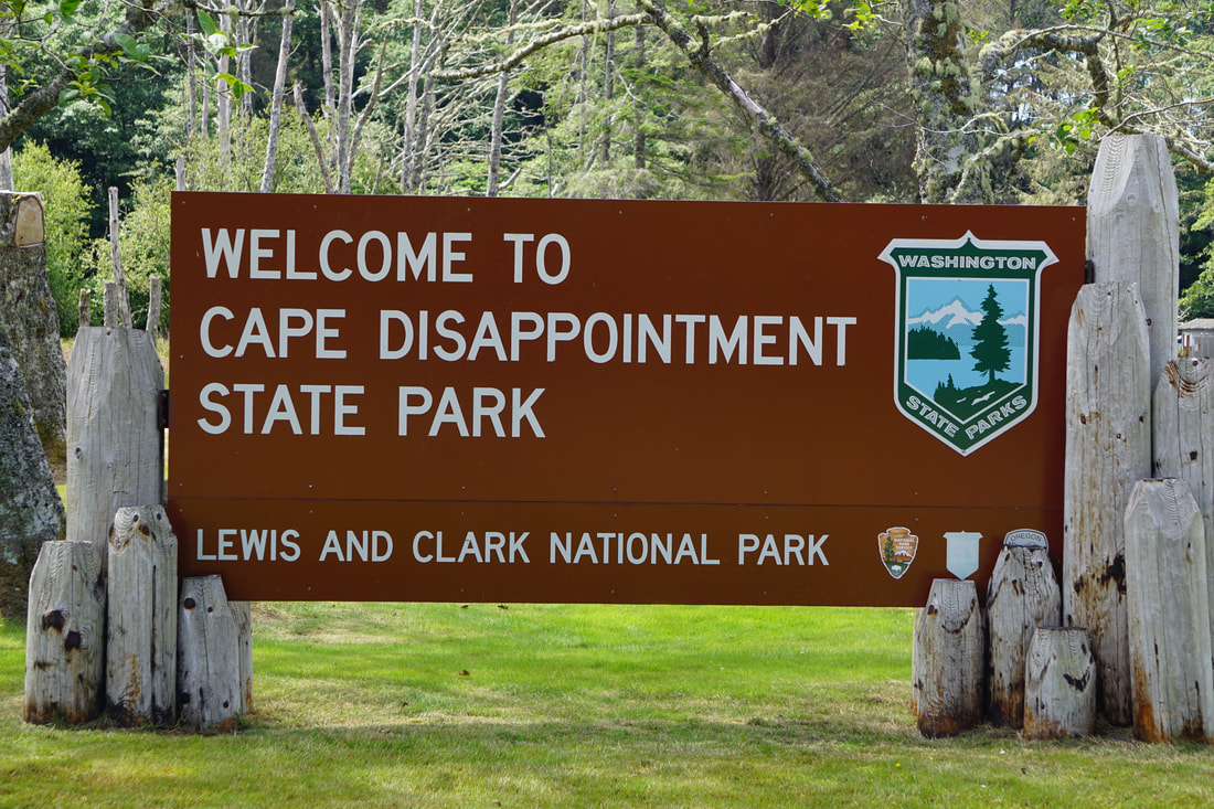 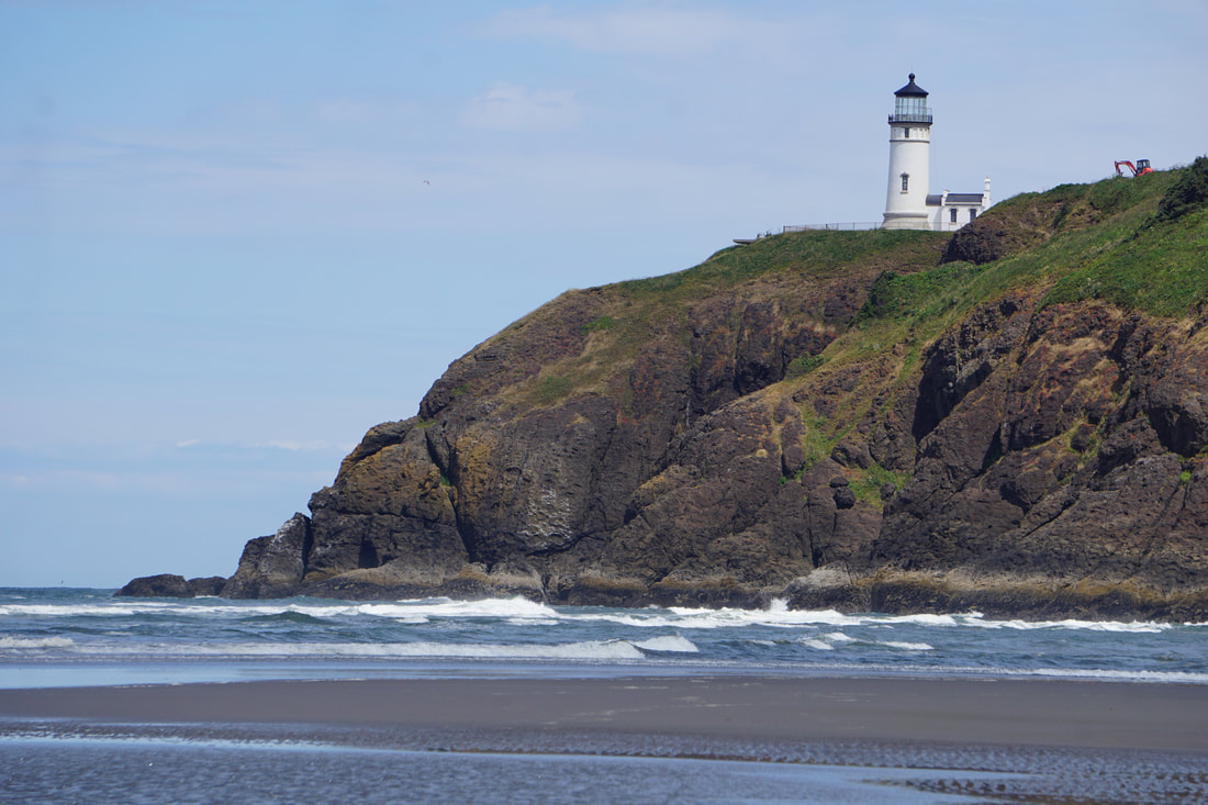 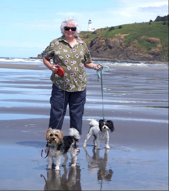  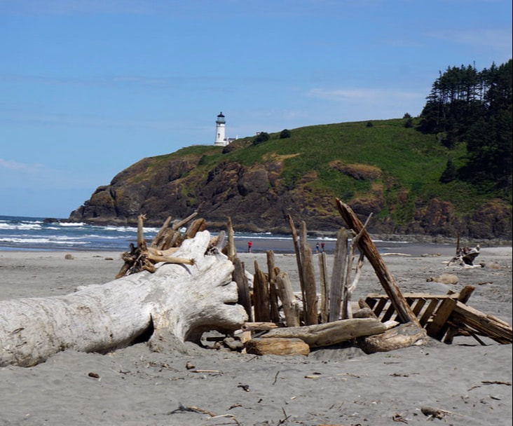 First stop: the North Head Lighthouse. At the parking lot there were two white/red-trim guesthouses that could be rented, and a path that led back to the lighthouse. It was undergoing a major renovation, but the view of the outside was grand. 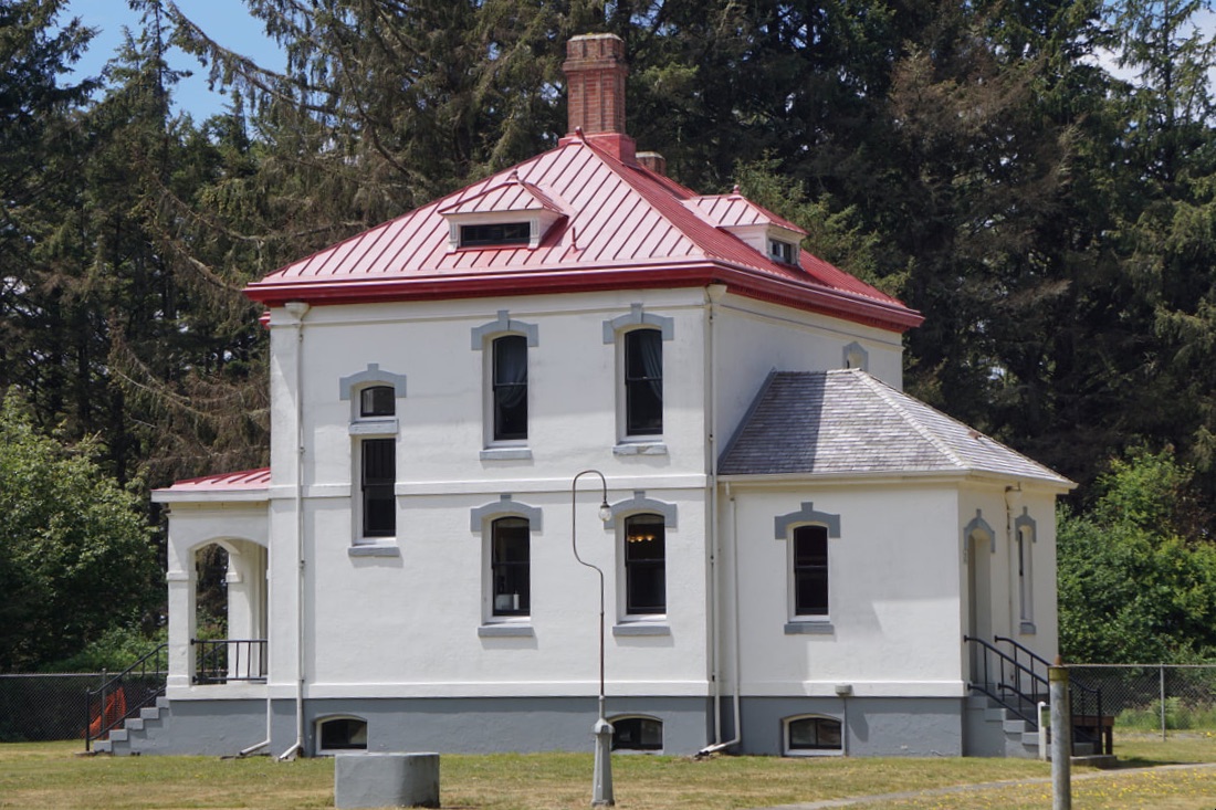 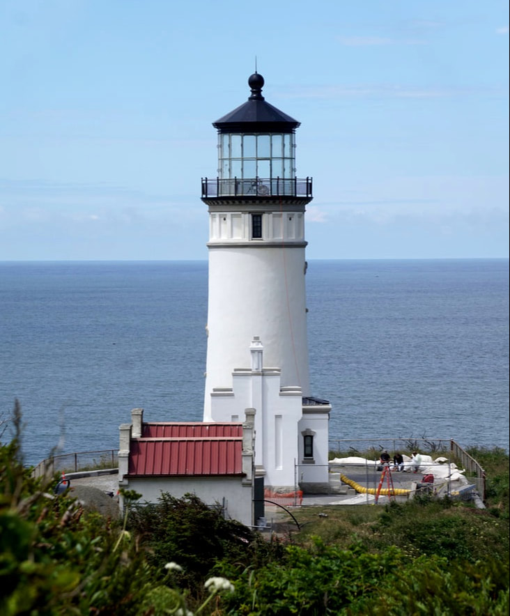 The Lewis and Clark Information Center was a bit difficult to find. After we did, we walked the trail up to the cliff top facility – no dogs allowed! We returned the dogs to the Silvermine (not far away) and went back to the interpretive center to hear the story of Jefferson’s Discover Corps reaching the Pacific Ocean. There was an excellent 24-minute movie. In November of 1805 the exploration team stopped here hoping to find a place to winter. Instead they were stuck for six days on a seaside shelf, hungry and miserable. Once the weather cleared the L&C party moved along the coast to Cape Disappointment and set up camp here and then walked the last miles to the Pacific Ocean. Then, they decided to head back across the mouth of the river to a more sheltered spot to set up a winter camp (Fort Clatsop). Thus, this place was called Cape Disappointment, because it was not a good place to survive the winter of 1805-1806. 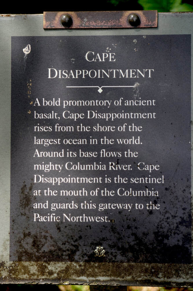  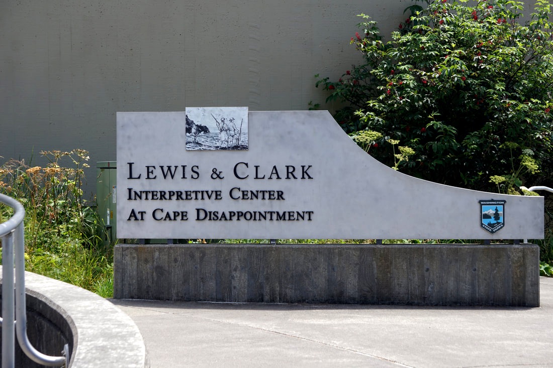 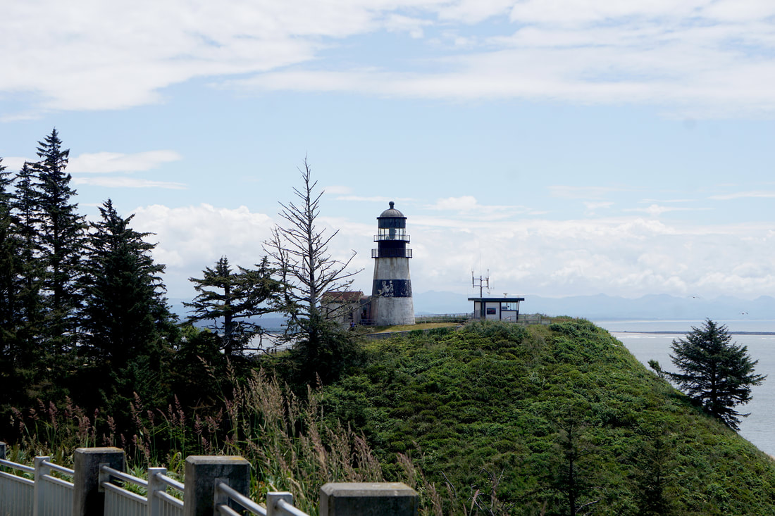  Three o’clock, and still a lot of touring to do! We picked up the dogs and headed up Route 103 on a twenty-mile spit of land to Leadbetter Point. At the fun little party town of Long Beach, we drove the truck right down on . . . the world’s longest beach! We also stopped to pick up some more Dungeness Crabs for supper. 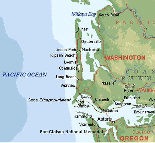 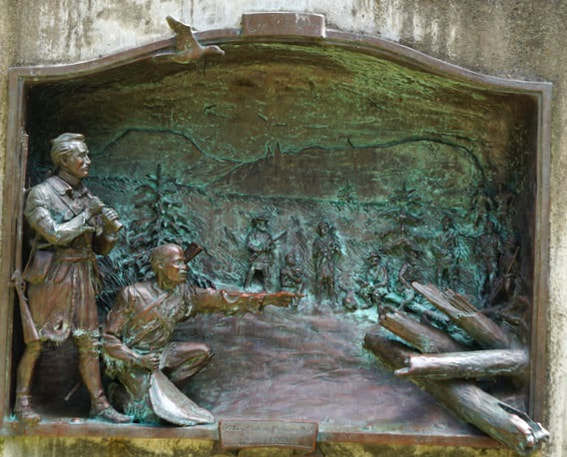 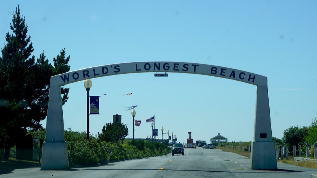 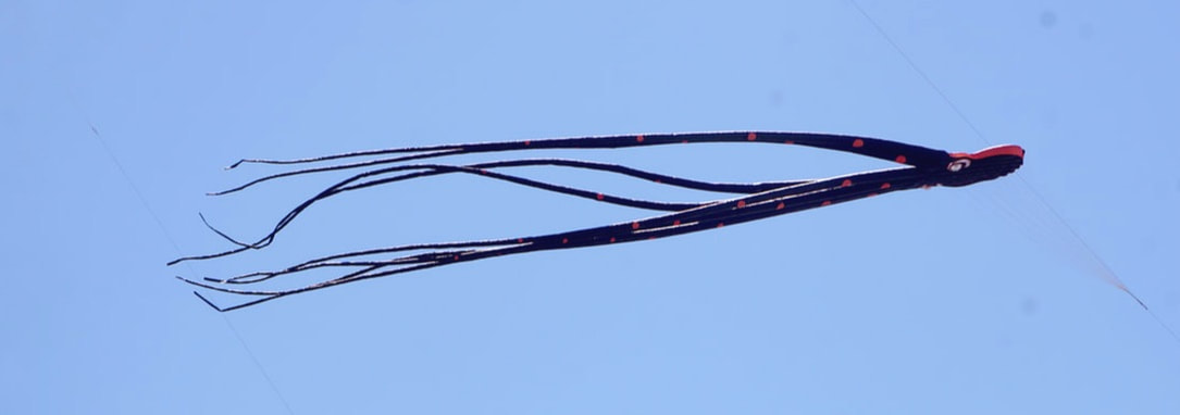  Back at the campground at 5:00 we were welcomed by deer. We did a few necessary chores before cooking our crab. Tom pulled out a bottle of our favorite Oliver Soft Red wine . . . another seafood, ocean-dinner delight! And, that ends our third full week of the vacation! 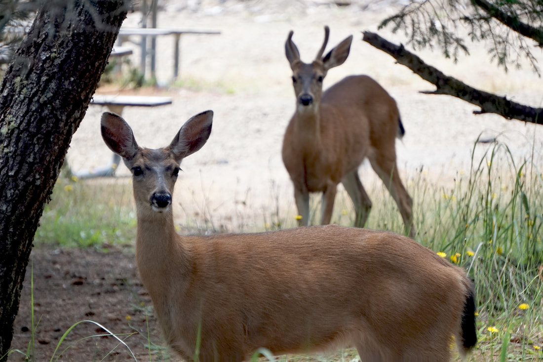 June 25, Tuesday Several years ago we visited the Graveyard of the Atlantic – today we headed for the Graveyard of the Pacific! Tom had to wait around until I decided to get up at 8:30. He walked the dogs around the campground – the biggest campground in the United States!  First stop: South Jetty. From the observation tower, a park volunteer told us the whole story of this 6-mile long (longest in the world) Jetty. It was begun in the 1890’s to tame the water where the Pacific Ocean met the Columbia River – the most dangerous section of waterway in the coastal USA! From where we stood on the tower, there were 2,000 wrecks in the area . . . each one with a story. The jetty has made the waterway consistent and predictable so that the channel does not change with each storm, and allows the river to flush its heavy load of silt. While there, we saw a large freighter navigating from the ocean to the river. 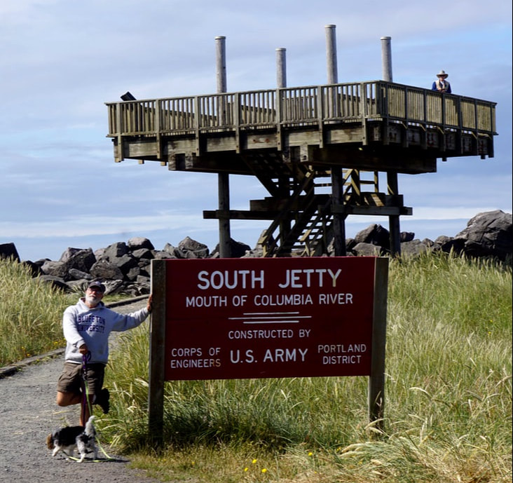 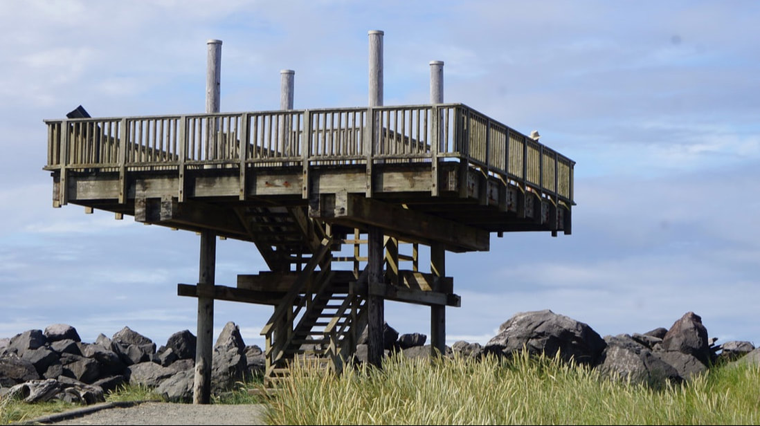 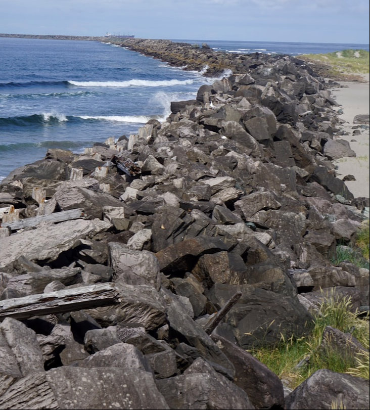 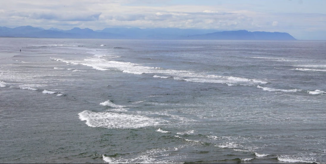 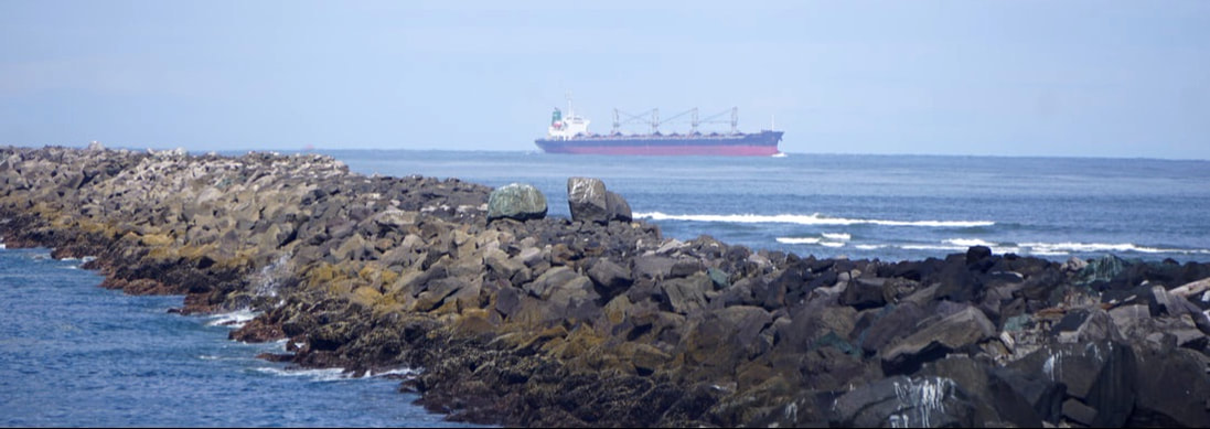 We drove a short mile to the Columbia River access and followed a trail back to the Wildlife Viewing Bunker! It was a pleasant boardwalk, with lots of wildflowers in bloom . . . but the only signs of wildlife we saw was scat! We saw the freighter up close as it continued up the Columbia River. 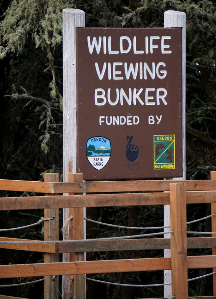  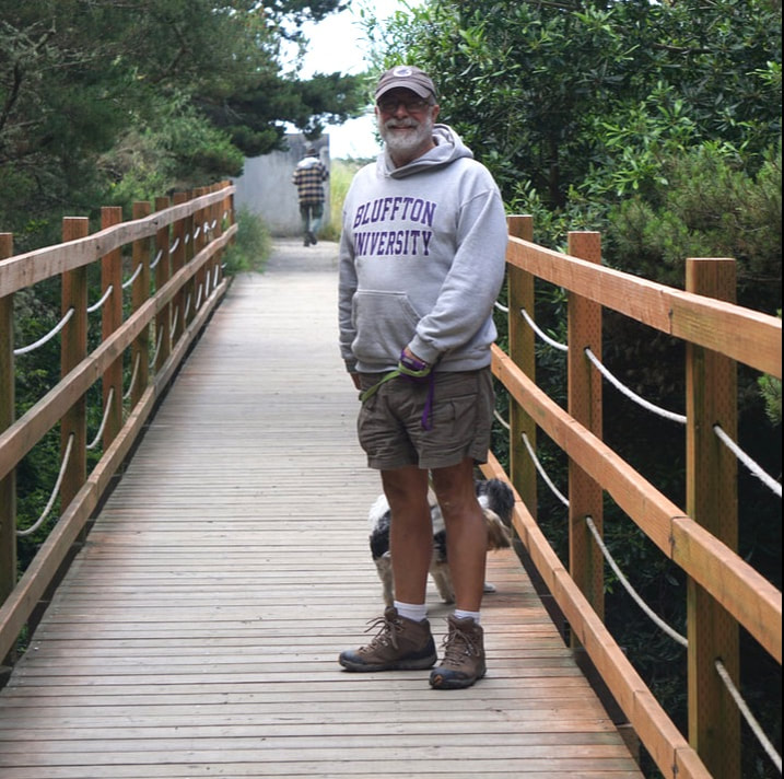    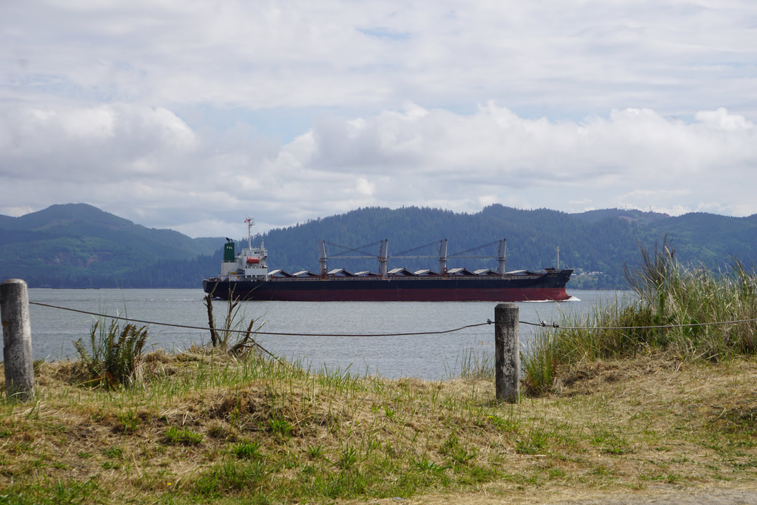 Lunch stop: Grizzly Fish & Chips. The fish is deep-fat-fried Tuna! Excellent! 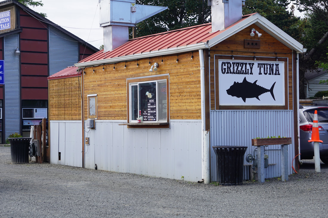 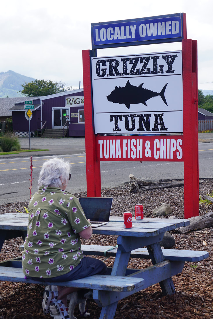 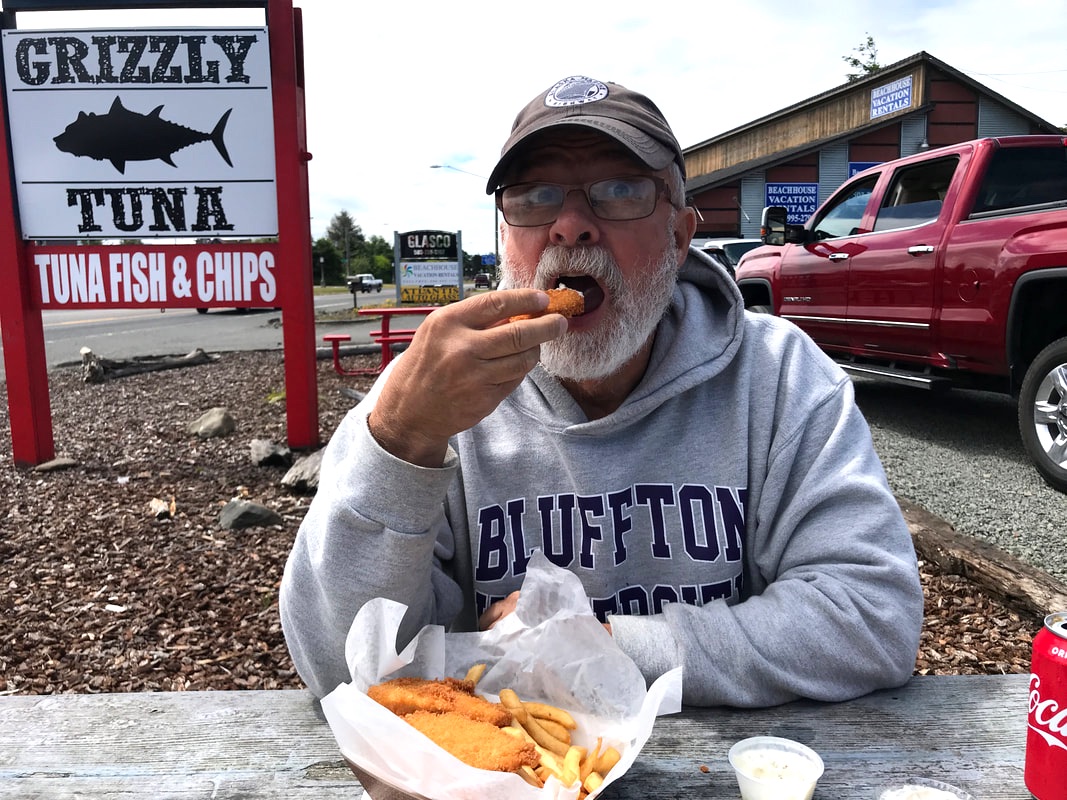 A drive out to Ecola State Park and Indian Beach gave us another high-up ocean view of beaches, craggy rocks, and the very short Tillamook Lighthouse – the only privately owned Oregon coast lighthouse on the National Register of Historical Places! After viewing the beach from the high cliffs, we drove the bouncy, narrow, wooded road down to the beach itself for a totally different view. 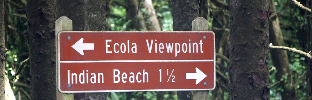 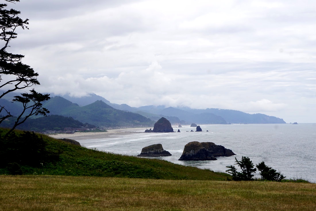 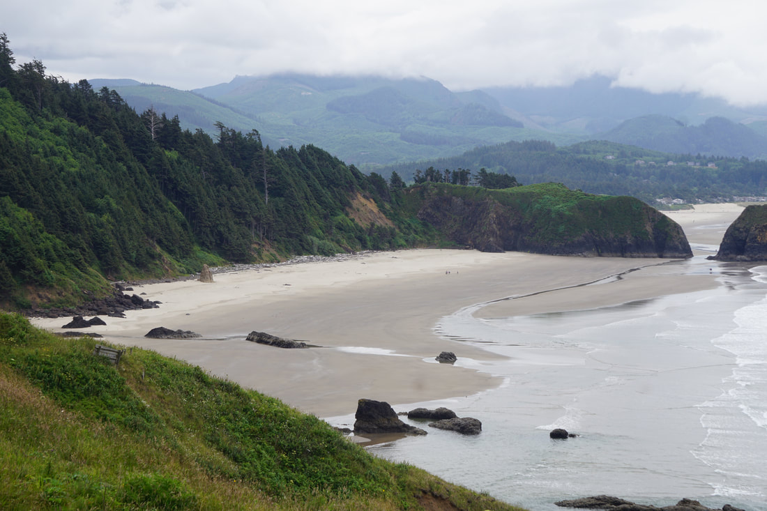 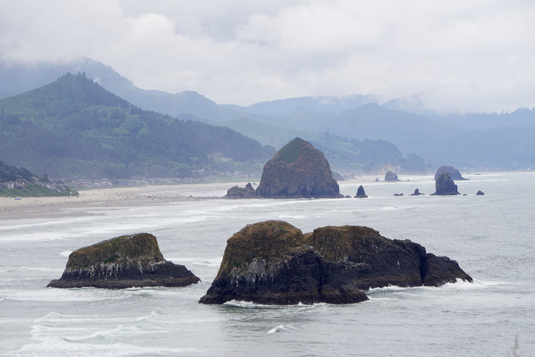 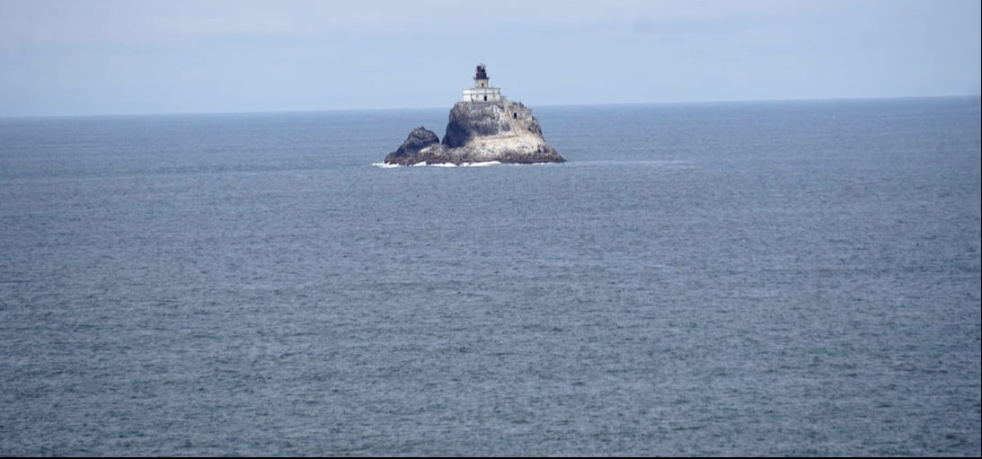 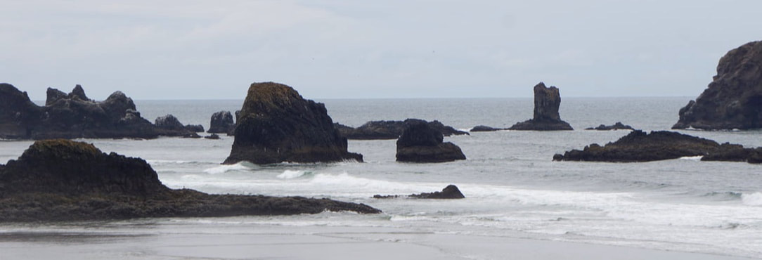 Our last sight-seeing stop of the day was the Lewis and Clark National Historical Park – the last stopping point of Lewis and Clark at the end of their 4,000 mile trek of exploration in 1805. Here they built Fort Clatsop which provided shelter as they waited out the winter, and gave them good facilities to work on their journals, to analyze gathered specimens, and to prepare for their trip home. 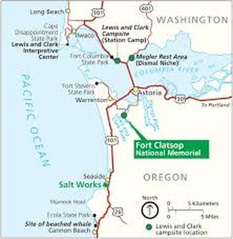 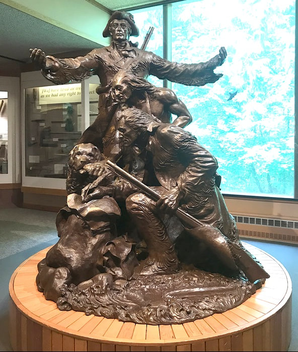 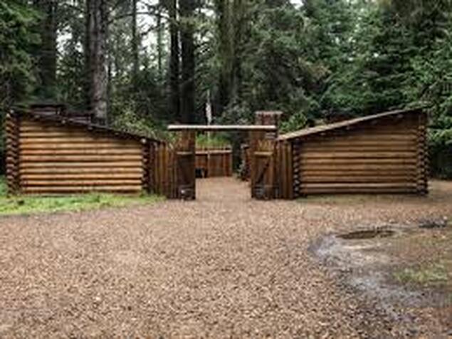 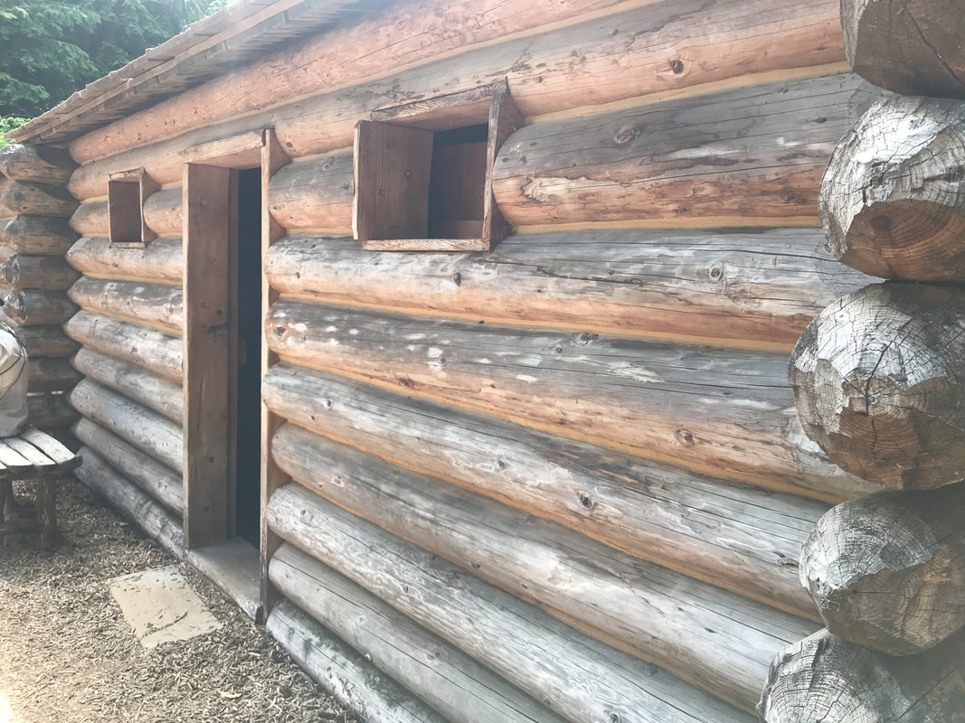 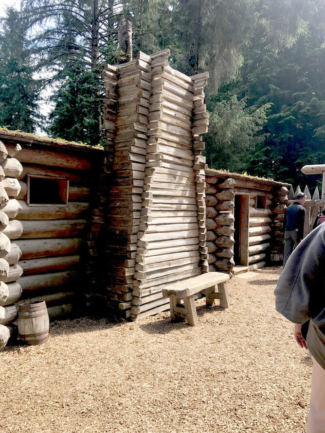 On our way back up the coast (we had drifted about 25 miles from our campground) we stopped at a fish market for Chinook Salmon and some scallops. We have been spending about $30 on our self-prepared seafood meals, and by the time we add our side-dishes, happy hour rations, and casual campsite seating . . . we are dining in cheap splendor.
,June 24, Monday Saying goodbye to the Columbia River Gorge, we headed west on Interstate 84, crossed the river into Washington at Portland (by mistake), and then drove Interstate 5 until we were able to cross the river back into Oregon. Here we were again on Route 30 to Astoria where the Columbia River opens into the Pacific Ocean at Young’s Bay and. . . Route 30 (that goes right through our hometown!) ended! 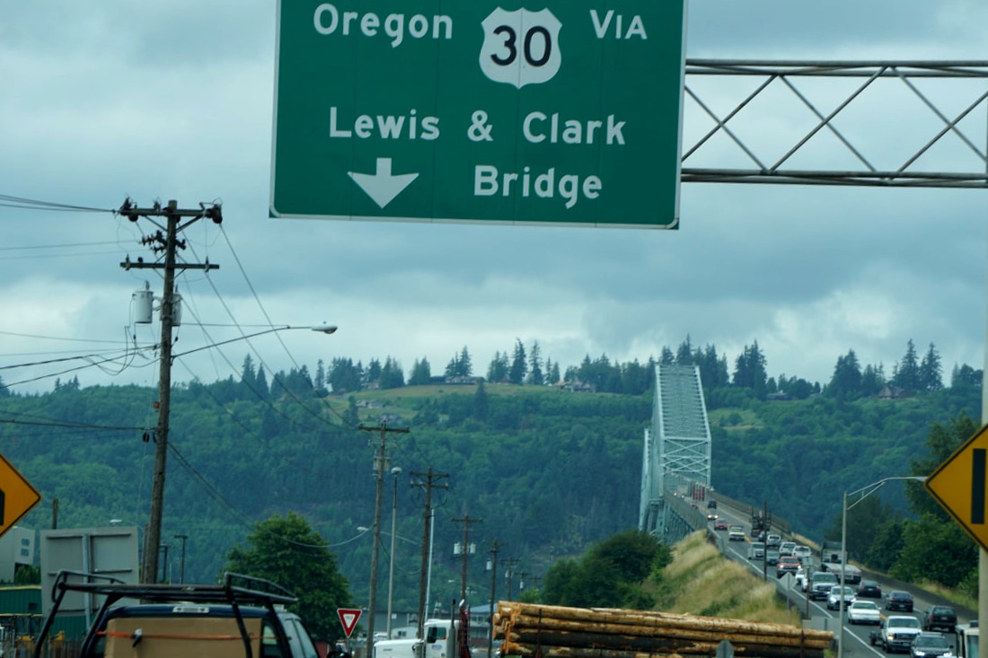 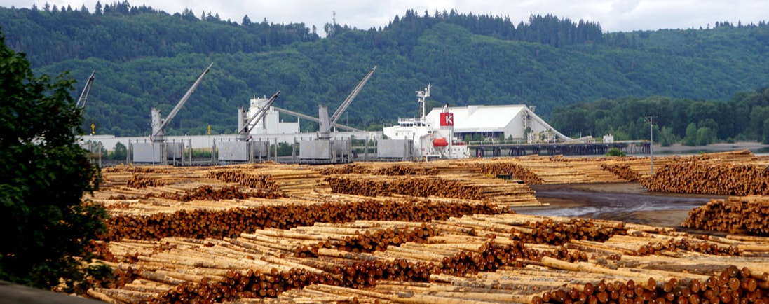  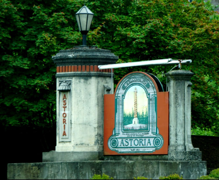 Our stop at Astoria yielded: fresh Dungeness Crab to cook for supper tonight, two clean dogs from a do-it-yourself dog wash, a full tank of gas, and a quick lunch. From Astoria, it was just another 10 miles out to our Fort Steven’s State Park. 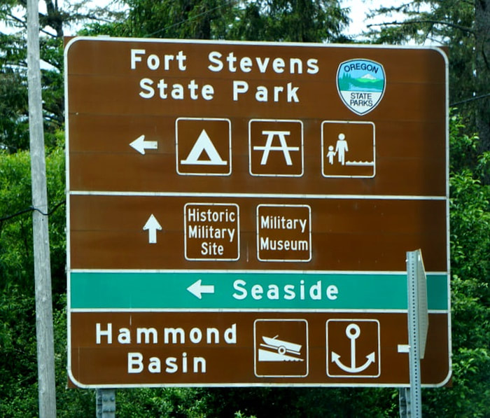 The Campground is close to the ocean, but you can’t see it. Less than a mile drive gets you to the beach, and our first stop was the century-old Peter Iredale Shipwreck. We don’t know anything about the shipwreck, except that it was a popular beach-gathering site for people playing in the surf, flying kites, and sitting in the sand. The sun was bright, the sand was beautiful quality and warm . . .but the temperature was 64. We enjoyed a walk on the beach for pictures. 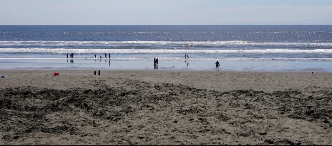 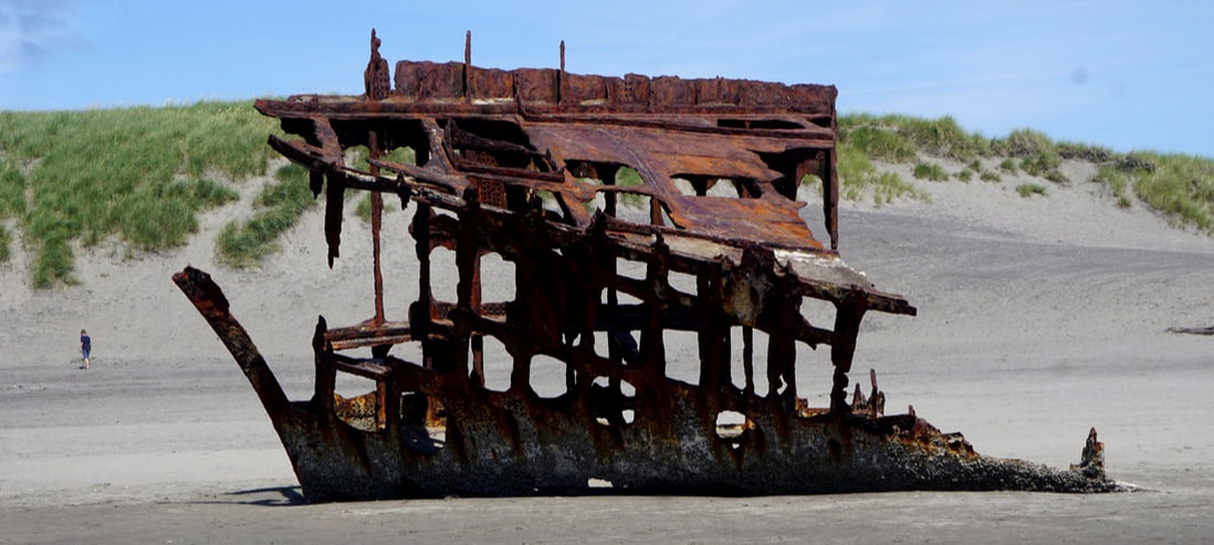 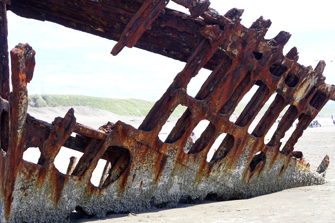 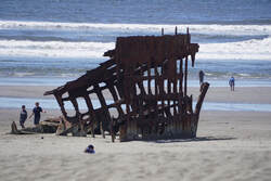 Something that we didn’t quite understand was that there was a Civil War Fort constructed in 1862 that remained active until after WWII! What on earth could such a heavily bunkered fort be guarding off of the coast of Oregon in the Civil War? We walked around some of the concrete batteries/bunkers, but as it was getting late in the afternoon we did not do the museum. We’ll try to read about that Fort on the Internet. 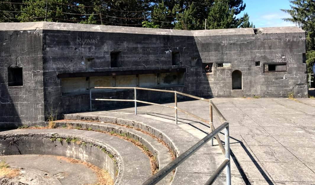  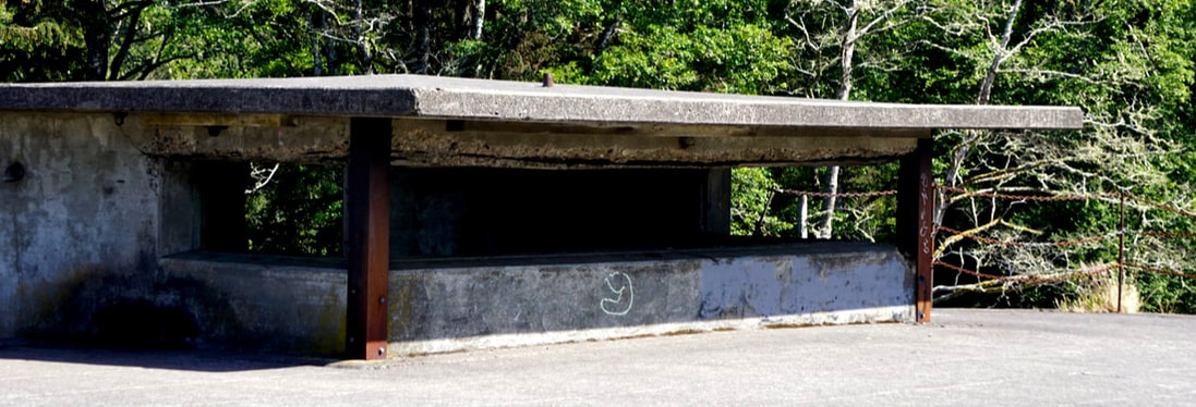 We were anxious to get back to the campground and our Dungeness Crab dinner! The store/restaurant that we had purchased them from was open for the first, today! The owner was very apologetic that he didn’t have his seafood cases full of fresh offerings, but he had something better than that . . . a tank of live Dungeness Crabs! He took Tom back into the kitchen to show him where and how to access the good meat outside of the claws, and he gave detailed instructions for cooking. We had brought a large pot just for this purpose, and they were to be boiled for 18 minutes – not more or less! I had twice baked potatoes to do in the convection oven, coleslaw, melted butter, a fresh lemon, and local fresh cherries. All eaten in the outdoor setting of our beautiful campsite!  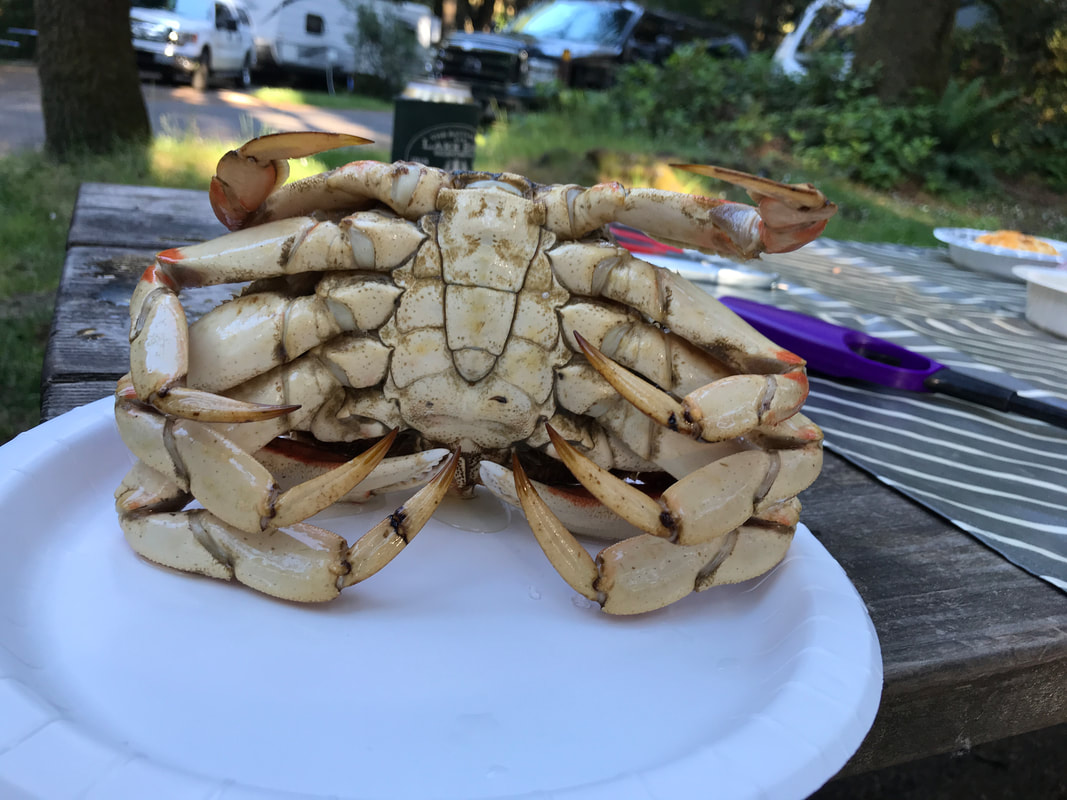 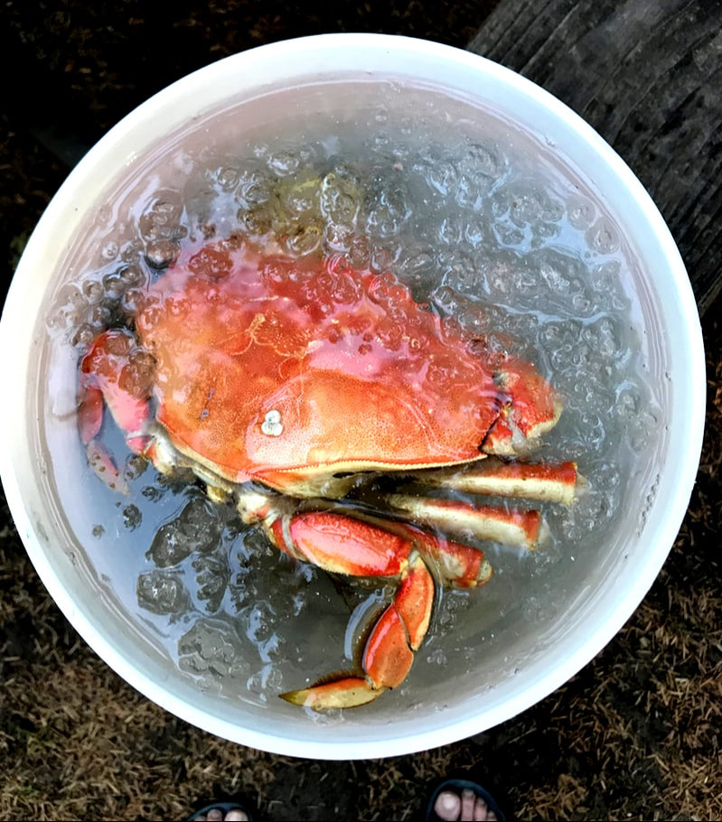 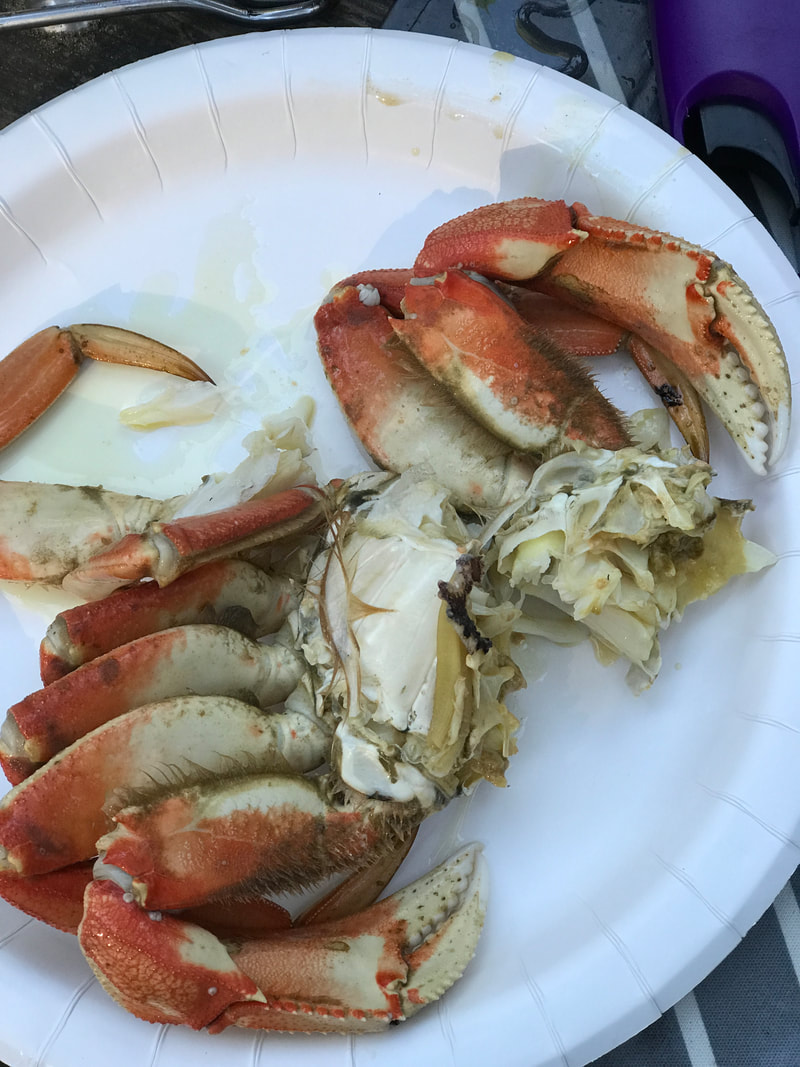 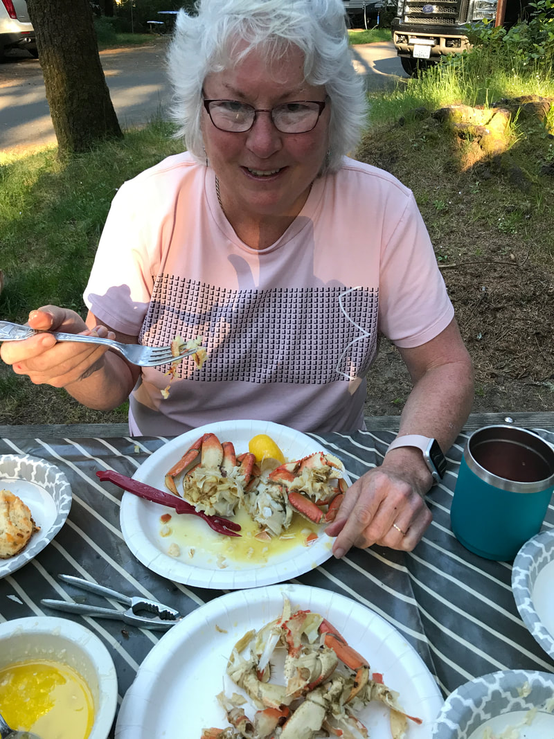 Sunday, June 23 We started out late, 9:30, after a pancake breakfast in our campsite. Today was devoted to driving the Columbia River Gorge – partially on the Interstate, and partially on our old friend Route 30! Route 30 was bicycle and pedestrian the whole way, but only parts were open to auto traffic. It ran high above Interstate 84, and the railroad ran between Route 30 and I-84. It was a very narrow road with frequent stops to see waterfalls and jump on hiking trails. In the beginning we were able to get parking spots, but as the morning wore on parking lots were completely full with many cars lined up in inconvenient places to wait on a space to open up. We drove on. 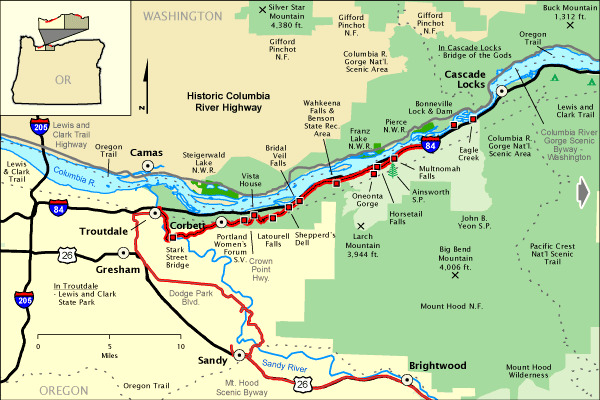 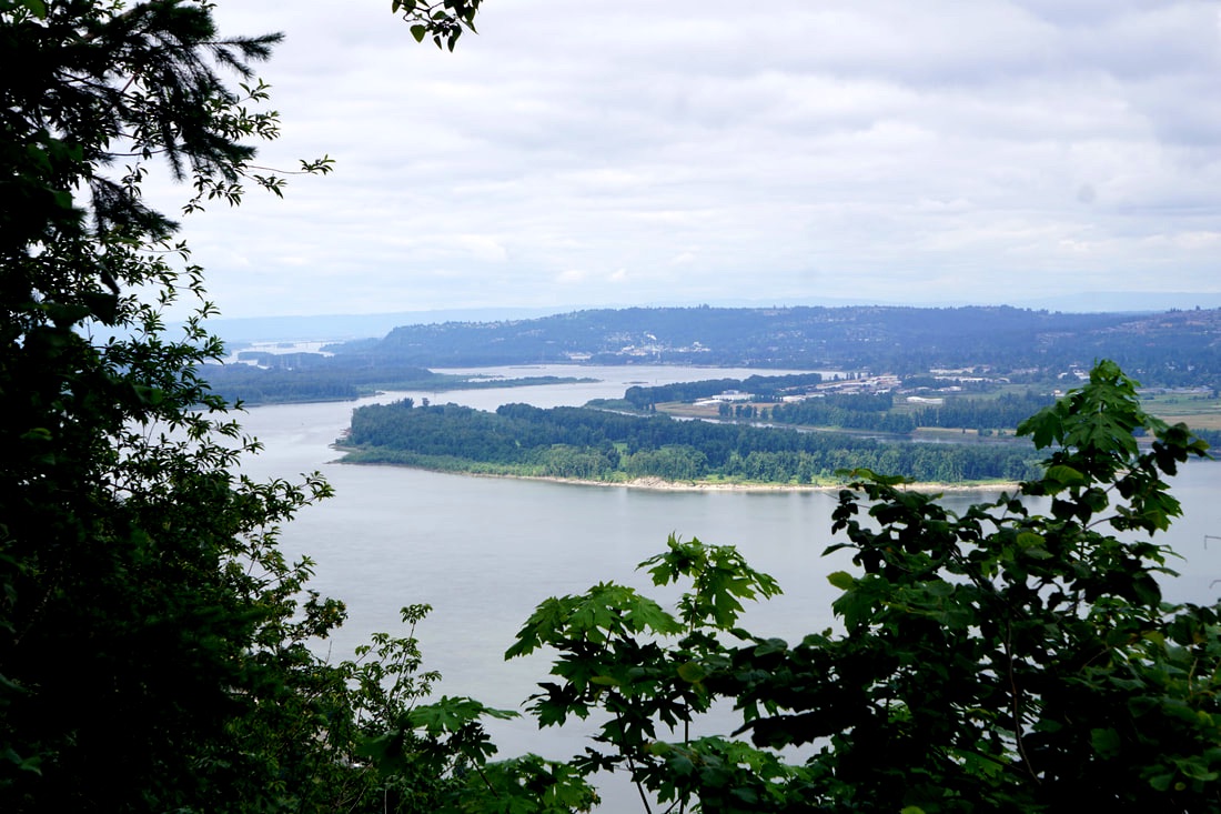  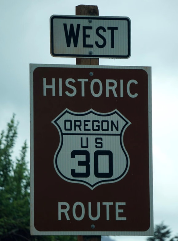 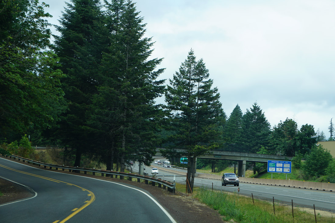 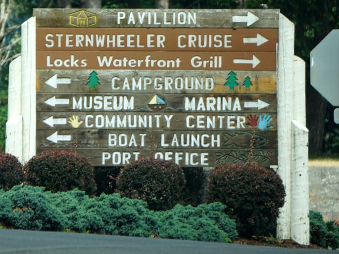    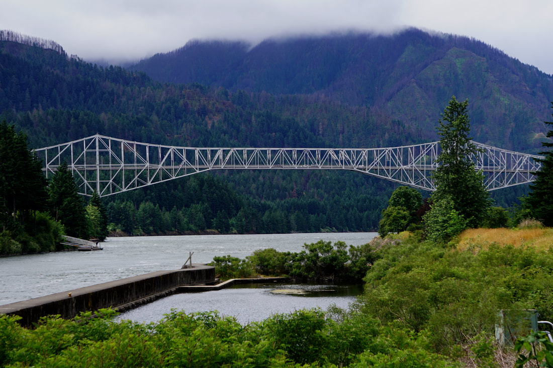   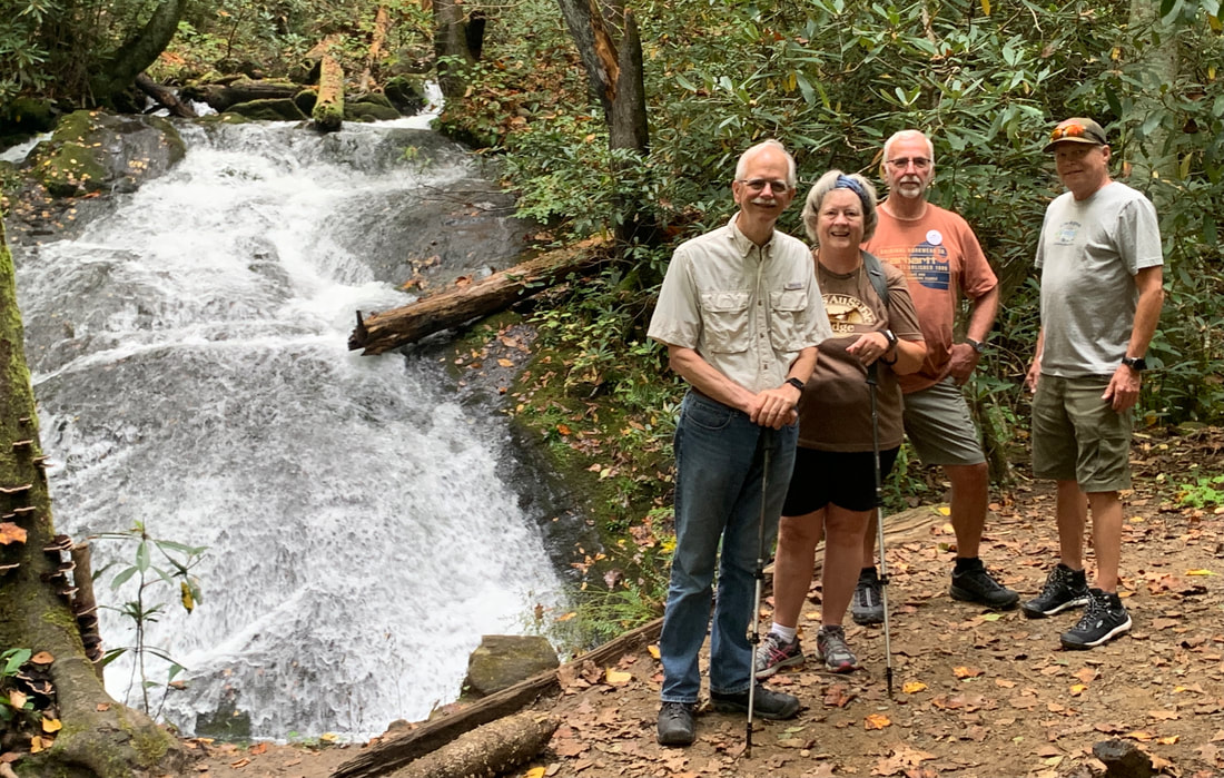  When we got to Vista House we were able to get a parking spot a bit down the road, walked back, and got some beautiful panoramas of the gorge. Vista House, completed in 1918 as a clifftop rest stop, observatory, and monument to Oregon Pioneers was a beautiful octagonal stone tower sitting high above the Columbia River. The next stop, Portland Women’s Oregon Forum, offered spectacular vies of the Vista House. 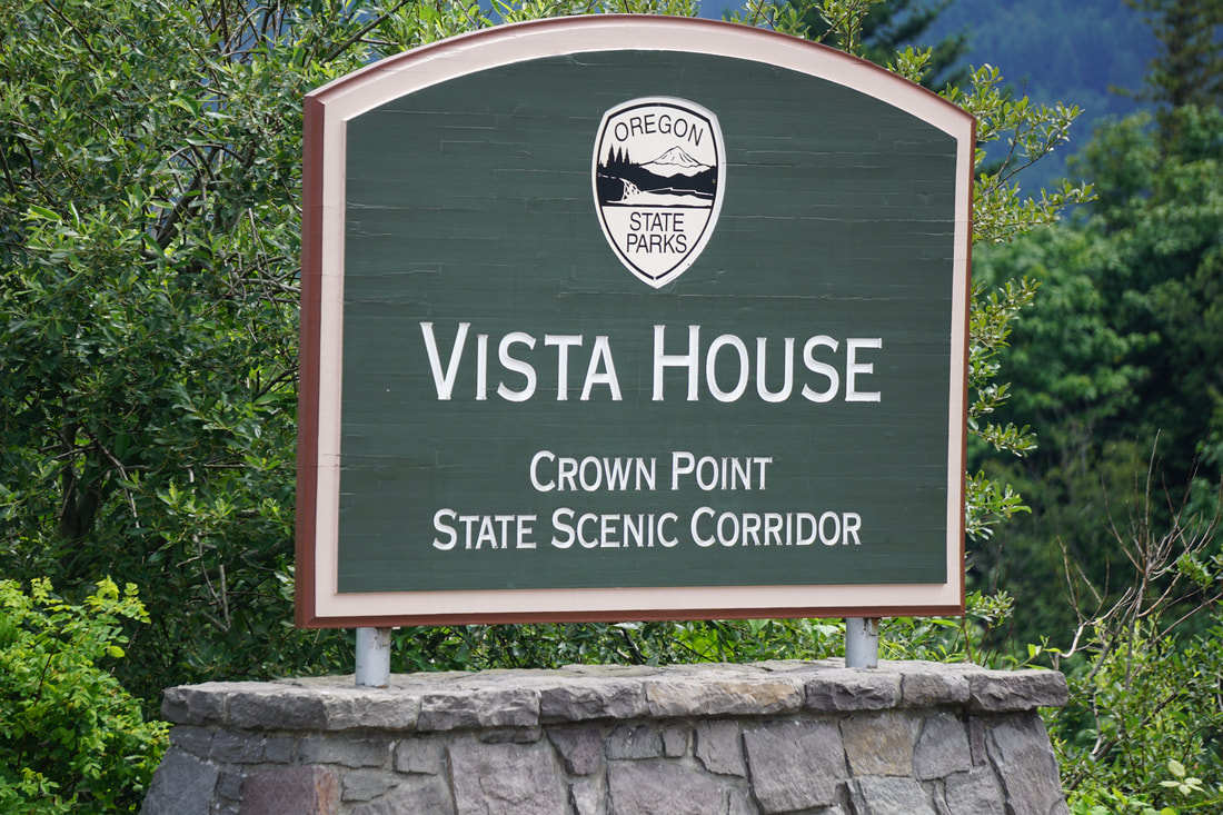 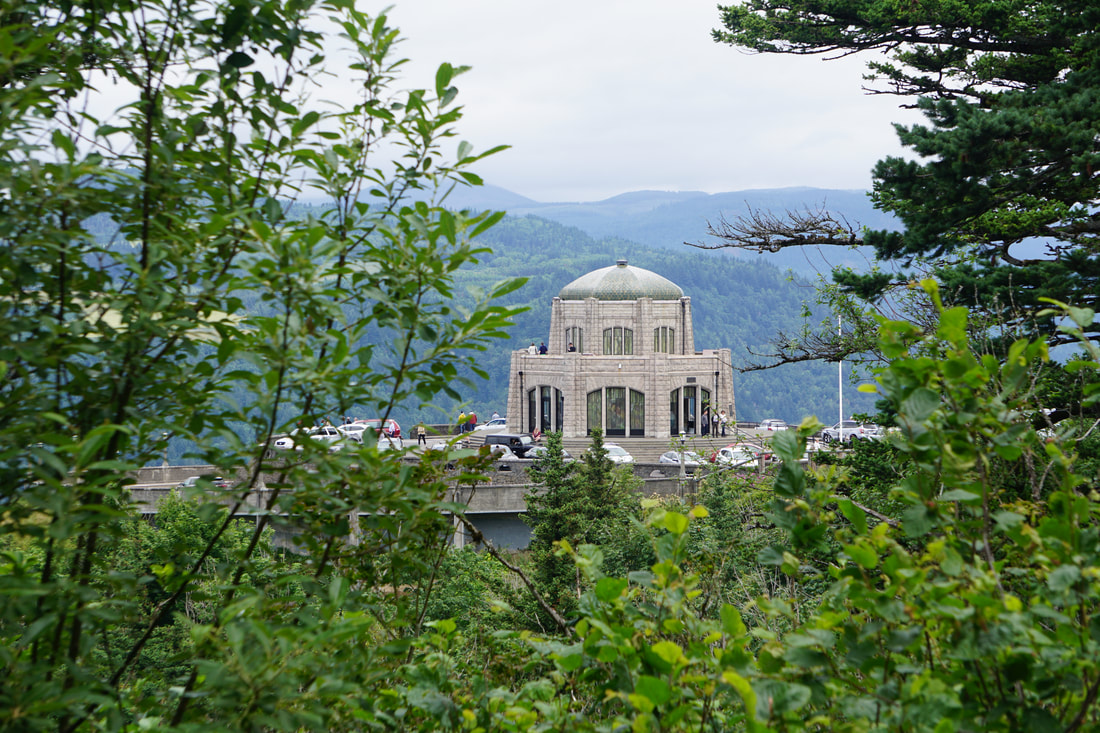 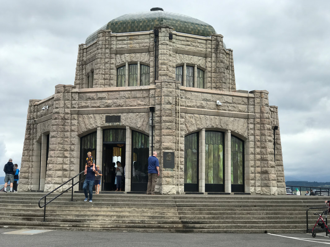 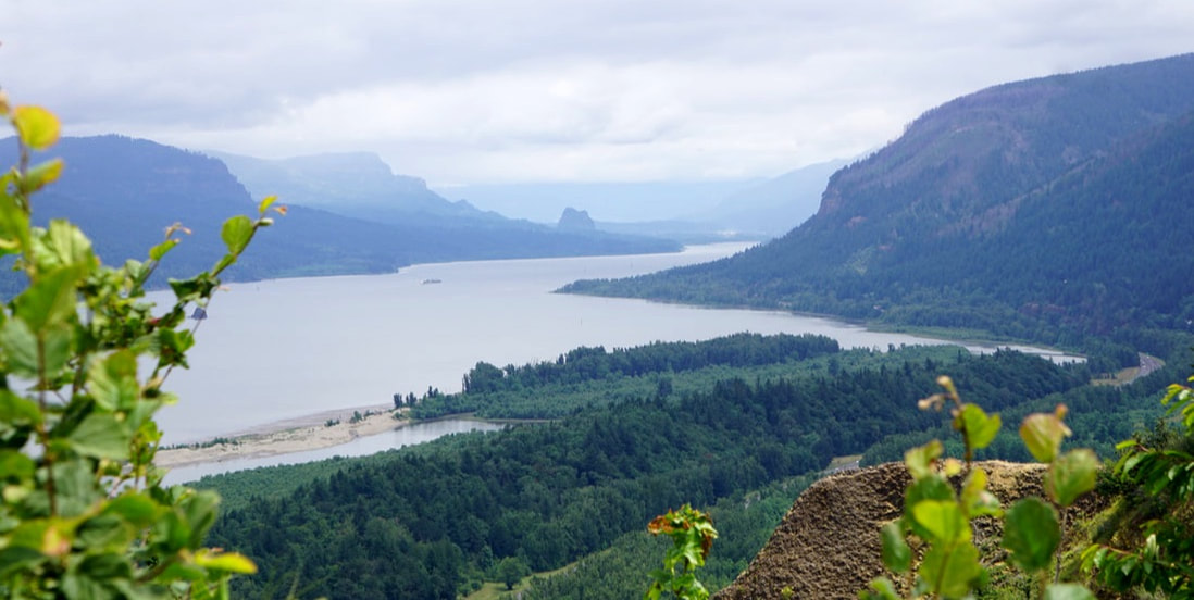   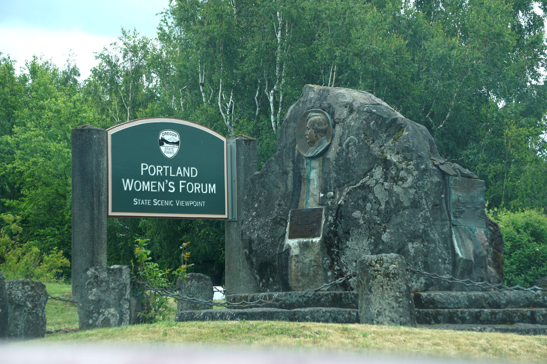 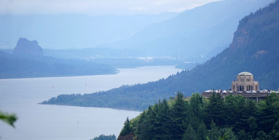 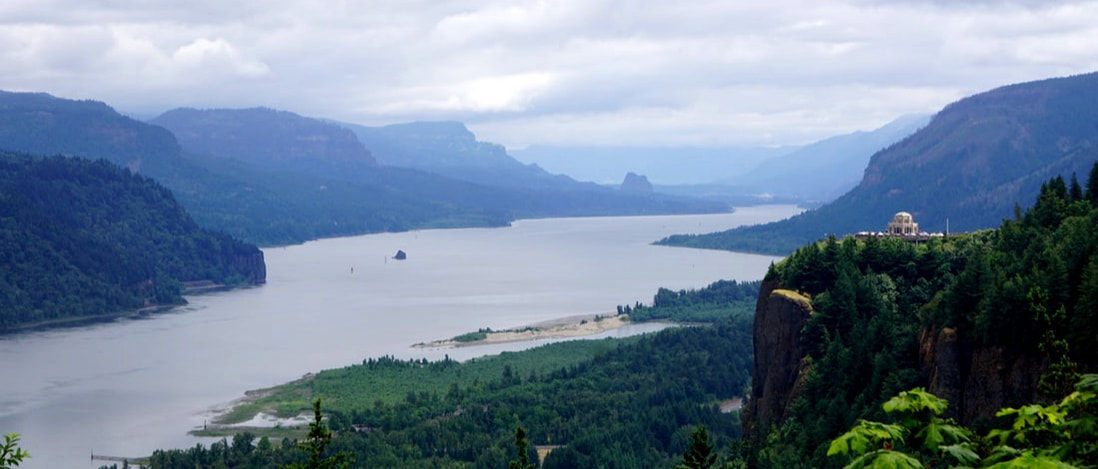 ColumCThe last stop, Lewis and Clark State Park, was a day-use area with a trail and picnic area. After that, we finished the gorge and our westward trek on Old 30. But, Tom had a plan to extend the views; he crossed the river and followed Washington State Route 14 all the way back to our campground! On the way back we crossed the Columbia River on the Bridge of the Gods -- pictured previously. 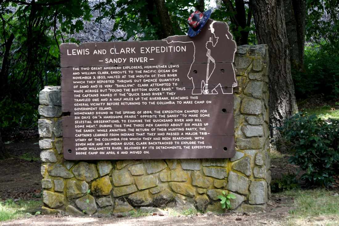 We enjoyed the campground for a couple of hours and then headed into Hood River for dinner. We found a Mexican Restaurant – the absolute best mex-food we had ever had . . . except that Tom’s was a little on the hot side!
Saturday June 22 This morning we left the coastal highway 101 and headed East towards the interior of Oregon. We bypassed Salem on the North, Portland on the South, and headed for Mt. Hood, and then the town of Hood River. 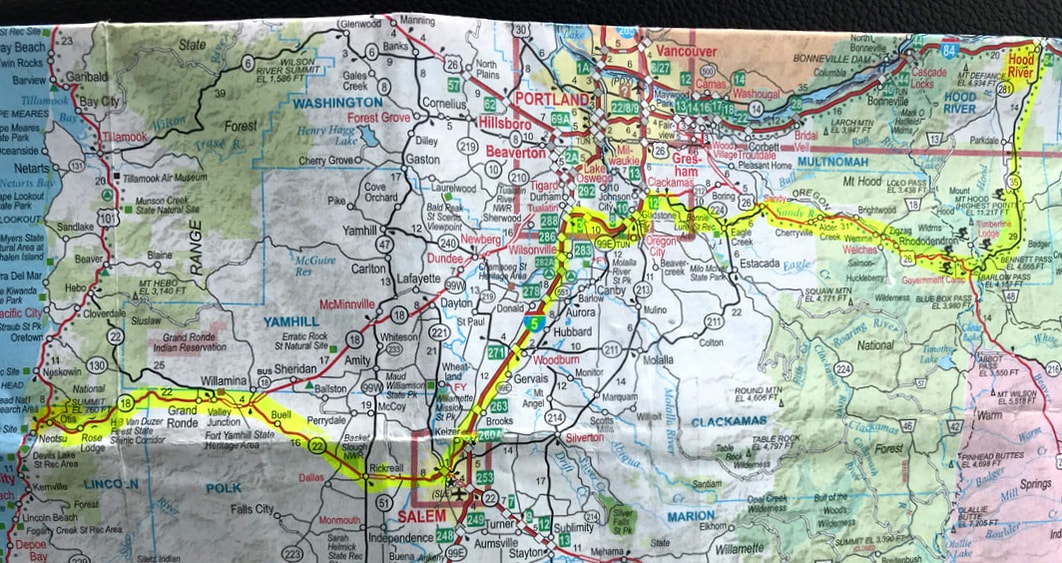 When we finally reached Mt. Hood . . . it played peek-a-boo as clouds blew across the summit and as the road twisted back and forth. Now you see it . . . now you don’t. We detoured off the road for a side-trip up to Timberline Lodge – a National Historic Landmark. 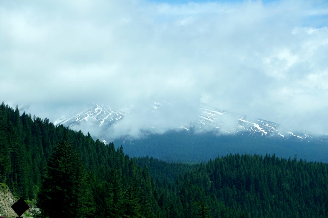 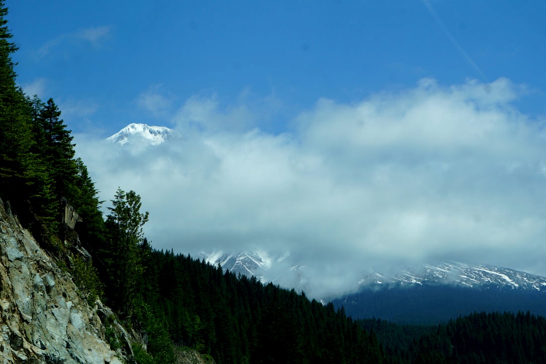 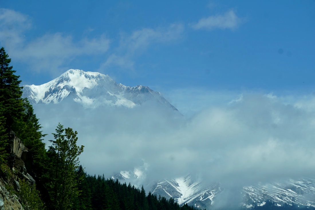 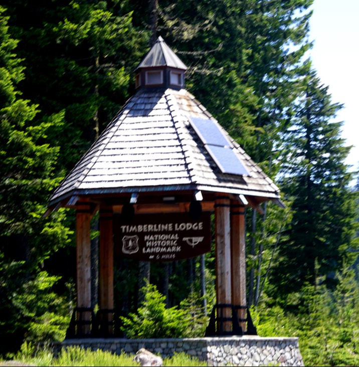 With no place for large rigs to park we went past the lodges and down the other side of the mountain until there was a pull-over space. We parked, Tom chalked the trailer, and we climbed the road back up to the top. The first hotel was a tent-hotel built in 1924: meals, mattress, and BYOB (bring-your-own-blanket.) The existing lodge was built in 1937 as a part of Roosevelt’s WPA and CCC programs and took its design inspiration from the spirit of the mountain. It has huge observation windows, hand-crafted furniture, overnight accommodations, and was declared a National Landmark in 1977. In 1981 the Day Lodge was built to ease the pressure from the day skiers. Even at this time of year, the parking lots were full and there were many skiers suiting up and on the slopes. 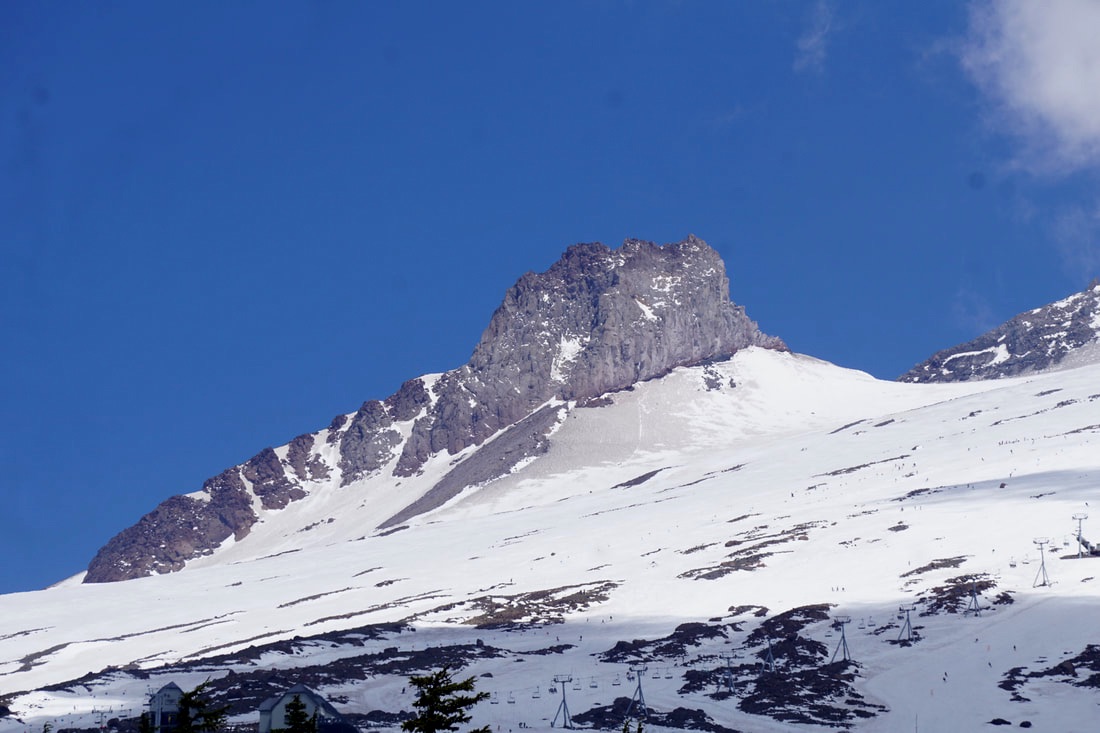 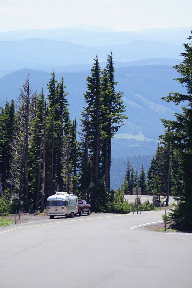 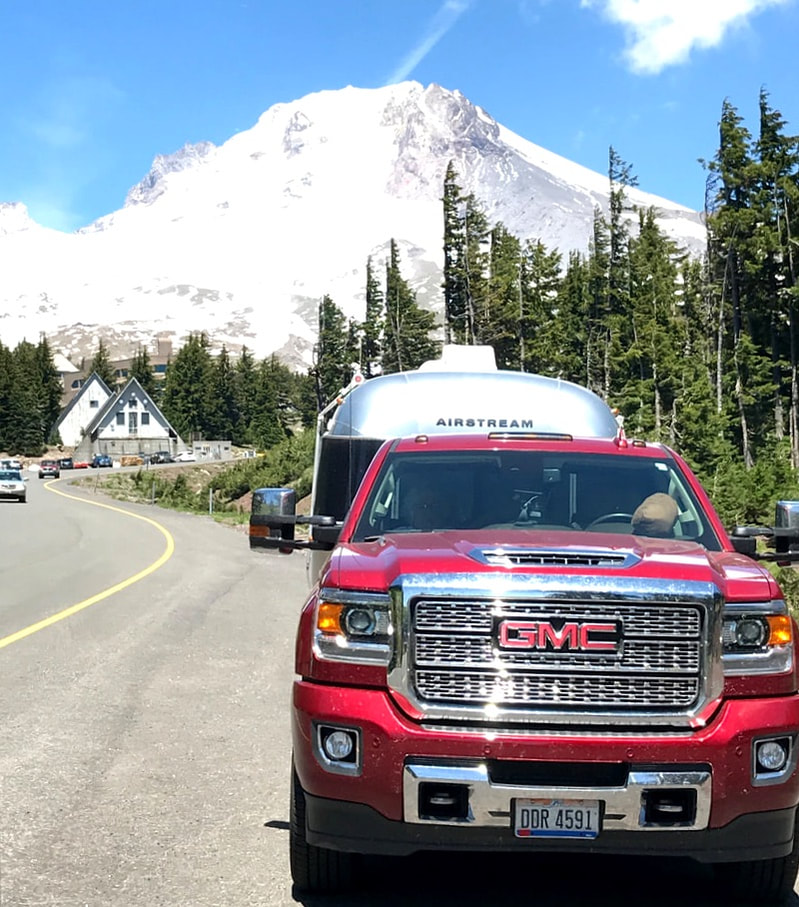 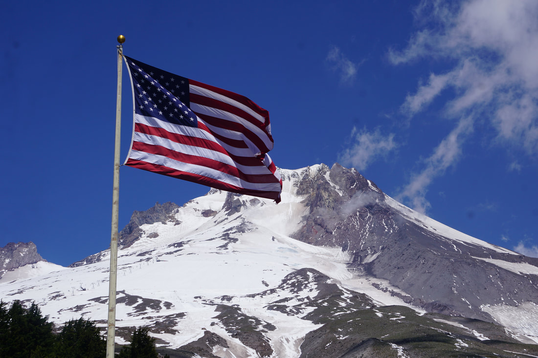 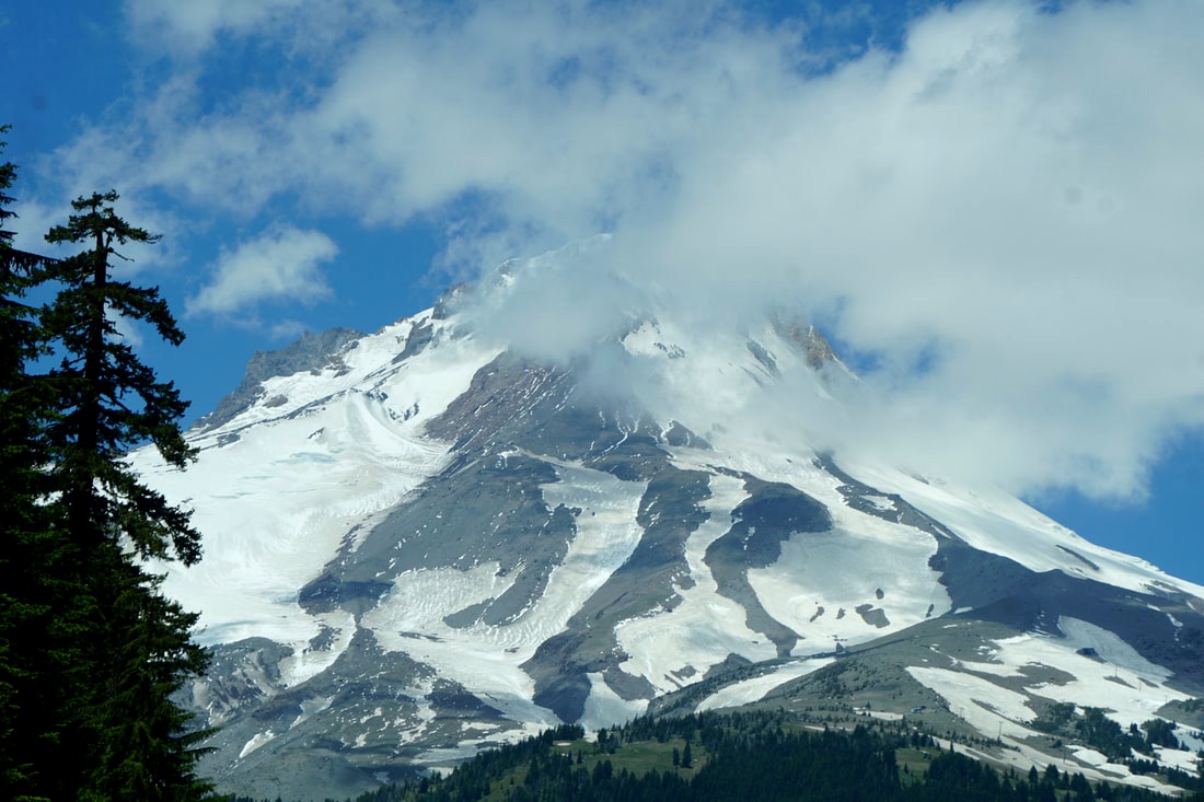 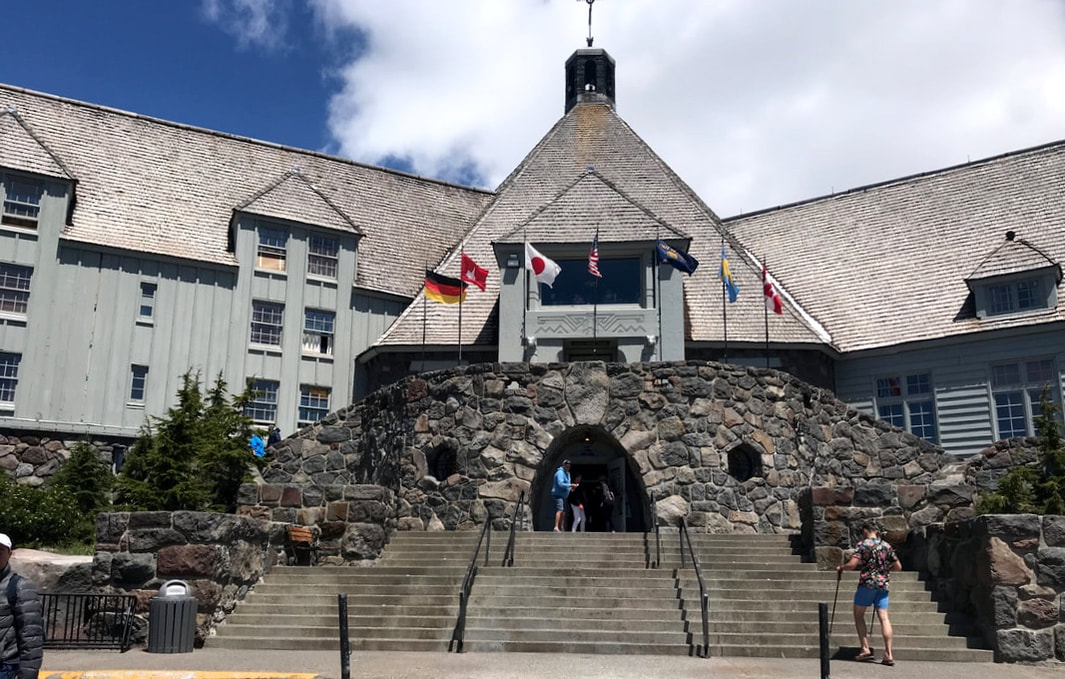 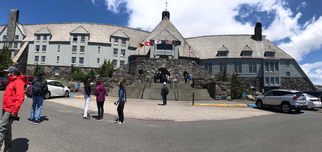 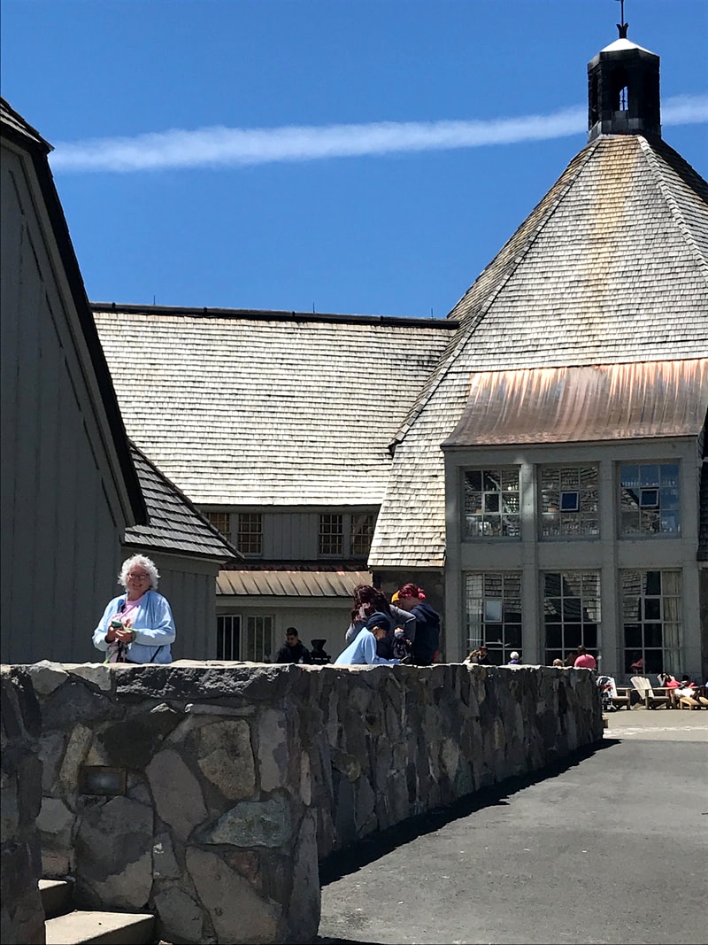 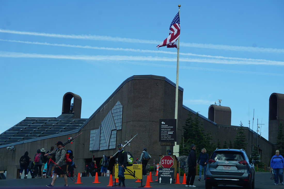 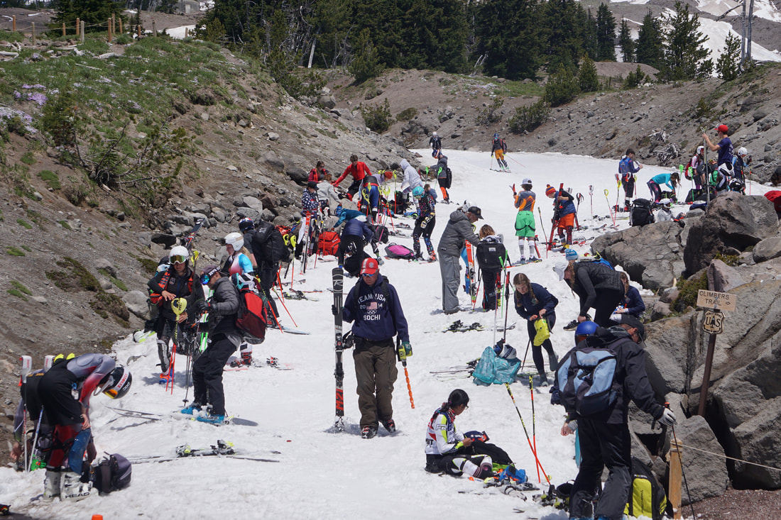 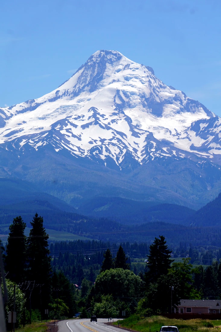 We were back on the road by 1:30 with a 50-mile drive to Hood River where we would be spending 2 nights at Viento State Park while exploring the Columbia River Gorge. It was a beautiful campground with tall trees and lots of shade. Our campsite was tucked into a small hill with a little stone fence. The only cause for concern was that there was a RR track close by, and within 2 hours we heard at least 4 trains barreling close by! 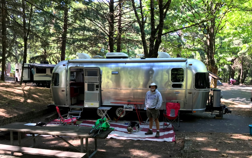 After supper we went for a little sneak-peak of the Columbia River. Most sight-seeing tours take you off the main road, but the Columbia River Gorge is right along Interstate 84. We only drove north 25 miles tonight, and tomorrow we will spend the day on the entire southern 60-mile stretch, stopping to see the views and sights.
Thursday, June 20 With a quick start at 7:00 a.m. we dropped by the Crater Lake Campground café for two coffees to go. We only had 200 miles to travel today, West on Oregon State Roads, but we were anxious to arrive at the Oregon Coast and the Pacific Ocean,  We stopped at Coos Bay, where the ocean flows in and out of the tidal basin. We stopped at a grocery store and saw our first hint of Pacific Coast seafood prices; we picked up two lobster tails ($7.00/each) and planned a little celebration supper for reaching the Ocean. Later we learned that Lobster were not a produce of the Oregon Coast! 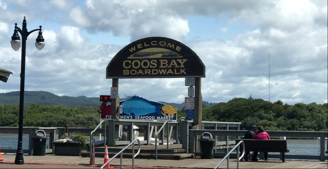 From Coos Bay we had 25 miles to drive north on US Route 101 – following the coastline. Our target was William Tugman State Park, and we reached it by 1:00. Having hook-ups after 3 nights of boon-docking was nice, and my wifi hotspot worked right from the campsite allowing me to get caught up on 3 days of blogging. Nice shaded spots where the sun dapples through the trees allowed me to find a good comfort zone of partial sun in the 65 degree temperature. 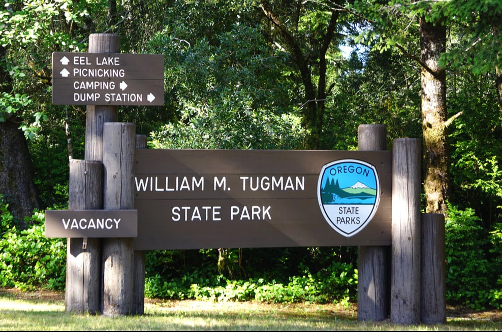 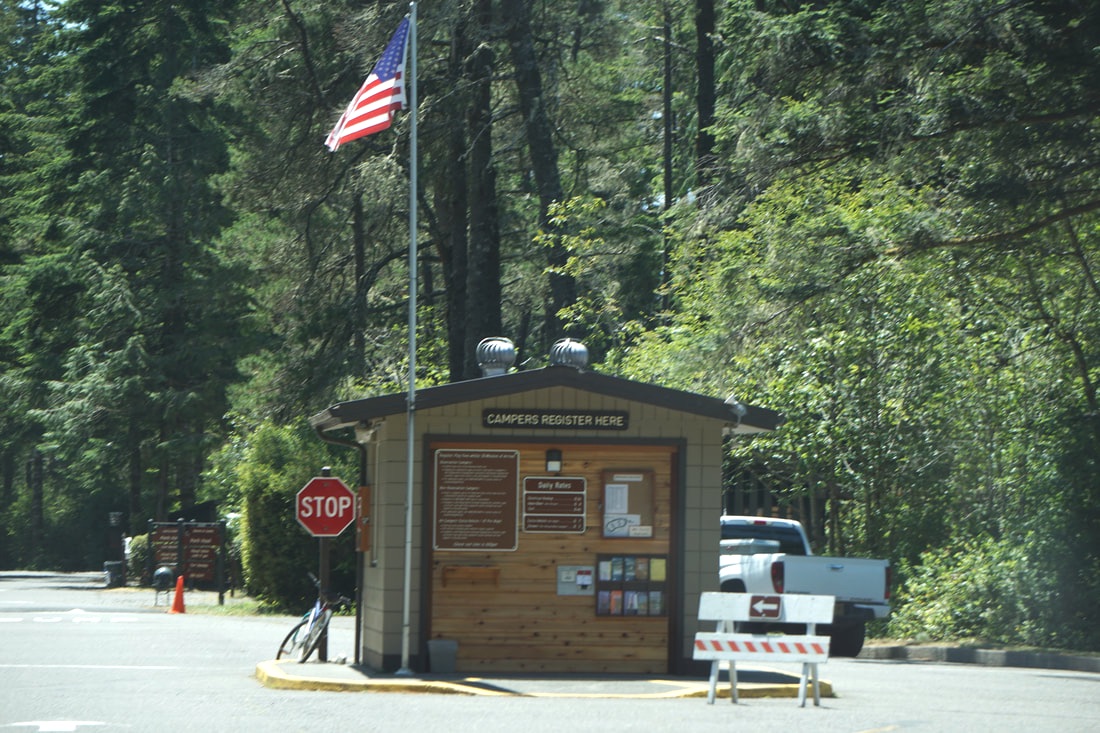 We went for an exploratory drive, following US Route 101, hoping for some good ocean-side vistas. There were glimpses of lighthouses, sand dunes, and flat sandy ocean beaches, but nothing dramatic like what we are anticipating in the next few days. We did pass at least 6 State Parks, and numerous bare-bones RV parks with trailers lined up close to each other, on gravel/sandy lots, with no shade. It made us very grateful for our beautiful Tugman State Park – even if it was just for one night.    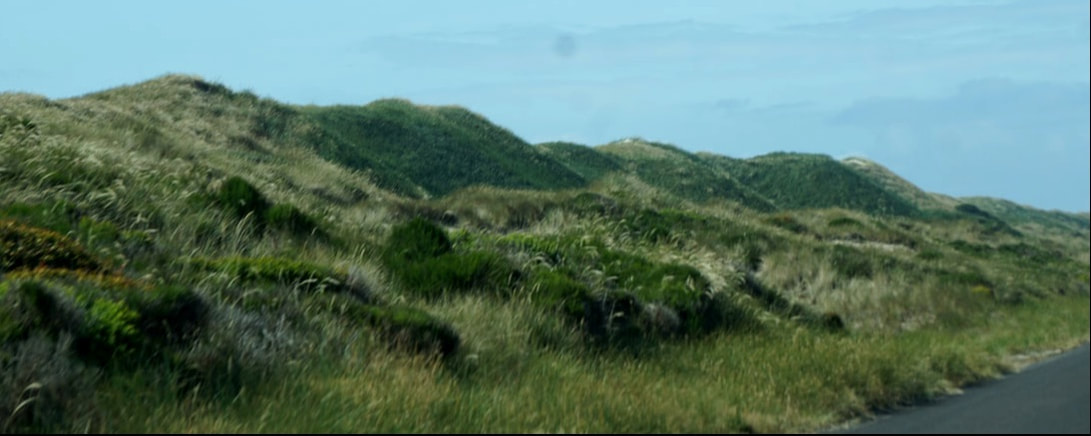 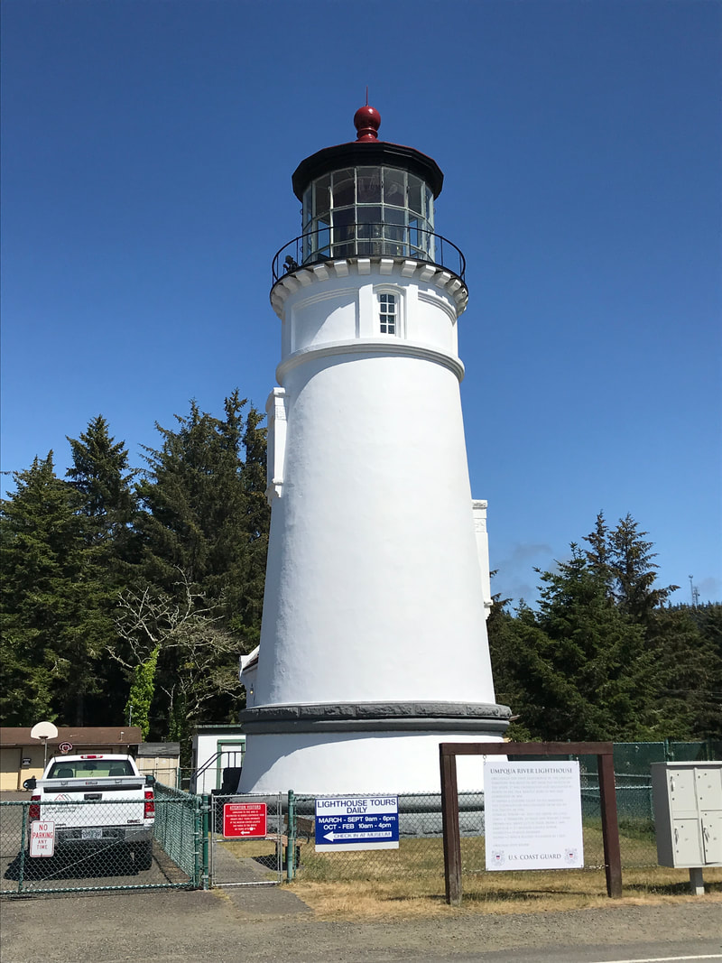 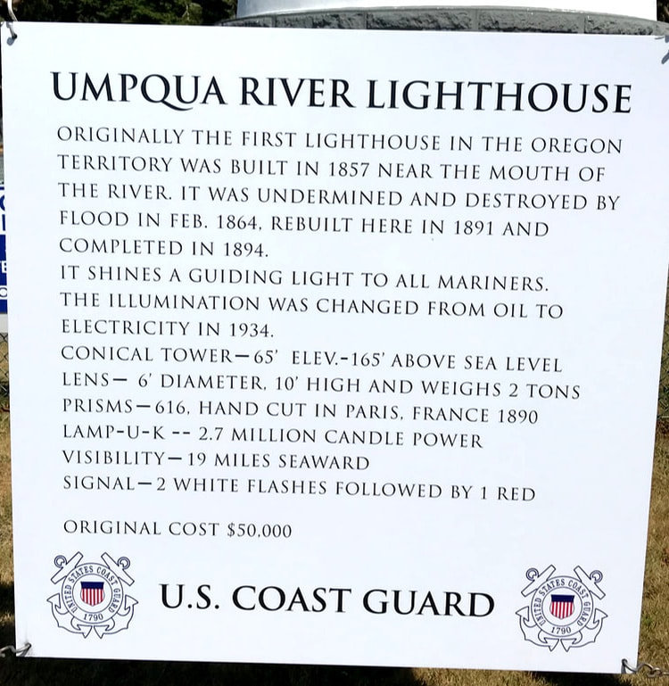 Lobster is not harvested on the Oregon Coast, until winter; ours was so good I figured it had to be good old Main Lobster from clear across the continent! As good as they were, from now on our seafood shopping will be from seafood markets that can give us the lowdown on its origin. Friday, June 21, 19 Armed with a pamphlet/map of the Oregon East Coast detailing Lighthouses (Oregon’s Sentinels), we were off by 10:00 – heading up US Route 101. There are nine surviving lighthouses today, and seven are open for public viewing. 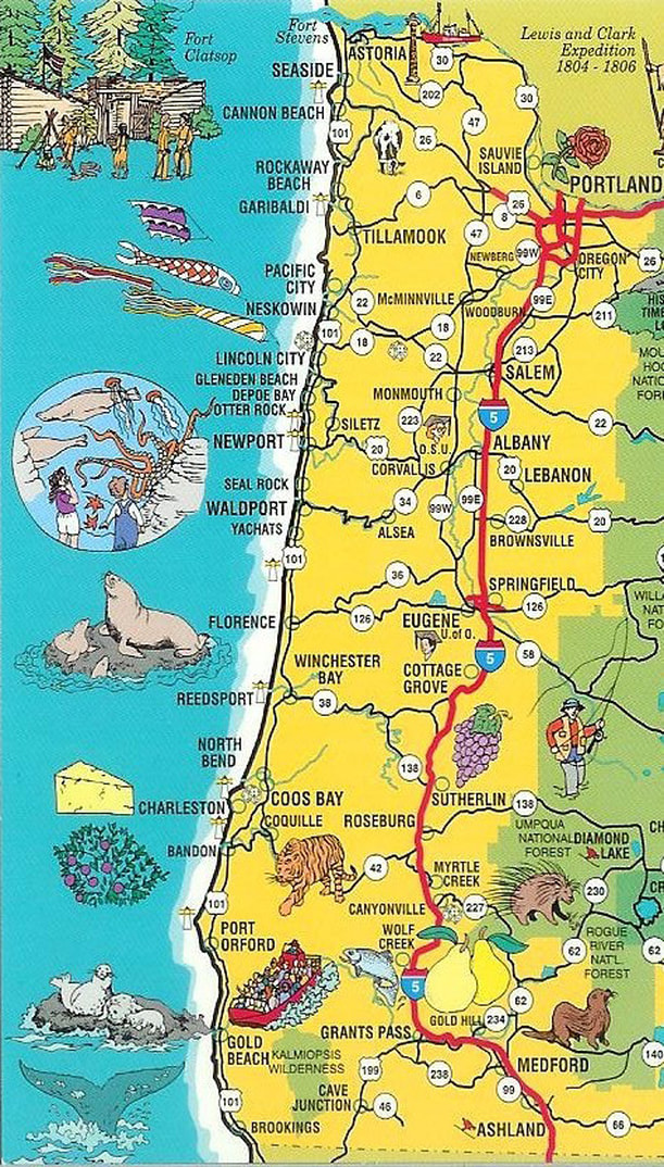 We only had 100 miles to drive today, and all of it was going to be along the famous Oregon coast highway. When the “oil change” light came on in the truck we had plenty of time to drive to a quick change operation and get it taken care of, and then back to the drive along the coast. At the end of the drive, we had only logged 119 miles . . . but it took us 5 hours to do it! Along the way we stopped at several overlooks, hiked a few trails,, viewed wildflowers in full bloom, visited a lighthouse, walked along the beach, and otherwise experienced the Oregon coastal experience. 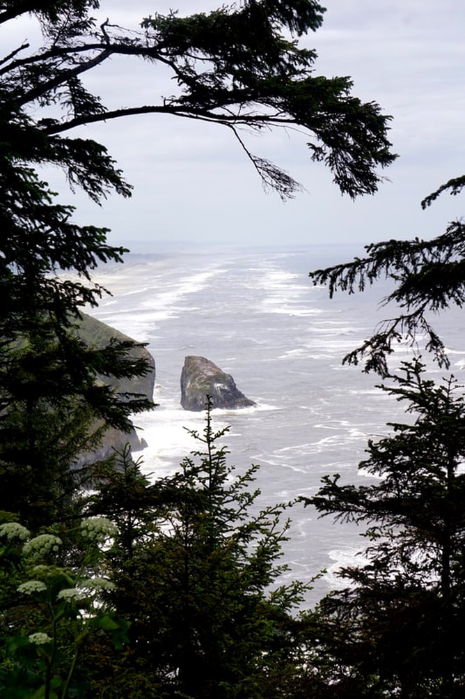 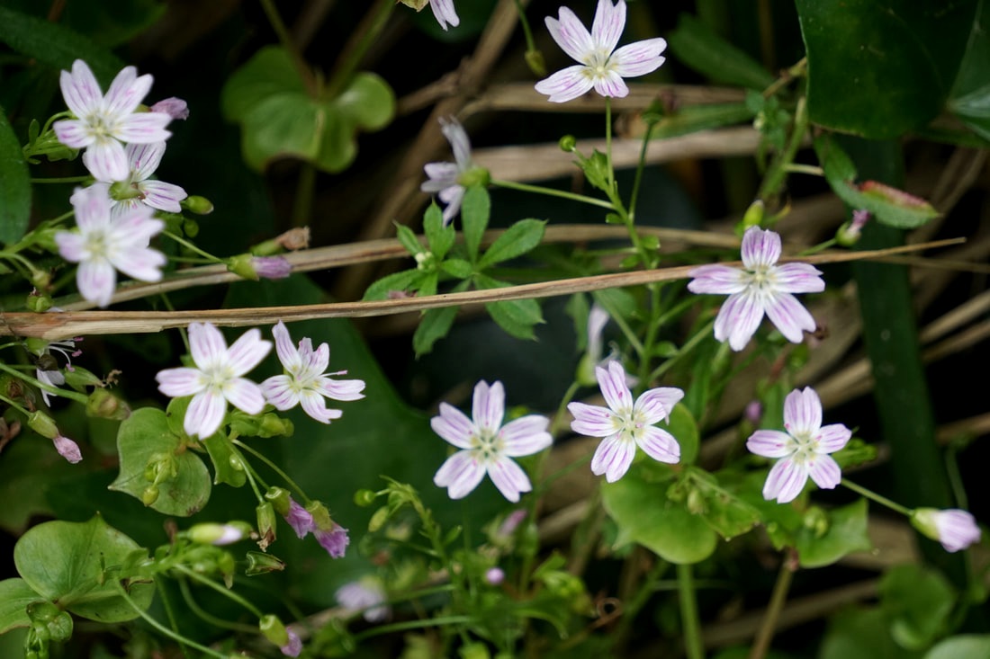 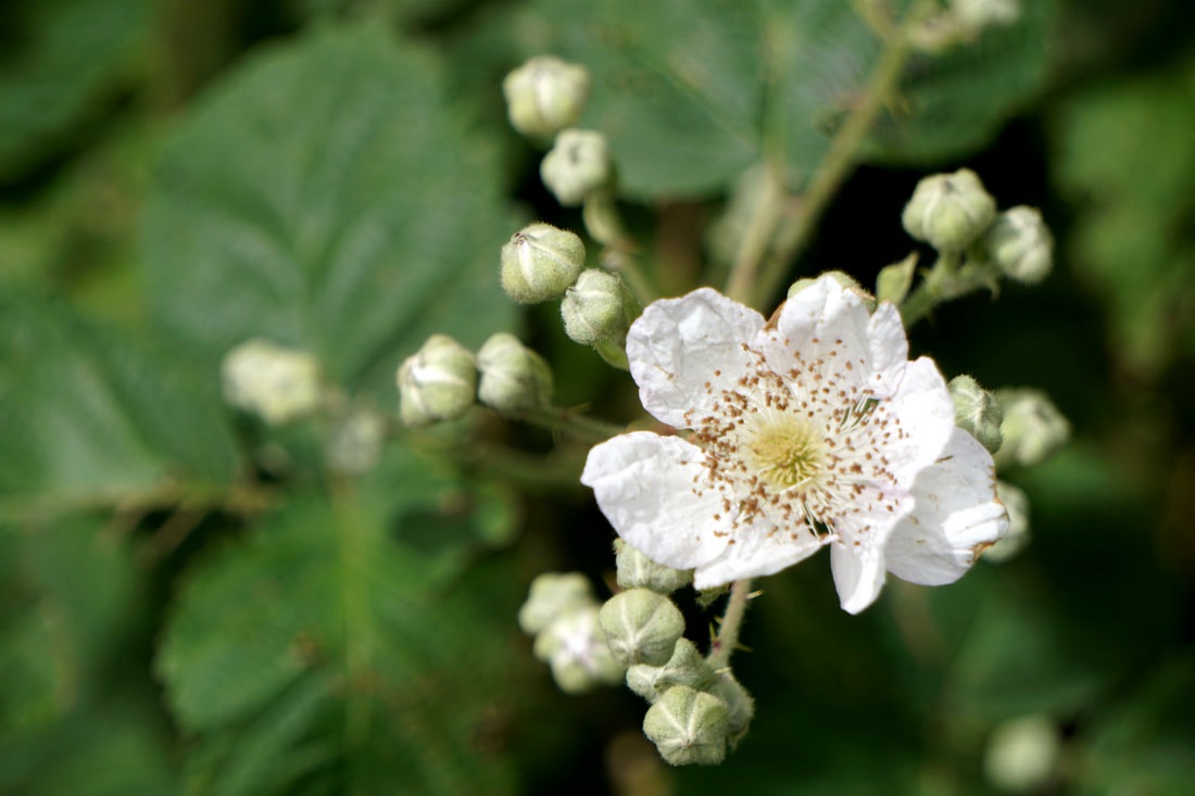 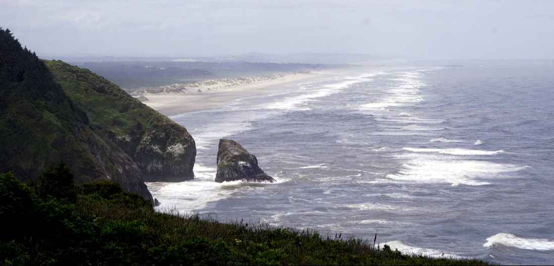 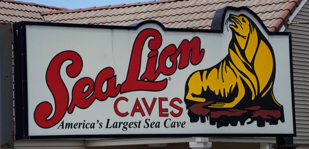  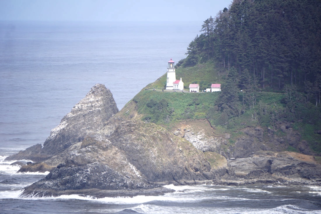 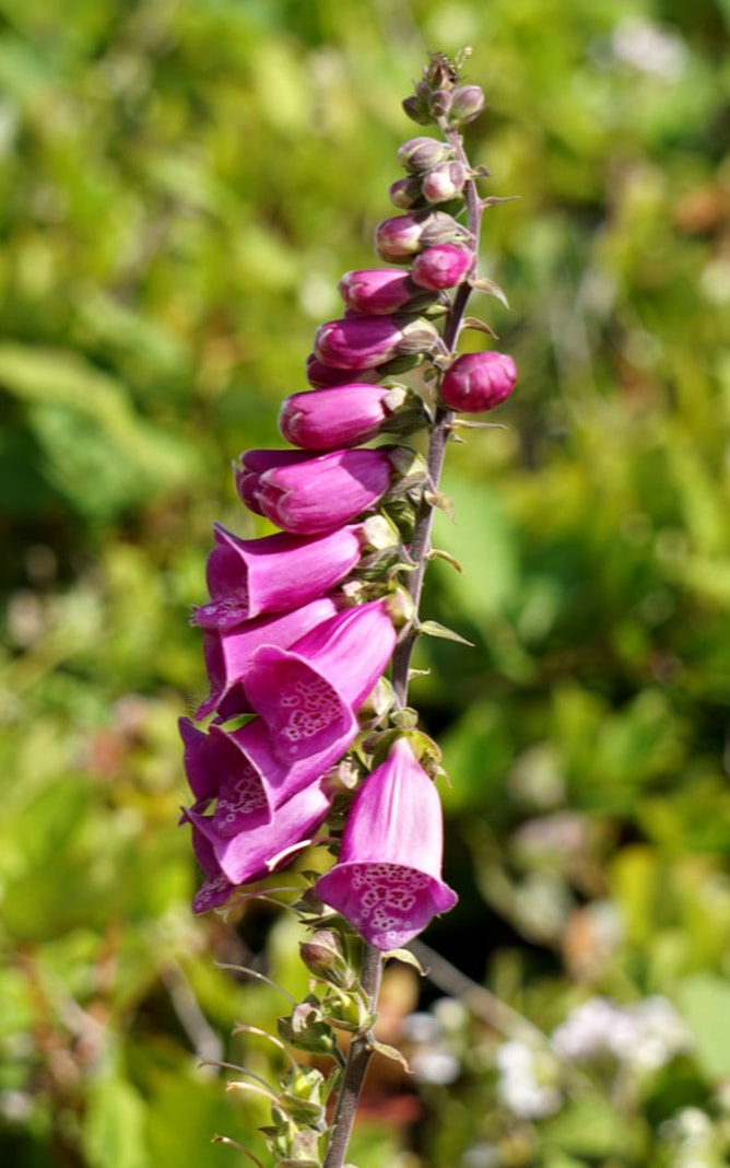 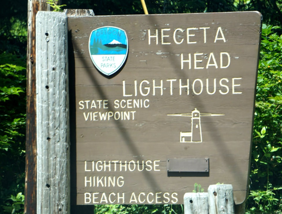 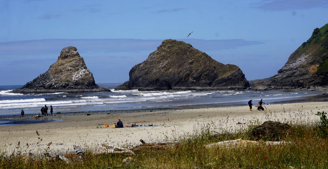  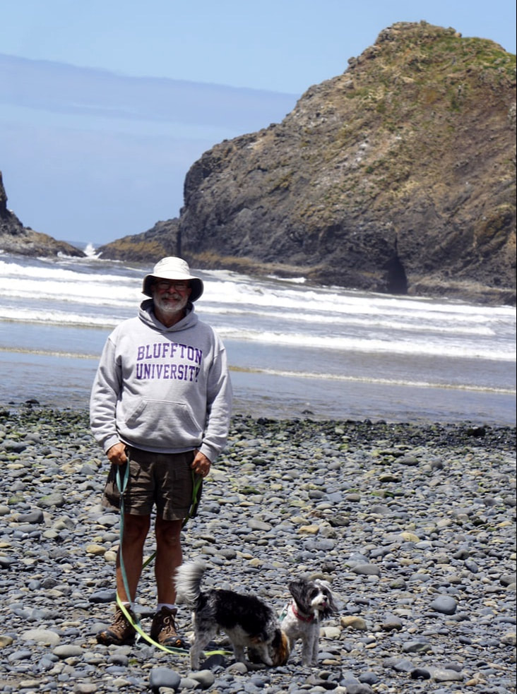 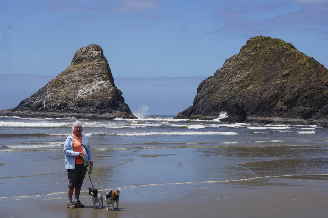   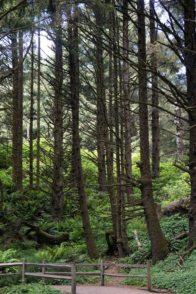 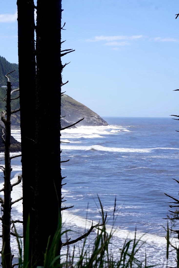 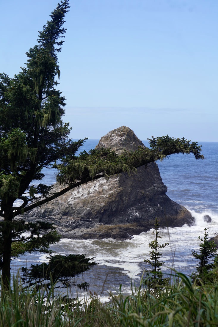 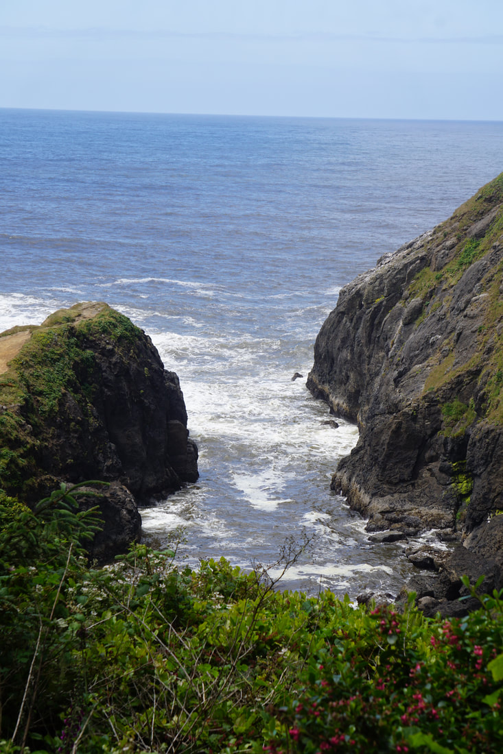 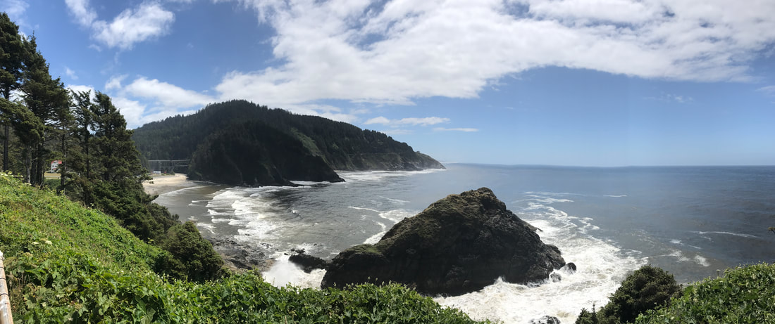 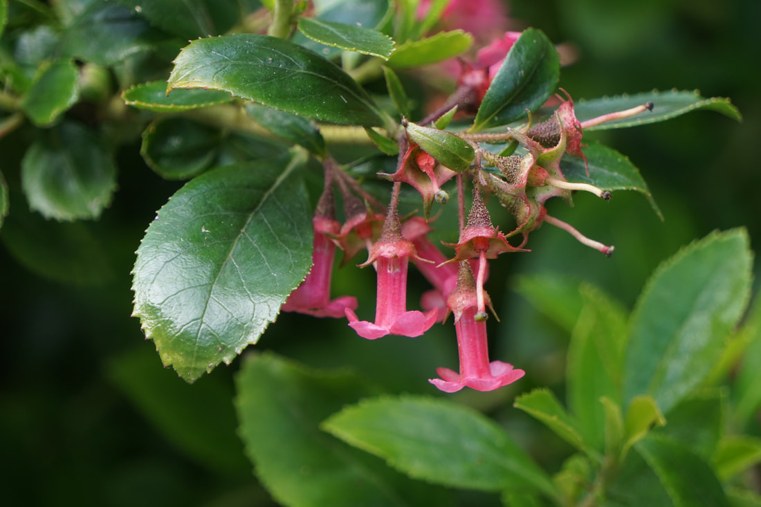 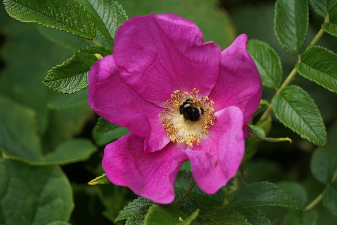 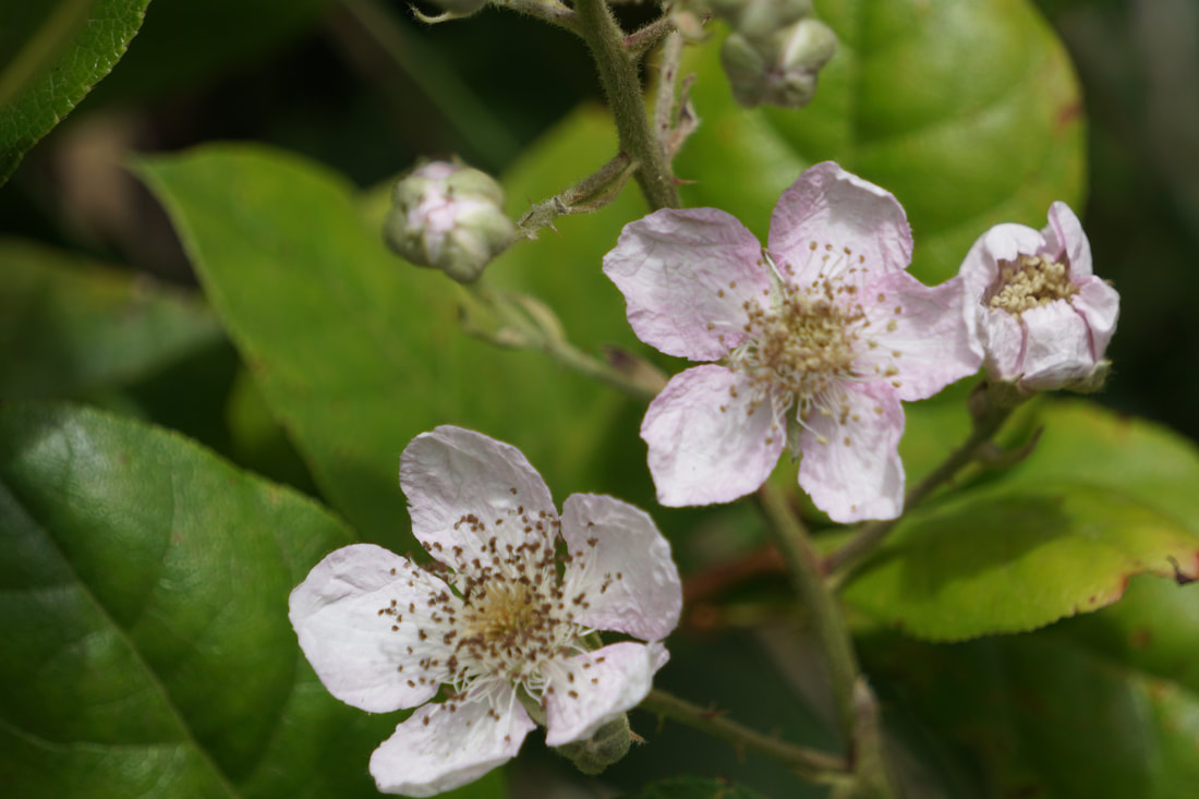 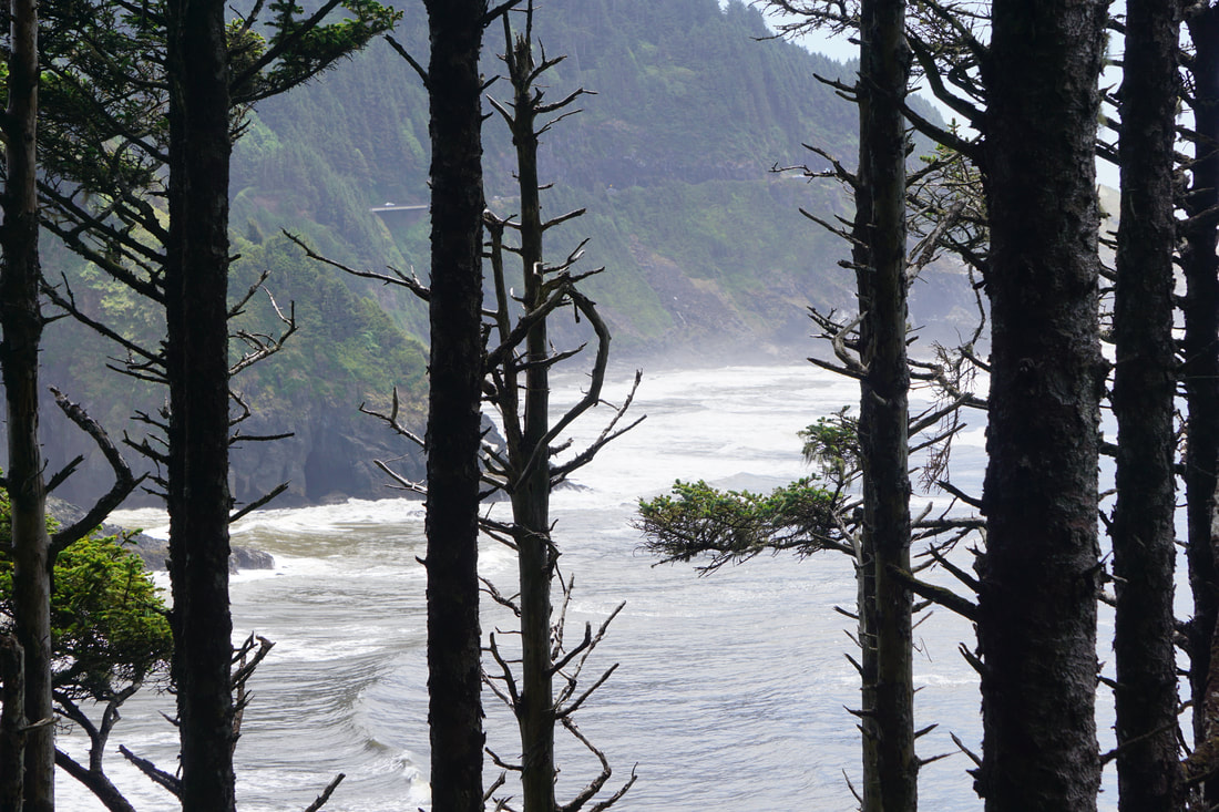  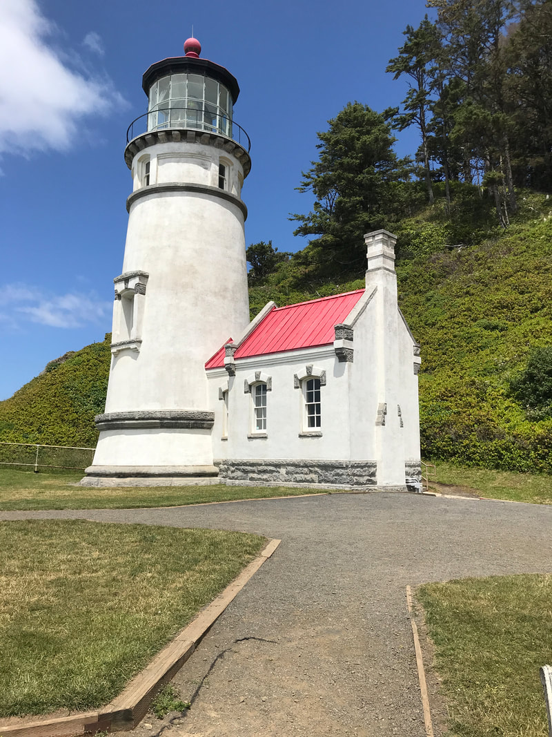 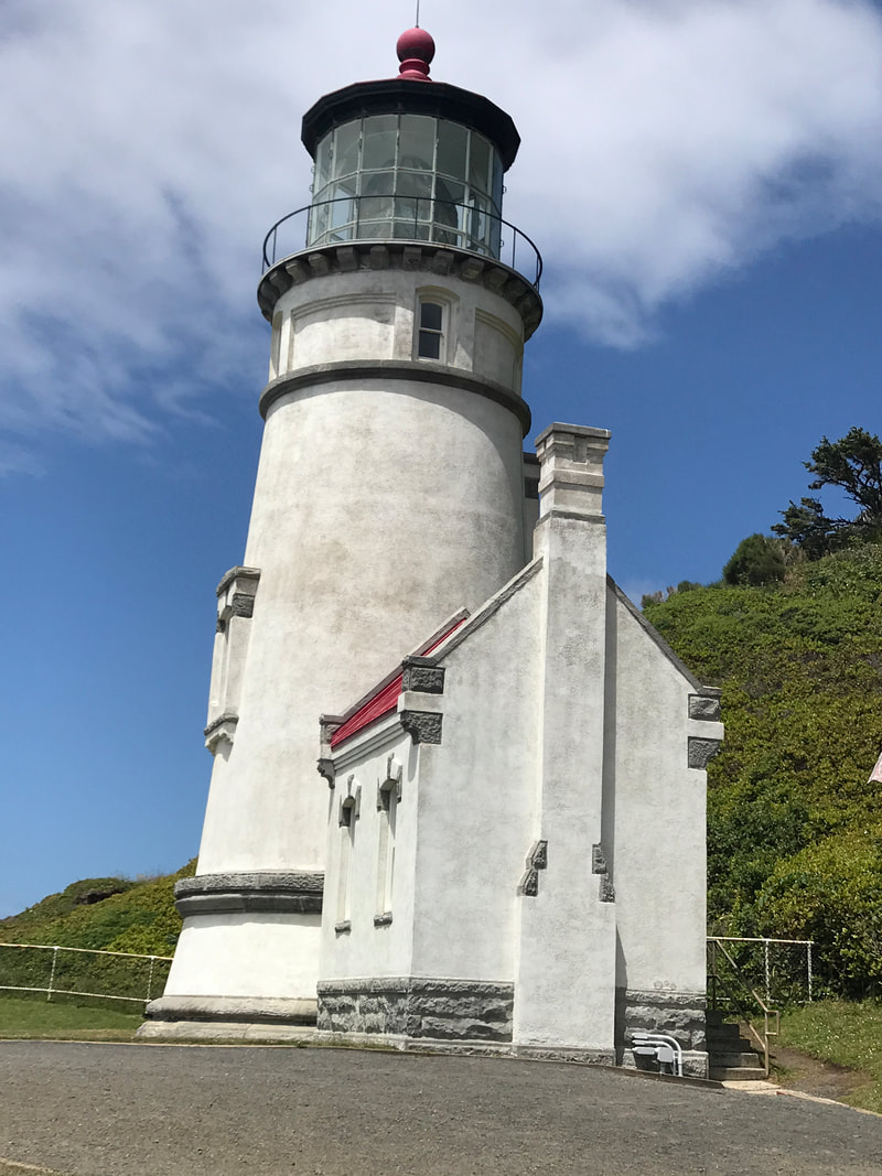 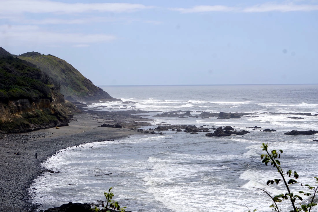 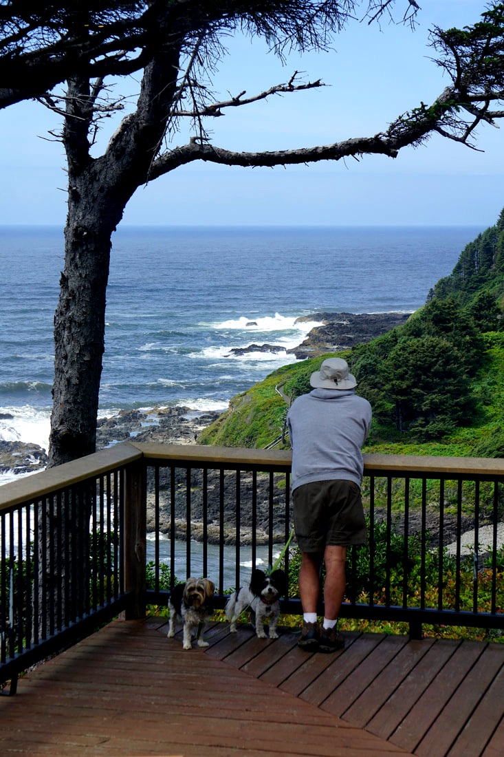 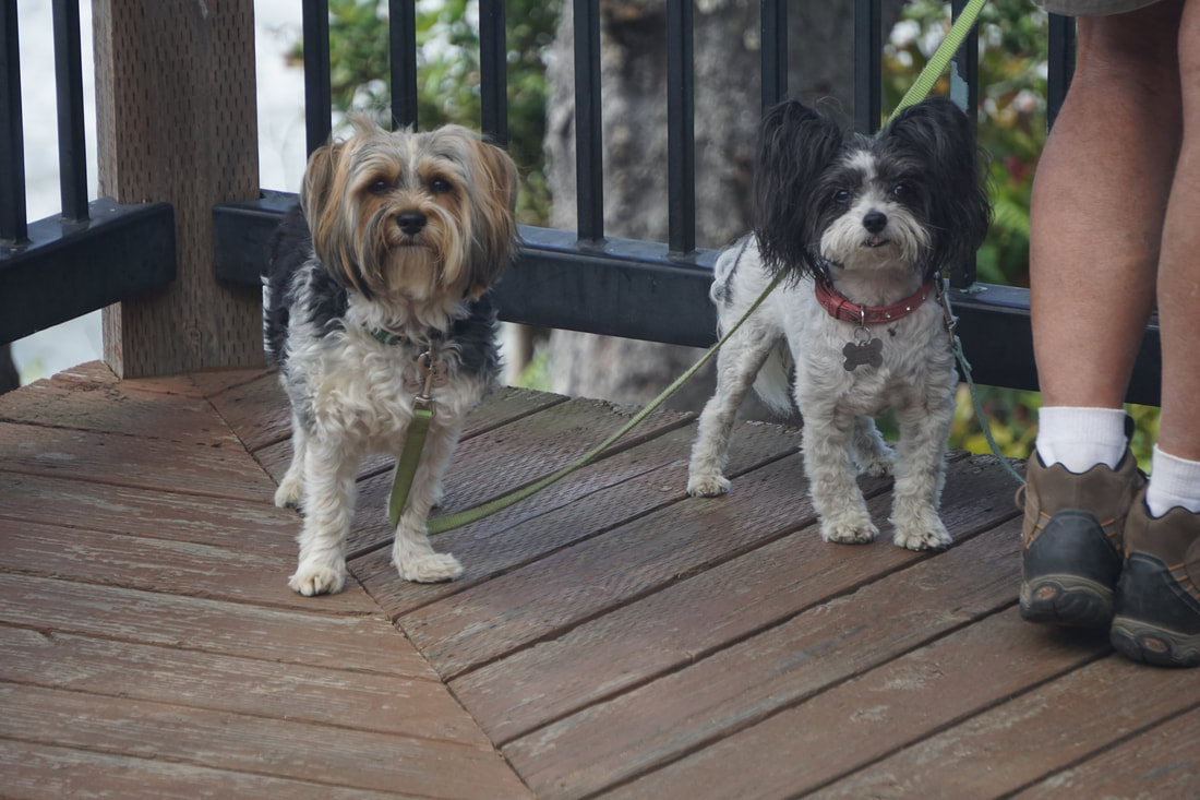 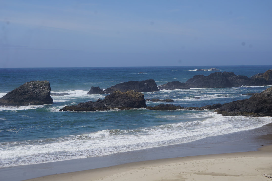 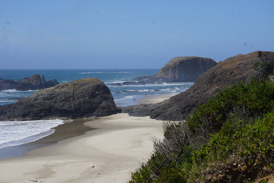 We arrived at our final destination of the little town of Otis at 4:00. The KOA that Tom had booked 6 months in advance assigned us to the worst possible site where we were unable to level front to back. We refused the site, drove down the road 3 miles to another campground, and obtained the last open site! We were set up by 4:30, processed 3 loads of laundry by 6:30, ate dinner, and settled down for the evening.
|
