|
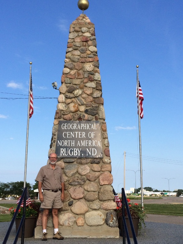
On day 15 of the Vapor Trail we left Glacier at a respectable 7:00 a.m. planning to follow U.S. Route 2 all the way to Michigan and Interstate 75. Many miles lay between us and I75 as we started out in the morning morning! We logged 674 miles the first day, ending up in Minot, North Dakota at a private campground. Along the way we stopped for a quick look at the geographical center of North America. 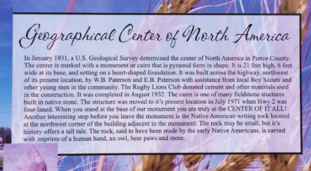
Day 16, continuing on the homeward journey, found us at Lake Itasca State Park, Minnesota, by 2:00 p.m. with plenty of time to see the headwaters of the Mississippi. When the kids were young, this was a favorite stop-over where we rented bikes and rode the miles of incredible bike paths. Biking wasn’t on our agenda this trip, and we settled for a nice walk back to the headwaters after a walk-through of the Visitor Center. As we approached the headwaters, we crossed a bridge where the newly birthed Mississippi River was shallow and narrow enough to walk across in a few steps! 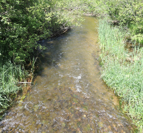
At the headwaters, where Itaska lake meets with the Mississippi, the opening widens a bit and becomes very shallow with a perfect little rock dam across the length. Tom walked out to scoop up a little water sample for our collection of waters from around the USA! 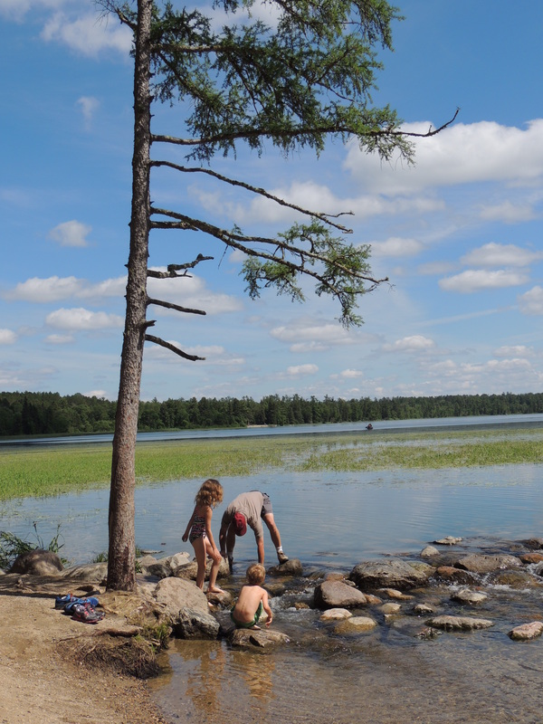
The location is a perfect wading and rock-hopping spot for young children . . . who are able to wade across the Mississippi River! 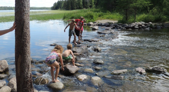
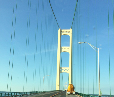
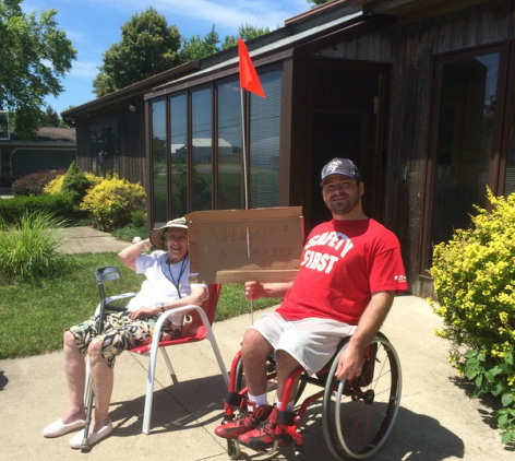
Day 17, following a 612 mile trek, still on U.S. Route 2, we arrived at St. Ignace Straits State Park in Michigan. It was a sentimental night as we were reluctant to stop vacationing, but excited to get home! On the last day of the Vapor Trail, day 18, we crossed the Mackinac Bridge with an easy 6 hour drive home! We gave Grandma and Caleb plenty of updates on our progress, and they met us in the driveway with a welcome home sign! 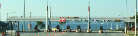
Before I close up the Vapor Trail blog, here are some stats from our 18-day journey: 4,330 miles on the Silvermine
5057 total miles (average of 280 miles per day) 367 gallons of gas (14 MPG average) $1,359.38 on gas Total cost of the trip . . . . PRICELESS!
1 Comment
Today would be our last day at Glacier, and Tom had another hike in mind. 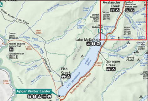 When we showed up at the trail-head for Avalanche Lake, a ranger was just beginning to gather a small crowd for a guided trek, and we jumped on that wagon for a different hiking experience. 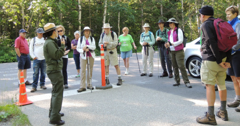
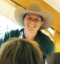
Becca, a tiny bit of a ranger, was enthusiastic and cheerful and had a real knack for sheparding a group of 20 hikers along the trail. At first glance I thought we had fallen in with some professional hikers -- everyone was fully out-fitted in high-brand trekking clothes, and I was in shorts and t-shirt and sneakers! I did have my stun gun and hiking stick, though. 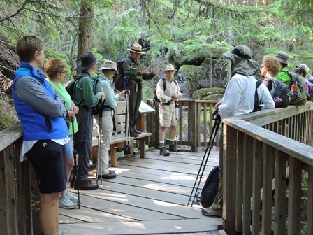
Becca's narrative as we went along was perfect for an explanation of how Glacier National Park was formed – and also served as good resting/stopping points on a fairly steep trail. 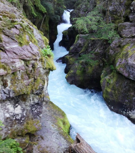
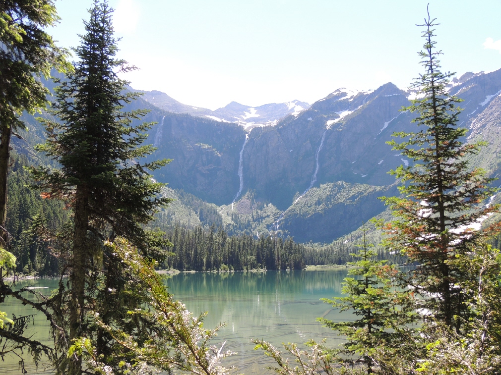
Becca stopped at one spot to explain the broken trees and scattered stumps on the ground. As an avalanche thundered down the mountain, seen in the background, the winds generated in front of the avalanche reached over 200 mph causing the trees to snap off --- at snow-depth level -- about 14 feet high! This particular event happened in 2011. 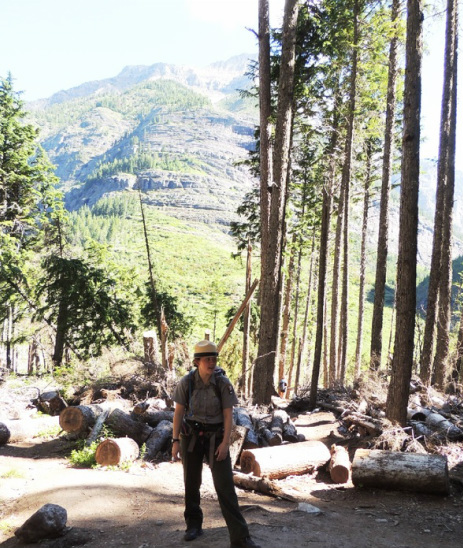
At the lake, Becca turned us loose to explore, giving us as much time as we wanted to enjoy the high altitude lake setting; hiking back out we would be on our own. The location is one of those paradise-type places. A high altitude mountain lake in all its glory, which invites you to linger. 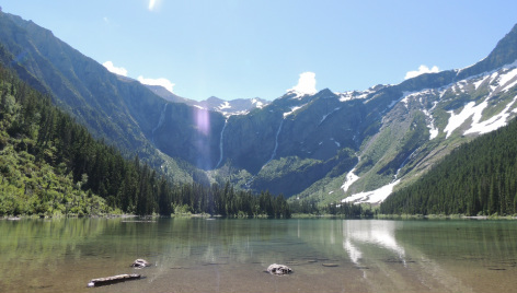
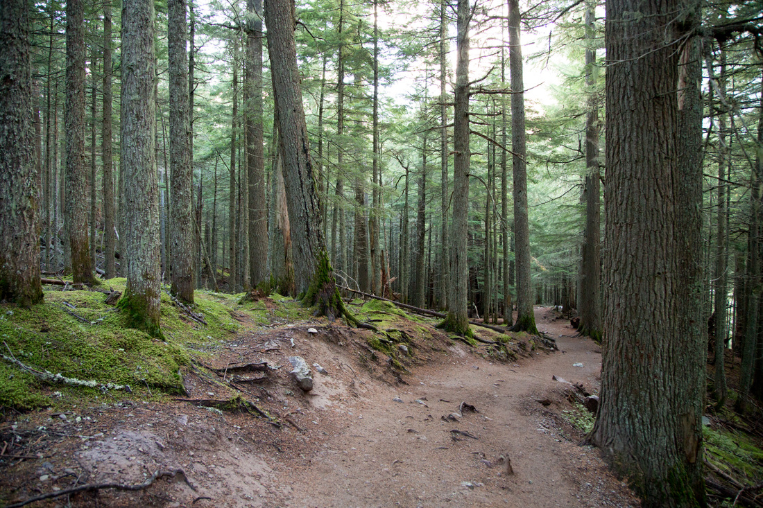
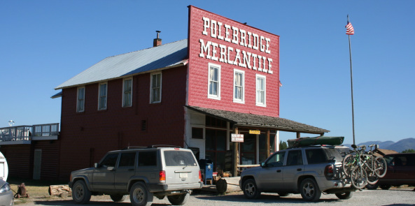
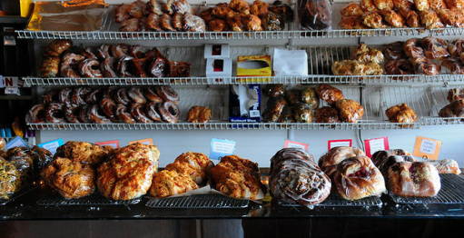
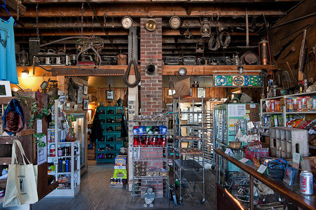
The walk in to Avalanche Lake was 2.5 miles, 2 hours, and the walk out was the same 2.5 miles (mostly downhill) and only one hour! We managed the hike back all on our own, and I was anxious to enjoy a total clean-up/shower back in the Airstream. The afternoon was a quick 25 mile drive on a mostly unpaved road that ran just outside the park boundary up the west side of the park to the little settlement of Polebridge. Not-quite-a-town, it was the location of a first settlement at the turn of the century, and today is a restaurant destination and a mercantile establishment featuring an impressive bakery! We bought huckleberry bear-claw pastries for breakfast! 
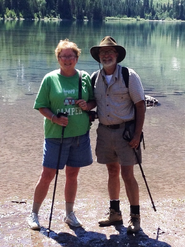
This trip got us back to our campsite in time to meet a fellow Airstreamer who was walking his dog. Hello led to --- I have an Airstream on “B” loop. With that in common it took only 2 minutes for us to find that we both grew up in Maryville, TN where his mother worked for my father. OH MY! Not only is the world getting smaller – but the Airstream world is also becoming very personal! What to do to celebrate our last night in Glacier? Go out to eat at McDonald Lodge -- a wonderful meal, in a beautiful setting! The next morning our Vapor Trail headed for home. 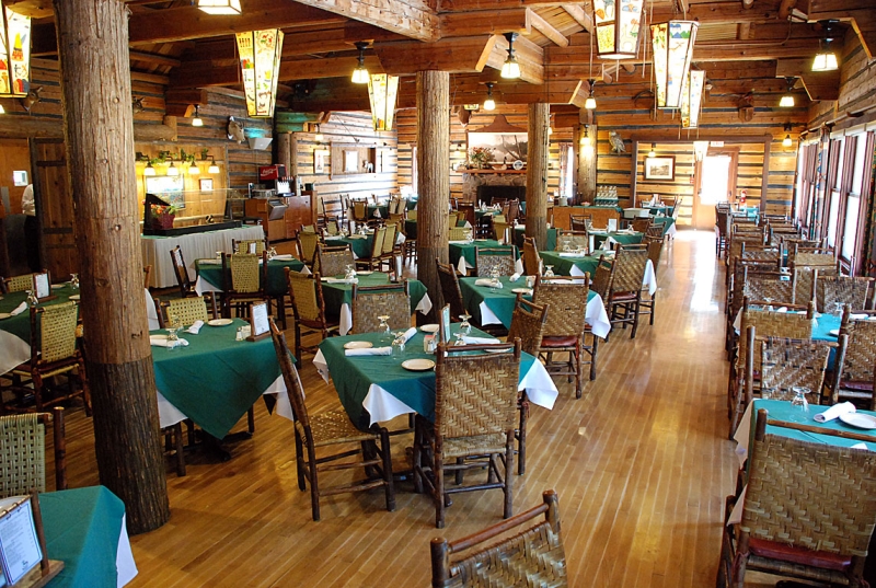
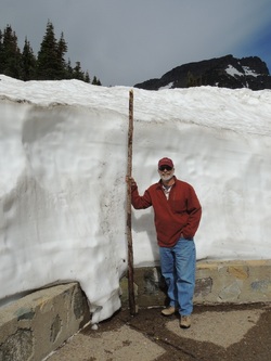
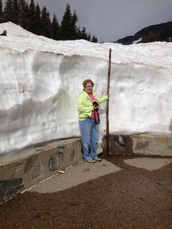
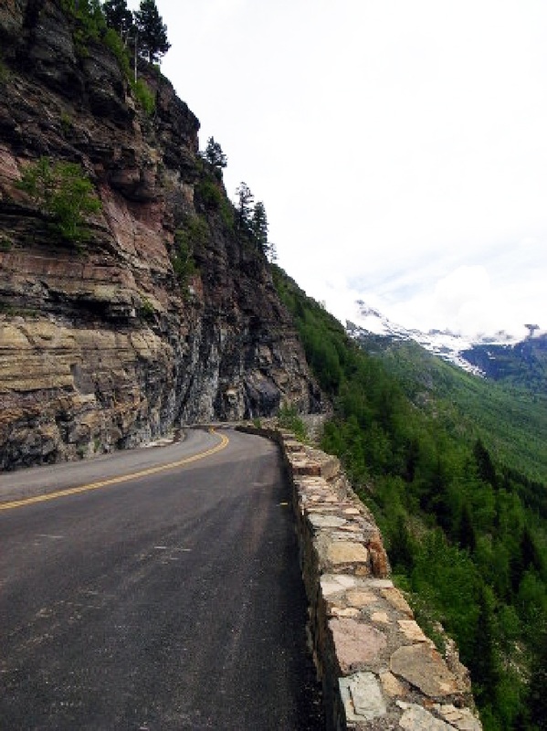
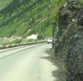
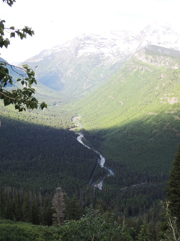
Talking to rangers about today’s drive, we were warned that much of the road “hangs from the cliff.” That is a polite way to say “if you are scared of heights and depths and narrow roads and straight-down cliffs . . . take the shuttle . . . or the legendary red-bus tour.” 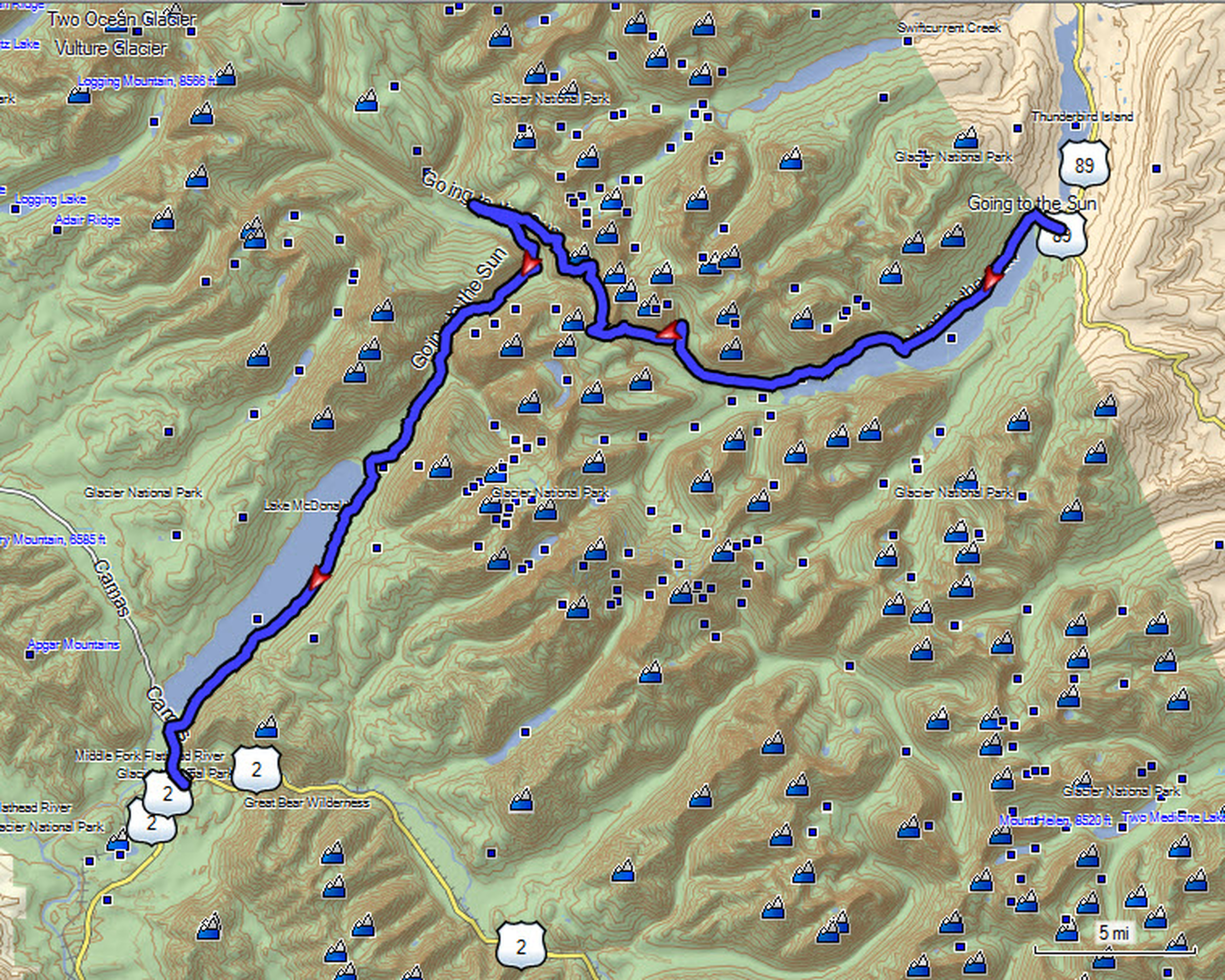 Tom has been known to be a bit sensitive about twisting roads with vertical drop-offs, but was surprisingly comfortable driving this road --- the legendary Going-to-the-Sun road. It bisects Glacier National Park in half, east to west, and is renowned for 50 miles of stunning scenery. There are not many other roads in Glacier National Park, and none that venture into the interior of the Park, so you can’t say you have seen Glacier unless you have traveled the Going-to-the-Sun road! Some of the road is open year-round, but the higher sections are only open after winter snows are plowed – that would be less than a week before we arrived!
The road is one of the most difficult roads in North America to snowplow in the spring. Up to 80 feet of snow on top at Logan Pass, and more just east of the pass where the deepest snowfield has long been referred to as the Big Drift. The road takes about ten weeks to plow, even with equipment that can move 4000 tons of snow in an hour. The snowplow crew can clear as little as 500 feet (150 m) of the road per day. On the east side of the continental divide, there are few guard rails due to heavy snows and the resultant late winter avalanches that have repeatedly destroyed every protective barrier ever constructed. 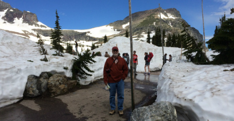 We began at 9:00 knowing that it would take a full day to see and fully appreciate this road and the beautiful views it offers travelers. Starting out was easy with familiar, pleasant driving past Lake McDonald. As we ventured away from the lake and commenced to climb, we passed a few trail-heads and stopped at several scenic turnouts and overlooks. 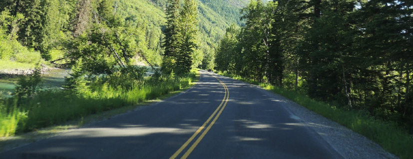
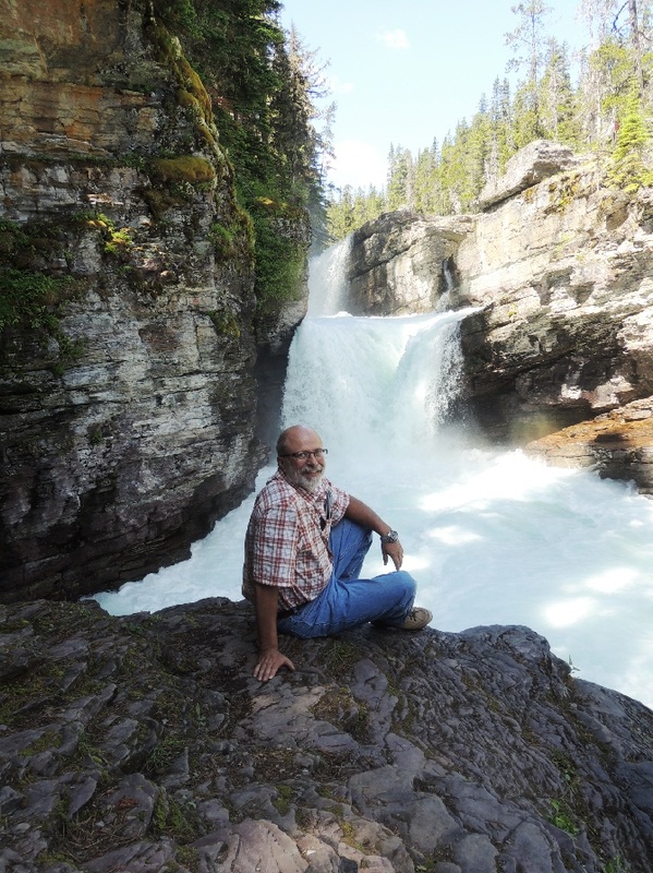
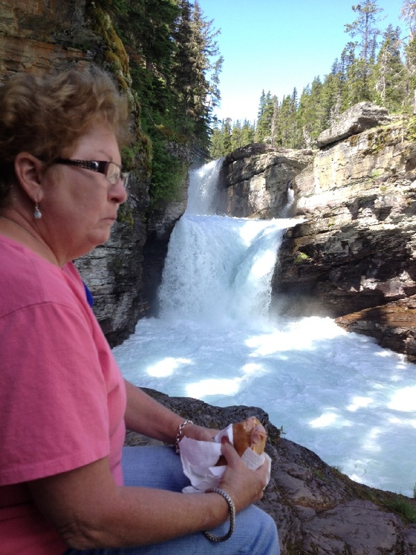
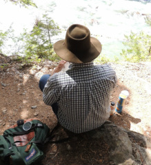
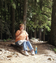
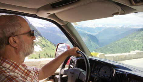 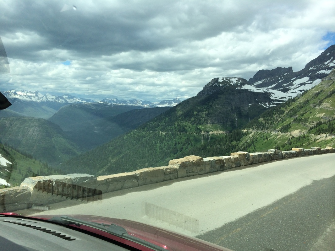 The half-way point is called the loop – the only switchback on the east-bound road as it abruptly turns west-bound in one giant turn. At this point the drive takes a definite increase on the Richter Scale as the road narrows, the cliff crowds in, and the granite wall starts gushing multiple waterfalls across the road, known as The Weeping Wall! Roll up the windows, Tom! 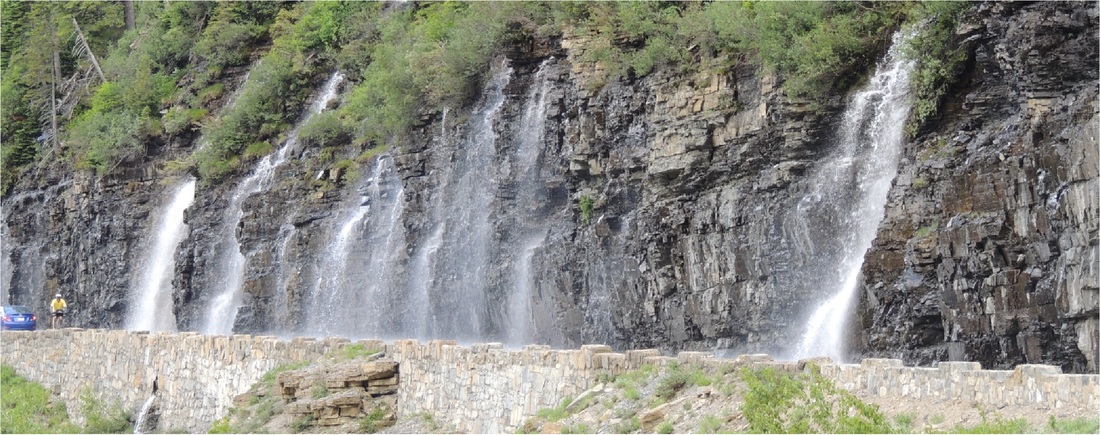 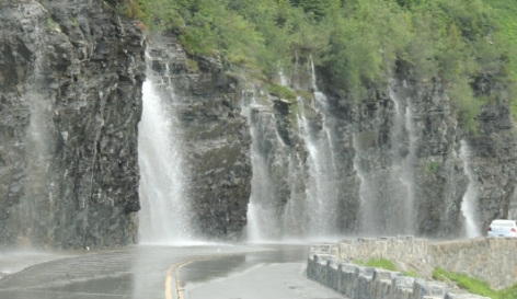 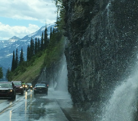 Shortly after is Logan Pass that sits on the Continental Divide at 6,646 feet. A stop at the Logan Pass Visitor Center relieves the tension of the drive as the worst was behind us and there are . . . “facilities!” 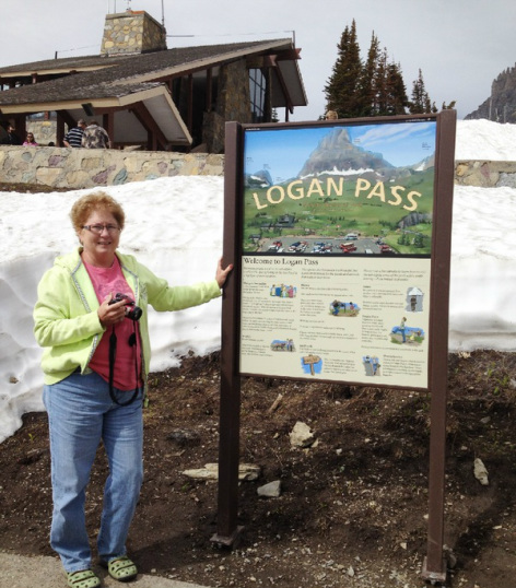 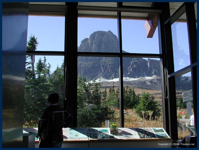 Once past the Logan Pass Visitor Center, we watched for the trail head to St. Mary’s Falls. The parking area was full and so our hike commenced ¼ mile down the road where we finally found a parking spot. A beautiful trail, it was packed with enough people to moderate our fear of hiking in grizzly bear country. We didn't have any bear spray, but Ella did strap on her stun gun! 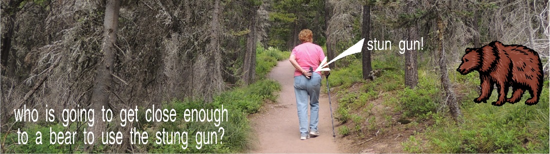 It was a gentle, downward trail and not overly rocky or rutty, and 45 minutes of hiking led us to the falls. We ate lunch on the rocks, watching the 25-or-so other people that were there, and then headed back out – facing an uphill climb to get back to the car. 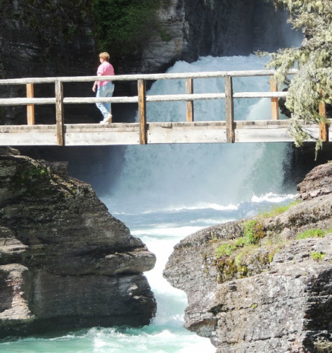
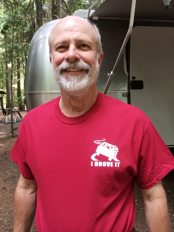
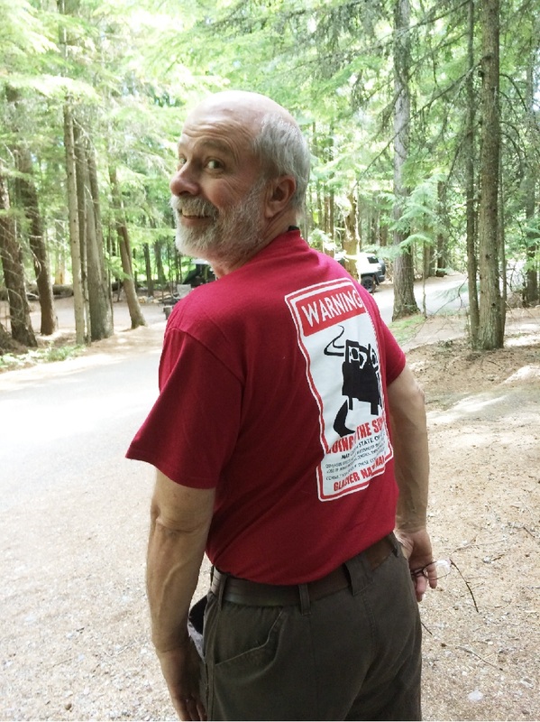
It goes without saying we completed all 50 miles, past Saint Mary Lake and to the east entrance where we enjoyed the restrooms and views of the Saint Mary Visitor Center. The deal was, however that we had to back-track the whole trip – same miles, same elevations – same drop-offs --- but different views!  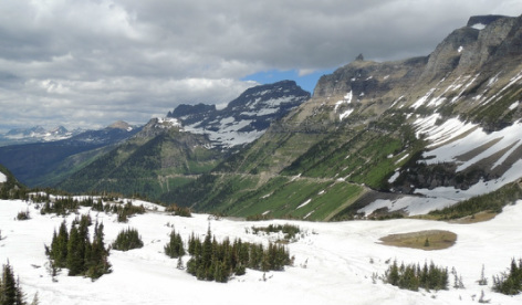 Back at the camper at 4:00 we took showers , Tom put on his “I drove it" shirt, and we broke open a favorite bottle of wine. We even managed to sit and relax for an hour in our campsite, reflecting on the unparalleled day!
If you want to drive a virtual tour of Going-to-the-Sun road, just follow along on this link to Google maps – satellite view! Tomorrow -- our last day at Glacier!
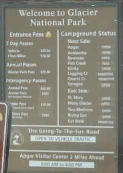
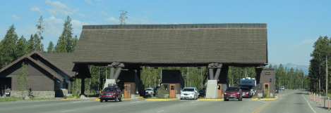
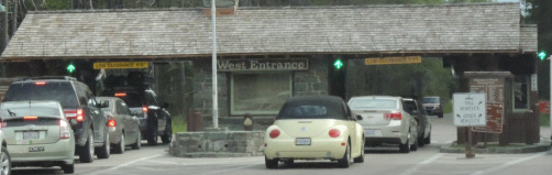  We were only 20 miles from Glacier National Park as we headed out Saturday morning -- July 5th -- Day 12 on the Vapor Trail. We were processed through the Park entrance by 9:00 and at our campground by 9:15. However, the people in our site could squat till noon, so we dropped the trailer in a parking lot, and set out to explore the area.
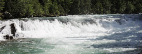
 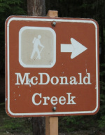 At Apgar Visitor’s Center we became oriented to the park and picked up maps and information to make a 3-day plan for sightseeing and hikes. For starters we did a 3 mile loop hike taking us past the McDonald river, a waterfall, a rushing cascade, and through a tall pine forest that was emerald green. We ate our sandwich lunch along the roaring river.  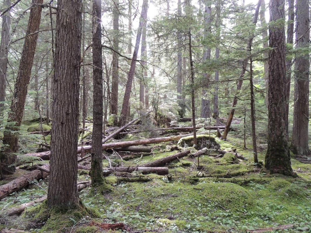 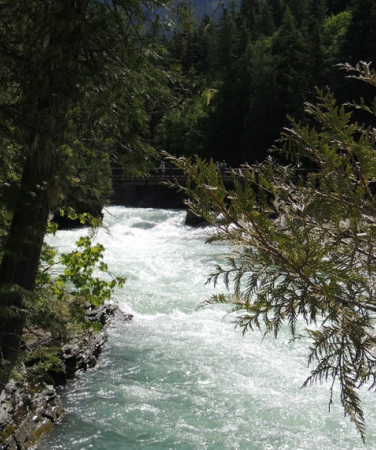
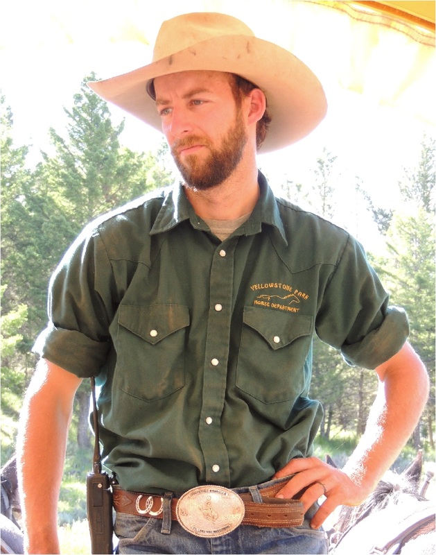
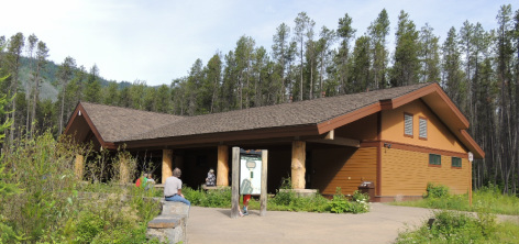
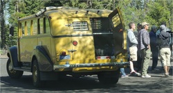
 Glacier has a fleet of Red Buses that have been providing visitors with a unique ride through the park since 1914 – 100 years! The current fleet was built by the White Motor Company in the 1930’s and recently when they threatened to quit touring because of age, the Ford Motor Company stepped in and updated the whole fleet! Canvas tops roll back and allow visitors to stand up for thrilling views during the interpretive tours.These buses are a Glacier tradition that we shared the road with many times during the next three days. 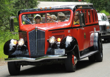 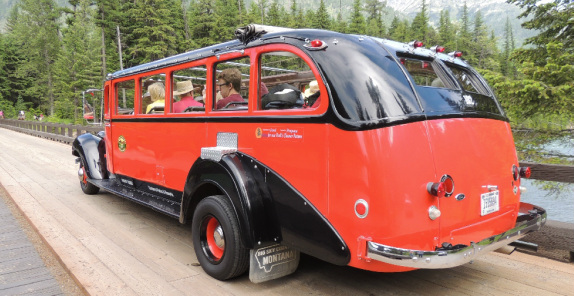 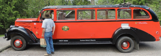 After the hike we stopped at Lake McDonald Lodge located on the western side of Glacier National Park. The lodge first opened in 1914, and today the lobby looks just as it looked 100 years ago! The lodge is also an essential stop as it is on the western end of the Going-to-the-Sun Road, a ride that we would be doing the next day. The front of the lodge is all rustic mountain setting -- while the back of the lodge is a lake-side resort! 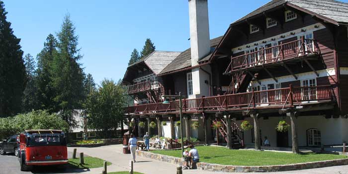 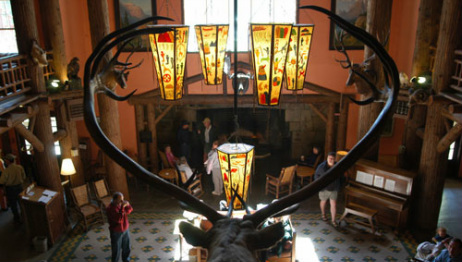 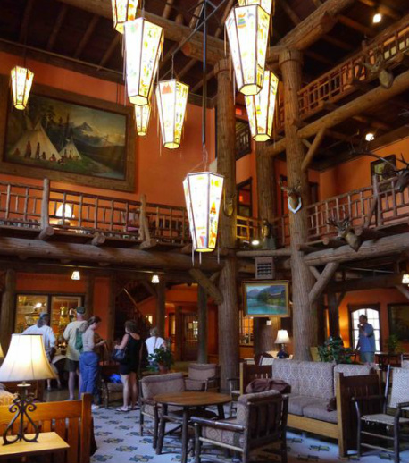 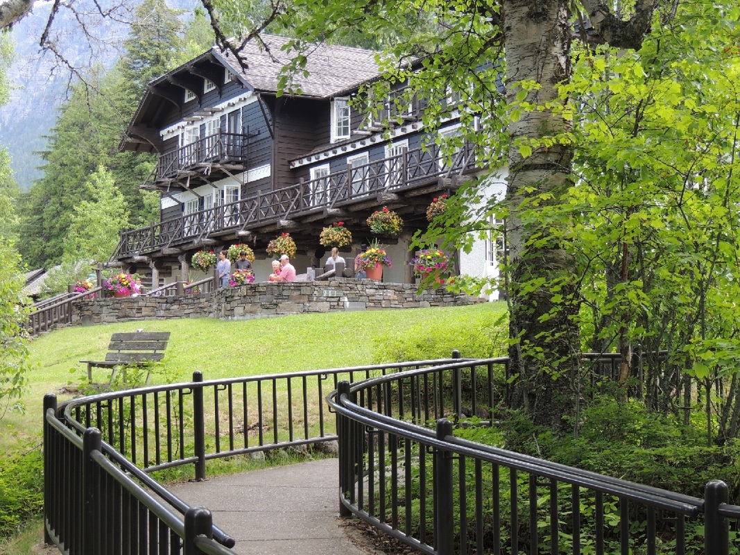 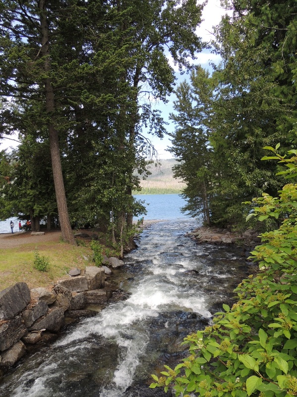 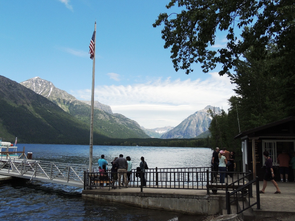 By noon we had picked up our camper and checked into Fish Creek Campground to claim our campsite -- beautiful lofty pine trees with heavily wooded sites. It took a little engineering and choreography, using all the leveling boards we had, to get into our campsite and get leveled!  At the campground we gathered inside information on what to see and do in the park from a lady who had been secretary to the Park Superintendent for 10 years. We traded information for a tour of the Airstream. The campground hostess also moseyed by with her welcome pitch and some more nice suggestions for exploring. Right across the street from our campsite was a trail winding along McDonald Lake, and before dinner we hiked the McDonald Lake Trail to a viewpoint called Rocky Point. 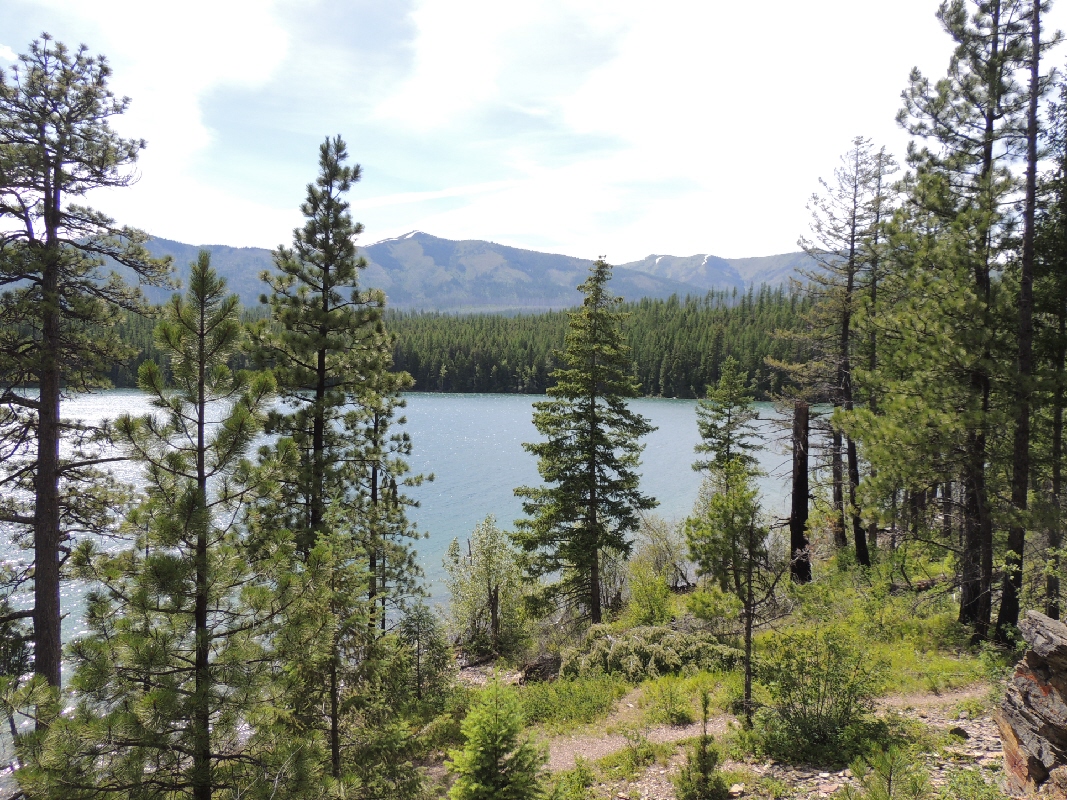  Before stepping out to the evening ranger show, Tom planned our next day's drive on the Road-to-the-Sun. The road is only for the bold and confident driver, and many people opt for the red-bus tour rather than driving it themselves. "We shall see . . . . ."
8:00 a.m. found us leaving the Canyon area of Yellowstone and heading for the West Park entrance. It was a beautiful drive as we transitioned from protected park vistas, to winding roads with mountains, rivers, lakes, fish camps, dude ranches, beautiful log cabin residences, and big sky! 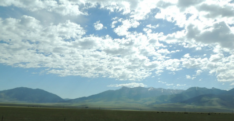
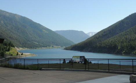
Our road toured us through the “Eatherquake Lake” area where a destructive earthquake triggered a devastating landslide and flood killing 28 people on August 17, 1959. The earthquake measured 7.5 on the Richter Scale and caused an 80-million ton landslide which formed a dam on the Madison River. 
A visitor’s center at the site illustrated through outside overlooks and displays the ruin produced by the quake. It happened in the middle of the night, and campers and hikers and hundreds of people were caught up in the nightmare of the tragedy. 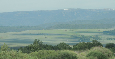
The river that we followed was saturated with boats and fisherman – maybe because of the 4th of July weekend? Fifty miles before the town of Ennis, Montana, a sign warned us to expect long delays in Ennis due to the 4th of July parade. Fifty miles! The population of Ennis is only 855! 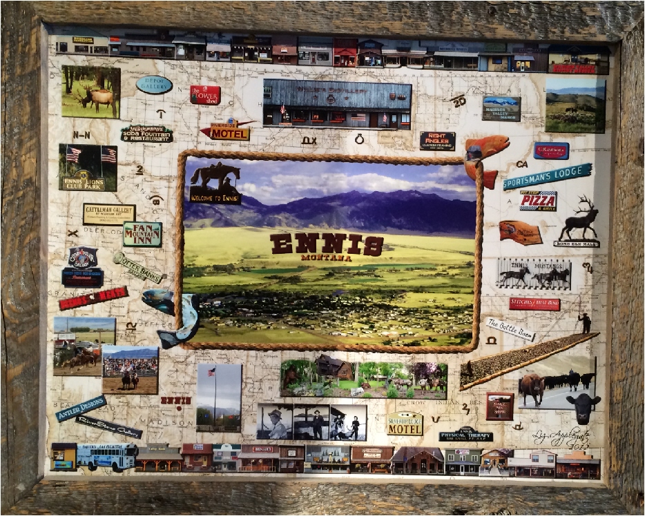
Well, we loved the town of Ennis, and because the parade wasn’t until the next day, we stopped to stroll through the great shops, to eat at an outdoor grill. and to buy Caleb some authentic Montana whiskey at a little distillery. All the townies were getting ready for the “western style” 4th of July parade, and we were convinced that it must be the biggest parade next to the Rose Bowl Parade! 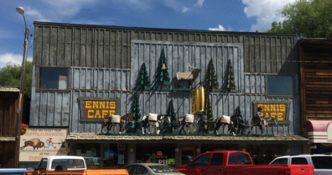
We zig-zagged north and south moving west and eventually came to Wisdom near the Nez Perce National Historical Park. We had scoped out a nearby “RV resort”, but it was the sorriest excuse for a place to stay we have ever seen – and the mosquitoes were appalling! 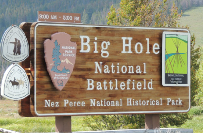
Having no cell phone reception, and not knowing what type of camping accommodations might be ahead of us, we forged on. We ended up at Broken Arrow “RV Resort” which offers a dozen camping sites with water and electric – behind the Broken Arrow Restaurant – beside the Broken Arrow cabins! A very low-budget place it is graced with being able to be called quaint, and the lady running the whole shebang was very nice. In their two-toilet, one-shower bathhouse, there were sweet little lavender wall decals, pretty towels all rolled up, and a variety of little soaps and shampoos for the “guests!” Well worth the $20 for an overnight! 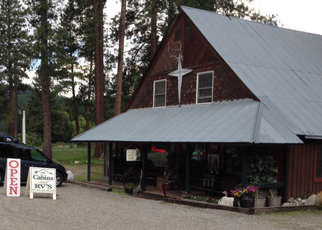
The drive to Broken Arrow took us over the border from Montana to Iowa. Caleb and Micah have never been to the State of Idaho, and Tom had to stop at the State line and take a picture to send to them! 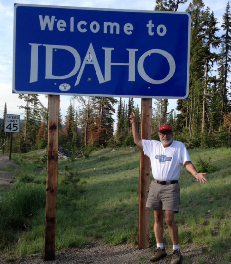 On July 4th, we left Broken Arrow campground and drove to the Whitefish, Montana KOA for the night in preparation of driving into Glacier National Park in the morning.For the evening we went into Whitefish, but all the stores were closed for the 4th. The bars, however, were open and flourishing! Supper was again cooked on the little Biolite grill -- chicken legs with the Huckleberry Barbque Sauce that we have seen everywhere in the area! 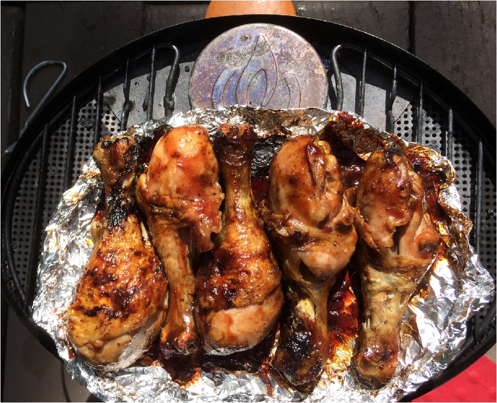
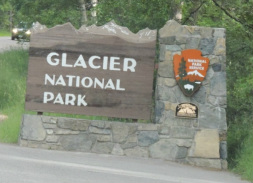
Tomorrow -- Glacier National Park!
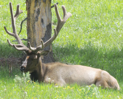
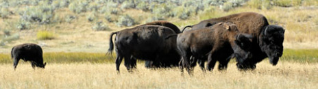
This morning Tom said: “Some day when we get younger, we’ll come back and do more of the big hikes.” Our morning drive began with a wildlife fanfare when we saw a little fox, large prey flopping in her mouth, trotting down the road directly towards us. She wasn’t intimidated at all by our van as we slowly passed by her. We guessed she was a mama taking a meal to her kits. Rather quickly after that we saw stopped cars signaling our first bear-jam. A mother bear with two little cubs was wandering around in a meadow. We were able to stop the car and watch her for quite a while. 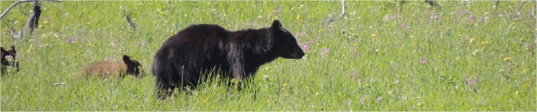
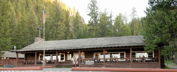
 Roosevelt Lodge is at the north end of the park in the mountains of Yellowstone. Compared to the rest of Yellowstone, this area is somewhat remote and not as developed. There are cabins but no hotel, and the lodge is on a very small rustic scale. It is also the headquarters for trail rides and chuck-wagon jaunts, and that is exactly what Tom had planned for our last night in Yellowstone! Although we would be very early for our chuck wagon dinner ride, we drove back down to Roosevelt Lodge and sat in the rocking chairs on the big, country, front porch a while (Tom took a nap) and then moved our own recliner chairs under the shade of some tall pine trees for an hour (Ella took a nap.) Suddenly it was time to head to the ticket booth to turn in our paper ticket for ride passes on the chuck wagon . 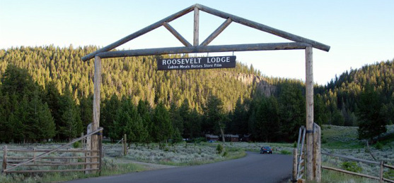
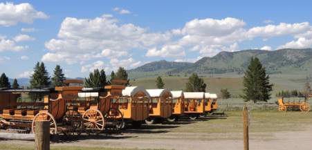
There was quite a bit of hanging around while those who were going to ride on horseback to the dinner location mounted up and took off. Then, our 7 big wagons were each hitched to a team of substantial draft horses, and each wagon was loaded with 30 people. 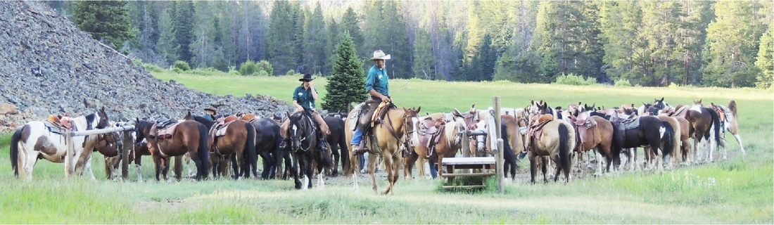
 Our destination was a nicely set up feeding area with some picnic tables in the sun, some under the shade of trees, and many under a large covered pavilion. 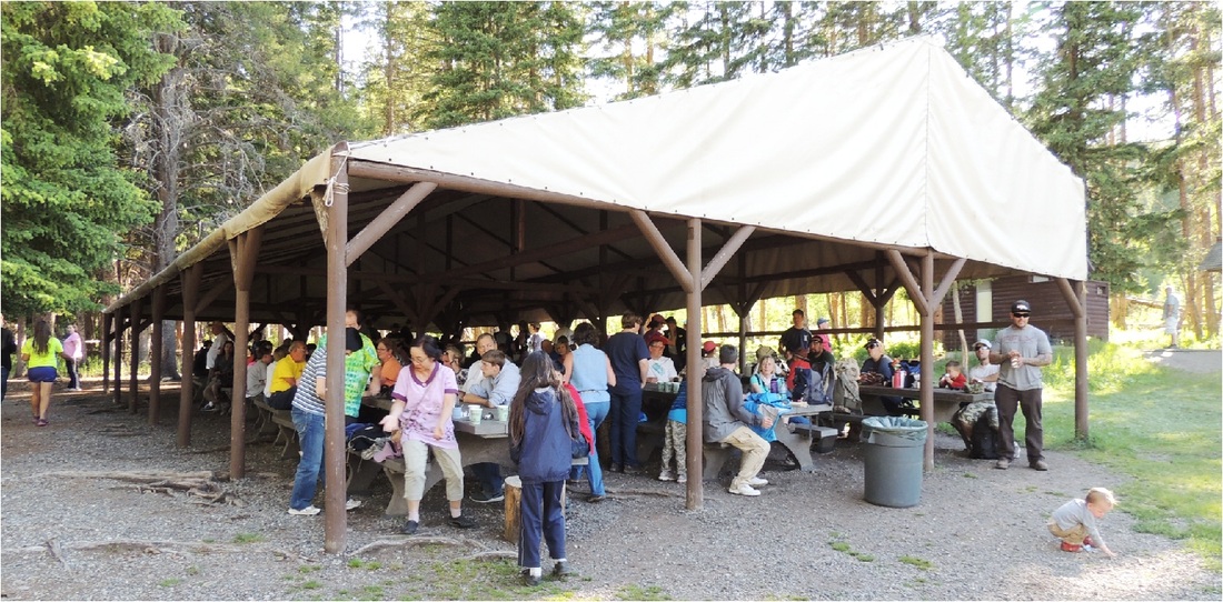
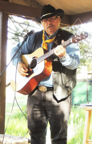
Seven days a week the cowhand-cooks feed about 250 people, all arriving by horseback or wagon. The menu is all the New York Strip steaks you can eat and cooked to order, cornbread, rosy beans, coleslaw, potato salad, corn, watermelon, and peach cobbler. For entertainment while feasting, Cowboy Dallas played guitar and sang cowboy songs; this is his 30th and last year on this summer gig! 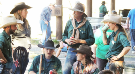
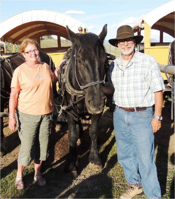
Dinner over, the wagon folk were entertained with tall tales around the campfire while the horseback folk mounted up and trotted on down the road. Tom and I posed with the big fella Clyde before getting back on the wagon. Following 4 hours of playing cowboy, we were back at Roosevelt – another 35 minutes by car, and we were back at the campground. Tired! I was dusty from the trail and sticky from bug spray, but the shower concessions closed just as we got back to the campground. I was never more grateful for that little wet-bath shower in the Silvermine, and I was also grateful that we still had plenty of water for a shower after 4 days of boondocking in Yellowstone!
Tomorrow morning we pack up and head towards Glacier National Park – a place that Tom and I have both visited as kids, but have never visited together. I wasn’t going to get out of bed (when Tom's alarm went off at 7:30) until I remembered that Tom had double-stack (2-egg) sandwiches planned for breakfast. Even then, it was a bit difficult. As I swung out of my nice cozy bed and into the 41 degree temperature inside the Airstream, "brrrrrr" was the thought that came to my mind. We slept without the furnace! Outside the temperature was 35, but warming by the minute. Breakfast was fabulous, (nothing like hot coffee in a tin mug to warm the hands,) and we were off to explore by 8:30. We started with a beautiful drive to the northwest, mountainous area of the park -- Mammoth Hot Springs. 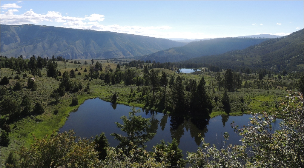 Yellowstone’s first hostelry was opened in 1871 at the Mammoth area. In 1883 the first hotel was opened with 150 rooms completely lit by electricity. The structure that is here today was opened in 1937. Mammoth is also the location of Historic Fort Yellowstone from which the US Army protected the park from 1886 - 1916. Today it is the home headquarters for the National Park and also home to the Albright Visitor Center. Mammoth area is home to a large cluster of official park buildings. 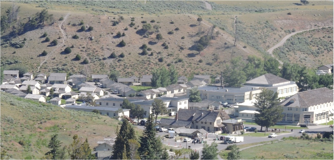  The thermal manifestations are very different in Mammoth than in other areas of the park and comprised mostly of calcium carbonate deposits. The Upper Terrace Drive loops around high above the Mammoth Hot Spring area with views of the thermal features from above and the distant hotel. The Lower Terraces' boardwalk puts you right on the terraces themselves for a very subjective and personal view. 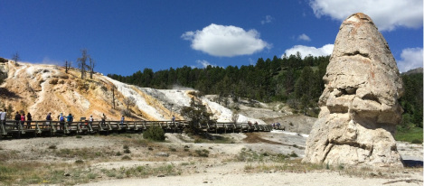 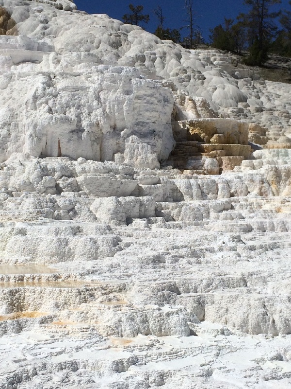 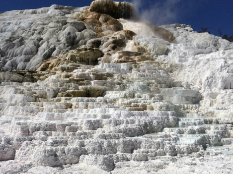 From that juncture we drove down to the Norris Geyser Basin – one of the hottest and most dynamic of Yellowstone’s hydrothermal areas. The Norris setting is home to one of the world’s largest active vents of the Yellowstone volcano, and it sits on the intersection of three major faults. Because the area is so active, it is also ever-changing and very unpredictable. Don’t expect a time-table of when these geysers might blow! 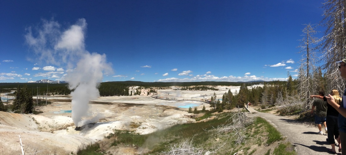 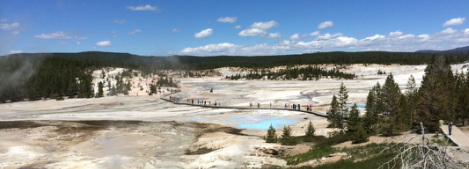 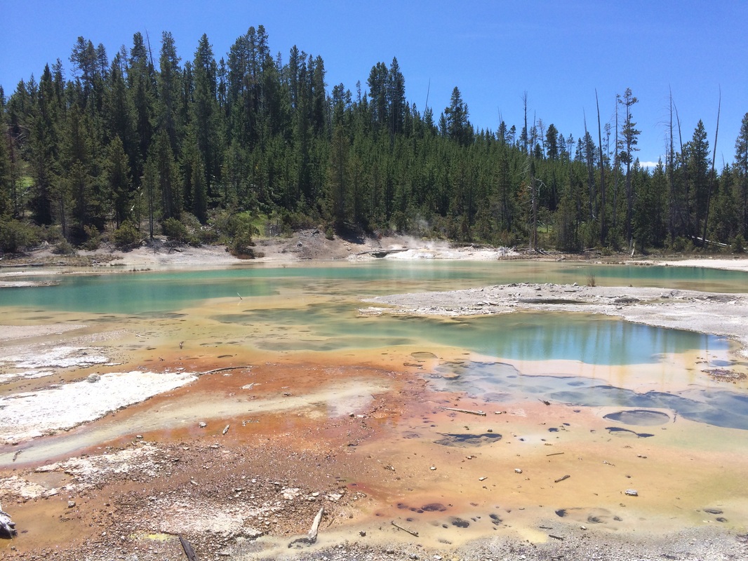 We were glad to get back to the campsite by 3:00, and for the first time on this vacation we each grabbed a lawn chair and relaxed for an hour. Of course, I get a lot of relaxing as Tom drives us from one place to the other, but in the chair we could unwind and not be afraid of missing something if our eyes closed. Tomorrow will be our last day in Yellowstone, and we will be ending with a surprise that Tom planned on and made reservations for 6 months ago!
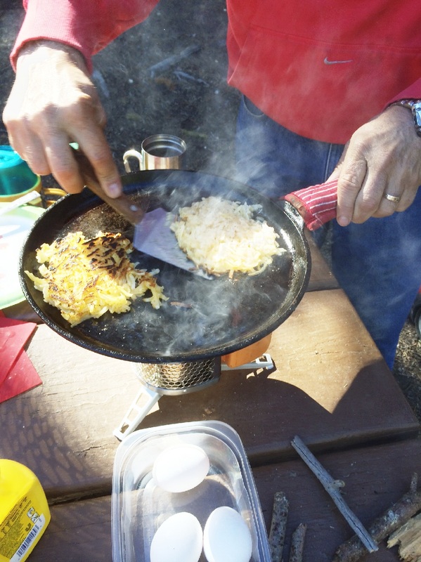
It felt good to sleep late and roll out of bed to a breakfast grilled by Tom. His menu was hashbrowns and eggs over-easy on a castiron griddle over the Biolite camp stove. We cheated and used the generator (allowed from 8:00 – 10:00 in the campground) to make coffee . . . and charge cell phones, camera, iPADS, and Kindle.
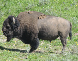
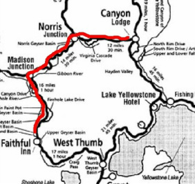 Our target for the day was the Old Faithful area and the Upper Geyser Basin. Leaving Canyon area we drove straight across the park to Norris, down to Madison, and then on down to Old Faithful. On the Sirius radio I found a channel called Beautiful Music – mostly instrumental – and it set the tone for our beautiful drive. Along the way we followed the Firehole River and took a little side trip to the old swimming hole that we went to as kids. Tom went with his parents, I went with mine, and we took Micah and Caleb when they were young. Oh, and I might have gone on a few illicit, late night, social visits with fellow employees back in the 70's! It is a well-known hotpot where the water is bath-temperature-warm for nice soaking in all kinds of weather. The steps were blocked to climb down to the river with a sign that said extreme high water levels had caused dangerous currents. Come back in a few weeks! 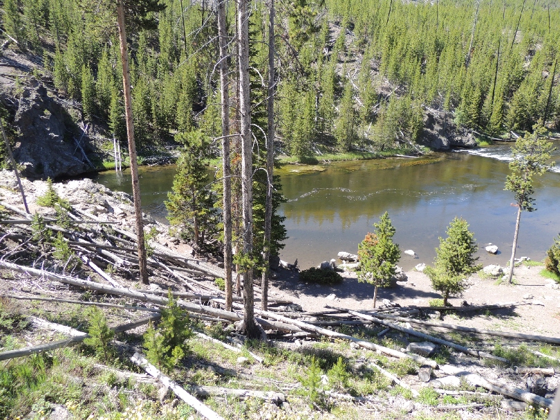 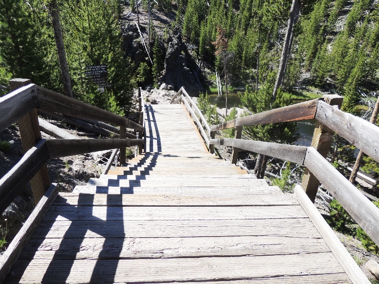 The first order of business at the Old Faithful area was to find out what time she would be venting -- 12:20. With over an hour to kill we walked around inside the Old Faithful Lodge and bought sandwiches to take outside for the show. At the stadium seating around the fountain we got front-row seats on the boardwalk, and Old Faithful did her thing right on time!  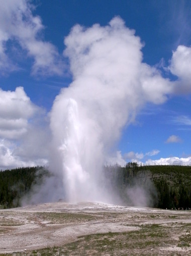 Next we turned our attention to the above-ground board-walk as it roved ‘round the Upper Geyser Basin with of hot pools, geysers, and hot springs. Over 3 hours (temps in the 60’s) we saw all kinds of thermal water display – spraying, steaming, sputtering, spewing, bubbling, boiling, hissing, and total discharge. 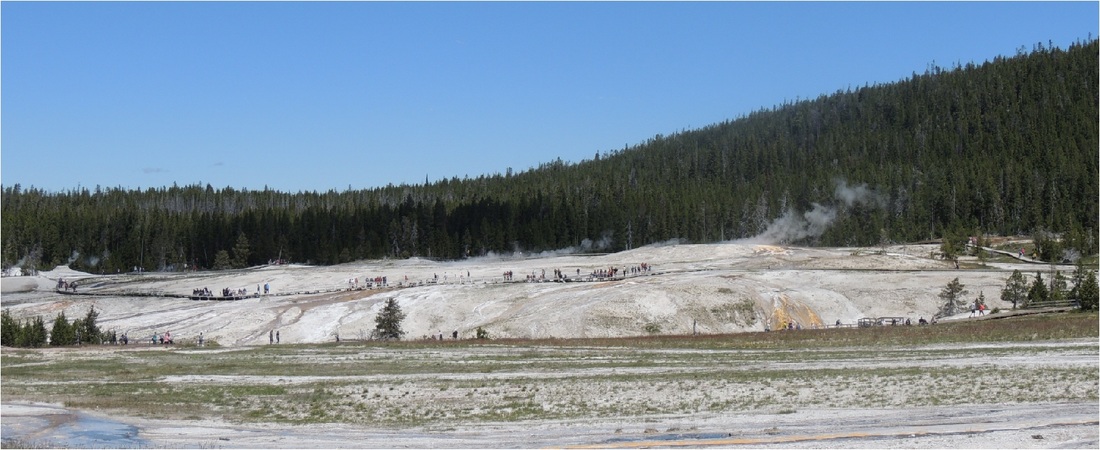 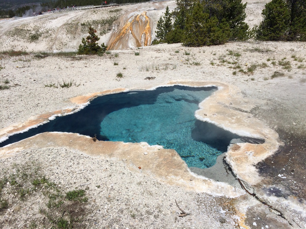 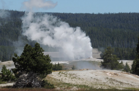 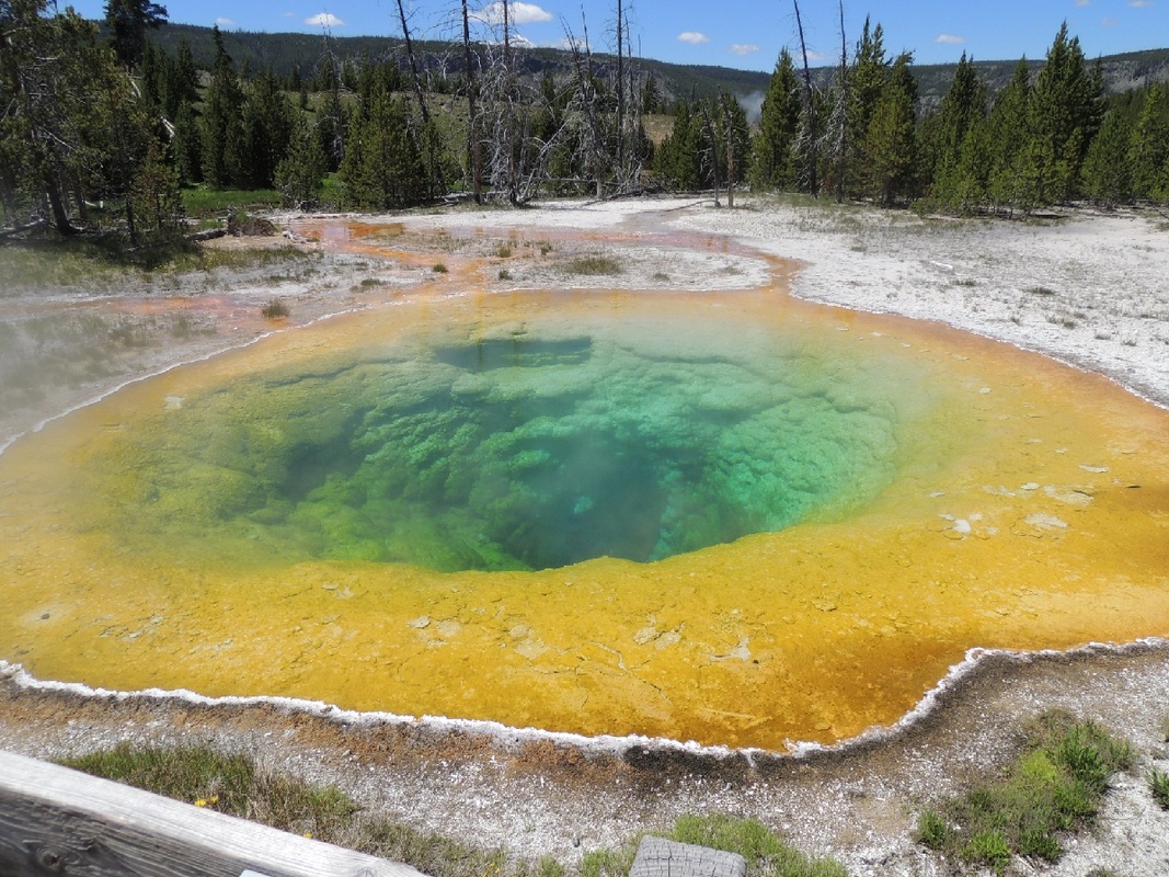 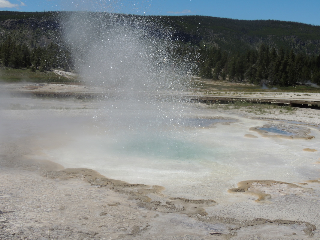 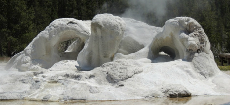 The Beehive geyser gave a tremendous, unexpected, display, and the boardwalk was so close that we could hear and feel the power of the outburst. This geyser is not on a schedule and is rarely enjoyed by tourists. We were lucky to be on the boardwalk just as it began to erupt. 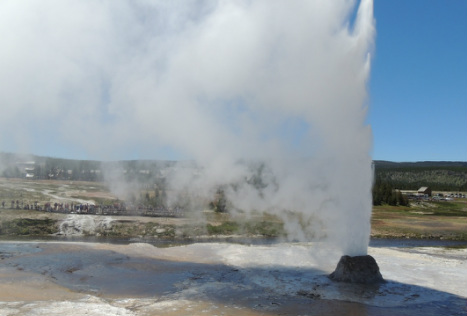 On the boardwalk we had many views of the man-made wonder of the Old Faithful Inn. As we approached at the completion of our walk, we had to tip-toe past a buffalo that was enjoying his dust wallow just a dozen yards off our boardwalk! He was looking rather sleepy and bored. 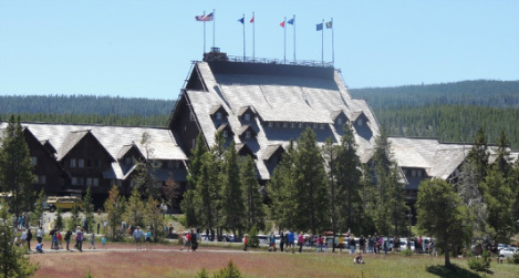 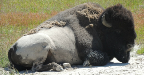 When we finally reached the Inn we walked into the lobby and saw the hallway that led to the room where we stayed in 1988 with the kids –- when we had to stay an extra night because a freak snow storm closed the roadway! The Inn is the largest log structure in the world - a giant log cabin, of sorts - and features an 85-foot tall lobby with a huge rough-stone fireplace. 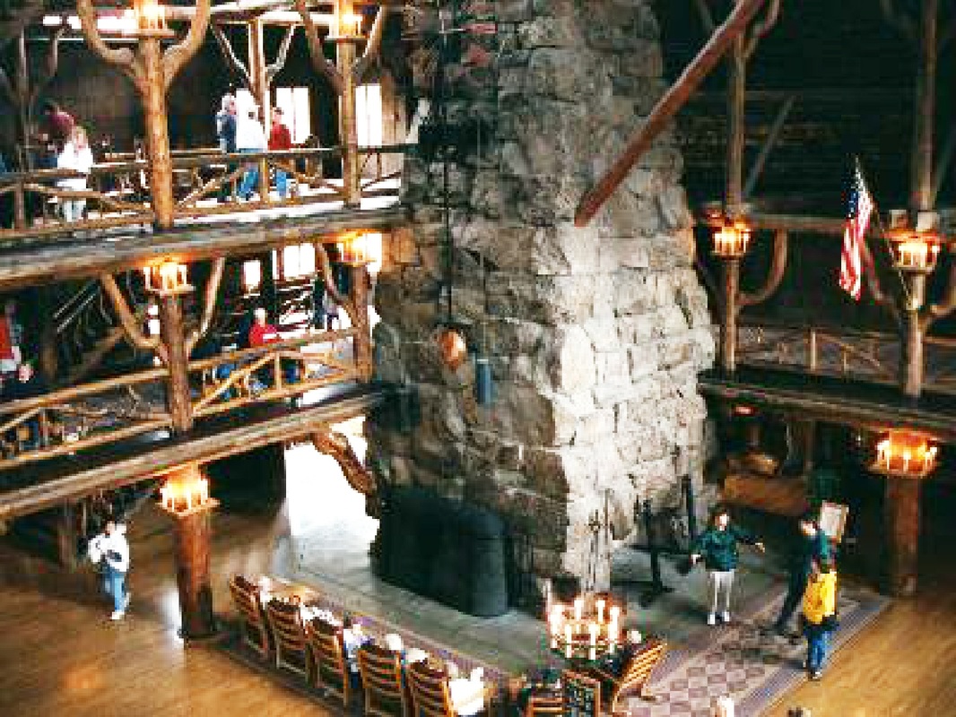 By 5:30 we were back at the camper where we loaded up our shower duds for the free token showers that came with the campsite. Love all that spraying water!
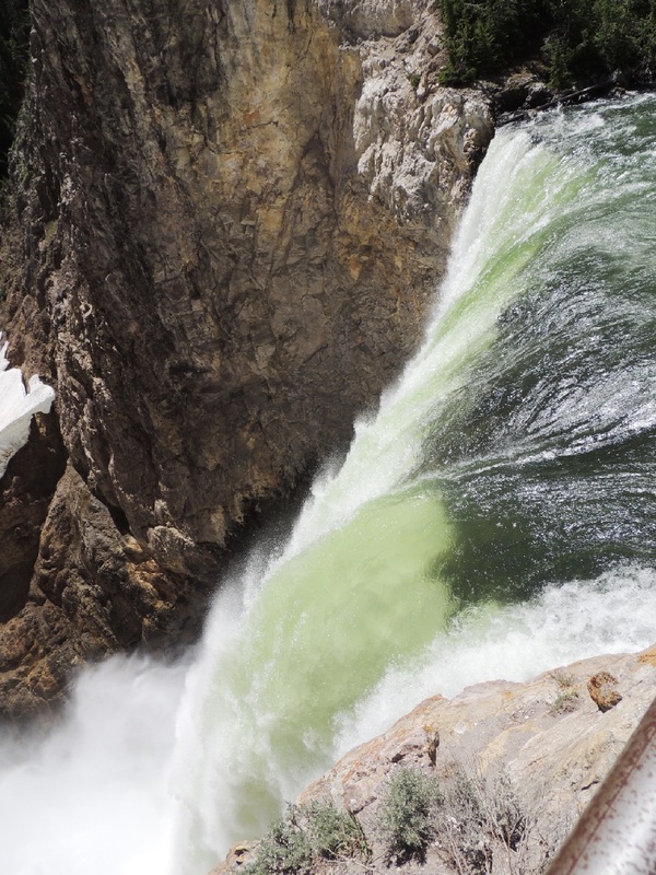
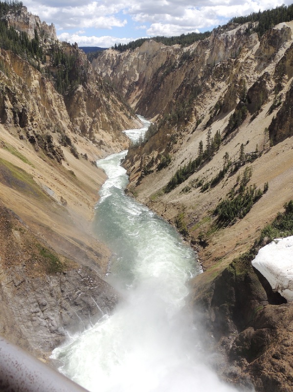
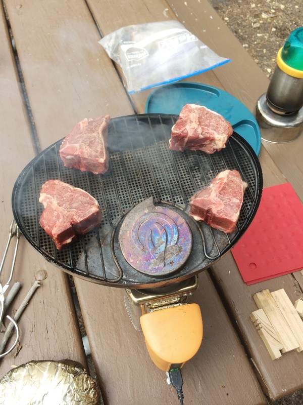
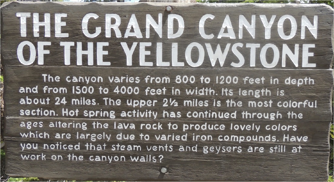
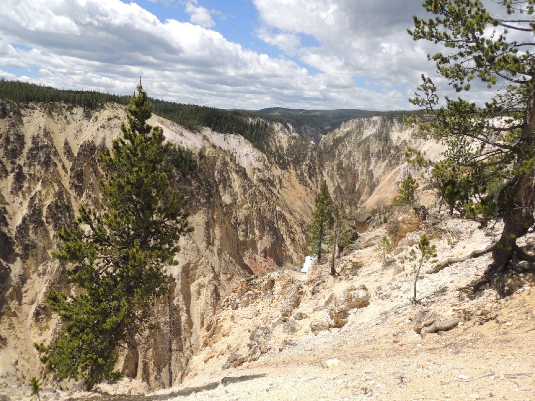
The meal-plan for the night was thin-cut rib-eye steaks, hash-brown potatoes and fresh cherries. As I rested and read in the Silvermine, Tom stole off again for the Ranger show in the amphitheater! Stay tuned for day 3 in Yellowstone – day 8 of the Vapor Trail.   Knowing that we were staying in Yellowstone National Park for 4 nights, we got up early and took showers and cleaned up the camper and loaded fresh water. We only had a 60 mile drive to the park entrance and slipped in at 9:00 arriving at our campground in the Canyon area by 10:30. One disturbing note along the way was large swaths of dead forest. It did not seem to be due to a fire (which actually signals a forest re-surge.) It was not until later we found out the trees have been unable to fend off invading armies of mountain pine beetles, and 85% of Yellowstone's forests are showing signs of mortality. 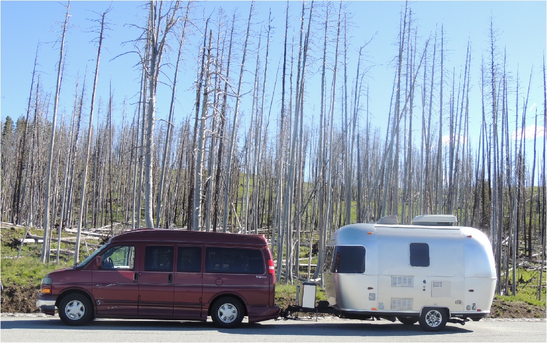 Canyon Campground had no hook-ups and we were mostly in the company of tents and other very small trailers. We had a generator that could keep our camper battery charged, perk morning coffee, and recharge the iPADS, iPHONES, Kindle, and Camera. The Canyon Visitor Services also had pay showers, and we were given free tokens for two showers each! Although our campsite was a bit small , the campground location in the tall pines was beautiful. 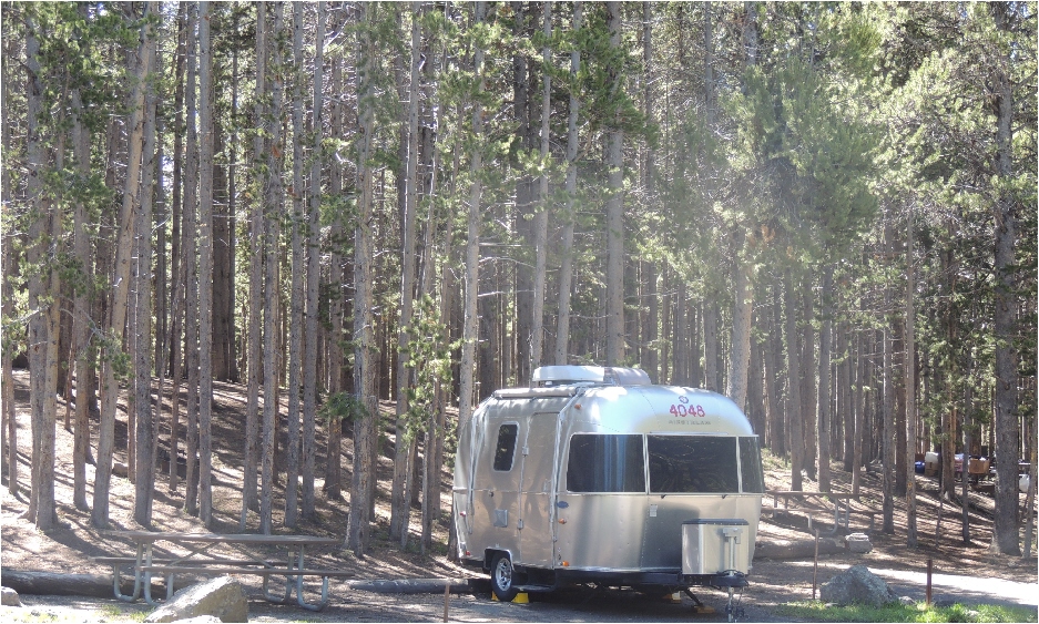 With housekeeping duties accounted for we moved out to tour the Canyon area of Yellowstone. Two rim drives (north and south of the Grand Canyon of the Yellowstone), 2 waterfall brink walks (upper and lower falls), 6 viewpoint lookouts, 1 grand lodge tour and 1 gift shop walk-thru. We also saw a little wildlife along the way! 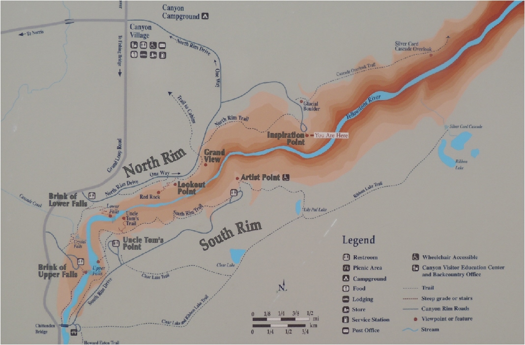
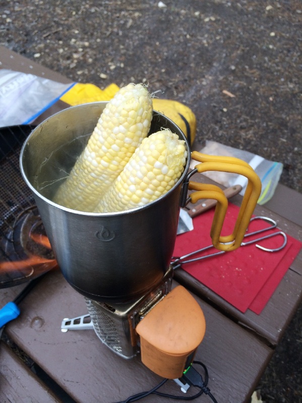
By 3:30 we moved on to the Lake area, where Ella had worked several summer seasons during the early 1970’s as a maid and then a cleaning inspectress in the hotel, followed by governing a cleaning staff in charge of 400 cabins in the Lake area. Every time I come back to Yellowstone it is fun to see the things that have changed, and the things that have stayed the same at the Lake Hotel. It has been over 40 years since I worked here, and I still feel an intimate “insider’s” familiarity with all things Yellowstone. 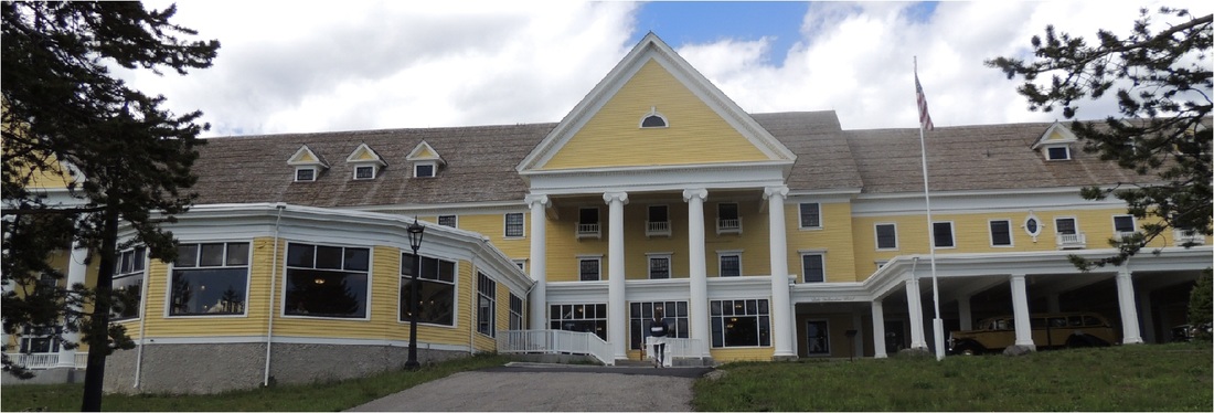 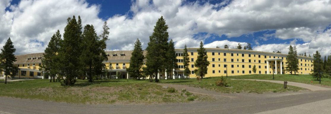 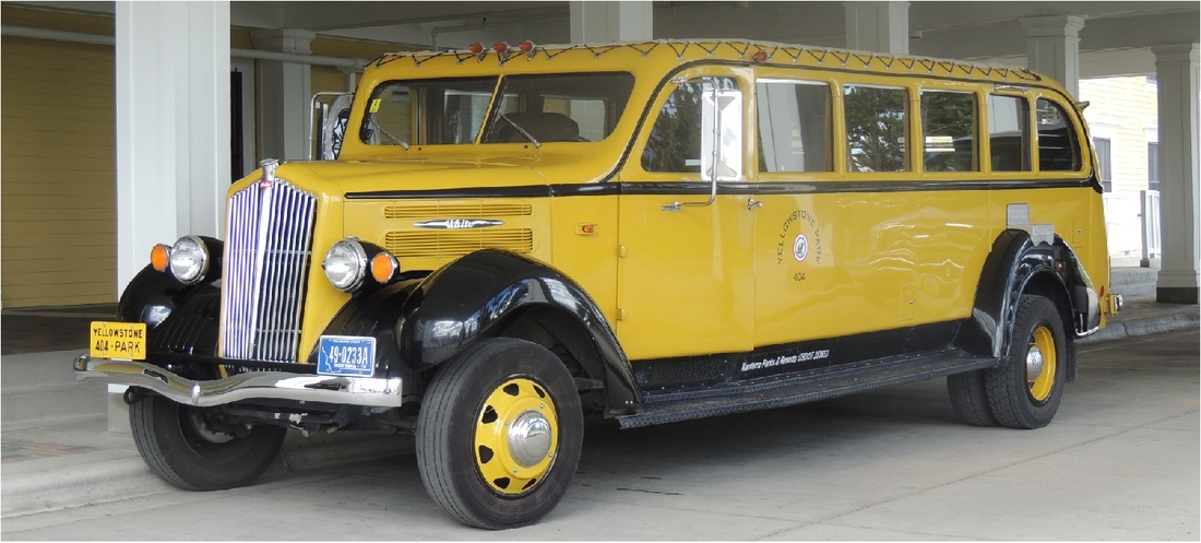 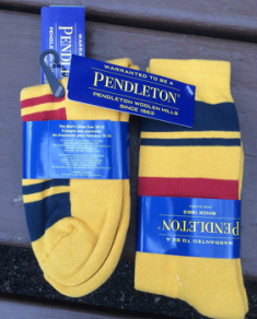 Wanting to buy some sort of souvenir from the Yellowstone Lake area, Tom and I browsed the General Store. The weather is much colder than we had planned on (high today of 61 and lows in the low 40 tonight) so we bought matching Pendleton wool socks to sleep in. We returned to our Canyon campsite by 5:00 to cook a special commemorative dinner for our first night in Yellowstone: Roasted potatoes, corn on the cob, grilled lamb chops with Huckleberry sauce, and our favorite Lancer’s Rose wine!
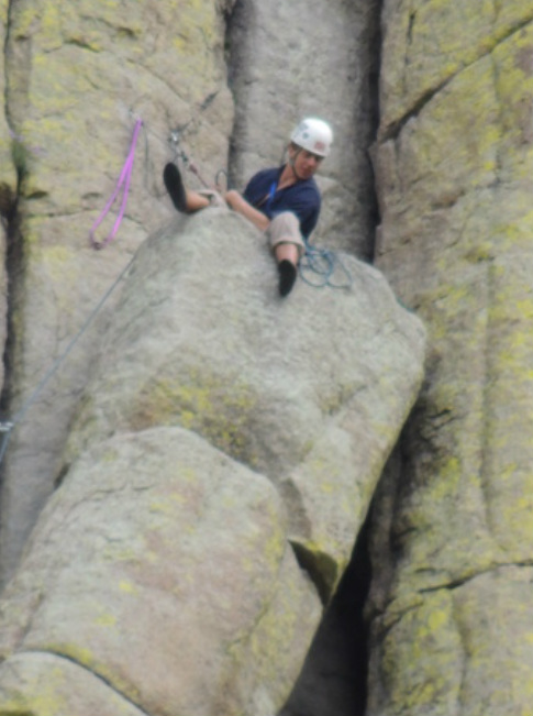
Here is a picture of our playground for the next 3 days!  Our morning drive jogged us briefly on I 90 and then on Wyoming 24 to Devil’s Tower. In 1906 President Theodore Roosevelt proclaimed Devils Tower the first National Monument under the new Antiquities Act. It is a most improbable geological rock formation, sticking up in the air above the surrounding valley like some giant, prehistoric tree-stump. 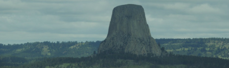 Our first views of the tower were breathtaking. The tower rises 867 feet from the base and the dome is 1.5 acres in size.We trekked around the base in about an hour with different views on all sides. Almost 5,000 climbers come every year from all over the world, and there are 220 routes that have been followed to the top. Today we were lucky that we saw climbers in several different locations. 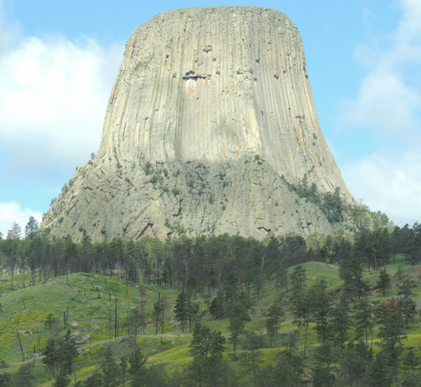 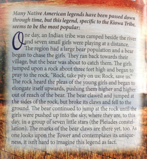 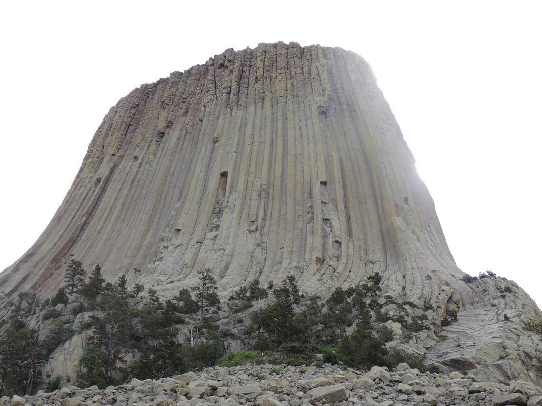
We had lunch in the parking lot, and then set out for Cody, Wyoming, still 350 miles away. Along the way we slipped past Gillette, Wyoming, where hundreds of Airstreamers were gathering for the yearly International Rally. Some day we will go to that Airstream rally. At Cody we got the last camping site in the Absaroka RV Park and quickly set up and headed out for downtown Cody. We did some shops and saw some of the downtown cowboy shoot ‘em up show in the streets. We ate at Irma Hotel built by Buffalo Bill Cody in 1902 -- a lovely and historic meal! 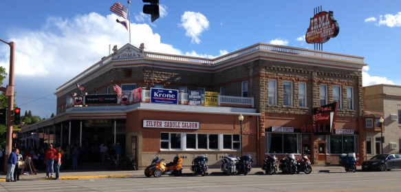 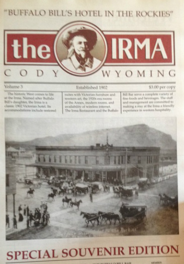 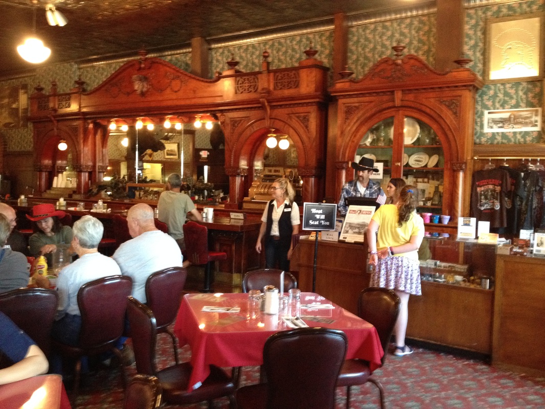 Tomorrow is an easy drive into Yellowstone! Come back to hear all about it!
|