|
Monday, July 24, day 29 Leaving the KOA at 7:00 a.m. we drove over the White Mountains via the Kancamagus heading west for New York and Fort Ticonderoga. Scenic back roads began to wear a little thin with only the small print of the atlas as a map, but by 12:30 we were touring Fort Ticonderoga. It was hot, humid, sprinkling rain, and not very good conditions for touring with Charlie. Tom jumped on the guided tour and I took Charlie back to the Airstream and left her with the windows open and the fans on high. Catching up with Tom, I got in on some of the history of the fort: “Two wars, five battles, one fort.” 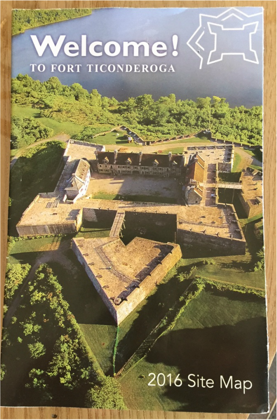 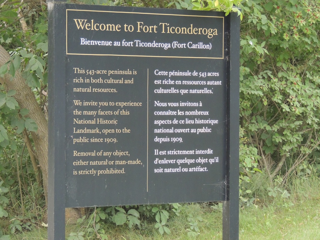      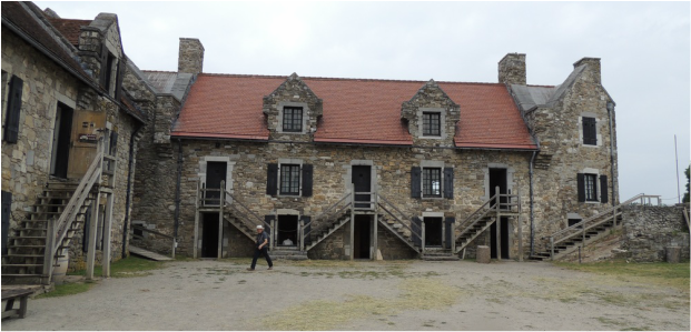 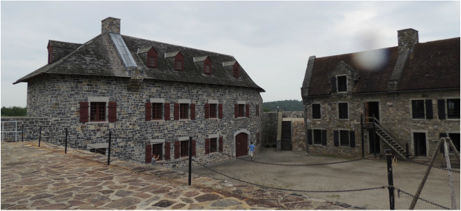 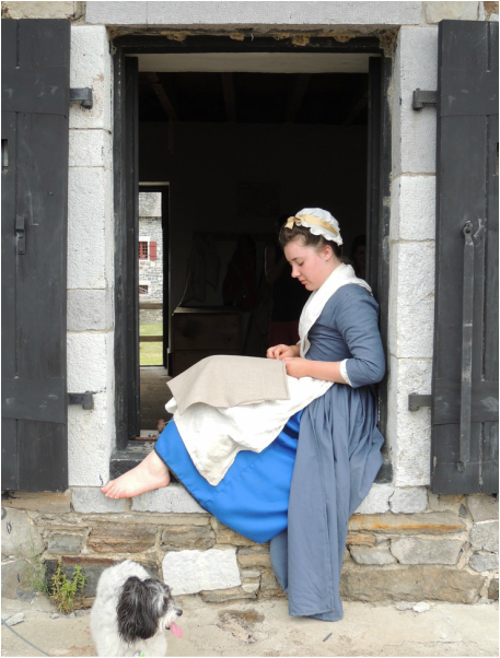 Tuesday, July 25, There is that moment in all trips, where thoughts turn to home. All it took was one look at the map and a quick calculation that 10 hours would do it – and home we headed. A total of 30 days, 6,240 miles (4551) of those pulling the Airstream, and it was good to be home!
0 Comments
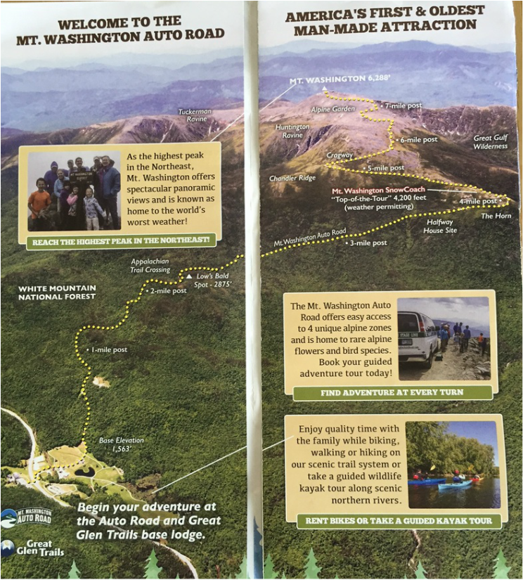 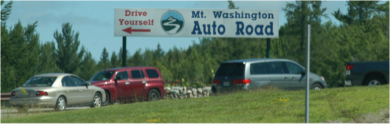 Mount Washington! Tom had ridden the cog railroad as a young child to the top, had hiked to the top with Micah 25 years ago, and now wanted to drive the legendary auto road. Mt. Washington, and the road itself are truly historic. At 6288 ft. Mt. Washington is the tallest peak in the Northeast. Although there are much taller peaks in the world, Mt. Washington is renowned worldwide for it’s fierce weather, and the highest land wind speed ever documented of 231 mph! It was first ascended in 1642, and fairly frequently in the 1800s. The first Summit House hotel was constructed in 1852, and a year later a carriage road (today’s auto road) was chartered and the Tip-Top House, which still stands today, was constructed. In 1861 the carriage road was completed and in 1869 the Cog Railway (the world’s first mountain-climbing train) began summer service. In 1870-71 the summit was occupied by a scientific team for the duration of the winter. The “firsts” and facts go on and on, and are wonderfully narrated by a CD that you are given when you purchase your pass to drive the 8-mile auto road to the top. 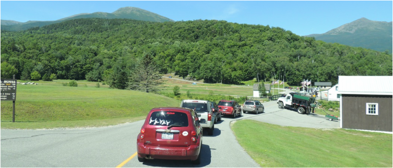
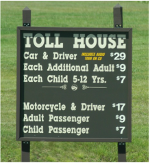
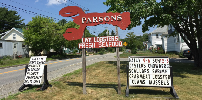
As we approached the toll booth there was a line of a dozen cars and motorcycles in front of us. From the get-go the road was very narrow, although there was not immediate cause for concern of the cliffs and the heights. The road wound through a Northern hardwood forest, and then into a spruce-fir forest and finally a balsam fir forest. At 4000 feet, the trees were twisted and stunted from the tension between the forest and the alpine zone. Above 4800 feet where there is mostly cold, snow, fog, rain, ice, rock and relentless wind, trees cannot survive, and there were hard rock boulders. And, this is when the road (with glimpses of the depths below) goes from intriguing to terrifying. With no trees to block the views, the narrow ribbon of road is all that cars have to cling to – and the uphill and downhill drivers have to share it! 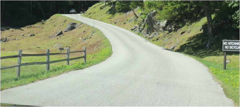 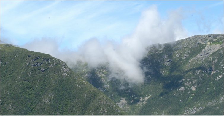 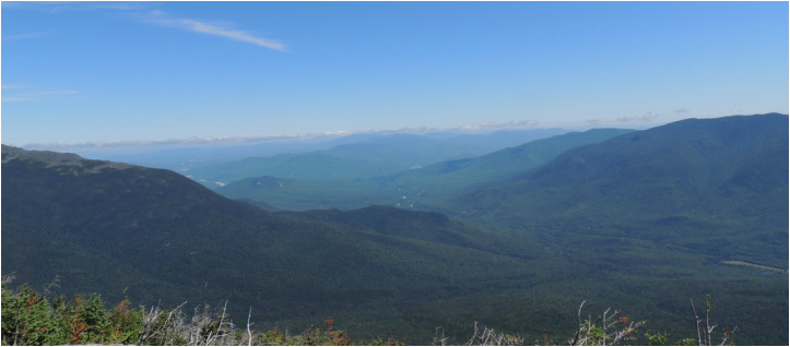 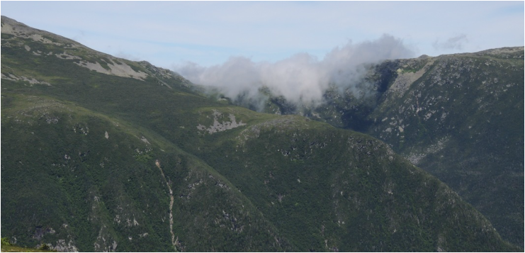 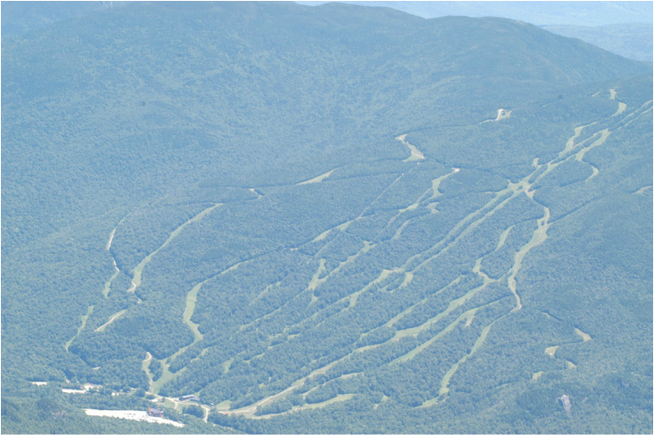 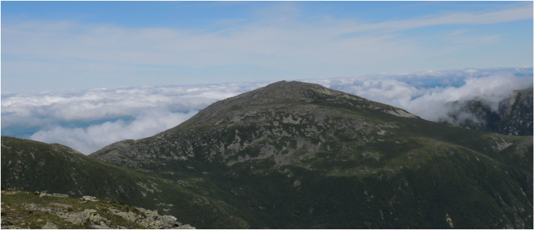 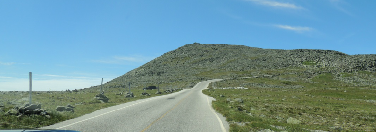 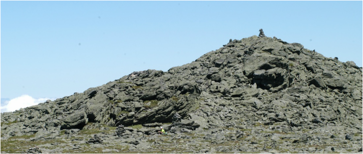 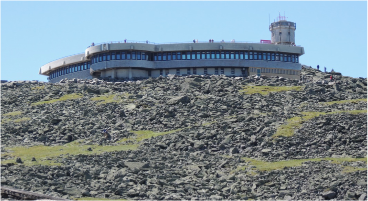 At the top, once the heartbeats slowed down and Tom took his first breath, there was much to explore. Foremost, of course the view, and also the still-existing original structure the Tip Top House. There were lots of people mingling around; some had driven the road some had ridden the cog railroad, and some had hiked one of the various trails to the summit. There were plenty of opportunities for pictures. 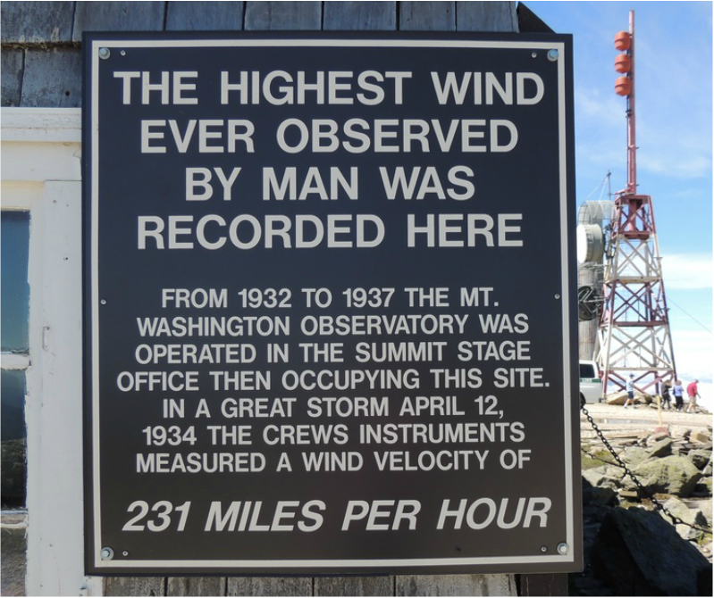 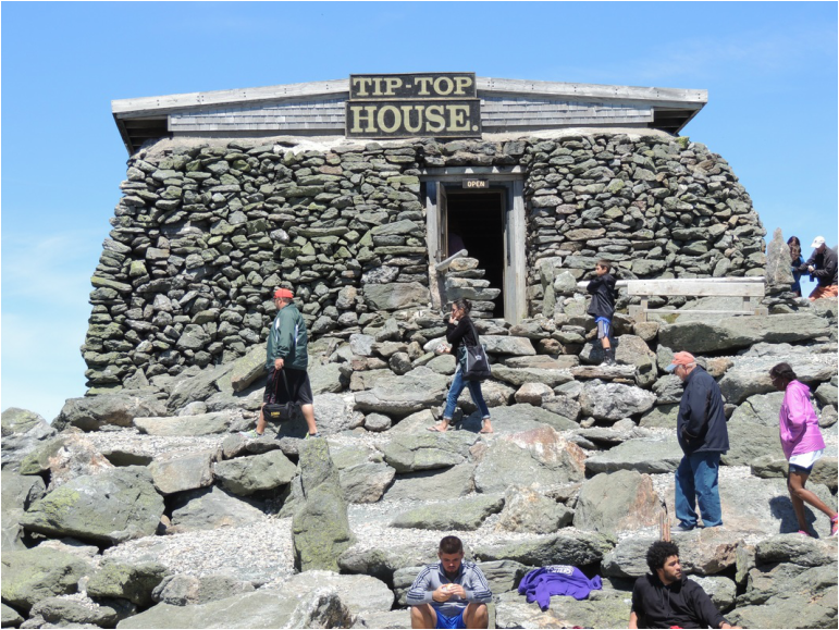 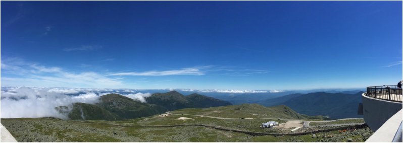 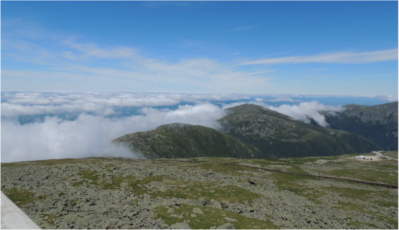 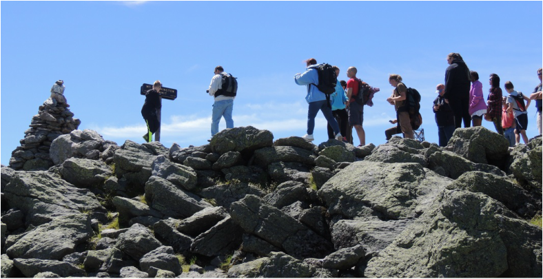 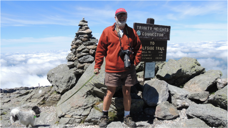 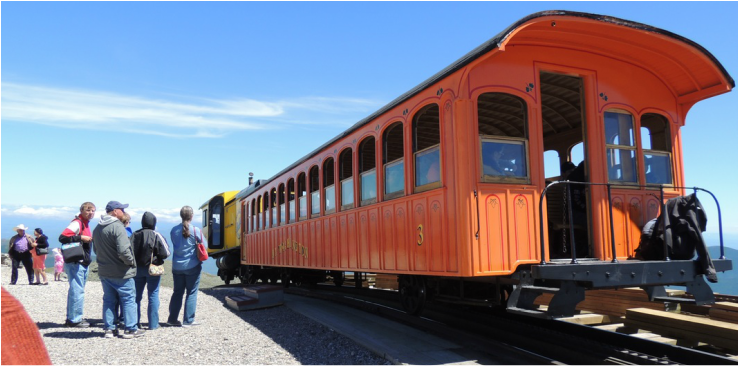 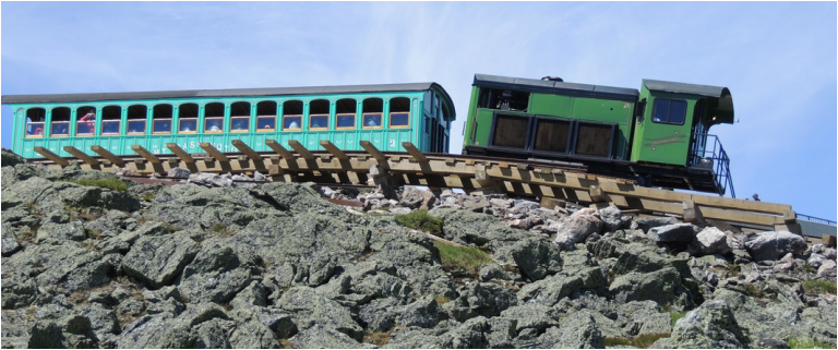 The trip down was almost as nerve-wracking as the trip up, except for the knowledge that the view was getting easier to "view" minute by minute (It was very important for Tom to keep his eyes open at all times no matter how close to the edge the cliffside tires were forced to run.) 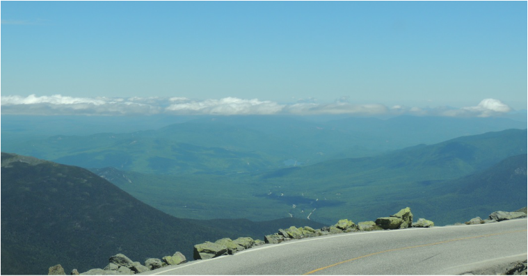 We didn’t get down from the mountain until 2:00 and had a late lunch at McDonalds...I just had to try their Lobster Roll. At the KOA we did some chores (beating the sand out of everything and working on the blog) by 7:00 we were still not hungry enough for dinner. It was a perfect opportunity to drive into town and indulge in an ice-cream-for-dinner splurge, and then back to the Silvermine for showers. I'll leave you with a picture of my McDonald's Lobster Roll . . . pretty darn good if you haven't had lobster for 48 hours! 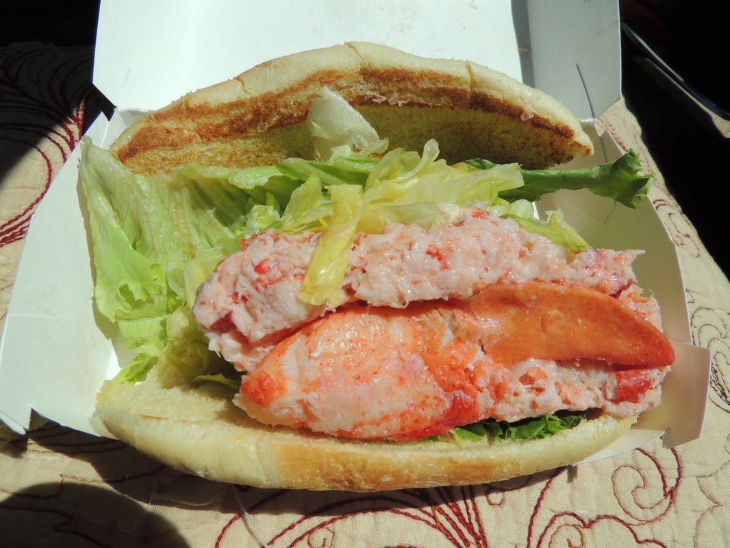 Saturday, July 23, day 28 Evidence of hard rain was all over the campsite Saturday morning, but the rain itself had moved out of the area, leaving it a bit cooler. By 8:30 we were on the scenic Kancamagus Highway inside the White Mountains National Forest. Route 112 is a 34-mile long route between Conway and Lincoln with many stops along the way. At the far end we stopped in the little town of Woodstock to stretch our legs in a few shops, and then headed back to the Silvermine for lunch. 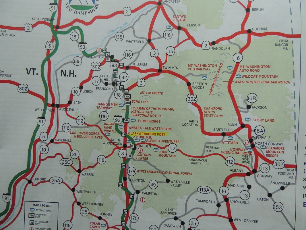 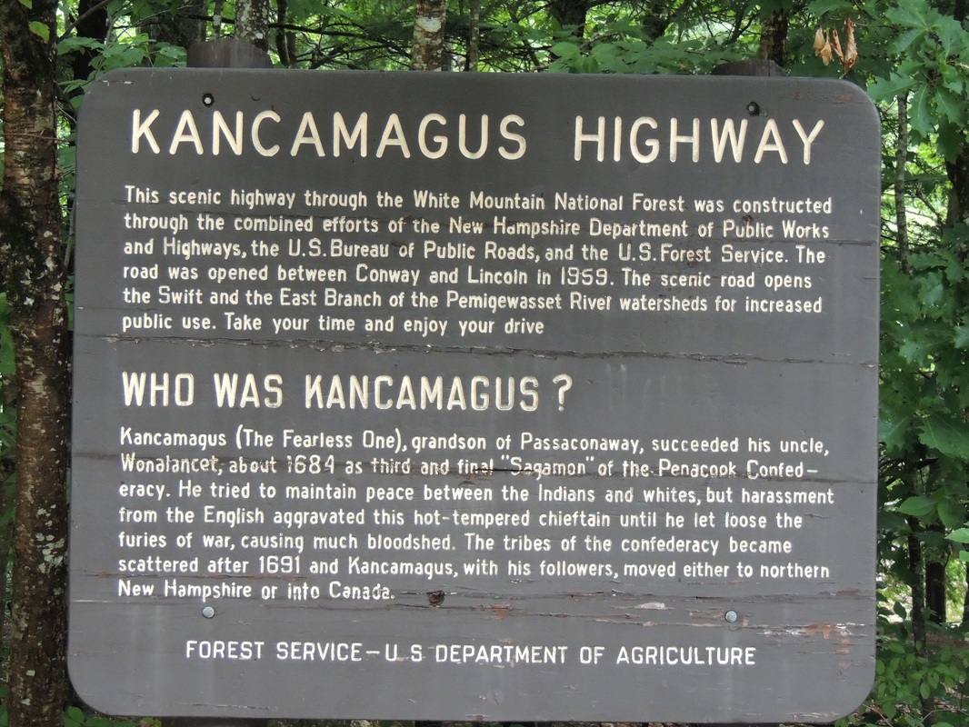  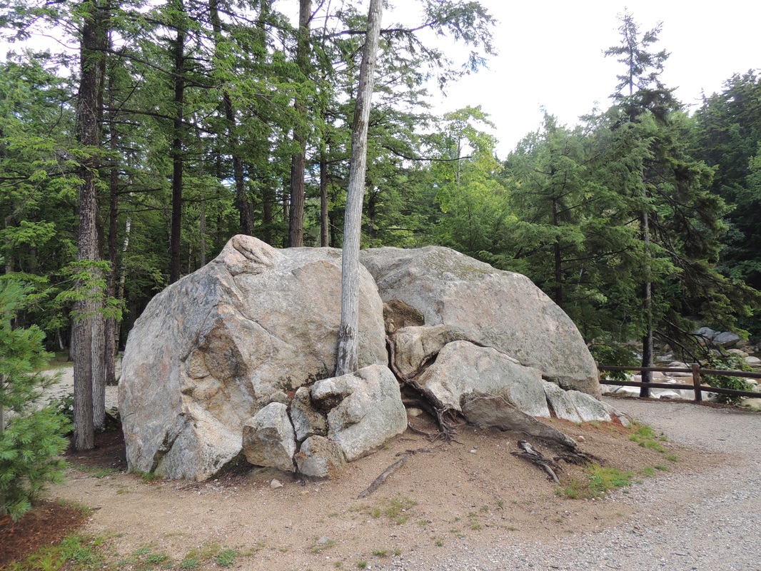 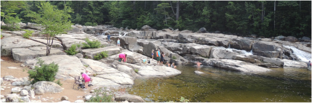  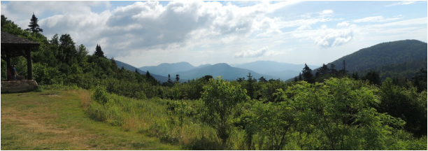 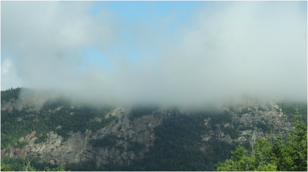 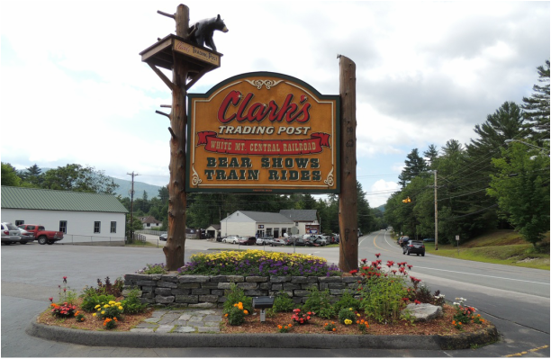 Dinner was a special pleasure – a ride on the Conway Scenic Railroad – in the dining car! The vintage train departed from the 1874 Victorian station at 6:00 p.m. Our car, the Chocorua was built in 1929 and offered a first-class dining experience; all the gourmet meals were prepared on board! The other couple assigned to our table was congenial, and we thoroughly enjoyed the 2 ½ ride. The scenery part of the scenic railroad trip was not that great, but the overall experience was distinctive. 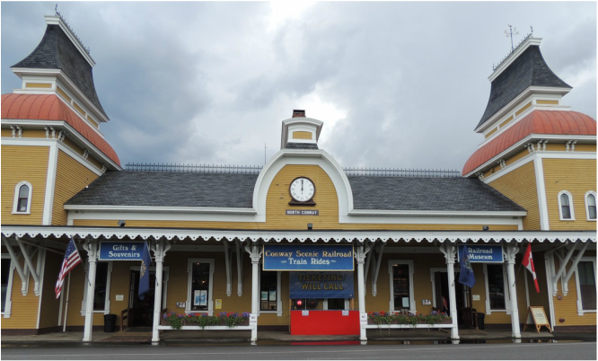 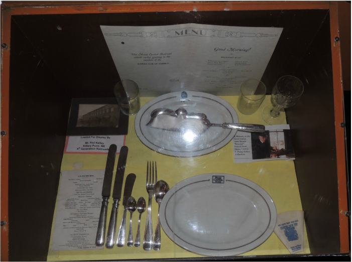  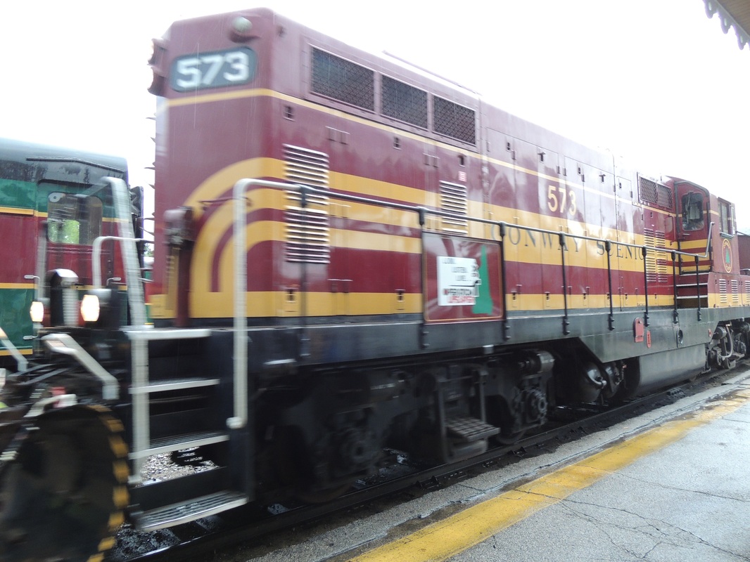 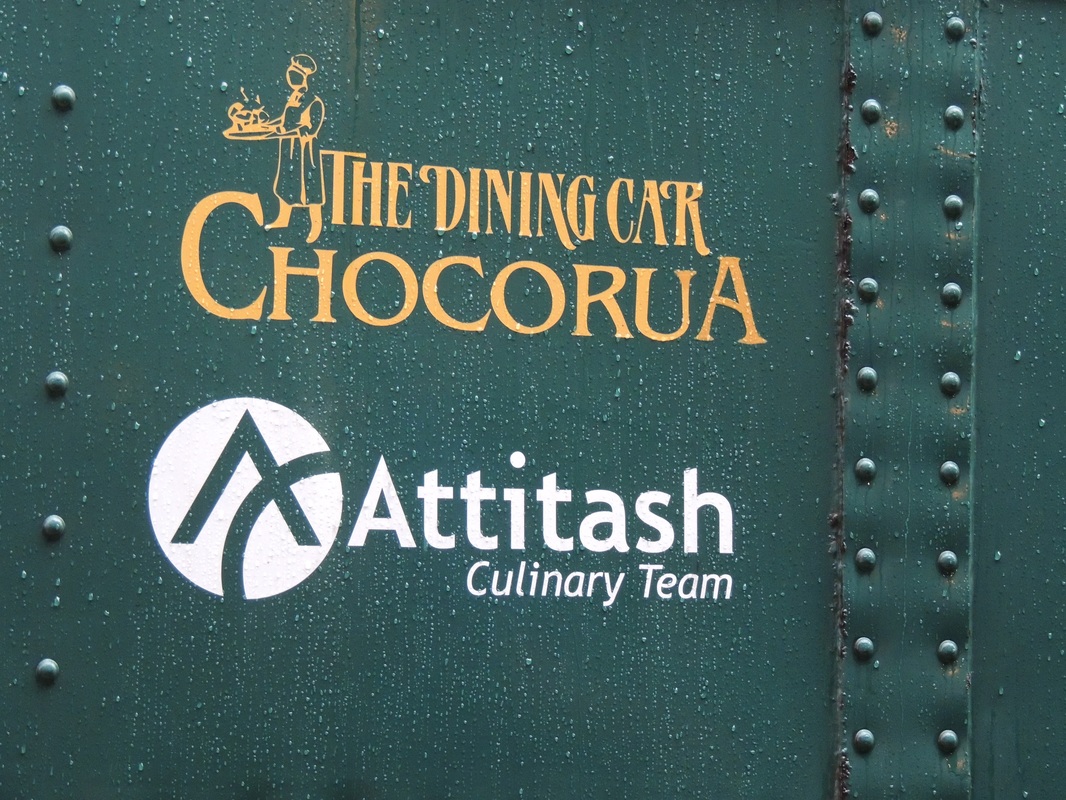 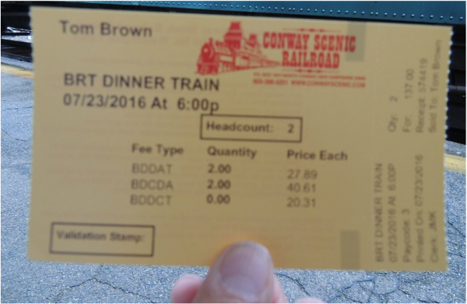 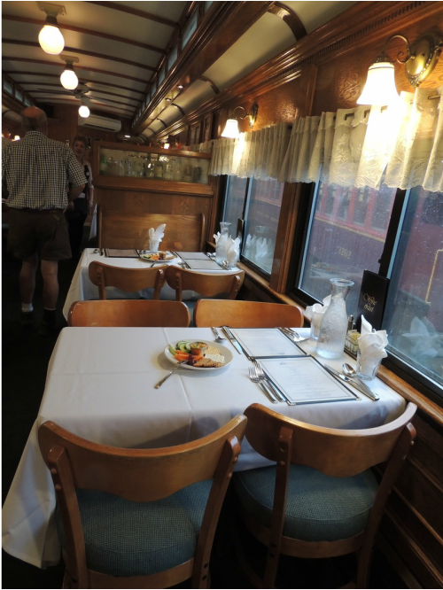 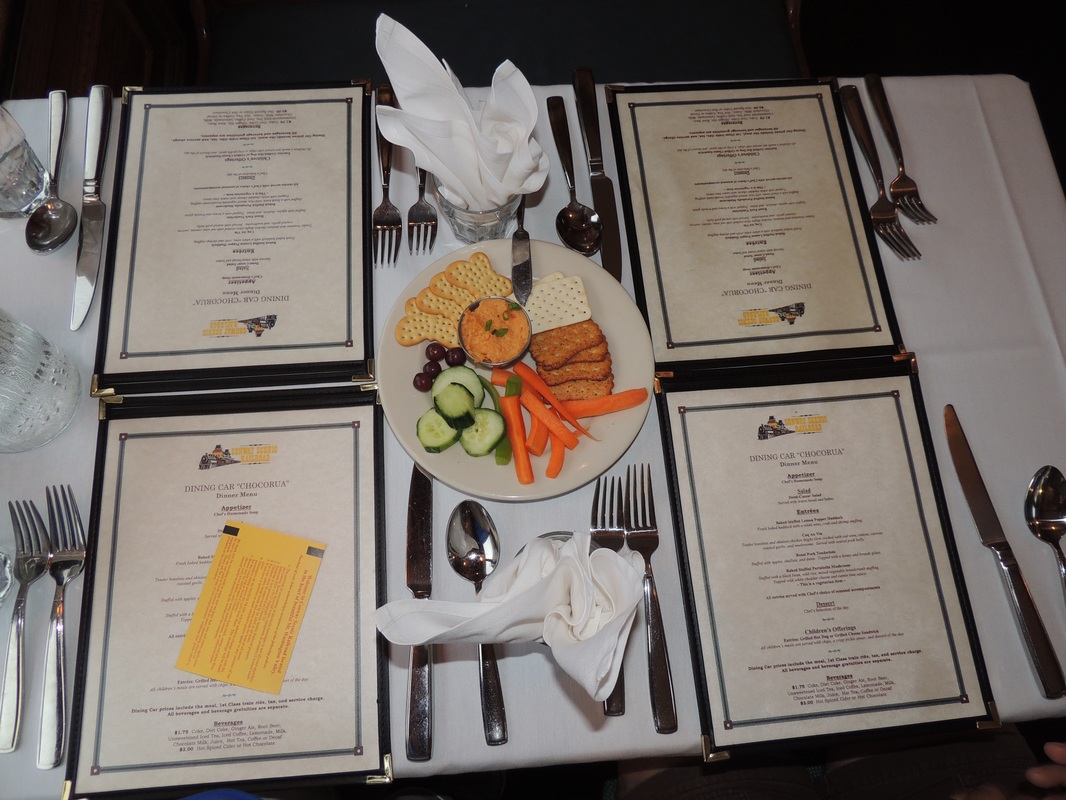 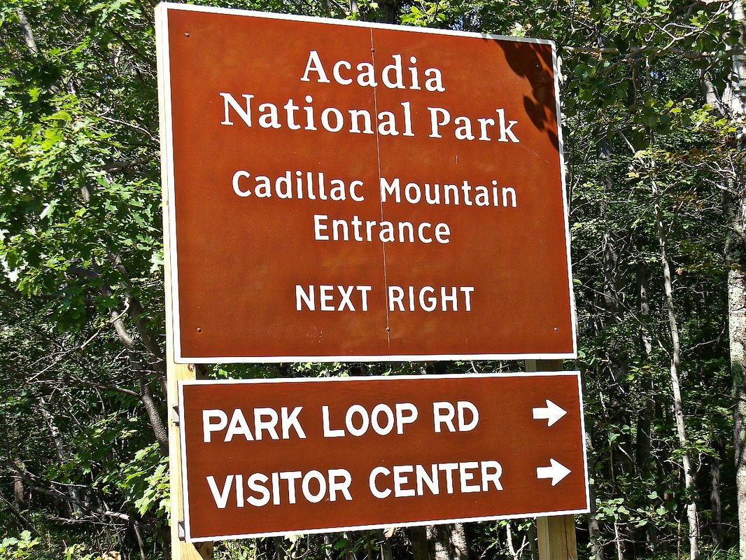 Thursday July 21, day 26 Twenty-five years ago when we were here with both boys, we watched the 4th of July fireworks, launched off a Navy cruiser in Bar Harbor, from the top of Cadillac Mountain! We have been to Cadillac Mountain since that time, and it is always a stunning drive. Less than 5 miles in length and very winding, the road transforms quickly through spruce forest to bare granite rock bolders . . . 1,500’ up. The view is not quite 360’ – but almost! 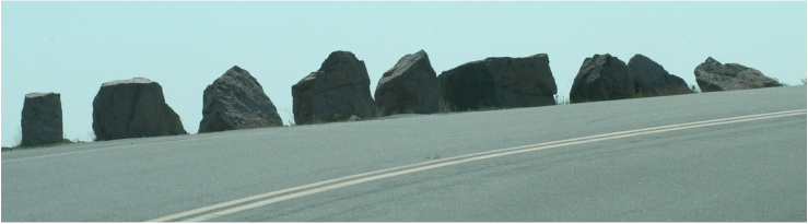 Guard rails on Cadillac Mt. road 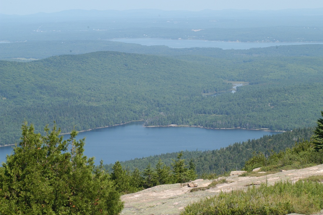 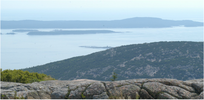 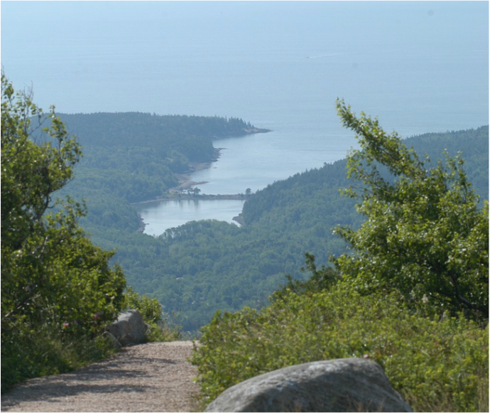 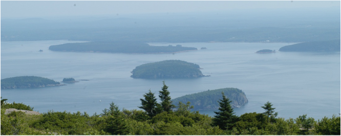 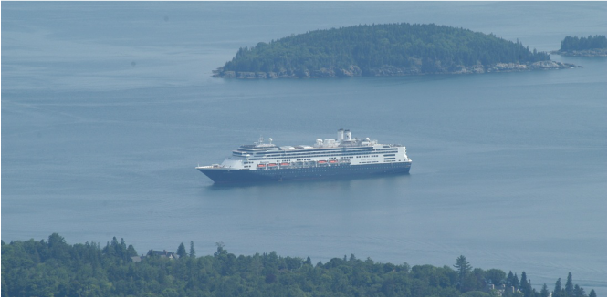 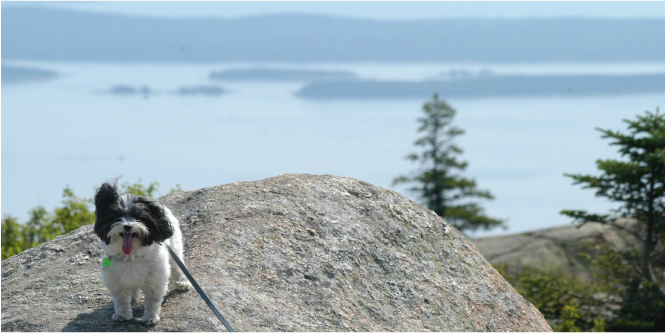 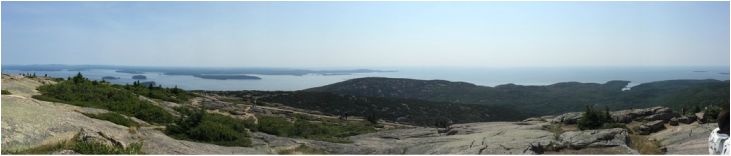 We brought Charlie back to the camper and dropped her off for a nap and headed into town for lunch. Bar Harbor has all the trappings of a good little tourist town – shops featuring souvenirs, arts, and crafts fashioned by Main artisans, and lots of restaurants. Of course, Lobster is the feature of many of the menus – we opted for Calzones! On the way back to the camp we stopped at Parson’s, a lobster market and a place that we have been coming back to every visit for 25 years. This will be our 4th and last lobster meal on this vacation and we did it right at the campground.
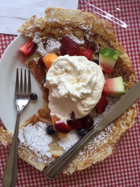
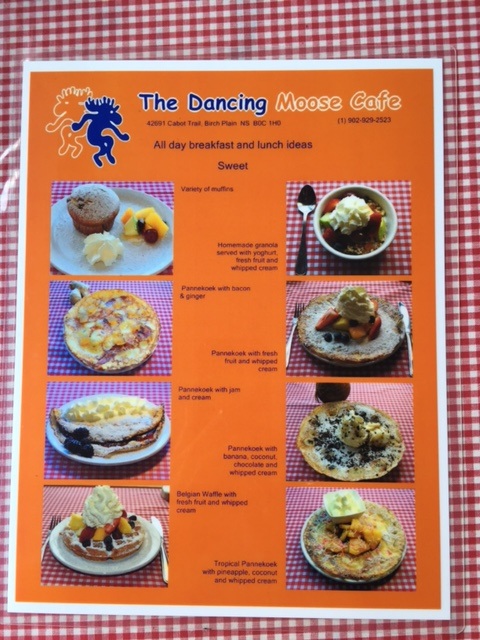
 Friday, July 22, day 27 Ready for the next slice of this trip, we were hooked up and departed Blackwoods Campground by 7:00 a.m. – destination New Hampshire and the White Mountains. The elevation climbed as we entered the White Mountains and we saw Mt. Washington off in the distance (home of the world’s worst recorded weather!) with fog and dark grey storm clouds engulfing it – it was 93degrees as we drove past. I scoped out the temperature on top of Mt Washington to find that it was 56 degrees! Our KOA campground was just 40 minutes away south of the little town of Conway and we arrived by 2:00. After setting up we headed back into Conway where there was an L.L.Bean outlet store (everything was discounted – but not by much!) and a Camping World. I bought a thick outdoor polypropylene mat for the camper – turned out we would need it as we got buckets of rain during the night. The next day our real sight-seeing in the White Mountain/Mt. Washington area would start early! 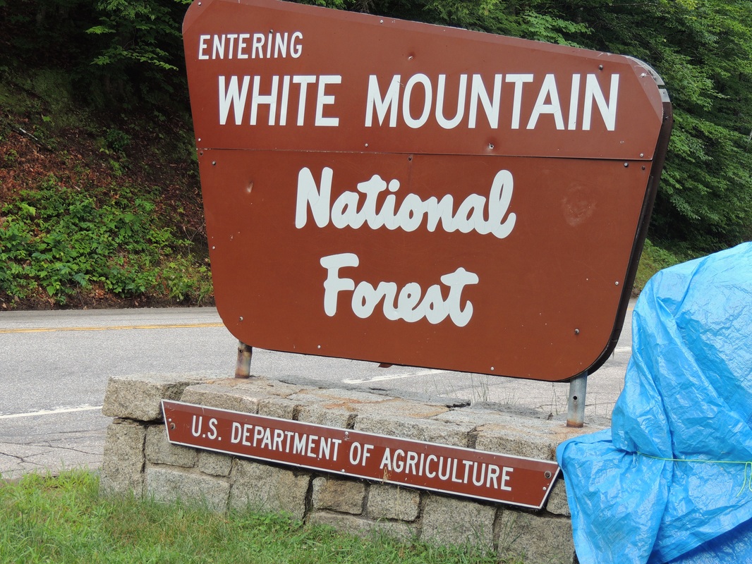 Monday, July 18, Vacation Day 24 It was a good thing we were up and gone early in the morning (6:30) because we had a two-hour snail delay through a construction zone. Stopping for 30 minutes at a time, and then inching forward, I still can’t figure why the back-up was so bad, or why there wasn’t more organization to the traffic pattern through the construction. Our destination was to Truro in New Brunswick, hoping for a chance to see the Tidal Bore in the Bay of Fundy; a phenomenon where the tide comes in as one single wave at high tide, rather than a series of surges. We had seen it several years ago at midnight, and had hoped for a daylight presentation this time. Skip ahead several hours . . . . . . . we missed it by 20 minutes! But, we did visit the Tidal Bore Inn where we stayed when we were here several years ago with Caleb. On that trip we had left the camper in Acadia and drove up for one night, and Tom got us a room at the Tidal Bore Inn. I had expected a romantic little quaint lodge, but it turned out to be just an plain-Jane motel, with screen windows and fans, but no air conditioning. I took this picture for Caleb! 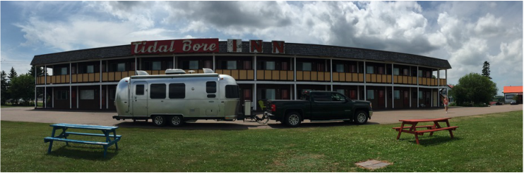 We ended up for an overnight stop at Camper City in Monkton, NB. This is the location of the famous magnetic hill which we have previously visited, but passed by this time. Tuesday, July 19, Vacation Day 25 A two hour morning drive got us out of Canada, through customs, and back in the world of miles per hour and dollars per gallon (vs kilometers and liters!) From there it was a backroad drive to Bar Harbor and Acadia National Park. The Blackwoods campground is just as I remember it – deeply wooded and shaded with lots of trees and growth between the campsites. We scored a long pull-thru campsite that was extra wide with plenty of room to spread out. No electricity, water, or shower houses – but we were fully prepared to “rough it” in this beautiful setting for 3 days. It was 75 degrees and breezy under the awning! Quick trip to hike the streets of Bar Harbor and the stores, then back to the camper for lobster dinner. Here is a picture of our wonderful set-up at Blackwoods. 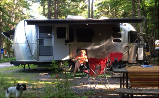 Wednesday, July 20 At 8:30 a.m. we jumped on the one-way Park Loop Road and headed out to tour Acadia. First stop was the Schooner Head Overlook with a short hiking path from the crest of the cliff down to the rocky shoreline. 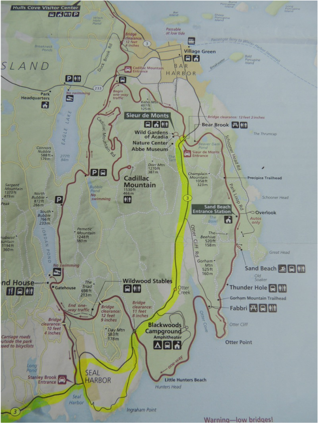 On around the road was Sand Beach (no dogs allowed) complete with changing rooms, outdoor showers, and people sunbathing and swimming. At this point the road follows a cliff trail down and beyond Thunder Hole. The last time we were at Thunder Hole it was thundering – today it was very calm with a few peaceful gurgles. Tom rock-hopped his way down to the seaside for a water sample, over-estimated the distance and ended up with wet feet. That was the extent of our water-side exploration.    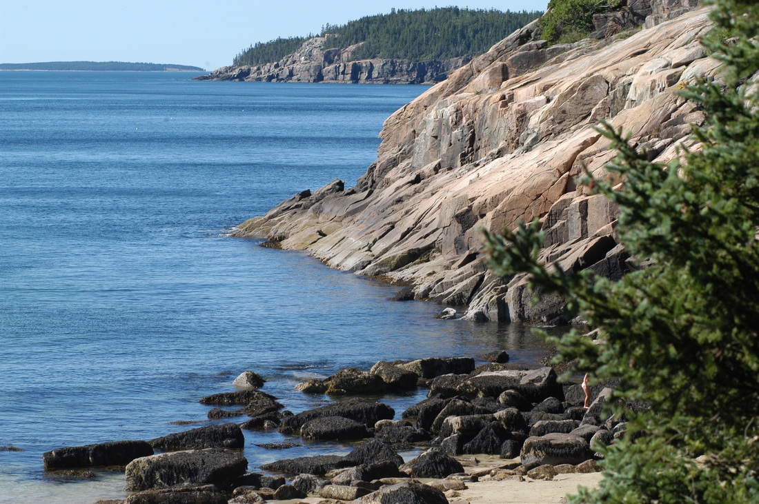 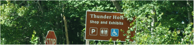 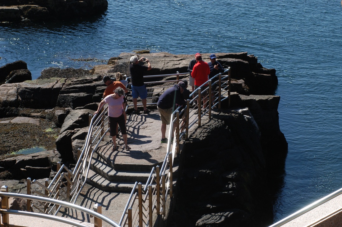  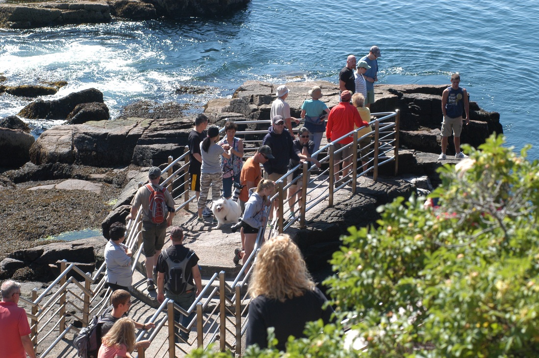 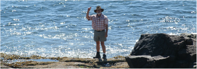 We ate lunch at the camper and headed back out to see Seal Harbor (no seals) and Northeast Harbor which seemed to be a nice mix of working lobster boats and pleasure/sail boats. One thing we are not doing on this trip, as in years past, is getting off the hiking paths and rock-hopping along the sea cliffs. Hips, knees and ankles prefer the well-worn path. Back around the rest of the loop road we avoided the turnoff to Cadillac Mountain and saved that for the next day. 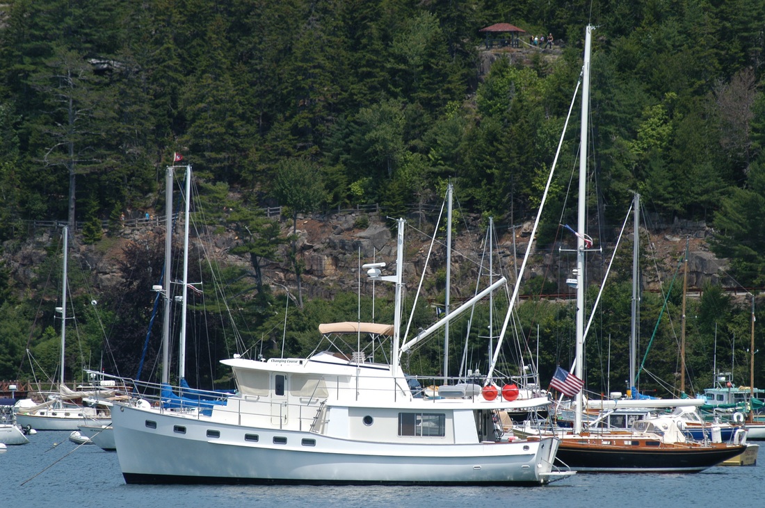 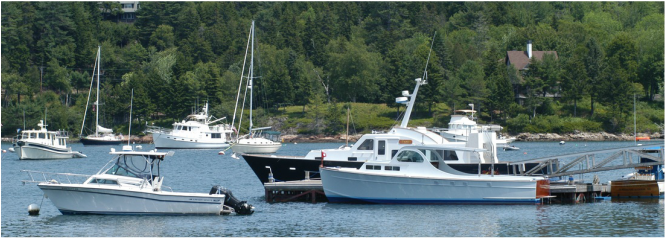  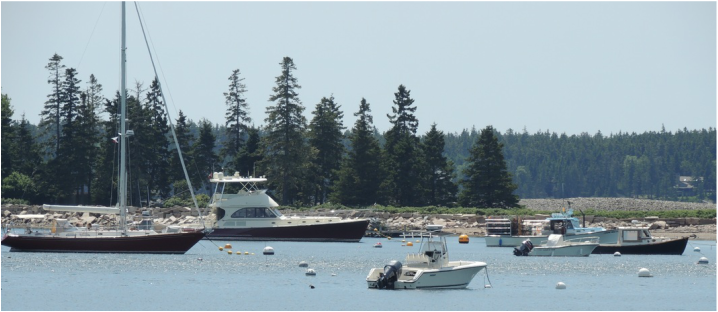 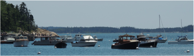 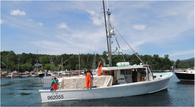 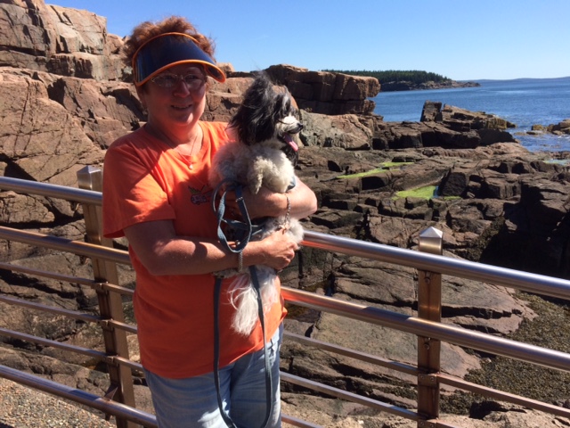 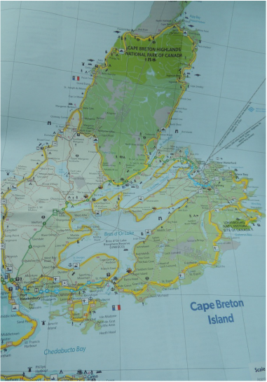 Day 21 of the vacation, Friday, July 15: We entered a time change yesterday, and I am not sure how I feel about it. This morning I got up at 6:00 – by my internal clock. Of course, I went to bed earlier last night too, and the big bonus is that we have a whole extra hour to get where we are going today. All in all it is a good deal. Today’s drive took us deep into Nova Scotia . . . with a destination of Cape Breton National Park which covers most of the tip of the island. In the town of New Glasgow we stopped for a grocery buy and a beer/wine stop, and a sandwich lunch, and then continued with the coast scenery getting more picturesque by the moment. Our campground, Cheticamp, is inside the park boundary and has full hook-ups . . . and wifi! There are even 4 other Airstreams and an Argosy in residence. We went for a walk and met about half of that population! I spent the evening posting to my blog (I am about a week late!) and then we took a short drive to scout out for tomorrow. 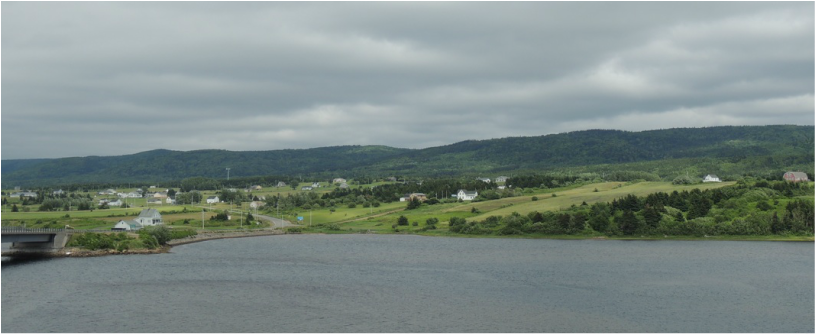 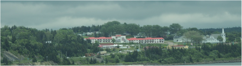 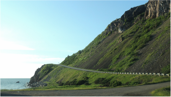 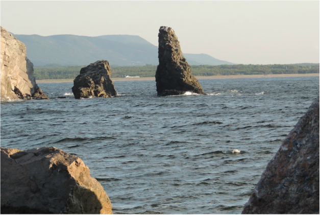 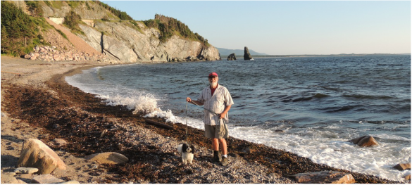 Saturday morning, on the famous Cabot trail, we followed along the coast of the Gulf of St. Lawrence and Cape Breton National Park. This scenic roadway offers options of hiking trails and viewing points every few miles, with promises of wildlife: bear, moose, whales, eagles, and even carnivorous plants. 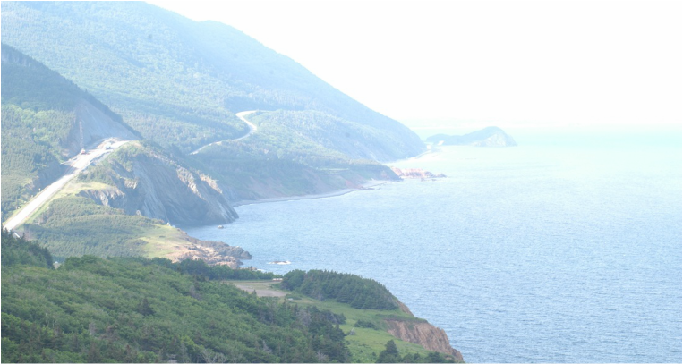 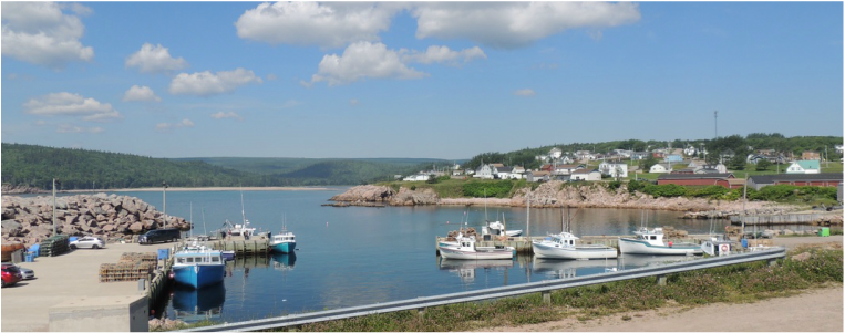 Our first hike was a bust – just an old road – that might have opened out into a good view after a couple of hours, but we didn’t give it the chance. Our second hike was just a little boardwalk around a bog. The signs said you “will probably” see a moose. Payoff. We came upon a smallish/juvenile moose that was stuck up to his withers in the bog. He huffed and puffed and grunted and he could NOT pull himself out of the marshy mess. Suddenly, the mother, we think, appeared, and she ambled (not really in a state of alert) into the quagmire beside the juvenile but could do nothing to help him. She came out and moved off as other people came along the boardwalk – we all knew better than to get between the mother and the baby. The mother moved off with the youngster still trying to get unstuck. Oh Ranger . . . . ! 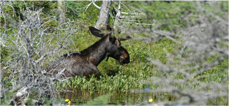 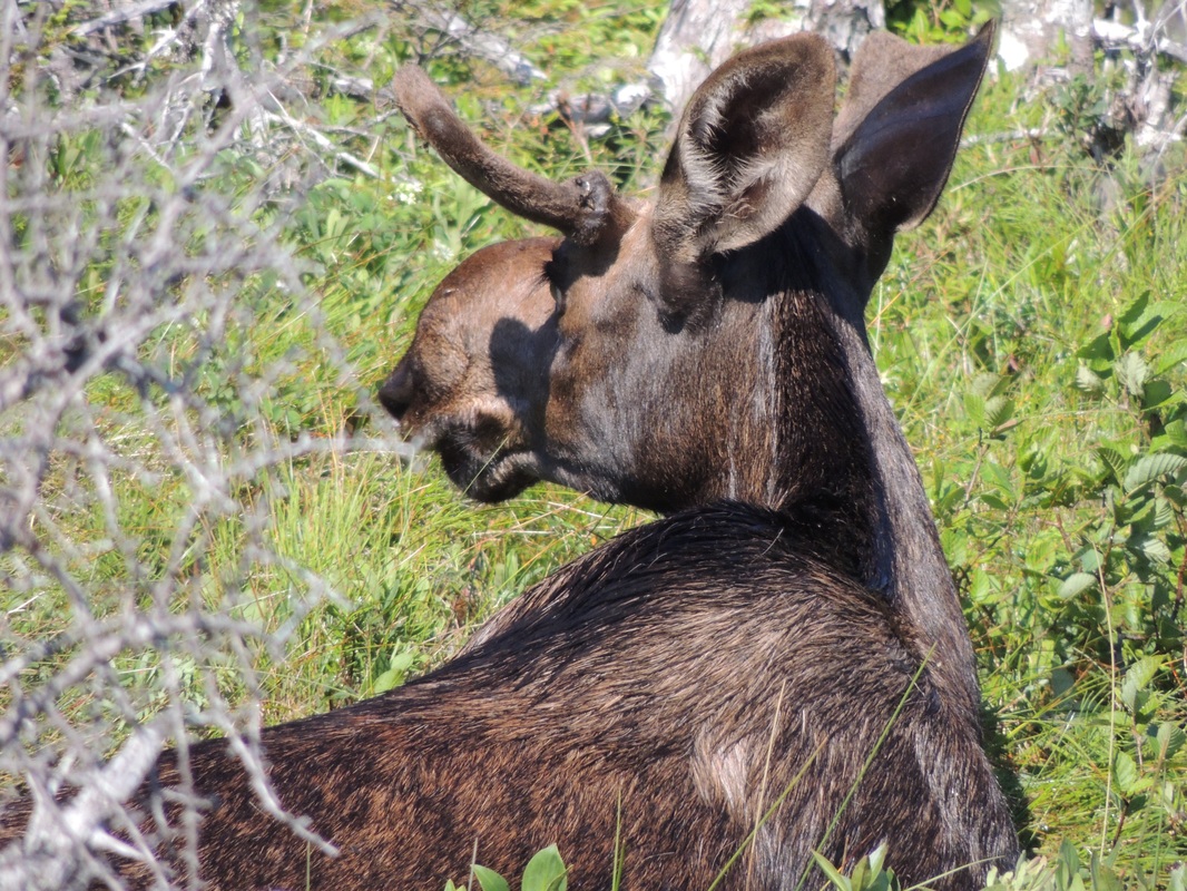 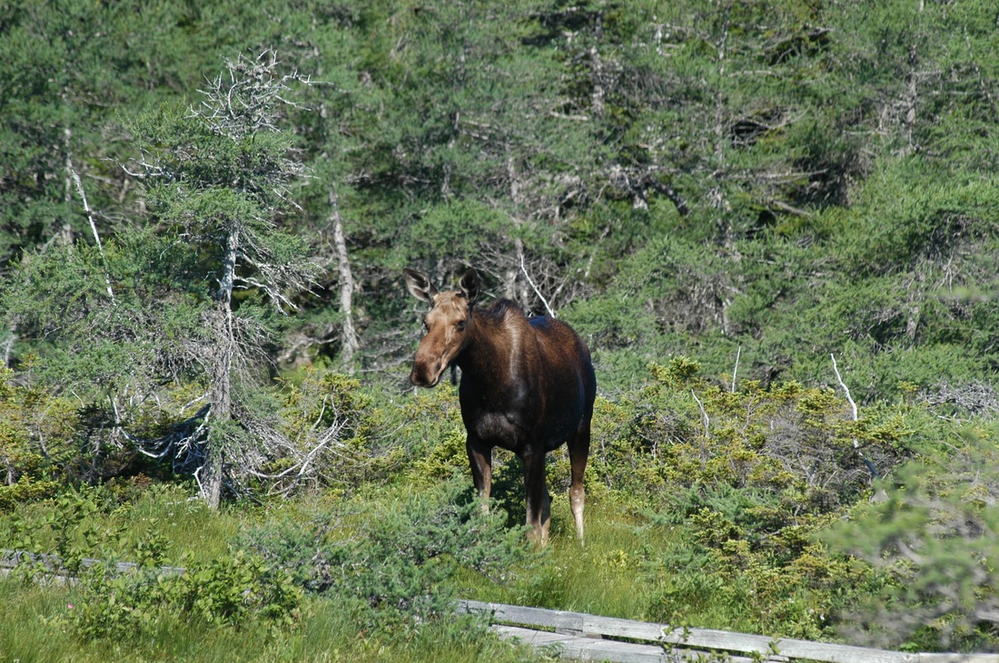 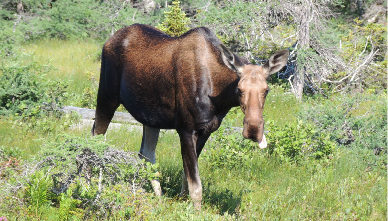 Continuing along the Cabot trail, we found a Ranger kiosk and stopped to report the moose mishap; the ranger seemed genuinely glad, probably more from concern of people getting hurt by the mother. Occasionally stopping at overviews and other stopping points, we located The Dancing Moose for lunch. Featuring a Dutch pancake cooked and topped with an infinite variety of options, it was hard to make a decision. Tom had the Farmer’s version with eggs, bacon, cheese, peppers, tomatoes and onions cooked into it, and mine was served with a good variety of fresh fruit and whipped cream piled on top.
At that point, after 5 hours, we were not quite ½ done with the Cabot trail, and we put the rest of the drive in high gear to get back to Charlie Button. Well, we did stop at the Lobster Pound to rescue a couple stray lobster for dinner tonight. 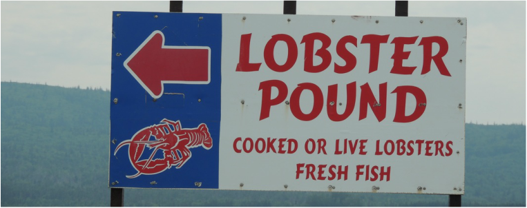 At the campground Information Center I told two girls working the desk about the juvenile moose; she said they had heard about it over the radio, and the trail has been closed all day. As I was there, an update came in that the trail was still closed! I guess our little errant moosie is still stuck! During the next two days that we were at Cheticamp we kept checking on the progress of the moose. At one point it was reported that he had been able to climb out, and then collapsed and stayed in one place for the rest of the day, They are not sure if he injured himself or if he is just exhausted. The mother left for awhile, but then was back and acting very irritated. The trail remained closed. Wish I knew the eventual outcome of the story. We slept late Sunday and went into the town of Chiticamp to wash some bedding and Tom washed the truck. Chiticamp is a real working lobster/crab town, and there is not much pretty and not much shopping to entice tourists, except there are lots of restaurants combined with fresh fish markets. There was one store that advertised “Real Hookers Work Here” and I had to stop for that. The hookers are rug hookers (not to be confused with latch-hook rugs we did as children!) who work with wool and rug backing to make intricate tapestries. The backing is stretched four ways and the hooker works small loops of wool into the pattern. When the whole thing is finished the backing is released and it springs together and locks the loops together. The finished products were horribly expensive – a 3’ X 4’ wall hanging was $800! The ladies that own the store mostly work at home, and each sign up to work a day in the store to demonstrate the process, and sell their finished products on commission. The hookings (you would never use as a rug) are lovely. 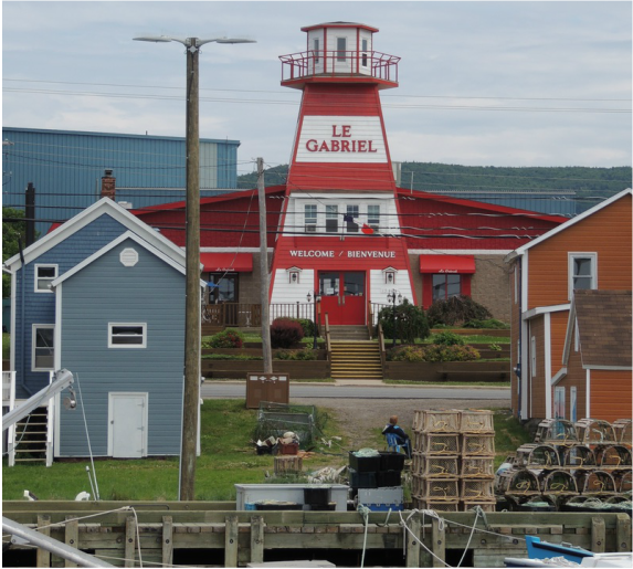 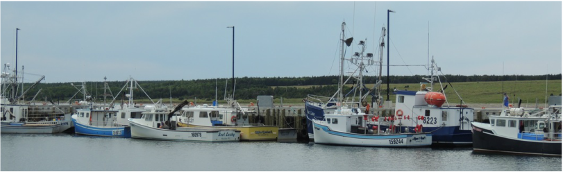 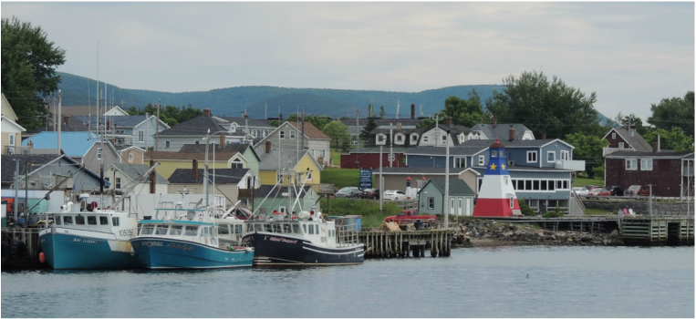 At the campground we prepared to pull out on Monday – Tom banged the dirt out of the rugs and I washed Charlie Button and we had a wonderful dinner of: BBQ chicken on the grill, roasted red potatoes, corn on the cob, salad and a fresh peach. During the early evening it sprinkled rain lightly and we enjoyed being outside and reading under the awning.
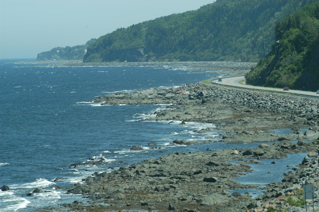
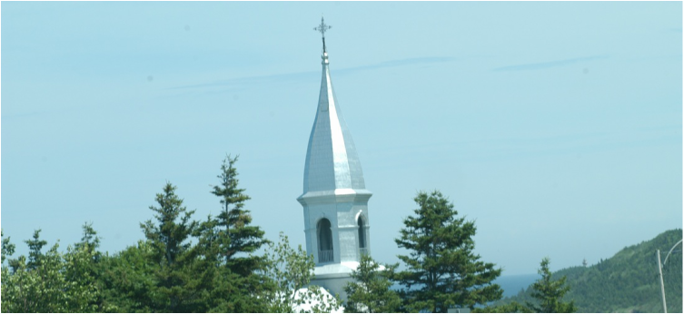
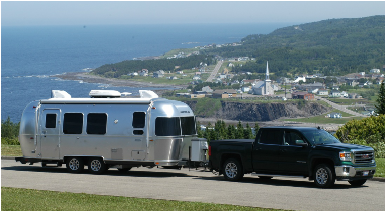
Day 19 of our vacation – our last day in the Gaspe. For a morning outing Tom had it in mind to drive to the location of the iconic rock-in-the-ocean picture -ile-Boneventure-el-de-Roch-Pierce. It was well around the tip of the Gaspe and back down the other side – about an hour drive. In the little town of Perce there was shopping, lots of restaurants, one place up on the top of a bluff to see the Rock, and several warfs along the bay with good views. We took the pictures, shopped the boutiques, and ate fish and chips at a small restaurant – best fish and chips I have ever had. Then, we headed back to the Silvermine and Charlie, and prepared to leave the Gaspe and head to Nova Scotia the next day.  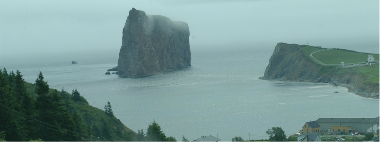 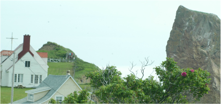 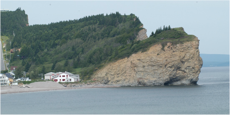 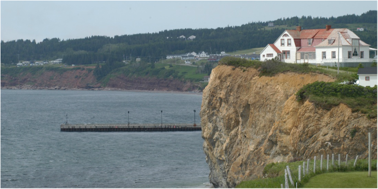 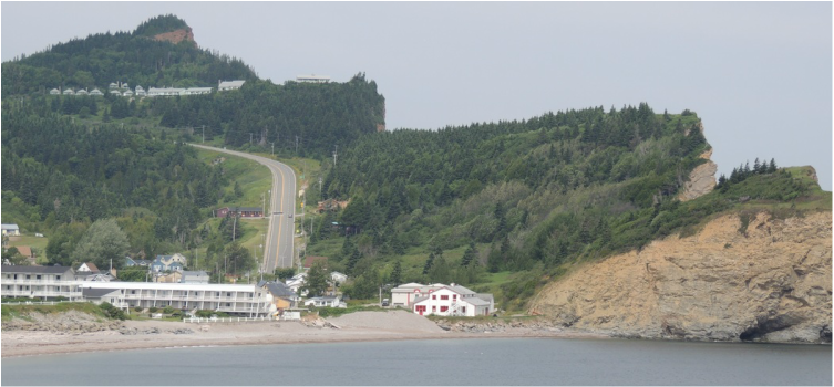 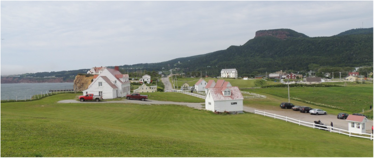  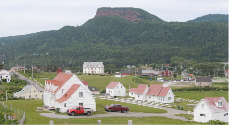 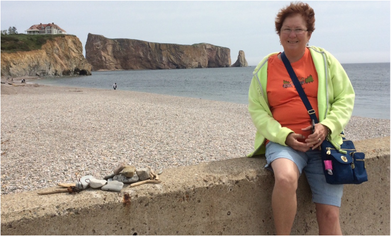 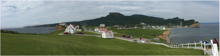 Thursday, July 14 (my birthday!) we started out re-tracking yesterday’s excursion, but this time with the Silvermine attached. Yesterday we had rehearsed the truck for the long 17% grade hill heading down into Pierce, and the rig of truck/trailer handled it just fine today (we have never seen a 17% grade on a public road before.) As we left the other end of Pierce, there was a small park where we could pull over and squeeze in a picture of the Airstream with the famous big rock icon in the background. 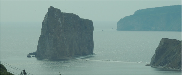 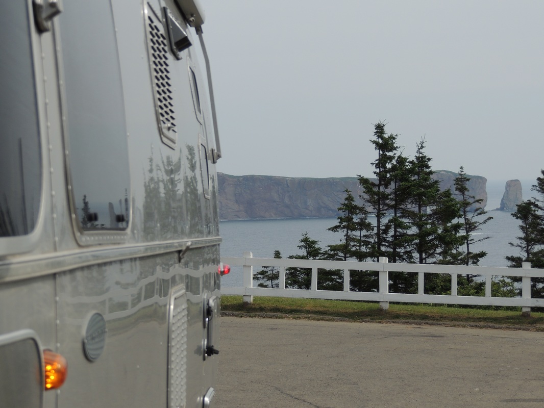 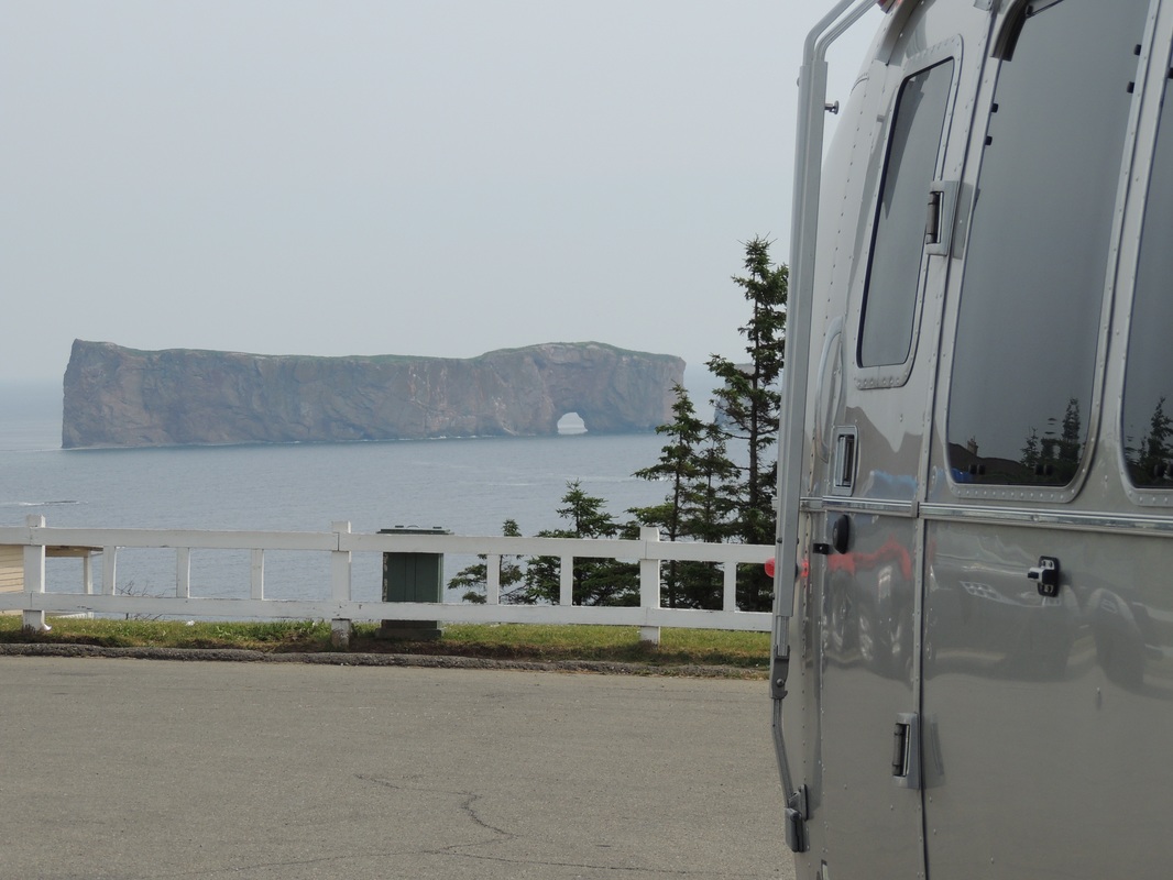 It was a longer drive than we had counted on – leaving the Gaspe, driving through a portion of New Brunwick, and then crossing into Novia Scotia. Still on the metric system – but at least the language and directions and maps are mostly American-Speak. Our Amherst Provincial Park campsite (just a one-night layover) is absolutely beautiful and the weather couldn’t be more perfect with temps in the 70’s and nice breezes. A perfect place for an outdoor 64th birthday dinner for ME!  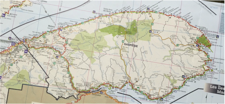 .Some impressions on Monday, July 11, Day 17continuing on route 132 deep into the Gaspe Penninsula:
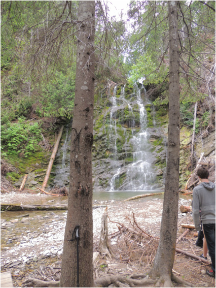
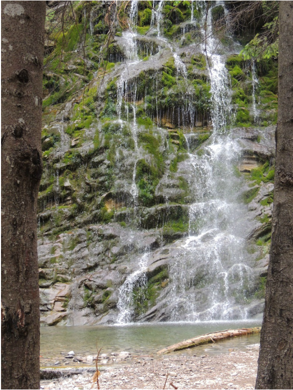
     We arrived at Forillon National (just declared a NP in 1973 -- so even if Tom had been at this location in the 1960’s with his parents – he would not have visited the National Park!) We later learned Forillon was a Provincial park in the 60s. We were set up by 4:30 – in the first “real” campground that we have been in the past 17 days of this trip! On top of that, the weather was a perfect 72 degrees, and Tom set out the lawn chairs for an hour/half of relaxation – the first of it’s kind for this trip! After supper (Tom had pork chops and I had sautéed scallops) we drove the short road down to the end of the road-portion of the Gaspe Peninsula! At the parking lot there were people gazing out to the seaway (not sure if it is officially the Atlantic Ocean yet!) and discovered they were looking at whales diving around in the distance. No breaching – just the lazy up and out curve. They would then disappear for minutes at a time, making it hard to track their movement. Tom was able to catch one on camera that appears as a tiny black arc in the water. We also enjoyed a beautiful sunset over the water. At the campground I enjoyed the luxury of the shower-house with all the water I wanted to use – before bed. 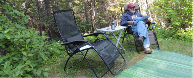  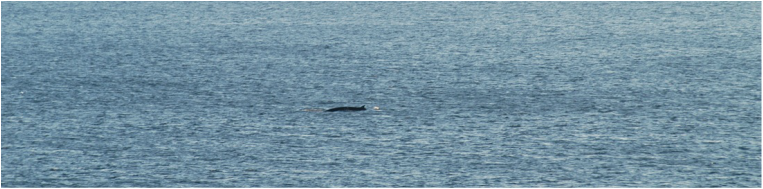    Waking to a beautiful sunny morning, we headed for the much-talked-about hiking trail Bon-Ami. There is not much opportunity to get lost in this National Park as there are very few roads – just highway #132 with some access roads branching off. On the way to the trailhead we passed a little, baby, bear grazing along the road. He was much too little to be alone – but no signs of mom. Shortly after was our first sighting of Cap-Bon-Ami – a viewing platform HIGH on top of a mountain. 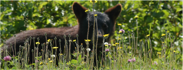 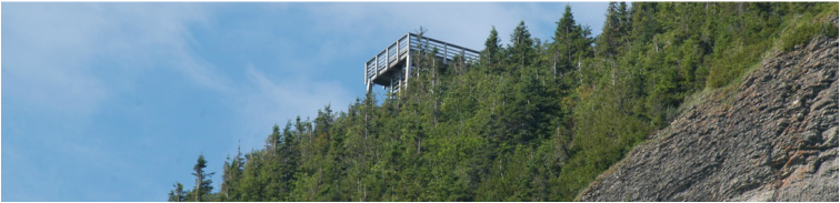 It was bound to happen sooner or later and it is a bit sad. I think both Tom and I had the stamina (at a slow speed) to climb the extremely steep, rocky trail. What stopped us is the thought of coming down that trail with weak ankles, bad stability, skidding on the rocks – falling – breaking a hip – ER ride to the hospital – surgery – end of vacation – you get the idea. The trail was easily a 15% grade and very rough with rocks. Not to worry – there were plenty of trails that we could handle! The next was down at the “center of Interpretation” and was a boardwalk roaming out into the seaside meadow with views of the ocean and the cliffs, and nicely illustrated signs and benches for lingering. 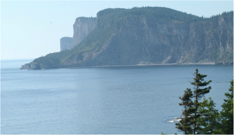 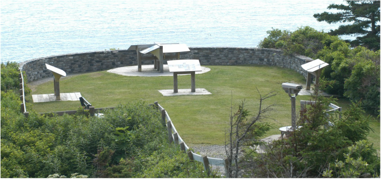 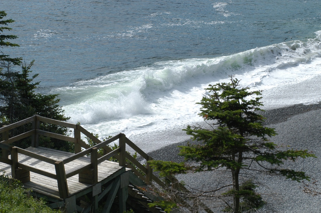    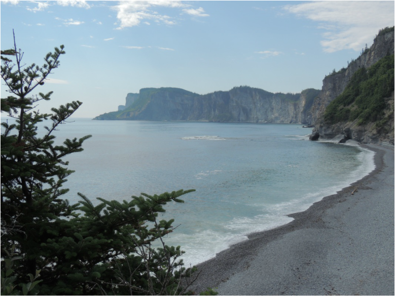 Then “The Chute” trail. . . chute means waterfall. A steep trail, but with trail steps carved into the mountain and shored up with wooden beams. Easier on the downhill to prevent skidding, but quite the effort on the uphill to make the big steps! I hadn’t realized I had gotten to the point that I needed a simple hiking path to follow such a strict set of rules for my use. The waterfall was worth it, down in a deep ravine with a nice-sized fall and good amount of water – and a beautiful swimming hole at the base. Then, back to the camper for lunch. 
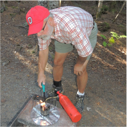
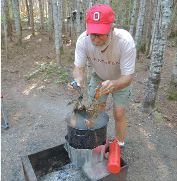
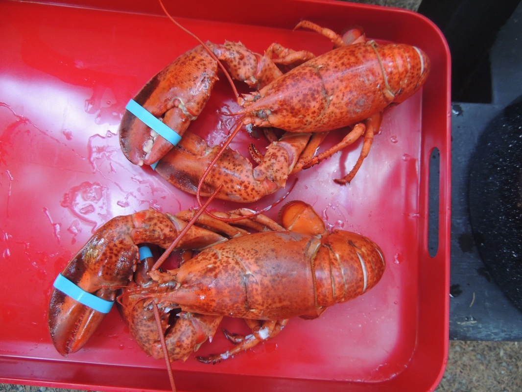
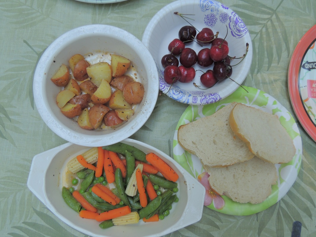
Our afternoon was a plan to go into the city of Gaspe and find a good hot spot for me to work on my blog. My own personal hotspot informed me I was out of data! In Gaspe, Tim Hortons was a bust, McDonalds was very sluggish, the library was only open on Wednesday, and the Hospital didn’t appear to have any wifi. It did, however, have a host of people waiting to be treated in what did not appear to be an emergency situation – free health care, maybe? My main observation – it didn’t smell too good in there! The victory for the little trip was when we saw a fish market and got two lobsters for supper -- $11/pound. We bedded them down in Charlie Button’s doggie car seat and headed back to camp. After a nice afternoon nap/reading session at the campsite, we turned our thoughts towards dinner. Tom had a high-powered small/hiking cook-stove and it boiled a large pot of water in no time. Because we had electricity I had the microwave for small red potatoes, mixed vegetables and Italian bread, and fresh cherries rounded out the meal. No more comments about supper – just pictures! 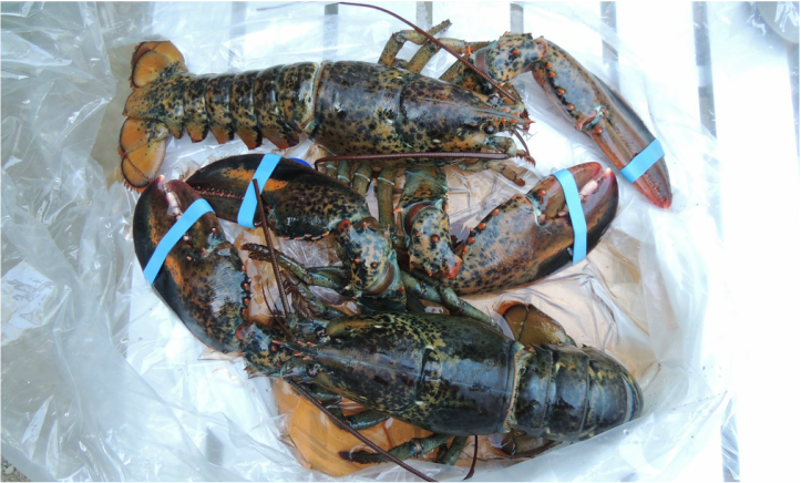
I opted to stay at the camper and tidy up while Tom took Charlie for an ocean-side experience. She thought the waves crashing in and rolling back were just about as exciting as the vacuum cleaner at home!
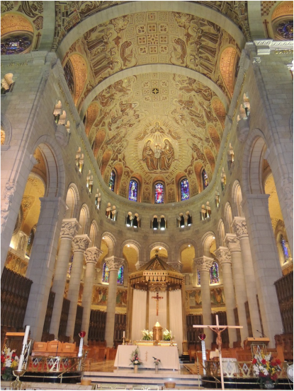
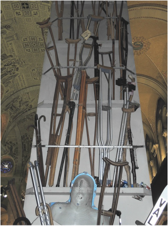
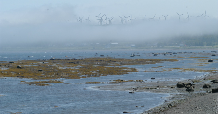
Today we left Quebec and continued North/East on Route 132 that paralleled the Saint-Lawrence – the father we went, the wider it grew.  The drive was only 5 hours, but there was a glitch as we reached our “Parc Nat du Bic” at Saint-Fabien. The providence of Quebec does not allow dogs in the Provincial parks –- or some National Parks within their boundary! So much for those reservations made 6 months ago – next time we’ll read the fine print. Accommodatingly close-by was a private park, The Rimouski. Being Sunday it had emptied out from the weekend, and we easily got a pull-thru with full hook-ups. At the rate of $55 a night, you still had to chuck quarters in the money-maker in the shower; 1 quarter = 2 minutes! Leaving Charlie in the Silvermine (no dogs allowed) we drove back to the entry point of the Bic National Park. The purpose of the park seemed to be to preserve the coastline along the St. Lawrence where the tide make its presence known every 12 hours. Our first views were during low tide. 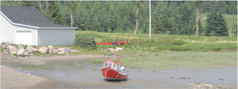 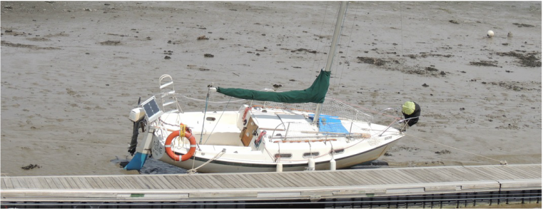 Our first stop was at the Kayak rental kiosk where there was a good view of the river where the tide was completely out. Hiking, biking and kayaking seem to be the approved way of exploring the neighborhood, and by car there is just one narrow dirt road to the trail drop-off points. Some of the trails are high above the high-tide point, and some of them lead you down on the mud flats at low-tide. We walked down o the mud flats and Tom scooped up a water sample for his water-around-the-america's water collections.  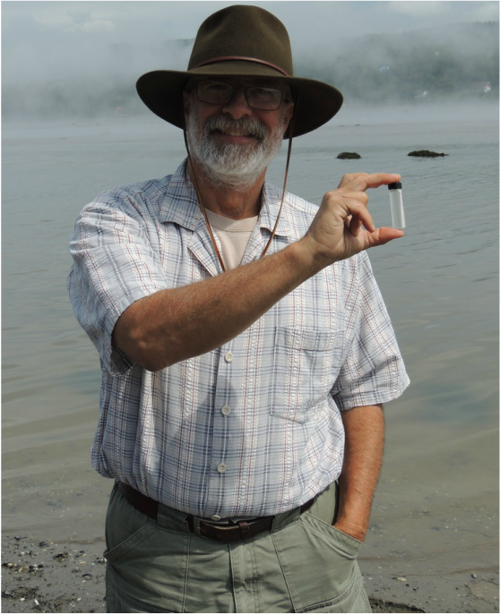 Half-way through there was a discovery center (visitor center) Ferme Rioux. There were signs alluding to seal-watching, but we did not see any seals. The seals do their basking business at a particular point in the tide cycle, and it must not be at low tide! 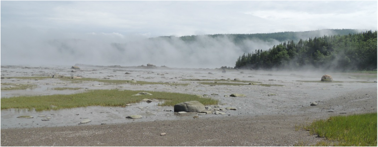 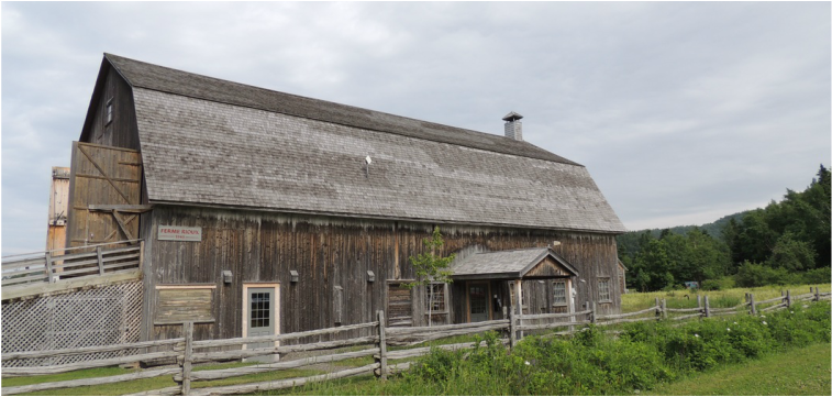 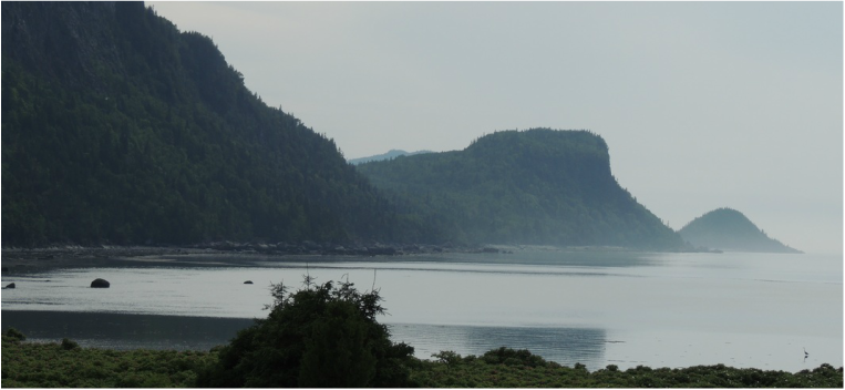 We took a rest break at the camper where I was able to work on this blog – I am usually about two days behind. Keeping up now depends on wifi access and strength of signal, as I blew through all of my wifi hotspot on the phone 4 days ago! After supper, we estimated that the tide would be back up from our previous viewing, and we headed back to the park. We saw a little fox trotting along the highway!Our first stop was the first stop of our low-tide visit. Sure enough, the red boat that had been sitting halfheartedly on the mud earlier, was floating contentedly in the water now. So it was for the rest of the drive – the same road with a completely different view. Where we had previously walked out around the mud flats, there was now just water. That’s what the Park du Bic is all about.I was especially tired when we got back to the camper, and was in bed immediately sleeping soundly all night. 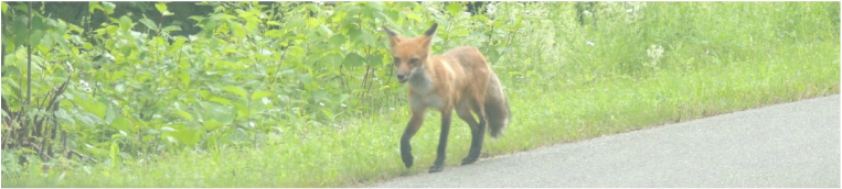 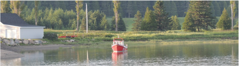 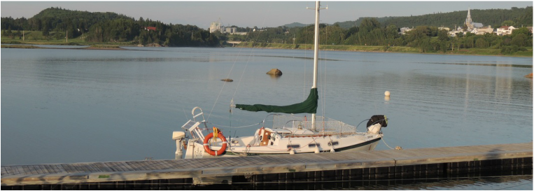 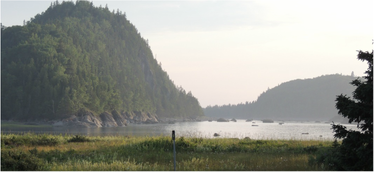 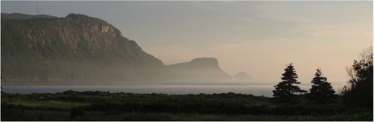 Today we took another guided tour, conducted by Tom, and Charlie Button got to go. She showed her enthusiasm by promptly perching her front feet on the window ledge and winding it down – twice. Tom had to activate the child lock on the truck! Oh, we miss those days of corralling the kids! Our plan was to drive out to the Montmorence Falls Park to view the waterfalls. They are taller than Niagara falls – but not nearly as wide. The park down below was dog-friendly and Charlie got to accompany us on the walk around the base of the falls. The hillside beside the falls was just an ugly, mud-washed cliff, and didn’t add much to the visuals. The falls themselves were also a bit “dirty” – but they were indeed tall and powerful. 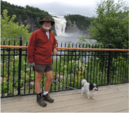 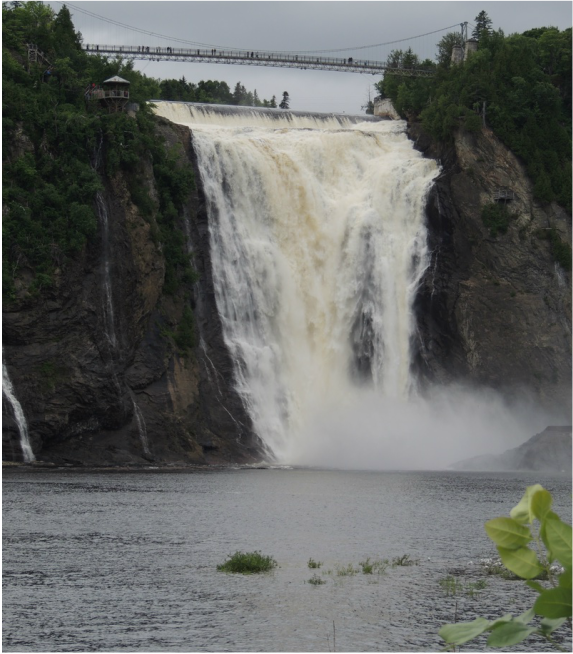 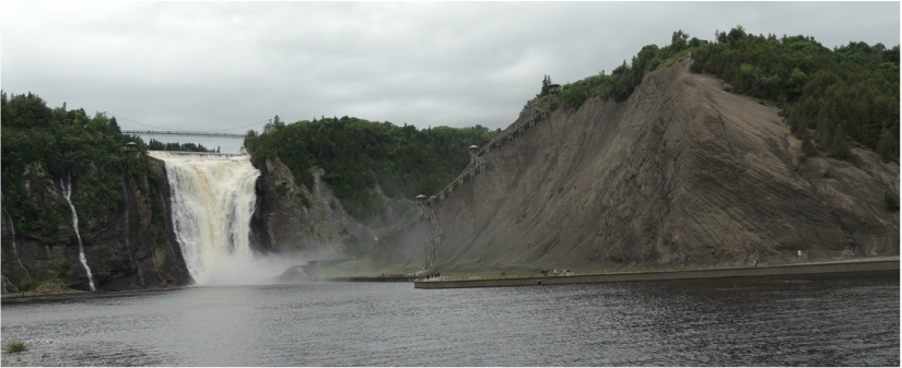 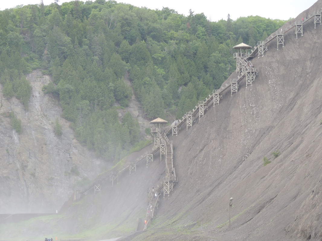 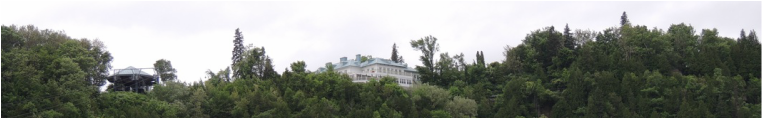 We found the Av. Royale drive to the top of the falls where there was a beautiful Maison Vezina (Historic Site.) There was a long boardwalk that wound around the top of the cliff and the crest of the falls, but we did not take it all. Eventually the boardwalk led to an impressive wood staircase structure dangling from that mud cliff, with over 450 steps leading to some viewing points. Not for us! 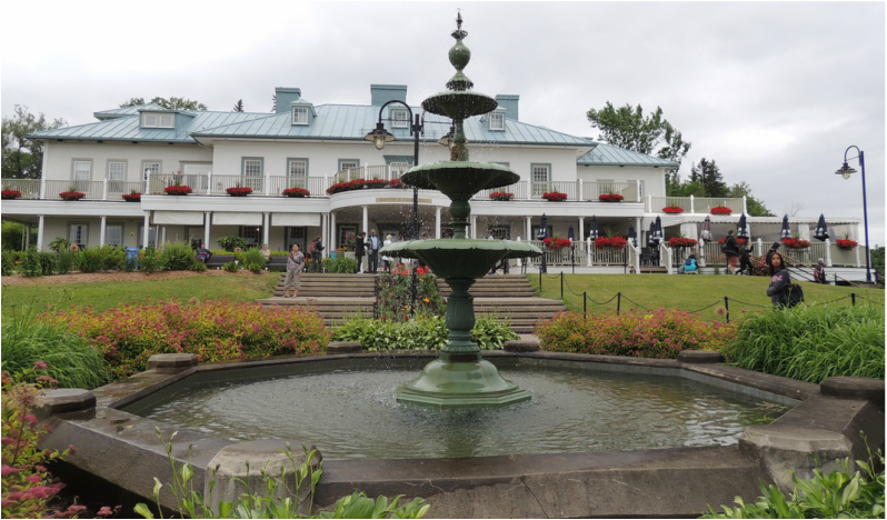 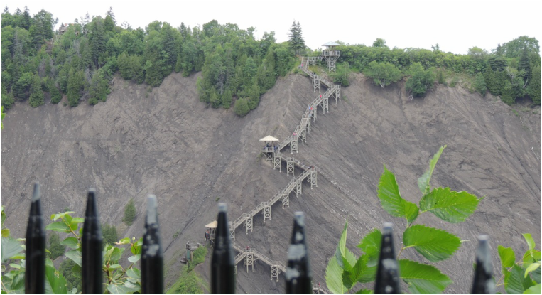 Leaving the falls, we continued on the Av. Royale that followed the cliff along the St. Lawrence River for quite a distance. Then, we came back down to river-side and found the impressive Shrine of Sainte-Anne-de-Beaupre – the grandmother of Jesus. The first Chapel was built in 1658, and a second/bigger was built in 1676. The third Church was a stone church that lasted until 1876, when the first Basilica was built. It was destroyed by fire in 1922, and rebuilt. There are multitudes of magnificent paintings, mosaics, stained-glass windows, and stone sculptures. They take their many witnessed healings very seriously, and there are several columns inside the main Basilica that bears testament with crutches and canes and other mobility aids affixed. 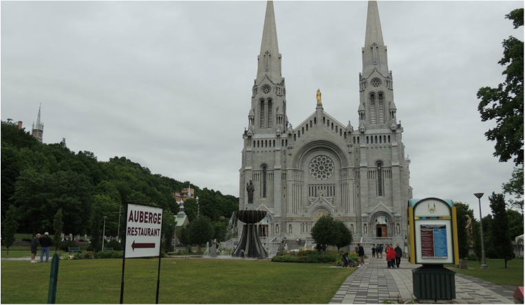 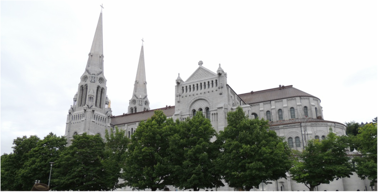 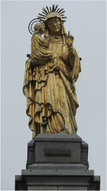
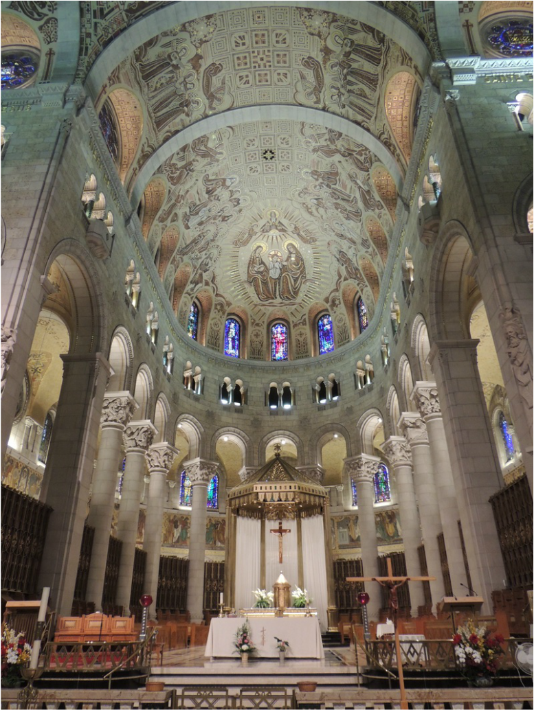 There was a funeral being conducted as we toured, but that only limited walking down the center aisle where the family was gathered. Otherwise, the service went on as planned, with visitors streaming along the side-aisles. An added benefit, because of the funeral, was we were able to hear the massive organ play and the bells toll.  Outside there was a switch-back hill hike that portrayed the Passion of Jesus in live-size bronze statutes; It was absolutely magnificent. A small tour group was reenacting the walk with a tour guide and we heard portions of the narration and understood what a meaningful walk it was. 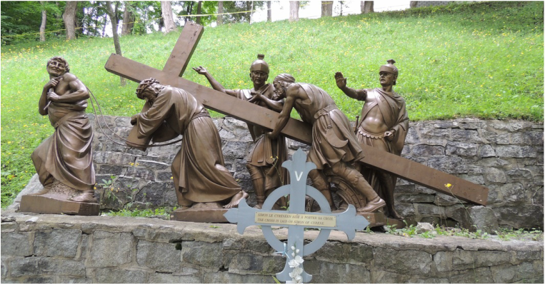 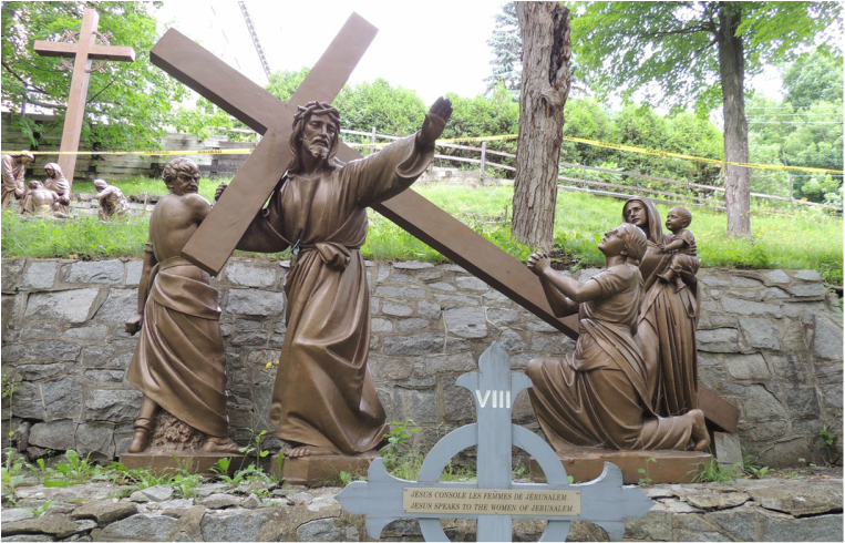 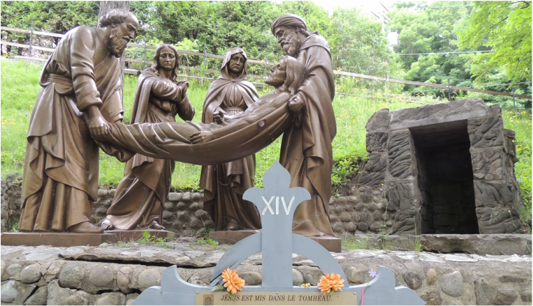 Those were the two visits on our agenda today, and even at that we didn’t get back to the KOA until after 4:00. There was a certain amount of picking up and cleaning up to be done, as we would be leaving Quebec in the morning! Check back for our journey deep into the Gaspe!
|