|
July 30, Sunday Last night, Tom discovered the Bear Paw Battlefield – a National Historical Park in Montana – just 15 miles off of our route home! Two years ago we had visited the Nez Perce Big Meadow Battlefield in Idaho, and had become fascinated with the story of the Nez Perce. This Battlefield is the location where the sad story ended. We just had to stop! As a part of the US western expansion, and the attempt of the Government to clear the land of native peoples, a portion of the Nez Perce nation fled from their native land in Idaho. They were on the run for 4 months and 1,500 miles, and as a last bid for freedom headed for Canada. Eight hundred got within 40 miles of the border, planning a resupply camp where several buffalo had been killed and water and grass for the 3,000 ponies was plentiful. They were low on supplies, the ponies were played out, and their blankets were thread-bear – it snowed. On September 29, 1877, they were attacked by Soldiers, and after a day of fighting they took defensive position and were held in siege for 5 days. There is much more to the story, and I suggest the book The Last Indian War: The Nez Perce Story by Elliott West for all the brutal details. Tom and I are listening to it on audio book as we drive along, and it is written in fascinating text. 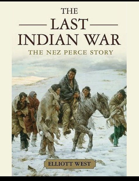 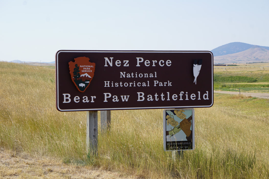 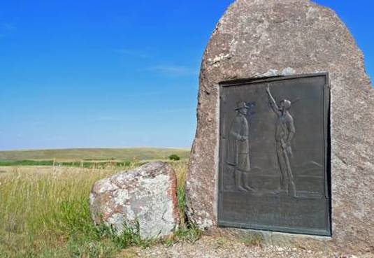 The Bear Paw Battlefield is mapped out as a self-guided tour, but it was our luck to have a very knowledgable ranger accompany us with a running narration of details. We walked along the trail that was cut through the rolling Montana grassland -- in temperatures above 90 degrees. 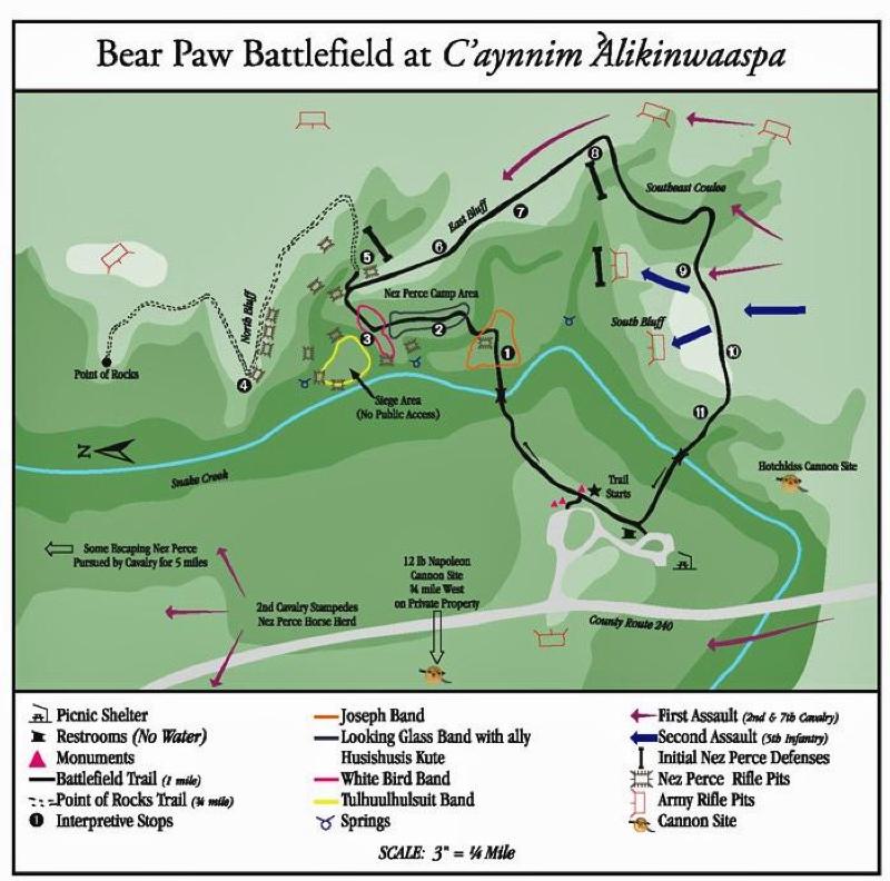 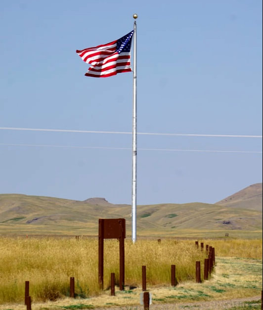 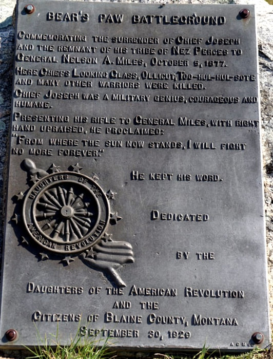 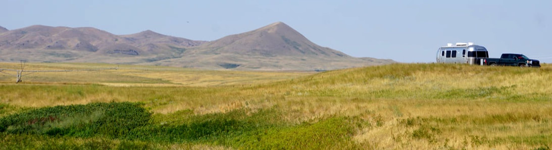 Several years after the battle, Nez Perce who were eye witnesses returned to mark the location of events on the field, making it a well-documented theater. Today, people leave small tributes at the markers. 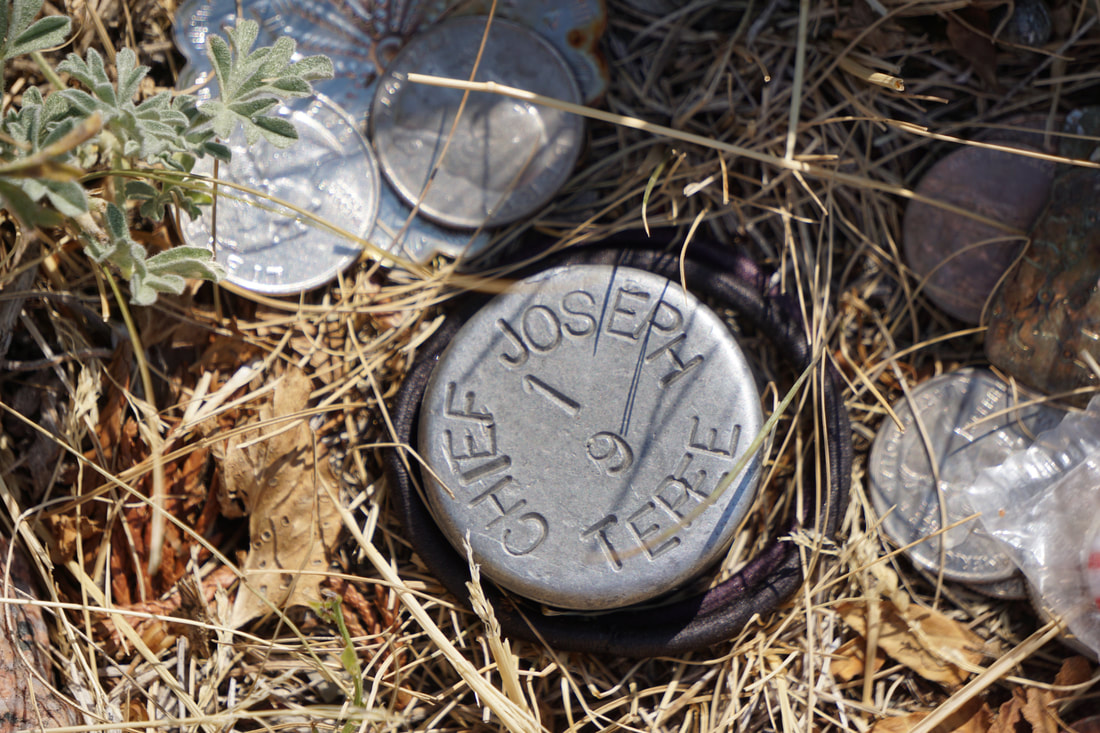 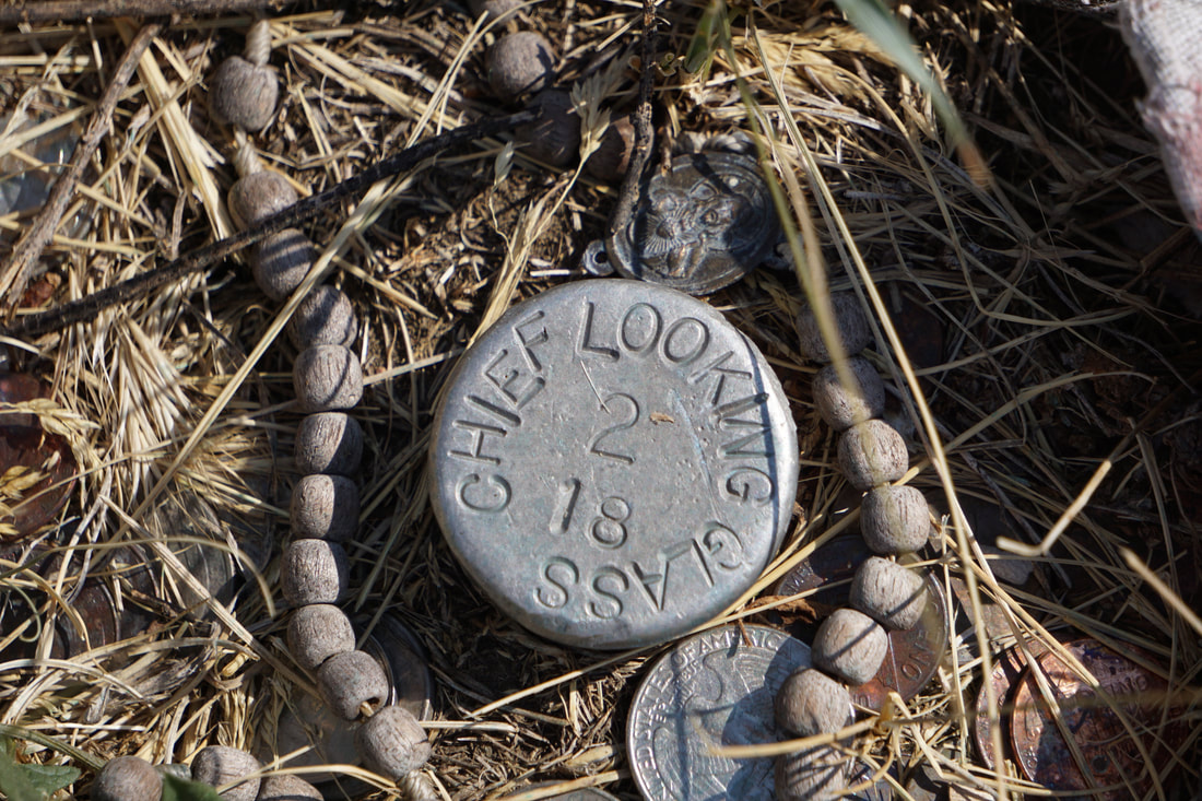 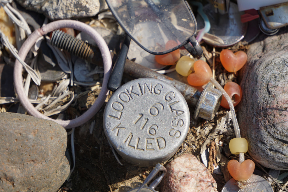 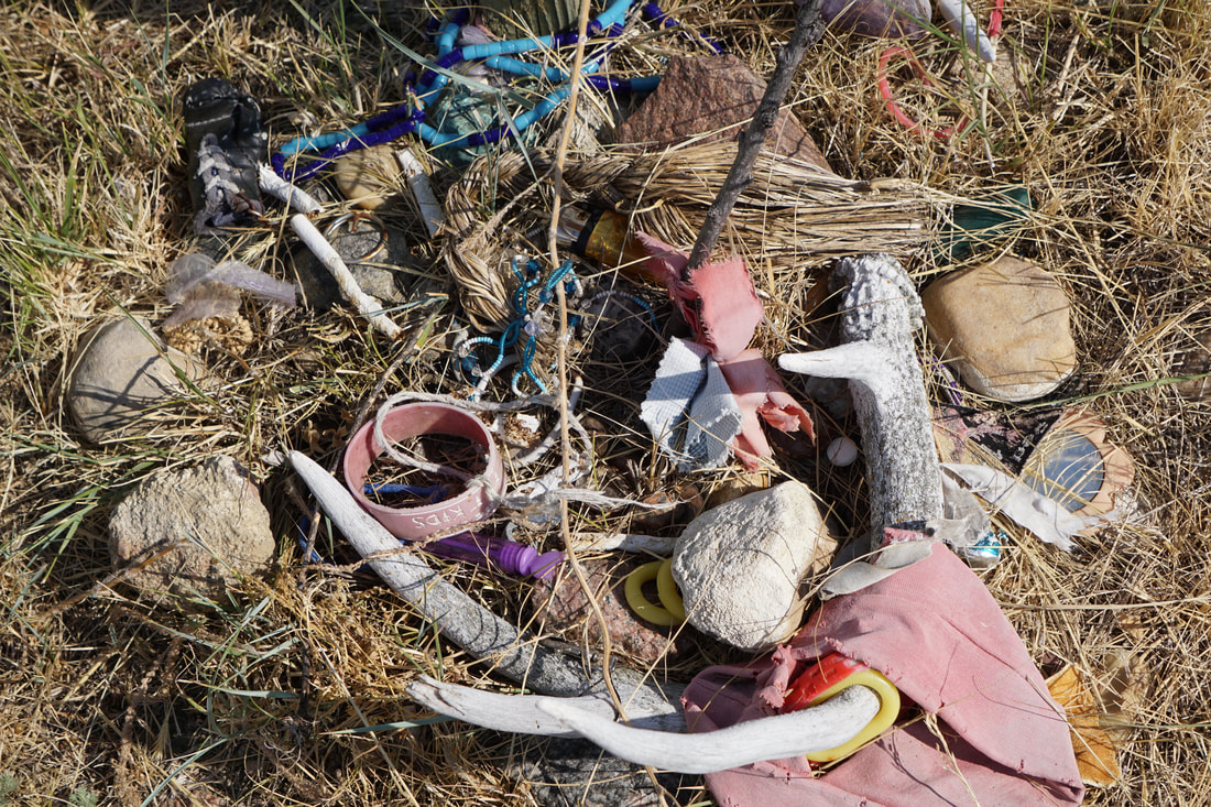 The artist who painted these sign posts, depicted the Nez Perce in correct detail with their striped blankets and teepees made without the customary tall lodge poles. 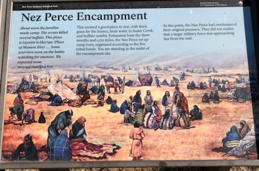 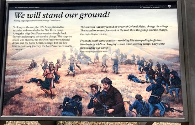 These pictures of the battlefield show that there was high ground -- and low ground, and everything was out in the open. 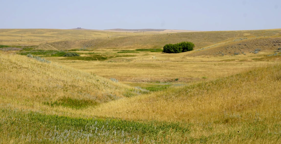 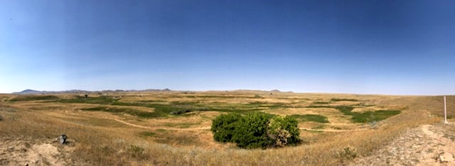 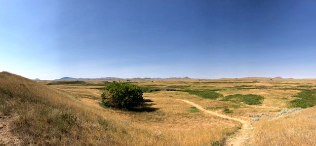 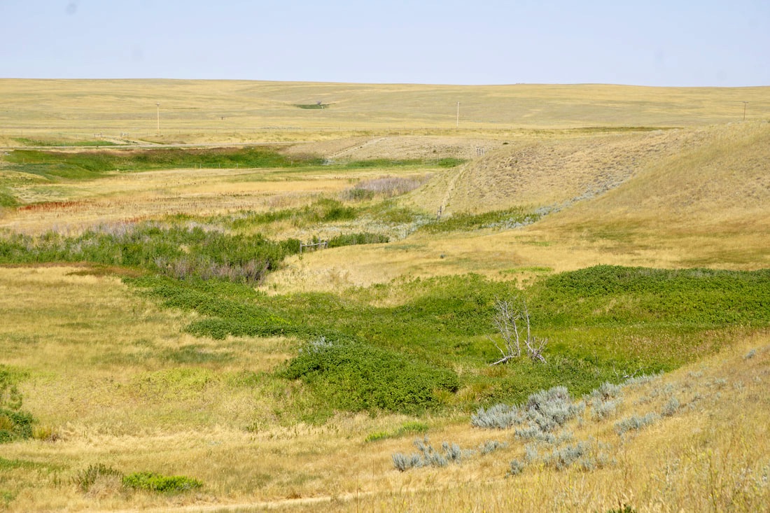 The 6-day battle/siege ended with the very moving and very famous surrender by Chief Joseph: "From where the sun now stands, I will fight no more, forever." 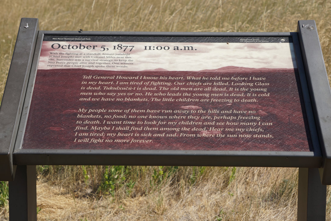 We got that far in the tour, and with the Airstream within sight -- Tom sat down. I took his picture. He tried to get up, and he sat down again -- hard. I grabbed his hand, and he leaned back on a rock, and then laid down on the ground -- flat -- saying he felt a little woozy! Minutes later he said he was better and sat up -- minutes later he was "fine." Even though he walked with no problem to the truck, I took the keys from his hand and had him relax in the AC for 2 hours. Heaven knows I don't get the opportunity to take the wheel very often! Here is the picture of him sitting -- and me driving!  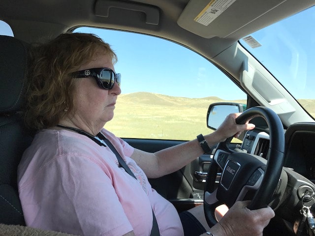 A time change, a long day's drive (450 miles), and the lengthy tour stop all combined to find us still on the road at 7:30 in the middle of nowhere on undeveloped Route 2, with no camping prospects for the next 58 miles! Tonight's campground is a Ramada Inn!
2 Comments
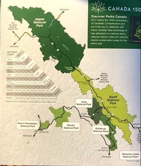  July 29, Saturday Oh . . . this hurts! Tom drew a homeward route right through the heart of the Canadian Rocky Mountains – Jasper and Banff National Parks – skirting Yoho, Kootenay and Waterton National Parks! Towns: Jasper, Lake Louise, Banff, Calgary! We have already decided that this will be next year’s vacation, so we are just counting today as a scouting trip! Here are some of the beauties that we passed right by. 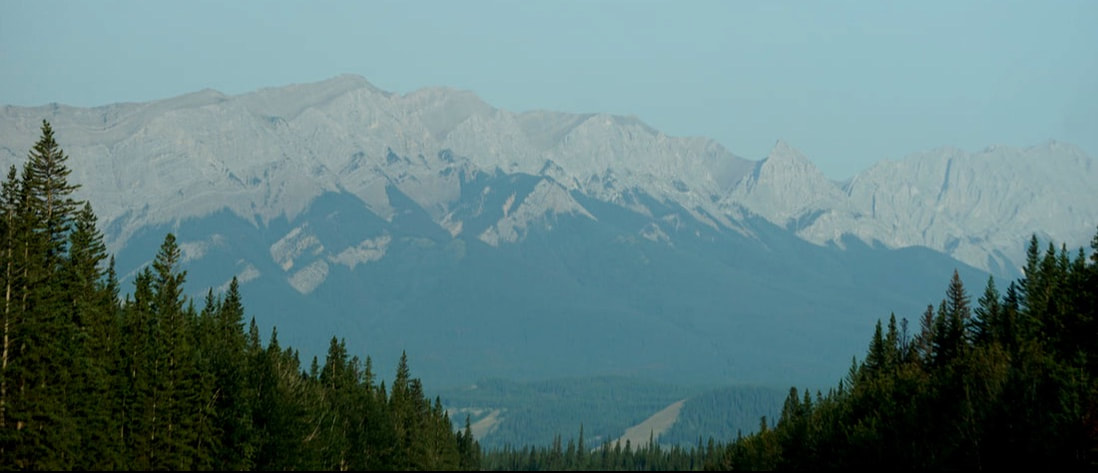 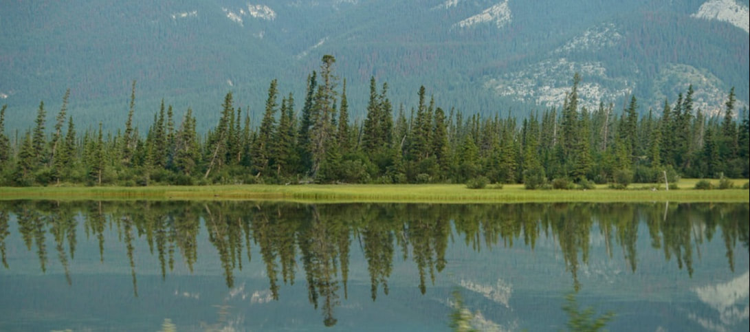  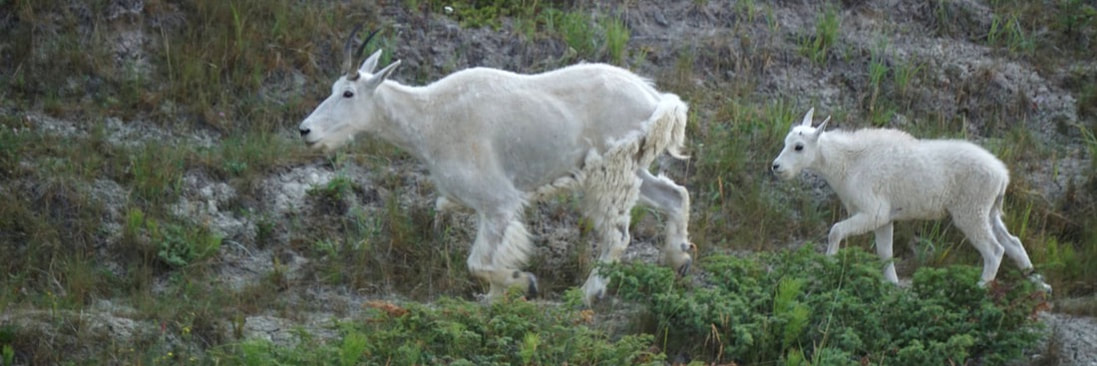 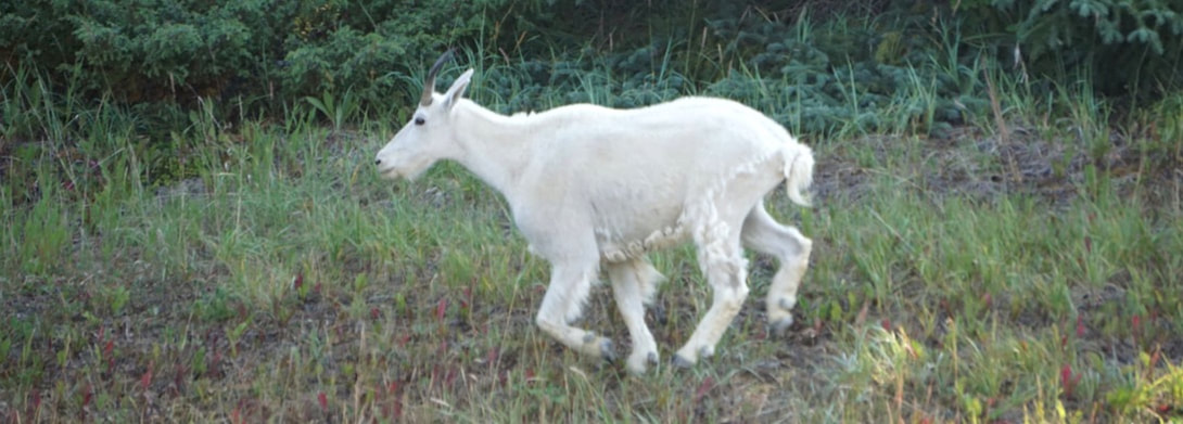 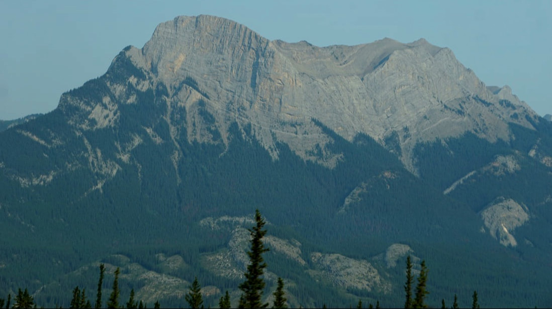 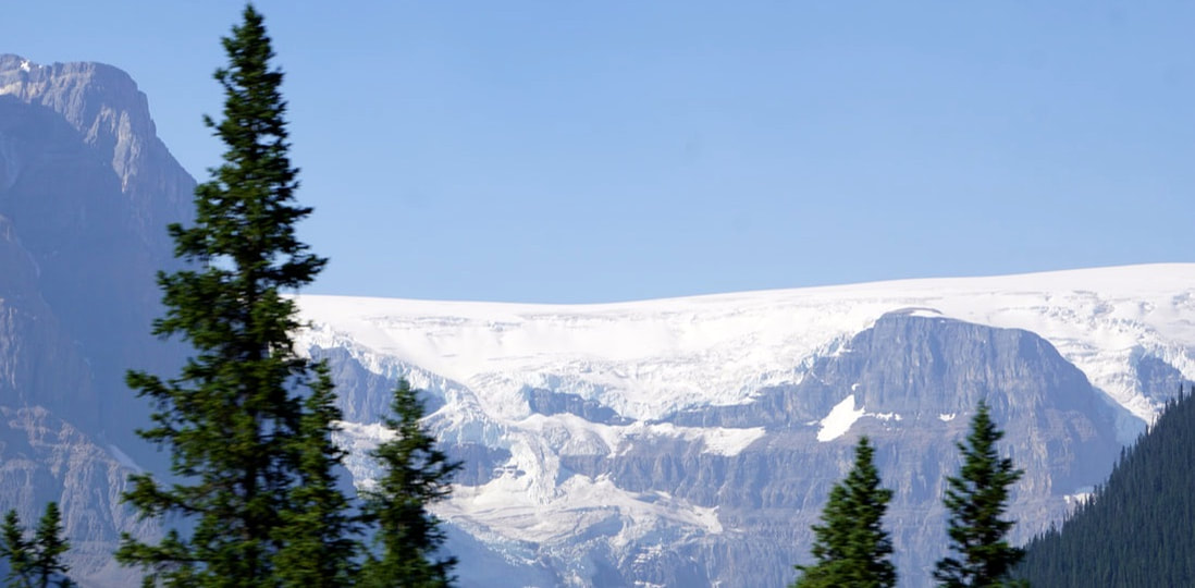 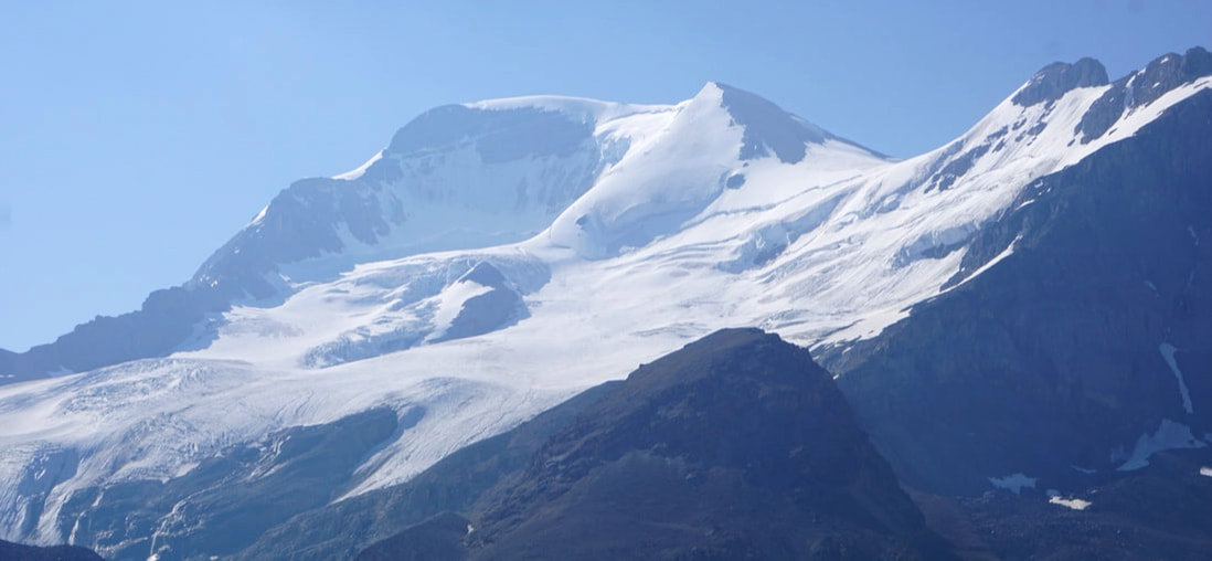 At 12:30 we entered Lake Louise – it was as busy as New York City! Nowhere to park and traffic cops that physically took over the routing of cars beyond the stop signs! Signs led to “overflow” parking out of town, with shuttle service back into town. We just stopped for gas and by the time were back on the road again, we were wondering if we should consider an early spring trip back! Out of Banff, heading for Calgary, we were on a 4-lane highway, and quickly traded the Rocky Mountains for rolling, agricultural and grasslands. We could see the city of Calgary miles ahead before when we got there – something we haven’t experienced on a regular basis for 8 weeks. Another landmark observation of having reached this latitude – last night it got dark -- Dark, dark! I had thought Alaska would just reach “dark” at a much later time in the evening, and that it would disappear at a much earlier time in the morning. What we found was that it achieved twilight at about 9:00 . . . and stayed there the rest of the night. In the middle of the night it was as light as could be, although not bright. I wonder what other conditions we are going to have to acclimate to! Oh, the temperature. As we dropped out of altitude we noticed the thermometer edging toward 90 degrees.
Our stop for the night (after 580 miles and 12 hours) was at a Casino that we had stayed at 8 weeks ago on the way out! July 28, Friday Today was the day we hit the “0” mile marker for the Alaskan Highway – in Dawson Creek, British Columbia. Of the 1,523 miles we only missed 23 of them when we took a cut-off out of Skagway. Of course, we did the highway backwards, from Fairbanks, with trips on and off to hit the major sights in the Alaska interior. Mile by mile on our morning drive we could tell we were getting closer and closer to civilization on a permanent basis; the outposts were closer together, more developed, and at the end one merged into the next. In Dawson Creek we saw the big-chain restaurants that we haven’t seen in quite some time. To celebrate we ate lunch at McDonald’s! 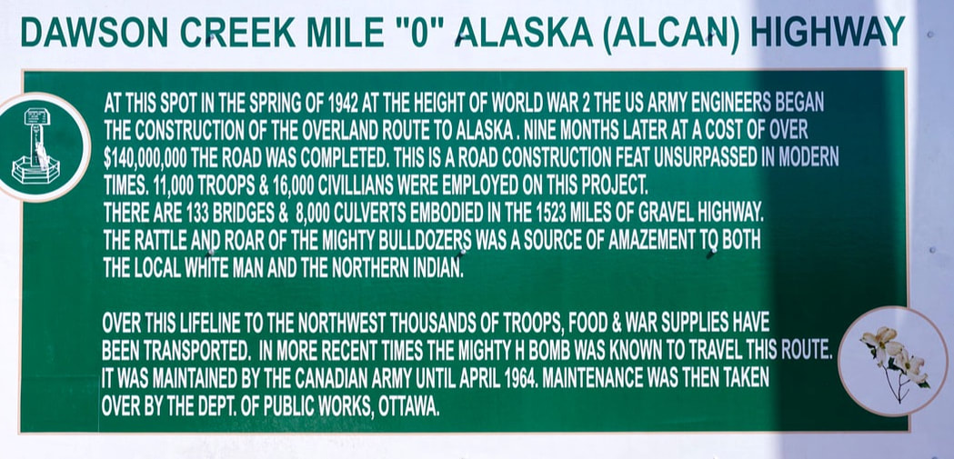  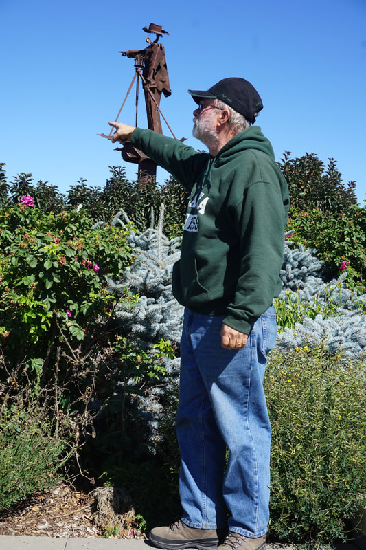 We spent a bit of time at the Visitor Center where the formal sign proclaiming the start of the Alaska Highway was. Across the street was a "metal man with boney fingers" pointing statue made by a local artist -- using scraps of metal from surrounding farms; Tom just had to strike the pose. It was almost a party atmosphere as people walked up and took turns taking each other’s pictures posing at the mile-marker. Some, like us, were just finished – others were just starting. All shared stories of their trip so far. We were able to move our rig to a point directly behind the sign to take a few pictures. 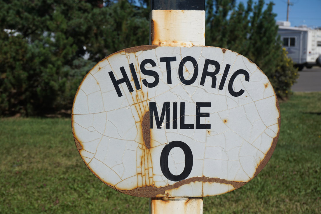 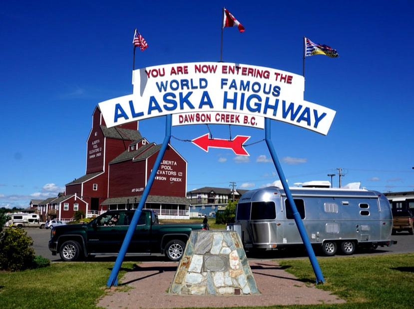 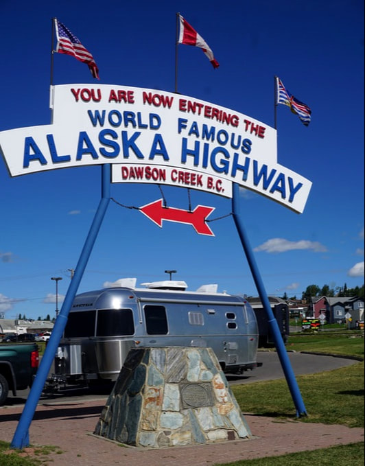 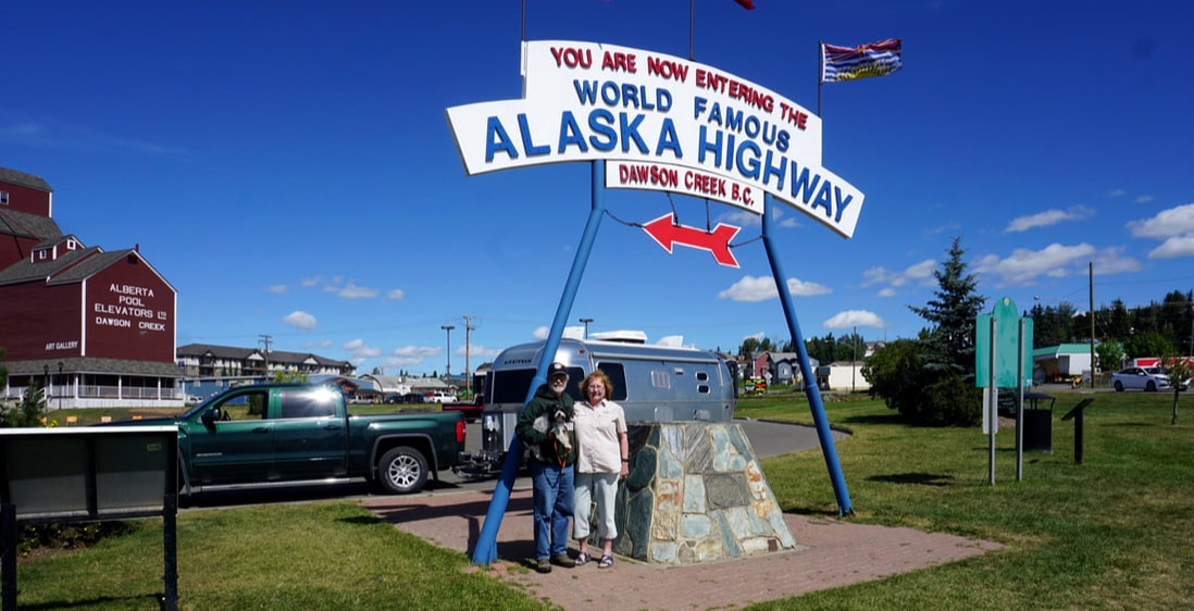 If that wasn’t enough, there was also The Mile 0 Post in the center of a downtown crossroad. I stationed myself on a street corner and Tom went to get our rig, and he dove it past the marker while I was poised to take pictures. 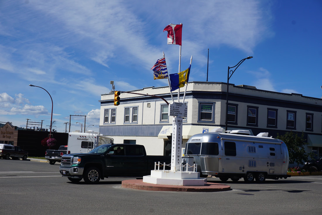 Tom collects t-shirts of famous roads he has driven, and we bought matching Alaska Highway T-shirts before we left Dawson Creek and headed on our way. We felt a bit lost without having that single highway to focus on, but Tom quickly got it together and plotted an east-bound route for the rest of the day – and the next few days. Looking at what lay ahead I can say: “It ain’t over yet!”
Wednesday, July 26, 17 I am amazed when I look at a map of Alaska and see the trip that Tom planned. It has included almost all the ports on the Intercoastal Highway, and the major roads on the Interior of Alaska. We have been off and on the Alaska Highway during the past 4 weeks, but now we are on until it ends! Here is some of the beautiful scenery we saw today. 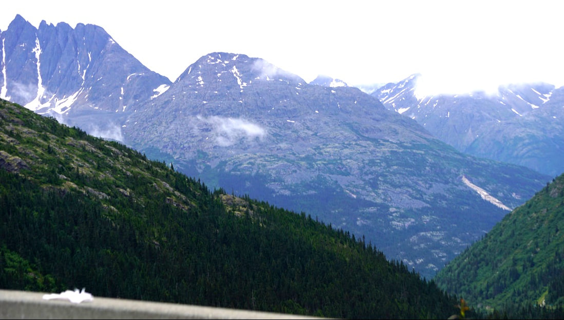 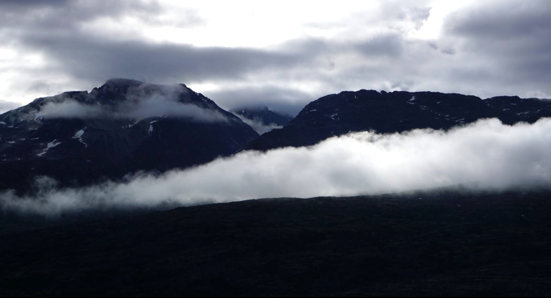 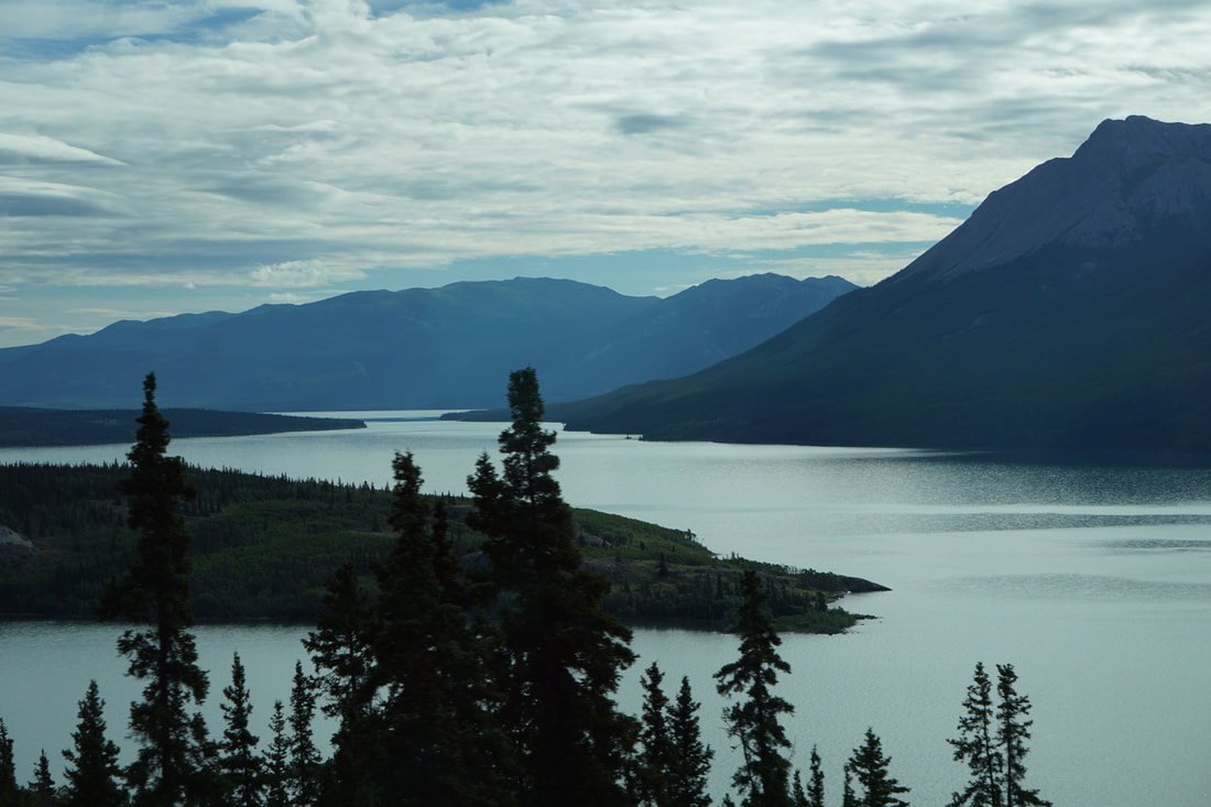 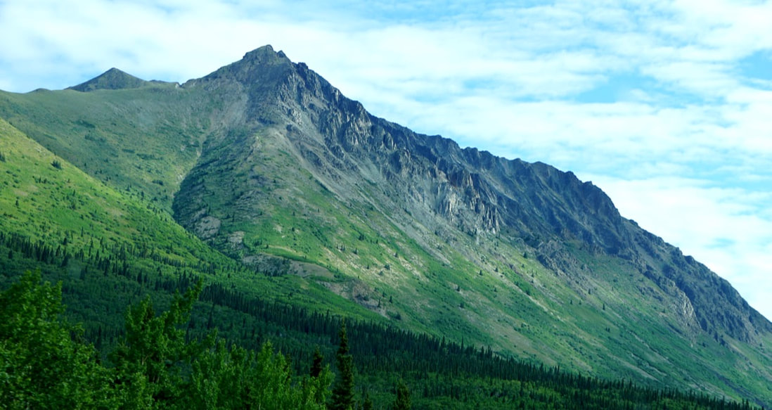 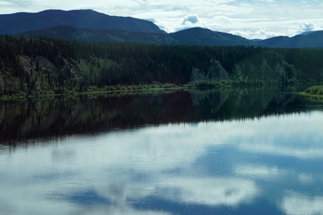 Today we traveled from Skagway back through customs and down into Yukon Territory. Our stop for the night was at Watson Lake – one of the big service centers on the AlCan. Population less than 1,500 – one grocery, one gas station, one liquor store, and one “department” store/gift shop! The town came to prominence when the Alaska Highway was built during eight months in 1942 as a World War II expressway to guard the Alaska territory and Aleutian Islands from Japan. I am sure we must have stopped here during our family trip of 1963! 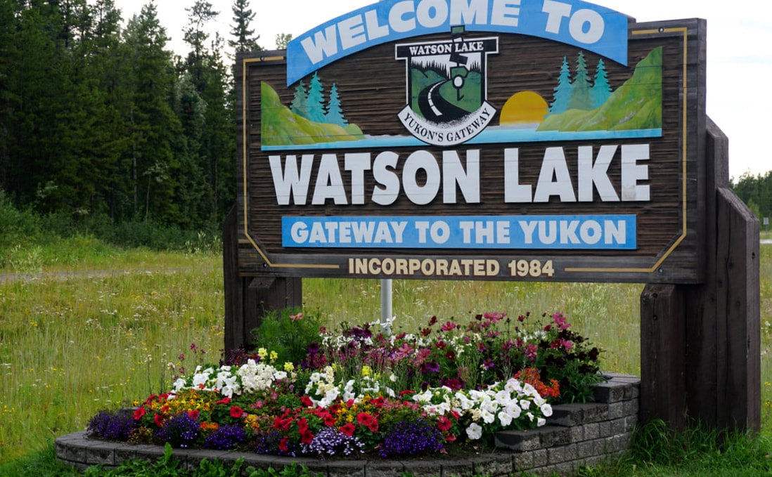 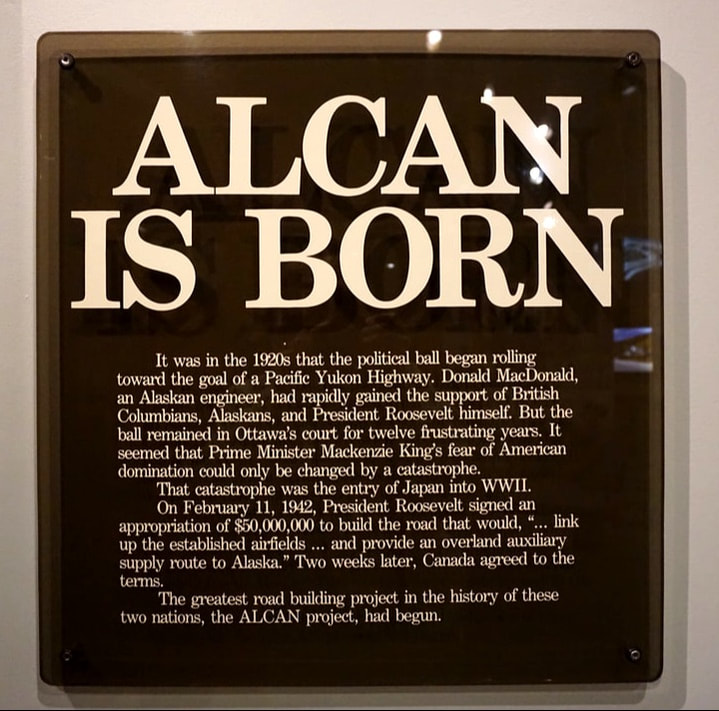 One quirky attraction here is the Watson Lake Sign Post Forest. In 1942 a US Army Soldier started the tradition of nailing a sign to a post telling how far away his hometown was. Now there are over 75,000 signs, and visitors are encouraged to nail up their own sign. I got a little carried away walking around looking for places I knew -- and taking pictures! 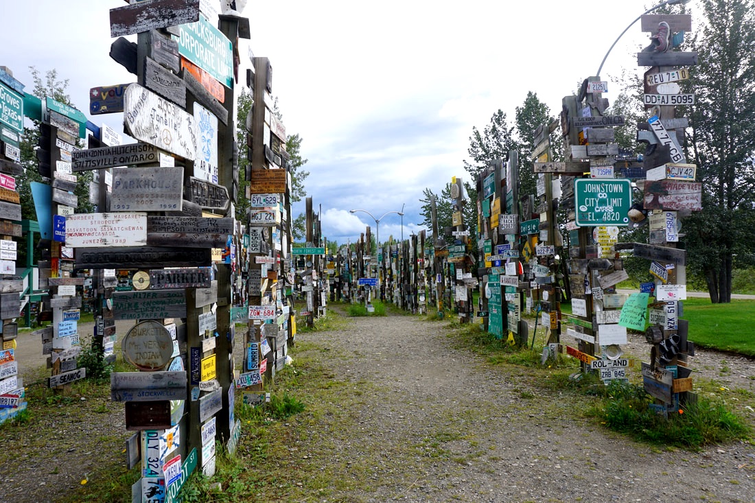 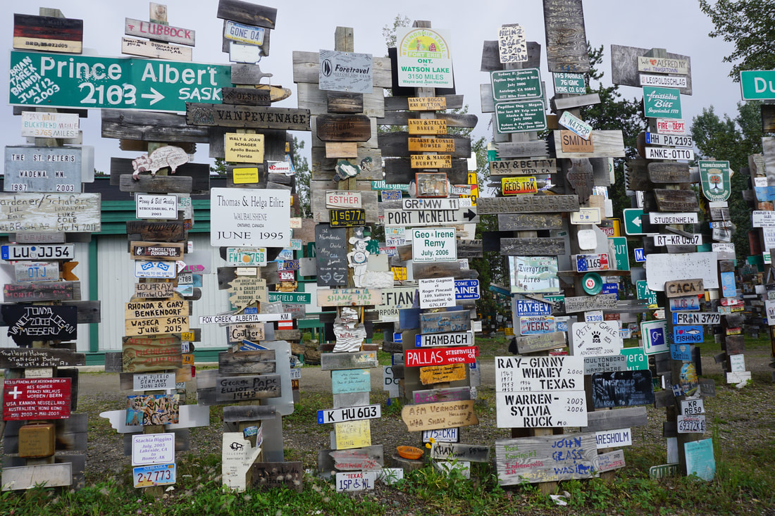 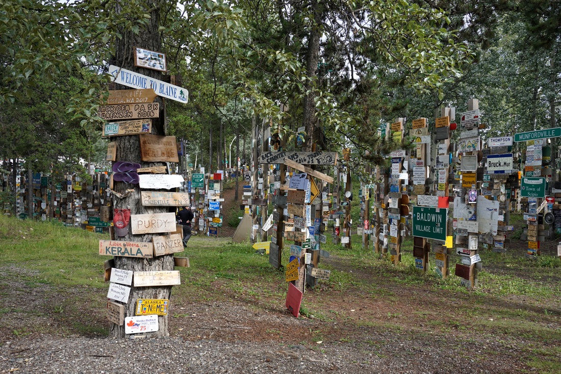 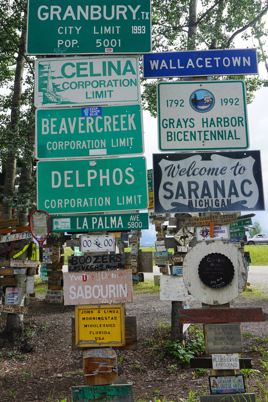 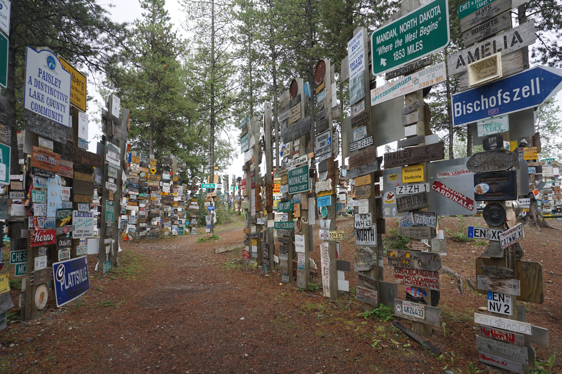 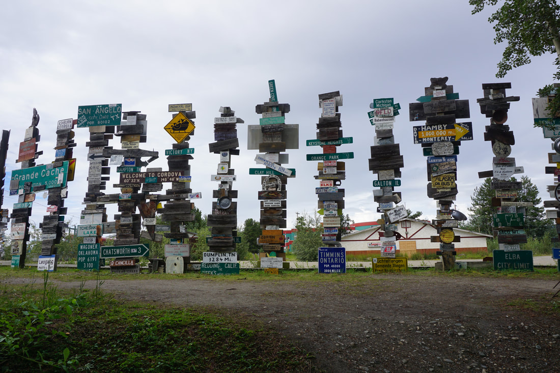 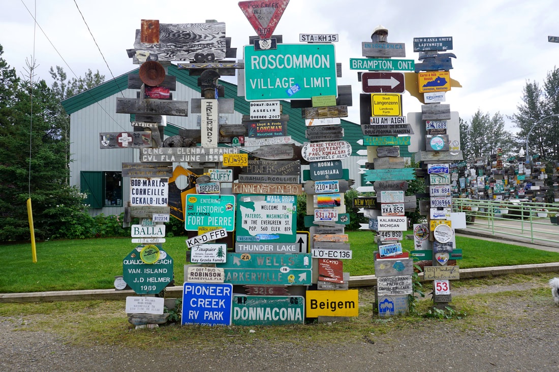 I don’t want to say that Lake Watson isn’t a happening place – but after doing the Visitor’s Center, the Sign Post Forest, and visiting the grocery, we didn’t find that much to do. As we are now homeward bound, we spent some time cleaning up and re-organizing. July 27, Thursday Today, with the start of week 9, we are truly heading for home. But, we are deep in the Yukon, and still on the Alaskan Highway, so it by no means feels like the vacation is over! I suppose the difference is that we will start counting the miles and getting the best out of a day that we can. This morning we left Watson Lake with no option of taking a wrong turn all the way to Fort Nelson (330 miles) – there were no other roads! On the Alaskan Highway there are occasional “service areas” with limited facilities and campgrounds and even more occasional incorporated towns that offer a bit more. Many of these are associated with the building of the Alaska Highway back in the 1940’s and none of them were here before that! Today’s drive was a true Alaska experience – mountains, valleys, rivers, lakes, wildlife . . . and dirt roads. We got another window chip! Our first stop was at Liard River Hot Springs – no hot-potting for us this time! There was a ½ mile boardwalk that led back to the natural hot springs pond where there were changing rooms but no lockers. This setting was much more of a “natural” setting than Chena Springs a week ago. Oh – if we didn’t have miles to make today . . . . 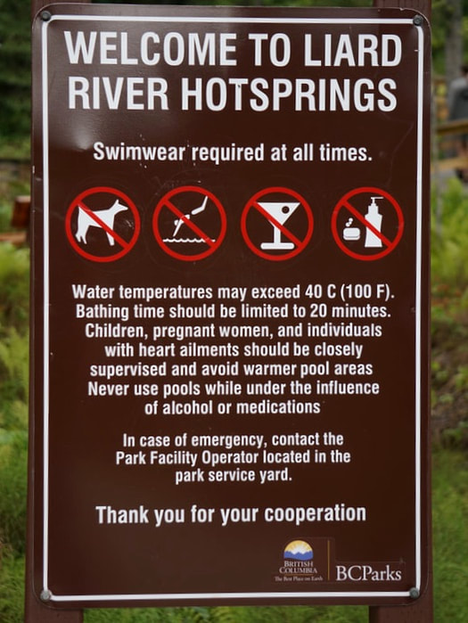 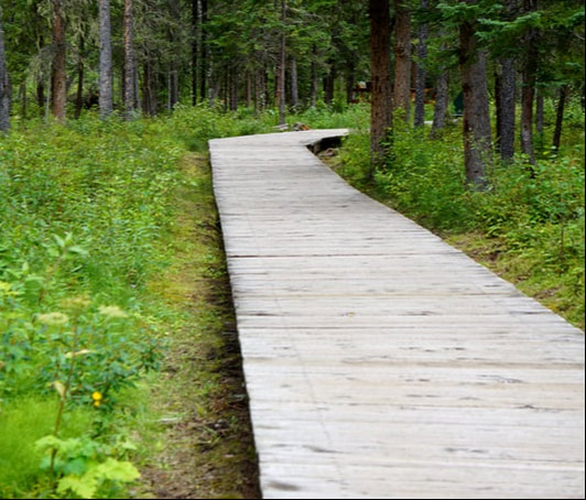 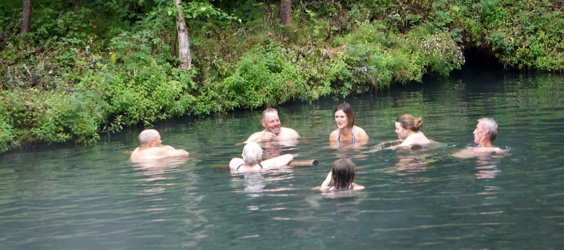 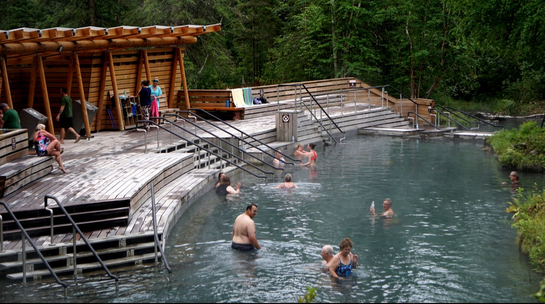 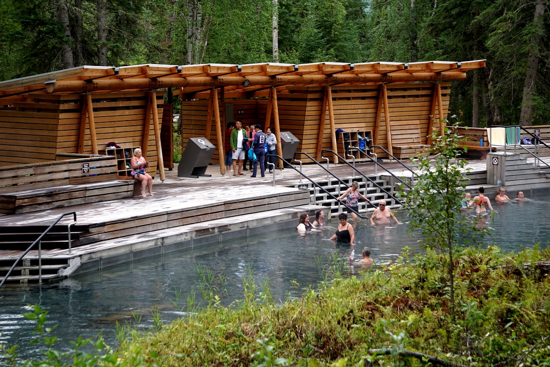 Beyond the Springs there was a sign for a Hanging Gardens, so we climbed the staircase up to see what it was all about. The warm climate and abundant nutrients create a perfect environment for algae, mosses, and wildflower. Some species (yellow monkey flower and Philadelphia Fleabane) would not be able to survive here without the hot springs environment. We were able to see the cliff, but the wildflowers were not in bloom right now! 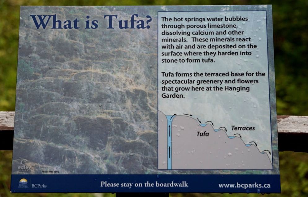 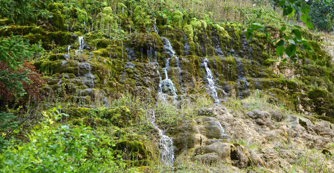 Right out of the gate we saw wildlife – two black bears right alongside the road within 5 miles of each other. There were no pull-offs and although Tom slowed down, we didn't get a good picture. Later we saw caution signs to watch for Stone Sheep, and within a few miles we started seeing them on a regular basis along the road in small groups. And, we were back in buffalo territory – no herds, just single or pairs of animals along the road. The Mileposts magazine says animals come to the roadside to get the “natural and artificial” salt that accumulates. 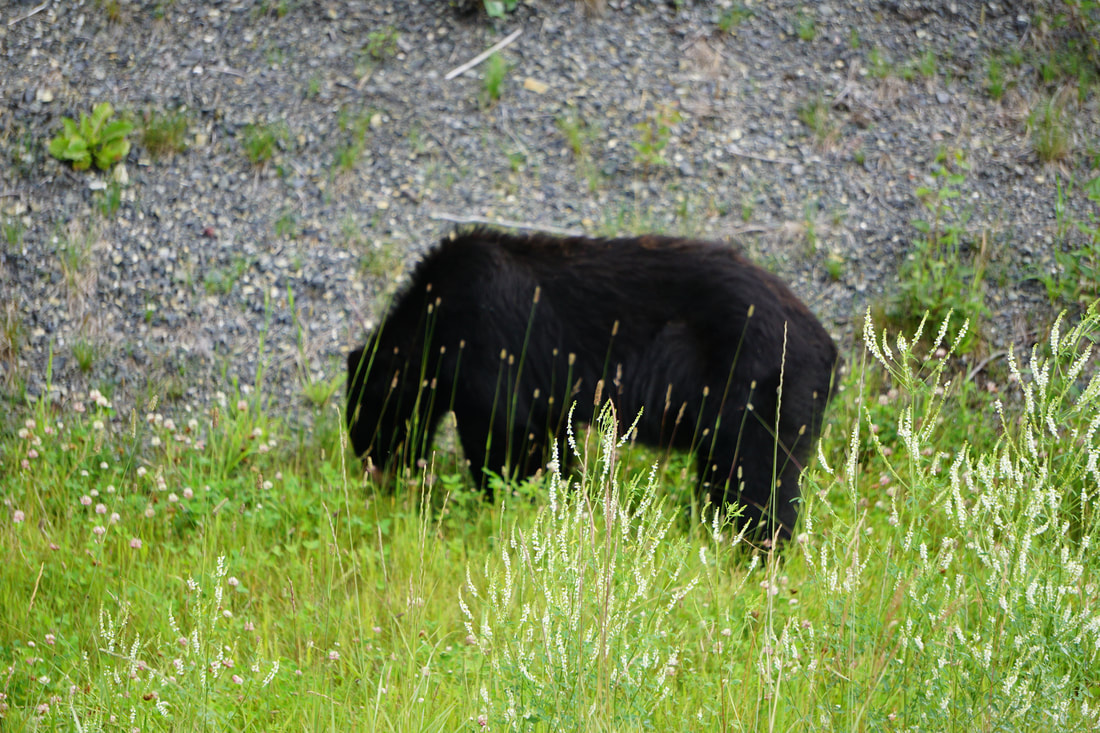 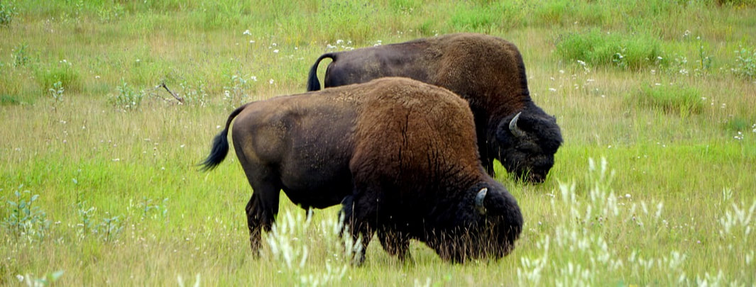 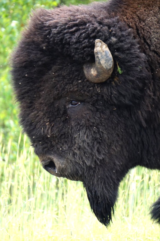 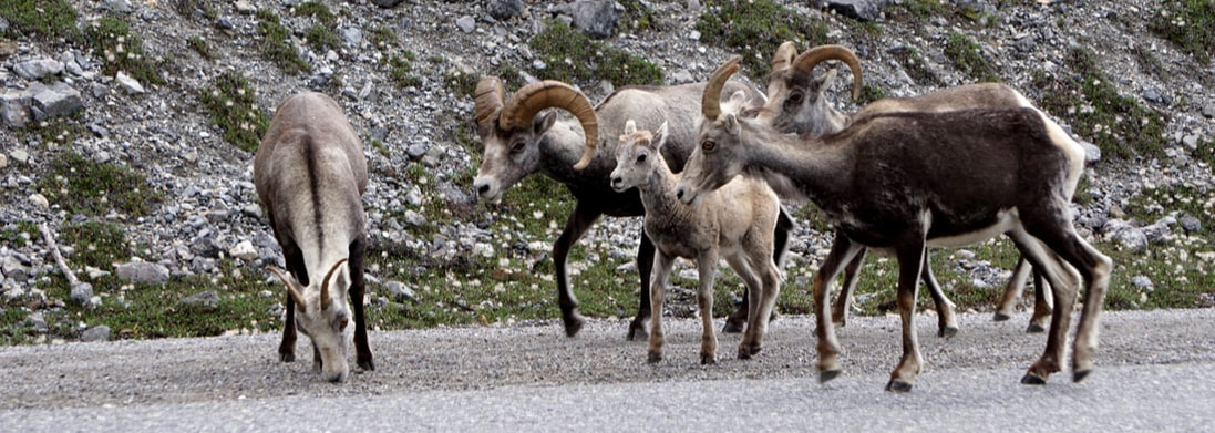 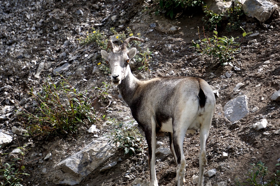 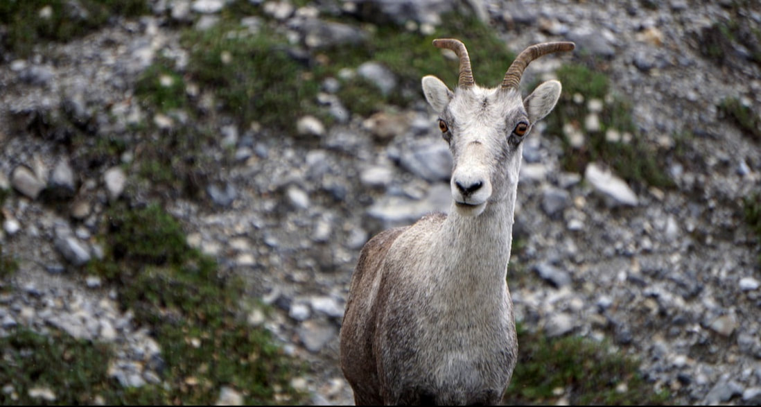 The mountain ranges were a constant all day, although they offered a big variety: old, rounded, green, tree-covered mountains; long strings of jagged granite cliffs silhouetted against the sky; brown, bare mountains covered in sand, gravel, and loose stone, and tall bluffs/cliffs upon which flat plateaus stretched. These mountains set as backdrops to beautiful blue-green lakes, smooth, lazy wide rivers, fast-moving streams with rapids, tree-covered meadows, and swampy valleys. This drive had it all! 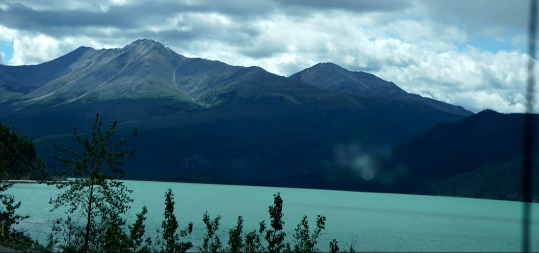 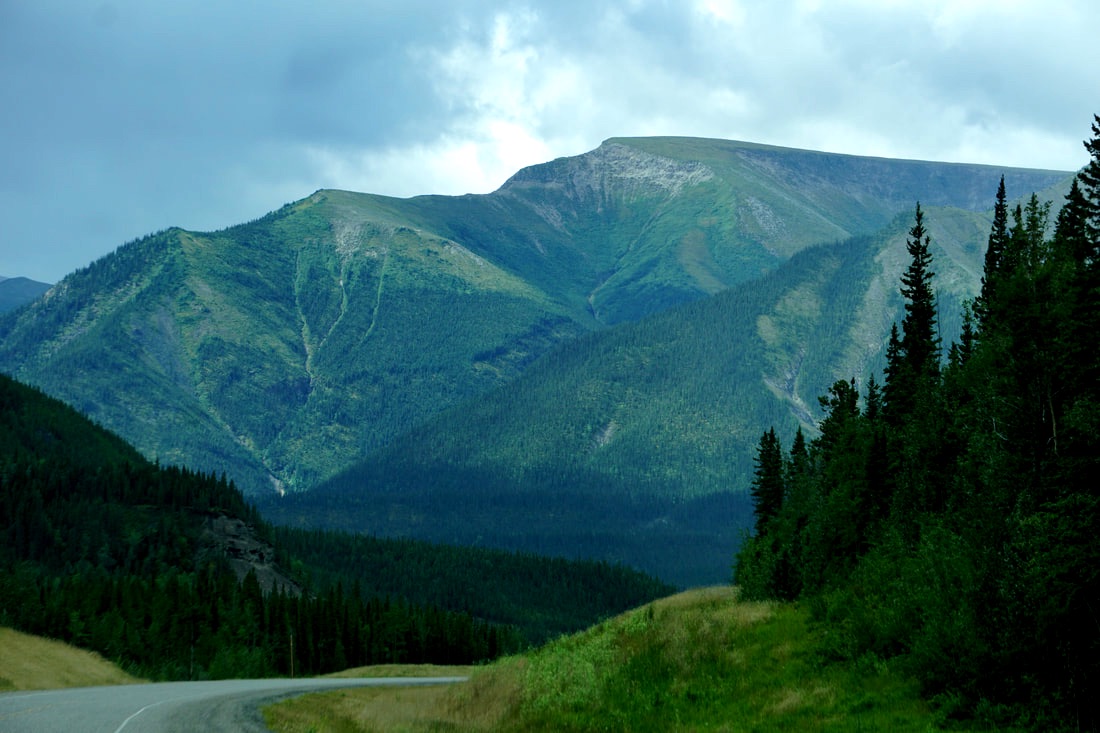 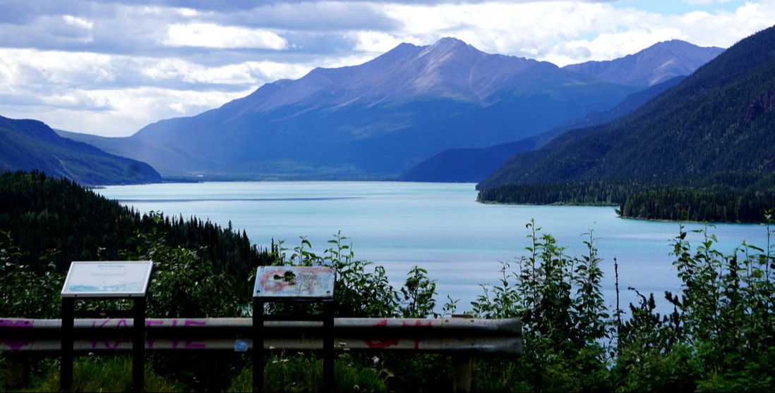 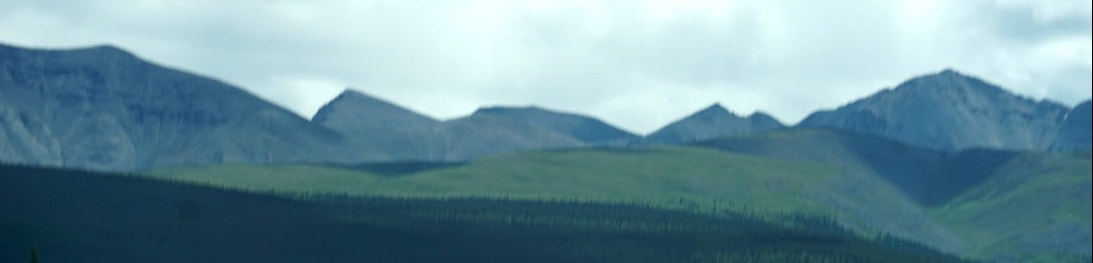 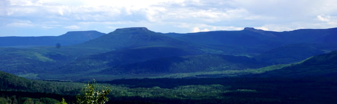 We got to Fort Nelson at 3:00, and feeling like driving another 3 hours drove on to Sikanni Chief. The weather was beautiful with temperatures close to 70 at the lower elevations and just two periods of rain that we drove through quickly. Although the privately-owned Sikanni had rave reviews in the Mileposts, it was the usual dusty and dirty parking lot with the added feature of a very large black mud-pit in the center! Tomorrow should see the end of the Alaskan Highway!
July 25, Tuesday Today we wanted to see how the other half arrived at the goldfields – via the town of Dyea and the Chilcoot Trail. The Chilkoot Pass became the emblematic trail of the Klondike Gold Rush, and pictures preserve the unbelievable scene of “The Golden Staircase” and thousands of miners climbing literally in the steps of each other to gain the top. Each miner had to climb the trail over 30 times to haul one year’s worth of food and gear up and over, or they would be denied passage. Imagine when they arrived at the goldfields of Dalton City to be welcomed by an established and well-stocked town! 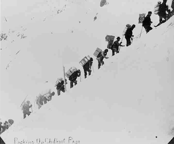 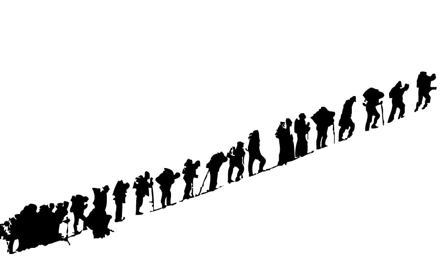 We stopped at the graveyard where many 98ers were buried – some famous (Soapy Smith) . . . and some unknown. Many were young men under the age of 30, along with teenaged girls and infant boys. 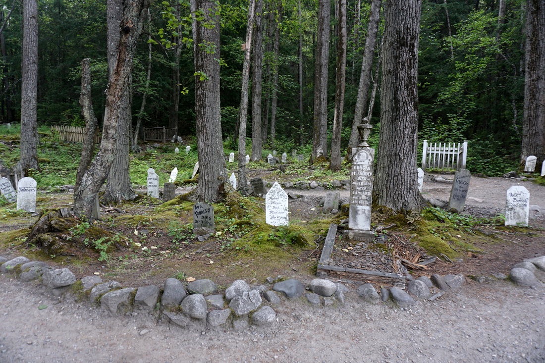 At one turnout we had a good view of the harbor down below where four new cruise ships had docked this morning. Each cruise ship holds about 2000 passengers, and it looked to us like all 8,000 were walking from the docks, past our campground, to the downtown shops! 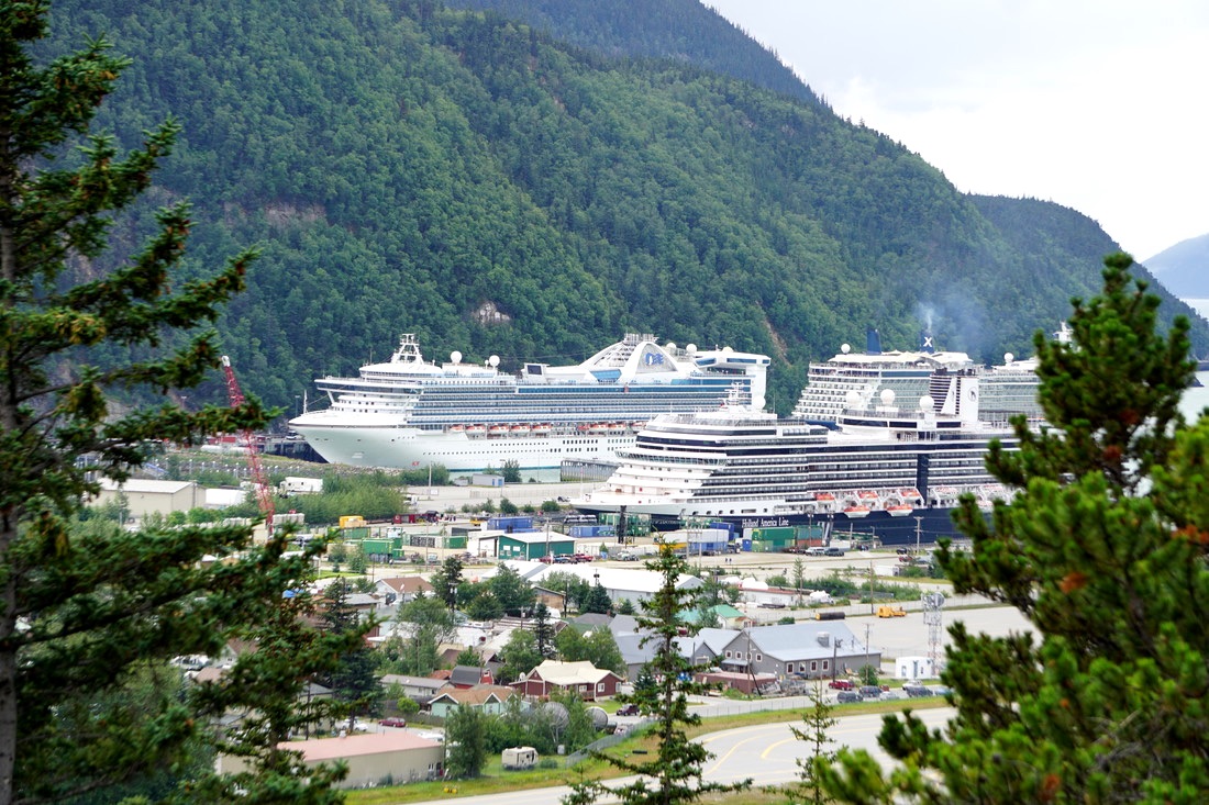 The way to the the town of Dyea and the Chilcoot trail was well marked as we drove the 5 miles. The scenery changed to a tidal plain with lush grasses and beautiful flowing waters. The town of Dyea was a short-lived community and nothing remains at the location. 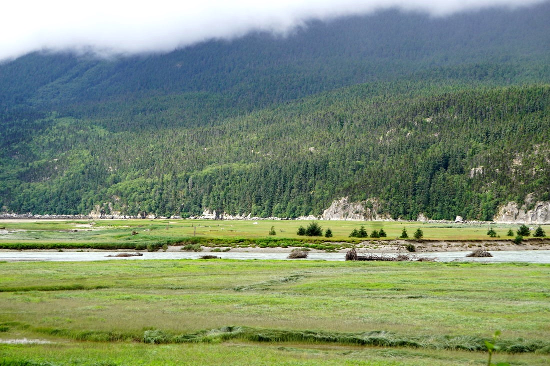 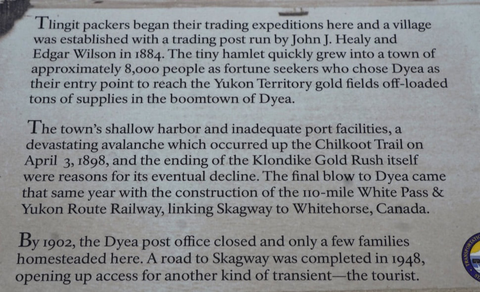 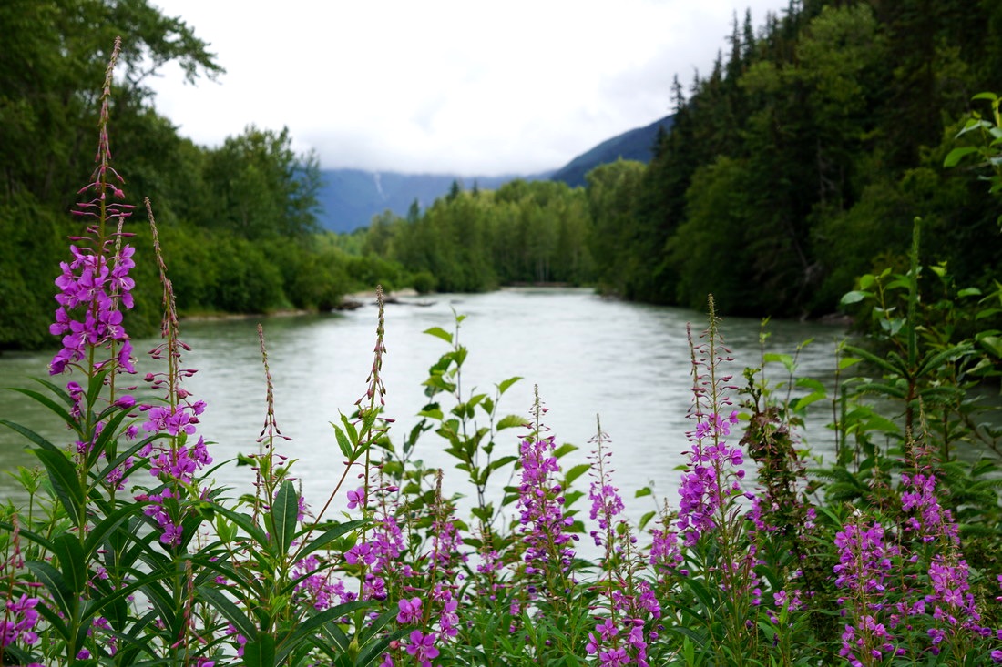 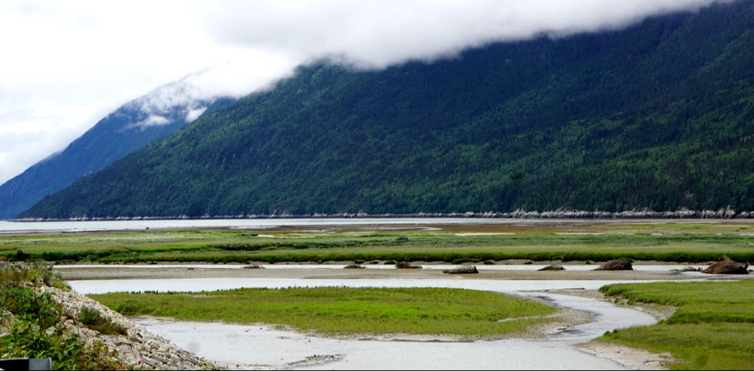 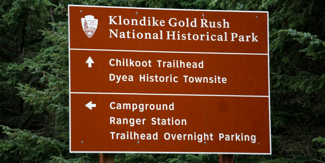 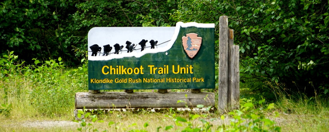 We walked back to the head of the Chilcoot Trail just as one group of overnighters was coming down, and another group was getting started on the 33-mile trek. Oh, I would LOVE to see that golden staircase! 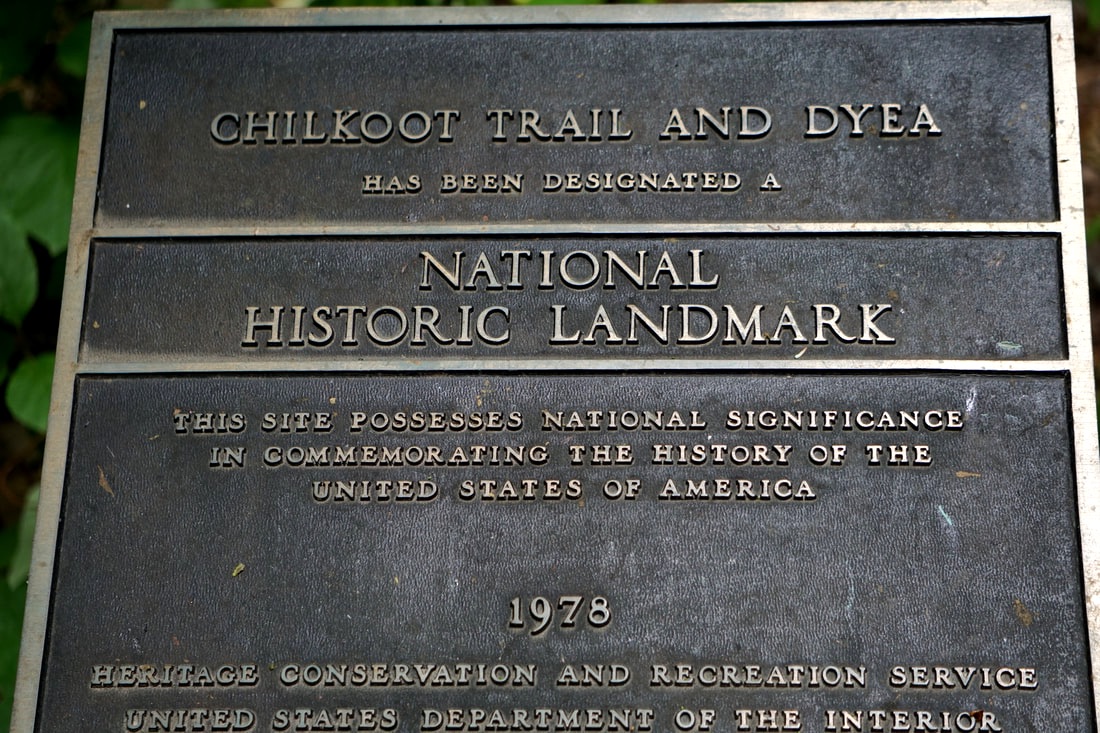 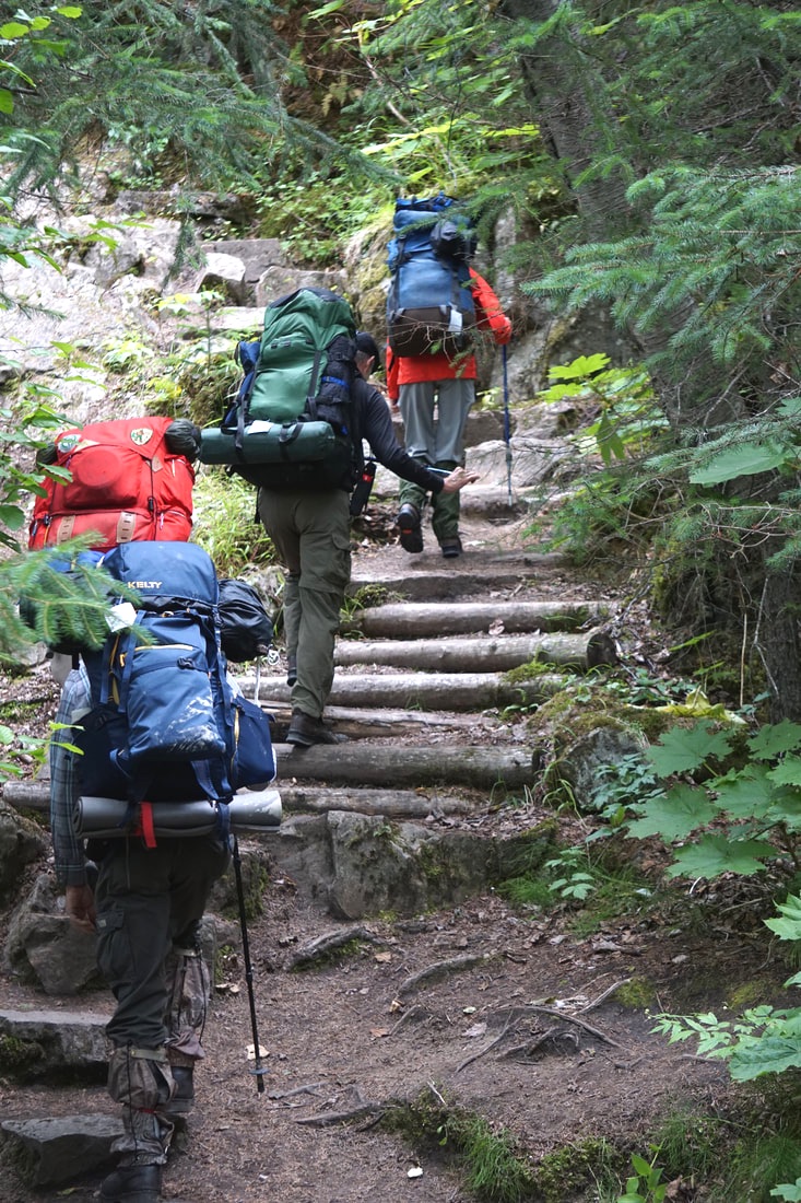 Another delight was just around the bend, as the road drove down close to the river. Tom saw fish jumping out of the stream! We pulled over, and low and behold here were Pink Salmon and spawning at it’s peak! Hundreds . . . thousands . . . swarms of salmon. My kingdom for a fishing pole! As much as we have read and heard about salmon spawning, it was quite something else to see it in this lonely, peaceful little valley. At times they seemed to spook, and as a group rushed up the river splashing and jumping and making lots of noise! 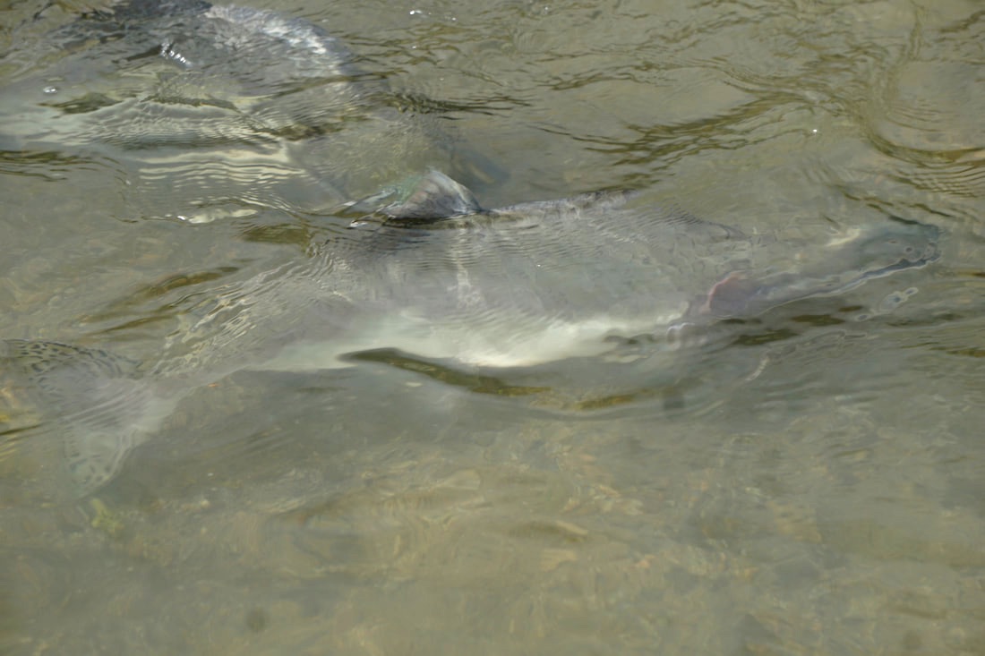 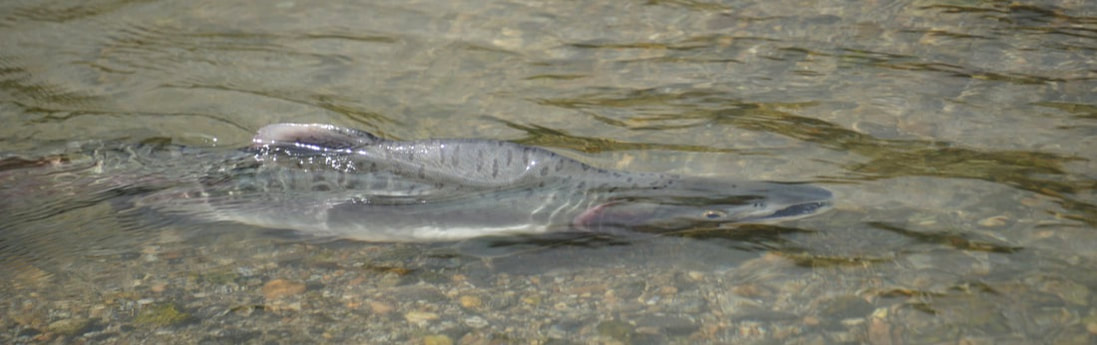 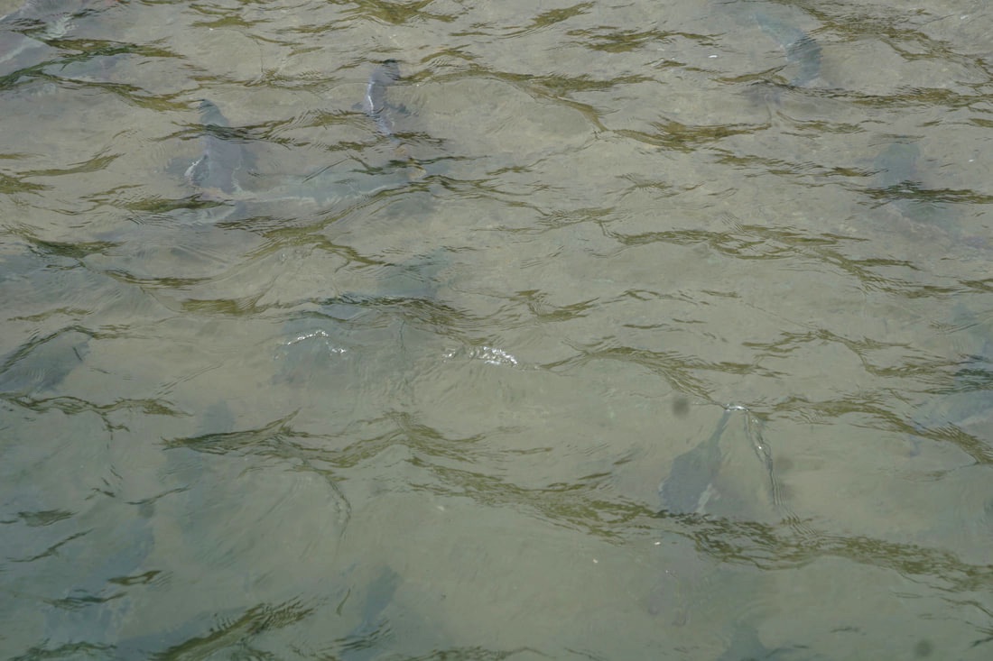 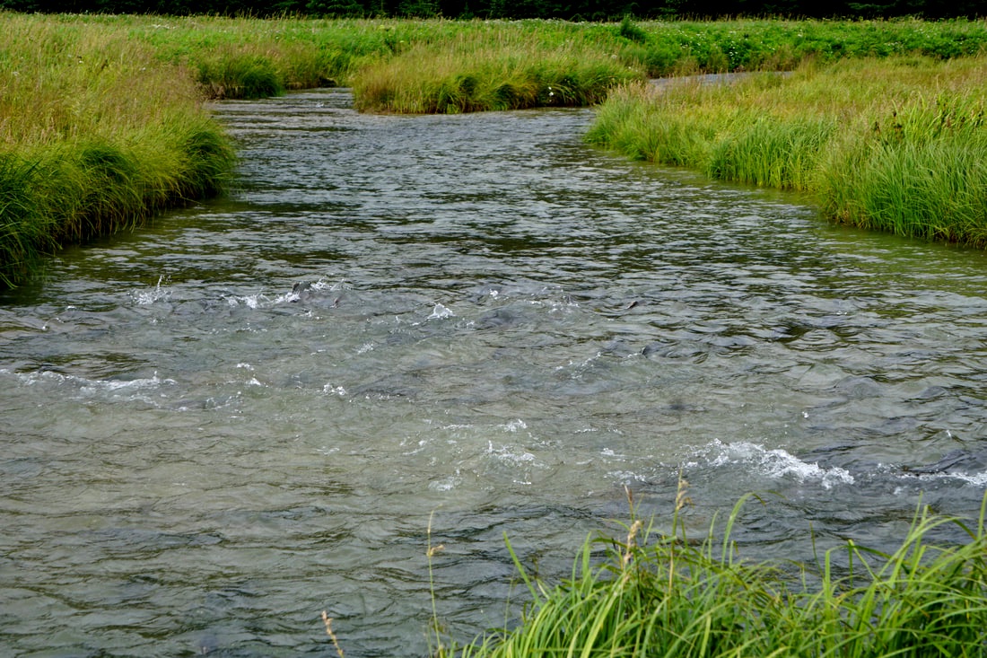 On the road back we stopped for a few more pictures – always different from another direction! 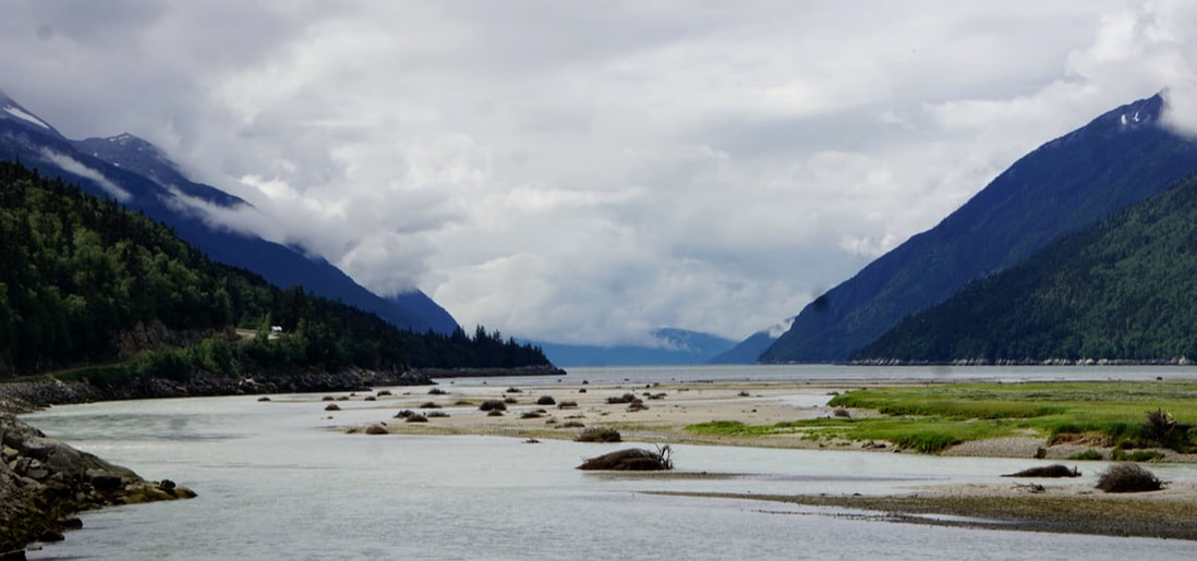 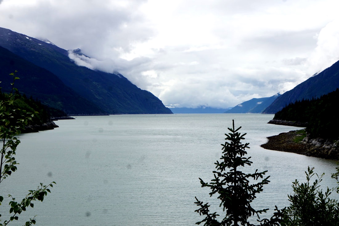 On the way back into town, I grabbed a picture of the Skagway Welcome sign. Over the three days we have been in Skagway we have walked from our campsite to the downtown several times for dinner or shopping, and it is by far one of our favorite Alaska towns. My parting shots today are of scenes of downtown Skagway. Tomorrow we are back on the AlCan Highway . . . and kind of turning towards home! 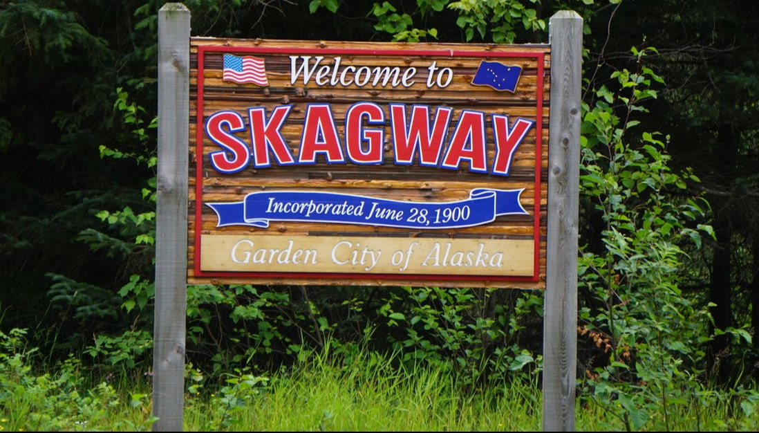 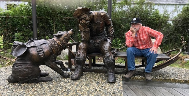 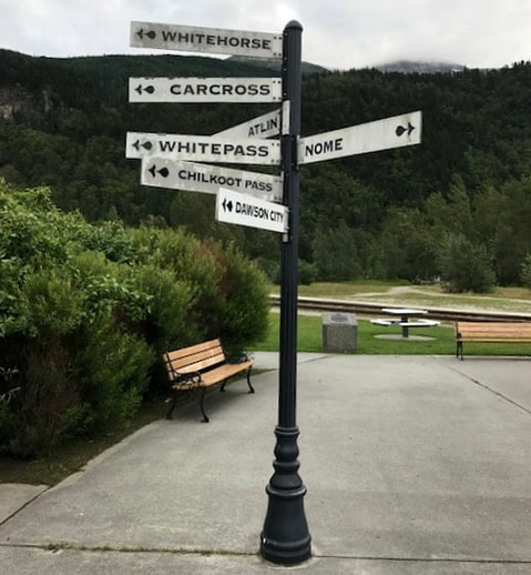 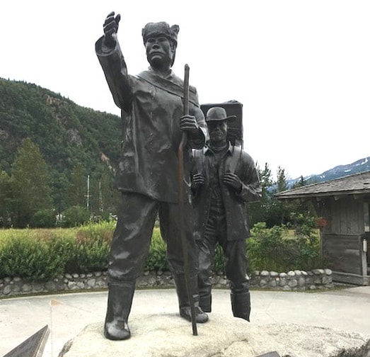 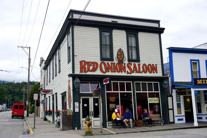 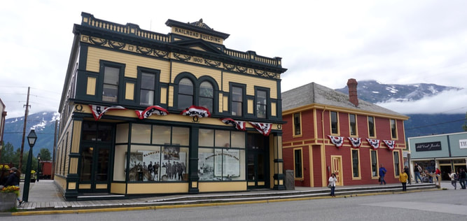 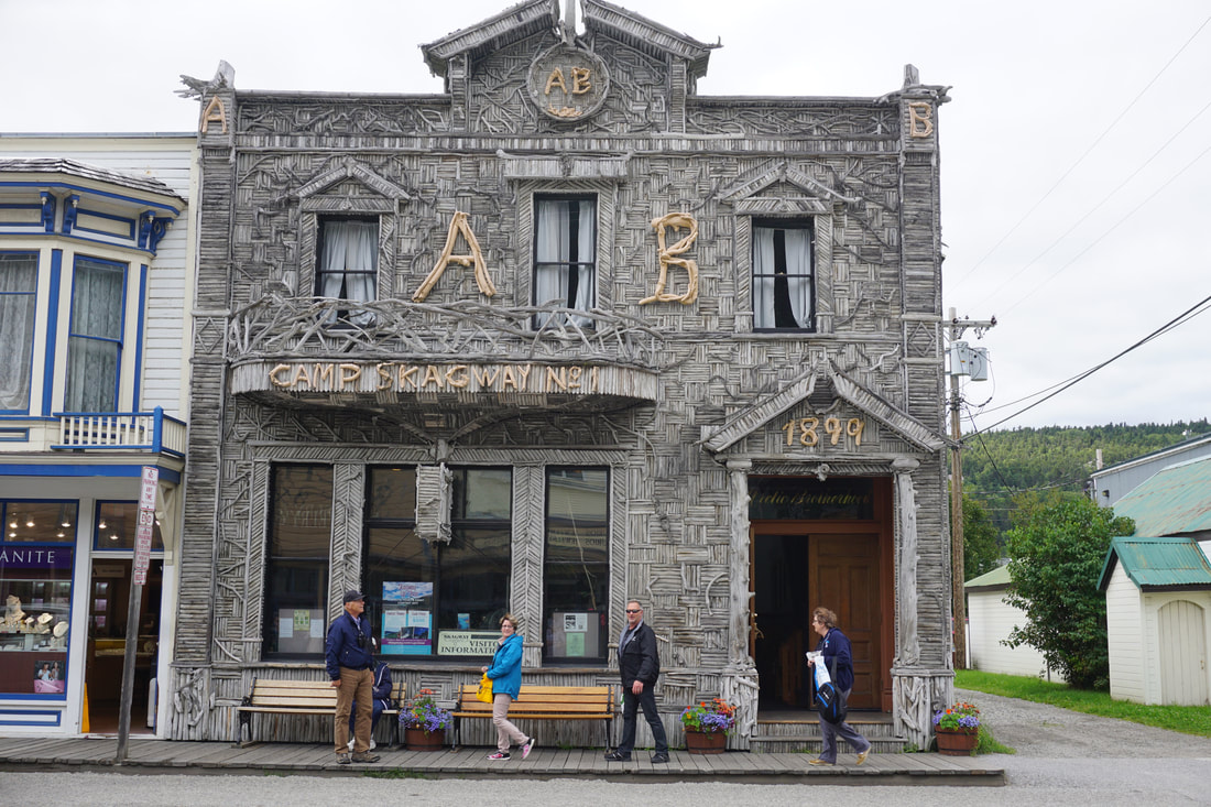 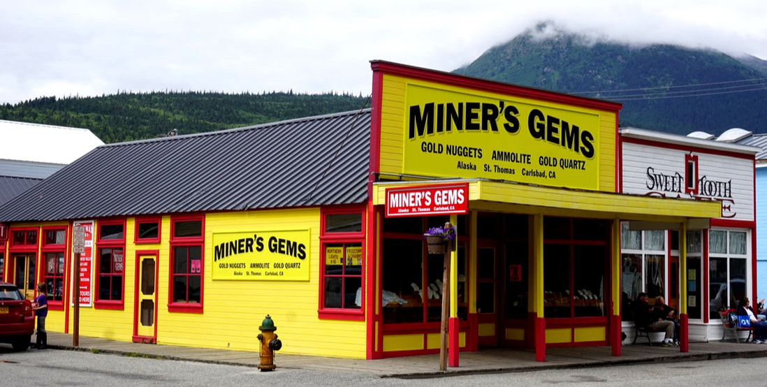 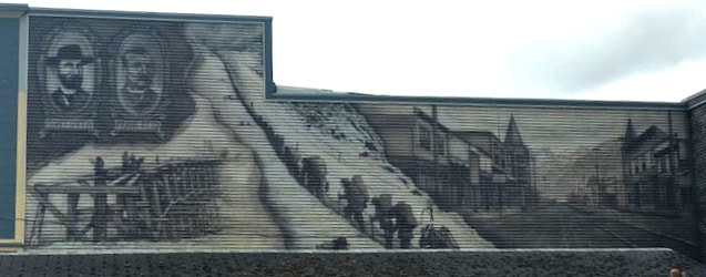 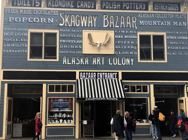 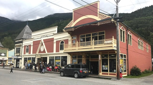 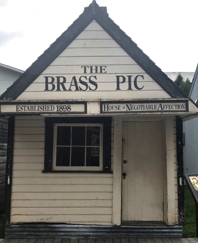 Monday, July 24, 17 Our train trip today was the Fraser Meadows Steam Excursion – four hours, 54 miles, departing Skagway at noon, climbing 3,000 feet in elevation (we started at sea level), and fully narrated by our coach attendant. The railroad was the White Pass & Yukon Route (WPYR) that was built from 1898-1900 just to service the Yukon gold fields. Before that, getting to the Klondike gold fields was not for the weedy! One route left Seattle and followed the inside passage (just like we did) and got off at Skagway or nearby Dyea. From Dyea they had to climb the Golden Stairs, looking like worker ants as they trudged nose-to-butt, up Chilcoot Pass. Each man had to make the climb 20-40 times to haul their 1,000 pounds of gear up and over the Chilkoot Trail. If they didn’t have the required gear, the Canadian Royal Mounted Police would not let them through. The other option was to leave from Skagway and negotiate the treacherous White Pass, often called “dead-horse-pass” because over 3,000 horses died on the trail in one winter. Whichever one they took, the miners swore they should have take the other! 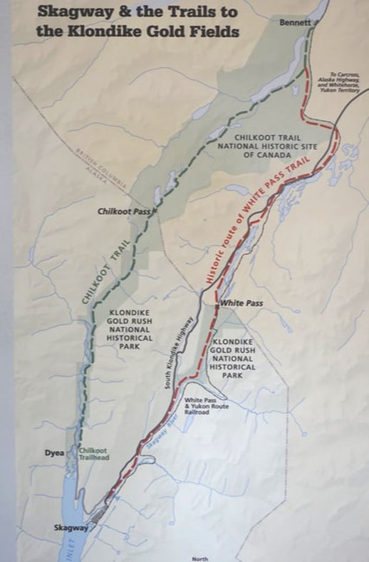 We walked from our campground across a little path and over a stream, and landed on the train station deck at 11:00. Our train was going to be crossing over the USA/Canada border, and even though we would not be getting off the train, we had to show our passports along with the tickets. Several diesel trains were arriving back in the station and loading up to go out again, along with our little black steam engine #73 – all narrow gauge. 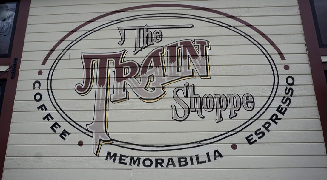 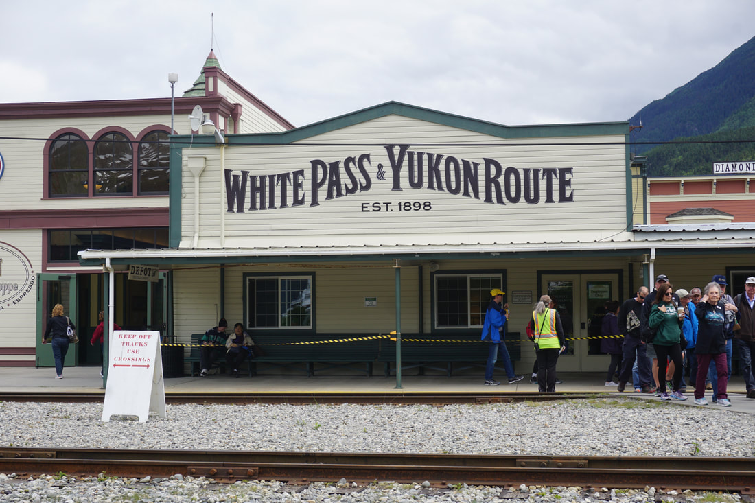 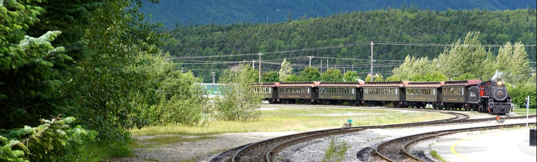 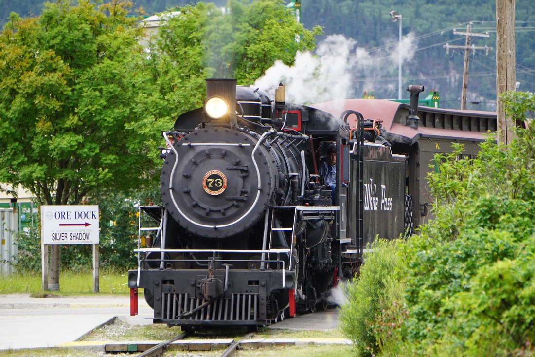 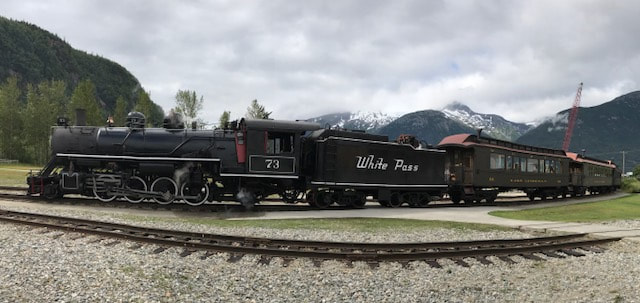 The first few miles were spent climbing out of sea level and skirting the Tongas National Forest coastal mountains and the Skagway River. Soon the train started winding around big bends to cross over a mountain stream, and then tunneled through two mountains to Dead Horse Gulch (that is where all the horses died!) and to the base of White Pass Summit. From here, due to the rise in elevation, short growing season, and 70 feet of winter snow, the vegetation thinned out and the stunted trees were only 3'-6’ tall -- but hundreds of years old! Along the way we could see the original trail of 1898 that the Stampeders followed! At our highest point, White Pass Summit at 2,885', we followed another 7 miles to our destination of Fraser. 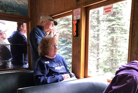 Ella got a seat in car #328, one of the newer cars. It was made in 1942 for the WPYR Railroad. 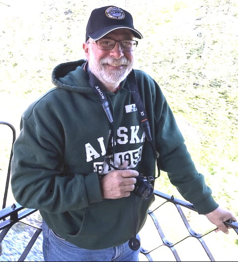 Tom, in his new train hat, took up position on the outside rear deck. 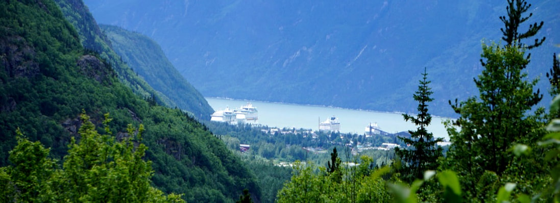 We had a brief glimpse of the Skagway harbor. 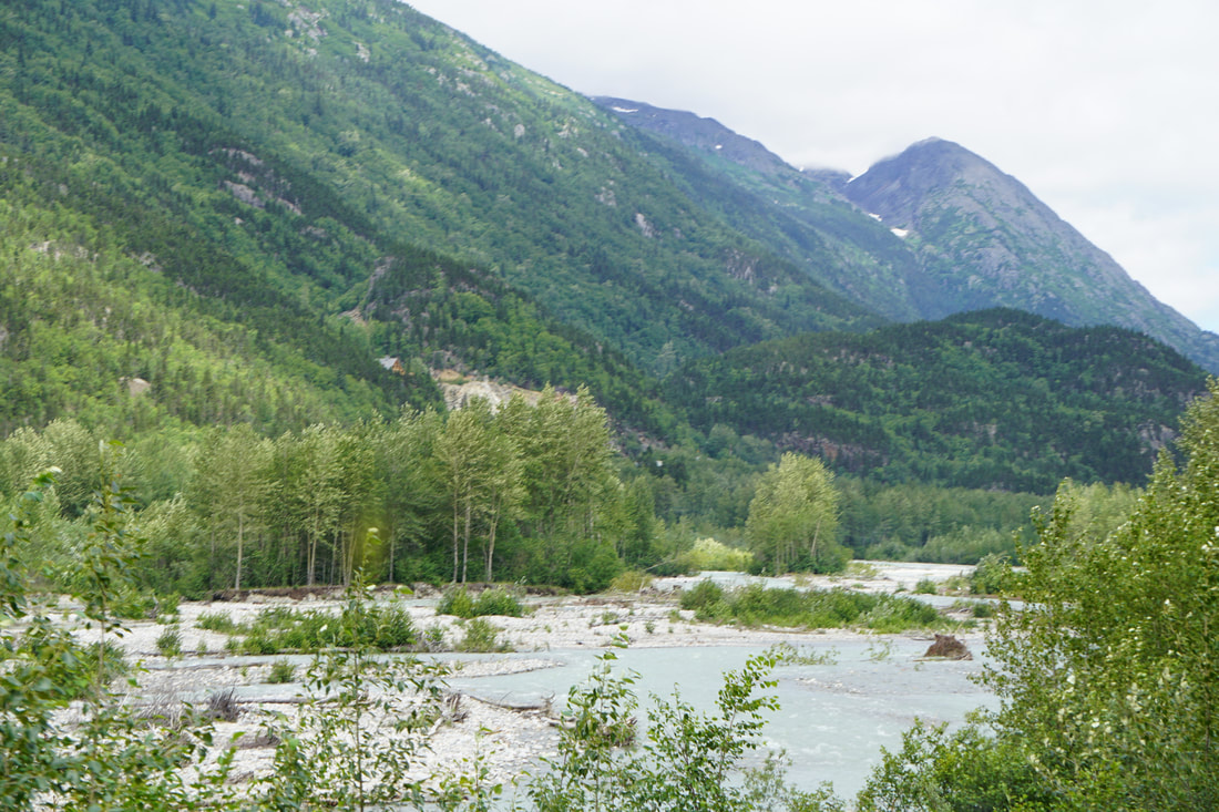  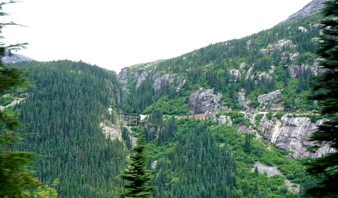 Far across the canyon, we saw the road that we had driven to Skagway. 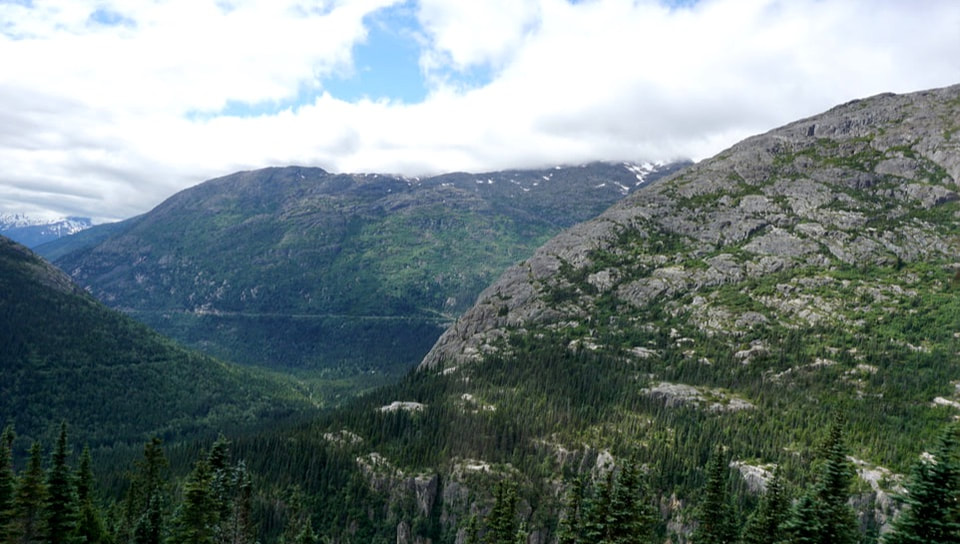 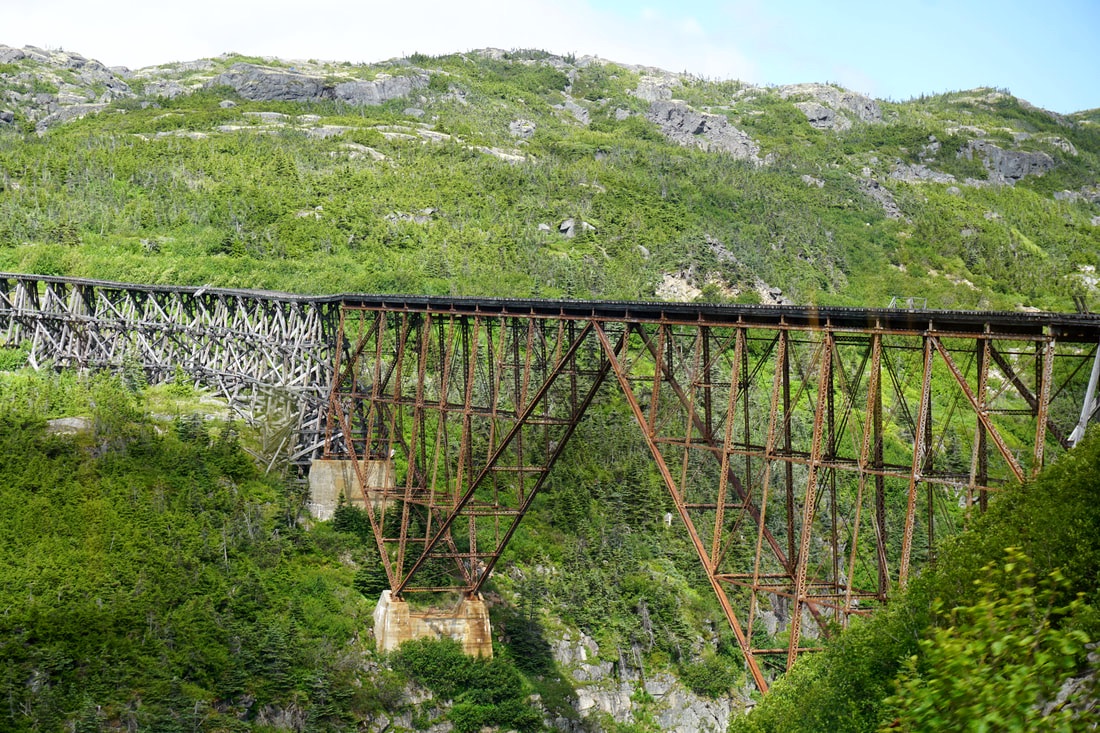 Thank the stars that this rickety, wooden bridge is no longer in use! 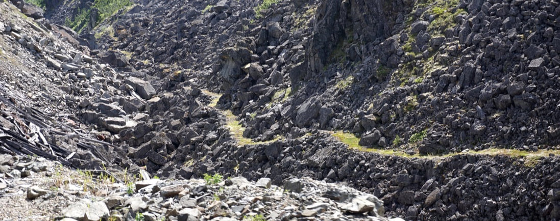 Along this portion of the tracks we could look across and see the original trail that the stampeders walked 119 years ago! 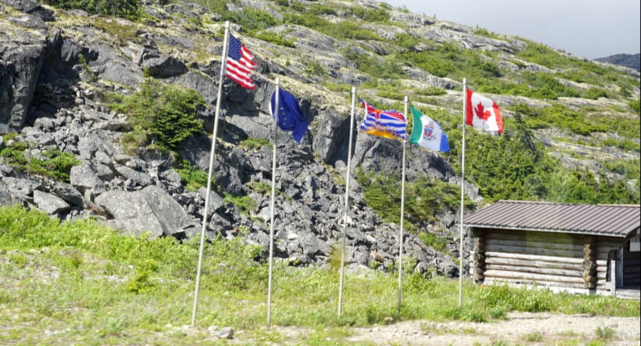 Crossing the USA/Canada border -- way out in the middle of NOWHERE! 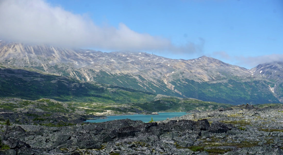 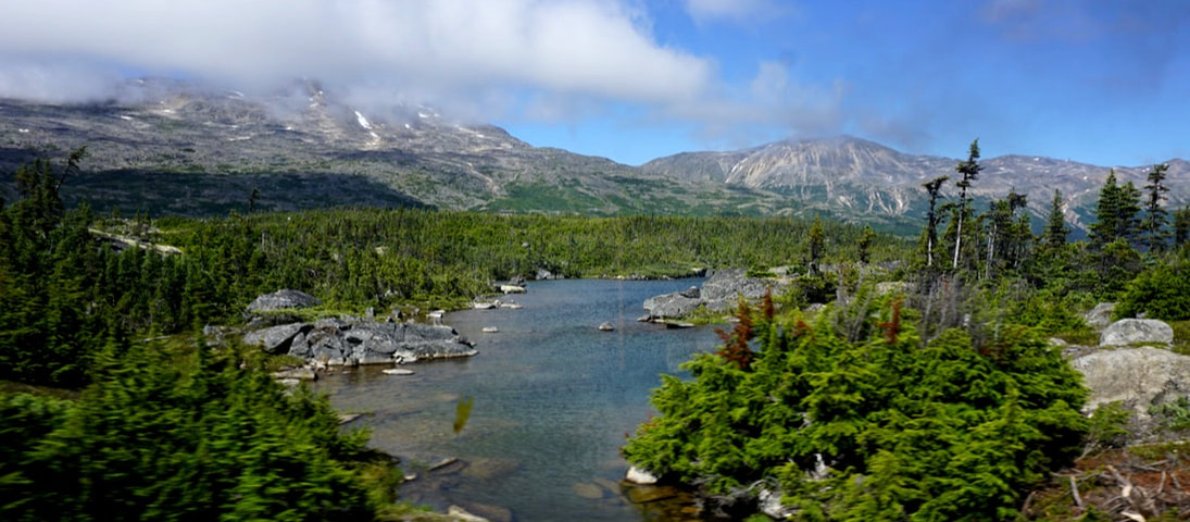 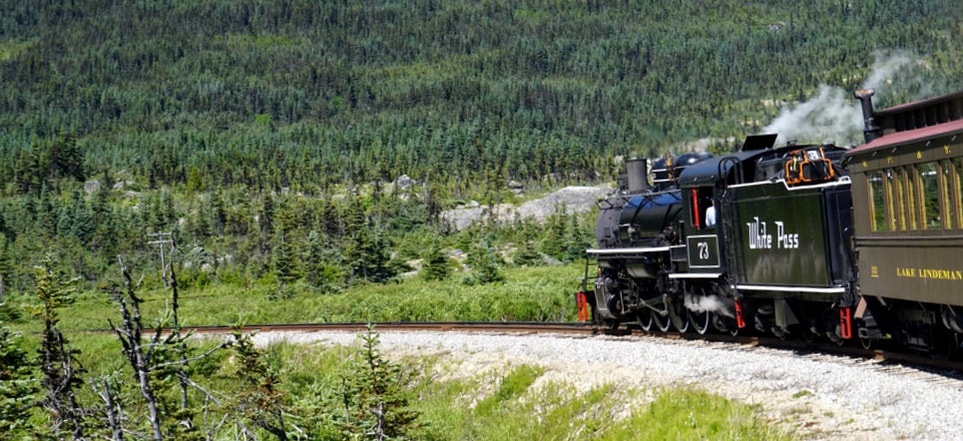 We caught an occasional glimpse of our engine as we went around a corner -- we were in the last car! 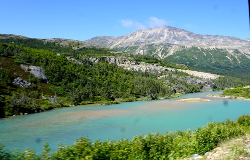 Fraiser was the end of the tracks for us. The miners hiked another 27 miles to Lake Bennett, where 30,000 of them settled for the winter of 1898-99 to build make-shift rafts to take them across Lake Bennett and down the Yukon River to the goldfields! For us there was a turn-around at the Canadian Customs, where we let the two Diesel trains go in front of us, and then we followed them down. If you want to see views of the return trip – look through the pictures above – backwards! Here is a picture of our route map today. Tomorrow we will be exploring the other route from Skagway to the gold fields -- the Chilcoot trail and the Golden Staircase. 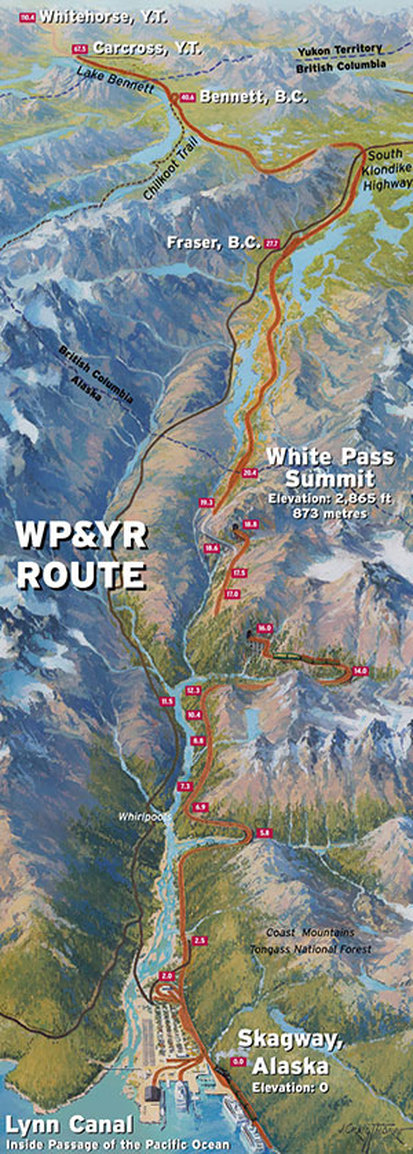 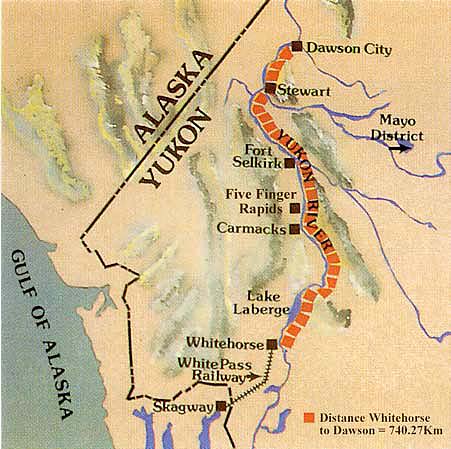 I didn’t crack the computer open to blog yesterday, July 22. The only event to record is that we moved from Dawson City to Whitehorse. On paved/gravel/dirt roads! 350 miles! Along the way we discovered that the trailer was leaking all of its fresh water onto the road. The shake-up on the dirt roads shook/broke the low-valve right off the water tank. After stopping at an RV repair place we learned the whole belly pan would have to come off for a true fix. Tom got some silicone seal stuff and tried to plug it up with that. Meanwhile we are in water business as long as we have city hook-ups! Another snag was the one we had been anticipating, and one we had hoped to be able dodge – a stone chip on the windshield! I saw the sucker coming straight for me, knew what it was, flinched, heard the crack . . . you can figure the rest. Whitehorse had a glass company, but it was closed on Saturday and Sunday. Today we are hoping that it doesn’t expand on the way to Skagway. We didn’t unhook, even though we were in Whitehorse. Camped next to us were two guys on an adventure. One was an aviation mechanic in the Coast Guard heading to far-out Kodiak island for 3 years; his wife and son will be joining him later. The other was his best-bud who figured one person shouldn’t make that journey alone – from Virginia Beach to Homer, Alaska! The saga would end after 10 days with one flying home from Anchorage, and the other loading on the ferry for Kodiak Island. Their jeep was equipped with a platform tent on the top and a tent section that hung down along the side – one slept up and one slept down. It was obvious they weren’t going anywhere for supper, and we invited them over for BBQ Pork Sandwiches, Italian Sausage, macaroni and cheese, and baked beans, and had a fun time around the picnic table sharing stories. Sunday, July 23 This morning, I feel like I need a vacation from my vacation. Poor Tom assumes more and more of the work and I find more and more ways to shirk. 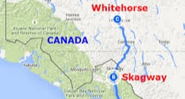 Today is a short drive to Skagway. We are back on the coast of Alaska, and it is our last planned stop of the trip. Skagway is called the "Gateway City" -- and I am wondering if we did our whole tour . . . backwards? After that we will turn for home and decide day by day how we are going to go and how long we are going to stop. There was no gold in Skagway. Instead, it was one of the ways to get to the Dawson City, Yukon goldfields. For miners arriving by boat, from Seattle or Vancouver through the inside passage, there were two choices to hike to Dawson City -- Dyea via the Chilcoot Trail, or Skagway via the dreaded White Pass. The Mayo drive took a bit of time, as it was so stunning with pull-offs that called to us to STOP! We passed a desert -- we passed a lake that was emerald green -- we passed a mountain pass that filled in with clouds! And, what we didn't get pictures of this time around we will get later this week when we drive back to Whitehorse.  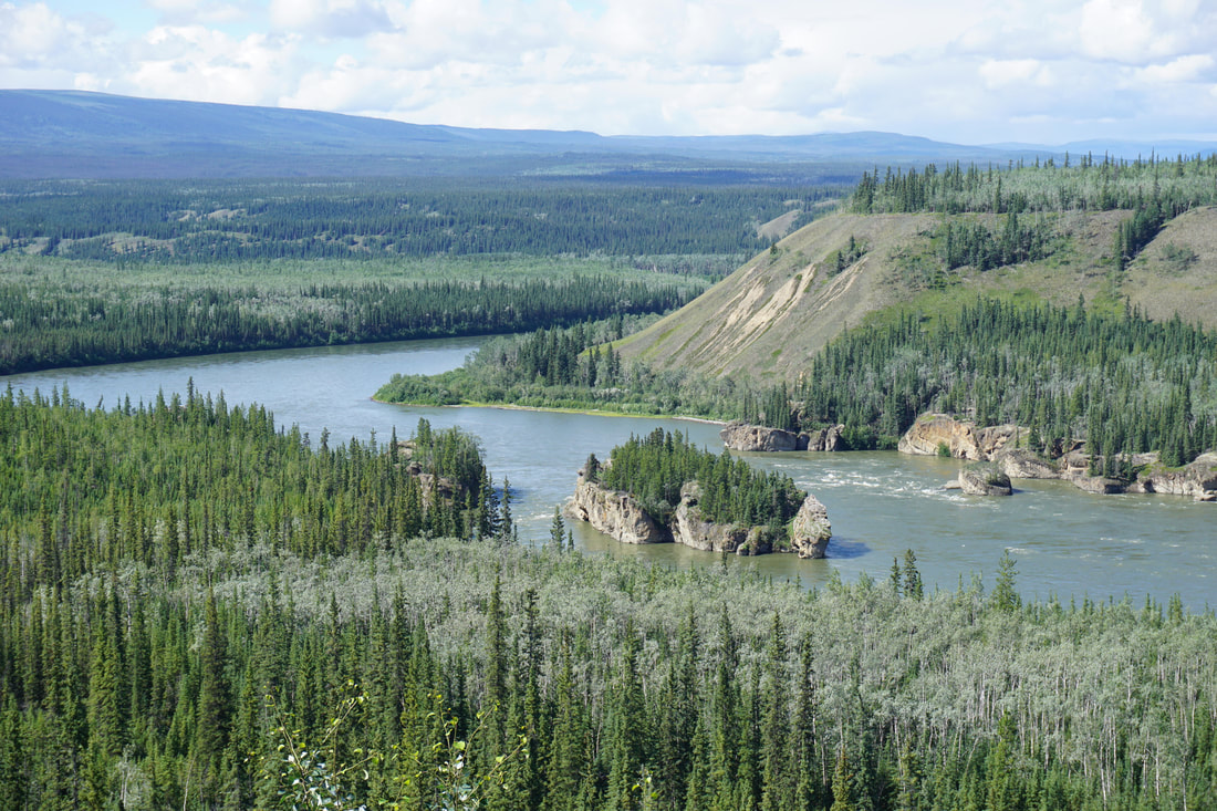 The swift water and narrow channels through Fiver Finger Rapid posed a formidable danger to the overloaded boats and rafts of the 1898 Klondike Stampeders. 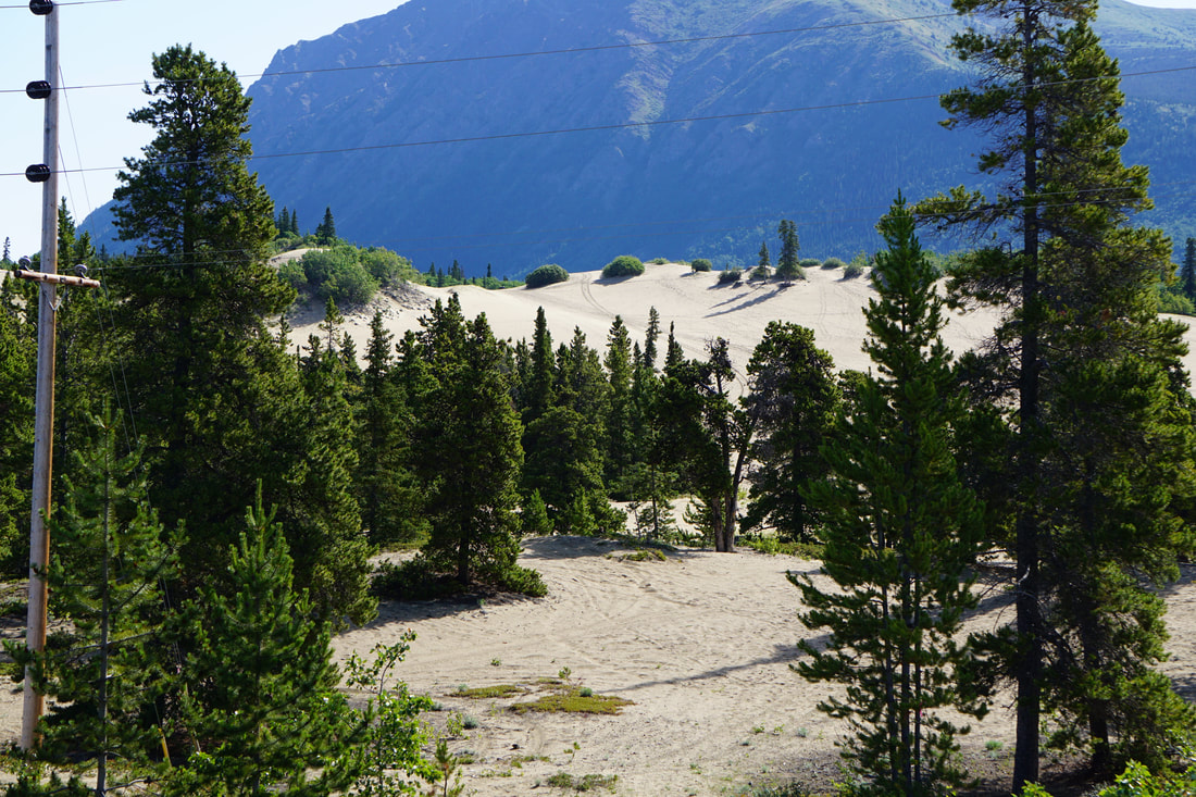 Would you believe an area of sand dunes in the mountains of Alaska?  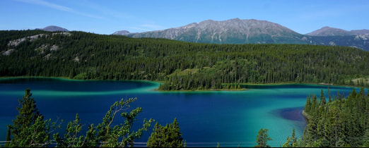 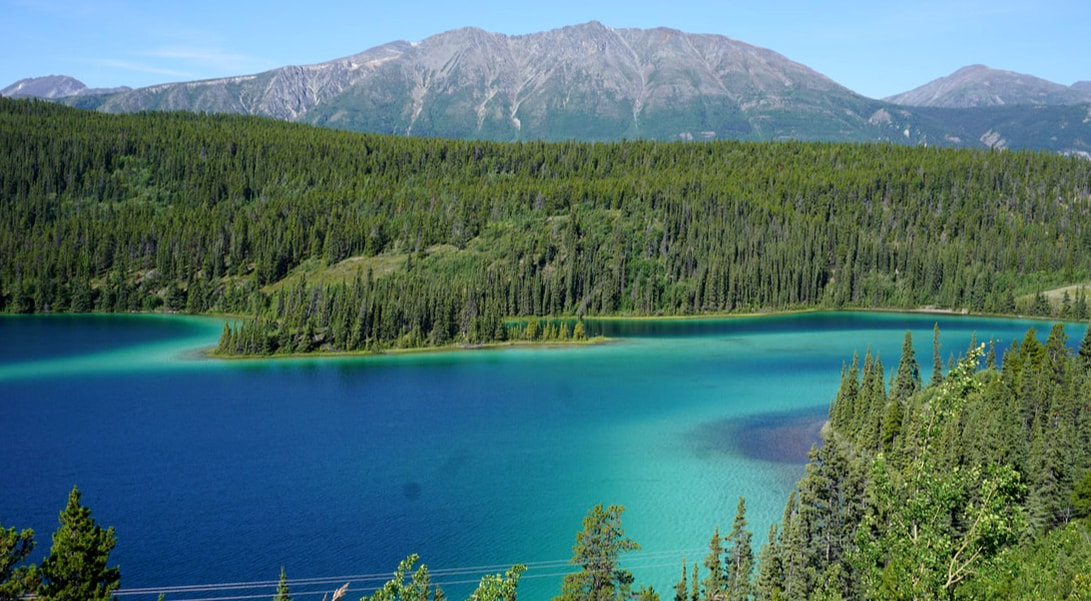 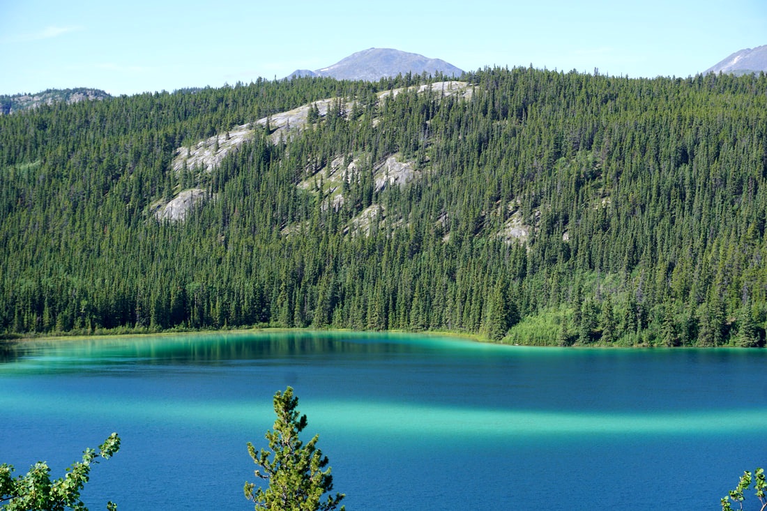 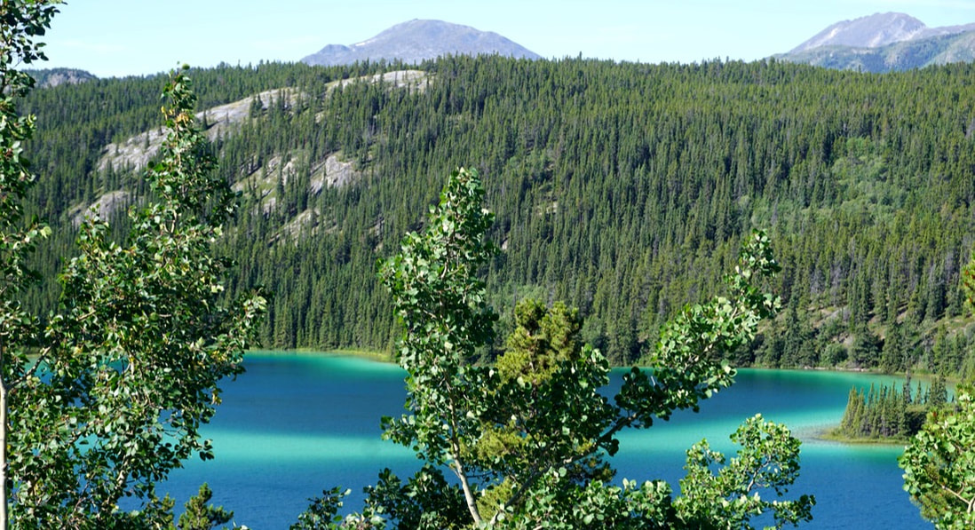 Carcross was a little stop half-way between Whitehorse and Skagway -- an unusual little way-station (not quite a town) with raised boardwalks and brightly painted store fronts featuring First Nation's clans and some really nice shopping.   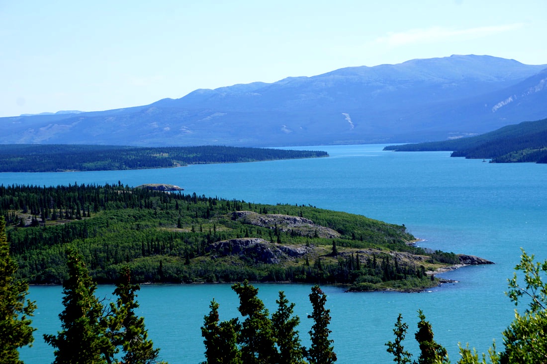 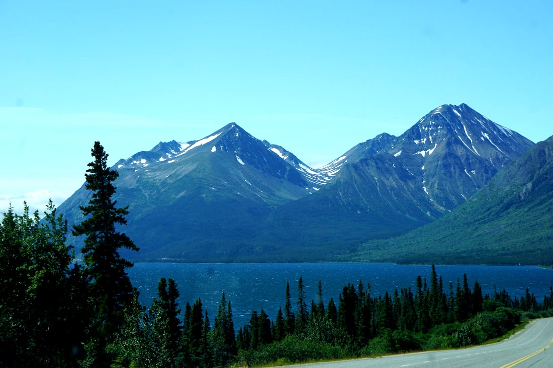 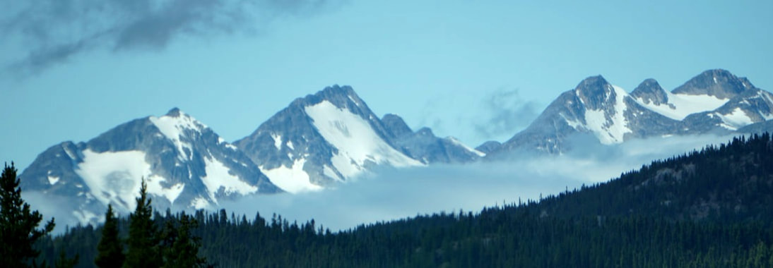  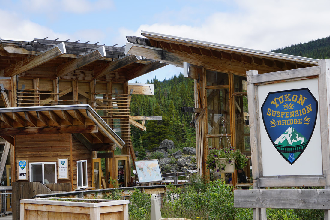 This place charged $18 to walk down and see theYukon Suspension Bridge. PASS. . . At the US border, we were asked these 5 words: "Are you bringing anything in?" Our answer - NOPE! I think they could tell we were experienced border-crossers! 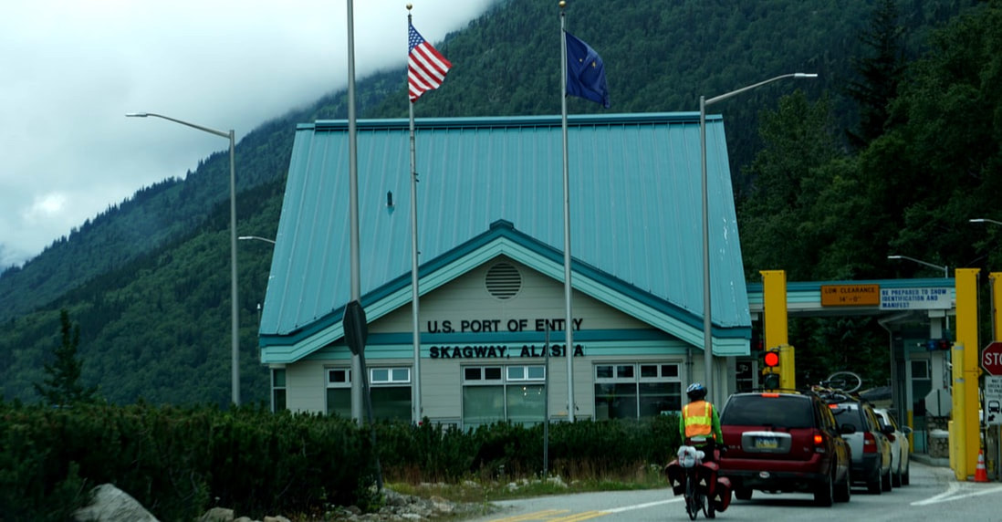 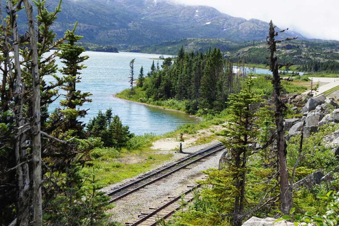 Our campground for the next three nights is Pullen Bay, right down on the Harbor with a short 3-block walk to town. We knew we were back in the cruise-ship domain when we saw two large liners parked in the harbor, and the tell-tale passengers roaming the streets. We set up and headed off down town and were pleased to see another little mining-town still going strong – well-cared-for stores, nice boardwalk sidewalks, and lots of attractions associated with the Skagway National Historical Park. We popped in The Railroad Store and bought tickets for the train through the White Pass for tomorrow -- a journey through the Yukon route to the gold fields. 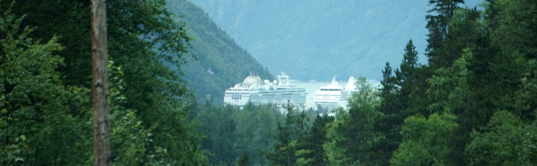 July 21, Friday We began the morning with a big breakfast at an Espresso Bar and a bit more canvassing of the downtown area. Dawson City is inseparably linked to the Klondike Gold Rush; it began in 1889, was incorporated in 1902, and quickly jumped to be a thriving city of 40,000 . . . in 2016 its population was 1375! A few main streets are paved but covered in a layer or dust, and the rest are quaint and somehow fitting dirt roads. The store fronts are re-constructed old-townish in bright colors, and preserve many of the same names and functions as the original buildings. Side by side are buildings that have been shuttered up and untouched for over 100 years. Sometimes it is hard to tell the difference between the old and the new. 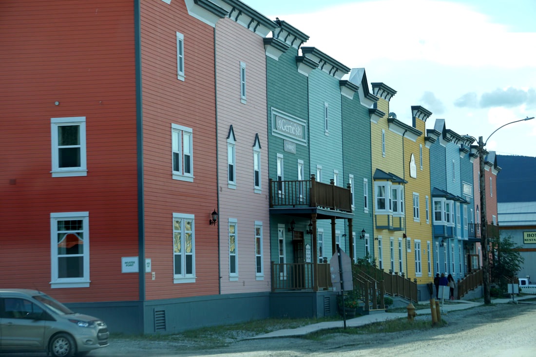 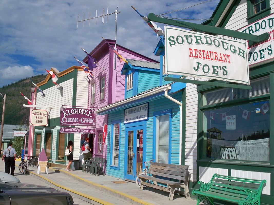 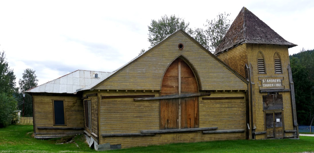 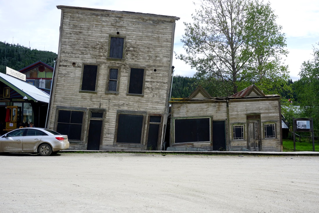     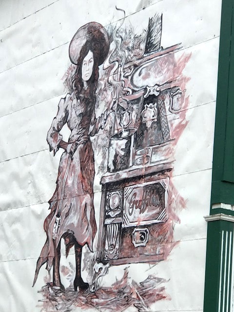 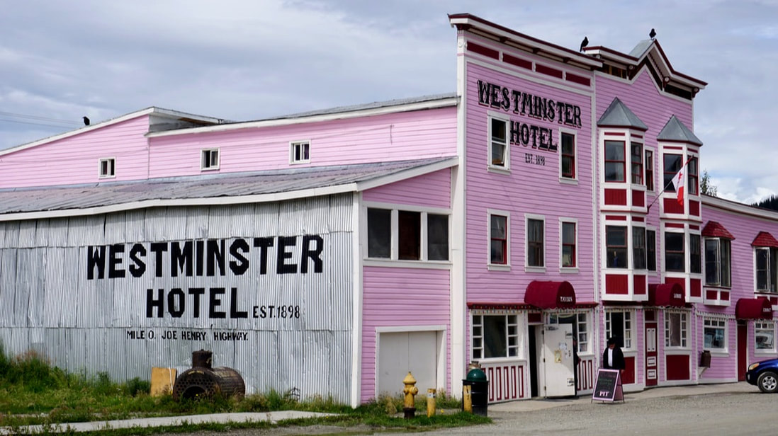 We headed out of town to see the Dredge No.4, a wooden-hulled bucket-line sluice dredge that mined placer gold on the Bonanza Creek from 1913 – 1959. It was the largest wooden-hulled dredge in North America with 72 large buckets excavating at the rate of 22 buckets per minute. It is essentially a floating boat that excavates raw material from a flooded “pond” through a process designed to cull the boulders, rocks, pebbles and sand, ending in a material called “black sand” which was then panned down, the old-fashioned way, by hand, with a gold-pan and water. The same process continues from hundreds of years ago to be used today in the TV show Yukon Gold. Dredge #4 worked 24/7 from late April until late November each season -- when the temperatures were above -40 degrees. (did you know -40 degrees is where the Fahrenheit thermometer meets the centigrade thermometer?) Our tour host was a great guy and had a lot of stories to tell about the days of operation of Dredge #4. It lay covered in frozen mud for over 30 years and was then purchased by Parks Canada for $1 in 1970 and excavated in 1992 and is now a National Historic Site of Canada. It is simply incredible! 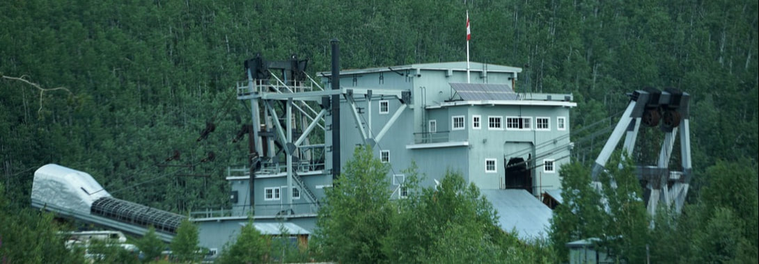 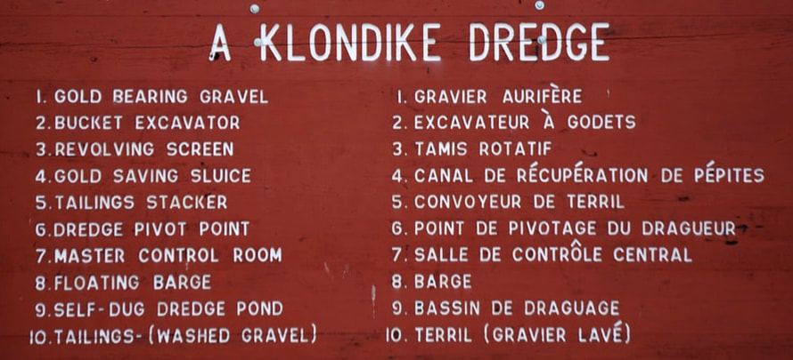 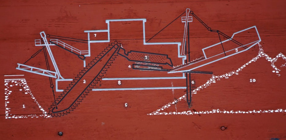 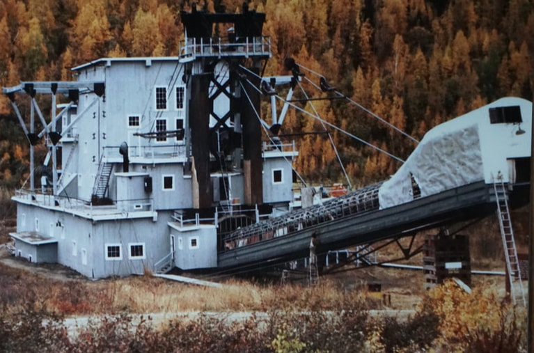 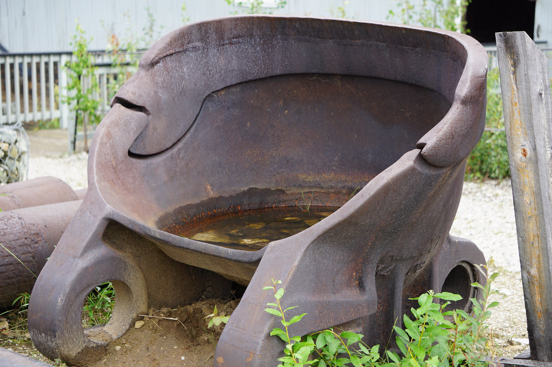 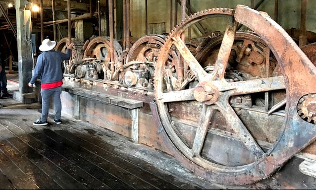 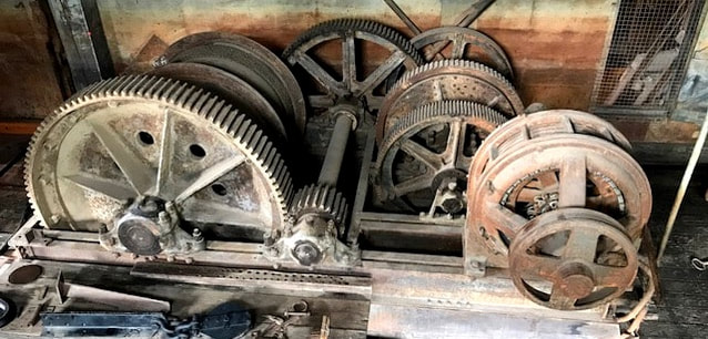 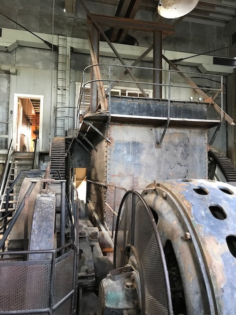 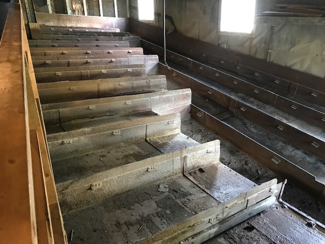 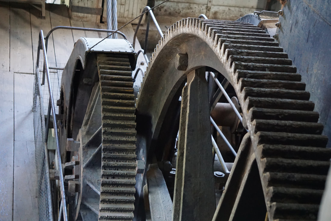 At that we returned to the Silvermine to pick up Charlie Button for an expedition to Midnight Dome Road. I forget the whole story of how it got its name, but I will share some spectacular pictures that we got of the Yukon River and Dawson City from high on the Dome lookout. 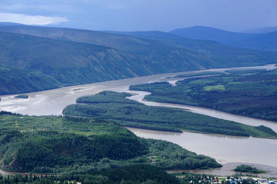 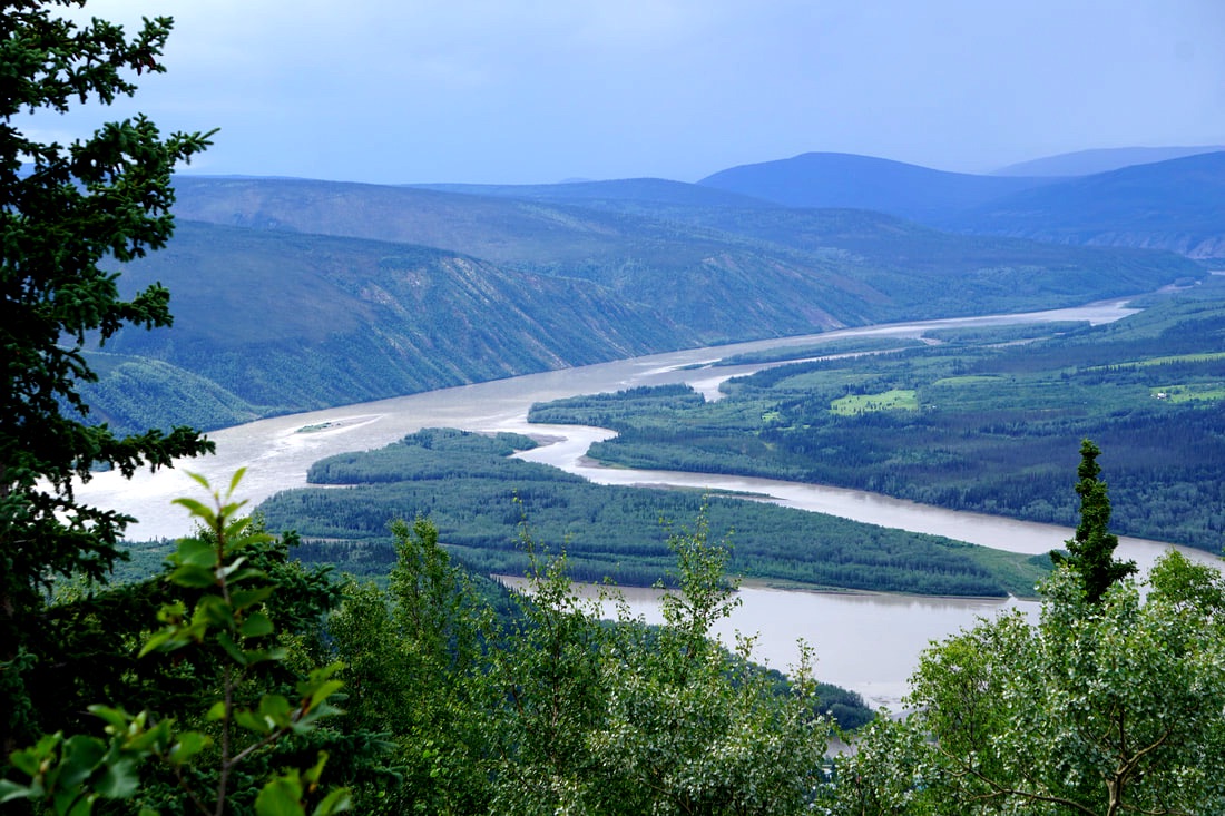 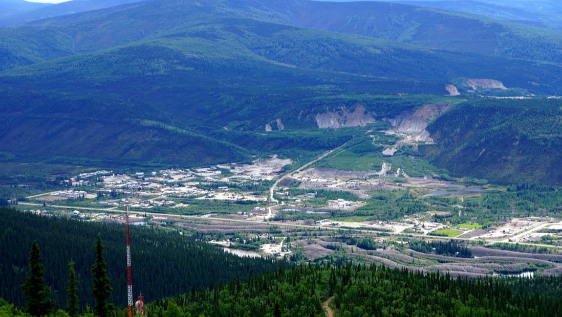 Our final stop for the day was the homestead cabin of Jack London, who at the age of 21 hustled out to be part of the Klondike Gold Rush from his home in San Francisco. He lived in this cabin on Henderson Creek for a summer and a winter, and returned to California penniless and sick – but with the motivation to write his famous novels The Call of the Wild and White Fang -- both of which we are listening to on audio tape as we drive along. His cabin was moved from its original location to Dawson Creek, and set up down the street from the Yukon great poet, Robert Service. It is just a one-room cabin with a food-cache, but many of the logs are the original logs! 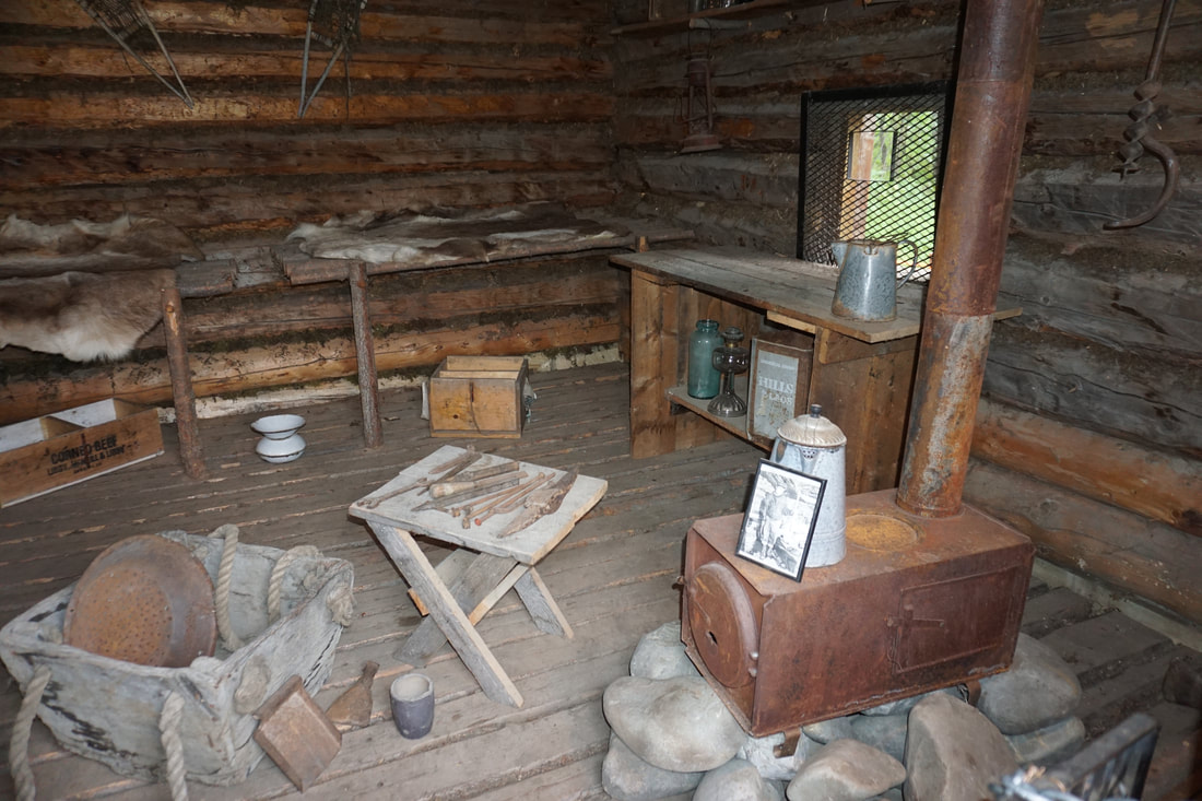 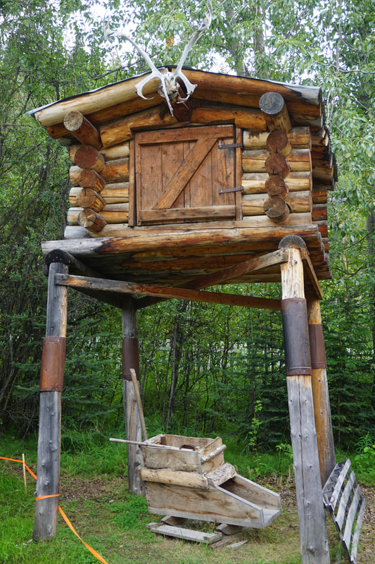 Robert Service lived a simple life in this cabin that sits on its original location. From here he wrote novels, but is mostly known for his poems: “The Cremation of Sam McGee,“The Ballad of Blasphemous Bill,” “The Shooting of Dan McGrew,” and (my favorite) “Bessie’s Boil.” His poems paint entertaining pictures of what life on the Yukon was like. I bought a little booklet of his poems and read them to Tom as we drive along. 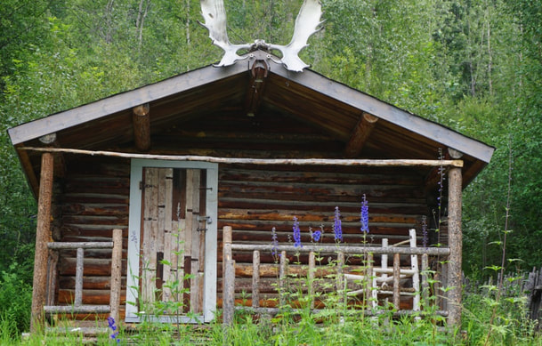 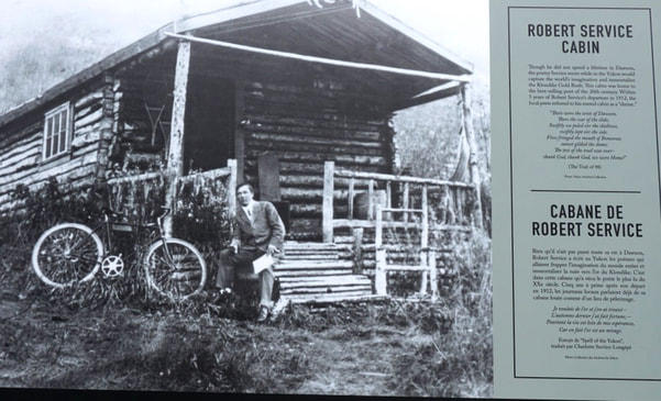 That’s a wrap for Dawson City. I do want to point out again that we are in Yukon Territory, Canada. I had always thought of Dawson City as being in Alaska. Tomorrow we move on to Whitehorse! That is also in the Yukon!
July 21, Friday I Just have to post this story as a separate blog post. We had heard the story of the “Sourtoe Cocktail” and decided last night that we should check it out – and that TOM should take the challenge. We found the saloon and asked at the bar, but they don’t bring out the toe until late in the evening. . . we weren’t going to wait around for 3 hours for any toe!  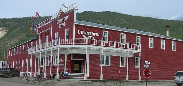 Here is the Origin of the story: The legend of the first “sourtoe” dates back to the 1920’s and features a feisty rum-runner named Louie Linken and his brother Otto. During one of their cross-border deliveries, they ran into an awful blizzard. In an effort to help direct his dog team, Louie stepped off the sled and into some icy overflow—soaking his foot thoroughly. Fearing that the police were on their trail, they continued on their journey. Unfortunately, the prolonged exposure to the cold caused Louie’s big toe to be frozen solid. To prevent gangrene, the faithful Otto performed the amputation using a woodcutting axe (and some overproof rum for anesthesia). To commemorate this moment, the brothers preserved the toe in a jar of alcohol. Years later, while cleaning out an abandoned cabin, the toe was discovered by Captain Dick Stevenson. After conferring with friends, the Sourtoe Cocktail Club was established and the rules developed. Since its inception, the club has acquired (by donation) over 10 toes. Here is the Recipe: Sourtoe Cocktail Recipe:
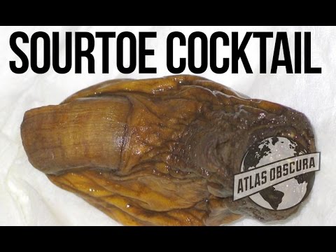 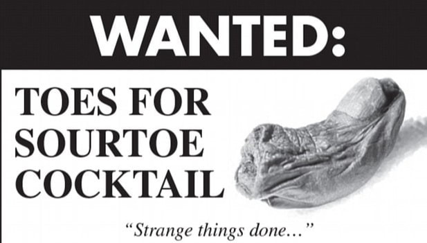 From everything we read and heard, it is a real toe served in a cocktail, your lips must touch it, and you can’t swallow it! When we got back to the camper that evening I searched for more information about it on line – and found that the toe had been stolen just one month ago! You have to check this out! It is a true story -- or else it wouldn't be on FOX news! 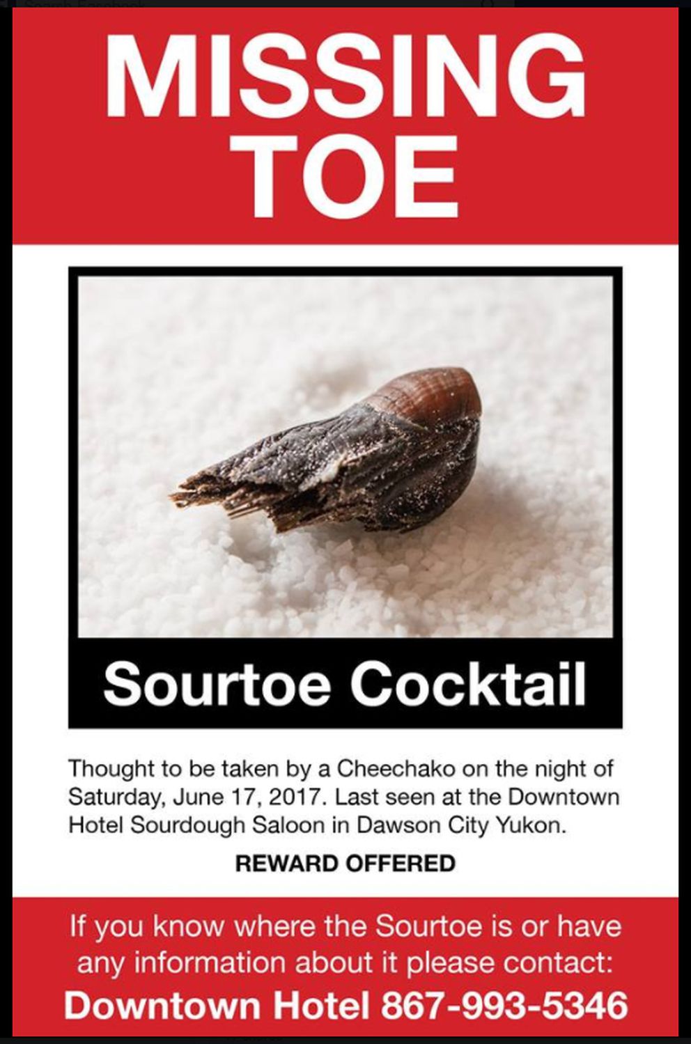  July 20, Thursday Time to pull on the big-boy driving gloves and take the wheel, Tom! So, what is the big deal about this Top of the World Highway? It is reported to be rough, narrow, steep, with hairpin curves, no guard rails, and very soft shoulders. Did I mention washboards? The Milepost cautions that it is a “very dangerous area to be driving big rigs” and I am wondering if our 45’ (truck and trailer) is considered big? As we set off at 8:00 there was another smaller jeep/trailer combo in front of us, and that suited us just fine. We called him “lead dog.” Behind us was another rig, and we called him “wheel dog.” It was nice to have company!  We were to find out that the early section of the road had a lot of construction. Also, within 40 miles we would go through customs and cross into Canada, Yukon Territory. One positive was that yesterday’s rain had dried up and the road was not slippery with mud, as some people had told us it could be. Another plus is that we were up so high and could hear Willie's Roadhouse loud and clear on Sirius Radio.  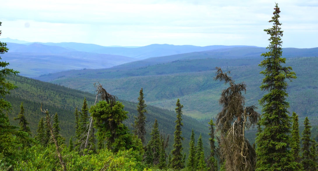 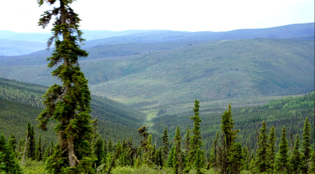 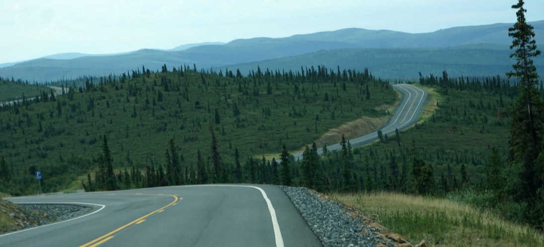 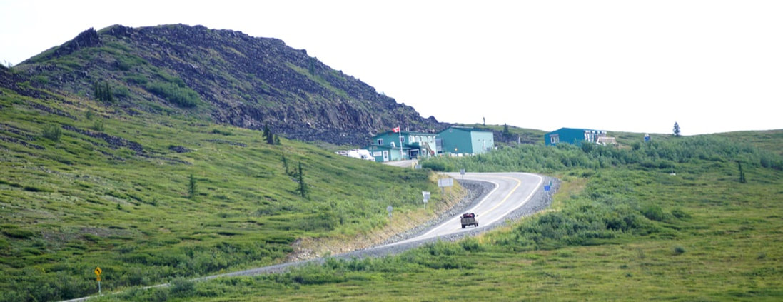 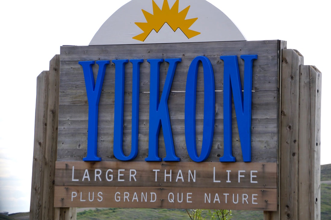 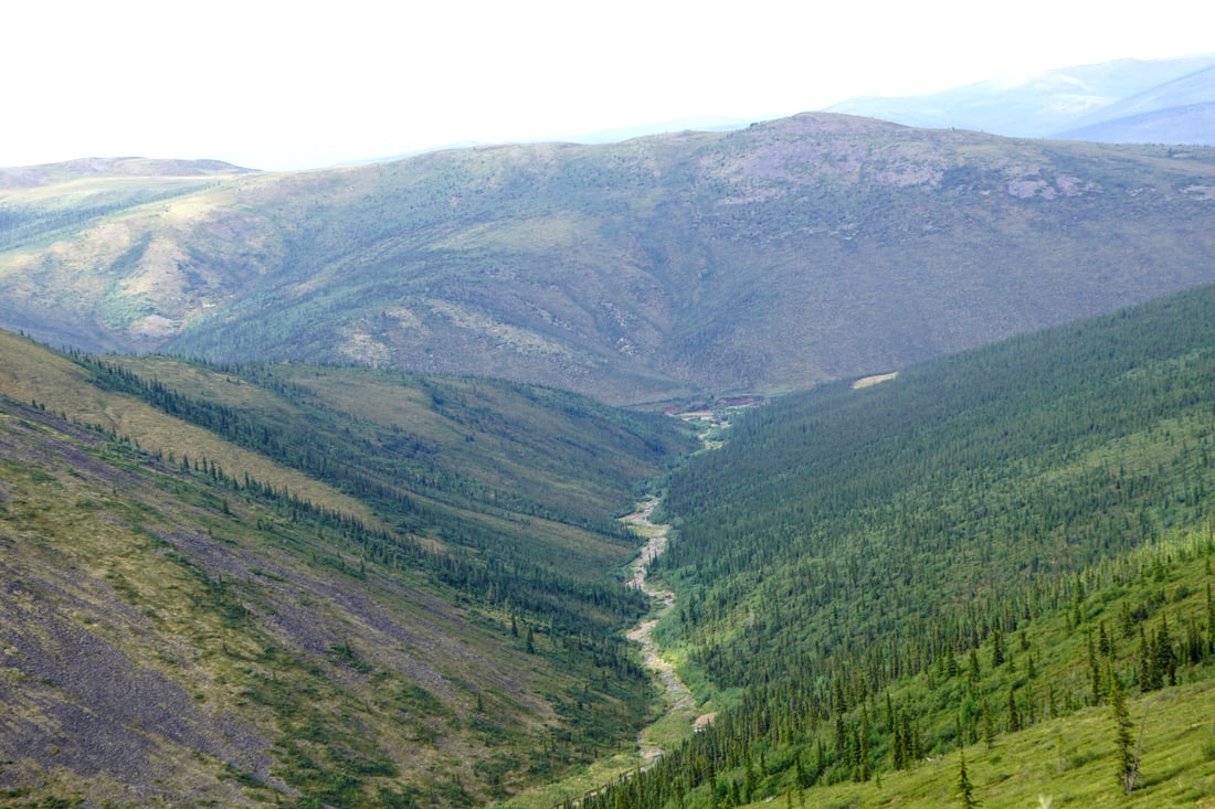 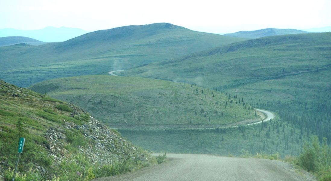 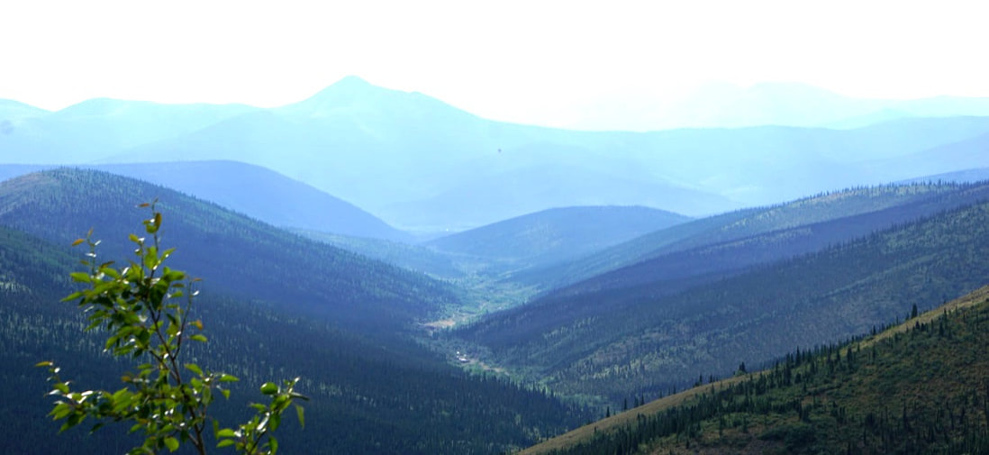 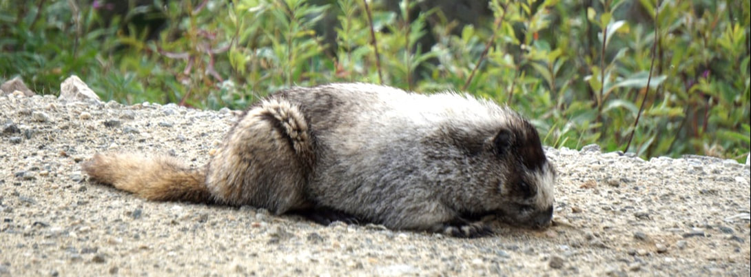 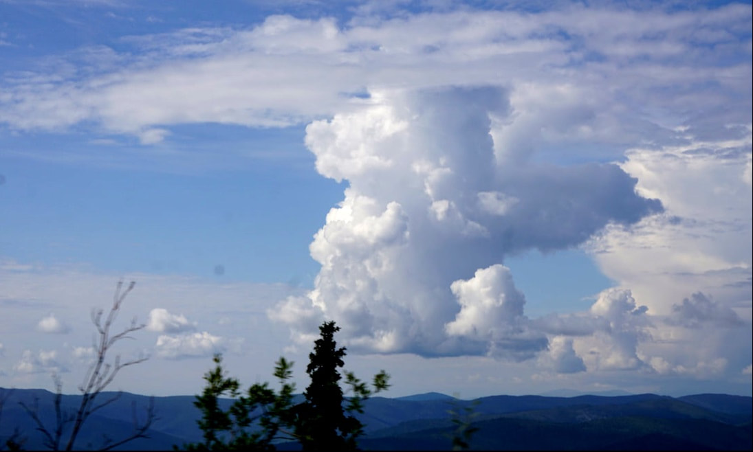  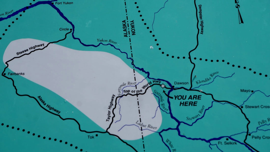  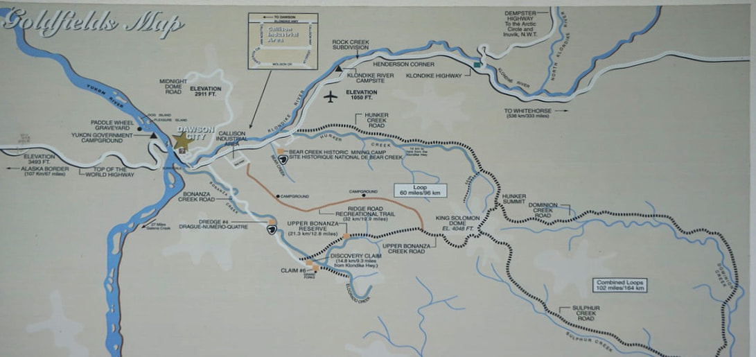 The road is aptly named, as we indeed felt we were driving across the “top of the world” -- steering through rounded, shrubby mountain ranges, following ridge after ridge that afforded views of great valleys down below. The last 6 miles we went down, down, down, and the road ended at the Yukon River’s edge. There are no bridges across the Yukon for hundreds and hundreds of miles (we had crossed over one up near the Arctic Circle) but there is a FREE ferry. A small ferry, that appeared to float on the fast current of the river as much as it relied on motor power! It was quick and efficient loading and unloading cars and RVs . . . about 3 minutes to load and 4 minutes to cross and 3 minutes to unload! 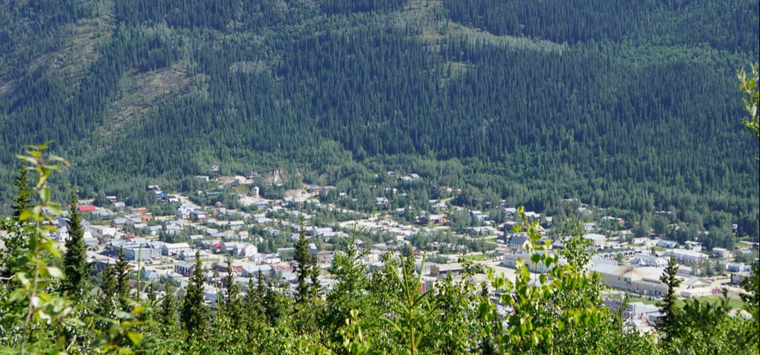 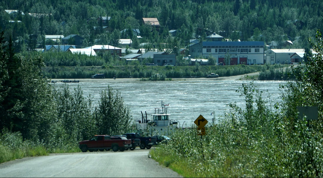  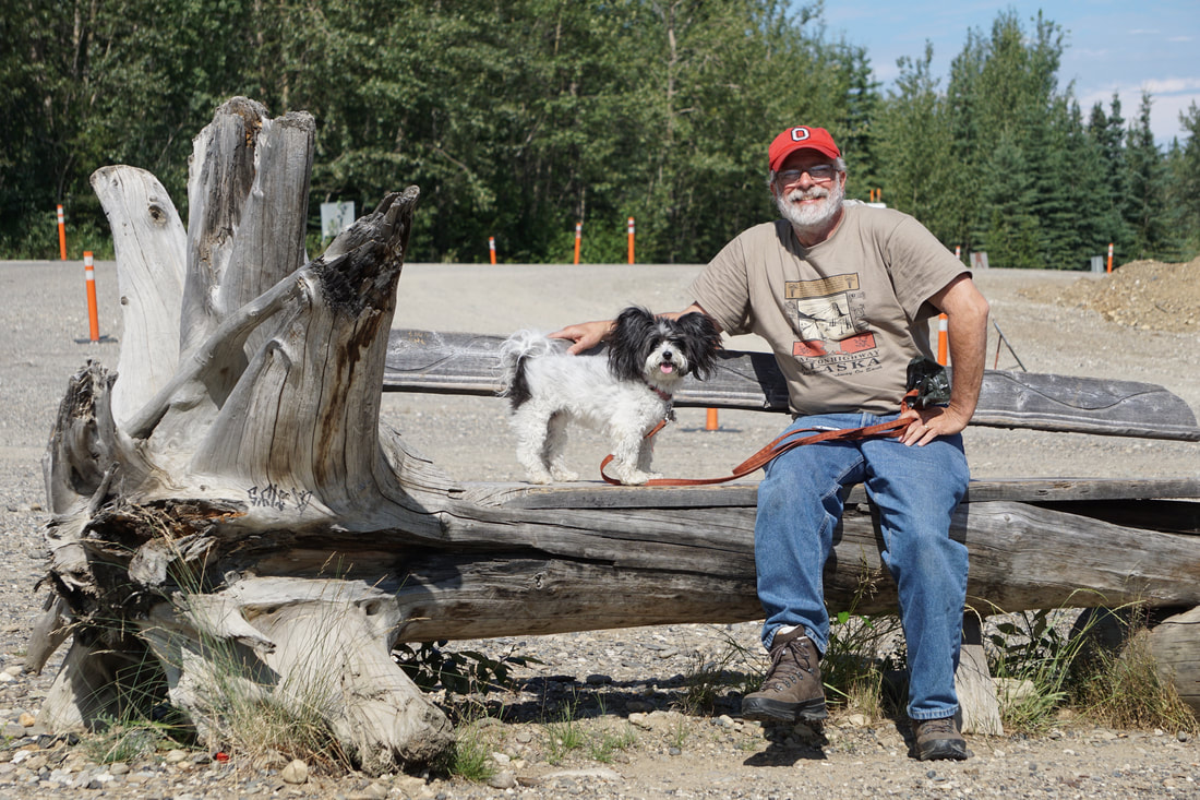 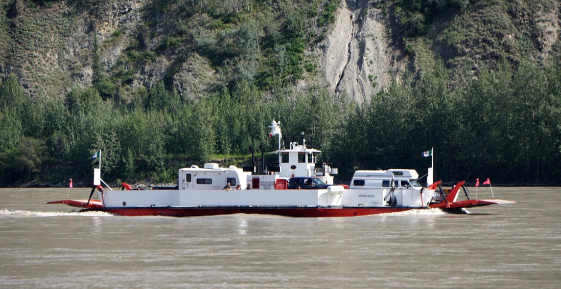 Now that we were safely across the Yukon River our reaction to the Top of the World Highway -- piece of cake! It was indeed, one of the “you must do” scenic highlights of the trip and we will always thank Terry B for guiding us to it!
|
